About the North Downs Way

country
England
length
246 km(153 mi)
Type of trail
Long-distance
difficulty

Difficulty is highly personal. Be aware of the weather conditions as bad weather turns easier trails in difficult trails especially in the mountains.

Moderate
accommodation

Lodging means a mix of hotels, hostels or AirBnB’s.

Camping, Lodging
Elevation gain
3250 m(10663 ft)
terrain
Countryside, Coastal, Forest, Hills
remoteness
Most of the time
Show more

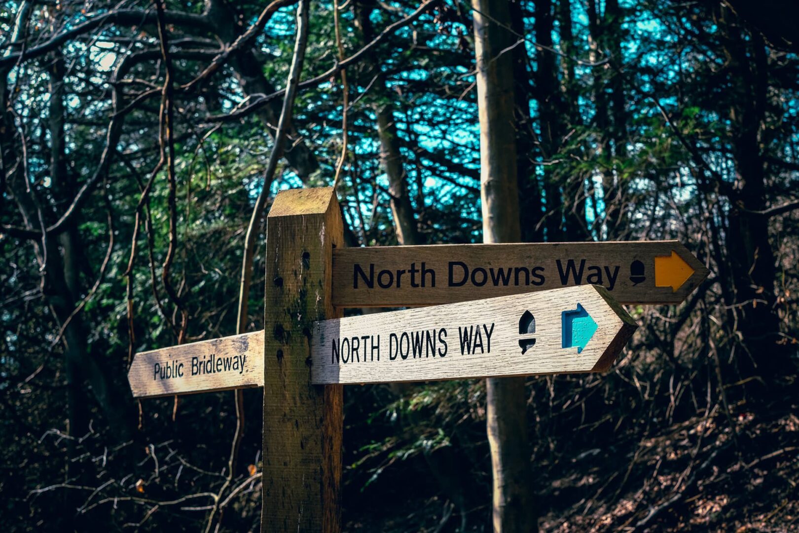
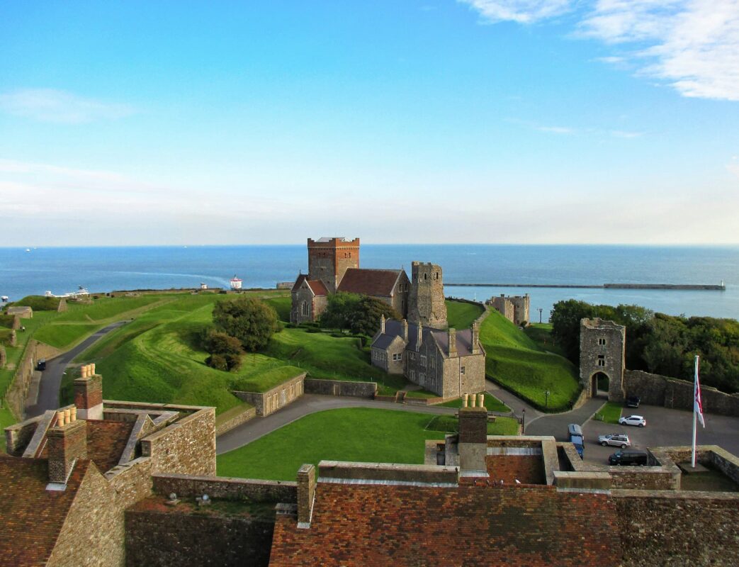
This long-distance trail takes you on a journey through the heart of the English countryside. Over 250 kilometers from Farnham in Surrey to Dover in Kent, it is known for its timelessness. If you are seeking an immersive experience in the great outdoors, the North Downs Way has a variety of landscapes that change with each step.

Whether you’re a seasoned hiker or a weekend wanderer, the North Downs Way is a fun experience. It is well-maintained and full of history, as well as the charm of the English countryside. You’ll find yourself in natural wonders that will make you feel like a curious child again, so embrace the culture and enjoy the peace of southern England.

Profile picture Tiina Gollum

Tiina Golub

Tiina has been running, hiking, and describing trails for over a decade. She grew up in the Baltics, which instilled her with love for forest trails, wild swimming, and foraging. Outside of her day job as a product designer, she regularly competes in endurance running races and enjoys exploring the UK and European trails on foot. You can follow Tiina on Instagram @tiinagolub.

View profile

The Trail

The trail starts in Farnham, where you’ll find rolling hills and woodlands. In the late spring and summer, there are wildflowers. Their colors will pop and be impossible to miss against the greens of the landscape.

As the path makes its way through Surrey, you’ll pass villages and historic sites that show the region’s history. Take a coffee in Guildford to explore its cobbled streets and visit Guildford Castle, a throwback to the area’s medieval history.

From here, you’ll hike to North Downs, where the woods open to vistas that showcase the beauty of the southeast of England. The chalk downs provide a unique walking experience, offering a firm and well-maintained trail that is both accessible and rewarding. It takes you through the heart of the Surrey Hills Area of Outstanding Natural Beauty, where you’ll have panoramic views.

If you like wildlife, the North Downs Way is a heaven for birdwatching. Keep an eye out for red kites and skylarks as you hike. You’ll also see butterflies, rabbits, and a variety of other birds.

As the trail makes its way toward the eastern terminus in Dover, you’ll be rewarded with the White Cliffs standing tall against the English Channel. The views of the sea and nearing the end of the trail add a bounce in your step to the final stage.

Stages

Upon reaching Wye, you can choose your path to Dover. The more direct approach to Dover is walking in the direction of Folkestone before reaching the coast in Dover.

The alternative route leads through Canterbury. This route passes through Chilham and Shepherdswell, before joining The Via Francigena towards Dover. It allows for a slower pace if you have extra time.

Stage 1:

Farnham – Guildford, 17.7 km | 11 mi

Stage 2:

Guildford – Dorking, 21 km | 13 mi

Stage 3:

Dorking – Merstham, 16 km | 10 mi

Stage 4:

Merstham – Oxted, 12.8 km | 8 mi

Stage 5:

Oxted – Otford, 18.9 km | 11.8 mi

Stage 6:

Otford – Cuxton, 24.1 km | 15 mi

Stage 7:

Cuxton – Detling, 20.1 km | 12.5 mi

Stage 8:

Detling – Lenham, 14.9 km | 9.3 mi

Stage 9:

Lenham – Wye, 17.9 km | 11.1 mi

Stage 10:

Wye – Folkestone, 24.4 km | 15.2 mi

Stage 11:

Folkestone – Dover, 13.5 km | 8.5 mi

Accommodations

The North Downs Way offers a variety of accommodation options depending on what you want. Most villages will have a few B&Bs where you can also buy a home-cooked breakfast the next morning (often also an option to buy a packed lunch).

For those seeking a more rustic experience, campsites are located along the trail, so you can see more of the nature of the southeast.

Finally, there are boutique inns and upscale hotels for luxury hikers in each town.

You can find a list of recommended places to stay along the North Downs Way on the National Trails website.

Best time of the year

The North Downs Way path is accessible to hikers all year round, but your choice of season will affect the necessary preparation and the kind of adventure you’ll have.

Safety & Gear

Regardless of the season, start by thoroughly researching the trail, creating a hiking itinerary, and assessing if your skills and equipment are fit for the challenge.

Before setting out, check the weather forecast and the current trail conditions. While most of the paths along the North Downs Way are well-maintained, they can get muddy and slippery, especially during the winter months.

Wear appropriate clothes and footwear and dress in layers to adapt to changing weather conditions. Include waterproof options and bring a spare dry set. Sturdy and comfortable hiking boots with good ankle support are a must, and a pair of trekking poles can provide extra stability, particularly on uphill or uneven sections.

Carry enough water, snacks, and a first aid kit. Don’t forget some seasonal essentials, like sunscreen and insect repellent in summer and a beanie and a pair of gloves in colder weather.

Good to know

There are enough water points in villages along the way, so no need to carry more than the daily supply. If you opt to stay at guesthouses, you will have the choice to buy a packed lunch. This can be a great option for keeping your energy levels up during the day.

Route
Point to point
Highest point
Botley Hill, 269m (883 ft)

Want to submit a trail or make this page more complete?

Comments

Be the first one to comment on this trail!

Reply to this trail

Your email address will not be published. Required fields are marked *

Reply to this trail

Log in to comment on this trail
Always read the disclaimer

Terms of Use: important to all visitors on this website. We strive to publish high quality content and information on this website. However it’s always possible that we’re missing out on some crucial information. In spite of the fact that this route, associated GPS track (GPX and maps) were prepared under diligent research by the specified contributor and/or contributors, the accuracy of such and judgement of the author is not guaranteed. Therefore, hiking-trails.com and contributors are in no way liable for personal injury, damage to personal property, or any other such situation that might happen to individuals hiking or following this route. Should you choose to hike this trail, this is always at your own risk. Check out our guidelines for safety hiking and Leave No Trace principles at the hiking 101 page.

Download GPX

Join the community!

Login or create a FREE account 😊

With an account you can:

Download GPX files

Pin trails to your wishlist

Mark trails as hiked by you

Rate hiking trails

Comment on trails, blogs and gear reviews

Happy trails!
Login

Don't have an account yet? Register here