About the Moselle 3 Trail

country
Luxembourg
length
33 km(21 mi)
Type of trail
Long-distance
difficulty

Difficulty is highly personal. Be aware of the weather conditions as bad weather turns easier trails in difficult trails especially in the mountains.

Moderate
accommodation

Lodging means a mix of hotels, hostels or AirBnB’s.

Lodging
Elevation gain
811 m(2661 ft)
terrain
Forest, Countryside, Hills
remoteness
Some of the time
Show more

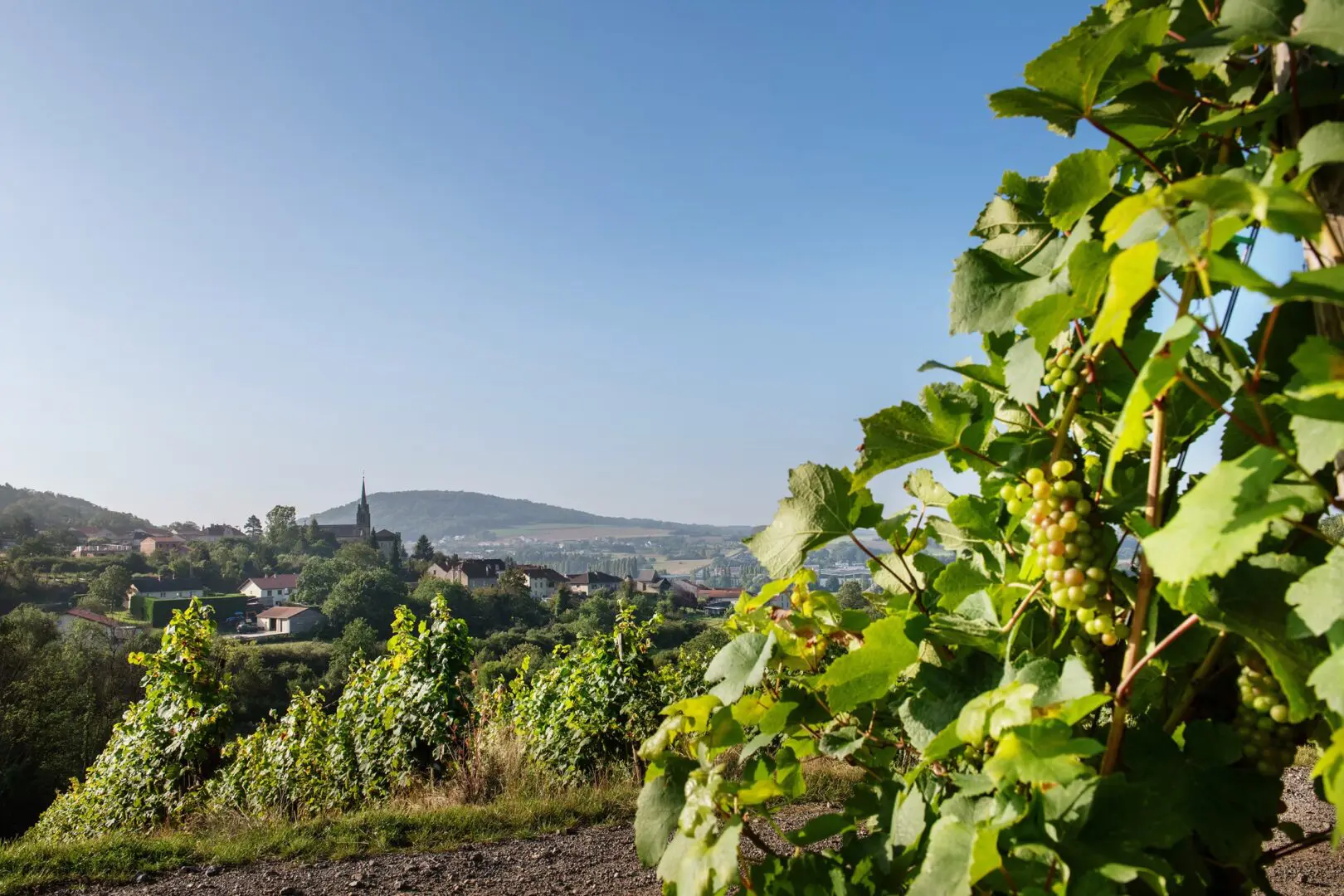
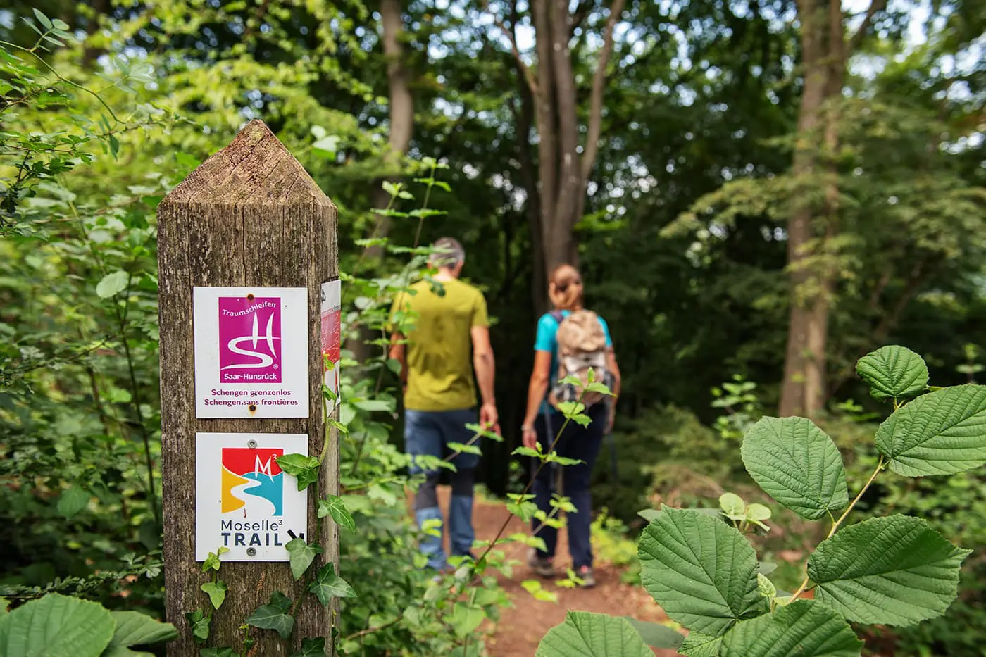
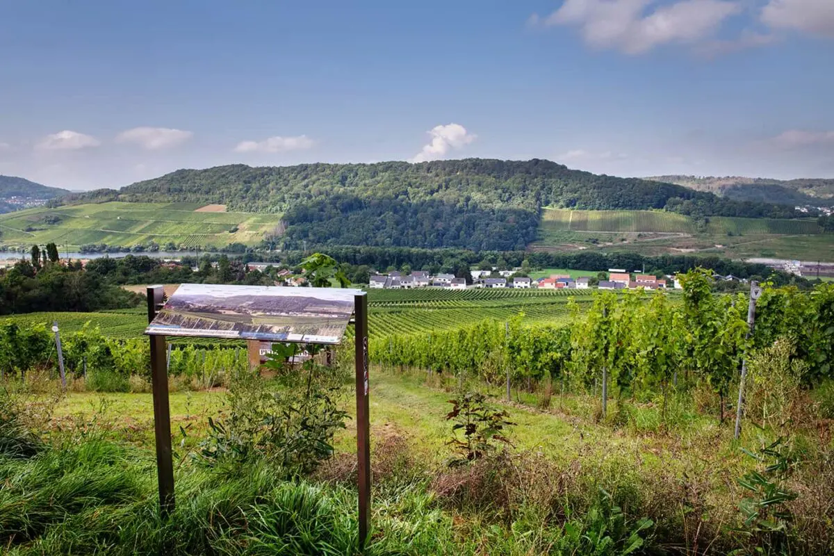
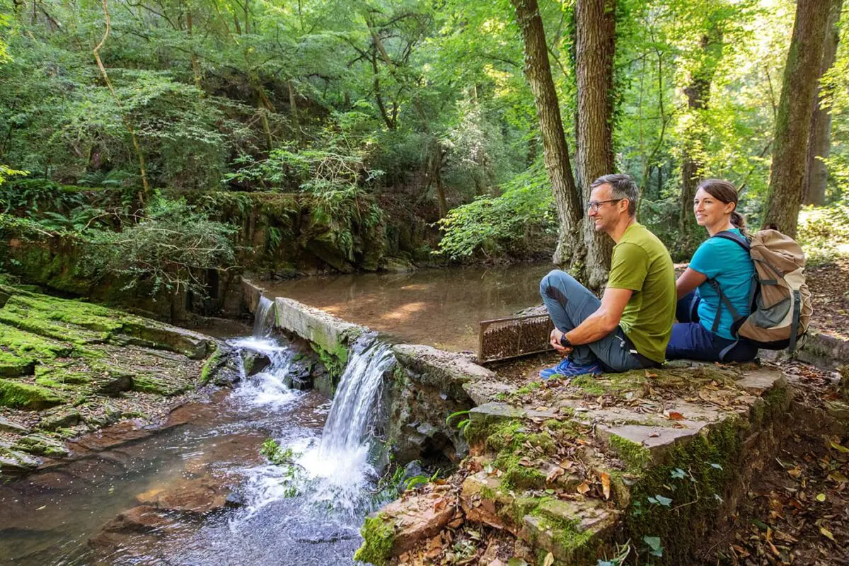
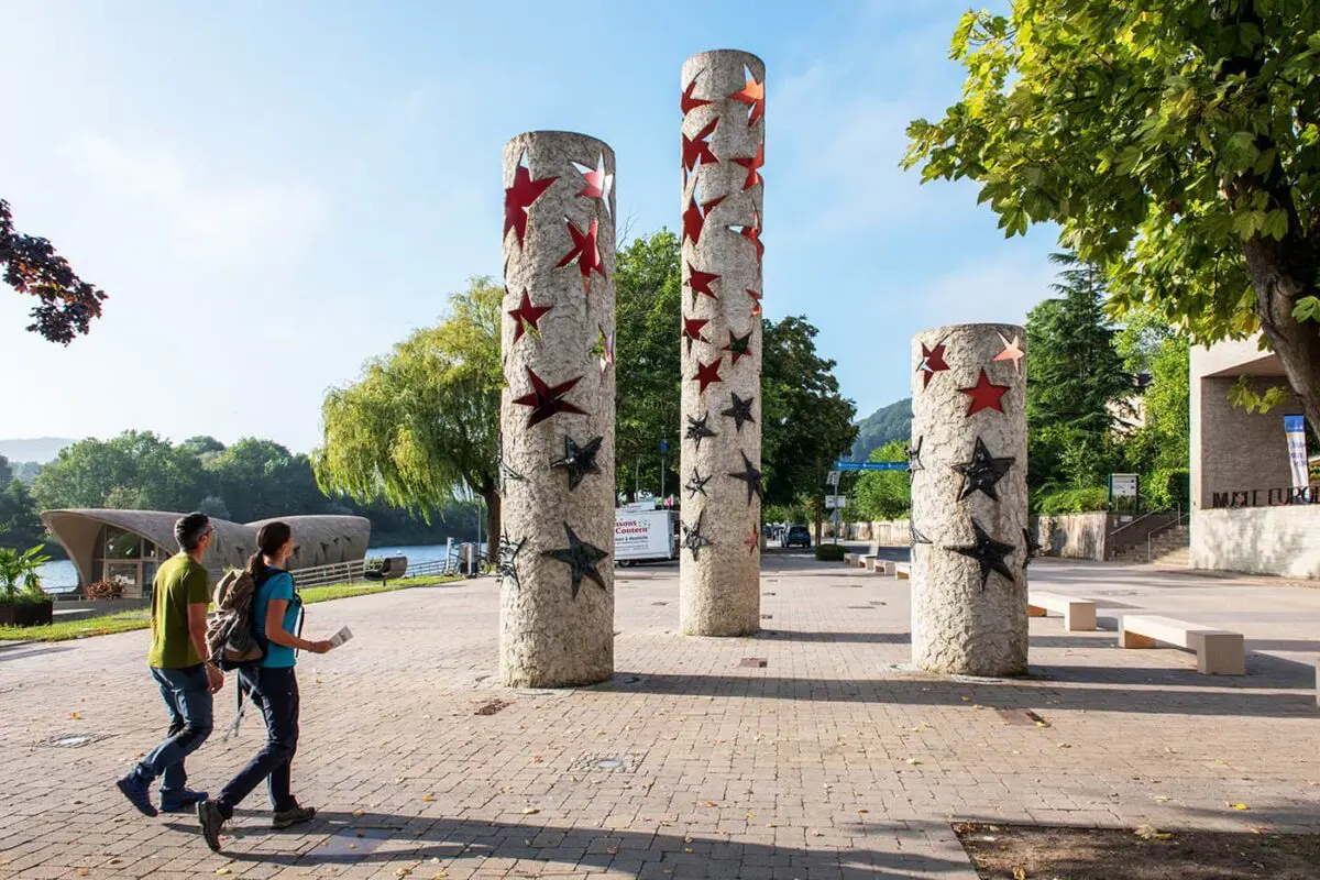
The Moselle 3 Trail is a 33-kilometer hiking route right at the meeting point of Luxembourg, France, and Germany, which is the perfect opportunity to explore the tri-border region of Europe. This trail navigates through a variety of landscapes, including vineyard-filled hillsides and the banks of the Moselle River, showcasing the area’s beauty. It also passes through historical sites and small villages, showing the cultural history of the region.

Designed for accessibility, the trail is suited to hikers for all different kind of levels, providing insights into the historical significance and contemporary relevance of this border-crossing area. Marked by clear signage, the Moselle 3-Trail facilitates an informative journey through a key European crossroads. This trail is a chance to explore a little-known region with a unique history in a short amount of time.

Editor

Elmar Teegelbeckers

Passionate hiker Elmar spends months of his time on the trail. He’s usually on the lookout for hidden gems in one of his favourite countries such as Slovenia, Switzerland and Japan. He founded hiking-trails.com in need for a community and detailed information about the trails. Before this, he worked for the Alpine asscociation in the Netherlands[ (NKBV) but lost his heart to the trails.

With this website and socials, he hopes to shape an inclusive community for hikers all over world. No matter your speed, experience or level, you can get out there to enjoy the trails and connect with the heartwarming hiking community. Life is so much better outside and he hopes to inspire hikers to take their first, or next, step on the trail.

View profile

The Trail

The region surrounding the Moselle 3 – Trail is a testament to resilience and transformation, having survived the violence of war, shifting borders, and political changes over centuries. Today, the area has the marks of its difficult past with remains like trenches, overgrown anti-tank fortifications, bomb craters, and bunkers. Yet, in the wake of the Schengen Agreement, this area has woven itself into a unified space of culture, history, and shared living.

Spanning 33 kilometers, this circular trail is designed for a great experience, weaving through natural landscapes like the scenic Stromberg near Schengen & Contz-les-Bains, the serene Hammelsberg between Perl & Apach, the biodiverse limestone meadows of Montenach, and the quartzite-rich areas of Sierck-les-Bains. Many of these areas are recognized for their ecological value, forming part of the Natura 2000 network, and are well-preserved for future generations.

Starting points for the Moselle 3 – Trail are conveniently located, with lots of parking available at Perl-Sehndorf, Perl train station, the Europa Museum in Schengen, and the Maison de la Nature in France. The trail caters to both nature enthusiasts and culture lovers, giving an unforgettable journey through the heart of Europe’s border triangle.

Stages

While you can hike this trail in one day, it would be better to hike the Moselle 3 – Trail in two stages so you can enjoy this area longer and keep an easier pace. If you choose to start at Montenach at the Maison de la Nature, you have the perfect option to end at a wine tasting in Sehndorf or in Perl and start the next day after a few meters with a visit to the European Museum in Schengen. Also, you can start in Schengen with an overnight stay in Montenach. Just be sure to reserve your stay early!


Points of interest

  • Centre Européen Schengen, Schengen
  • Château des Ducs de Lorraine, Sierck-les-Bains
  • Peace Chapel, near Perl

Wine tasting at one of the numerous wineries

Accommodations

A few possible accommodation options for while on the trail are below. You can choose to hike this trail a few different ways, which means you have great flexibility of where you’d like to sleep.


Best time of the year

The best time of the year to hike the Moselle 3 – Trail is from April to early October. Here you’ll have more daylight and better conditions to hike the trail. Keep in mind that in summer, it can be really hot on the trail. Late spring and early autumn are considered the best time to hike the Moselle 3 – Trail.

Safety & Gear

Even for shorter trails like the Moselle 3, be sure to load the GPX onto a mobile device with extra batteries, and know your route before you begin. Bring at least 2 liters of water with you for each day and plenty of high-energy snacks to avoid dehydration or exhaustion. You may also want to pack layers in case the weather changes on you while you’re on the trail.

We also recommend that you tell a person you trust where you’re headed and when you expect to return, and inform them if your plans change.

Finally, check out our extensive gear list so you don’t forget any of the basics.

Good to know

Just keep in mind to book your overnight stay a few months in advance. Most accommodations can be booked by sending them an email or applying on their website.


  • Water resources: You can find water in cafés, restaurants, and villages along the way, so you won’t need to bring a filter.
Route
Point to point
Highest point
379m (1243 ft)

Want to submit a trail or make this page more complete?

Comments

Be the first one to comment on this trail!

Reply to this trail

Your email address will not be published. Required fields are marked *

Reply to this trail

Log in to comment on this trail
Always read the disclaimer

Terms of Use: important to all visitors on this website. We strive to publish high quality content and information on this website. However it’s always possible that we’re missing out on some crucial information. In spite of the fact that this route, associated GPS track (GPX and maps) were prepared under diligent research by the specified contributor and/or contributors, the accuracy of such and judgement of the author is not guaranteed. Therefore, hiking-trails.com and contributors are in no way liable for personal injury, damage to personal property, or any other such situation that might happen to individuals hiking or following this route. Should you choose to hike this trail, this is always at your own risk. Check out our guidelines for safety hiking and Leave No Trace principles at the hiking 101 page.

Download GPX

Join the community!

Login or create a FREE account 😊

With an account you can:

Download GPX files

Pin trails to your wishlist

Mark trails as hiked by you

Rate hiking trails

Comment on trails, blogs and gear reviews

Happy trails!
Login

Don't have an account yet? Register here