Minett Trail Logo

About the Minett Trail

country
Luxembourg
length
90 km(56 mi)
Type of trail
Long-distance
difficulty

Difficulty is highly personal. Be aware of the weather conditions as bad weather turns easier trails in difficult trails especially in the mountains.

Easy
accommodation

Lodging means a mix of hotels, hostels or AirBnB’s.

Lodging
Elevation gain
1064 m(3491 ft)
terrain
Hills, Countryside
remoteness
Most of the time
Show more

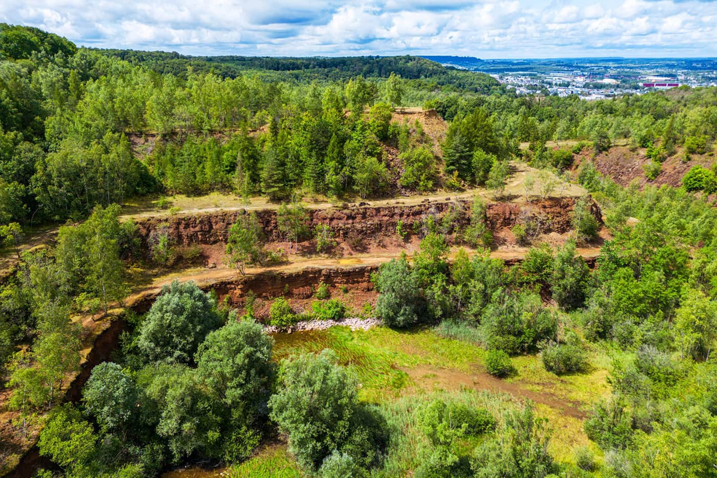
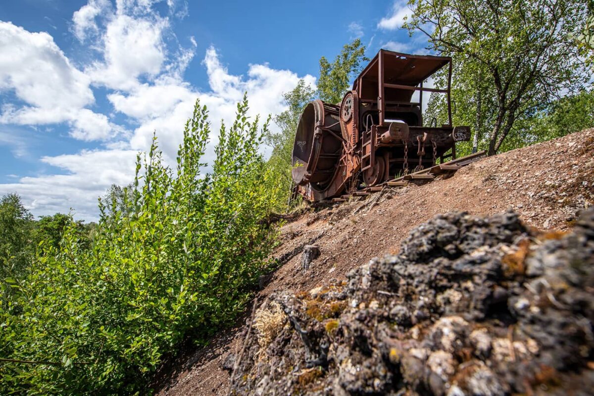
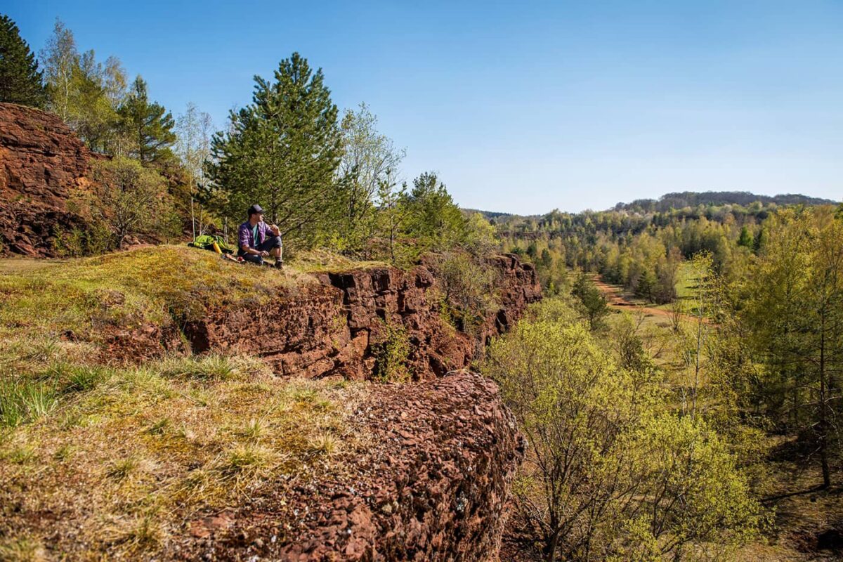
The Minett Trail is a fairly new, 90-kilometer long-distance trail through the nature reserves of southern Luxembourg, a region historically significant for its iron ore (minett) extraction. This area, known as Minett, has been influenced by industrial activities, which have shaped its landscapes, culture, and natural environments.

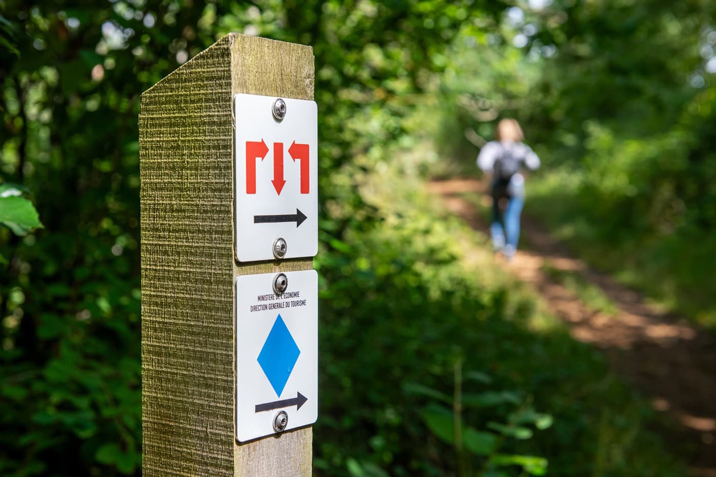
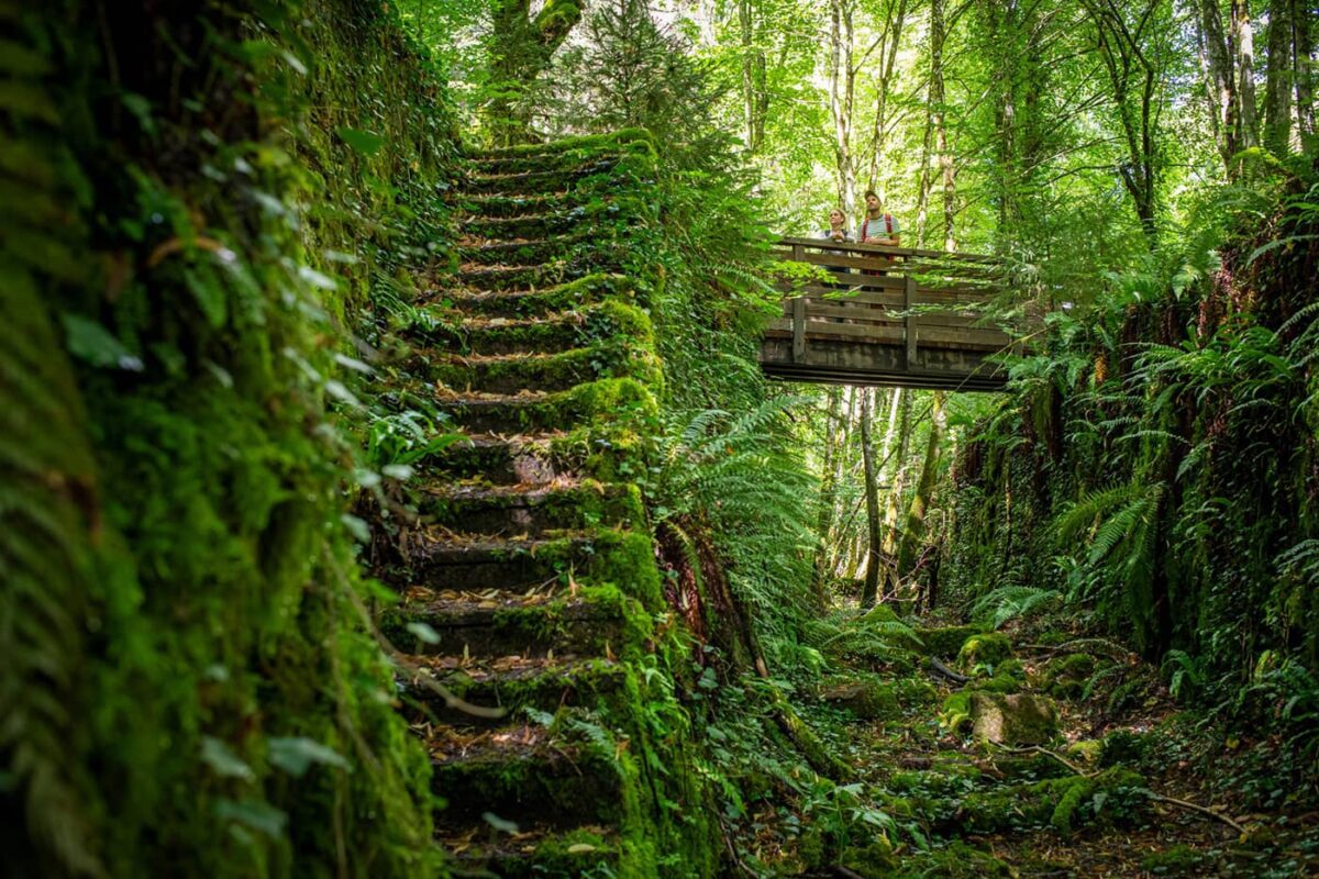
Nowadays, you can hike through 10 stages where nature has taken over again the region where there was such great industrial influence. You’ll even hike through several former open-pit mines. These sites, inactive for over 40 years, have gradually been overtaken by natural regrowth, transforming the ecosystems back to their natural glory.

Editor

Elmar Teegelbeckers

Passionate hiker Elmar spends months of his time on the trail. He’s usually on the lookout for hidden gems in one of his favourite countries such as Slovenia, Switzerland and Japan. He founded hiking-trails.com in need for a community and detailed information about the trails. Before this, he worked for the Alpine asscociation in the Netherlands[ (NKBV) but lost his heart to the trails.

With this website and socials, he hopes to shape an inclusive community for hikers all over world. No matter your speed, experience or level, you can get out there to enjoy the trails and connect with the heartwarming hiking community. Life is so much better outside and he hopes to inspire hikers to take their first, or next, step on the trail.

View profile

The Trail

The Minett Trail spans 11 municipalities, starting in Clemency and ending in Bettembourg, and features a variety of landscapes including rocky outcrops, lush vegetation, and former mining sites. The industrial sites you’ll hike through are enriched by a mild microclimate that fosters biodiversity. Furthermore, it is also recognized by UNESCO.

The region of the Minett Trail has been recognized by UNESCO as a “Man and Biosphere” reserve. Today, the goal is to ensure the greater sustainability of human activity in the region, so as to protect nature in the area.

Along the 90-kilometer route, you will stay at a series of uniquely designed lodges, called Kabaisercher, which are really unique, cool, architectural concepts. These include a floating lodge on a lake near the water tower in Dudelange, temporary mobile lodges in Esch-sur-Alzette, a lodge set within a former water basin in Schifflange, and a repurposed old railway carriage at Fond-de-Gras in Pétange.

Stages

As this trail consists of ten stages in total. Of course, you can always link two (shorter) stages together or decide to stop your day earlier. These are the suggested official stages.

Stage 1:

Clemency – Pétange, 7 km | 4 mi

Stage 2:

Pétange – Differdange, 16 km | 10 mi

Stage 3:

Differdange – Belvaux, 8 km | 5 mi

Stage 4:

Belvaux – Esch-sur-Alzette, 7 km | 4 mi

Stage 5:

Esch-sur-Alzette – Tétange, 12 km | 8 mi

Stage 6:

Tétange – Rumelange, 8 km | 5 mi

Stage 7:

Rumelange – Dudelange, 11 km | 7 mi

Stage 8:

Esch-sur-Alzette – Schifflange, 9 km | 6 mi

Stage 9:

Schifflange – Bergem, 6 km | 4 mi

Stage 10:

Bergem – Bettembourg, 12 km | 7 mi

Accommodations

As for places to stay, you’ve got a pretty wide selection depending on what you’re looking for. There are cozy bed and breakfasts set up in old buildings that have been fixed up to keep their charm. If you prefer something a bit more up-to-date, there are plenty of modern hotels that offer more luxury.

Stay at the Kabaisercher

Have you ever thought about spending the night in a little castle, or maybe an old school building? How about a floating cabin or a train sleeping compartment? It might not sound too fancy, but the “Kabaisercher” on the Minett Trail are something special. These hiking lodges mix their interesting histories with modern materials, design, and technology, offering stylish and comfortable accommodations.

There are eleven different “Kabaisercher,” each selected for its historical significance and its integration into the Minett Trail. These places are historic sites or buildings that have been renovated or constructed to enhance your experience on the Minett Trail.

Best time of the year

The best time of the year to hike the Minett Trail and general in Luxembourg is from late spring to early autumn, specifically between May and October. During these months, the weather is most favorable for hiking, with warmer temperatures and longer daylight hours. Note that it can be snowy and temperatures drop dramatically in the winter months here.

Safety & Gear

Always bring your essentials for a better trail experience. Before you go, make sure you have shoes with enough grip and have broken them in at home. Especially when it rains and the paths can be muddy, you’ll want a comfortable shoe. Bring your layers, at least a baselayer, mid-layer, and a hardshell rain jacket for occasional rain showers. Take enough water and food with you and always put the GPX in an app for navigation on your mobile phone.

Good to know

The Minett Trail is a perfect trail for beginner long-distance hikers and is best walked from April to October. The trails are well-marked and not too technical. It’s a wonderful area to get away from it all, recharge, and enjoy nature. In the winter months, it can be quite cold and snowy. One thing that is great about Luxembourg is the free public transport in the whole country.

Route
Point to point
Water resources
Enough

Want to submit a trail or make this page more complete?

Comments

Be the first one to comment on this trail!

Reply to this trail

Your email address will not be published. Required fields are marked *

Reply to this trail

Log in to comment on this trail
Always read the disclaimer

Terms of Use: important to all visitors on this website. We strive to publish high quality content and information on this website. However it’s always possible that we’re missing out on some crucial information. In spite of the fact that this route, associated GPS track (GPX and maps) were prepared under diligent research by the specified contributor and/or contributors, the accuracy of such and judgement of the author is not guaranteed. Therefore, hiking-trails.com and contributors are in no way liable for personal injury, damage to personal property, or any other such situation that might happen to individuals hiking or following this route. Should you choose to hike this trail, this is always at your own risk. Check out our guidelines for safety hiking and Leave No Trace principles at the hiking 101 page.

Download GPX

Join the community!

Login or create a FREE account 😊

With an account you can:

Download GPX files

Pin trails to your wishlist

Mark trails as hiked by you

Rate hiking trails

Comment on trails, blogs and gear reviews

Happy trails!
Login

Don't have an account yet? Register here