Two women hiking the Meraner Höhenweg (Alta Via di Merano)

Meraner Höhenweg

Alta Via di Merano

About the Meraner Höhenweg

South Tyrol
country
Italy
length
100 km(62 mi)
Type of trail
Hut to hut, Long-distance
difficulty

Difficulty is highly personal. Be aware of the weather conditions as bad weather turns easier trails in difficult trails especially in the mountains.

Moderate
accommodation

Lodging means a mix of hotels, hostels or AirBnB’s.

Lodging, Mountain huts
Elevation gain
5100 m(16732 ft)
terrain
Mountains, Forest, Hills
remoteness
Some of the time
Show more

The Meraner Höhenweg stands out as one of the most breathtaking circular hiking routes in the Alpine region. Marked with the number 24, this trail was crafted by the AVS mountain guides Robert Schönweger and Helmuth Ellmenreich and was inaugurated in 1985. The Meran Alta Via is divided into a northern and a southern section, circling the Texel Group Nature Park at a relatively consistent elevation.

The Meraner Höhenweg is a more accessible alternative to crossing the Alps or any other mountain tour in the Dolomites with wonderful inns, occasional mountain huts for refreshments, and stunning panoramic views. And that’s exactly how you can describe the journey – except for one alpine stage over the Eisjöchl, it’s a pleasant gourmet tour with a continuous, gentle undulation. Each day is entirely different, and it’s a fantastic feeling when you turn into a new valley, and the entire landscape transforms before your eyes.

women climbing mountain
Author

Silvie Asler

Silvie Asler was born in Berlin with no mountains far and wide. However, as soon as she moved to Switzerland for a job, she immediately fell in love with the country and its mountains. She spends her free time  in the Alps or the Dolomites, whenever possible with her family. She particularly likes multi-day hut-to-hut hikes and her life goal is to visit every of the official SAC mountain huts in Switzerland. You can follow Silvie on her blog, on Facebook or on Instagram.

View profile

The Trail

In five to eight-day stages, experienced and sure-footed hikers cover nearly 100 kilometers, exploring the Texel Group Nature Park. Along the way, you’re treated to panoramic views – on clear days, the Dolomites and the Ortler Massif are visible. Particularly in the southern section, there are fantastic views of the city of Merano, the Adige Valley, and the Vinschgau.

The Merano Alta Via offers a glimpse into the world of South Tyrolean mountain farmers who, through centuries of hard work, have shaped and preserved this mountainous cultural landscape.

The lowest point of the trail is at 839 meters, and the highest point reaches almost 3,000 meters. The trail keeps the same elevation throughout the majority of the days making it a beautiful high route.

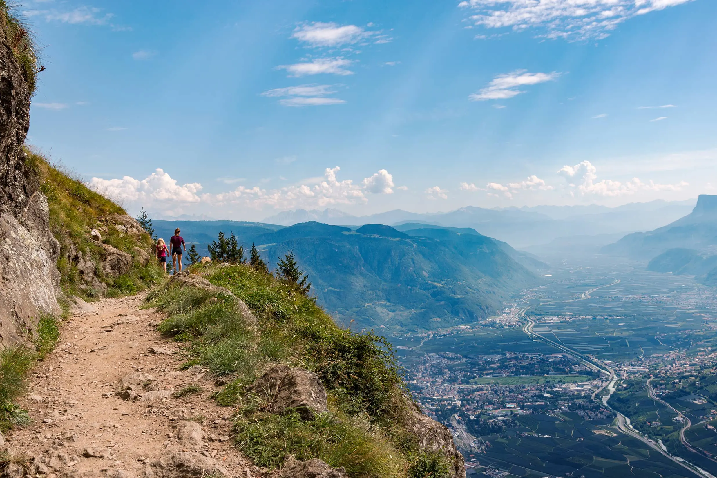
The first stage runs from Hochmuth to Giggelberg, which is about 13 kilometers. You’ll start by taking the Hochmuth cable car up the mountain before you actually get on the trail. From here, it follows well-marked paths along the southern slopes of the Texel Group, where you will hike through larch forests and get your first taste of the many open ridges to come, with views of the Etschtal Valley and Merano. You’ll stop for the night in Giggelberg, where you’ll stay in the mountain hut. The second stage continues from Giggelberg to Katharinaberg and is known for the “1000-Stufen-Schlucht,” a gorge loved by hikers for its countless steps, ladders, and narrow passages. It’s fun, but also can be a challenge! On this day, the trail crosses deep ravines and open meadows, alternating between woods and slopes, before descending to the Schnalstal Valley and the village of Katharinaberg.

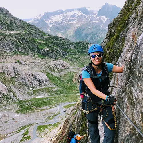
From Katharinaberg, the third stage takes you through quiet mountain farms and alpine pastures into the Pfossental Valley, one of the most scenic and remote valleys in South Tyrol. The trail climbs steadily to reach the Eishof, a high pasture farm surrounded by peaks. You’ll sleep here in the Eishof Alm, just be sure to book it far ahead of time. The fourth stage from Eishof to Pfelders is one of the most demanding of the entire circuit. The route ascends through rocky terrain to the Eisjöchl at 2,895 meters, passing the Stettiner Hut, then drops into the Pfelderer Valley. The descent takes you through alpine meadows and past the Lazinser Alm before reaching the village of Pfelders. As of 2025, there is a trail closure on this stage, and you will need to detour via the Tumlhof farm. It’s going to add about 1.5h to your day, so it’s good to start early. The closure is expected to be present until 2026 at the earliest.

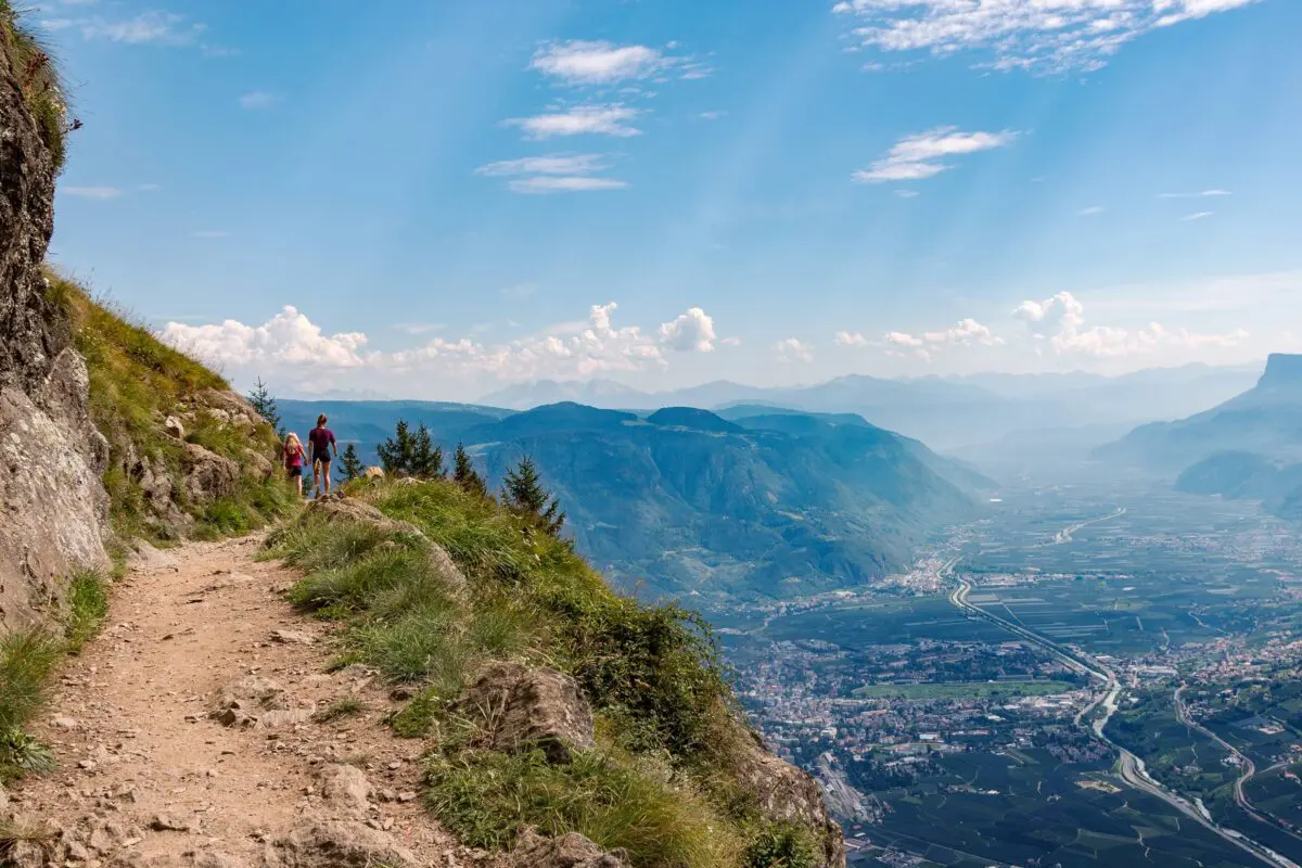
The fifth stage continues from Pfelders to Matatz. The trail softens here and is a bit easier after the demands of the day before. You will follow forest paths, gentler slopes, and farms as the trail goes through Ulfas and Christlhof. Finally, the last stage from Matatz back to Hochmuth closes the circuit. It climbs and descends through forested ridges, giving you open views over the Vinschgau Valley, Merano, and the Dolomites before returning to the starting point at Hochmuth.

Stages

The trek can be divided into 6 main stages. They all waver between 13-18 kilometers with roughly the same elevation gain each day.

6 stages of the tour

Stage 1:

Hochmuth – Giggelberg, 13.4km | 8.3 mi (6:30h)

Stage 2:

Giggelberg – Katharinaberg, 14.1km | 8.7 mi (5:30h)

Stage 3:

Katharinaberg – Eishöfe, 13.4km | 8.3 mi (4:50h)

Stage 4:

Eishöfe – Pfelders, 16.8km | 10.4 mi (6h)

Stage 5:

Pfelders – Matatz, 18km | 11.2 mi (5h)

Stage 6:

Matatz – Hochmuth, 18.3km | 11.4 mi (6:30h)

Accommodations

Plenty of accommodations along the route so that you can plan the route according to your fitness level and the number of stages you want to plan. You can either stay in luxurious mountain huts, farm stays, hotels, or pensions that all serve amazing food. You cross through little villages so that you can stock up on snacks along the route. Make sure to book about 6 months in advance if you want to get hold of private rooms. Other rooms can be booked on short notice since there is plenty of accommodation.

When debating where to stay before and after the tour, the Hotel Golserhof is a great mountain hotel in Dorf Tirol. It’s only a few minutes from the Hochmuth cable car, which will take you to the beginning of the trail. Plus, it is a boutique hotel (only 30 rooms!) with great food and hiking-knowledgeable staff.

Stage 3:

Eishof Alm

Stage 4:

Pfelders (multiple options)

Stage 5:

Krusterhhof

Best time of the year

The southern part of the trail can be done between May and October. The northern part, particularly the crossing over the Eisjöchl, should only be done without snow, which is still possible until the end of June. It’s hard to judge when the snow will be completely melted, so it can be helpful to call hut wardens before you head out to ask about the trail conditions. They will be able to give you real-time updates on trail accessibility and any abnormalities you need to plan for.

Safety & Gear

Preparing for the Meraner Höhenweg should not be taken lightly. This trail is only for experienced hikers and should be approached as such. While you sleep in accommodations each night, carrying a few safety items along with your normal clothes and toiletries is still important. Pack a basic first aid kit (and know how to use it!) with an emergency blanket, a mirror for rescue, and normal items for scrapes and injuries. It may also be helpful to take along some basic pills like paracetamol and some for allergies.

Before you start hiking, download the GPX and guidebooks to familiarize yourself with the route, including any potential hazards and emergency exit points.

Check the weather forecast before you start to hike because mountain conditions can change rapidly. Be prepared for different weather, including sudden changes in temperature, rain, and strong winds. Dress in layers and wear appropriate hiking gear, including sturdy boots with good traction.

Hiking in groups is recommended for safety, especially if you’re less experienced in the mountains. Stay on marked trails and avoid straying off-path to avoid getting lost.

Be mindful of your surroundings and watch out for potential hazards such as steep drops, loose rocks, and unstable footing. Take breaks when you need to rest and rehydrate, and listen to your body’s signals to avoid injury.

Difficulty

The Meraner Höhenweg is rated as a moderate trail, with a few difficult high-alpine sections. However, this is a trail only for experienced mountain hikers. While the itinerary can be adjusted for your personal preferences and it is possible to have shorter days, there are still a few sections that are more technical and require previous alpine hiking experience. You can still make your itinerary such that you hike just a few hours or longer, full days. This means you can go at your own pace and take it easy if you need to.

Good to know

The trek can be done in both directions with the majority of hikers going clockwise.

One trail closure that’s expected to be present until 2026 at the earliest is between Katharinaberg and Pfossental Valley because of rockfalls. To avoid this, there is a detour via the Tumlhof farm, which adds about 1.5 hours of walking to your day. Plan accordingly!

Numerous access and descent points along the Meraner Höhenweg make it possible to start the hike at various locations or descend to the valley. Approaches are easily accessible via cable cars, public transportation, cars, or taxis. Certain sections along the trail require surefootedness, a head for heights, and caution. At exposed points, safety features such as chains, ropes, or railings are in place. However, the trail can be done with kids and dogs as well and does not pose too much of a challenge.

You can refill your water along the route if you cross through villages or pass by restaurants. Always carry 1.5L to be on the safe side and refill at every opportunity.

As for remoteness, the trail is very popular with hikers of all ages and also big hiking groups. All stages are also done by day hikers, so you will never be alone.

Route
Circuit
Highest point
2879M (9446 FT)

Want to submit a trail or make this page more complete?

Always read the disclaimer

Terms of Use: important to all visitors on this website. We strive to publish high quality content and information on this website. However it’s always possible that we’re missing out on some crucial information. In spite of the fact that this route, associated GPS track (GPX and maps) were prepared under diligent research by the specified contributor and/or contributors, the accuracy of such and judgement of the author is not guaranteed. Therefore, hiking-trails.com and contributors are in no way liable for personal injury, damage to personal property, or any other such situation that might happen to individuals hiking or following this route. Should you choose to hike this trail, this is always at your own risk. Check out our guidelines for safety hiking and Leave No Trace principles at the hiking 101 page.

Download GPX

Join the community!

Login or create a FREE account 😊

With an account you can:

Download GPX files

Pin trails to your wishlist

Mark trails as hiked by you

Rate hiking trails

Comment on trails, blogs and gear reviews

Happy trails!
Login

Don't have an account yet? Register here