About the Manaslu Circuit Trek

Himalaya
country
Nepal
length
145 km(90 mi)
Type of trail
Long-distance
difficulty

Difficulty is highly personal. Be aware of the weather conditions as bad weather turns easier trails in difficult trails especially in the mountains.

Difficult
accommodation

Lodging means a mix of hotels, hostels or AirBnB’s.

Lodging, Mountain huts
Elevation gain
5100 m(16732 ft)
terrain
Mountains, Forest, Hills
remoteness
Some of the time
Show more

The Manaslu Trek lies in a protected natural region and its access is strictly regulated. It is in my opinion the most beautiful and the most genuine trek to do in Nepal as it hasn’t been ruined (much) by the tourism industry. Therefore, it is less accessible than most treks and there are more regulations to obey and some important considerations to know before. Every hiker on the Manaslu Trek must be accompanied by a guide or part of a group with a guide. Therefore it is one of the most expensive treks you can do in Nepal, as it needs more permits (see the details later in this article) and to pay for a guide. Your local travel agency in Kathmandu or Pokhara will propose packages detailed with an organized trip, where you can rarely choose where you can sleep and the program remains the same for most trips.

black and white portrait photo
Author

Jérôme Servais

Jerome left everything he had behind in Belgium ten years ago and after a long trip reached Southeast Asia where he lived there for a couple of years. From Vietnamese rice terraces to Borneo’s deep jungles, from Mount Fuji to the Everest base camp, he hasn’t stopped moving since, always looking for new challenges and seeing as many wonders as he can. You can discover his photographer’s work and follow Jerome on Instagram here: @jerome_srv

View profile

The Trail

The villages and areas you will cross on the Manaslu Trek live there all year long, or are seasonal local workers, and tourism isn’t always the main business in the area. Therefore, bear in mind that there are no more vehicles past Maccha Khola, and resources can be limited in teahouses in terms of snacks, comfort, and shops are rare if you need to replace or buy some new gear. All the resources you will see past the second day of the trek were brought by mule, yak, or manpower, therefore price rises with altitude and distance from the road. Most of the circuit is the same for every hiker as the agencies propose all-in-one packages that tend to be similar, but of course, you can sleep in other villages than those I have detailed later in the trek stages depending on your pace and how many kilometers you can do per day or how you handle the altitude. Your guide will always propose one or two options and can be flexible depending on the situation.

The transport (bus or jeep) will bring you to Soti Khola from either Pokhara or Kathmandu, where the official road ends, or a bit further if the conditions of the path allow the vehicle to go to Macha Khola. You will sleep in either of these two villages and start the next day, following the river Buri Gandhaki. For a while, you will walk along this canyon which will progressively get higher and higher in elevation and will show serious drops with the river down. You will be able to see some secluded villages and areas, where each usually has a little tea house or restaurant and a source of water.

For the three first days, the Manaslu Trek will go through mostly alpine forests and wide paths, but can go through some seriously damaged areas, with former landslides barely consolidated by locals, so it is advisable to tread lightly in some areas, and guides are all experienced in that matter to support you. Until you reach Nyak, Bihi Phedi, you will face some seriously high cliffs and narrow paths, so if you are subject to vertigo, it is not a joke. After this, you will start to get past the 3000-meter line where forest and flora are less present, but also you are more on a wider plateau in between two mountains, which is a bit easier to evolve. You will find villages with more character and atmosphere and might go across a few apple orchard plantations that often sell delicious apple pies or juice, a must-try.

Tibetan culture

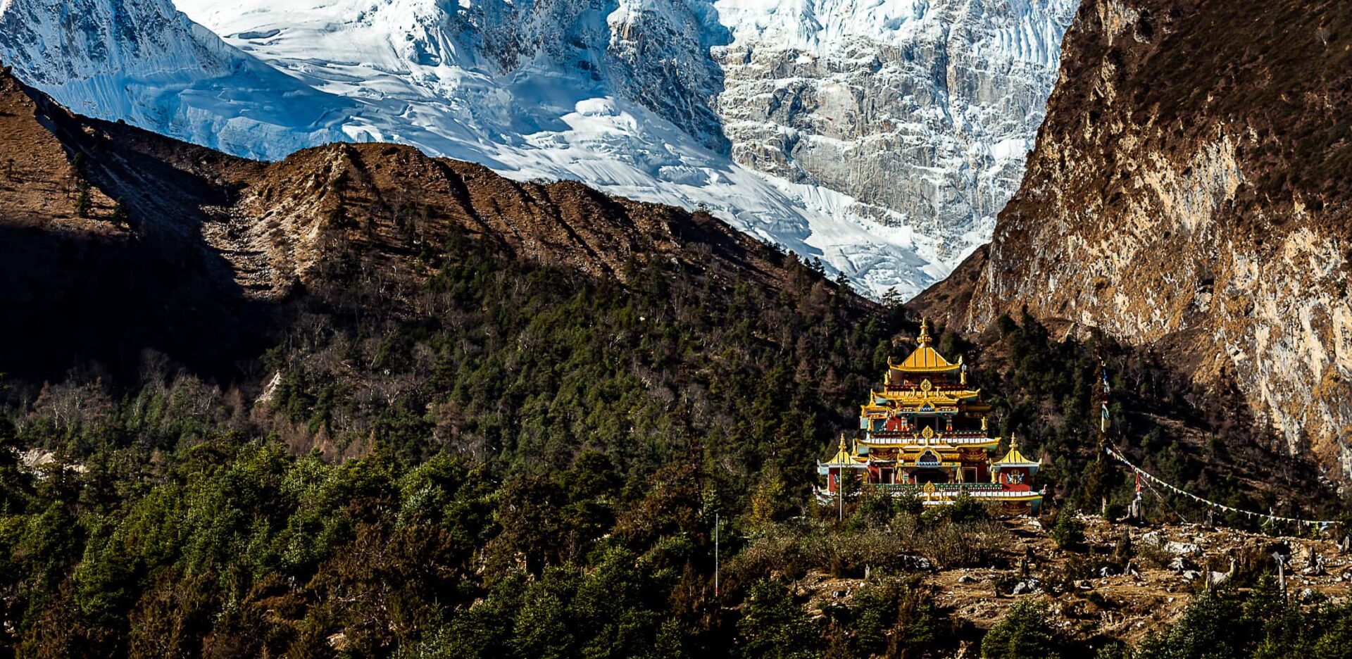
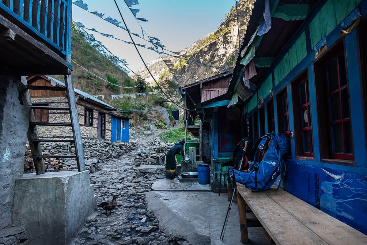
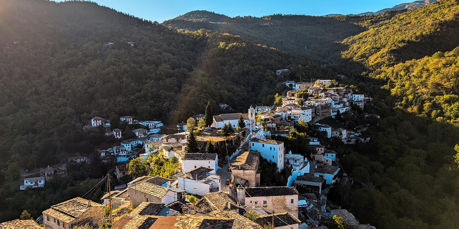
Once you reach Lho and its mystical monastery, and more noticeably in Samagaon, you will see a wonderful switch in architecture, food, culture, language, and people as you reach a more Tibetan side of the area. It is time to try Tibetan salty yak butter tea, traditional thukpa, and thenthuk soups. The Namaste will be soon changed to Tashi-Delek and you’ll be surrounded by shortens, praying flags, prayer wheels, and painted yak skulls. And faster than you will realize, the peaks surrounding you are now only covered by eternal snow. This feeling is truly incredible and still authentic compared to other trails in Nepal, and it was truly the highlight of this trek atmosphere. Past Lho, the higher altitude and lack of oxygen can become more noticeable, and often, guides suggest a two-night stop to acclimatize in Samagaon, with a day of rest, where you’ll be proposed a day hike either at the glacier lake or the Manaslu base camp. Find at the end of this article more tips on how to deal with altitude and how to be careful with altitude sickness.

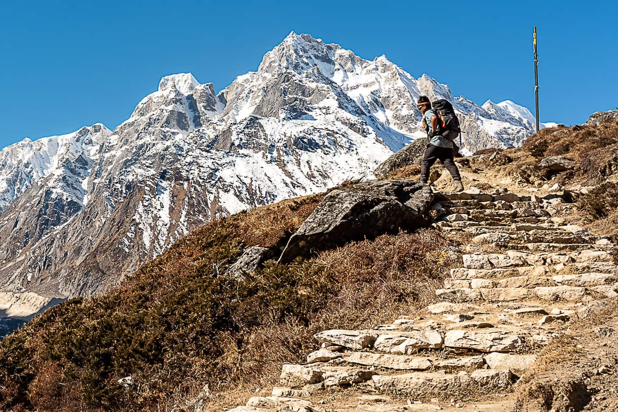
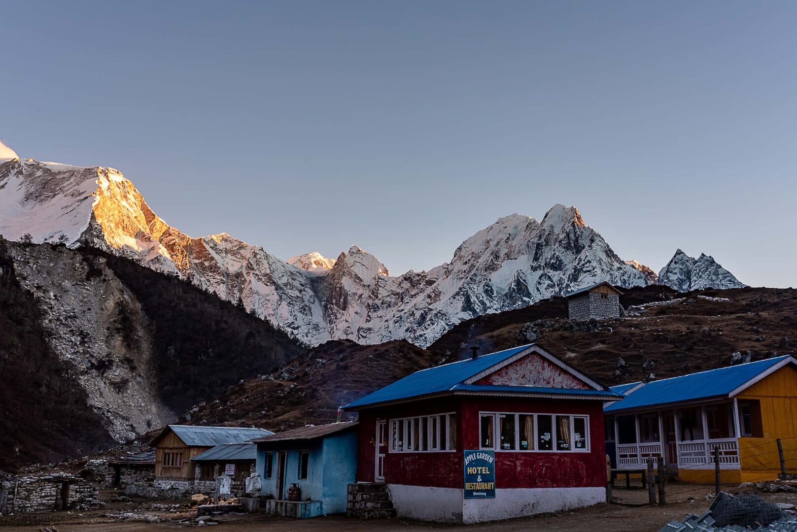
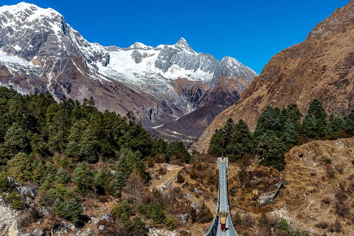
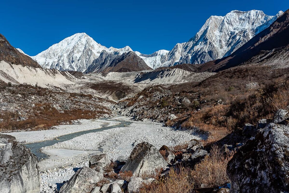
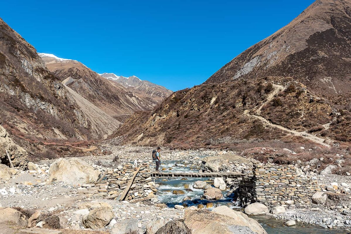
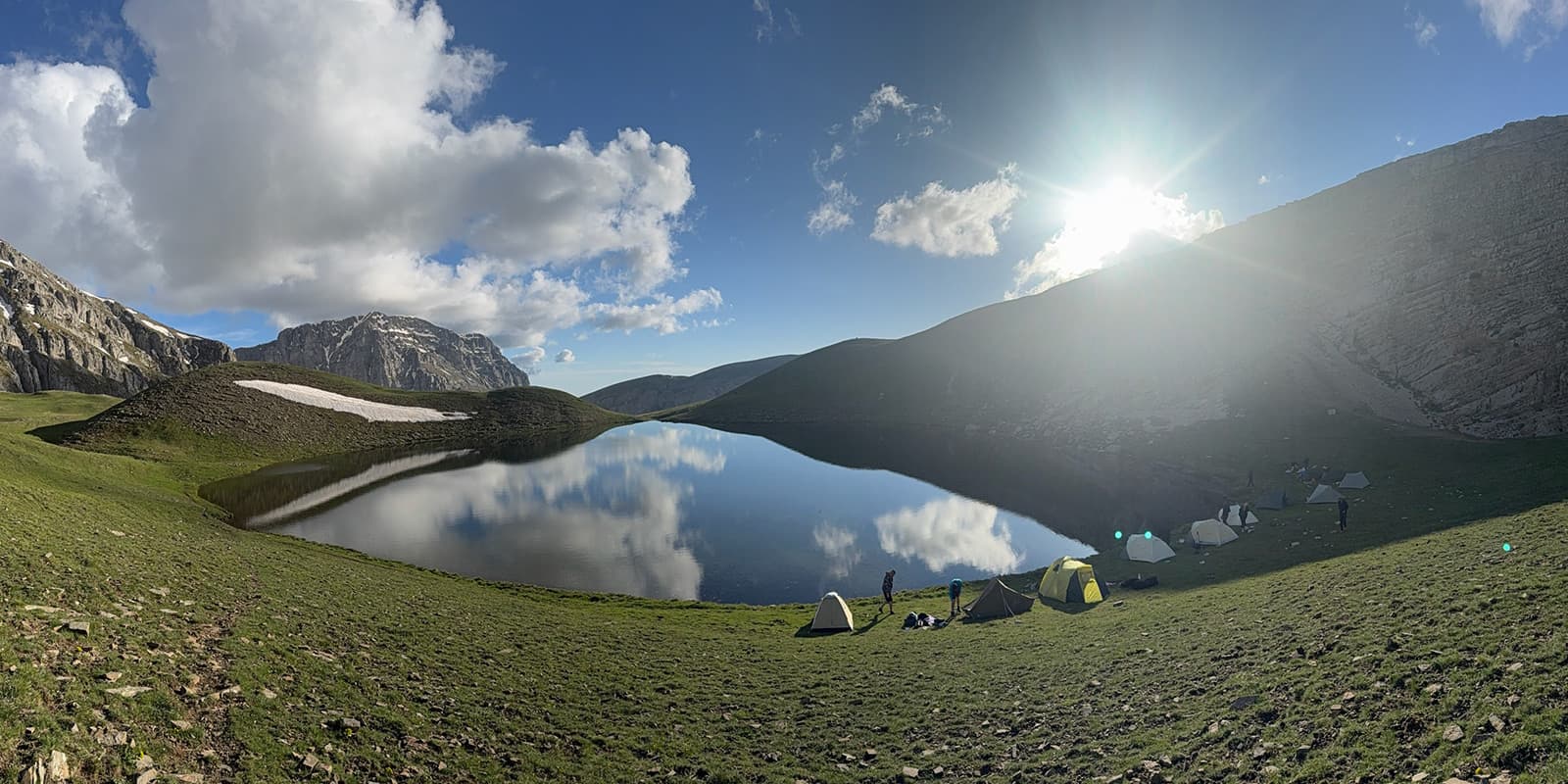
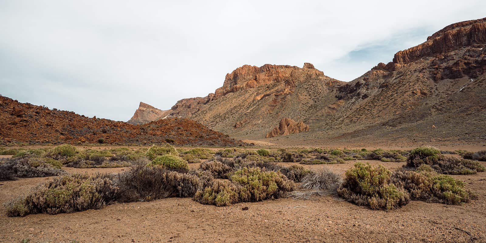
From Samagoan to Samdo, you will enter the wildest part of Manaslu, where the paths get more and more barren with only a few yaks and huts, and the walk there can become long and difficult as you are in a never-ending long couloir in between two mountains. In this area with less vegetation, you see the next villages from far away, but they always take a very long time to reach. In Samdo, you can, if it’s allowed, do a day hike to the Tibetan border, but it is probably still closed due to political tension. Samdo is the last permanent settlement that used to live from the trade with the Chinese merchants, and past this point, you will have to reach a long hike that ends in Dharamsala, also called Larke Pass base camp. This hike will challenge your lungs and the lack of oxygen can be intense here if you haven’t been to this altitude yet on your trip. It’s only a few 6km, but you will climb up nearly 600 meters in elevation, so get ready early in the morning full of energy. The base camp is not even a refuge, more a collection of construction-site block houses with a few tents where locals can cook some meals. It won’t be a comfortable night and the food is far from the best Nepali food you can find, but it is mandatory to eat to have energy for the next day. The little huts where you sleep are quite warm, but it is where you will be happy to have carried a sleeping bag with you all the way here. Make sure to put your batteries, water filter, and water bottles inside your sleeping bag at night as everything freezes at night in the rooms.

Your guide will wake you up in the morning at no later than 4 AM for breakfast before the Larke Pass. Garlic soups are often advised for helping with the altitude and try to eat something hot and rich for the hike, combine it with chapatis or light bread, or a classic hot breakfast. The beginning follows a ridge and you will see mostly nothing but your guide’s backpack in front of your headlamp as it will be completely dark, with only the dark summit silhouettes surrounding you visible or if you are lucky a sky lit by stars. There’s about 6 km of distance, with 600 meters of elevation before the top, and the first half, depending on the season and snow condition, can be relatively easy and just repetitive stairs and walking in the dark. The second half will require you most likely to put microspikes or crampons on your shoes as it’s covered in ice and snow, but quite wide and not very dangerous, so be prepared and have them easily accessible in your bag and practice on how to put them on before, as your fingers can become very cold during this operation.

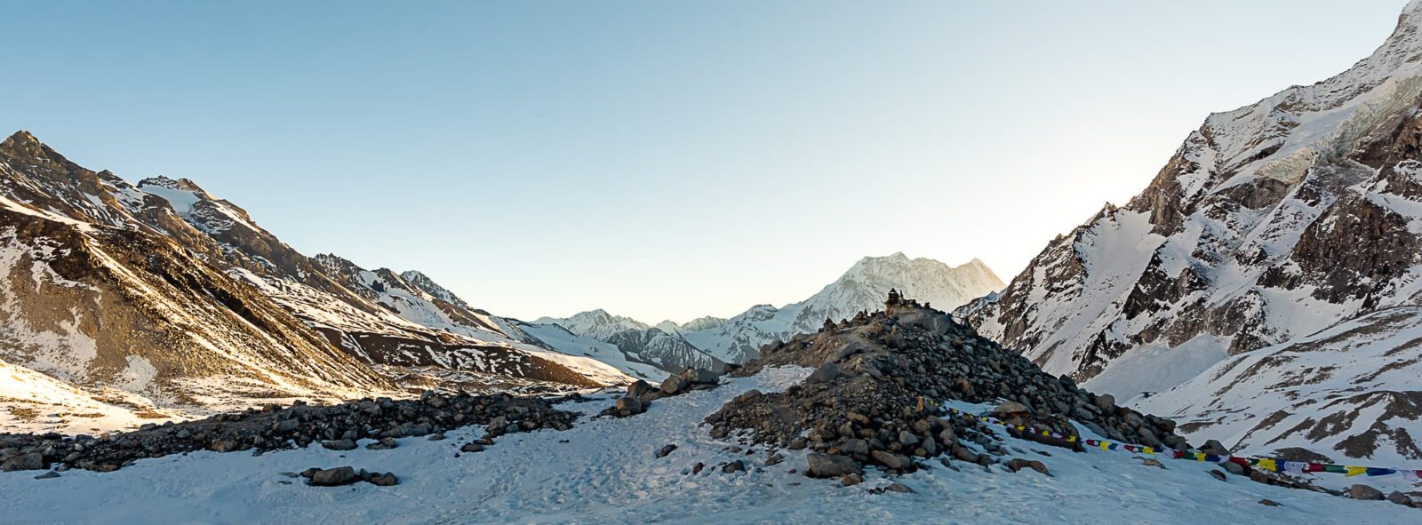
The summit is reached at 5100m, with a stone covered in prayer flags. The summit sadly doesn’t offer a view, as it’s on a small plateau, but as soon as you pass this area, you will start the long and steep descent. This is the reason why you have started your hike early, as now, the sun is up and you have to reach the mountain down before the ice melts too much. Most of the time, before winter, yak herders dig “steps” in the ice that should be “wide enough to fit a yak”. Therefore, the path is usually quite clear and defined, but again, crampons and spikes are helping a lot here. This steep descent lasts a couple of km, and once you reach the rocky moraine on the other side, you will slowly come back to the same kind of landscape seen before Samdo. After a long day, you will reach the cute and colorful village of Bimtang, most likely at the beginning of the afternoon, and deserve a long rest.

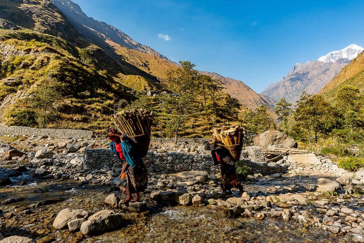
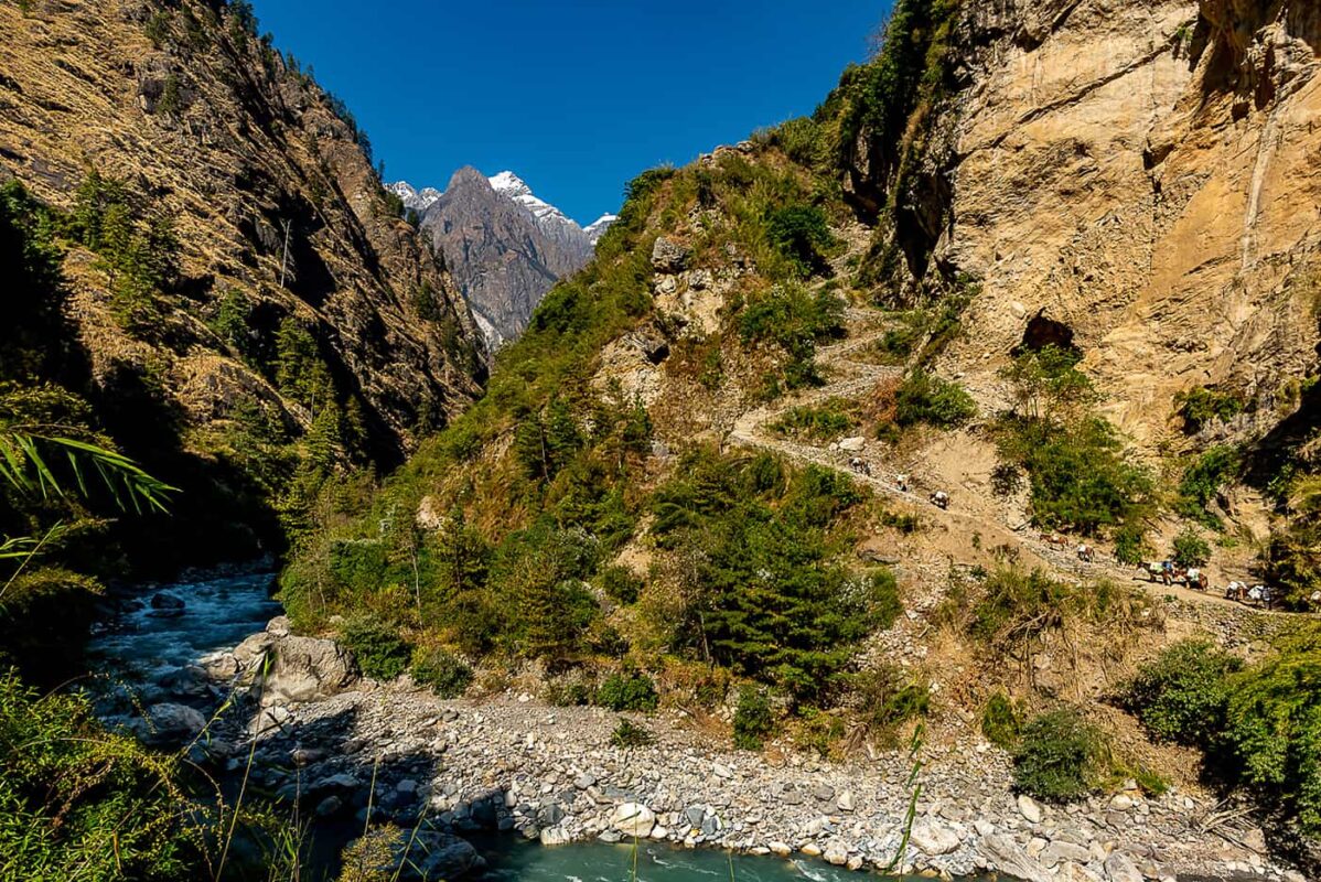
After leaving Bimtang, you will get down a 1000m in elevation, through some steep forests. While the paths are very enjoyable and a nice relaxing forest walk after the mountain pass, you will keep going down all day on sometimes very high natural steps made of roots and rocks, and it can start to get on your knees. You will then go down more and more into the valley towards Gowa, and from there spend a last night in the Manaslu region the next morning you can catch a Jeep in Tilje or Dharapani that will go towards Pokhara or Kathmandu, or keep hiking on towards the Annapurna Circuit trek, this is arrangeable with your trekking agency.

Stages

Manaslu Trek stages

Stage 1:

Soti Khola (760) – Tatopani (900), 20 km | 12.4 mi

Stage 2:

Tatopani (900) – Philim (1590), 18 km | 11.2 mi

Stage 3:

Philim (1590) – Bihi Phedi (1960), 17 km | 10.6 mi

Stage 4:

Bihi Phedi (1960) – Namrung (2500), 13 km | 8 mi

Stage 5:

Namrung (2500) – Lho (3160), 10 km | 6.2 mi

Stage 6:

Lho (3160) – Samagaon (3560), 9 km | 5.6 mi

Stage 7:

Acclimatisation day – day hike to Manaslu base camp or glacier lake

Stage 8:

Samagaon (3560) – Samdo (3830), 11 km | 6.8 mi

Stage 9:

Samdo (3830) – Dharamsala (Larke Pass base camp) (4475), 6 km | 3.7 mi

Stage 10:

Dharamsala (4475) – Bintang (3600) via Larke Pass (5100), 16 km | 10 mi

Stage 11:

Bintang (3600) – Gowa (2400), 16km | 10 mi

Stage 12:

Hike a few kilometers down from Gowa to catch a Jeep in Tilje that will go south towards Pokhara or Kathmandu, or keep hiking on towards Dharapani and the Annapurna Circuit trek.

Accommodations

On the Manaslu Trek you will stay in traditional commercial tea houses, homestays owned by a family, hotels, or base camp settlements. Most of the time you won’t be allowed to choose, or only choose between one or two options, depending on your guide and the packaging you have with the tourist agency. All guesthouses can provide basic food and local snacks but do not expect to find exotic food or international snacks that you can find in Kathmandu or more popular treks like Everest base camp or Annapurna circuit.

Most of the rooms consist of two single-person beds, with a plug, a light, and a table. It is more comfortable than it seems and they are usually surprisingly clean. They all offer a thick blanket, but it is strongly advised to have a sleeping bag that can withstand cold temperatures at night. Some places can offer hot showers or buckets of hot water for daily hygiene but do not expect it to be the norm everywhere.

Best time of the year

Nepal has two main active seasons, each one between winter and the monsoon. The first most crowded and arguably the best time of the year to hike in the Himalayas is between September and December, and the second period ranges from April to May. The first tourist season tends to be described as the one having the most clear blue skies and the least rain with a dry atmosphere and progressively colder temperatures, but shorter days. The second period tends to be more humid, with remnants of the last winter. Still, it shows more attractive colors in the fauna as spring unveils beautiful flowers like rhododendrons and many others.

Outside of these periods, the Manaslu Trek might be either uncomfortably hot and humid in summer, or extremely cold and snowy in winter. Bear in mind that due to climate change effects in the region, over the past couple of years, the starting/ending dates tend to be more variable and each season tends to shift or linger, therefore predictions on the weather a few months/weeks prior might not follow usual trends anymore. As an example, I was still hiking in January 2023 in the Everest region, and according to locals, trails should have been covered in snow already. Also, it has been reported that a few heavy monsoon rain showers tend to still happen up until late October, enough to create flooding of river beds or even landslides in many regions of the Himalayas.

From personal experience, and maybe luck, the end of November / December seems to be the best weather-wise and with fewer crowds due to be considered “end of season”. Prices can also be a bit bargained with tourism agencies or tea houses regarding room prices, depending on the season and tourist affluence of the moment. For instance, in Annapurna, it is easier to get a free room if you stay eating dinner and breakfast in a lodge or discount a shower if you are in low season.

Remoteness

Peak time of the season can be quite busy and can lead to overcrowded trails, but rare shortages of accommodation space from what I’ve heard. The Manaslu Trek is one of the wildest, least traveled, most off-the-beaten paths you can have in the region, and you will avoid the ever-growing crowds of Annapurna and Everest trails. You start the trek where the roads end, and the more you arrive towards Larke Pass, you will progressively go through the most remote villages and paths you can travel in Nepal. Phone coverage can become erratic or even not available for longer periods and wifi service is still not as widely developed as other more popular treks.


Safety & Gear

Altitude

Altitude Sickness or Acute Mountain Sickness (AMS) is a medical consideration faced while trekking in the Himalayas and it is nothing to joke about. It rarely occurs at altitudes lower than 2,800m/9,186 ft., and only minor symptoms occur below 3,000m/9842ft. The sickness occurs when the body does not adjust well to the lack of oxygen at higher altitudes. The major cause of high altitude sickness is ascending to a height greater than 2,800m or 9000 ft. too rapidly. Giving the body little to no time to get used to the thinner air and lower oxygen levels triggers AMS. The primary signifier of altitude sickness is a persistent headache. However, if not addressed in due time, it may develop into more complicated variations such as high-altitude cerebral edema and high-altitude pulmonary edema. Medicine like Diamox can be taken to help prevent symptoms. However, they are to take into consideration that they are not a cure, just temporarily help your body to acclimatize, but do not take them if you are stranded at a high altitude with severe symptoms. The only medicine is to go down on altitude as quickly as you can, and nothing else. Taking paracetamol or anything else can even worsen the effects.

It is imperative to communicate your symptoms immediately to a person in your group, a guide of another group, or a staff from the tea houses who will know what to do. Many hikers each year get surprised and get into trouble once they reach 4000m. It is recommended to not go higher than 500m in elevation compared to the elevation of the last place you slept, as it is after 6 hours at high altitude that the “discreet” symptoms can occur in your body. Most hiking groups and guides will stop in Samagoan to have a rest day to acclimatize, however, they can advise not to if they see you fit and show no symptoms of altitude sickness, as was the case for me. There are many more detailed articles regarding AMS and its effect on the body, and it is always good to know what are the basic symptoms and how they affect the body before going to this region.

Cold

Be mindful of the sun as you’ll progressively hike deeper inside a canyon in a south-north axis, the Sun will set behind the mountain way quicker than usual, and temperatures can drop quite dramatically very fast starting from 3-4 PM (depending on the season), it is very good practice to start hiking quite early in the morning (leaving no later than 8 AM) and your guide will most likely make you wake up early. Starting from 3000m, it is advisable to wear proper gear for the season and not underestimate the temperatures. For instance, when I slept at the base camp, temperatures in my room were negative and it is strongly recommended to bring a sleeping bag with you, even if most lodges provide thick blankets and often fire in the kitchen area.

On Larke Pass, temperatures can drop to minus 20 degrees with strong wind, which can freeze your water. It is recommended to sleep with your water filter (as this shouldn’t freeze or it can damage the filter), your batteries, and a bottle of water inside your sleeping bag if you want to avoid them from freezing at night. For Larke Pass, a pair of good gloves was something I wish I had as I could feel my fingers getting numb very quickly.

Recommended gear

The Manaslu Trek is very rugged at the beginning and you will go through steep sections on very narrow paths with a huge cliff on the side. It is advised to have proper footwear, it is doable in trail runners but make sure you have a safe and strong foot. Some trails are not to be underestimated as landslides and floods tend to create temporary side trails that have jaw-dropping cliffs on the side and can be quite gnarly. Once you reach Loh, it will become more like a proper alpine forest walk then you’ll reach the first mountain feet at Samagaon, where you will have to walk on more rocky barren terrain. At the mountain pass, it is recommended and even mandatory by some agencies to wear crampons or at least spikes as the whole descent is on the ice.

There’s an uncountable amount of stairs on the Manaslu Trek, made of rocks that are never the same, and very treacherous terrain with unstable rocks, so a pair of walking sticks can help to climb up, to find stability, and it helps alleviate the pain on your knees when you go down as well. Warm clothes for the evening as rare are the rooms heated. A sleeping bag for the night, even during the warmer seasons. A headlamp to walk on Larke Pass as most of the ascent will be before sunrise. A system to filtrate or purify your water.

You can have a lightweight backpack as long as it fits a sleeping bag, warm clothes, water, and snacks. All of the gear listed here can be found in all knock-off markets of Kathmandu or Pokhara. You can also find places that rent sleeping bags or backpacks, but sleeping bag quality and warmth rating there are very subjective and shouldn’t be trusted to avoid bad surprises at high altitudes. In this whole region, there are no shops that I have seen that would sell any hiking or trekking gear other than pairs of socks at best, so be advised to have all your gear when you leave Kathmandu. Not that they are necessary, but in most bookshops of Kathmandu you can find cheap paper maps of the region, or to keep as souvenirs.

You can pack some snacks from Kathmandu and Pokhara that will be cheaper, like nuts, Snickers, biscuits, tea bags, coffee bags, honey, peanut butter, etc as supply is quite limited in the area.

Good to know

Permits

The Manaslu Trek lies in a national park and natural reserve that is highly protected. It’s part of its charm and beauty, but also means it is required to buy different permits to access this area. It is mandatory to get these permits (RAP and MCAP) through a tourist agency in Kathmandu or Pokhara, which will provide you a package Guide (mandatory) + porter (optional) + permits + transports. A guide costs roughly 25 USD/day (that is fixed for up to 6-8 persons) and also expects a baksheesh (tip) at the end of the trip. Also, you will be required to have the Annapurna Conservation Area Permit (ACA) if you continue towards this trek past Dharapani. This permit also grants you access to the Annapurna Circuit trek + base camp. It can be bought without the help of a tourist agency at the Tourist Service Centre and the Department of National Parks and Wildlife Conservation in Kathmandu, as well as The Annapurna Conservation Area Project (ACAP) office in Pokhara.

Be prepared to have 2 passport pictures when you apply for each permit (if you require more permits later, you will also need to bring more pictures, and they are more expensive to be made on the spot). It used to be recommended to also get a TIMS card (hiker’s ID) in Kathmandu, but it’s now rarely recommended nowadays as even tourist agencies will advise you not to waste your money on it, and during my 46 days in the Himalayas, nobody ever asked me to show it. However, tourism laws and politics can change quickly each season, so always double-check this information with your agency or official sources.

Permit costs Manaslu Trek
Special Restricted Area Permit for Manaslu (Manaslu RAP) 100 USD
Manaslu Conservation Area Project (MCAP Permit) 30 USD
Annapurna Conservation Area Project (ACAP Permit) 30 USD

Water and food

Every village I passed on the Manaslu Trek had a water fountain and water was widely available, but that can change a little bit depending on the seasons. It’s well recommended to have your own filtration or purification system to avoid buying plastic bottles of water and possible water contamination. Water in the area (taps and fountains) is from the mountain and unfiltered. I used a filter like Platypus, but chlorine tabs work well, are cheap, and are widely available in Kathmandu’s pharmacies. Always take water from moving water as lakes in the areas are heavily sedimented and can clog filters faster.

Food in teahouses is usually very good, but the price increases proportionally to the altitude. I strongly recommend trying local food, like the famous dal bhat (rice and lentil curry) which provides everything you need for a full day of hiking or to recover from it, and locals will swear by it as they eat it every day. Every guesthouse has its own recipe, which can vary from passable taste to the most exquisite flavors. You can also try momos (stuffed dumplings, steamed or fried), and many other Tibetan or Indian-influenced dishes, to combine with a masala chai tea. Try Tibetan butter tea for being as strong as a yak once you reach Samagaon. If you can find a place that makes snickers-roll, you have to try it (after you finish your hike). The guesthouses are very resourceful and some menus can offer some surprising meals, with some good recreations of Western-inspired dishes.

Local wildlife

During your hike on the Manaslu Trek some gray langurs can be seen after Bimtang. You will see quite a few mules and later in higher elevations, they will be replaced by yaks. It is a good practice to always position yourself the furthest away from the cliff when passing or crossing a beast of burden. As they are loaded “on their side” with gas canisters, rice bags, and more, they are not aware of their real width and can push people towards cliffs when they walk next to them. You will see quite a few eagles and birds of prey and can hear marmots whistling sometimes. A friend of mine showed me a video of a white wolf far away in the mountains he captured 10 minutes before I walked there, so keep your eyes open.

Tourist Agencies

Many tourist agencies in Kathmandu or Pokhara offer packages for the Manaslu Trek (jeep + guide + porter + anything else) and do not hesitate to ask to personalize what you want. It is not necessary to have a porter unless you have a large group or a family for example. Many agencies offer tours that are similar and prices can always be haggled, especially if you are in a lower season period or in a bigger group. It is mandatory to have a guide with you in this area. Also, keep in mind anything tour or trip bought online before arrival in Nepal will be double or triple the price of any tour you can get here.

Route
Circuit
Highest point
5100m (16732 ft)

Guidebooks

cover guidebook

Trekking in the Himalaya

View guidebook

Want to submit a trail or make this page more complete?

Comments

Be the first one to comment on this trail!

Reply to this trail

Your email address will not be published. Required fields are marked *

Reply to this trail

Log in to comment on this trail
Always read the disclaimer

Terms of Use: important to all visitors on this website. We strive to publish high quality content and information on this website. However it’s always possible that we’re missing out on some crucial information. In spite of the fact that this route, associated GPS track (GPX and maps) were prepared under diligent research by the specified contributor and/or contributors, the accuracy of such and judgement of the author is not guaranteed. Therefore, hiking-trails.com and contributors are in no way liable for personal injury, damage to personal property, or any other such situation that might happen to individuals hiking or following this route. Should you choose to hike this trail, this is always at your own risk. Check out our guidelines for safety hiking and Leave No Trace principles at the hiking 101 page.

Download GPX

Join the community!

Login or create a FREE account 😊

With an account you can:

Download GPX files

Pin trails to your wishlist

Mark trails as hiked by you

Rate hiking trails

Comment on trails, blogs and gear reviews

Happy trails!
Login

Don't have an account yet? Register here