women with big backpack hiking in grassy field

Main Beskid Trail

Główny Szlak Beskidzki

About the Main Beskid Trail

country
Poland
length
500 km(311 mi)
Type of trail
Thru-hike, Long-distance
difficulty

Difficulty is highly personal. Be aware of the weather conditions as bad weather turns easier trails in difficult trails especially in the mountains.

Moderate
accommodation

Lodging means a mix of hotels, hostels or AirBnB’s.

Mountain huts, Camping, Lodging
Elevation gain
22000 m(72178 ft)
terrain
Hills, Countryside, Forest, Mountains
remoteness
Most of the time
Show more

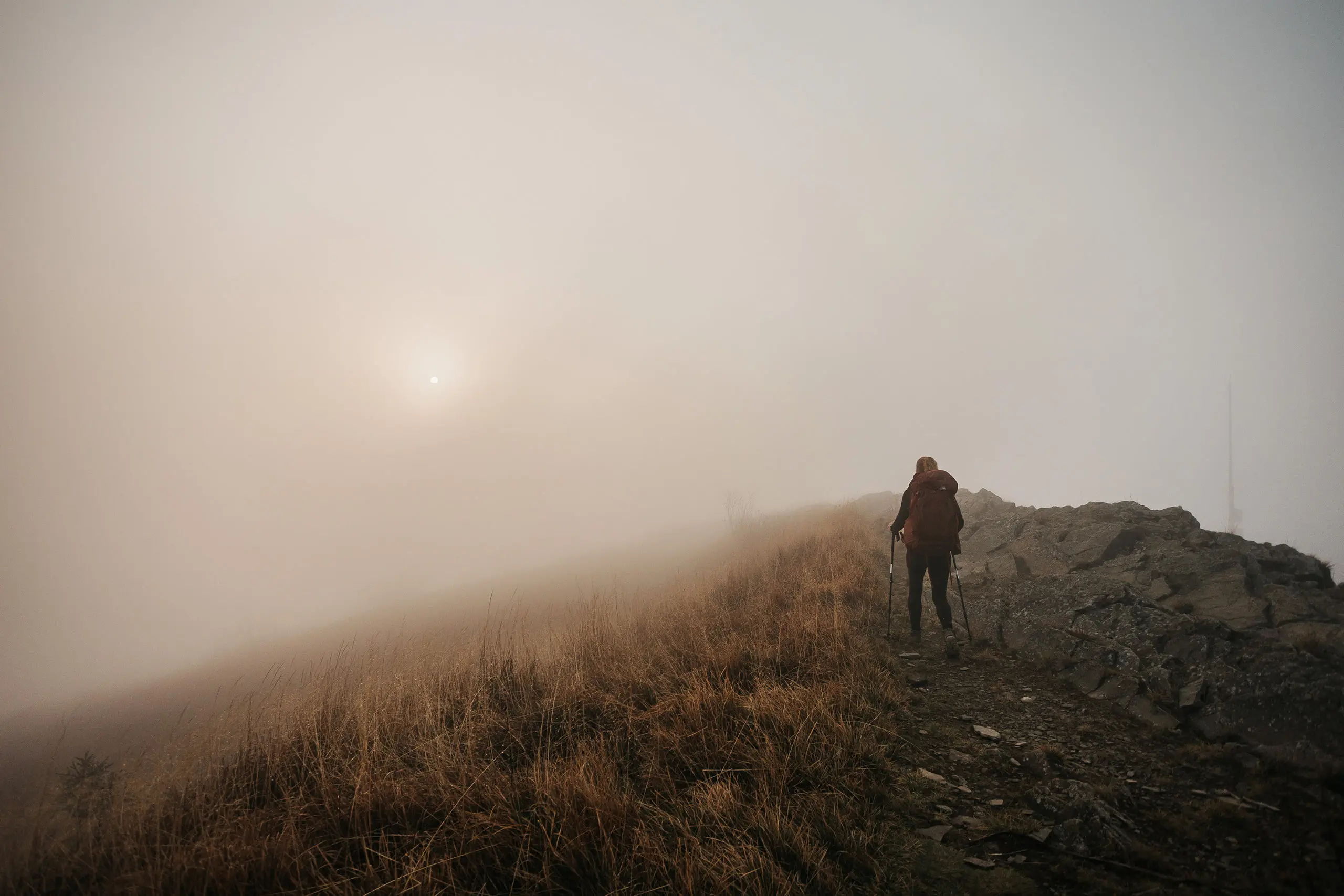
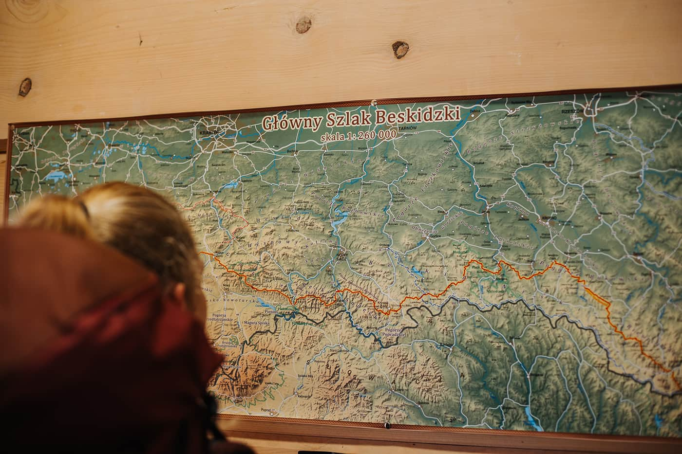
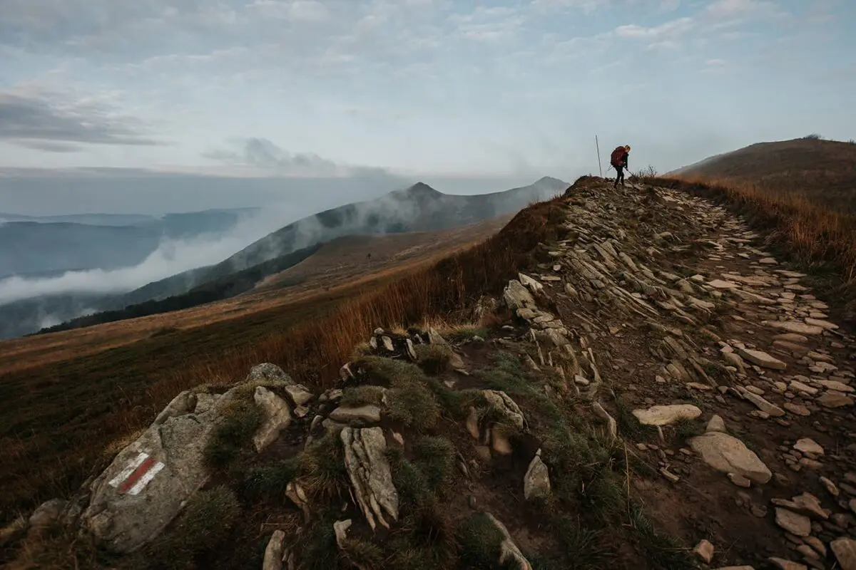
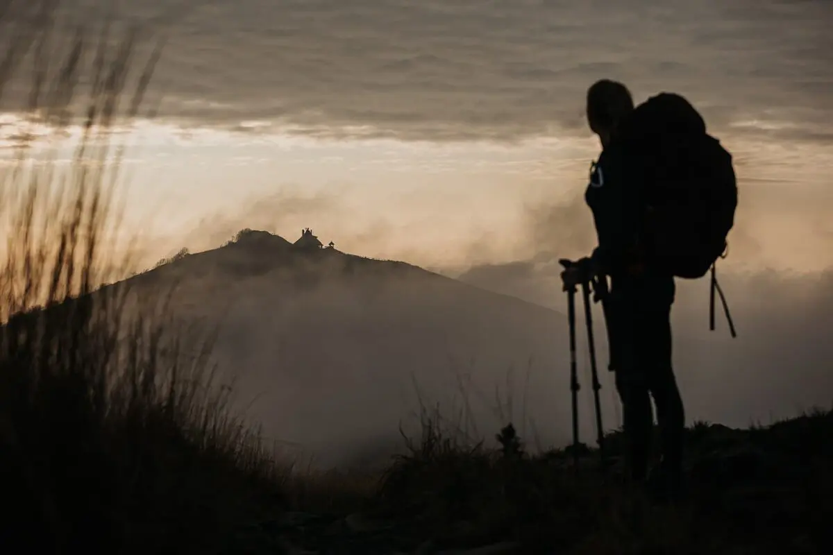
Poland’s longest hiking trail and a thru-hike through the Beskiden mountain range, the Main Beskid Trail, presents a great exploration of the Polish mountains, stretching over 500 kilometers across Silesia, Lesser Poland, and Subcarpathian regions. Starting from the Czech frontier and extending to the Ukrainian border, it weaves through the Beskidy range, linking four national parks and six mountain ridges.

Despite bypassing the Tatra Mountains or Hohe Tatra in Poland, the Main Beskid Trail still has magnificent vistas of the country’s summits. Its red and white markers make for easy navigation. The trail intersects with the European Long-Distance Path E8 between Chyrowa and Wołosate, offering terrain that may pose challenges in some sections due to its steep climbs, descents, and uneven paths. Thus, you should have experience and be in good shape.

Women taking a selfie
Author

Shanna Bussink (Rayu)

Rayu is a solo hiker at heart. She has hiked in the wilds of Canada, embarked on freestyling through Montenegro and Latvia, and has also hit the beaten track of Kungsleden, Rota Vicentina and the Jordan Trail, among others. She is a certified hike & survival instructor, and also runs the all-round preparation process for the Fjällräven Classic Sweden and gives workshops. Be sure to check out her website: hikenbeginthier.nl.

View profile

The Trail

The trail’s roots trace back to the World Wars, with it starting in 1925 and concluding a decade later, under the direction of mountain enthusiast Kazimierz Sosnowski. Initially, it stretched into what is now Ukraine, reaching Romania’s border, reflecting the pre-World War II Polish borders. Post-war adjustments were made to finalize its current course. Along its length, you will encounter historical sites from World War II, including bunkers and trenches, with some mountain lodges bearing historical significance from that era.

Starting from Ustroń, the trail ascends through Beskid Śląski, touching upon notable peaks and traversing the highest parts of the Western Beskids, including the trail’s pinnacle at Babia Góra in Babiogórski National Park.

You will continue through Gorczański National Park, covering the Gorce mountains, known for their scenic beauty and historical significance. The trail then winds through Beskid Sądecki, offering views of the layered landscapes and dipping to its lowest point in Rytro. Special mention goes to the Hali Łabowskiej mountain hut, a focal point for trail enthusiasts.

As the trail ventures into the Beskid Niski, or Lower Beskids, the terrain becomes more rugged and remote, with the wilderness of the Magura National Park adding to its beauty. The trail passes historic sites like the wooden church of Komańcza and continues through the scenic Cisna-Wetlina Landscape Park, reaching into the Eastern Carpathians with their unique landslide lakes.

You will finish in the breathtaking Bieszczady region, a UNESCO World Heritage site, which has the high peaks like Smerek and Tarnica, and ends in Wołosate. The final stretch across the Bieszczady ridges provides a fitting and spectacular conclusion to this beautiful hike through Poland’s mountainous beauty. A real hidden gem and thru-hike across Poland!

Stages

Of course, you can determine the stages yourself due fitness level and preferences. Due to the PTTK, Polish Tourism Association, you can earn a badge for hiking the following stages of the Main Beskid Trail in 21 days/stages. To enjoy the trail even more, we would recommend taking more time.

Stages of the Main Beskid

Stage 1:

Mountain hut PTTK na Stożku, 20 km | 12.5 mi

Stage 2:

Mountain hut PTTK na Stożku – Mountain hut PTTK Przysłop Pod Baranią Górą, 16 km | 10 mi

Stage 3:

Mountain hut PTTK Przysłop Pod Baranią Górą – Mountain hut Słowianka, 26 km | 16 mi

Stage 4:

Mountain hut Słowianka – Camp Głuchaczki, 27 km | 16.7 mi

Stage 5:

Camp Głuchaczki – Mountain hut PTTK na Hali Krupowej, 28 km | 17.4 mi

Stage 6:

Mountain hut PTTK na Hali Krupowej – Rabka Zdrój, 32 km | 19.9 mi

Stage 7:

Rabka Zdrój – Mountain hut PTTK na Turbaczu, 16 km | 10 mi

Stage 8:

Mountain hut PTTK na Turbaczu – Camp na Lubaniu, 22 km | 13.7 mi

Stage 9:

Camp na Lubaniu – Mountain hut PTTK na Przechybie, 22 km | 13.7 mi

Stage 10:

Mountain hut PTTK na Przechybie – Mountain hut Cyrla, 20 km | 12.5 mi

Stage 11:

Mountain hut Cyrla – Krynica Górska, 26 km | 16 mi

Stage 12:

Krynica Górska – Camp w Regietowie, 29 km | 18 mi

Stage 13:

Camp w Regietowie – Mountain hut PTTK w Bartnem, 19 km | 11.9 mi

Stage 14:

Mountain hut PTTK w Bartnem – Chyrowa, 31 km | 19.3 mi

Stage 15:

Chyrowa – Rymanów Zdrój, 25 km | 15.5 mi

Stage 16:

Rymanów Zdrój – Hut w Przybyszowie, 26 km | 16 mi

Stage 17:

Hut w Przybyszowie – Komańcza, 19 km | 11.9 mi

Stage 18:

Komańcza – Mountain Hut PTTK pod Honem, 24 km | 15 mi

Stage 19:

Mountain Hut PTTK pod Honem – Smerek, 18 km | 11 mi

Stage 20:

Smerek – Ustrzyki Górne, 24 km | 15 mi

Stage 21:

Ustrzyki Górne – Wołosate, 22 km | 13.7 mi

Accommodations

While hiking the Main Beskid Trail you’ll find a lot of mountain huts alongside the trail. On the west side, there are many, making it easy to adjust the stage planning. On the eastern part of the trail, there are fewer options, here you sleep sometimes in mountain huts and sometimes in accommodations in the small towns you’ll pass. Make sure you make reservations when hiking this trail in July or August. You may also camp next to most of the mountain huts. Just ask the hut owner before pitching your tent.

More information about the huts: PTTK.

Overnights in the mountain huts & accommodations per stage:

Stage 1:

Ustroń – Mountain hut PTTK na Stożku

Stage 2:

Mountain hut PTTK Przysłop Pod Baranią Górą

Stage 3:

Mountain hut Słowianka

Stage 4:

Camp Głuchaczki

Stage 5:

Mountain hut PTTK na Hali Krupowej

Stage 6:

Rabka Zdrój

Stage 7:

Mountain hut PTTK na Turbaczu

Stage 8:

Camp na Lubaniu

Stage 9:

Mountain hut PTTK na Przechybie

Stage 10:

Mountain hut Cyrla

Stage 11:

Krynica Górska

Stage 12:

Camp w Regietowie

Stage 13:

Mountain hut PTTK w Bartnem

Stage 14:

Chyrowa

Stage 15:

Rymanów Zdrój

Stage 16:

Hut w Przybyszowie

Stage 17:

Komańcza

Stage 18:

Mountain hut PTTK pod Honem

Stage 19:

Smerek

Stage 20:

Ustrzyki Górne

Stage 21:

Wołosate

Best time of the year

The best time to hike the Main Beskid Trail is roughly between May and October. This period offers the best weather conditions, with warmer temperatures and reduced likelihood of snowfall in May and October, which is especially important given the trail’s diverse terrain and range of altitudes. Most mountain huts are open between these months, note that they may close during the off-season, and make sure you book the mountain huts in advance during the high season in July and August.

Safety & Gear

Being safe on the Main Beskid Trail, as with any long-distance hiking trail is the most important thing. Assess your physical condition and choose trail segments that match your hiking experience and fitness level. Some parts of the trail are more challenging than others, with steep ascents, descents, and rugged terrain. Research the stages in advance, including distances between points, elevation changes, and estimated hiking times. Be aware of the locations of shelters, water sources, and emergency exits from the trail.

Of course, carry appropriate gear, including a reliable map and/or GPS device, a compass, a first-aid kit, a multi-tool, and a headlamp. Dress in layers to adapt to changing weather conditions and wear your comfortable and sturdy hiking shoes.

The trail is well-marked with red and white markers. Always stay on the marked trail to avoid getting lost and to minimize environmental impact. Let someone know your plans, including your route and expected return time.

Mountain weather can be unpredictable and change rapidly. Check the weather forecast before setting out and be prepared for sudden changes, including rain, fog, and temperature drops. While wildlife encounters are generally rare and not a significant danger, it’s important to know how to react if you encounter wild animals. Keep a safe distance and do not feed or provoke them.

Carry enough water and high-energy snacks. Be aware of water sources along the trail, but also consider carrying a water filter or purification tablets.

Have the contact information for local emergency services and mountain rescue teams. In some areas, there may be emergency points or shelters. Basic first-aid knowledge can be invaluable in case of minor injuries. Consider carrying a basic first-aid kit and know how to use it.

Good to know

Some ATMs are available in towns including Ustroń, Rabka, Krościenko, Rytro, Krynica Górska, and Komańcza, where you can also stock up on supplies. Additionally, many mountain shelters offer the choice of card payments.

For those interested in adding an element of challenge to their hiking experience, collecting stamps to earn badges is a popular activity. You can obtain a trekking passport at PTTK offices or directly from the mountain shelters. Unique wooden stamps, featuring intricate graphic designs, are available at all shelters and select landmarks like observation towers.

It’s important to remember that these trails are home to wildlife such as bears, wolves, and lynx. While encounters are rare, you should remain vigilant and know how to respond if you come across these animals.

Always follow the Leave No Trace principles to minimize your impact on the environment. Carry out all trash, respect wildlife, and be considerate of other hikers.

Route
Point to point
Highest point
1711m (5613 ft)

Want to submit a trail or make this page more complete?

Comments

Be the first one to comment on this trail!

Reply to this trail

Your email address will not be published. Required fields are marked *

Reply to this trail

Log in to comment on this trail
Always read the disclaimer

Terms of Use: important to all visitors on this website. We strive to publish high quality content and information on this website. However it’s always possible that we’re missing out on some crucial information. In spite of the fact that this route, associated GPS track (GPX and maps) were prepared under diligent research by the specified contributor and/or contributors, the accuracy of such and judgement of the author is not guaranteed. Therefore, hiking-trails.com and contributors are in no way liable for personal injury, damage to personal property, or any other such situation that might happen to individuals hiking or following this route. Should you choose to hike this trail, this is always at your own risk. Check out our guidelines for safety hiking and Leave No Trace principles at the hiking 101 page.

Download GPX

Join the community!

Login or create a FREE account 😊

With an account you can:

Download GPX files

Pin trails to your wishlist

Mark trails as hiked by you

Rate hiking trails

Comment on trails, blogs and gear reviews

Happy trails!
Login

Don't have an account yet? Register here