About the Lugano Trekking

Alps
country
Switzerland
length
46 km(29 mi)
Type of trail
Hut to hut, Long-distance
difficulty

Difficulty is highly personal. Be aware of the weather conditions as bad weather turns easier trails in difficult trails especially in the mountains.

Easy
accommodation

Lodging means a mix of hotels, hostels or AirBnB’s.

Mountain huts
Elevation gain
2850 m(9350 ft)
terrain
Mountains
remoteness
Most of the time
Show more

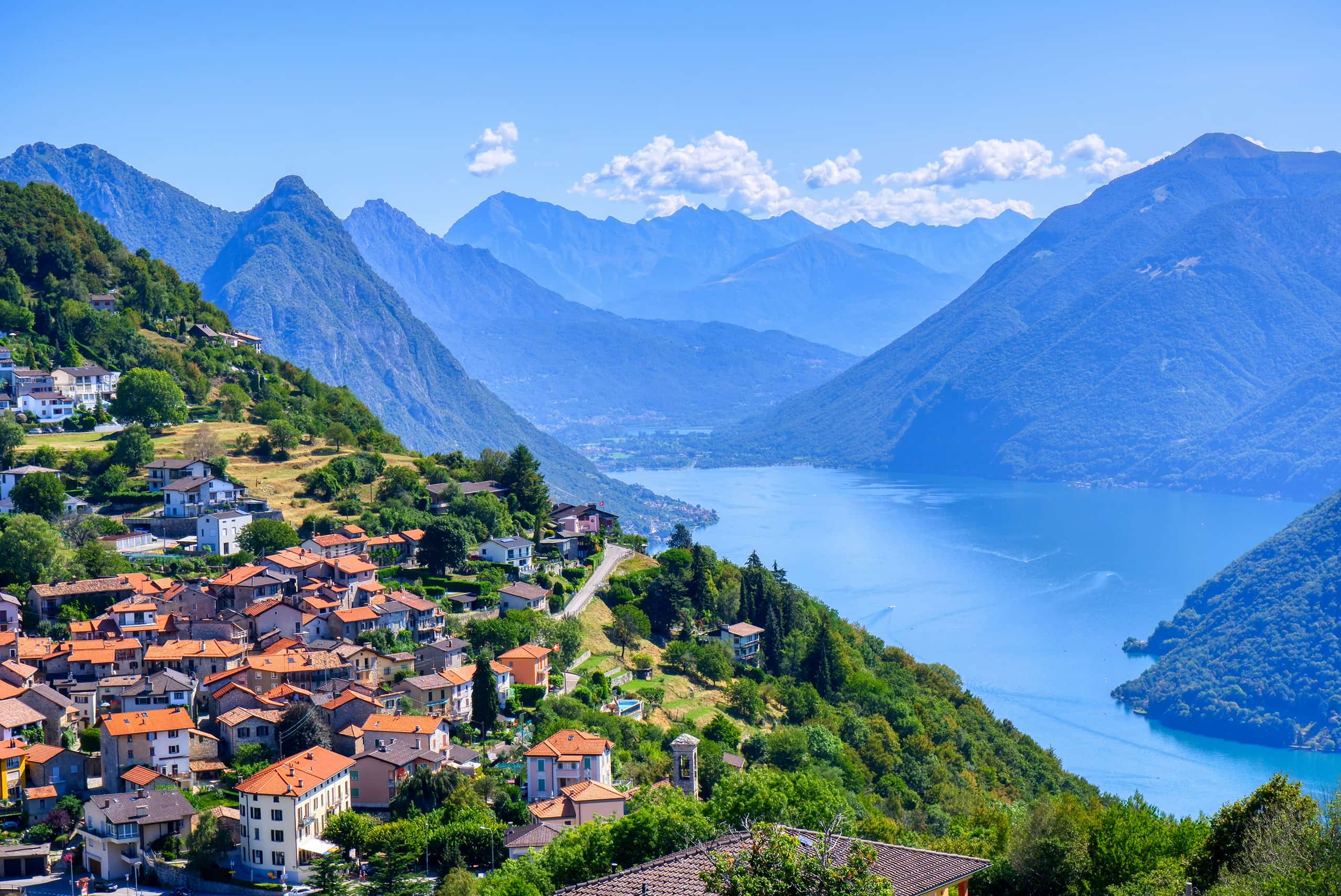
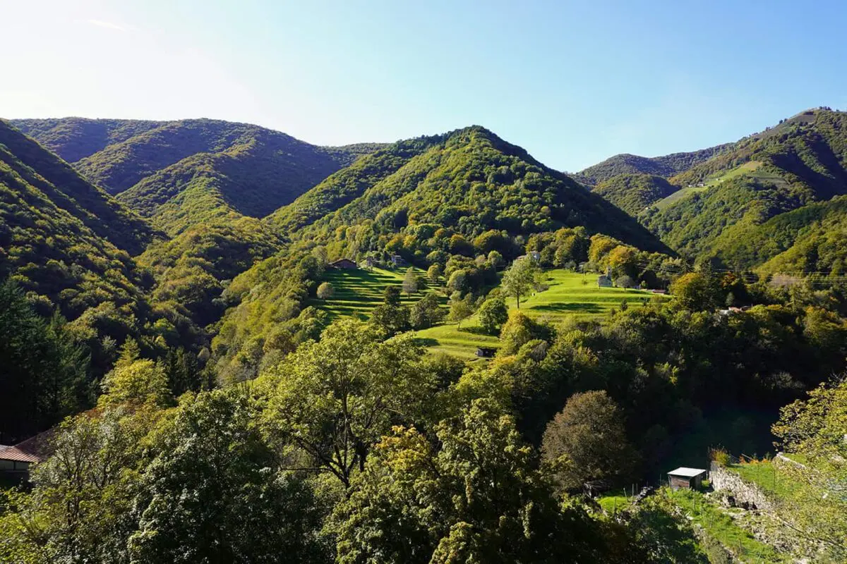
At the southernmost tip of Switzerland lies Ticino, the sunniest canton in the country! Famed for its numerous lakes shared with Italy, Ticino might not be the first place that comes to mind for a hut-to-hut hiking tour. However, it’s a missed opportunity, as Lower Ticino offers nearly year-round hut-to-hut hiking possibilities. One of these trails is the Lugano Trekking, a three-day hut-to-hut hike starting from Monte Bré, a small peak next to Lugano, ending in Tesserete. Discover Ticino’s scenery, the cuisine, and the delightful Mediterranean ambiance.

The Lugano Trekking is a perfect hut-to-hut hiking trail for beginners. It’s not too difficult and at only three days it’s doable for most hikers. Pack light and enjoy the great food in the mountain huts alongside this trail.

Editor

Elmar Teegelbeckers

Passionate hiker Elmar spends months of his time on the trail. He’s usually on the lookout for hidden gems in one of his favourite countries such as Slovenia, Switzerland and Japan. He founded hiking-trails.com in need for a community and detailed information about the trails. Before this, he worked for the Alpine asscociation in the Netherlands[ (NKBV) but lost his heart to the trails.

With this website and socials, he hopes to shape an inclusive community for hikers all over world. No matter your speed, experience or level, you can get out there to enjoy the trails and connect with the heartwarming hiking community. Life is so much better outside and he hopes to inspire hikers to take their first, or next, step on the trail.

View profile

The Trail

This hike starts near Lugano, where you can enjoy views over Lake Lugano and Monte Bré. At the peak of Monte Bré, the trail starts. The first part of the trek takes you to Pairolo, a picturesque mountain hut known for its Italian-style charm and peaceful setting, though occasionally, you might hear the loud ring of a church bell.

As the trail continues, it goes through thick forests and includes a challenging climb to get above the tree line, where you’re greeted with views from a ridge that shows off the region’s mountain lakes. The path includes both downhill and uphill sections, with places to rest and enjoy some Swiss cheese before ending the day at a mountain hut.

As lakes and mountains surround you, the weather on the hike can vary, sometimes bringing thunderstorms at night which add a dynamic element to the mountain atmosphere. Mornings might start with cloudy skies, which calls for careful trekking due to the changing mountain weather. The trail leads to Capanna Monte Bar, offering a chance for rest. This is a luxurious mountain hut with great views of Lake Lugano. This part of the trail is easier, with flat paths through grasslands, offering views that reach into both Italy and Switzerland.

The trek also includes cultural highlights, like coming across twin huts near the Santa Lucia chapel, showcasing the hospitality and traditions of both Switzerland and Italy within a small area. The trail ends with a walk down to the small town of Tesserete, completing this three-day trek.

The Lugano Trekking route is suitable for hikers of various skill levels, featuring clear paths and a maximum difficulty rating of T3 – which stands for mountain trail in the range of T1 (easy wide trails) to T6 (very hard alpine trails). There are several huts along the way, making it easy to plan your trip. All you need is to be in good shape and have the right hiking equipment and if you like, trekking poles. This trek offers a mix of nature, culture, and a bit of a physical challenge, showcasing the quieter charm of Ticino.

Stages

Stage 1:

Monte Bré – Capanna Pairolo, 10 km | 6 mi (5h)

Stage 2:

Capanna Pairolo – Capanna Monte Bar, 16 km | 10 mi (7h)

Stage 3:

Capanna Monte Bar – Tesserete, 16 km | 10 mi (5.5h)

Accommodations

You can stay in the beautiful Swiss mountain huts. Here you can buy food and drinks and sleep in dormitory-style rooms or even a single bedroom at Capanna Monte Bar. Make sure you book them in advance on the websites linked.

Mountain huts per stage

Stage 1:

Capanna Pairolo

Best time of the year

You can almost hike all year round in this lower region of Switzerland. Although you’re dependent on the opening seasons of the mountain huts which open most of the time around May until October. This period also offers the most favorable weather conditions. Make sure you book the mountain huts in advance and be aware of the hot weather in July and August.

Safety & Gear

Prepare accurately for your hut-to-hut hiking trail to be safe out there. Of course, carry appropriate gear, including a reliable map and/or GPS device, a first-aid kit, and a headlamp. Dress in layers to adapt to changing weather conditions and wear your comfortable and sturdy hiking shoes. Carry enough water (at least two liters) and high-energy snacks.

Mountain weather, especially in this region can be unpredictable and change rapidly. Check the weather forecast before setting out and be prepared for sudden changes

Good to know

It can be more crowded during the months of July and August. If you have the option, choose the months of June and September for hiking in Lugano. This is a perfect hut-to-hut hiking trail for hikers who want to begin with hut-to-hut hiking with stages that are not too long or difficult.

Route
Point to point
Highest point
2098m (6883 ft)

Want to submit a trail or make this page more complete?

Comments

Be the first one to comment on this trail!

Reply to this trail

Your email address will not be published. Required fields are marked *

Reply to this trail

Log in to comment on this trail
Always read the disclaimer

Terms of Use: important to all visitors on this website. We strive to publish high quality content and information on this website. However it’s always possible that we’re missing out on some crucial information. In spite of the fact that this route, associated GPS track (GPX and maps) were prepared under diligent research by the specified contributor and/or contributors, the accuracy of such and judgement of the author is not guaranteed. Therefore, hiking-trails.com and contributors are in no way liable for personal injury, damage to personal property, or any other such situation that might happen to individuals hiking or following this route. Should you choose to hike this trail, this is always at your own risk. Check out our guidelines for safety hiking and Leave No Trace principles at the hiking 101 page.

Download GPX

Join the community!

Login or create a FREE account 😊

With an account you can:

Download GPX files

Pin trails to your wishlist

Mark trails as hiked by you

Rate hiking trails

Comment on trails, blogs and gear reviews

Happy trails!
Login

Don't have an account yet? Register here