three persons hiking near mountains and body of water

Lofoten Crossing

Long Crossing of the Lofoten Islands

About the Lofoten Crossing

country
Norway
length
160 km(99 mi)
Type of trail
Long-distance, Thru-hike
difficulty

Difficulty is highly personal. Be aware of the weather conditions as bad weather turns easier trails in difficult trails especially in the mountains.

Strenuous
accommodation

Lodging means a mix of hotels, hostels or AirBnB’s.

Wild camping
Elevation gain
6680 m(21916 ft)
terrain
Mountains, Coastal
remoteness
Most of the time
Show more

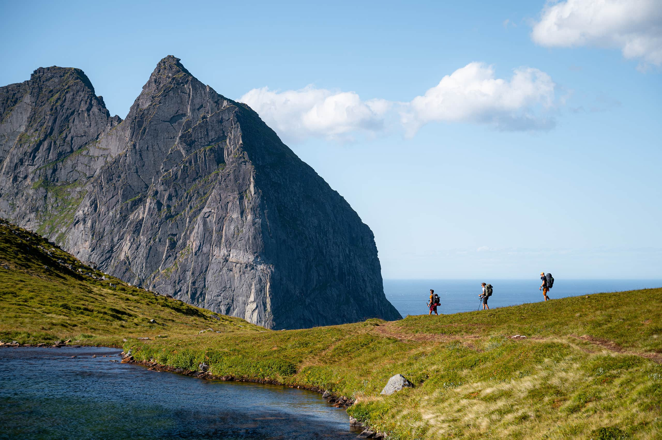
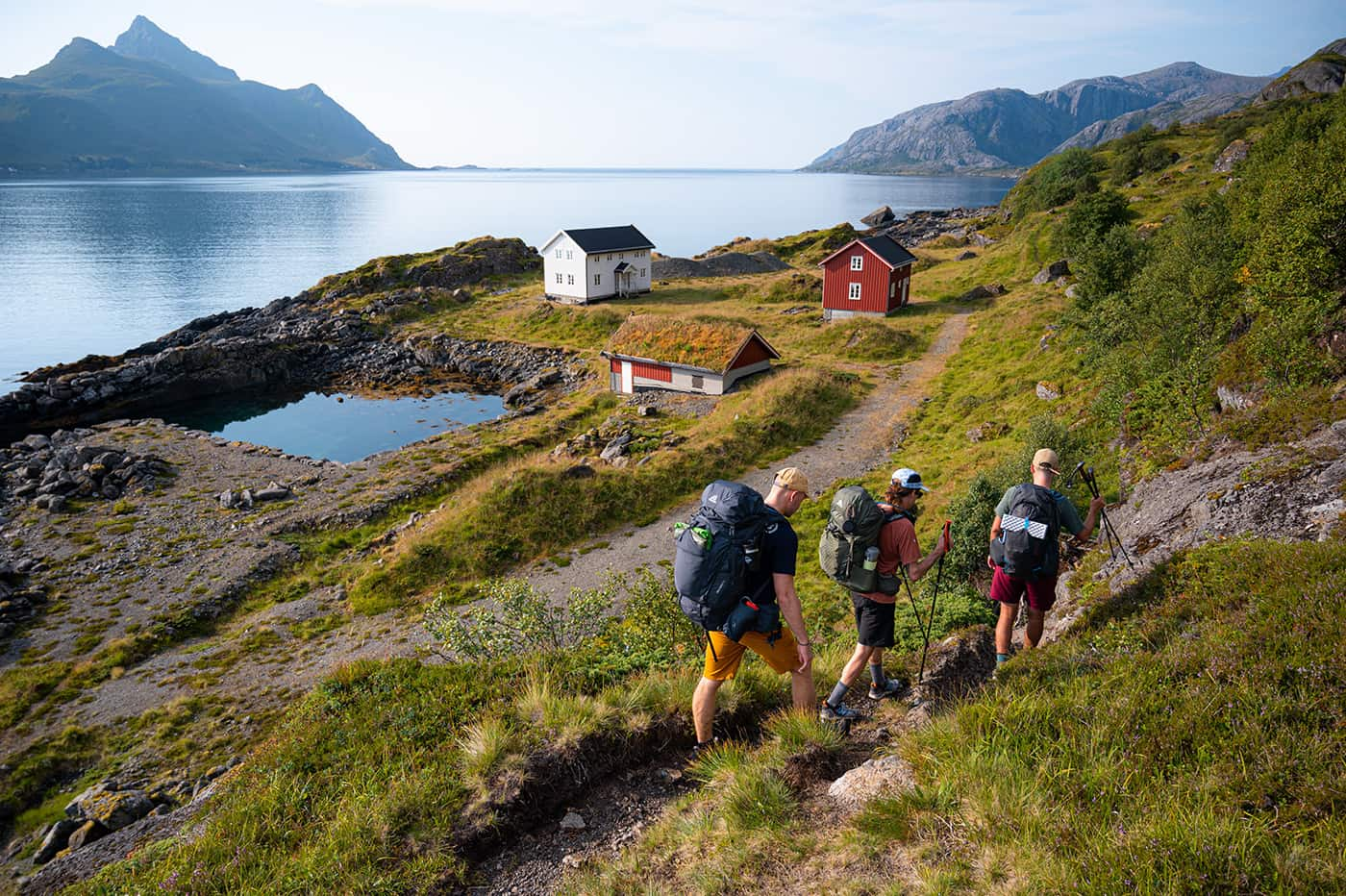
The Lofoten Crossing of the Lofoten Island is a traverse and thru-hike on this special archipelago in Norway. It’s an ‘unofficial’ hiking trail that has gained traction among enthusiastic thru-hikers in recent years. This trail, pieced together by a passionate group of hikers, combines the premier trails across Lofoten into an authentic east-to-west thru-hike. You will hike through the largest islands, exploring Lofoten’s rugged terrains, occasionally using ferries to transition across fjords to the other islands.

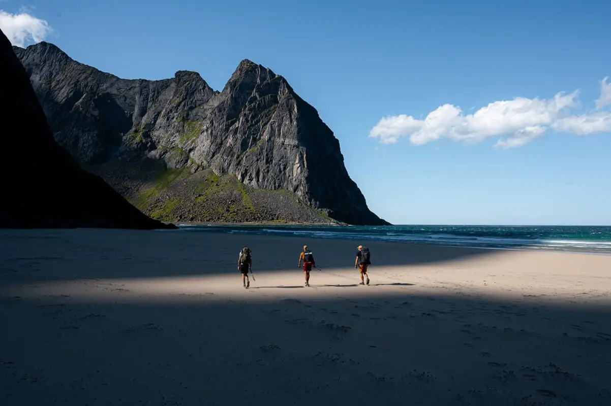
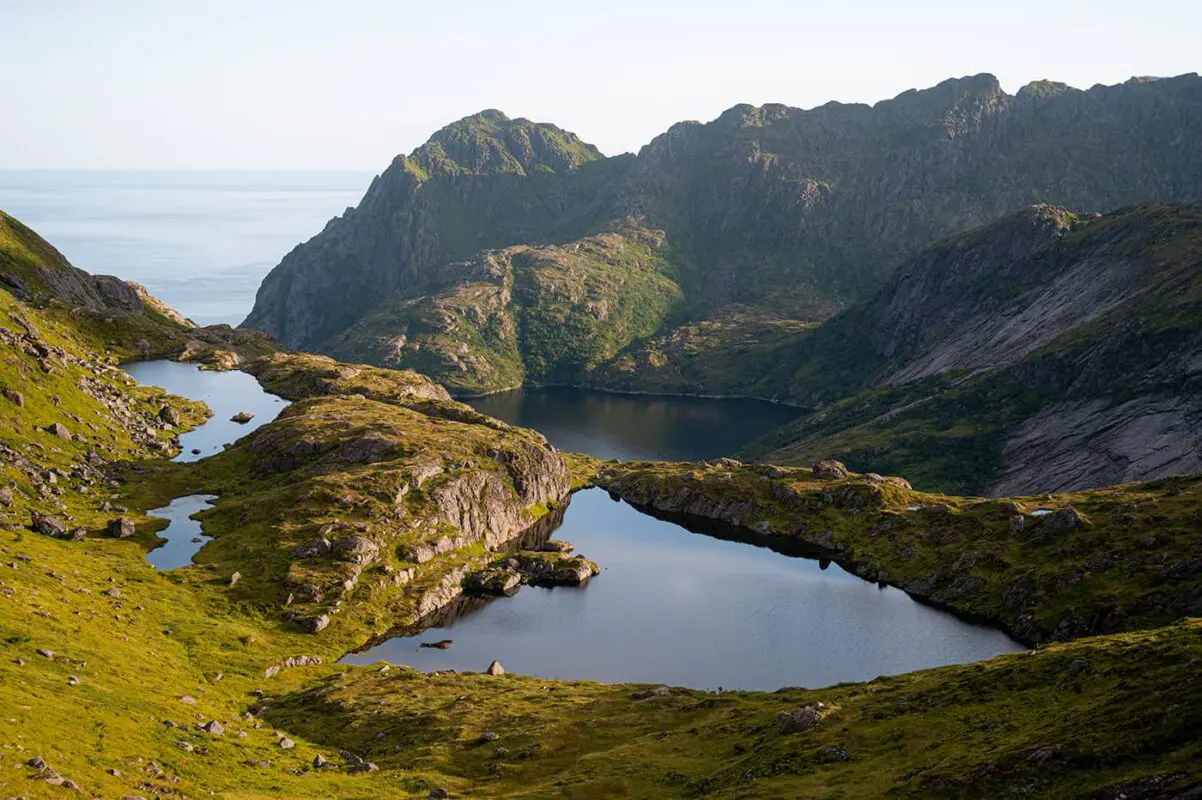
Situated over 180 kilometers within the Arctic Circle in the Norwegian Sea, the Lofoten archipelago is well known for its dramatic mountains that rise up directly from the ocean, spectacular fjords, white sand beaches, green valleys, and traditional fishing villages. The larger islands, Austvågøy, Vestvågøy, Flakstadøy, and Moskenesøy alongside numerous smaller ones, are steeped in a profound fishing heritage tracing back to the Viking era. The community still upholds age-old fishing traditions with the air-drying of cod on timber scaffolds, as a big part of their cultural heritage.

Editor

Elmar Teegelbeckers

Passionate hiker Elmar spends months of his time on the trail. He’s usually on the lookout for hidden gems in one of his favourite countries such as Slovenia, Switzerland and Japan. He founded hiking-trails.com in need for a community and detailed information about the trails. Before this, he worked for the Alpine asscociation in the Netherlands[ (NKBV) but lost his heart to the trails.

With this website and socials, he hopes to shape an inclusive community for hikers all over world. No matter your speed, experience or level, you can get out there to enjoy the trails and connect with the heartwarming hiking community. Life is so much better outside and he hopes to inspire hikers to take their first, or next, step on the trail.

View profile

The Trail

The Long Crossing of the Lofoten Island traverses rugged Norwegian terrains, occasionally incorporating a ferry to jump to the other island. Unlike the well-maintained trails in the Alps, you will navigate rocky, unmarked paths, sometimes, but mostly not, marked by red paint. GPS tracks are necessary and you can enjoy the right to wild camp at the most scenic spots.

Prepare with a fully packed backpack with freeze-dried meals and essentials, thoughtful of the limited amenities along the trail, as you begin this spectacular long-distance trail. The hike begins in Austvågøya near Matmora trailhead, advancing through forests over mountain peaks, experiencing the region’s unpredictable weather, which can span four seasons in a single day.

The trail gives you the challenge of navigating steep terrains, relying on weathered ropes for support, and great free small shelters. As most of the time at Lofoten, weather setbacks will force a pause. Flexible planning is essential in such unpredictable environments.

You will continue seeing views of the fjords, and ancient fishing villages like Nusfjord, and will push through towards Fredvang bridge and Kvalvika beach. The final days feature a ferry ride to Moskenesøya, an ascent of Hermannsdalstinden, Lofoten’s highest peak, and a last stretch towards the end pint Stokvikka to end the trail in style. Now, you’ve thru-hiked the Lofoten islands.

It’s crucial to recognize that the Long Crossing of the Lofoten Islands doesn’t constitute an official route. This trail is a compilation of interlinked hiking trails, presenting a challenge that spans mountain crests and rocky landscapes. It is advised solely for adept hikers with some alpine knowledge and a strong head for heights due to the technical and rugged level of the hiking trails. The GPX file can be found on this page and at Rando Lofoten.

Stages

You can easily adapt the stages to your preferences. Due to the allemannsretten, the right to wild camp, you can easily choose to hike a bit further or stop earlier. You can resupply at the towns Svolvær and Leknes and there’s a campsite with a shop at Moskenes. These are suggested stages, if possible, hike a bit further on stage four to shorten stage 5.

Stage 1:

Matmora Trailhead, 20 km | 12.5 mi

Stage 2:

Matmora – Svolvær, 25 km | 15.5 mi

After the you pass the town Svolvær you hike up towards the lake where you can find a cabin. You can stay there when it’s not occupied or you can find a wild campin spot.

Stage 3:

Svolvær – Kringbotsnavet, 22 km | 13.7 mi

Stage 4:

Kringbotsnavet – Leknes, 10 km | 6.2 mi

It’s better to hike 10 to 15 km further on this stage so you shorten the next stage

Stage 5:

Leknes – Fredvang camp, 40 km | 25 mi

Stage 6:

Fredvang camp – Fagervatnet, 18 km | 11 mi

Stage 7:

Fagervatnet – Moskenes, 23 km | 14.3 mi

Optional you can climb Hermannsdalstinden, the highest peak on the Lofoten Islands.

Stage 8:

Moskenes – Stokkvika, 18 km | 11 mi

After you’ve reached the end point you need to hike back on the same trail towards Moskenes.

Accommodations

Because of the Allemansretten, also known as the right of public access, you’ll mainly wild camp alongside the Long Crossing of the Lofoten Island. This Allemannsretten is a principle Norwegian law that grants individuals the freedom to roam and enjoy nature. This right is deeply embedded in Norwegian outdoor traditions and allows for access to uncultivated land for activities such as hiking, skiing, and camping. While allemannsretten encourages you to enjoy the outdoors, it is accompanied by responsibilities and respect for nature preserving the environment. This includes guidelines on leaving no trace, not disturbing wildlife, and keeping a respectful distance from private residences and cultivated land.

Additionally, sometimes you can opt for staying in the traditional Norwegian cabins. In the villages you pass, there are hotels and B&Bs available. Some days there are shelters available, too. Note that these are free and mostly occupied. So it’s always necessary to bring a tent with you. These shelters are basic wooden structures providing cover from the weather, sometimes with a bed. They’re typically located near lakes and other beautiful spots.

Best time of the year

If you’re hiking the Long Crossing of the Lofoten Island you’re bound to the summer months. The best times to hike the trail are July and August, though it’s wise to prepare for unpredictable weather, including possible rainfall and strong winds even in these months. You should only hike this trail off-season if you’re seriously prepared for harsh conditions. The locals say: four seasons in one day which refers to snowfall, sun, wind, and calmer weather all on one single day. Welcome to the Lofoten Islands!

Safety & Gear

Hiking on the Lofoten offers some of the most stunning and varied landscapes on the planet, from fjords to rugged mountain peaks and waterfalls. However, the rugged terrain and unpredictable weather conditions require careful preparation and respect for safety guidelines.

Equip yourself with layers, including a reliable wind- and waterproof jacket, and consider pre-booking mountain huts for a comfortable night’s rest. The most important thing while hiking on the Lofoten is that you be aware of all weather conditions which are also possible in the summer season. Rain with a cold wind is always possible so bring your hardshell layers and know how to deal with such weather.

Good to know

The Long Crossing of the Lofoten is not an official route. The trail consists of various hiking paths that are connected to each other. It is a very challenging journey that goes over steep mountain ridges in rocky terrain. Only undertake this hike if you are an experienced mountain hiker and have experience in alpine areas.

Sometimes you can buy resupplies at the campsites but you’ll need to bring most of your food and snacks with you for this trail. You can fill up your water bottle in the streams and on the campsites. It’s recommended to take a water filter with you.

Route
Point to point
Highest point
1029m (3376 ft)

Want to submit a trail or make this page more complete?

Comments

Be the first one to comment on this trail!

Reply to this trail

Your email address will not be published. Required fields are marked *

Reply to this trail

Log in to comment on this trail
Always read the disclaimer

Terms of Use: important to all visitors on this website. We strive to publish high quality content and information on this website. However it’s always possible that we’re missing out on some crucial information. In spite of the fact that this route, associated GPS track (GPX and maps) were prepared under diligent research by the specified contributor and/or contributors, the accuracy of such and judgement of the author is not guaranteed. Therefore, hiking-trails.com and contributors are in no way liable for personal injury, damage to personal property, or any other such situation that might happen to individuals hiking or following this route. Should you choose to hike this trail, this is always at your own risk. Check out our guidelines for safety hiking and Leave No Trace principles at the hiking 101 page.

Download GPX

Join the community!

Login or create a FREE account 😊

With an account you can:

Download GPX files

Pin trails to your wishlist

Mark trails as hiked by you

Rate hiking trails

Comment on trails, blogs and gear reviews

Happy trails!
Login

Don't have an account yet? Register here