About the Liechtenstein Trail

country
Liechtenstein
length
75 km(47 mi)
Type of trail
Long-distance, Thru-hike
difficulty

Difficulty is highly personal. Be aware of the weather conditions as bad weather turns easier trails in difficult trails especially in the mountains.

Easy
accommodation

Lodging means a mix of hotels, hostels or AirBnB’s.

Lodging
Elevation gain
1560 m(5118 ft)
terrain
Forest, Hills, Urban
remoteness
Some of the time
Show more

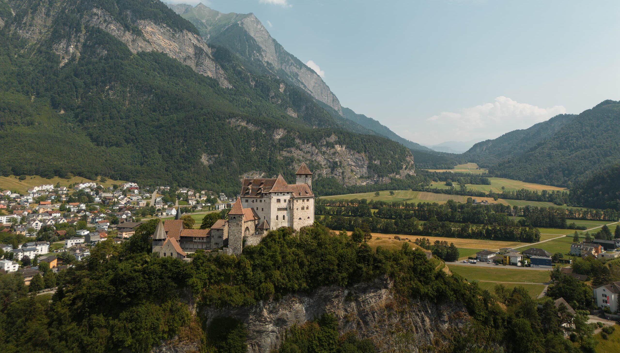
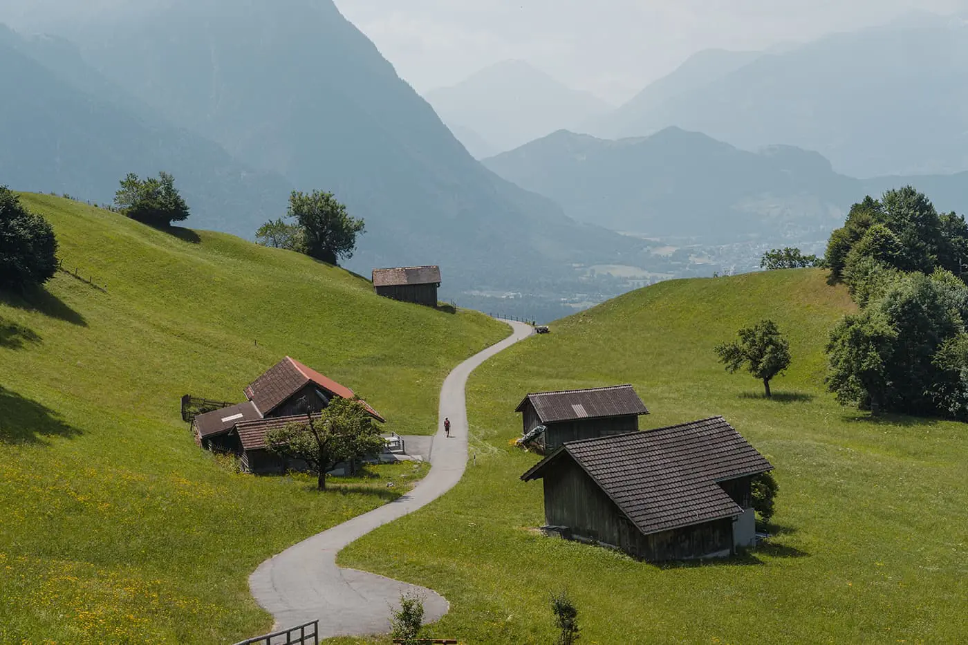
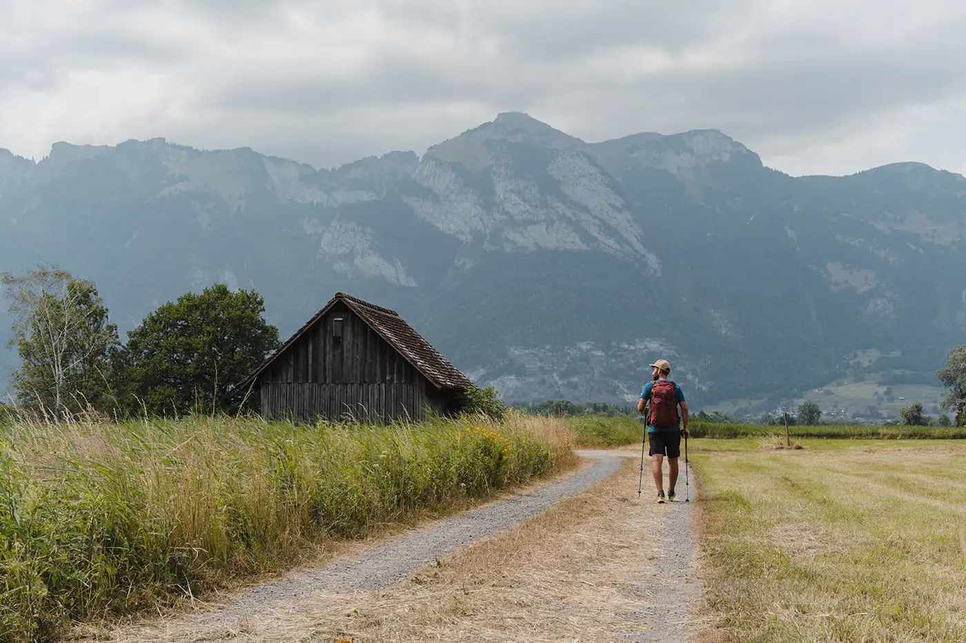
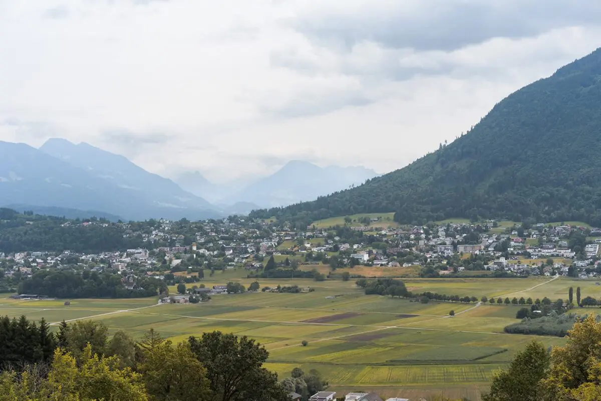
In the heart of Europe, between the imposing mountains of Switzerland and Austria, hides a tiny principality: Liechtenstein, also known as the Fürstentum Liechtenstein. It’s the sixth smallest country in the world! Despite the country’s mere 45-kilometer length, a 75-kilometer trail meanders through this diminutive state and all its municipalities, known as the Liechtenstein Trail.

The Liechtenstein Trail traverses the Rhine Valley, passing ancient fortresses, castles, forests, and small villages on the hills, always surrounded by mountain peaks. The trail, almost twice as long as the country itself, was created to provide a deeper acquaintance with Liechtenstein and its communities.

Editor

Elmar Teegelbeckers

Passionate hiker Elmar spends months of his time on the trail. He’s usually on the lookout for hidden gems in one of his favourite countries such as Slovenia, Switzerland and Japan. He founded hiking-trails.com in need for a community and detailed information about the trails. Before this, he worked for the Alpine asscociation in the Netherlands[ (NKBV) but lost his heart to the trails.

With this website and socials, he hopes to shape an inclusive community for hikers all over world. No matter your speed, experience or level, you can get out there to enjoy the trails and connect with the heartwarming hiking community. Life is so much better outside and he hopes to inspire hikers to take their first, or next, step on the trail.

View profile

The Trail

You can hike the Liechtenstein Trail in both directions. This description starts in the Schaanwald at the Austrian border and ends in Balzers at the Swiss border. The trail starts with a climb through the woods towards Mauren, a section once used as a smuggling route due to its proximity to the border. A brief pause in the village for coffee and sandwiches at a local bakery will fuel you for the journey. The trail then continues along broader gravel paths towards the Robert Ritter mountain hut, which has panoramic views of the high mountains in the Appenzeller Alps and the valley villages below.

Day two weaves through small villages, with the path occasionally passing by locals tending to their gardens. The trail ascends through forests to Planken, where tree roots have reclaimed the path, leading to a steep but rewarding climb with a view of the Swiss mountains beyond the Rhine Valley. The descent towards Eschen, a larger village, includes a stop for snacks before passing by the white church with its red clock tower. The day ends in Schaan.

From Schaan, the final leg of the Liechtenstein Trail leads to Vaduz, the capital. The route meanders through the city, with luxury shopping streets and casinos interspersed with historic buildings.

The trail ascends further, offering viewpoints over the villages traversed in the last days, even offering a clear enough view for you to count them. Near the old ruins of Schalun Castle, the view extends over the Rhine Valley and Swiss mountains. The path then leads to Triesenberg, Liechtenstein’s highest municipality, before descending to Gutenberg. Here, ancient Roman roads now head towards the Gutenberg Castle, surrounded by vineyards and like a scene from a fairy tale. The Liechtenstein Trail ends at the Swiss border, wrapping up three days and 75 kilometers through this tiny country.

Stages

The trail can be walked from Schaanwald to Balzers or from Balzers to Schaanwald. It has 5 official stages but you can easily connect some stages to hike the trail in 4 or even 3 days.

Official stages

Stage 1:

Schaanwald – Ruggell, 19 km | 12 mi

Stage 2:

Ruggell – Nendeln, 15 km | 9 mi

Stage 3:

Nendeln – Vaduz, 17 km | 11 mi

Stage 4:

Vaduz – Triesenberg, 10 km | 6 mi

Stage 5:

Triesenberg – Balzers, 16 km | 10 m

Accommodations

Opting to tackle this trail from a single “basecamp” allows for daily stage completions before returning to base. Located in the village of Schaan-Vaduz, the Swiss Youth Hostel serves as an ideal central hub for hikers and cyclists. As there are not too many (affordable) accommodations in Liechtenstein, this might be a great option. Of course, you can also choose other accommodations in the larger villages.

Best time of the year

The best time to hike the Liechtenstein trail is typically from early spring to late fall, roughly from late April to late October. This period offers the best weather conditions, with warmer temperatures and longer daylight hours, making them the perfect months for hiking in Liechtenstein. However, what’s special about this trail is that it can be hiked year-round in either direction. Also in winter, this is a great option for hiking in a winter wonderland. Of course, because you’re in the mountains, expect way lower temperatures and make sure you stay warm.

Safety & Gear

It’s important to know that mountain weather can be unpredictable, so it’s always a good idea to check the local weather forecast and trail conditions before setting out. Always bring essentials for your day hike like good sturdy shoes for mountainous terrain, and layer up with a baselayer, mid-layer, and hardshell for rain conditions. Bring enough food and always a minimum of two liters of water with you. Download the GPX on your device and bring, when necessary, a paper map with you. The Liechtenstein Trail is well marked, but in any case, it’s good to know how to navigate.

Good to know

The Liechtenstein Trail is an easy long-distance trail for beginners, mostly through urban areas. What’s special about this trail is that it can be walked all year round on the excellently marked paths. You can walk the trail from one place or book different accommodations in the villages you pass through. The official language is German, but various dialects are spoken. Consisting of eleven municipalities you’ll hike through, the principality is a constitutional, hereditary monarchy. The head of state is Prince Hans-Adam II von Liechtenstein who still has his seat in the Vaduz Castle.

Route
Point to point
Highest point
1100 m (3609 ft)

Want to submit a trail or make this page more complete?

Comments

Be the first one to comment on this trail!

Reply to this trail

Your email address will not be published. Required fields are marked *

Reply to this trail

Log in to comment on this trail
Always read the disclaimer

Terms of Use: important to all visitors on this website. We strive to publish high quality content and information on this website. However it’s always possible that we’re missing out on some crucial information. In spite of the fact that this route, associated GPS track (GPX and maps) were prepared under diligent research by the specified contributor and/or contributors, the accuracy of such and judgement of the author is not guaranteed. Therefore, hiking-trails.com and contributors are in no way liable for personal injury, damage to personal property, or any other such situation that might happen to individuals hiking or following this route. Should you choose to hike this trail, this is always at your own risk. Check out our guidelines for safety hiking and Leave No Trace principles at the hiking 101 page.

Download GPX

Join the community!

Login or create a FREE account 😊

With an account you can:

Download GPX files

Pin trails to your wishlist

Mark trails as hiked by you

Rate hiking trails

Comment on trails, blogs and gear reviews

Happy trails!
Login

Don't have an account yet? Register here