red Japanese temple

Kumano Kodo – Imperial route

Nakahechi Route

About the Kumano Kodo – Imperial route

country
Japan
length
68 km(42 mi)
Type of trail
Pilgrimage
difficulty

Difficulty is highly personal. Be aware of the weather conditions as bad weather turns easier trails in difficult trails especially in the mountains.

Moderate
accommodation

Lodging means a mix of hotels, hostels or AirBnB’s.

Lodging, Camping
Elevation gain
3000 m(9843 ft)
terrain
Mountains, Forest, Hills
remoteness
Some of the time
Show more

Amid the lush Kii Mountain Range in the prefecture of Wakayama lies the Kumano Kodo, a vast walking network that has been used by pilgrims for centuries. With its beautiful and serene shrines, it is no surprise that it’s listed as UNESCO World Heritage. But these trails and their sacred sites aren’t for worship and purification only, people from all over the world travel to this area to experience the rich and unique culture that Japan has to offer whilst finding peace and reflection in the ‘Land of the Trees’ (Kii-no-Kuni).

The Kumano Kodo pilgrimage consists of multiple routes to its sacred sites: the Access Route (Kiiji), the Mountainous Route (Kohechi), the Coastal Route (Ohechi), the Eastern Route (Iseji), the Ascetic Route (Omine-Okugakemichi) and the Imperial Route (Nakahechi). This last one is considered the main route of the Kumano Kodo which makes this part the most developed and well-maintained of the six.

Women holding hiking pasport
Author

Hanne Govaerts

Hanne Govaerts is a Belgian outdoors enthusiast. During the week she works a full-time office job but every moment of spare time she tends to spend outdoors, on trail. Her passion for hiking started at the early age of 16, when she impulsively went on a summer camp hiking the Wicklow Way in Ireland. Ever since, her holidays have been filled with hiking trips such as the Matterhorn Trek in Switzerland and the Kumano Kodo Nakahechi Route in Japan. Hanne’s main goal is to hike all the Belgian long-distance trails. With its +/- 10.000 kilometers of trails throughout the country, it’s a challenge that should not be taken lightly. You can follow her hiking adventures on her Instagram account @hannehikes.

View profile

The Trail

The 68-kilometer Imperial Route will lead you through small picturesque villages, bamboo groves, rice fields, magical Oji’s (subsidiary shrines of the Grand Shrines), and sacred temples. Due to its popularity, hikers will have many options (authentic lodging or campsites, meal plans, luggage transfers, local guides, and a developed bus network…) to plan this pilgrimage to your preference, pace, and level of fitness.

Breakdown of the stages

The Imperial route is marked in both directions but most people walk it from East to West.

Starting in the East you’ll find Takijiri-Oji at the trailhead, one of the five important subsidiary shrines lining up the Kumano Kodo. Make sure to also pay a visit to Kumano Kodo Kan Pilgrimage Center where you can buy some last-minute essentials and visit the introductory exhibition. From Takijiri-Oji the trail climbs steeply to the mountaintops. Test your faith along the way by doing the Tanai-Kaguri ritual (where one would crawl through a crack of a boulder), before heading to Takahara. This village with a population of only ~75 is also known as Kiri-no-Sato (village of the mist) since it is located on a hillside with a gorgeous view of the valley filled with terraces of rice paddies, often covered in mist.

After leaving Takahara, the trail climbs further uphill passing more rice terraces. Along the way, you’ll find Uwadawa-Jaya Teahouse Remains as the highest point of this section. It was used until 1912-1916 as an important place to rest. The next few kilometers follow the trail through thick forests, before arriving at a Michi-no-Eki (road station) where it’s possible to stack in on souvenirs, snacks, drinks, and light meals. Not long after you’ll arrive in Chikatsuya, home to the oldest Oji shrines along the route and the Kumano Kodo Nakahechi Museum. 900 years ago groups of up to 300 people would stay in this important town.

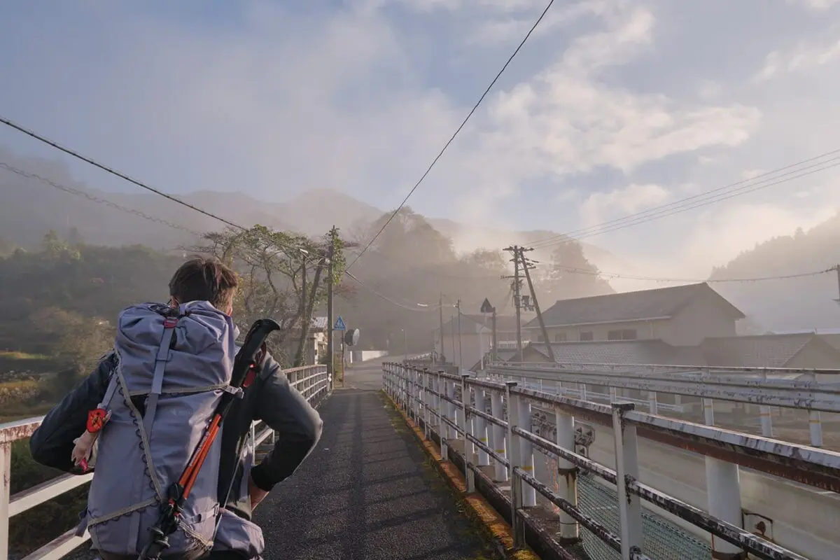
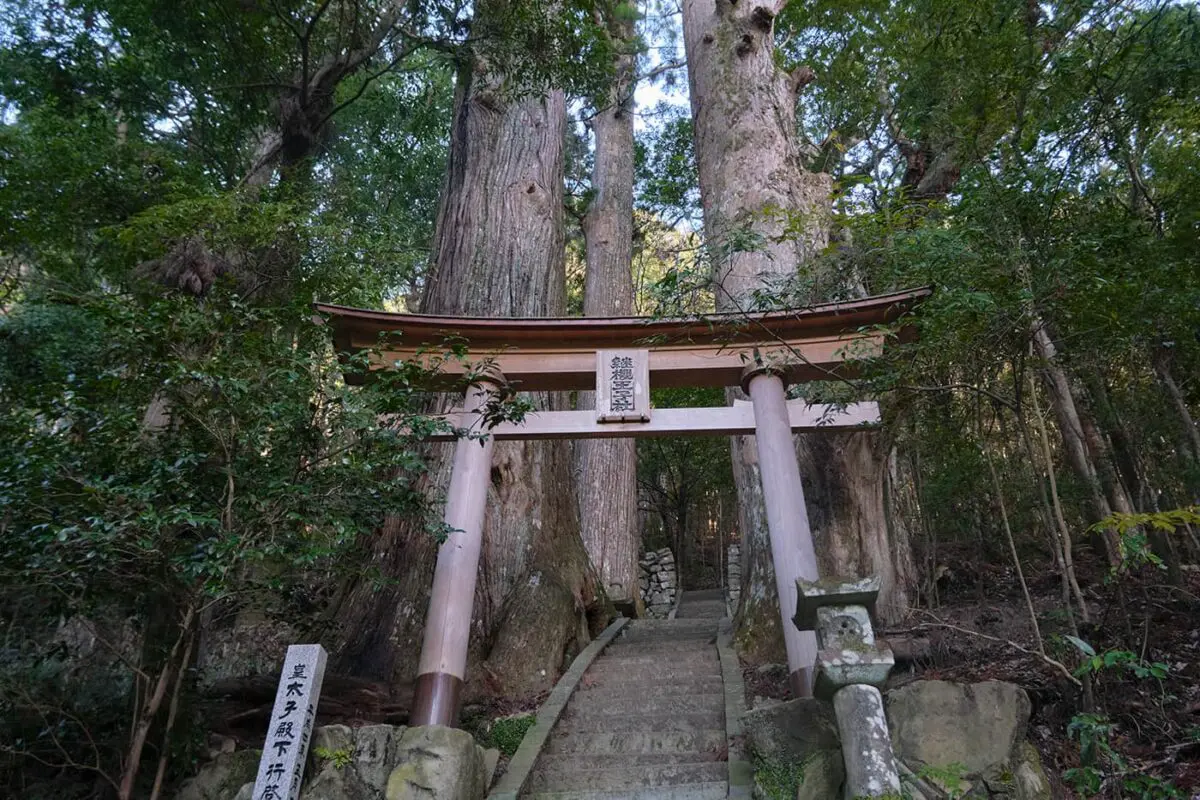
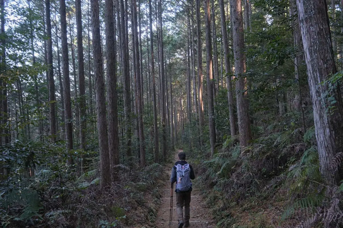
The path continues by passing multiple smaller villages. Make sure to also make a brief stop at Tsugizakura-Oji, a beautiful subsidiary shrine with massive cedar trees (some with a circumference of 8m and up to 800 years old), and at Nonaka-no-Shimizu spring (the water claimed to be pure enough to directly drink it from the source). The trail then follows a bigger, paved road for a few kilometers. If desired, the paved part can be skipped by taking a bus.

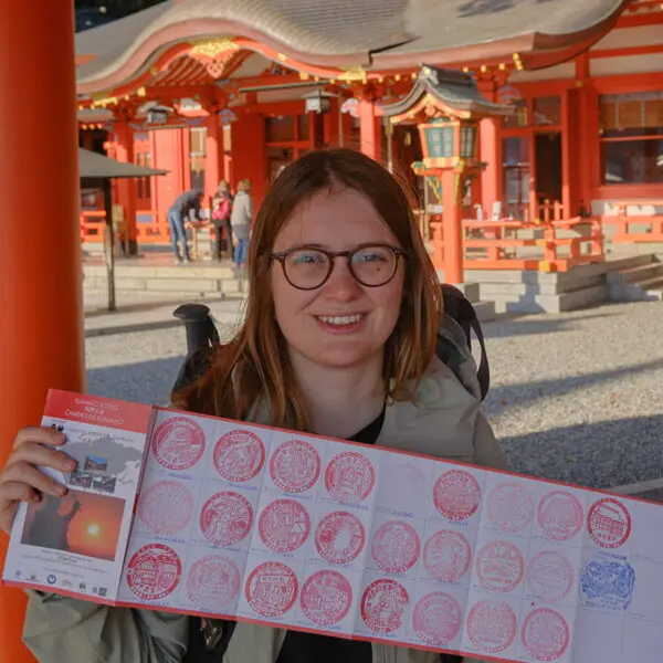
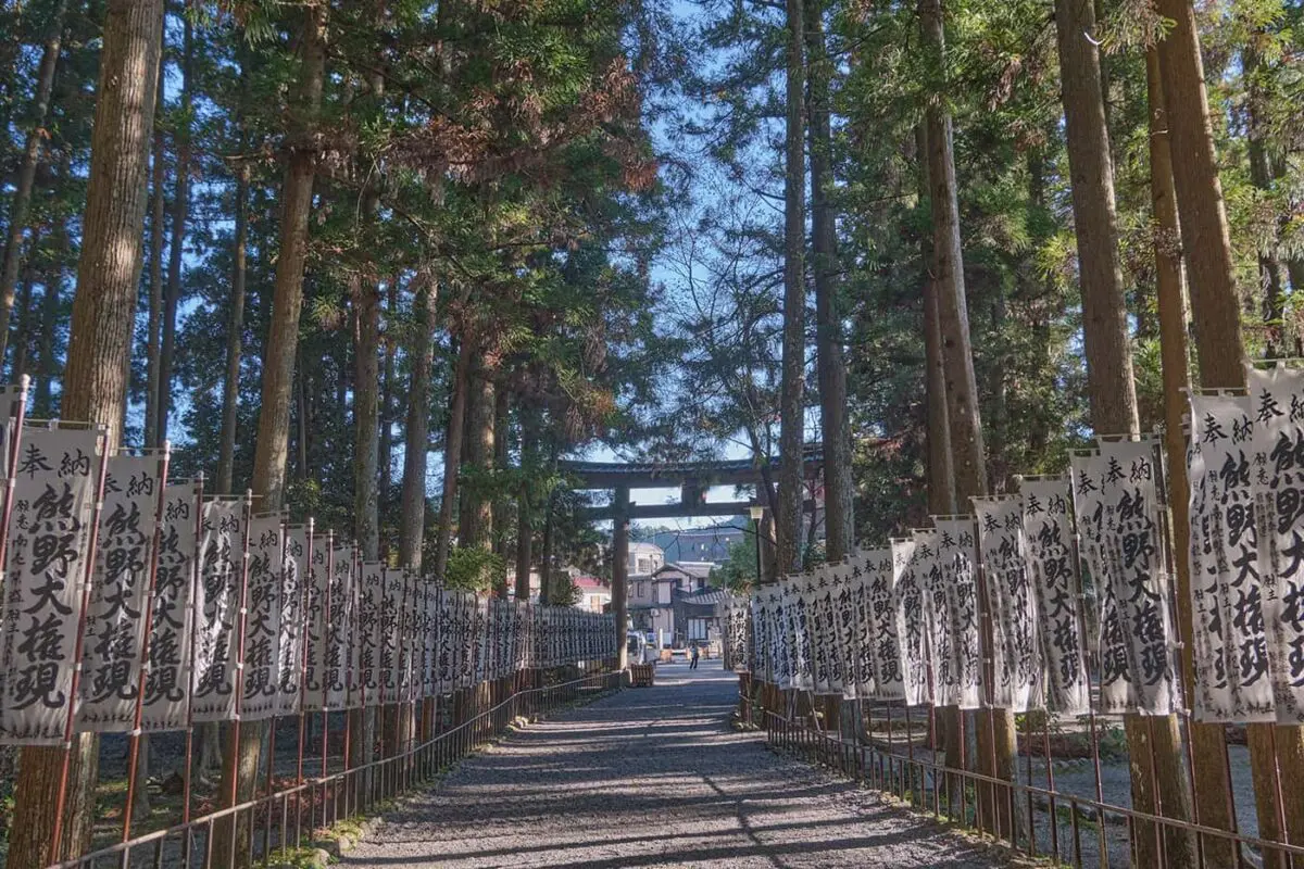
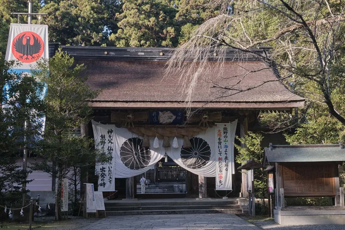
After a beautiful but intense climb through forests and with amazing views from mountaintops, the trail arrives at Hosshinmon-Oji, the outermost entrance to Kumano Hongu Taisha Shrine that can be reached by descending through incredible bamboo groves (don’t miss the look-out point along the way). Hongu Taisha Shrine is one of the most important grand Shrines of the Kumano Kodo since all pilgrimage routes pass this shrine. Make sure to also visit Oyunohara on the other side of the street, this is the original site of the shrine and is known for its Otorii (the biggest torii gate in Japan). A bit further down the street Kumano Hongu Heritage Center is located where you’ll find various exhibitions and tourist info.

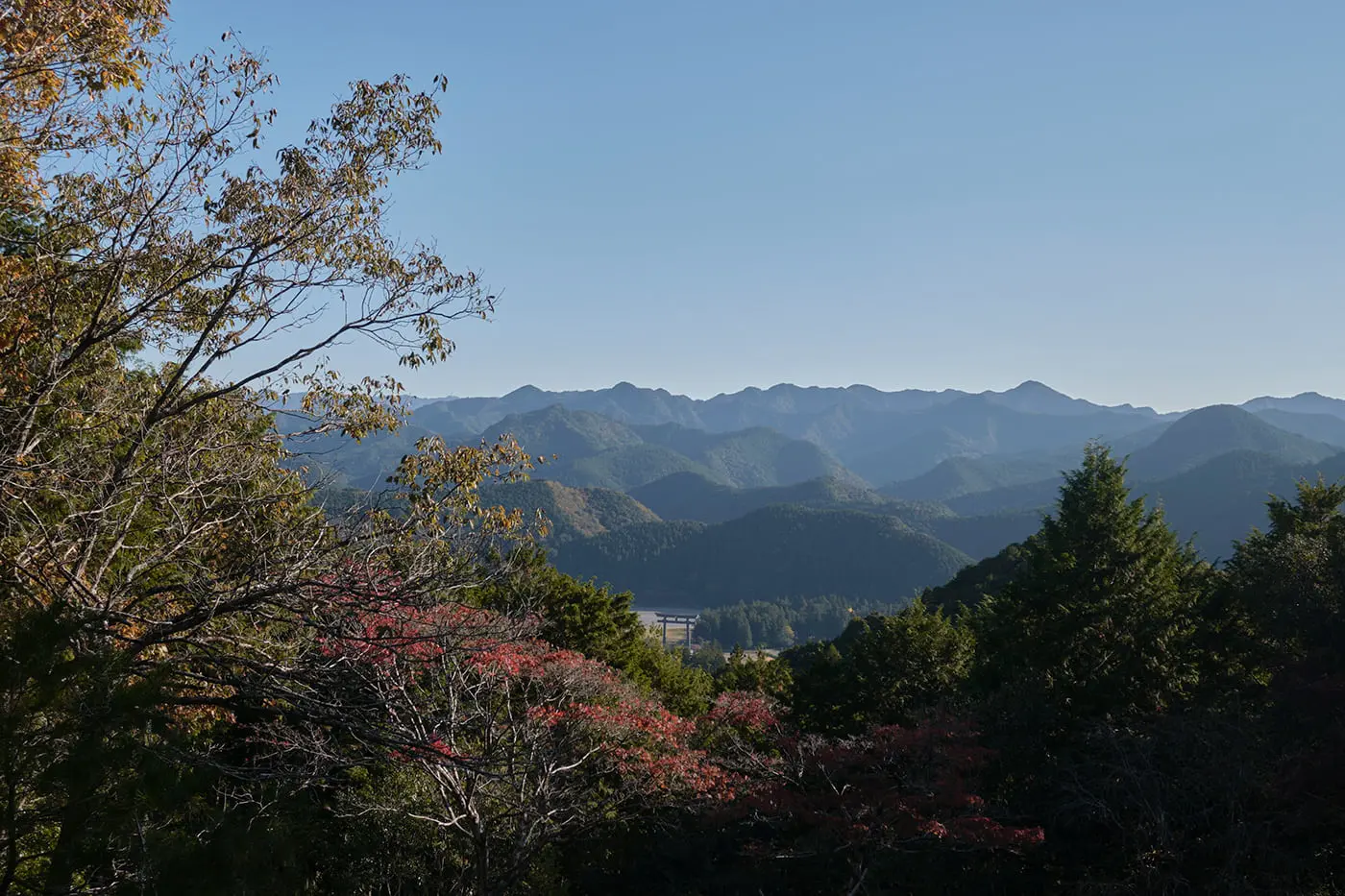
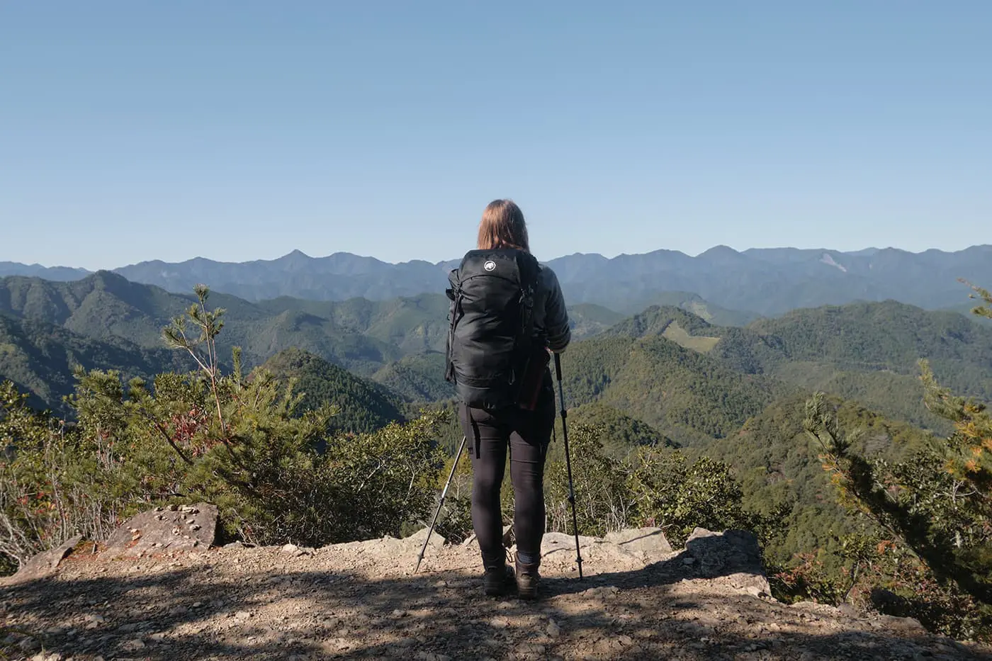
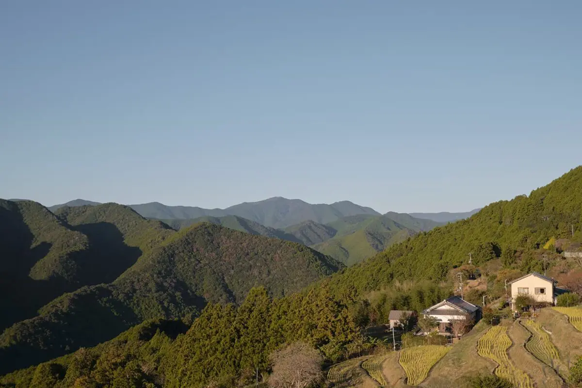
After following the paved road to the Ukegawa trailhead (that once again, can be skipped by taking the bus), the trail climbs through the forest to Hyakken-Gura, a look-out point with a view over the rugged and numerous peaks of the Kumano region. After admiring this incredible view, the trail descends to the valley and a river before arriving at Koguchi. A little village where it’s possible to buy extra snacks and drinks.

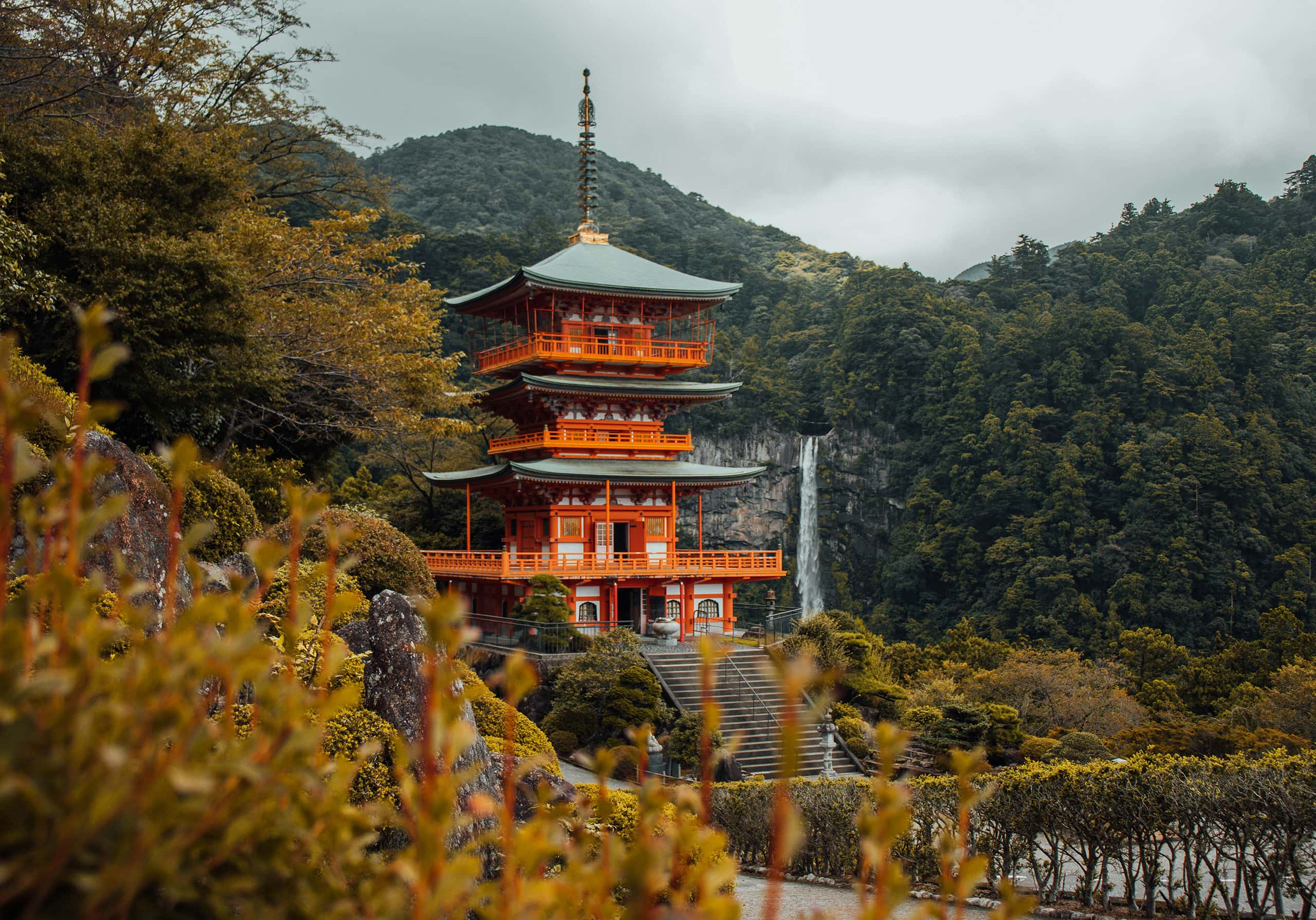
The last stage starting from Koguchi is claimed to be the hardest of the journey with lots of elevation and no facilities along the way. This section is famous for its Dogiri-Zaka or the body-breaking slope, an 800m elevation gain over 5 kilometers. After ascending, one will be rewarded with the Funami-Toge Pass, a Pacific ocean view, perfect for a picnic. After descending through the forests and passing a park the trail finds its ending point at Kumano Nachi Taisha. A grand shrine famous for its sacred waterfall.

Stages

The Kumano Kodo is often hiked in 5 days making it a perfect week long journey including travel days.

Stages for a 5 day itinerary

Stage 1:

Takijiri-oji – Takahara Kumano-jinja, 3.9 km | 2.4 mi

Stage 2:

Takahara Kumano-jinja – Tsugizakura-oji, 13.1 km | 8.1 mi

Stage 3:

Tsugizakura-oji – Oyunohara, 21.9 km | 13.6 mi

Stage 4:

Oyunohara – Koguchi, 15.5 km | 9.6 mi

Stage 5:

Koguchi – Kumano Nachi Taisha, 14.2 km | 8.8 mi

Accommodations

When walking the Imperial Route, one can decide between staying in traditional and authentic lodging or camping along the trail.
Staying at traditional and authentic lodging is highly recommended on the Kumano Kodo. By sleeping in an accommodation you will not only support the local community in the mountain region but you’ll also experience the Japanese culture and traditions to the fullest. Most accommodations in this area offer you an onsen (a Japanese natural hot spring), as well as the experience of sleeping in a traditional Japanese room (with futon beds). When also booking a meal plan with your accommodations you will also be treated to amazing Japanese cuisine. A culinary experience you don’t want to miss out on!

Walking up to accommodations without a reservation is not common in Japan and since the Kumano Kodo is located in a mountainous region, there are only a limited amount of lodgings. Therefore it’s highly recommended to book your stays well in advance to make sure you have a place to sleep after an intense day full of hiking.

It is also possible to camp alongside the Imperial Route, however, it is not commonly done and therefore not recommended. Free camping is prohibited along the UNESCO World Heritage route and on public and private properties. There’s only a possibility to camp at designated campsites, such as the sites at Chikatsuyu, Kawayu Onsen, Watase Onsen, and Koguchi.

Example of stays on the trail:

Stage 1:

Kiri no Sato Takahara Lodge “Organic Hotel”

Stage 2:

Guesthouse Housen

Stage 3:

Blue Sky Guesthouse

Stage 4:

Minshuku Momofuku

Stage 5:

Mitaki Sanso

Best time of the year

The Kumano Kodo pilgrimage trails are open year-round. One can walk it any time of year. However, since the Kii Mountain Range is sandwiched between two shores of the Pacific Ocean it’s the wettest area in Japan. Therefore it’s a sensitive area for flooding, landslides, and typhoons which is why the rainy season (June) is best to avoid.

During summer (July to September) temperatures rise and it’s very humid. During winter (December to February) the weather is cold and snow isn’t uncommon.

Spring (March to May) and autumn (October to November) are the most popular seasons to hike the Kumano Kodo. The weather is mild and one will get beautiful sights on the cherry blossoms (during Spring) or the foliage (during autumn). However, the days are not as long as during summer, therefore one should start each hiking stage early.

Safety & Gear

The Kumano Kodo Imperial Route is not a technically difficult trail, however it is physically demanding. Due to its steep uphill climbs, it is important to have a good fitness level and to plan the stages accordingly.

Due to its historic background, this trail includes lots of cobblestoned paths. These cobblestones, especially when ascending or descending can become very slippery. Make sure to watch your step, and concur them at a slow pace. Hiking poles are highly recommended to ensure your balance and to avoid knee strains. The Kumano Kodo Kan Pilgrimage Center sells hiking poles and other necessary gear.

In this area, there are some dangerous animals like the Japanese Pit Viper, the Giant Centipede, and the Asian Giant Hornet. You must be wary of them and watch your step. It is not advised to wear shorts and short-sleeved t-shirts. Make sure to cover your legs and arms to avoid any stings from insects and wear higher hiking shoes. Always check your shoes before putting them on since the Giant Centipede like nestling into them.

The Kii Mountain Range is normally not home to the black bear. However, the population of black bears in Japan is increasing fast and therefore there are lots of warning signs for bears on the trail. Do bring a bear bell to ensure your safety.

Cell phone service and emergency numbers are always within reach. Make sure you memorize the emergency numbers before coming to Japan.

Good to know

The Kumano Kodo is a pilgrimage route. Just like the St. James Way, there are stamp posts along the way to collect in a booklet. Don’t forget to pick up the booklet at the tourist office in Tanabe before taking the bus to the trailhead. But that is not the only thing that links the Kumano Kodo route with the St. James Way in Spain. If you walk the two routes (both UNESCO world heritage pilgrimages) one can get a ‘dual pilgrim certificate’. More info about this specific certificate can be found on the official website of the Kumano Kodo.

Japan is known for its etiquette, rules, and proper manners, this is no different on the Kumano Kodo. Lodging along the way will be in traditional homes, make sure to enlighten yourself with the basic rules (by watching the ‘how to’ Kumano Kodo videos) as respect for your host and the culture.

The Kumano Kodo Imperial Route is the most popular pilgrimage route and due to its limited lodgings in the small towns along the way, there isn’t always room for all hikers. Make sure to book your trip as early as possible. The easiest way to book when you are not native in Japanese is by booking through the Kumano Travel Agency. They will contact the hosts for you and make sure everything is reserved for you.

However, do note that the booking procedure is not like any other booking website. If you want to hike the trail and want the Kumano Travel Agency to help you book all the accommodations, you will have to fill in a few forms on their booking website with your top 3 accommodations per location, the dates, if you want food, if you want luggage shuttles and so on. After filling in all the forms the travel agency will review your request in the next 30 days (this sometimes can take longer in busy seasons) and will then reply to your request. Do make sure to book in time through this service.

Route
Point to point
Highest point
860m (2822 ft)

Guidebooks

Kumano Kodo

View guidebook

Want to submit a trail or make this page more complete?

Comments

Be the first one to comment on this trail!

Reply to this trail

Your email address will not be published. Required fields are marked *

Reply to this trail

Log in to comment on this trail
Always read the disclaimer

Terms of Use: important to all visitors on this website. We strive to publish high quality content and information on this website. However it’s always possible that we’re missing out on some crucial information. In spite of the fact that this route, associated GPS track (GPX and maps) were prepared under diligent research by the specified contributor and/or contributors, the accuracy of such and judgement of the author is not guaranteed. Therefore, hiking-trails.com and contributors are in no way liable for personal injury, damage to personal property, or any other such situation that might happen to individuals hiking or following this route. Should you choose to hike this trail, this is always at your own risk. Check out our guidelines for safety hiking and Leave No Trace principles at the hiking 101 page.

Download GPX

Join the community!

Login or create a FREE account 😊

With an account you can:

Download GPX files

Pin trails to your wishlist

Mark trails as hiked by you

Rate hiking trails

Comment on trails, blogs and gear reviews

Happy trails!
Login

Don't have an account yet? Register here