Trail sign Koasa trail

About the Koasa Trail

Alps
country
Austria
length
86 km(53 mi)
Type of trail
Hut to hut, Long-distance
difficulty

Difficulty is highly personal. Be aware of the weather conditions as bad weather turns easier trails in difficult trails especially in the mountains.

Difficult
accommodation

Lodging means a mix of hotels, hostels or AirBnB’s.

Lodging, Mountain huts
Elevation gain
4678 m(15348 ft)
terrain
Mountains
remoteness
Some of the time
Show more

The Koasa Trail is a stunning hiking route located in the Kaisergebirge mountain range in Austria. This trail offers breathtaking views of the surrounding alpine landscape, with opportunities to explore lush forests, crystal-clear mountain streams, and rugged peaks. Hike around the Kaisergebirge on this 86-kilometer-long trail while you enjoy your nights in cozy mountain hotels and huts with Austrian food and flair.

This is a moderate to challenging trek, with well-marked paths and plenty of opportunities to immerse in nature. Whether you’re a seasoned hiker or just looking for a memorable outdoor adventure, the Koasa Trail is sure to leave you in awe of Austria’s natural beauty.

Jannik Jauer profile picture
Author

Jannik Jauer

I’m Jannik and I like hiking. Trekking even more. And I also like to document my adventures. That’s why I founded @Trekkinglife together with my good friend Thomas. Check out our Blog trekkinglife.de for serious content or our YouTube and Instagram for fun content!

View profile

The Trail

This trail won’t lead you to the high peaks of the Kaisergebirge which are extremely steep with alpine character but you rather hike around the Kaisergebirge and can enjoy the stunning views while hiking. It is not a typical hut-to-hut tour with overnights in mountain huts. The stages usually end in small villages and you can sleep in cozy hotels and enjoy the local food.

With the Lower Kaiser Ridge always in sight, the trailhead begins at the tourist information office in St. Johann, heading north in the first few kilometers to the hermitage Maria Blut and the baroque Gmail Kapelle, which was built right into a rock. The trail leads through a mixed forest on the Lower Kaiser Ridge and crosses over Schatterberg. Then it descends to Bacheralm, continues to Gasteig, and further to Griesenau, where the Gasthof Griesenau awaits as an overnight accommodation.

From Griesenau, the trail leads you into the beautiful Kaiserbachtal, passing by Fischbachalm and Griesner Alm; followed by a steep ascent west towards Stripsenjochhaus. From here, you will continue north to Stripsenkopf (1,807 meters) – with secured rope passages near the summit. After a descent, the trail leads to the highest peak of the Koasa Trail: Feldberg (1,813 meters). Facing the majestic northern side of Wilder Kaiser, continue marching eastward along the ridge. Descend back into Kaiserbachtal via Vordere Ranggenalm and hike back to Fischbachalm.

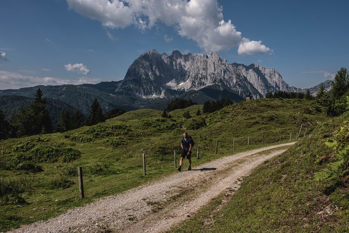
The third stage leads you across several alpine pastures to the east. Shortly after Griesenau, you pass the legendary Devil’s Chapel; then turn left past the Gasthaus Altmühl into the Schnappengraben. Soon a beautiful alpine plateau is reached, where the Stubenalm with its cheese offers a rest stop. Shortly after, you pass through a mystical rock labyrinth known as the Devil’s Alley. After another break at the subsequent Prostalm with breathtaking views in all directions, only the descent to Erpfendorf remains.

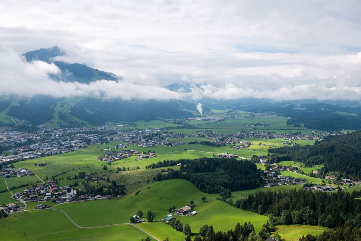
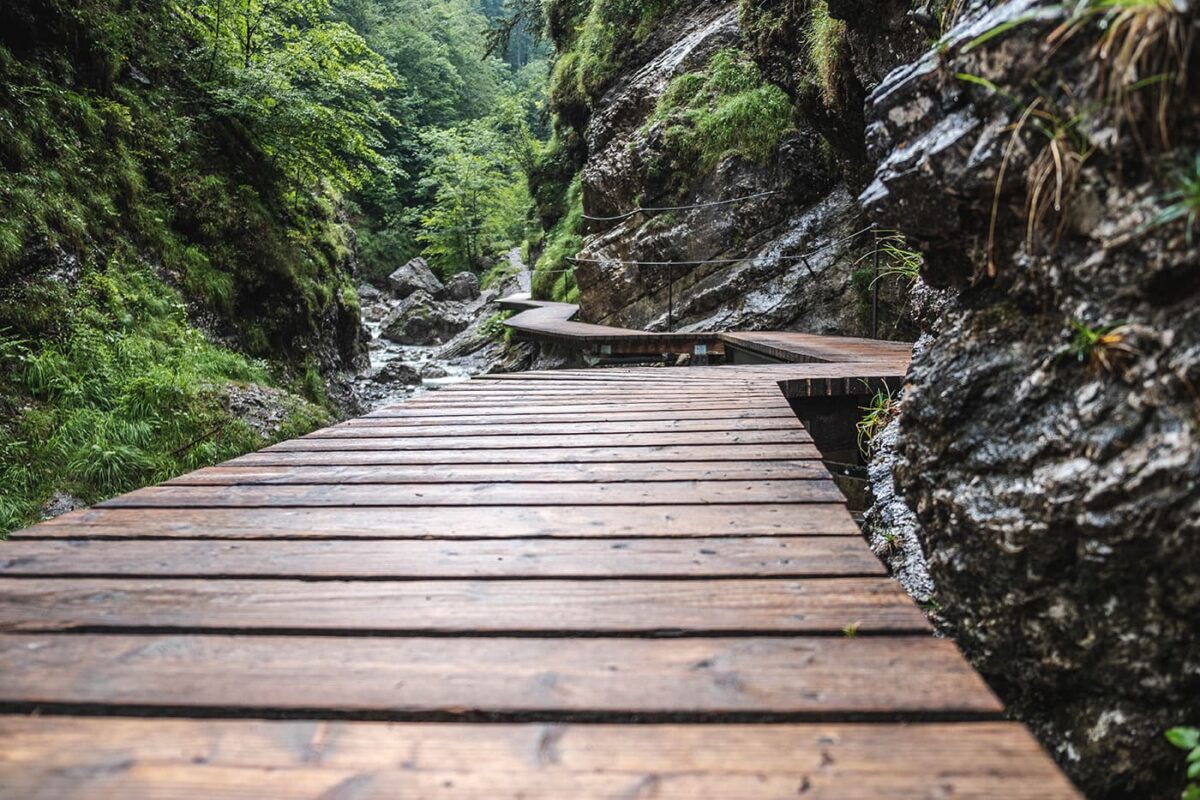
From Erpfendorf, hike along a lightly trafficked road to the entrance of Grießenbachklamm (parking lot). Walk on footbridges and hanging bridges through the quaint gorge with waterfalls. At the end, the Jägersteig leads up to the Angerlalm, a managed alpine pasture. Descend on a trail first to the south, then on a forest road to the west. Passing through the hamlet of Scheffau, you reach the outskirts of St. Johann and – slightly south – Eichenhof.

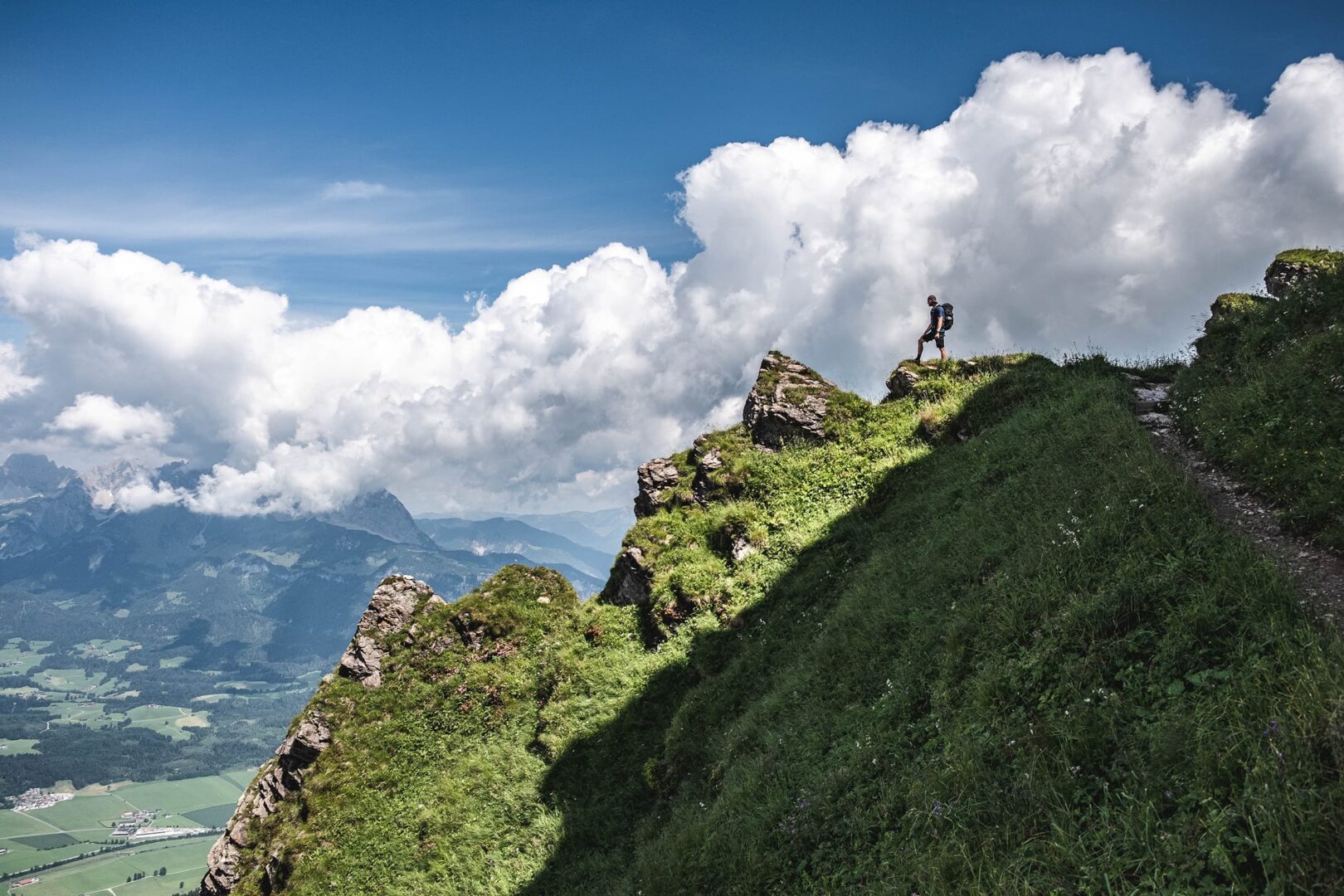
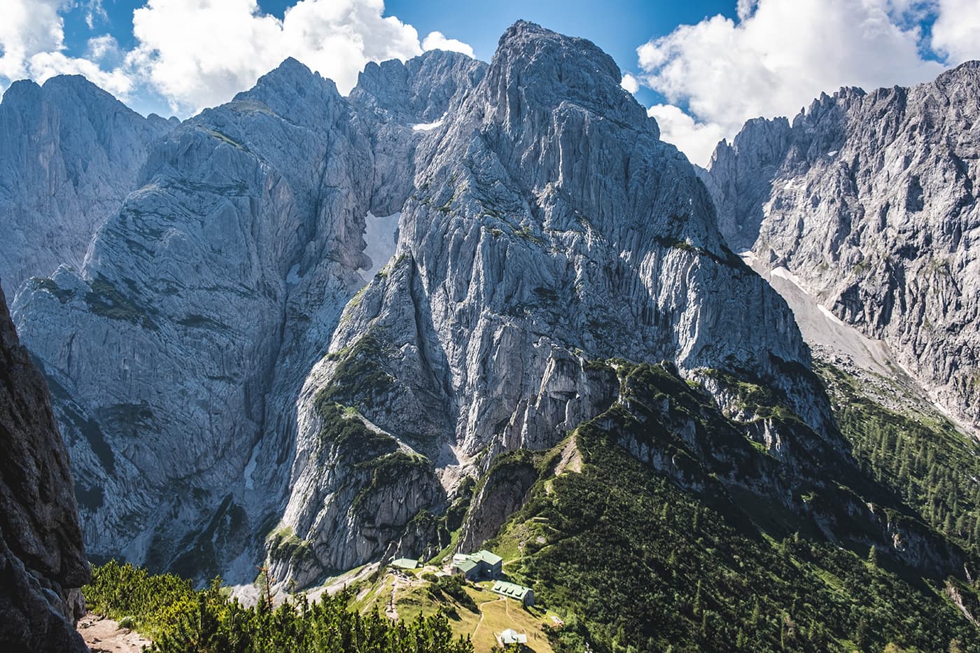
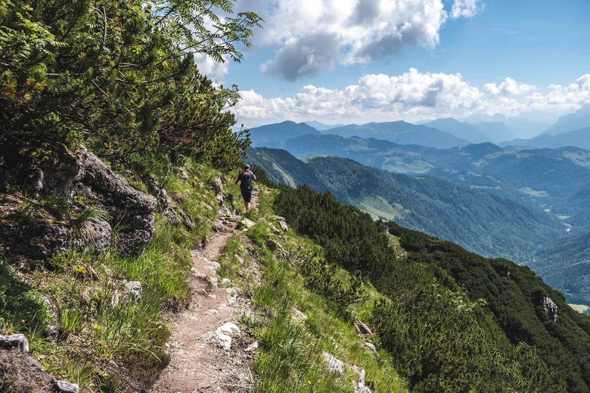
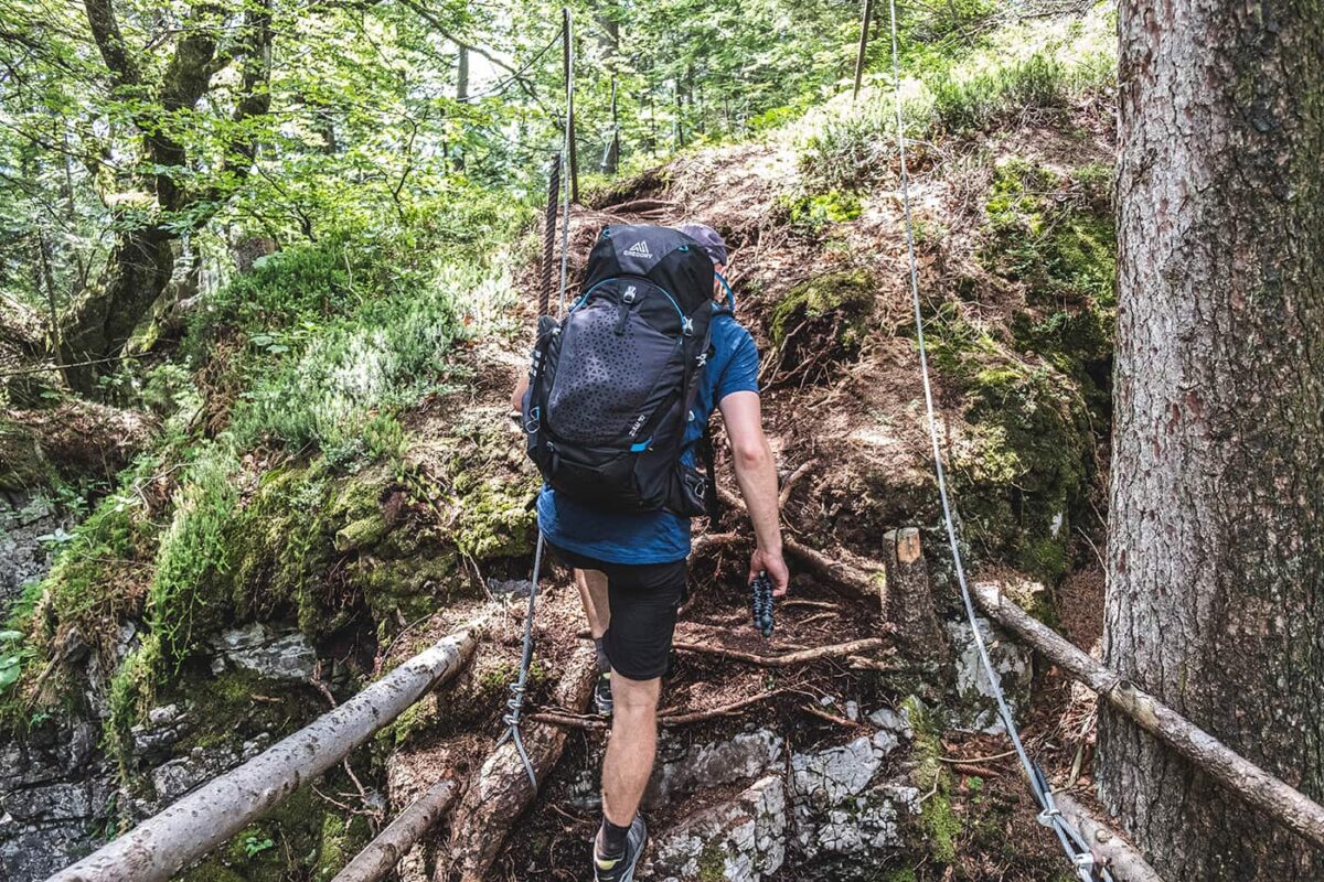
In the final stage, following signposted trails, you first make your way to the Eifersbacher Waterfall. Along the way, you’ll pass by the Theresienbrunnen, the center of a former spa town. At the end of the gorge, a steep staircase leads up to a forest road; now follow the signs to Kröpflalm and Harschbichl. From Harschbichlalm (1,604 meters), there is a fantastic view of the Wilder Kaiser. Either take a detour (approximately one and a half hours) to Kitzbüheler Horn (1,996 meters) or descend directly via Stanglalm and Müllneralm – mostly on alpine roads and farm tracks – to Wiesenschwang, the endpoint of the Koasa Trail.

Stages

Stage 1:

St. Johann – Griesenau, 13.8 km | 8.5 miles, 6h

Stage 2:

Griesenau – Griesenau (round trip), 18.8 km | 11.6 miles, 9h

Stage 3:

Griesenau – Erpfendorf, 16.8 km | 10.5 miles, 6h

Stage 4:

Erpfendorf – Eichenhof/St. Johann, 20,8 km | 13 miles, 8h

Stage 5:

Eichenhof/St. Johann – Wiesenschwang/Oberndorf, 14 km | 8.7 miles, 6u

Accommodations

When hiking this trail you’ll mainly stay in the beautiful hotels along the trail. Book all accommodations a few months in advance as the Kaisergebirge is a popular place for hikers. One great thing about the hotels in Austria is that they offer really tasty food keeping you fueled for your next big hiking stage. Make sure you don’t miss out on the local sweet “Kaiserschmarrn” and a good plate of pasta with mountain cheese.

Overnights per stage

Stage 1:

Gasthof Griesenau / Griesner Alm

Stage 2:

Gasthof Griesenau / Griesner Alm

Stage 3:

Unser Berghof Erpfendorf

Stage 4:

Sporthotel St. Johann in Tirol

Best time of the year

The best time to hike the Koasa Trail is typically during the summer months, from June to September. During this time, the weather is generally more stable, and the alpine meadows are in full bloom, offering stunning views along the trail.

Keep in mind that the weather in the high mountains can change rapidly, and it’s essential to be prepared for various conditions, including sudden rain or snow showers. Always check trail conditions, and local weather forecasts before embarking on a high-alpine hike. Additionally, consider your hiking experience and skill level, as this trail can be challenging.

Safety & Gear

Research the trail thoroughly to gauge its difficulty, length, and terrain. Consult resources like this website, guidebooks, previous hikers, and local hiking organizations for insights.

Before departing, inform friends or family of your plans, including start and end times, the route, and emergency contacts.

Check the weather forecast and avoid hiking in extreme conditions like thunderstorms or high heat to minimize risks. We recommend checking multiple weather sources!

Staying hydrated and energized is essential. Carry sufficient water—at least two liters, more in summer—and snacks to keep your energy levels up.

Study the trail map carefully and use navigation tools such as a compass or GPS to avoid getting lost.

Invest in appropriate hiking gear including sturdy footwear, suitable clothing, and essential items like a first-aid kit. For specific gear recommendations, refer to our long-distance gear list.

Additionally, mountain trails often involve more drastic elevation changes and rougher terrains compared to standard trails. It’s important to prepare physically for the demands of a mountain hike by incorporating cardio and strength training into your routine weeks before your hike. This preparation helps you tackle steep ascents and descents safely and effectively.

Adhere to Leave No Trace principles to minimize environmental impact. Stick to designated paths, pack out all trash, and respect wildlife and their habitats.

Good to know

The Kaisergebirge mountain range is divided into two main parts: the Wilder Kaiser (Wild Emperor) and the Zahmer Kaiser (Gentle Emperor). The Wilder Kaiser is known for its rugged peaks and challenging climbing routes, while the Zahmer Kaiser offers more gentle terrain and scenic hiking trails. On the Koasa trail you won’t go deep into the Wilder Kaiser but rather hike around the mountain range.

Route
Point to point
Highest point
1.813m (5948 ft)

Want to submit a trail or make this page more complete?

Comments

Be the first one to comment on this trail!

Reply to this trail

Your email address will not be published. Required fields are marked *

Reply to this trail

Log in to comment on this trail
Always read the disclaimer

Terms of Use: important to all visitors on this website. We strive to publish high quality content and information on this website. However it’s always possible that we’re missing out on some crucial information. In spite of the fact that this route, associated GPS track (GPX and maps) were prepared under diligent research by the specified contributor and/or contributors, the accuracy of such and judgement of the author is not guaranteed. Therefore, hiking-trails.com and contributors are in no way liable for personal injury, damage to personal property, or any other such situation that might happen to individuals hiking or following this route. Should you choose to hike this trail, this is always at your own risk. Check out our guidelines for safety hiking and Leave No Trace principles at the hiking 101 page.

Download GPX

Join the community!

Login or create a FREE account 😊

With an account you can:

Download GPX files

Pin trails to your wishlist

Mark trails as hiked by you

Rate hiking trails

Comment on trails, blogs and gear reviews

Happy trails!
Login

Don't have an account yet? Register here