Huayhuash Trek Peru Mountains

Huayhuash Trek

Peru Cordillera Huayhuash Trek

About the Huayhuash Trek

country
Peru
length
120 km(75 mi)
Type of trail
Long-distance
difficulty

Difficulty is highly personal. Be aware of the weather conditions as bad weather turns easier trails in difficult trails especially in the mountains.

Difficult
accommodation

Lodging means a mix of hotels, hostels or AirBnB’s.

Camping, Lodging
Elevation gain
6320 m(20735 ft)
terrain
Mountains
remoteness
Most of the time
Show more

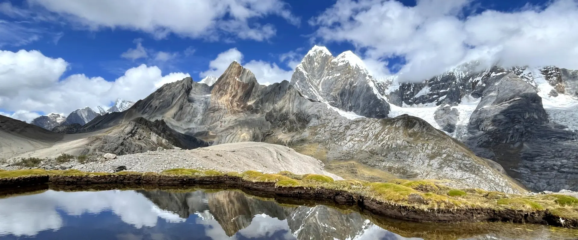
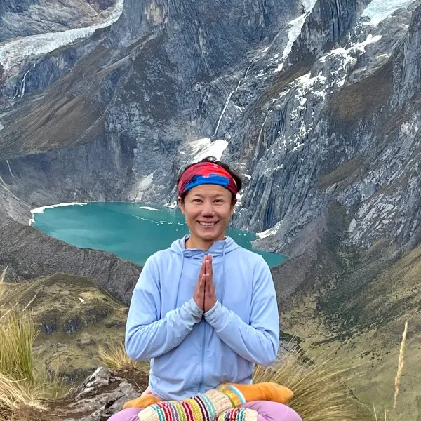
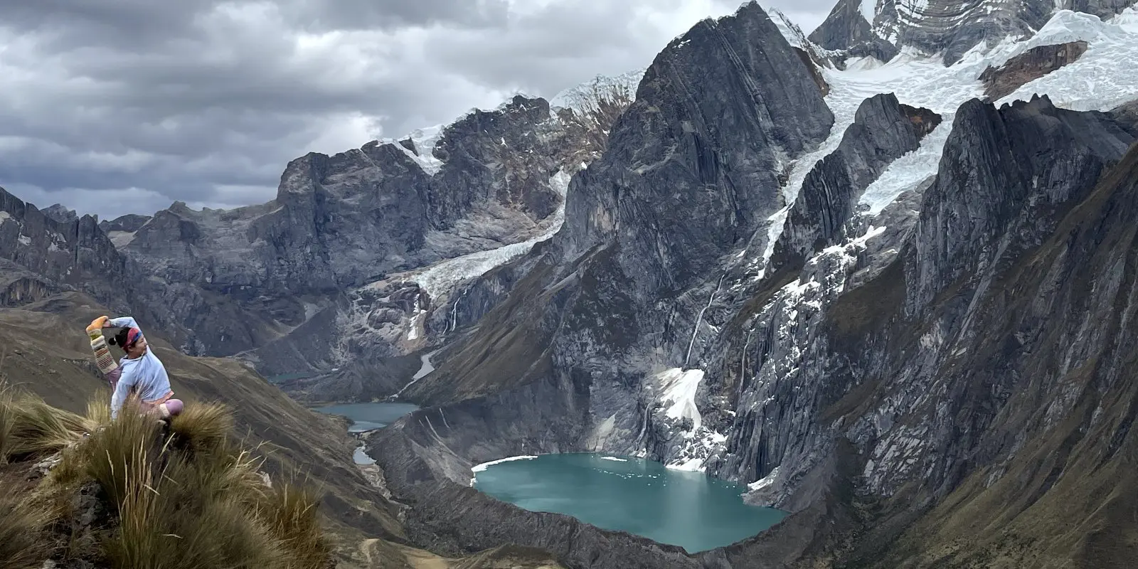
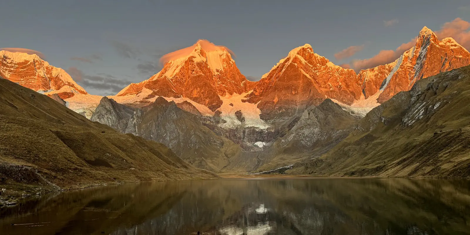
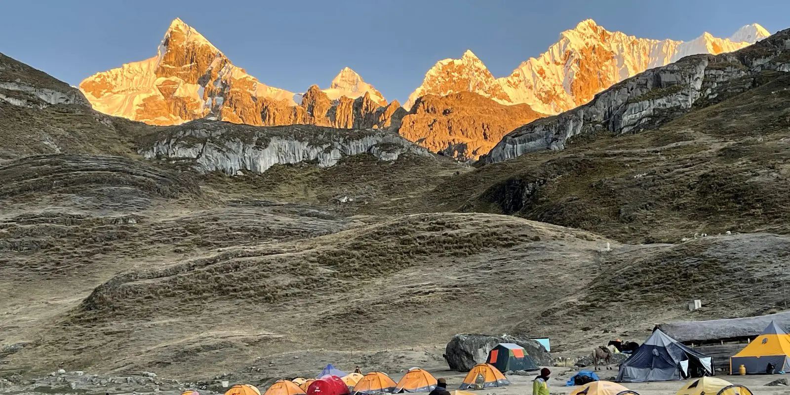
The Huayhuash trek in Peru is known as one of the most beautiful trails in the world. Circling for 120 kilometer around the Cordillera Huayhuash mountain range, you’ll have spectacular views on the high mountains, peaking over 5000 and 6000 meters in some of the most incredible and remote places of Peru.

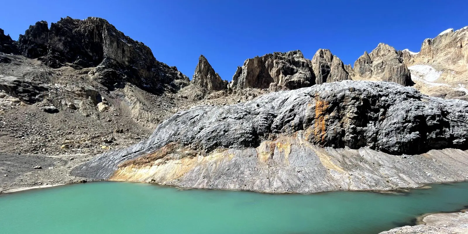
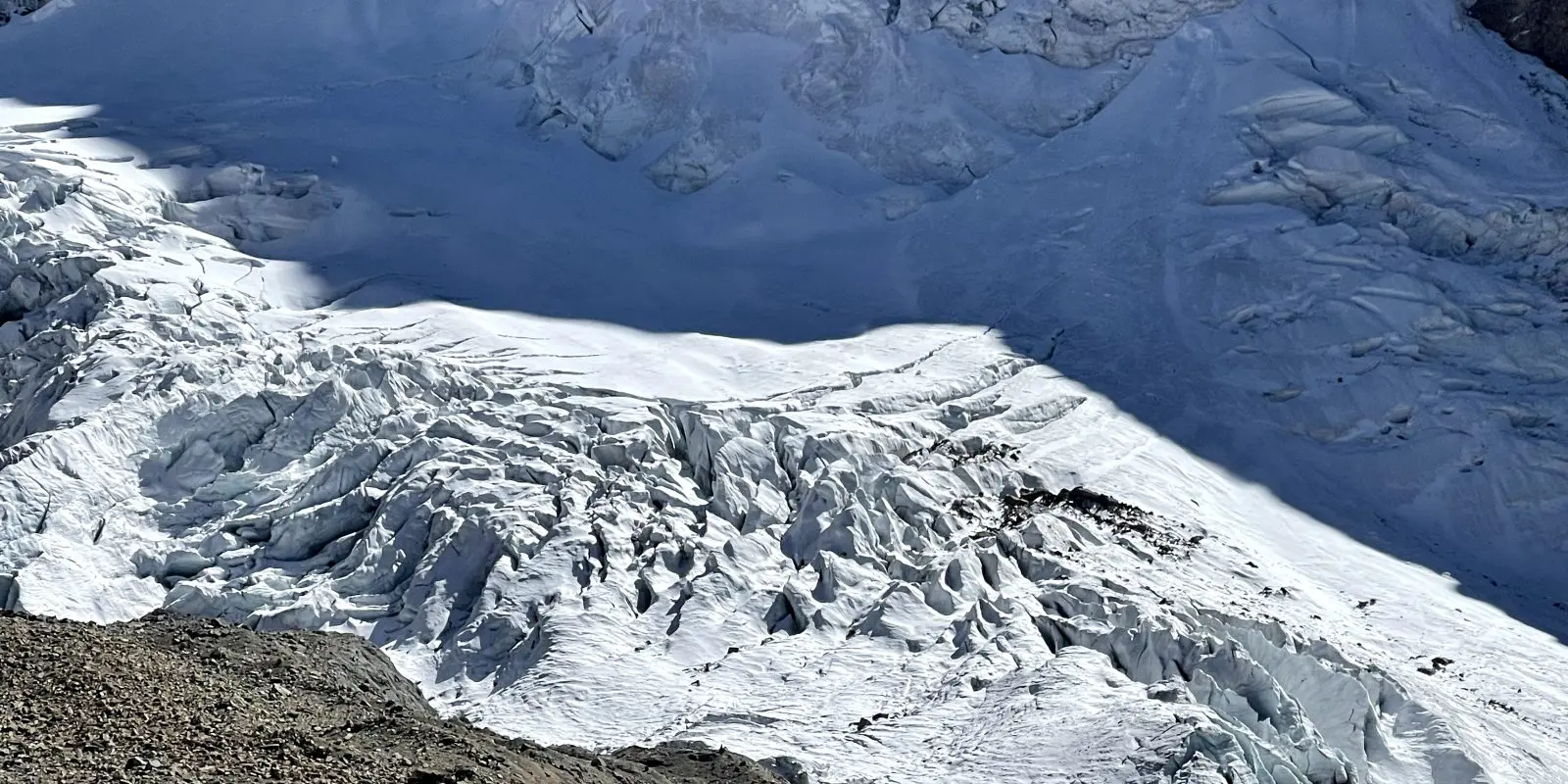
This trek offers some magnificence beyond imagination: glaciers, snow-capped mountains, blue turquoise lakes, glorious sunrise/sunsets and breathtaking milky ways, endless valleys, and vast open spaces. Every little corner is beautiful.

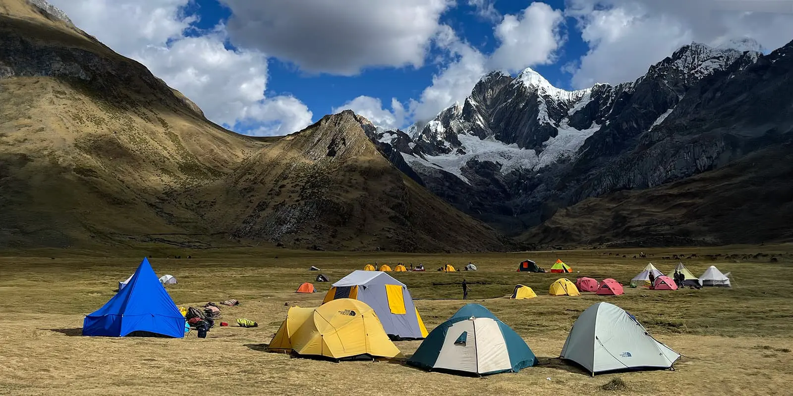
The Huayhuash trek is moderate to strenuous because most of the stages are above 3000m and 4000m. The high altitude makes everything much harder. The average elevation gain and loss is more than 1000m a day with the longest day of hiking being 18km.

Yanyan Yan

Yanyan Yan

Yanyan Yan (3Y) was born in China. She lived in London for 10 years and Helsinki for one year before she moved to Australia 5 years ago. She is now a yoga teacher and a massage therapist in the beautiful yoga and surf town of Byron Bay, Australia. She fell in love with hiking, especially long distance, when she was studying in London.

Some of her favorite hikes include Nepal Everest Base Camp, Chile Patagonia Torres Del Paine W trek, Camino De Santiago trek, Tour De Mont Blanc, Peru Inca Trail Machu Picchu trek, Kilimanjaro trek, and more. You can follow Yanyan on Instagram @yoga_yanyanyan

View profile

The Trail

The trek is around 120 kilometers as you hike a circuit around the Cordillera Huayhuash mountain range. You will have views of some of the most spectacular mountains that are over 5000m and 6000m, including Siula Grande, Trapecio, Yerupaja, Jirishanca (hummingbird), Rondoy, and Diablo Mundo.

Because it’s a circuit, you’ll also see the Cordillera Huayhuash from different angles. The view is breathtaking with the most beautiful views on days 3,5, and 7.

Don’t get it wrong though, this is also one of the most difficult of the popular treks you can attempt. While the elevation gains and losses aren’t too intense each day, you’ll be at such a high altitude that you’ll likely need to deal with altitude sickness (bloating gas, nausea, stomach pain), and potential blisters from the gear and weather. In addition to the altitude sickness, you’ll be camping in -5-degree weather. This isn’t for the weak of the heart!

On the first day, you’ll take a 5am bus transfer (4 or 5 hours) from Huaraz (the hiking capital in Peru) to a little village for breakfast and the basecamp for the trek. From there, you’ll start with a 9-kilometer acclimatization trek by ascending from basecamp 4180m to 4750m and then descending to 4200m. From there, the stages get a bit more difficult. On stage two, you’ll increase your distance and hike 12 kilometers between your camps, and on stage three you’ll hike 16 kilometers. Stage four has the option for an additional hike to see the mountain Trapecio and the glacier if you have the energy!

Stage five is the longest day of the trek, at 18 kilometers. You’ll hike from 4400m to 5000m then down to a cute local village Huayllapa (3490m). There’s an option to spend the night in a hostel to have a warm shower and escape the frozen tent, and they also have wifi. However, there is still the option to pay to have a warm shower, use the wifi, and still sleep in your tent.

Stage six is another long day of 16 kilometers. You’ll ascend from 3490m to 4800m then down to 4500m, where you’ll sleep at the highest and coldest campsite.

Stage seven is much shorter, 9.5 kilometers, with some of the best views of the circuit. You’ll ascend from 4500m to 4700m then descend to 4080m, where you’ll sleep at the most beautiful campsite. Finally, for stage eight, you’ll hike a long way downhill to the village where you began. This is where you’ll wait for the bus back to Huaraz.

Stages

This trail is mostly hiked in 8 days, but some people choose to do it 5 days (skip some parts) or 10 days (with an option to explore the hot springs and hike at a slower pace). Because there are many different itinerary options and the trail is a majority camping trail, there are a few variations. We are not including specific stages because of this and recommend reaching out to a tour agency or guide for specific options.

Most people choose to join the guided tour so that they don’t have to carry the necessary heavy warm clothes (the temperature drops to -5 or -15 in the evening sometimes) sleeping bag, tent, or food for 5 days (on day 5 you can top up your food in the small village). The guided tour will have donkeys to carry the food and other stuff for you. They will cook 2/3 meals a day, provide the snacks, and set up/pack down the tent for you. You only need to carry a day pack for hiking (even that can be challenging with the high altitude and length of the trek).

You can also choose to do the trek self-guided. But you have to carry all the equipment for a minimum of 5 days of trekking. On day 5, when you pass through and rest in the small village of Huayllapa, there are options to buy food and water etc. However, this is not common and we we saw fewer than 5 people who completed the trek self-guided throughout our 8 days.

Accommodations

There are assigned camping sites throughout the trail, usually by the river with fresh water. They are some of the most beautiful camping sites I have ever seen in my life. They’re usually surrounded by snow-peaked mountains, glaciers, rivers, and lakes. You will see some of the most incredible sunrises, sunsets, and the Milky Way in the evenings. They all also have toilets.

On day 5, when you arrive in the village of Huayllapa, you’ll have an option to camp or stay in a local hostel with hot water and WiFi for a good price.

Best time of the year

The best time of the year to hike the Huayhuash trail is June to August. This is the dry season in Peru Cordillera mountain range when the sky is crystal blue, the sun will keep you warm in the daytime, and the view is spectacular with fewer clouds and less rain. However, there might still be some rain or hail sprinkled throughout.

Keep in mind that the weather in the high mountains can change rapidly, and it’s important to be prepared for all conditions, including rain or snow. Always check trail conditions and local weather forecasts before starting a high-alpine hike. Additionally, consider your hiking experience and skill level, as this trek is challenging and requires proper equipment and experience.

Safety & Gear

If you do the trek with a guided tour, the hiking guide with brief you on the safety guidelines for each day. If you do the trek self-guided, make sure you are well prepared for the changing weather in the mountains and have sufficient food and gear. Note that this is a very remote area. We recommend this tour with an official guide or at least to hike in a group.

You’ll need a pair of hiking shoes with good grip, hiking poles (recommended, as some sections are very steep especially downhill), good winter sleeping bags (comfort -10), a tent, sleeping mattress, warm clothes, and different layers of clothes (as day time is hot and evening can get very cold with a temperature drop down to -15), gloves, scarf, sunglasses, sun cream, headlamp, and a first aid kit. Find some extensive gear lists here.

Good to know

I highly recommend doing the trek in the dry season (June to Aug, May/Sep might still be ok) to get the best views of the mountains, glaciers, and lakes.

You take a bus from Lima to Huaraz (the hiking capital and outdoor paradise, 7-10 hours bus with option of overnight bus). Here, you’ll need to slowly acclimatize for 2 days before the Huayhuash trek. There are many incredible day hikes/ice climbing/glacier climbing in Huaraz, for example: Laguna 69, Laguna Peron, Glacier Pastoruri, and more.

Please bring some high-altitude sickness pills (Diomax etc) and/or coca leaves when you are in Huaraz. You can bring a big flask/thermos to have hot water every day and you’ll also want some baby wipes for a simple “shower” as there are no showers until day 5 in the village. Prepare some cash for the tips if you do a guided tour.

Please do not throw any trash (including fruits, like oranges, banana skins, etc.) as it’s very difficult for the food to decompose at such high altitudes, taking sometimes more than 10 years.

Please give way to donkeys/horses when they pass through, stay on the side that is away from the cliffs as the donkeys might push you to the edge of the cliffs if you’re on the wrong side.

For safety reasons, it’s always recommended to book a tour with an official guide / company or at least to hike in a group.

Highest Point
5100M (16732 FT)
Type of Trail
Circuit

Want to submit a trail or make this page more complete?

Comments

Be the first one to comment on this trail!

Reply to this trail

Your email address will not be published. Required fields are marked *

Reply to this trail

Log in to comment on this trail
Always read the disclaimer

Terms of Use: important to all visitors on this website. We strive to publish high quality content and information on this website. However it’s always possible that we’re missing out on some crucial information. In spite of the fact that this route, associated GPS track (GPX and maps) were prepared under diligent research by the specified contributor and/or contributors, the accuracy of such and judgement of the author is not guaranteed. Therefore, hiking-trails.com and contributors are in no way liable for personal injury, damage to personal property, or any other such situation that might happen to individuals hiking or following this route. Should you choose to hike this trail, this is always at your own risk. Check out our guidelines for safety hiking and Leave No Trace principles at the hiking 101 page.

Download GPX

Join the community!

Login or create a FREE account 😊

With an account you can:

Download GPX files

Pin trails to your wishlist

Mark trails as hiked by you

Rate hiking trails

Comment on trails, blogs and gear reviews

Happy trails!
Login

Don't have an account yet? Register here