About the High Tatra hut-to-hut

country
Poland
length
43 km(27 mi)
Type of trail
Hut to hut
difficulty

Difficulty is highly personal. Be aware of the weather conditions as bad weather turns easier trails in difficult trails especially in the mountains.

Difficult
accommodation

Lodging means a mix of hotels, hostels or AirBnB’s.

Mountain huts
Elevation gain
3194 m(10479 ft)
terrain
Mountains, Forest
remoteness
Some of the time
Show more

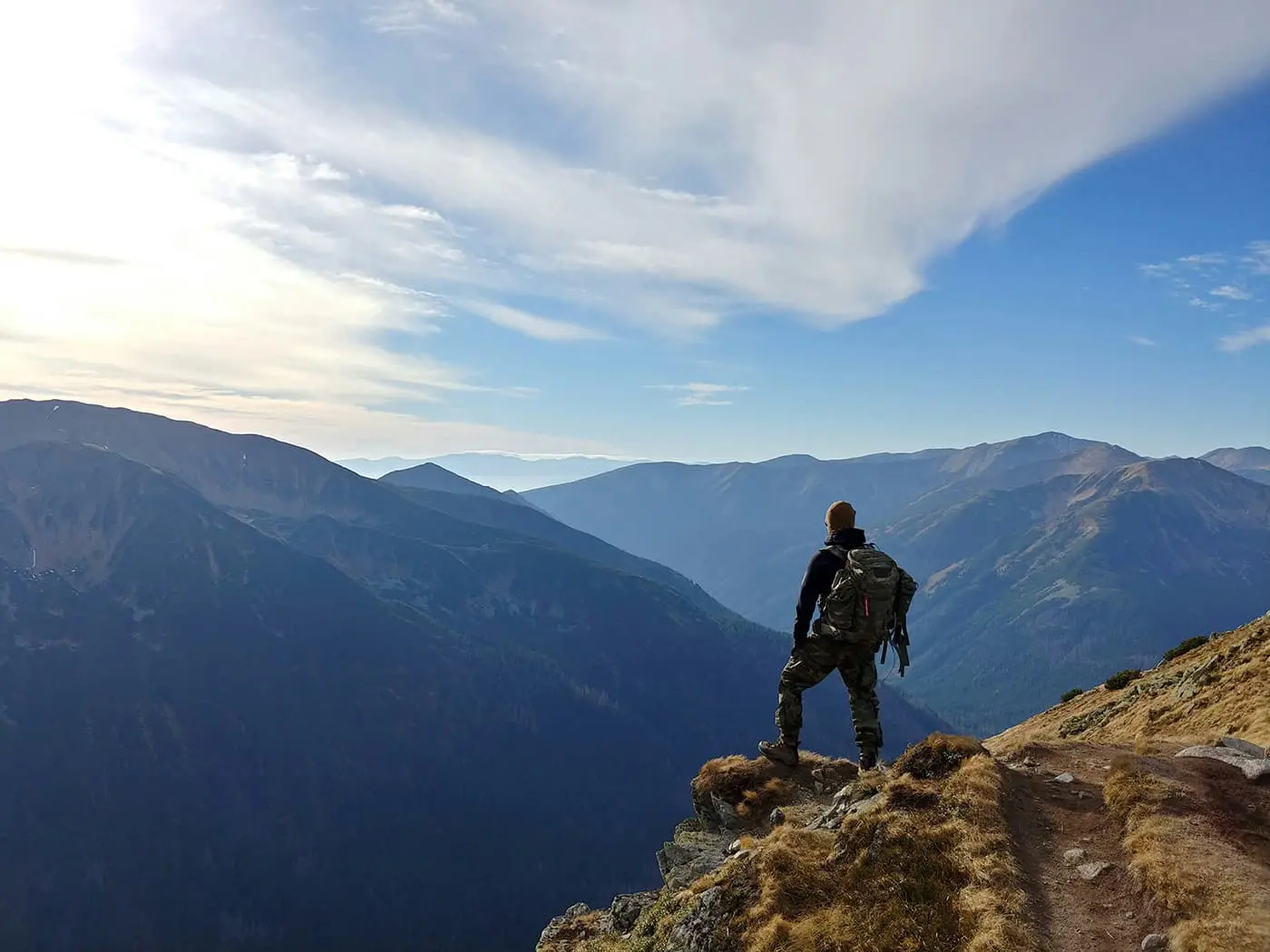
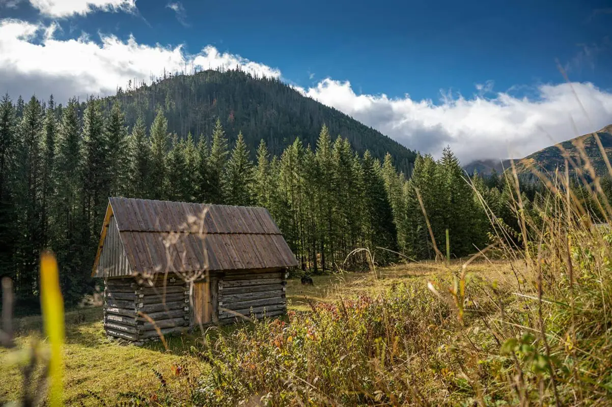
At the border of Poland and Slovakia, you’ll find the Tatra Mountains, a rugged mountain range, and the highest in the Carpathian Mountains. The Polish side is often referred to as the “High Tatras” or “Hohe Tatra” in German. Here, you’ll find some of the most incredible hiking experiences on the continent. The High Tatras are well known for their dramatic green mountains and sharp peaks, which make it a perfect spot if you like more rugged terrain. This Hohe Tatra hut-to-hut is sure to win over your heart.

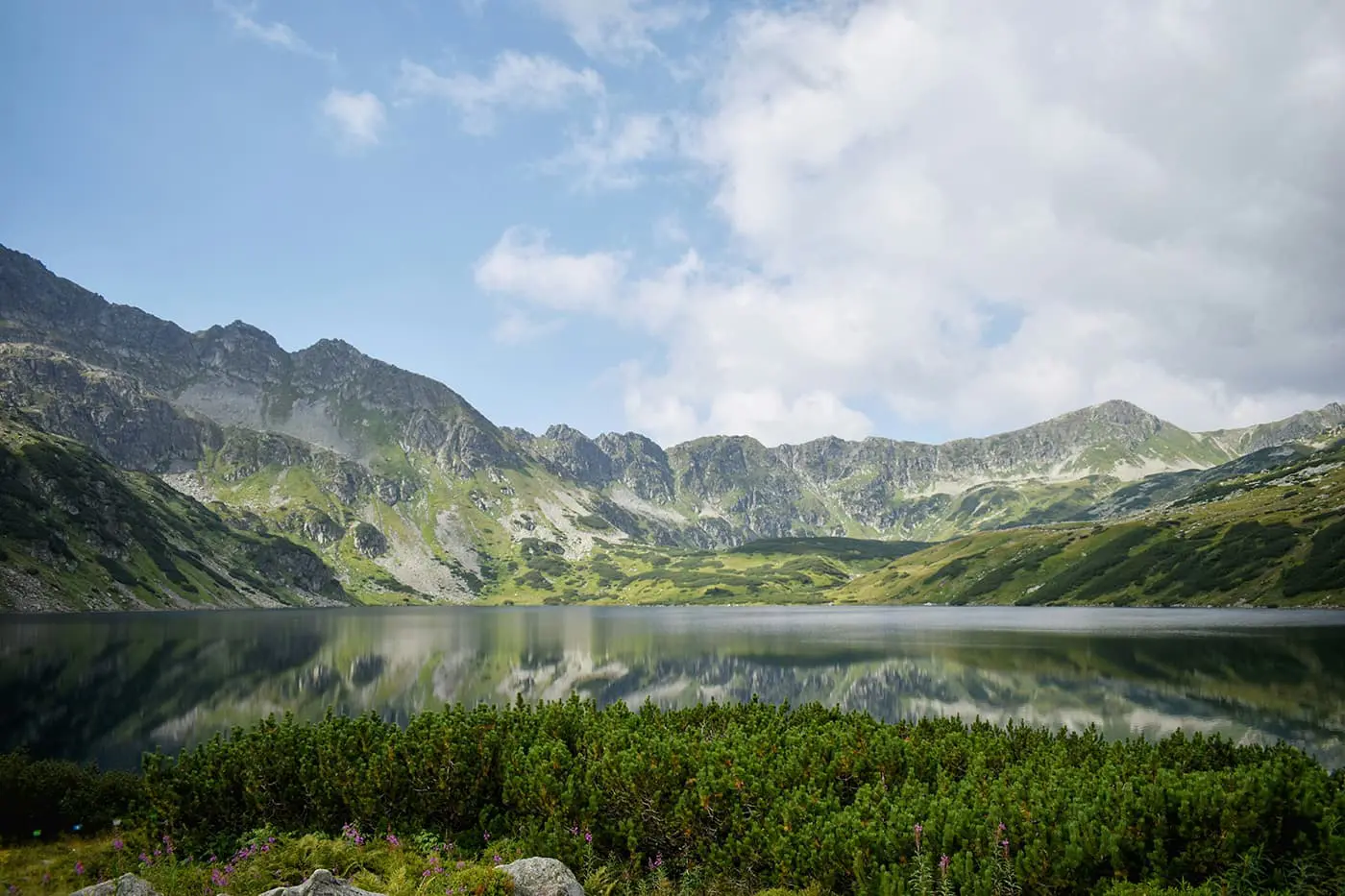
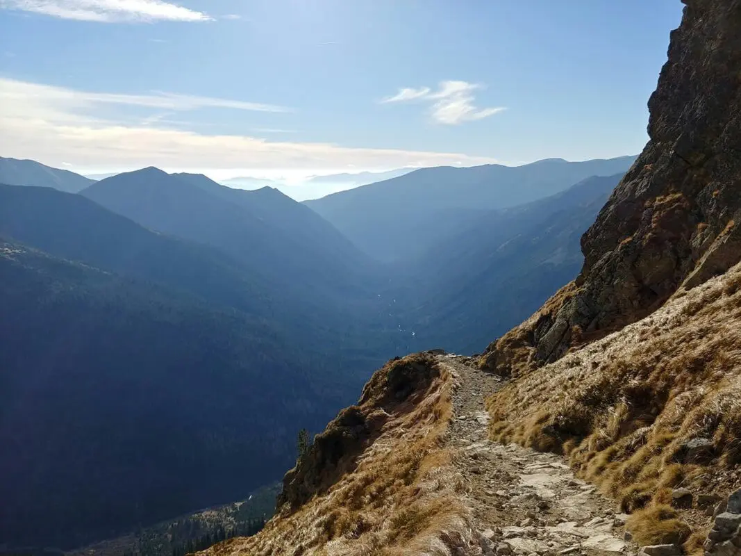
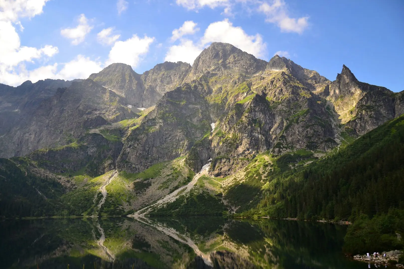
The High Tatra region of Poland has a great four-day hut-to-hut trek through this area in the heart of Tatra National Park, a UNESCO Biosphere Reserve with views of the Rysy (2500m), the highest mountain peak in Poland.

Elmar profile picture
Editor

Elmar Teegelbeckers

Passionate hiker Elmar spends months of his time on the trail. He’s usually on the lookout for hidden gems in one of his favourite countries such as Slovenia, Switzerland and Japan. He founded hiking-trails.com in need for a community and detailed information about the trails. Before this, he worked for the Alpine asscociation in the Netherlands[ (NKBV) but lost his heart to the trails.

Not long ago, Elmar published the book (in Dutch) Hiking Trails – best long-distance trails in Europe. With this book, website and socials, he hopes to inspire and shape an inclusive community for hikers all over world. No matter your speed, experience or level, you can get out there to enjoy the trails and connect with the heartwarming hiking community. Life is so much better outside and he hopes to inspire hikers to take their first, or next, step on the trail.

You can reach Elmar at info@hiking-trails.com.

View profile

The Trail

This hut-to-hut hiking trail in Poland starts from the ChochoƂowska Valley, setting off towards Ornak. The first stage covers a distance of 10 kilometers, so it’s an ideal start for the tour. However, the section is still difficult, especially after it rains and the stones are slippery. Nonetheless, the trail is manageable and you might even see some wildlife, including the rare sight of bears, which are known to be in this area.

The High Tatra Mountains, though not as high as the Alps, are maybe even more rough, and can be a great alternative. The most demanding stage involves a 16-kilometer trek to Murowaniec, which will take you through everything from dense forests to alpine zones above the treeline. You’ll also stand at the border with Slovakia on this stage.

The trek’s third day is slightly less demanding but no less amazing. It will take you to the renowned Five Lakes Shelter. The path here is marked by the challenging Zawrat pass, where there are steel chains to assist you, showing off the characteristics of some of the more challenging trails in the Hohe Tatra.

On the last day, you’ll make your way to Morskie Oko, a final 16 kilometers. This day is still challenging as you may get stuck with the Halny wind, which can show up and is a result of the unpredictable nature of the Tatras weather. The final endpoint has a rewarding panorama of neighboring lakes and peaks, which is a lovely way to remember the trail.

Stages

You can hike this tour in 4 stages. They’re divided below:

Hohe Tatra 4-day hut-to-hut stages

Stage 1:

ChochoƂowska – Ornak, 10 km | 6 mi

Stage 2:

Ornak – Murowaniec, 16 km | 10 mi

Stage 3:

Murowaniec – Five Lakes Shelter, 8 km | 5 mi

Stage 4:

Five Lakes Shelter – Morskie Oko, 16 km | 10 mi

Accommodations

You can stay in the cozy Polish mountain huts. Here you can buy food and drinks and sleep in dormitory-style sleeping rooms. Make sure you book them in advance on the following websites.

Mountain huts per stage

Stage 1:

Ornak

Stage 2:

Murowaniec

Best time of the year

The best time to hike this hut-to-hut hike in Poland is from June through September. This timeframe has the best weather and it’s not as crowded as in the peak season of July and August. Most of the huts should be open between June and September, but note that they close in the off-season. Make sure you book the mountain huts in advance, especially if you’re planning to hike during the high season in July and August.

Safety & Gear

Hiking in the High Tatras will always be a challenge, the same as hiking in the mountains in general. Of course, carry appropriate gear, including a reliable map and/or GPX device, a first-aid kit, and a headlamp. Dress in layers to adapt to changing weather conditions and wear your comfortable and sturdy hiking shoes. Carry enough water (at least two liters) and high-energy snacks.

Mountain weather can be unpredictable and change rapidly. Check the weather forecast before setting out and be prepared for sudden changes, including rain, fog, and temperature drops. While wildlife encounters are generally rare and not a huge danger, it’s important to know how to react if you encounter wild animals like bears, wolves, or dogs. Keep a safe distance and do not feed or provoke them.

Good to know

It can be crowded during peak season in the High Tatras. Consider hiking this trail in June or September. Book the shelters well in advance. The weather is very unpredictable in the High Tatras, so you’ll need to be prepared and keep a close eye on the weather forecast. You can ask the hut wardens each day for help determining your best course of action if you’re unsure how’s the best way to proceed. Some parts of the trail are exposed with steel cables (not a Via Ferrata) and are only suitable for experienced and sure-footed mountain hikers.

Route
Point to point

Want to submit a trail or make this page more complete?

Join the community!

Login or create a FREE account 😊

With an account you can:

Download GPX files

Pin trails to your wishlist

Mark trails as hiked by you

Rate hiking trails

Comment on trails, blogs and gear reviews

Happy trails!
Login

Don't have an account yet? Register here