Rating
0 Rate this trail

About the HexaTrek

country
France
length
3034 km(1885 mi)
Type of trail
Thru-hike, Long-distance
difficulty

Difficulty is highly personal. Be aware of the weather conditions as bad weather turns easier trails in difficult trails especially in the mountains.

Strenuous
accommodation

Lodging means a mix of hotels, hostels or AirBnB’s.

Mountain huts, Camping, Lodging
Elevation gain
136000 m(446194 ft)
terrain
Mountains, Forest
remoteness
Most of the time
Show more

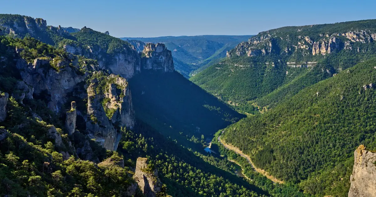
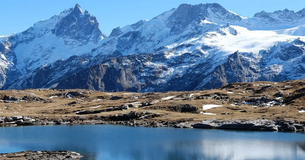
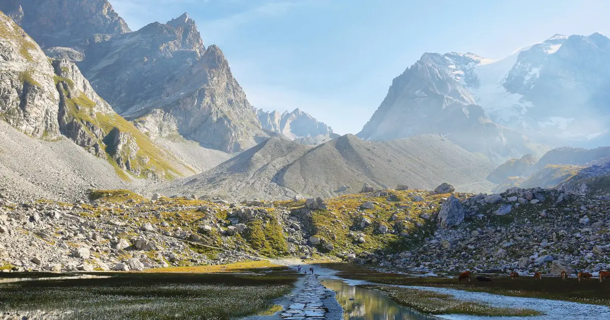
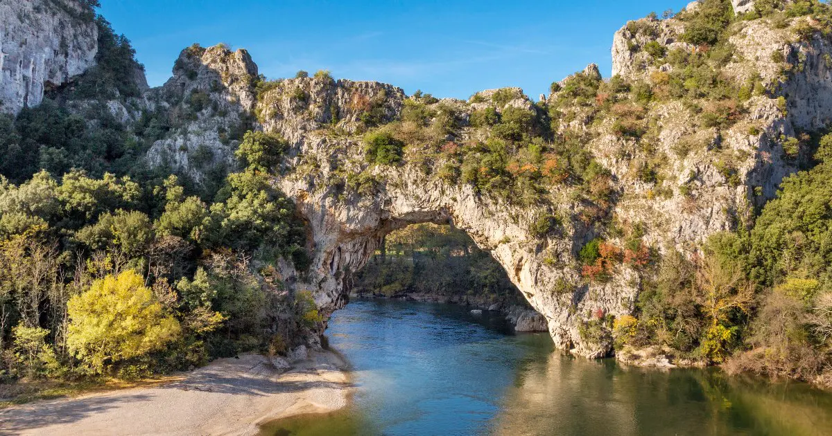
The HexaTrek is a 3,034 km hiking trail that connects 14 national parks, stretching across France from the Vosges to the Pyrenees. The trail goes across the highest mountain regions of the country, often referred to as “l’Hexagone” due to France’s hexagonal shape. Along the way, you encounter iconic summits, natural wonders, and some of the wildest places in France.

The route combines 47 Great Hiking GR® trails into a single path, offering a unique thru-hiking experience. As you walk, you’ll pass through picturesque villages, immersing yourself in the wilderness, traditions, history, and culture of France.

women in blue smiling at camera
Editor

Katie Mitchell

After a whirlwind of 8 years on the road (and trail!), Katie has hiked the Camino Frances, the Peaks of the Balkans, the Fisherman’s Trail, and extensively in the United States. She is an avid trail runner and now lives in Colorado where she plays in the mountains in her free time. You can follow her adventures on Instagram.

View profile

The Trail

Six main sections of the trail give you a taste (not just of the wine and cheese) of the diversity of France’s wilderness. The first section, in the East, takes you between lakes and mountains. You’ll hike past numerous ruins, evidence of the region’s turbulent history, with one of the highest densities of castles per square kilometer in the world. “La route des vins,” local gastronomy, and the picturesque villages of Alsace will awaken all your senses.

Moving on, you head into the Northern Alps. Here, the HexaTrek lifts you to the highest summits, with plenty of glaciers, high mountain lakes, and of course, lots of cheese! While the Northern Alps are renowned for their bustling ski resorts, those who explore them in the summer discover a completely different side of this range.

Continuing south, you enter the Southern Alps. Similar to the Northern Alps but with more sunshine, the Hautes-Alpes are a paradise for adventurous hikers. The altitude difference per kilometer in this stage is among the highest in HexaTrek. It’s challenging but guarantees a deep immersion in nature. Less crowded than its neighboring Hautes-Alpes, this stage introduces you to the Pre-Alps, Vercors, and Baronnies region.

Leaving the Alps behind, you trek through the Corges and Causses region in south-central France, full of surprises shaped by time and water. Deep gorges and high plateaux provide stunning views for HexaTrek hikers. This stage is great because you can refresh with almost daily dips in natural water reserves.

Stage 5 dances along the summits of the Eastern Pyrenees, crossing borders between France, Andorra, and Spain in the heart of the Pyrenean range. The forests of Ariège and the Pyrenean hinterland offer beautiful landscapes.

The sixth and final stage in the Western Pyrenees boasts the range’s highest peaks. You’ll face significant altitude changes but will be rewarded with incredible vistas where rugged ridges meet stunning natural beauty.

Stages

The HexaTrek can be divided into six main sections that you can hike at your own pace. Because of the longevity of the trail, you are able to thru-hike it, section hike it, or even be a weekend warrior and pick your favorite areas to slowly hike when you have time.


  • Section 1: The Great East (Vosges – Doubs – Jura), 670 km | 416 mi 
  • Section 2: Northern Alps (Haute Savoie – Vanoise – Beaufortain), 382 km | 237 mi
  • Section 3: Southern Alps (Ecrins – Belledonne – Vercors), 497 km | 309 mi
  • Section 4: Gorges & Causses (Cevennes – Tarn – Languedoc), 514 km | 320 mi
  • Section 5: Eastern Pyrenees (Catalogne – Ariege – Central Pyrénées), 532 km | 331 mi
  • Section 6: Western Pyrennes (National Park, Bearn, Basque), 437 km | 272 mi

Accommodations

A lot of the time, you’ll be able to camp and wild camp. But you’ll also have options along the way to stay in mountain huts, guesthouses, and hotels/hostels in towns as you pass them. On about 75% of the trail, you’ll be able to legally bivouac. So you’ll want to bring your own tent/bivouac system and cook system to support yourself for most of the trail.

Best time of the year

The best time of the year to hike the HexaTrek is June through October. However, it depends on if you hike SoBo or NoBo. If you hike SoBo, you can begin anytime between mid-May and mid-June, while if you hike NoBo, you’ll need to begin in mid-June to stay on track and (hopefully) avoid snow.

Safety & Gear

Begin setting your expectations of the weather conditions specific to each region through research. Be prepared for rapid weather changes, especially in the Alps and Pyrenees, where storms can arise suddenly. Pack accordingly with layered clothing, a waterproof jacket, and sturdy shoes to navigate the terrain safely.

Thru-hiking gear list


Navigational skills are essential because this trail includes remote sections. Carry detailed maps, a GPS device or smartphone with offline maps, and know how to use them effectively. A compass never hurts, either!

In remote regions such as the Corges and Causses or the Pre-Alps, be prepared for limited communication and medical facilities. Carry a fully charged phone and consider a portable charger or solar charger. Your first aid kit should include essentials like bandages, antiseptic, blister treatments, and any personal medications.

Good to know

The Hexatrek is a massive undertaking and must be regarded as such. Tap into the community of hikers who have already hiked the trail in past seasons for advice and download the Hexatrek app for help (linked below). The app works entirely offline, will identify bivouac areas and nearby refuges, show you points of interest, and even point you in the direction of water and food sources.

The trail can be hiked NoBo (Northbound) or SoBo (Southbound), and there are official resources for both on the app.

The HexaTrek also includes the HRP, Haute Route des Pyrenees. You can find more about the trail here.

ROUTE
Point to point
HIGHEST POINT
2,784M (9,137 FT)

Want to submit a trail or make this page more complete?

Comments

Be the first one to comment on this trail!

Reply to this trail

Your email address will not be published. Required fields are marked *

Reply to this trail

Log in to comment on this trail
Always read the disclaimer

Terms of Use: important to all visitors on this website. We strive to publish high quality content and information on this website. However it’s always possible that we’re missing out on some crucial information. In spite of the fact that this route, associated GPS track (GPX and maps) were prepared under diligent research by the specified contributor and/or contributors, the accuracy of such and judgement of the author is not guaranteed. Therefore, hiking-trails.com and contributors are in no way liable for personal injury, damage to personal property, or any other such situation that might happen to individuals hiking or following this route. Should you choose to hike this trail, this is always at your own risk. Check out our guidelines for safety hiking and Leave No Trace principles at the hiking 101 page.

Download GPX

Join the community!

Login or create a FREE account 😊

With an account you can:

Download GPX files

Pin trails to your wishlist

Mark trails as hiked by you

Rate hiking trails

Comment on trails, blogs and gear reviews

Happy trails!
Login

Don't have an account yet? Register here