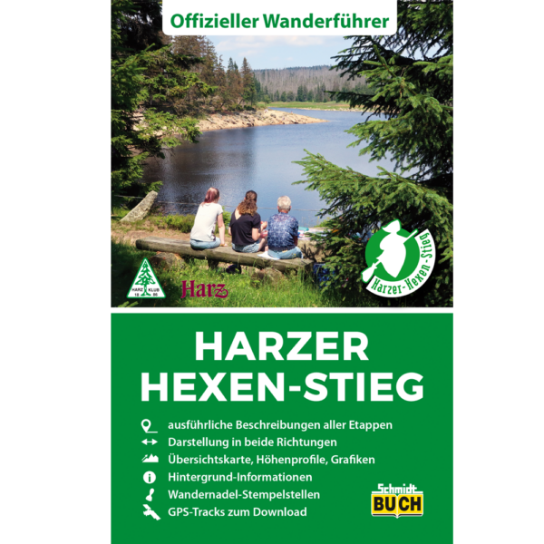
About the Harzer-Hexen-Stieg

country
Germany
length
94 km(58 mi)
Type of trail
Long-distance
difficulty

Difficulty is highly personal. Be aware of the weather conditions as bad weather turns easier trails in difficult trails especially in the mountains.

Moderate
accommodation

Lodging means a mix of hotels, hostels or AirBnB’s.

Camping, Lodging
Elevation gain
2135 m(7005 ft)
terrain
Mountains, Forest, Hills
remoteness
Some of the time
Show more

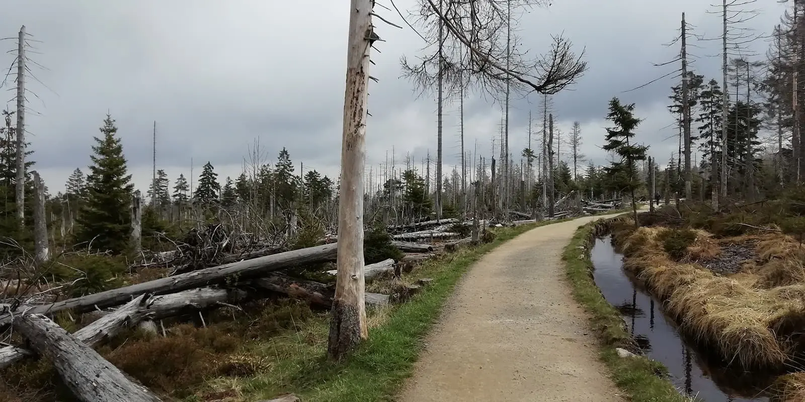
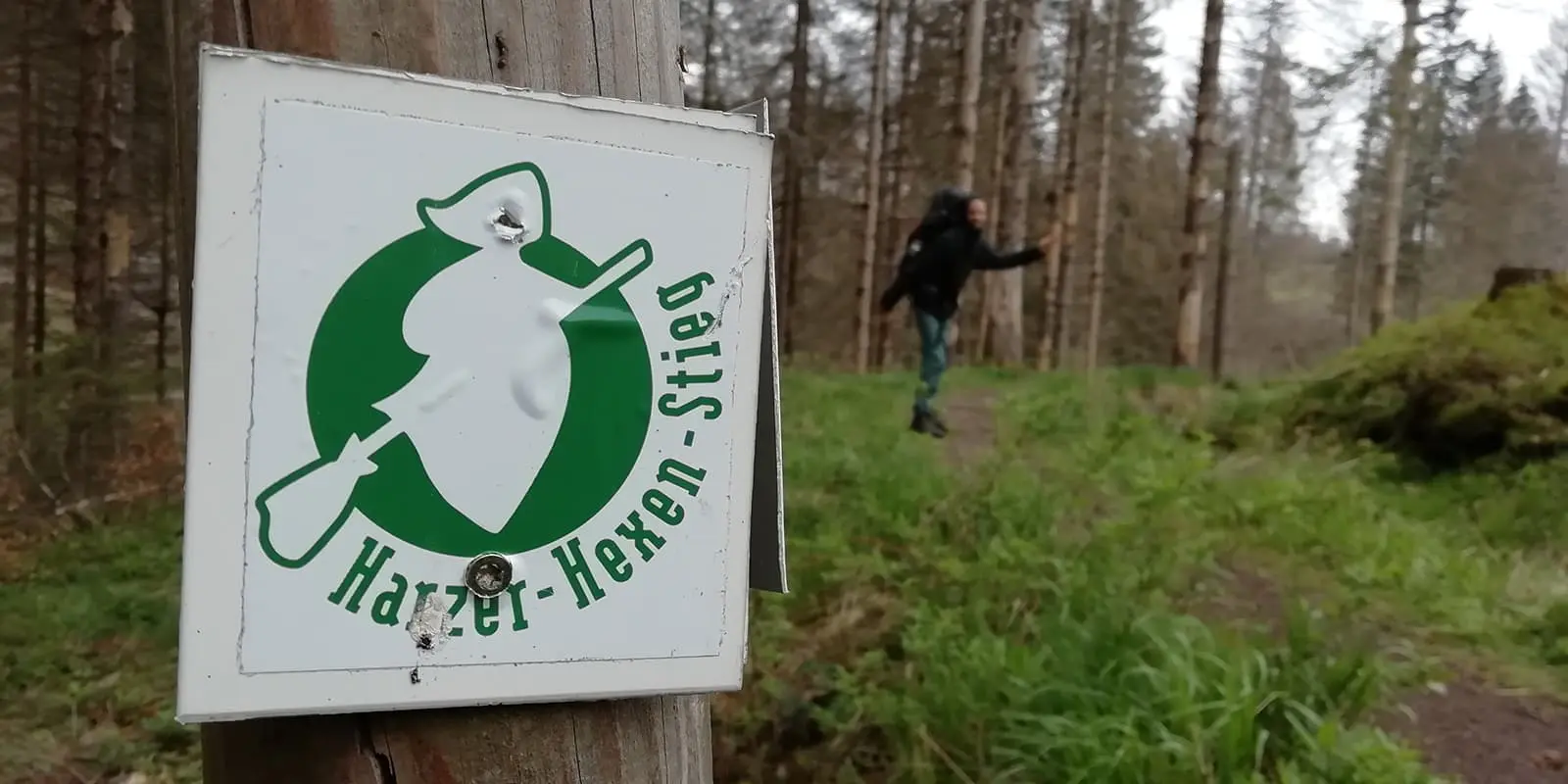
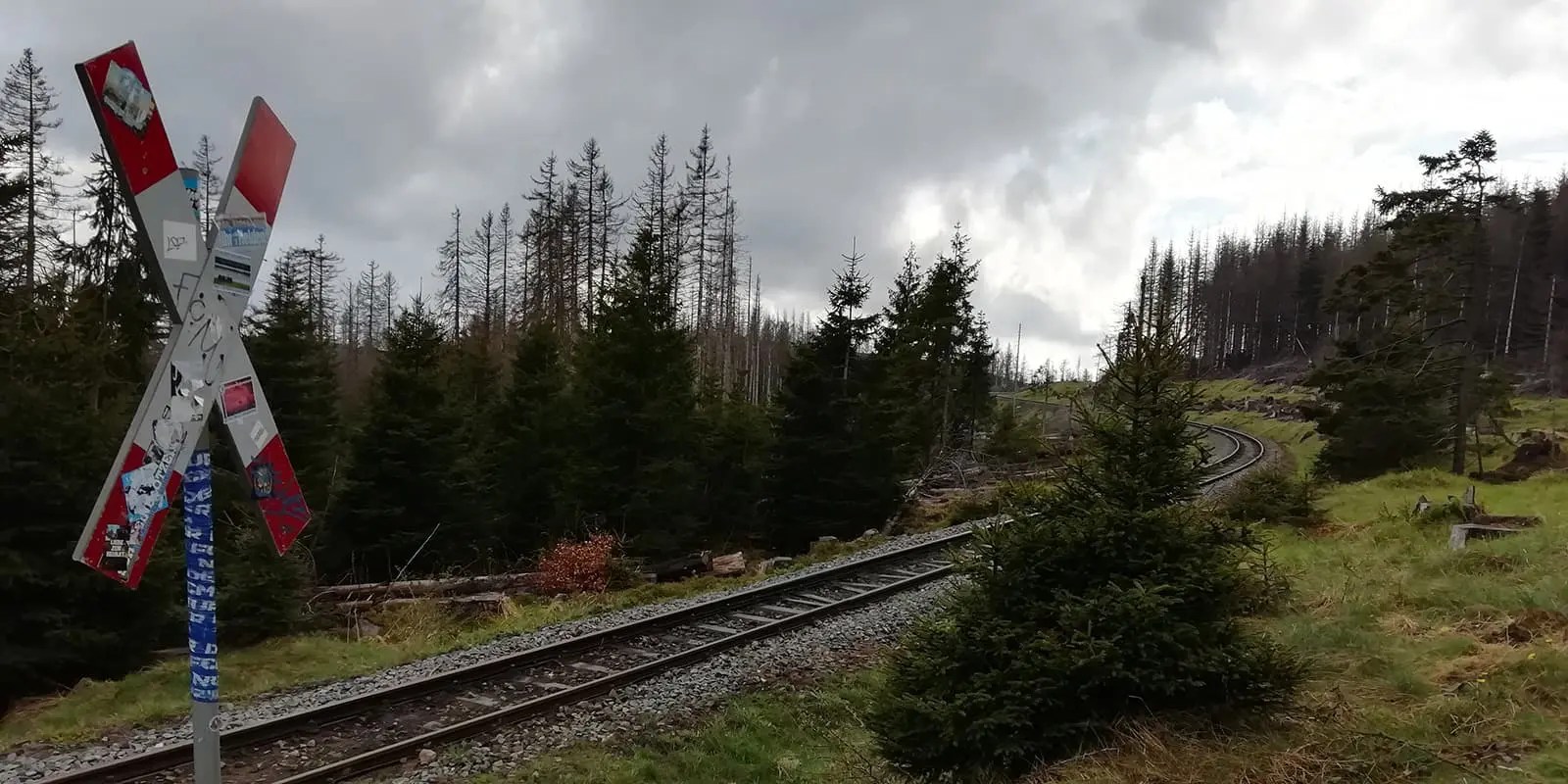
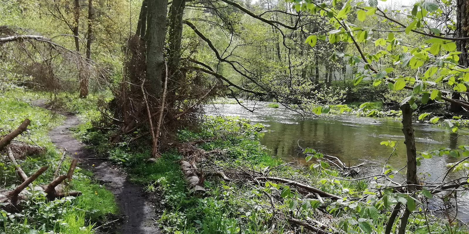
The Harzer-Hexen-Stieg runs from the town of Osterode to the town of Thale and is 94 kilometers (58 mi.) long. The possibility of crossing Brocken, the highest mountain in the Harz low mountain range, is just one of many highlights. The trail combines nature, geology, history, and culture. 

Harz National Park has a variety of forests, canyons, cliffs, and bogs as well as little villages with medieval half-timbered houses. You will pass by remnants from the mining history of the area and a culture full of myths and legends about knights, witches, trolls, and more. Therefore, it is no surprise the Harzer-Hexen-Stieg has been honored twice by Top Trails of Germany as well as Qualitätsweg Wanderbares Deutschland.

Merle profile picture

Merle Wünderling

Merle is an outdoor enthusiast who’s passionate about hiking, rock climbing, mental health, and sustainability. Born in Germany but at home in the world, she’s hiked trails in New Zealand (Abel Tasman Coast Track, Kepler Track), Europe (Rota Vicentina/ Fishermen’s Trail, Tour du Mont Blanc, GR20 Corse, Kungsleden… ), and the Balkans (Peaks of the Balkans). Over the years she became a bit of a nerd, constantly improving her gear for upcoming hikes, such as GR11 Spain, Tour des Ecrins, Te Araroa, and the Transcaucasian Trail.

You can follow Merle on Instagram @merlewunderkind.

View profile

The Trail

From the medieval town of Osterode, you will start walking uphill and pass by the old mining village of Lerbach. Marienblick is going to offer you a wonderful view of the Lerbach Valley before you continue hiking toward Buntenbock.

The next day you are going to hike past numerous ponds of the “Upper Harz Water Management.” These are remnants from mining times and a UNESCO World Heritage Site. Narrow paths will guide you past the mountain town of Altenau, where you are going to enter Harz National Park and continue to Torfhaus.

The next stage takes you up Brocken, which stands at 1141 meters (3743 ft), making it the highest peak in the Harz as well as in northern Germany. After enjoying the view, you are going to descend to the Brockenchaussee. Dense forests and rustic rocks guide you past Schlungklippen, Ahrensklint, and Trudenstein to Drei Annen Hohne.

For those who find the route over the Brocken too demanding or already know it, there is an alternative: the Brocken bypass through the Oder Valley via St. Andreasberg and Braunlage to Königshütte. Although it is longer, it has fewer meters in altitude gain.

Between Königshütte and Altenbrak, you can choose between a north and a south variant.

The north variant takes you from Königshütte up to Königsburg Castle with a beautiful view over Harz National Park. Afterward, you will hike along the Bode River and pass the village of Bodfeld before you cross open-cast mines and the Tiefenbach Valley. From here, a trail will guide you towards Rübeland, with its famous stalactite caves and the still active open-cast mine which is worth a visit. Next, narrow forest paths take you to Rappode Dam, the largest drinking water dam in Germany, and then on to Altenbrak.

The south variant also takes you from Königshütte up to Königsburg Castle. Afterward, the  Bode River guides you past the Rappbode Reservoir towards the spa town of Hasselfelde, where the charcoal burners’ path begins. It leads you past the charcoal-burning museum Stemberghaus to Altenbrak.

The last stage is here to impress with the Bode Valley Gorge, where you hike along huge granite walls. The trail leads you over the Devil’s Bridge and up a steep and narrow path toward the legendary Rosstrappe. The route continues along the Bode River, where the Witch’s Dance Floor is worth a detour before you continue to the final destination Thale.

Stages

The main route of Harzer-Hexen-Stieg runs from Osterode over the Brocken to Thale and is 94 kilometers (58 mi.) long. It can be hiked in 5 stages, which can also be adapted individually to your own fitness and ability. If you take the Brocken bypass via St. Andreasberg and Braunlage, the distance measures 107 kilometers (66.5 mi).

5-stage itinerary

Stage 1:

Osterode – Buntenbock, 11 km | 6.8 mi

Stage 2:

Buntenbock – Torfhaus, 22.3 km | 13.9 mi

Stage 3:

Brocken: Torfhaus – Drei Annen, 19.9 km | 12.4 mi

For those who find the route over the Brocken too demanding or already know it, there is an alternative: the Brocken bypass through the Oder Valley via St. Andreasberg and Braunlage to Königshütte.

Brocken bypass: Torfhaus – Königshütte, 34.2 km | 21.3 mi

Stage 4:

North variant: Drei Annen – Rübeland – Altenbrak, 29 km | 18 mi
South variant: Drei Annen – Hasselfelde – Altenbrak 30.3 km | 18.8 mi

Stage 5:

Altenbrak – Thale, 15 km | 9.3 mi

Accommodations

Along the Harzer-Hexen-Stieg, you will find a vast range of accommodations for each budget and all needs. There are hotels, guesthouses, holiday homes, apartments, youth hostels, and camping sites. During the hiking season (April – October) it is recommended to book your accommodations of choice in advance.

On the official website of Harzer-Hexen-Stieg, you will find a list of Hosts close to the Harzer-Hexen-Stieg (in German).

The number of camping sites along the Harzer-Hexen-Stieg is rather small. For those hiking on a budget and/ or wanting to mainly stay in a tent, here´s a list of youth hostels and camping sites along the way:

Accommodations per stage

Stage 2:

Torfhaus Youth Hostel Torfhaus

Stage 3:

Brocken Drei Annen Hohne/ Schierke Harz Mountain Camping
Brocken bypass Braunlage Youth Hostel Braunlage

Stage 4:

Altenbrak Hosts close to the Harzer-Hexen-Stieg (German)

Best time of the year

Hiking the Harzer-Hexen-Stieg is possible all year long. But the best time of the year to hike Harzer-Hexen-Stieg is from April to October when there is no snow. Most stages of the Harzer-Hexen-Stieg are suitable for hikes in winter. Except the stage between Treseburg and Thale in Bodegorge, which is closed in winter. During this time, there is an alternative route towards the Hexentanzplatz (“Witches’ dance floor“) signposted. Also in winter, the Harz Mountains turn into a popular destination for winter sports of all kinds.

But the most convenient times to hike the Harzer-Hexen-Stieg are in late spring (May to June) or early autumn (September to October), when the temperatures are mild. Due to fewer tourists than in summer (July to August), these seasons are perfect for those who want to avoid the crowds.

Safety & Gear

Before the hike, gather information about the route (length, altitude, difficulty, current conditions) and assess your skills realistically.

Plan your overnight stays and keep in mind that wild camping is prohibited. Please choose between lodging or campgrounds instead.

Adapt your equipment to the tour. Wear layers, choose suitable footwear, and be prepared for rain and shine. While in spring and autumn, it can be quite warm during the day, the mornings and evenings might get cold. Make sure to bring a jumper or fleece, also when you plan to hike up Brocken, where it is often windy and foggy due to its altitude. If you happen to hike between November and April be prepared to hike through snow.

Bring sufficient food for lunch and snacks during the day as well as drinking water. Also, remember to bring a first-aid kit. A map or GPS will help you find your way. If you walk by yourself, share your plans with somebody else for your safety.

Before you start to hike, check the local weather forecast, as rain, wind, and cold increase the risk of accidents.

During the hike avoid taking shortcuts and stay on marked trails.

Difficulty

Different variants of the route allow you to adapt it to your individual fitness and ability. In combination with well-developed paths, it has been rated as moderate.

Good to know

The starting points Osterode and Thale can be reached easily by public transport. Along the way there are numerous parking spaces as well as bus stops with regular services. Make sure to check the timetables of Deutsche Bahn (DB) in advance.

Take enough drinking water with you and top up your water supply whenever possible at the restaurants and villages along the way.

Thanks to well-developed hiking trails and a manageable number of meters in altitude, the Harzer-Hexen-Stieg is also doable for your four-legged friend/dog.

route
point-to-point
highest point
1,141m (3743 ft)

Guidebooks

Harzer Hexen-Stieg (German)

Harzer Hexen-Stieg (German)

View guidebook

Want to submit a trail or make this page more complete?

Always read the disclaimer

Terms of Use: important to all visitors on this website. We strive to publish high quality content and information on this website. However it’s always possible that we’re missing out on some crucial information. In spite of the fact that this route, associated GPS track (GPX and maps) were prepared under diligent research by the specified contributor and/or contributors, the accuracy of such and judgement of the author is not guaranteed. Therefore, hiking-trails.com and contributors are in no way liable for personal injury, damage to personal property, or any other such situation that might happen to individuals hiking or following this route. Should you choose to hike this trail, this is always at your own risk. Check out our guidelines for safety hiking and Leave No Trace principles at the hiking 101 page.

Download GPX

Join the community!

Login or create a FREE account 😊

With an account you can:

Download GPX files

Pin trails to your wishlist

Mark trails as hiked by you

Rate hiking trails

Comment on trails, blogs and gear reviews

Happy trails!
Login

Don't have an account yet? Register here