About the Guttland Trails

country
Luxembourg
length
11 km(7 mi)
Type of trail
Day hike
difficulty

Difficulty is highly personal. Be aware of the weather conditions as bad weather turns easier trails in difficult trails especially in the mountains.

Easy
accommodation

Lodging means a mix of hotels, hostels or AirBnB’s.

Camping, Lodging
Elevation gain
233 m(764 ft)
terrain
Forest, Hills
remoteness
Some of the time
Show more

Explore the beauty of Luxembourg’s Guttland, the “good land” known for its fertile soil and beauty. Just outside the capital, this region offers an escape with charming villages, restored farms, classic castles, and natural wonders. Embrace “slow tourism” with calm experiences amid a unique cultural backdrop. Dive into the history of the country with the Valley of the Seven Castles, ancient Gallo-Roman sites, and local museums, while enjoying hundreds of kilometers of hiking trails. There are eight Guttland hiking trails with a maximum of 11 kilometers, perfect for an easy day hike in nature.

These trails go through the charming natural scenery, highlighting the area’s beauty and inviting hikers to pause and enjoy the moment. Notably, two circular trails have earned the “Leading Quality Trails – Best of Europe, Day Walk” designation from the European Hiking Association: the Guttland.Trail Siwe Brécke-Wee in Reimberg and the Guttland.Trail Fuussepad in Steinsel.

Editor

Elmar Teegelbeckers

Passionate hiker Elmar spends months of his time on the trail. He’s usually on the lookout for hidden gems in one of his favourite countries such as Slovenia, Switzerland and Japan. He founded hiking-trails.com in need for a community and detailed information about the trails. Before this, he worked for the Alpine asscociation in the Netherlands[ (NKBV) but lost his heart to the trails.

With this website and socials, he hopes to shape an inclusive community for hikers all over world. No matter your speed, experience or level, you can get out there to enjoy the trails and connect with the heartwarming hiking community. Life is so much better outside and he hopes to inspire hikers to take their first, or next, step on the trail.

View profile

The Trail

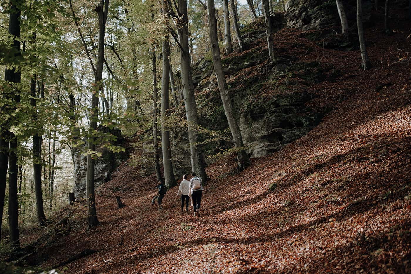
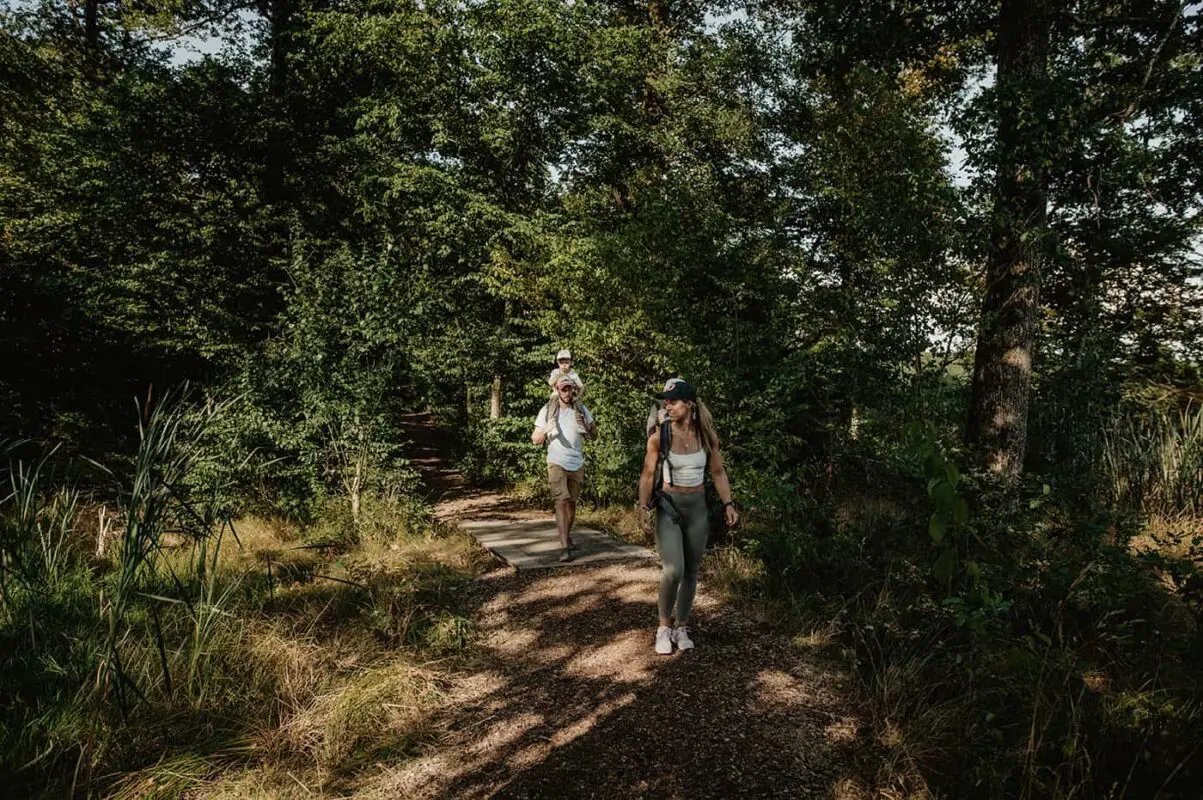
Discover the eight Guttland.Trails, all unique in their own ways.

Guttland.Trail Siwe Brécke-Wee

Length: 5.2 km | 3.2 miles
Duration: 1:25h
Best time of the year: May – October
Elevation Gain: 86 m

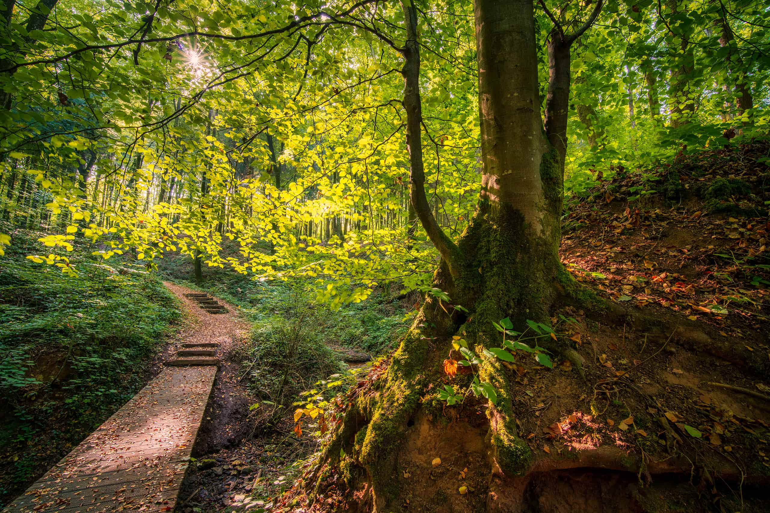
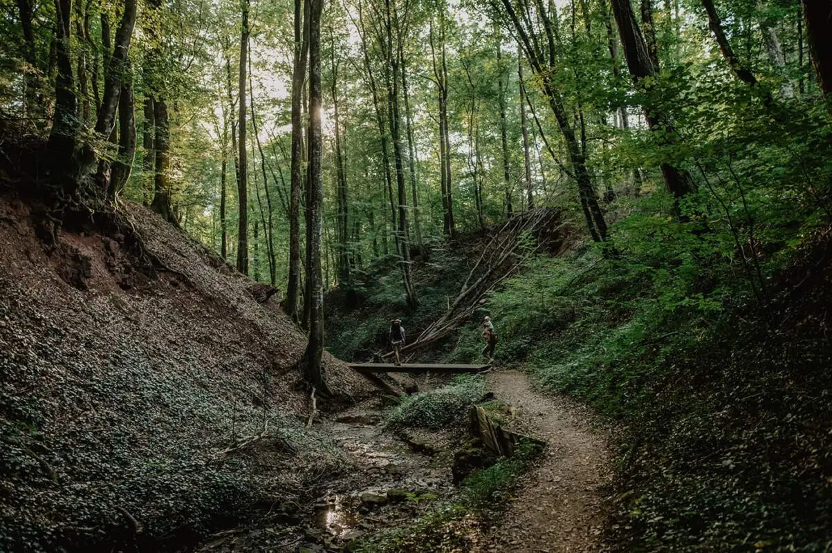
This five-kilometer hiking trail begins in Reimberg at the 19th-century St Roch Chapel. The dirt path at the beginning of the trail leads through a quiet forest with some clearings. The highlight of the tour is definitely the valley of the “Schankegriecht.” The valley takes its name from the legend of the “Schankemännchen,” a “little bone man,” who is said to have frightened the inhabitants of surrounding villages at night. Along a stream, past imposing rocky landscapes, wooden bridges and natural paths wind their way. Finally, the forest clears and you will face wide fields and meadows in a gently rolling landscape, which offers views of the rural life of Guttland.

Guttland.Trail Mamerleeën

Length: 7.5 km | 4.6 mi
Duration: 2:25h
Best time of the year: May – October
Elevation Gain: 233 m

The highlight of this circuit has to be the “Mamerleeën,” a complex of natural sandstone caves and artificial tunnels. This cave system extends over a thousand meters. Particularly spectacular is the “Huellee” cave, with its view of Schoenfels Castle’s impressive tower.

However, as well as numerous rock and cave formations, there are many other highlights on the Mamerleeën Guttland.Trail which will tempt you to relax and stop for a break. For example, the large picnic table near the “Huellee” has a lovely view of Schoenfels Castle and is perfect for a mid-hike break. Walk just a little further and you’ll come to the “Hunnebuer” local recreation area, a place associated with many sagas and legends.

Finally, you’ll walk through the small, unspoiled, and mysterious “Wollefsgriecht” gorge, which offers welcome shade on hot summer days and is the perfect way to end this circuit.

Guttland.Trail Biisser Weier

Length: 9 km | 5.6 mi
Duration: 2:35h
Best time of the year: May – October
Elevation Gain: 150 m

Dive into the forest and enjoy the tranquillity of nature that accompanies you here: through calm woods on the bank of a rippling stream and on towards picturesque ponds. A gentle walk that invites you to relax and spend time in the here and now. One of the longer of the eight trails, this is the perfect way to spend an afternoon.

Guttland.Trail Fuussepad

Length: 11.6 km | 7.2 mi
Duration: 3:20h
Best time of the year: May – October
Elevation Gain: 175 m

The varied “Fox Trail” promises a quiet hike through rustic forests with high treetops, along small natural streams and beautiful rock formations as well as across wide fields. The tour has some particularly beautiful spots, such as the hidden “Huel Kimmerchen” (Hollow Chamber), a rock formation with a small chamber, or the picturesque promenade along the rocks as well as the fairytale pavilion with a view over the Alzette Valley.

But the highlight is undoubtedly the Roman temple complex. Built in the 1st century, the Roman villa was once comprised of 50 rooms. At 100 metres long and 50 metres wide, it is one of the largest Roman villas discovered in the Grand Duchy of Luxembourg.

Families with children will not miss out on this trail either! At the starting point of the circular hiking trail, there is a beautiful forest playground with many picnic benches that invite you to linger.

Guttland.Trail Raschpëtzer

Length: 5.9 km | 3.7 mi
Duration: 1:50h
Best time of the year: May – October
Elevation Gain: 203 m

This tour, with a wealth of discoveries, runs through the unique Sonnebierg nature reserve – along old rail tracks that recall the now-closed gypsum mines in Walferdange, and on to the impressive Raschpëtzer construction, a still-intact underground aqueduct system on an imposing scale dating from the Gallo-Roman period. This is a great way to learn more about the history of the area if you have some free time!

Guttland.Trail Schéiferei

Length: 10.2 km | 6.3 mi
Duration: 3:05h
Best time of the year: May – October
Elevation Gain: 234 m

This trail goes through fabulous forests with impressive long alleys, vast fields, and panoramic views. It is far removed from the daily hustle and bustle ‒ for once, all you can hear is the birds singing. If you want some down-time – you are in just the right place! This is the perfect landscape to slow down and enjoy some alone time.

Guttland.Trail Aarnescht

Length: 9.5 km | 5.9 mi
Duration: 2:40h
Best time of the year: May – October
Elevation Gain: 104 m

Right from the beginning of the hike, you find yourself in a green oasis. The dense forest surrounds you with its tranquil beauty. The sight of the treetops swaying in the wind instantly makes you forget about the daily grind, allowing you to pause for a moment and appreciate nature in its purest form. The highlight of this tour is the hilly nature reserve ‘Aarnescht,’ a diverse habitat that is well-known for its variety of orchids. Here, delightful expansive views enchant you, and you may even catch a glimpse of airplanes taking off or landing. As you leave the dry grasslands behind, great fields open up, where, with a stroke of luck, you may spot a deer before making your way back through the dense forest to the starting point.

Guttland.Trail Bildchen

Length: 6.2 km | 3.9 mi
Duration: 2:10h
Best time of the year: May – October
Elevation Gain: 204 m

This is a trail that has unique rock formations and leads you through royal forests with special charms that can enchant you in every season. In addition to the Dreiburen leisure area and the Saint Mary grotto, called “Bildchen,” the tour is a delight thanks to its many different landscapes.

Accommodations

On the Guttland.Trails you can choose one of the comfy accommodations in the Guttland area such as hotels and B&Bs. If you’re looking for more of an immersion into nature, there are also several campsites located near the trail that are a great place to sleep. Finally, a great option is to stay at one of the many cottages in the region. Take a look at all accommodations here.

Best time of the year

The best time of the year to hike in Guttland is from late spring to early autumn, specifically between May and October. During these months, the weather is most favorable for hiking, with warmer temperatures and longer daylight hours. Note that it can be really snowy and temperatures drop dramatically in the winter months here.

Late spring (May) is particularly beautiful as the forest blooms, with fresh greenery and budding wildflowers. This period also benefits from fewer crowds.

Summer (July to August) has warmer temperatures, making it a popular time. The lush landscapes and full foliage provide enough shade, though it’s important to be prepared for occasional rain showers. During this peak season, the trail and accommodations may be busier, so booking any accommodations in advance is recommended.

Early autumn (September to October) is another excellent time for hiking in Guttland. The cooler temperatures are comfortable for long walks, and the changing colors of the leaves paint the forest in spectacular colors of yellow and gold. In the autumn months, you’ll also see fewer hikers on the trail.

Safety & Gear

Always bring your essentials for a better trail experience. Make sure you have shoes with enough grip, especially for when it rains and the paths are muddy. Bring your layers, at least a baselayer, mid-layer, and a hardshell rain jacket for occasional rain showers. Finally, take enough water and food with you and always put the GPX in an app for navigation on your mobile phone.

Good to know

The Guttland.Trails are perfect trails for beginning hikers. The paths are well-marked and not too technical. It’s a wonderful area to get away from it all, recharge, and enjoy nature. In the winter months, it can be quite cold and snowy. You can extend the hiking trails by one of the many other paths in the Guttland region.

Another thing that is truly great about Luxembourg is the free public transport in the whole country which makes it super easy to get around.

Water resources: Streams for filtering alongside the way and sometimes restaurants an accommodations in the villages

Want to submit a trail or make this page more complete?

Comments

Be the first one to comment on this trail!

Reply to this trail

Your email address will not be published. Required fields are marked *

Reply to this trail

Log in to comment on this trail
Always read the disclaimer

Terms of Use: important to all visitors on this website. We strive to publish high quality content and information on this website. However it’s always possible that we’re missing out on some crucial information. In spite of the fact that this route, associated GPS track (GPX and maps) were prepared under diligent research by the specified contributor and/or contributors, the accuracy of such and judgement of the author is not guaranteed. Therefore, hiking-trails.com and contributors are in no way liable for personal injury, damage to personal property, or any other such situation that might happen to individuals hiking or following this route. Should you choose to hike this trail, this is always at your own risk. Check out our guidelines for safety hiking and Leave No Trace principles at the hiking 101 page.

Download GPX

Join the community!

Login or create a FREE account 😊

With an account you can:

Download GPX files

Pin trails to your wishlist

Mark trails as hiked by you

Rate hiking trails

Comment on trails, blogs and gear reviews

Happy trails!
Login

Don't have an account yet? Register here