About the GRR1 Réunion

country
France
length
60 km(37 mi)
Type of trail
Long-distance
difficulty

Difficulty is highly personal. Be aware of the weather conditions as bad weather turns easier trails in difficult trails especially in the mountains.

Difficult
accommodation

Lodging means a mix of hotels, hostels or AirBnB’s.

Lodging
Elevation gain
4900 m(16076 ft)
terrain
Mountains
remoteness
Some of the time
Show more

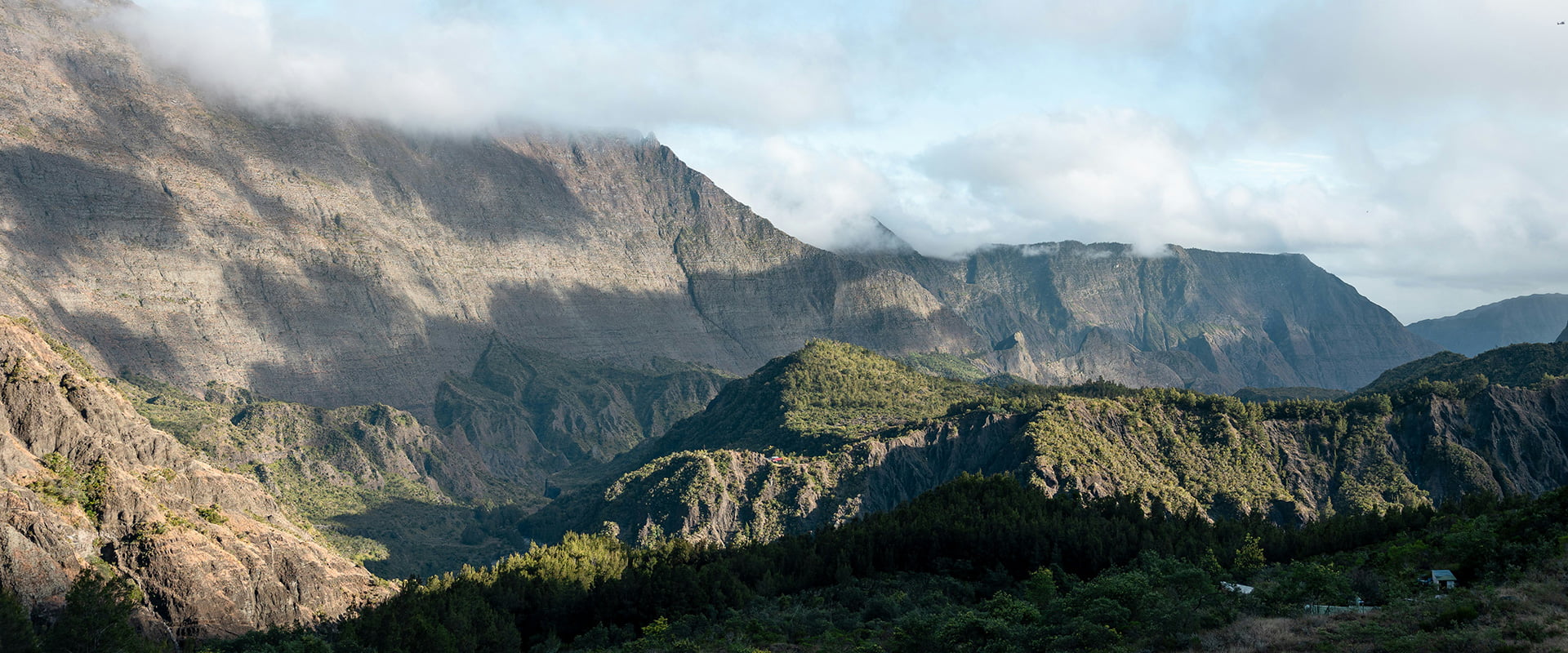
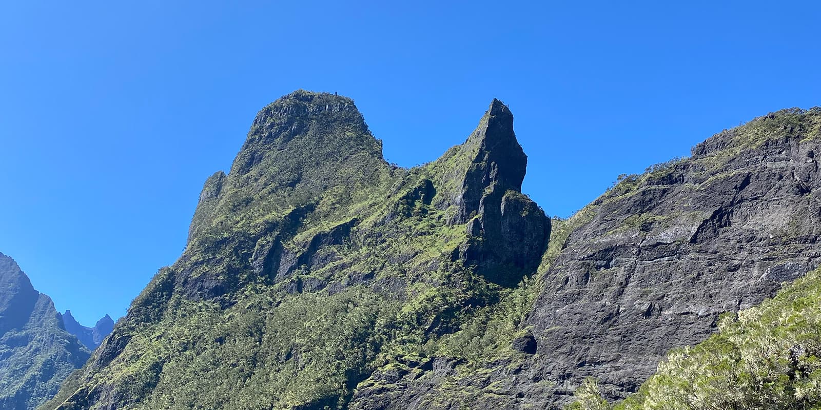
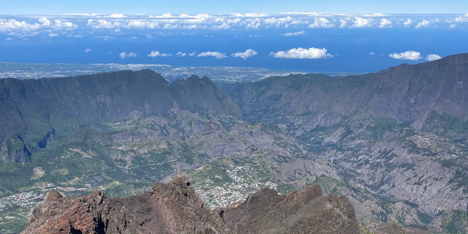
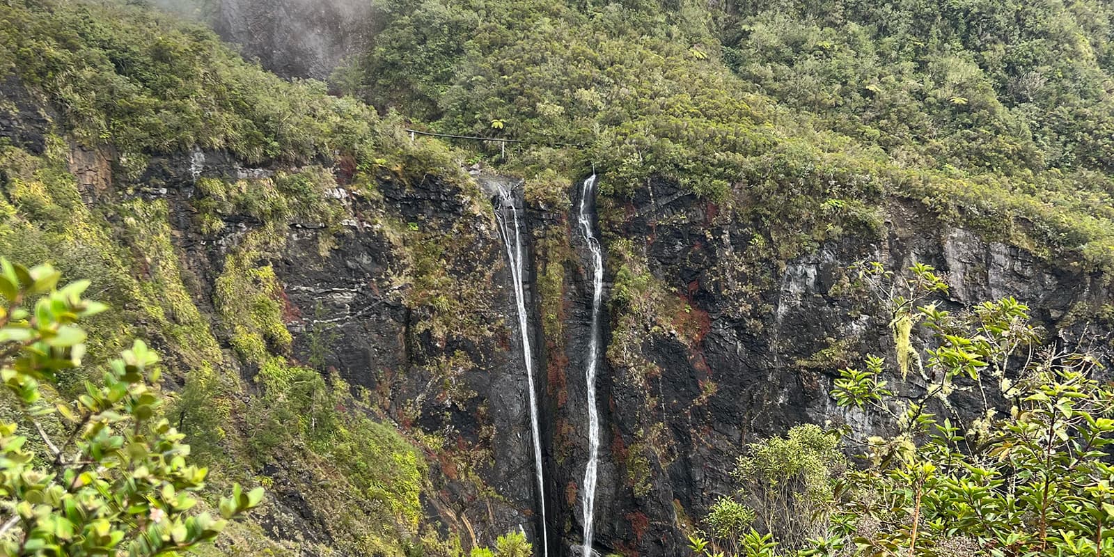
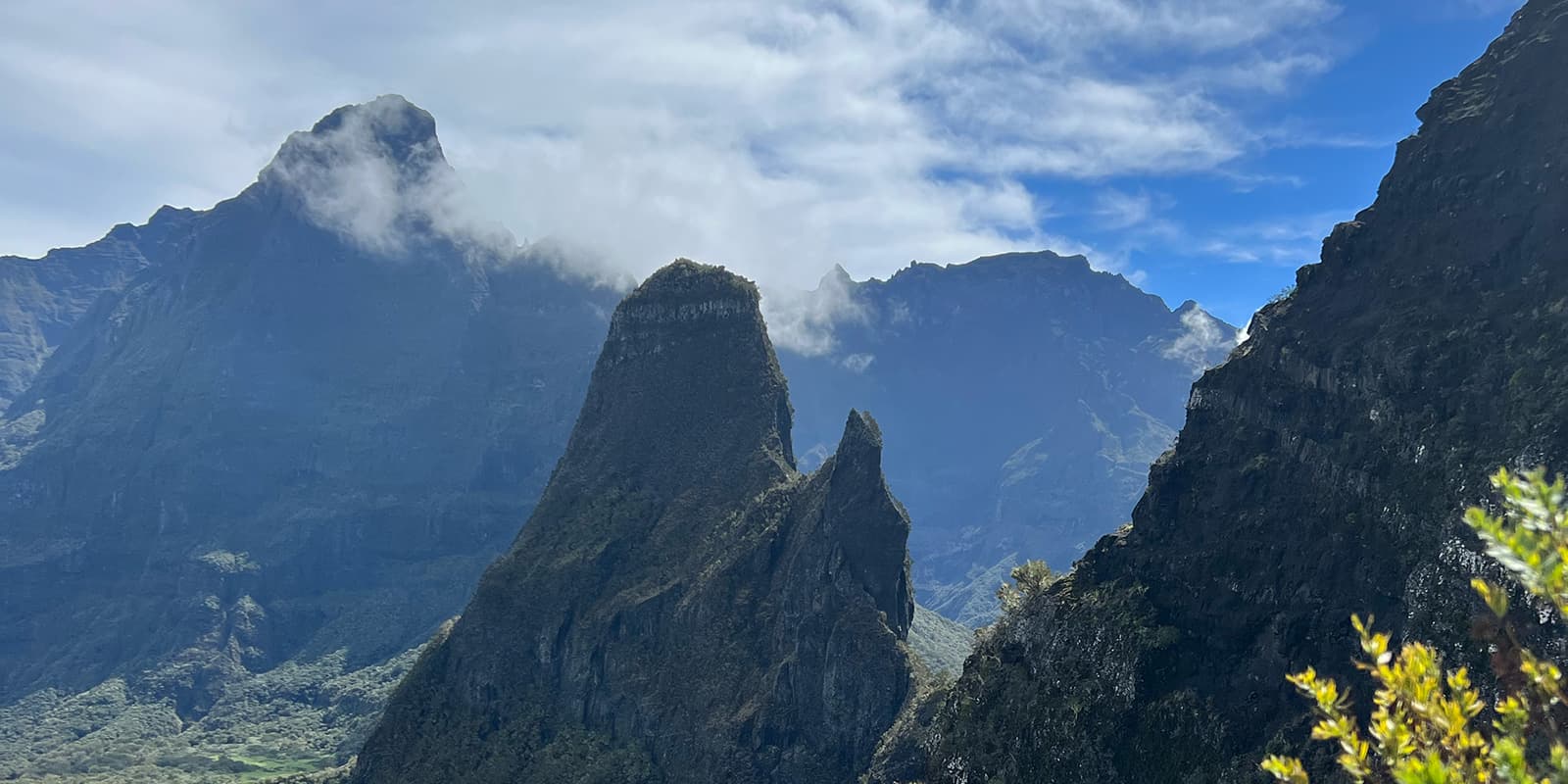
The GRR1 is probably THE three-day hike you want to do on Réunion Island. The island is a French overseas department located in the Indian Ocean that’s known for its stunning island landscapes. Symbolic and classic, the GRR1 is a pleasant loop that ventures into the three circuses of Cilaos Mafate and Salazie, in three stages balanced in length and difficulty, circling around the island’s highest peak, the Piton des Neiges at 3,070 meters (10,070 feet).

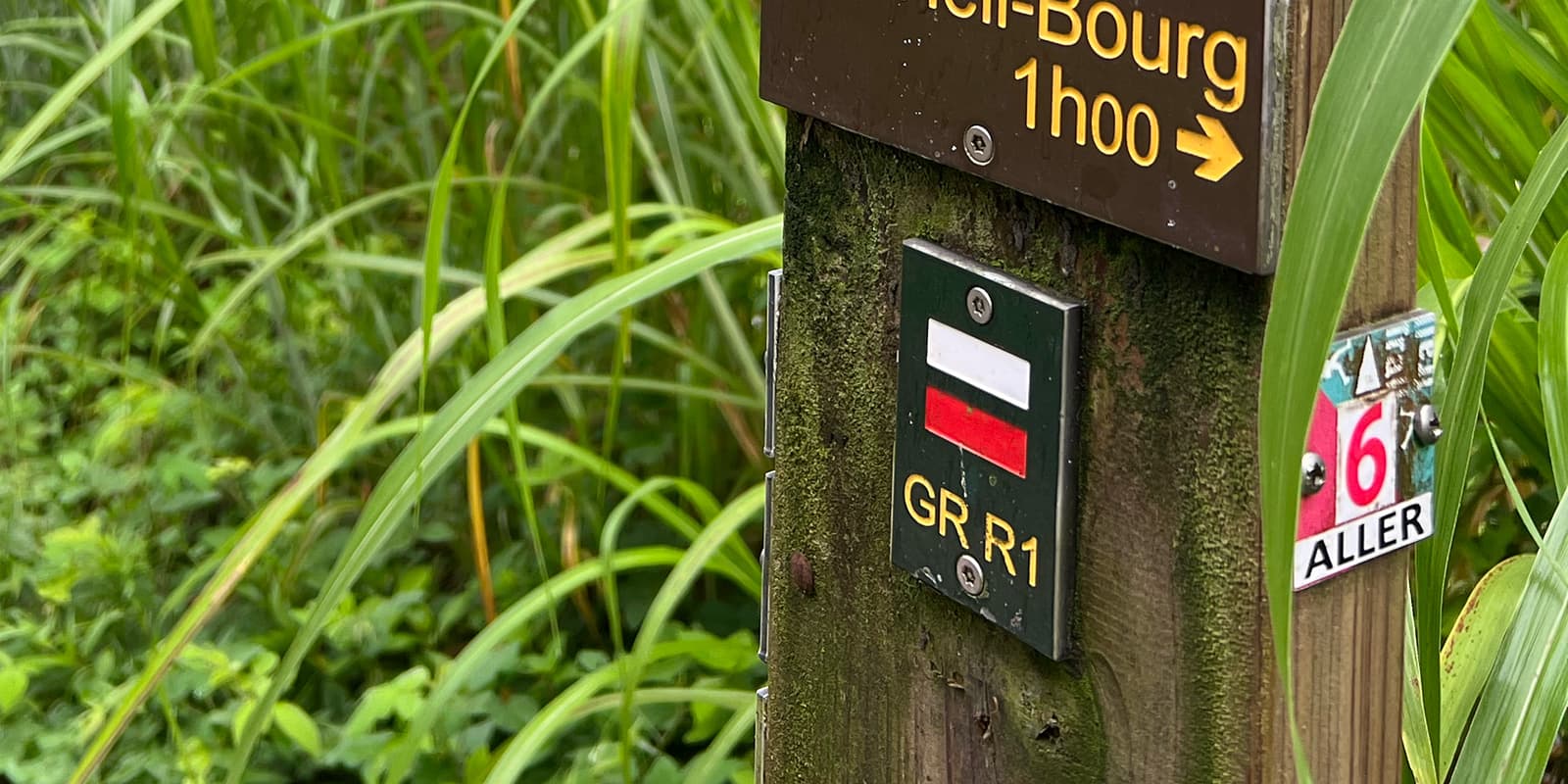
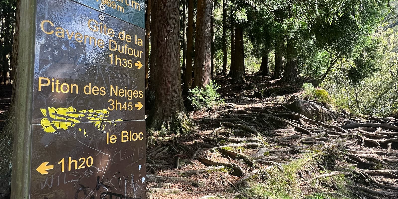
The trail can be hiked in a clockwise or counterclockwise direction, starting either from the village of Hellbourg in Salazie or from Cilaos. It can not be started from Mafate as there are no roads in this circus. I recommend starting from Cilaos, in a counterclockwise direction to have the opportunity to start hiking at night to enjoy the sunrise on top of Piton des Neiges.

women in hiking gear

Mathilde Fox

Meet Mathilde, a nature lover born and raised on Réunion Island. She knows the island’s mountains like the back of her hand and always has her white dog, Moka, by her side. When she’s not soaking in the views, she’s training for her next trail running competition. Splitting her time between Réunion and Brussels, Mathilde loves exploring Europe’s hiking trails, especially the Alps, her absolute favorite. You can find her on Instagram  @fox.mathilde

View profile

The Trail

On the first stage, you’ll leave Cilaos via the Cascade du Bras Rouge trail. The walk is pleasant up to the waterfall and becomes more difficult after crossing the fjord. A rather steep climb leads to the road of Îlet à Cordes with some steep slopes that are a good warm-up for the ascent to Taïbit. Cross the road of Îlet à Cordes. Then begin the long ascent to Col du Taïbit by way of a lot of stairs. The trail is wide and always in good condition. There are two flat sections that will give you a little breather mid-climb. Reaching Col du Taïbit, you can enjoy the views of the two circuses of Cilaos behind and Mafate in front, before starting the descent to Marla. The trail is narrower and includes a somewhat vertiginous rocky section. You can cross the vast îlet of Marla without difficulty. Along the way, you’ll see different stops for dining or resting. Walk past Maison Laclos towards La Nouvelle, where you have two options. I recommend going by the nice bridge (“par la passerelle” on the sign). Either way, you end up on the common trail a bit further up. A few short steep slopes are the final effort to the largest îlet of Mafate for the night.

The next stage, you head towards Col des Bœufs/Col de Fourche with a first climb that is quite steep in places, up to Plaine des Tamarins. The plain, covered with magnificent tamarins, means you can walk slower to enjoy these beautiful trees. Leave the large trees and turn right at the first trail climbing over the rocks towards Col de Fourche. Again, when you reach the top of the climb, you’ll have beautiful views of Mafate and the Salazie Circus before starting the descent. The slope is really steep on stairs with high steps. After the steep slope that crosses a beautiful forest of cryptomerias lower down, keep heading down on a trail crossing the river several times. Pay attention to the water height in the rainy season (January to May) and avoid spending time in the river bed as the water can rise incredibly quickly. The trail quickly turns into a track and the descent is easier down to the Rivière du Mât. Cross the river by a high and impressive metal footbridge and climb a few winding turns to the end of the road of Bras Marron. The end of the course uses a long paved or concrete section up to Hell-Bourg.

On the third stage, leave Hell-Bourg and climb towards the Bélouve lodge, starting under the filaos, amidst chouchous, and near large bamboo. There are many cemented and stoned steps, making this ascent a pleasant way to climb a rampart. Some vertiginous parts have railings and support cables. Higher up, a long concrete staircase is used before reaching the gîte, just steps from the viewpoint. Then you’ll cross the lodge’s facilities and head back onto the trail.

The trail crossing the primary forest starts here, muddy from the start. It is almost flat and pleasantly bordered by the beautiful tropical forest. It runs alongside ferns, sabres, and large trunks of tamarins often twisted in the branches of which the rays of the morning sun create such a beautiful vibe. Higher up, the mud is still there, but there are some boardwalks to avoid filling your shoes with mud. Some ladders or footbridges help with delicate passages but are nothing to be afraid of. Approaching the rampart, you’ll find magnificent panoramas. You’ll come across some clearings and the vegetation is replaced by high-altitude heaths.

Do not take the trail going right at Cap Anglais (or you would go back down to Hell-Bourg!) but continue towards Piton des Neiges. Unstable stones replace everything on the trail, making this section of the trail very technical. Soon, you’ll see the lodge Caverne Dufour in the distance. There you can decide to do a return trip to the summit of Piton des Neiges or head down to Cilaos. If you choose Cilaos, you’ll hike down dozens of hairpin bends with high wooden steps for two to three hours on this technical descent. When you arrive under the cryptomeria, the descent is over and the trail continues towards Cilaos on the road.

Stages

3-stage itinerary

Stage 1:

Cilaos – La Nouvelle (Mafate), 16 km | 10.5 mi

Stage 2:

La Nouvelle – Hellbourg (Salazie), 18 km | 11 mi

Stage 3:

Hellbourg – Cilaos 19 km | 12 mi

Accommodations

When hiking the GRR1, you will mainly stay in one of the lodges alongside the trail. In Cilaos and Hellbourg, villages accessible by car, you will find lots of different options, from basic dorms to fancy hotels. In Mafate, because of its remoteness, you will only find mountain huts owned by locals. There, you will experience the local food, which will keep you fueled for your next big hiking stage, and the hospitality of the people from Réunion. Especially in Mafate, try to book your accommodation a few weeks in advance, as it is a very popular place for hikers.

Accommodation per stage

Stage 1:

Hell-bourg (Salazie)

Stage 2:

La Nouvelle (Mafate)

Stage 3:

Cilaos

Best time of the year

You can hike the GRR1 all year round as Réunion has only two seasons: a warm summer and a warm winter. Some months are still better than others: in winter (June to September), you will benefit from dry days with very little rainfall, and from October to December, the rains are still rare and the temperatures are higher and the days longer.

Keep in mind that the weather in the high mountains can change rapidly, and it’s important to be prepared for all conditions, including tropical rainfalls or heavy heat. Always check trail conditions and local weather forecasts before starting the hike, especially in the cyclone season from January to May.

Safety & Gear

For hiking the GRR1 on Réunion Island, pack for heavy heat as well as heavy rain! Bring lightweight, moisture-wicking clothing, a waterproof jacket, sun protection (hat, sunglasses, sunscreen), a warm layer for higher altitudes (including gloves and a cap if doing the sunrise on Piton des Neiges), a good backpack with a rain cover, plenty of water (2.5L min per day), high-energy snacks as there is nowhere to resupply during the day, a first aid kit, a headlamp, and a map or GPS device. Be sure to include a quick-dry towel for the night in Mafate as most huts don’t provide towels.

Good to know

Chances are high that your host won’t speak very good English or any English at all. Google Translate or the other hikers will help smooth the conversation.

There are no water sources between the villages, so pack water for the day. Keep in mind that the water in the refuge near Piton des Neiges (Caverne Dufour) is not drinkable.

Route
Circuit
Highest point
3069m (10070 ft)

Want to submit a trail or make this page more complete?

Comments

Be the first one to comment on this trail!

Reply to this trail

Your email address will not be published. Required fields are marked *

Reply to this trail

Log in to comment on this trail
Always read the disclaimer

Terms of Use: important to all visitors on this website. We strive to publish high quality content and information on this website. However it’s always possible that we’re missing out on some crucial information. In spite of the fact that this route, associated GPS track (GPX and maps) were prepared under diligent research by the specified contributor and/or contributors, the accuracy of such and judgement of the author is not guaranteed. Therefore, hiking-trails.com and contributors are in no way liable for personal injury, damage to personal property, or any other such situation that might happen to individuals hiking or following this route. Should you choose to hike this trail, this is always at your own risk. Check out our guidelines for safety hiking and Leave No Trace principles at the hiking 101 page.

Download GPX

Join the community!

Login or create a FREE account 😊

With an account you can:

Download GPX files

Pin trails to your wishlist

Mark trails as hiked by you

Rate hiking trails

Comment on trails, blogs and gear reviews

Happy trails!
Login

Don't have an account yet? Register here