About the Greater Patagonian Trail

Patagonia
country
Chile, Argentina
length
5000 km(3107 mi)
Type of trail
Long-distance, Thru-hike
difficulty

Difficulty is highly personal. Be aware of the weather conditions as bad weather turns easier trails in difficult trails especially in the mountains.

Strenuous
accommodation

Lodging means a mix of hotels, hostels or AirBnB’s.

Wild camping, Camping, Lodging
Elevation gain
116000 m(380577 ft)
terrain
Mountains, Desert
remoteness
Most of the time
Show more

The Greater Patagonian Trail is a long-distance route network in the southern Andes that spans from the outskirts of Santiago to southern Patagonia.

It’s a stunningly beautiful and diverse trail system that guides you from the semi-desert of the Precordillera into scenic Andes valleys. The trails cross numerous dormant and active volcanos with partially healed volcanic scars and fresh open wounds from recent eruptions. You can take a dip in more than a dozen hot springs along the way to draw from this energy.

This trail is not an official trail and the original GPX goes through private property. If you hike this trail, you hike it at your own risk and should respect the land and laws of the regions you pass through.

Stiina Kristal

Stiina Kristal

Stiina is an IML-qualified mountain leader and an experienced long-distance hiker. Together with her partner Kris, they love to explore trails all around the world, learning more about themselves with every adventure.

View profile

The Trail

The trail connects several existing routes, creating a long-distance hike that takes you through some of Patagonia’s most beautiful and rugged spots. You’ll start in the northern parts of Patagonia and make your way south, crossing into Chile and Argentina. The route weaves through national parks, remote valleys, and high mountain passes. If you packraft, you can paddle over lakes and float down rivers into the Patagonian fjords where the Pacific Ocean hits the coast.

Eventually, you reach the Southern Patagonian Icefield, one of the world’s largest extra-polar ice fields. Here giant rock towers stab into the sky and enormous glaciers crash colossal blocks of ice into wind-battered lakes.

On the northern part of the route, you will meet solitary cowboys (In Chile called arrieros or puesteros) with their animals. Every spring the livestock is moved to higher ground to graze on mountain pastures. The trail later crosses the homeland of the indigenous Pehuenche (one of the Mapuche tribes) where Araucaria trees tower above the tribal land and provide the traditional food for these sometimes shy and sometimes proud people. When going further south you will meet settlers who have ventured into the challenging back-country of Patagonia. If you are interested, you can listen to their stories while sitting around the warm stove and sharing the traditional drink of this region: mate. These authentic encounters are part of the beauty of this trail.

In countless locations the trail branches into different routes creating a wide network of tracks that gives you many choices. You may either walk the entire distance or you can bring a packraft to float down rivers and paddle and sail over lakes and fjords.

There are also various volcanoes and other summits along the route that can be ascended without rock climbing gear. I have also included optional tracks that get you literally into the last valley on the border between Chile and Argentina. These remote corners of the southern Andes are of particular interest to hikers who love to venture into the remote backcountry.

The main route currently spans approximately 5000 km and the entire route network (including all options) contains more than 20000 km of tracks. The Greater Patagonian Trail is an informal trail network that grows and changes regularly. Since the GPT is an informal route network, few signposts and trail markers facilitate route finding and none of these signs and markers refer to the GPT. The national parks contain some marked trails, though these signs are often unmaintained and inconsistent.

Stages

No official stages are available, the current route is divided into 90 sections.

Best time of the year

The best time to hike depends on the sections you plan to tackle. Some sections include river crossings, thus meaning it is better to hike those later in the Southern Hemisphere’s summer season. In general, the hiking time is from mid-November to late February.

Safety & Gear

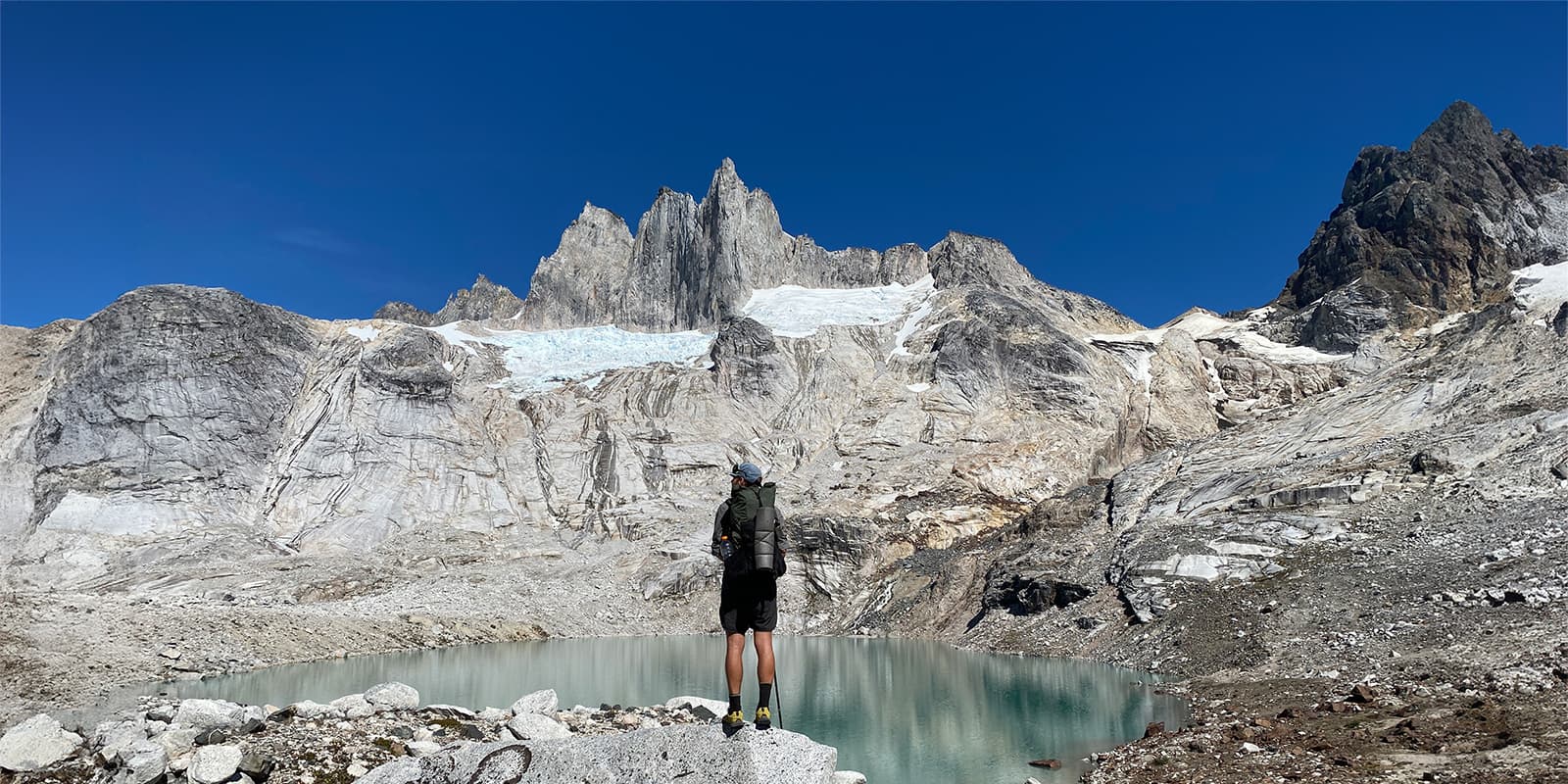
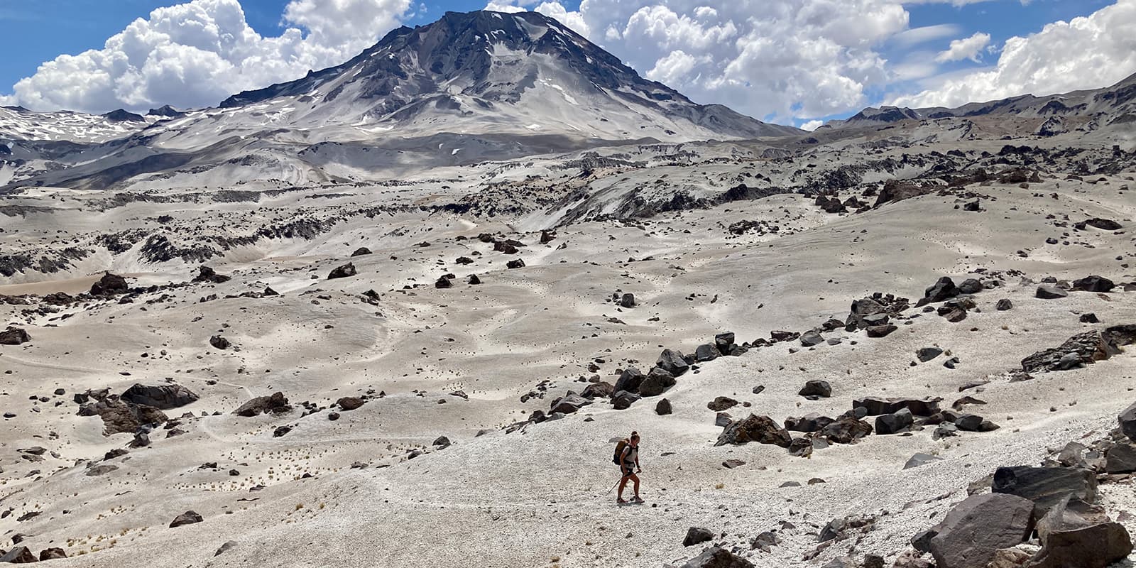
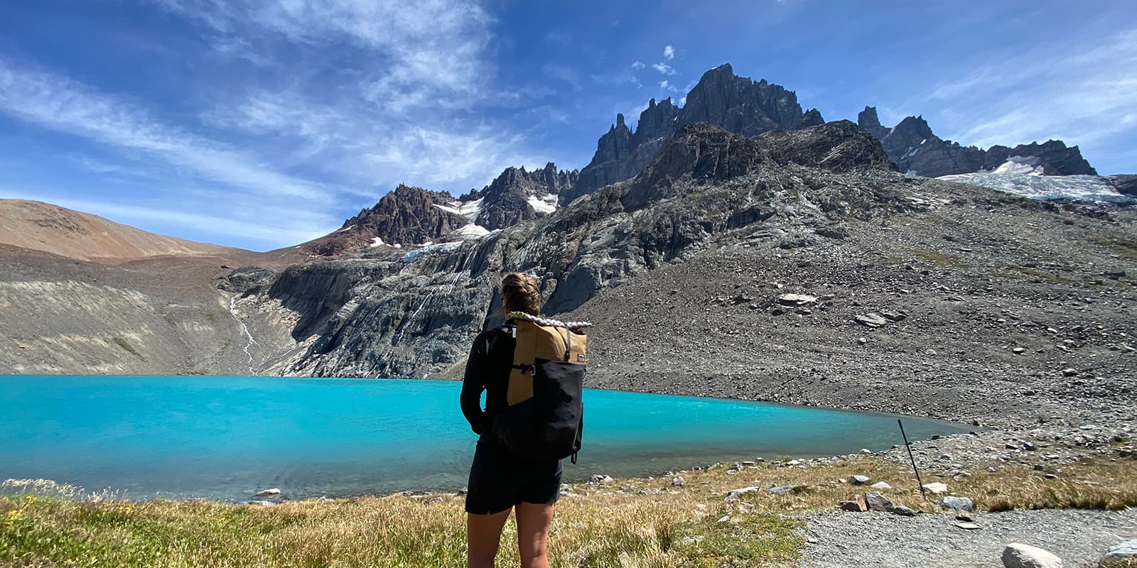
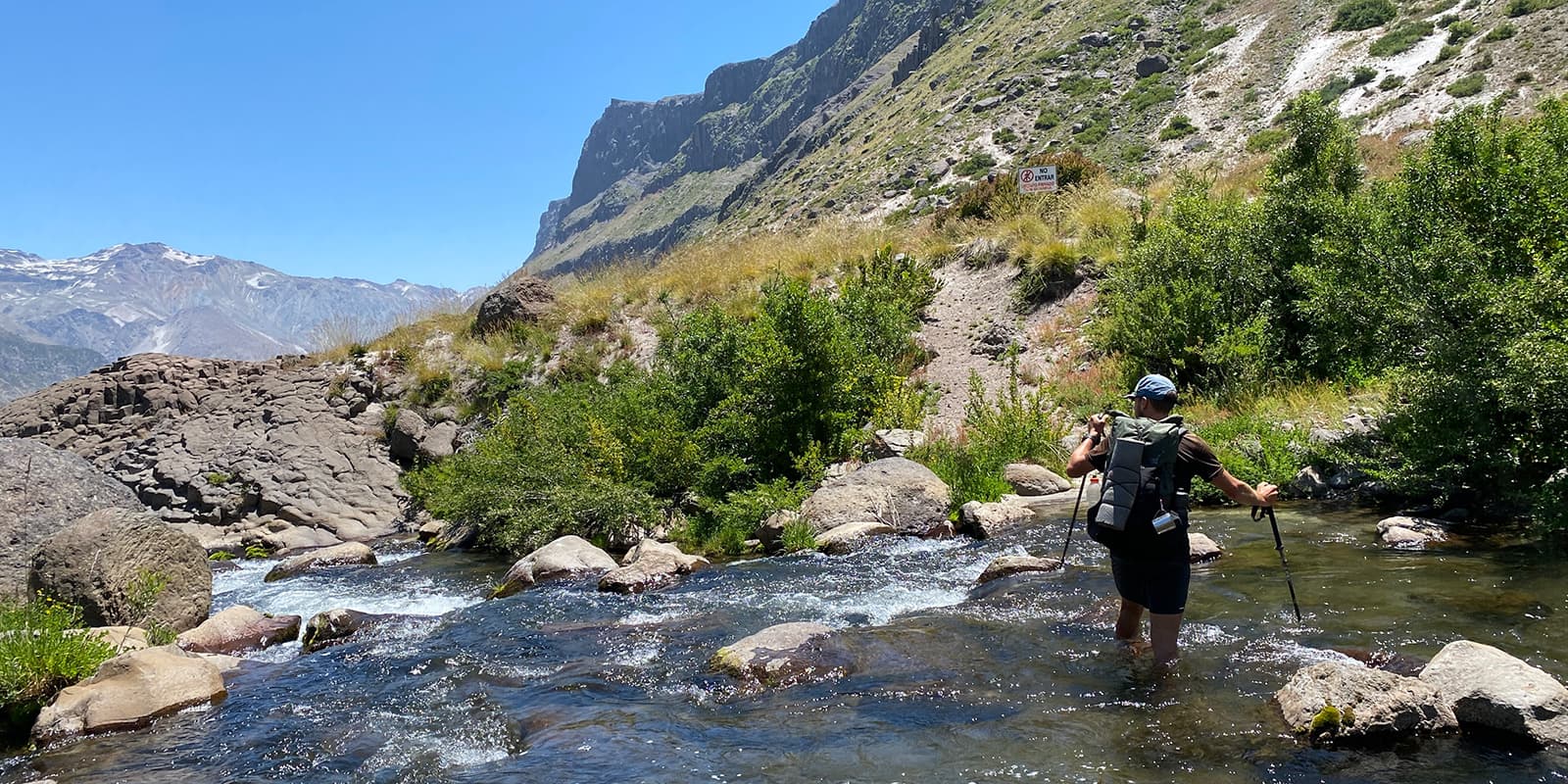
First, acquaint yourself with the route. The GPT isn’t a single, well-marked path but a network of trails and routes that require navigation skills. Study detailed maps and guidebooks, and consider investing in a GPS device with preloaded tracks. You’ll also want to have a strong knowledge of Spanish as you navigate through people’s land.

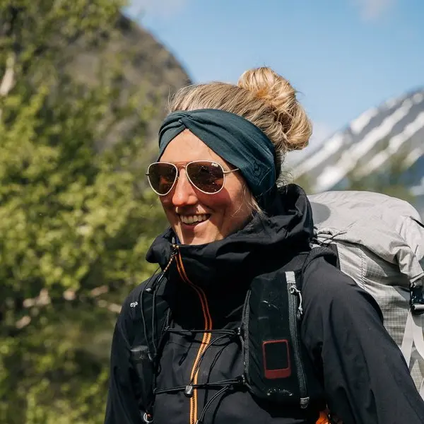
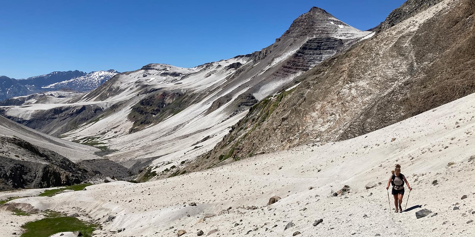
Patagonian weather is famously unpredictable, with sudden shifts from sunshine to snow, even in summer. Bring layered clothing to adapt to changing temperatures, including a waterproof jacket, thermal layers, and a warm hat and gloves. High-quality, durable hiking boots are going to be very helpful for navigating rocky paths and muddy forest floors.

Your gear should also include a sturdy tent and a reliable sleeping bag rated for cold temperatures. Patagonia’s strong winds can be relentless, so check that your tent is designed to withstand harsh conditions. A lightweight cooking stove and enough fuel are necessary since resupply points are few and far between. Plan your meals carefully, focusing on high-calorie, non-perishable items.

Water sources are generally plentiful, but they may not always be safe to drink. Carry a water filter or purification tablets to ensure you have access to clean water. It’s wise to always have a couple of liters on hand, especially during stretches where streams and rivers are low.

Communication in this remote area can be challenging. A satellite phone or an emergency beacon can be lifesavers, providing a way to call for help if needed. Inform someone of your itinerary and check in regularly if possible.

Lastly, respect the local environment and communities. Patagonia is home to diverse wildlife and fragile ecosystems. Follow Leave No Trace principles by packing out all trash and minimizing your impact on the land. Be considerate of local customs and practices, particularly when passing through private lands or indigenous territories.

Good to know

  • Mobile phones do not work in large areas of the Andes, and because you will be crossing the country border you will need either two SIMs or e-SIMs.
  • Water can be obtained from natural sources along the route. Always filter or boil as there might be cattle around.
  • Chile is not a cheap country, so plan your funds accordingly.
  • Knowledge of Spanish is very useful on this trail, especially when asking permission to cross private land.
  • Many sections of this route network can be tackled via a packraft.
  • All hikers tackling any part of the GPT are asked to contribute to the trail information via the Wikiexplora page.
Route
Point to point

Want to submit a trail or make this page more complete?

Comments

Be the first one to comment on this trail!

Reply to this trail

Your email address will not be published. Required fields are marked *

Reply to this trail

Log in to comment on this trail

Join the community!

Login or create a FREE account 😊

With an account you can:

Download GPX files

Pin trails to your wishlist

Mark trails as hiked by you

Rate hiking trails

Comment on trails, blogs and gear reviews

Happy trails!
Login

Don't have an account yet? Register here