About the Grand Mountet Hut

Alps
country
Switzerland
length
10 km(6 mi)
Type of trail
Day hike
difficulty

Difficulty is highly personal. Be aware of the weather conditions as bad weather turns easier trails in difficult trails especially in the mountains.

Moderate
accommodation

Lodging means a mix of hotels, hostels or AirBnB’s.

Mountain huts, Lodging
Elevation gain
1213 m(3980 ft)
terrain
Mountains
remoteness
Most of the time
Show more

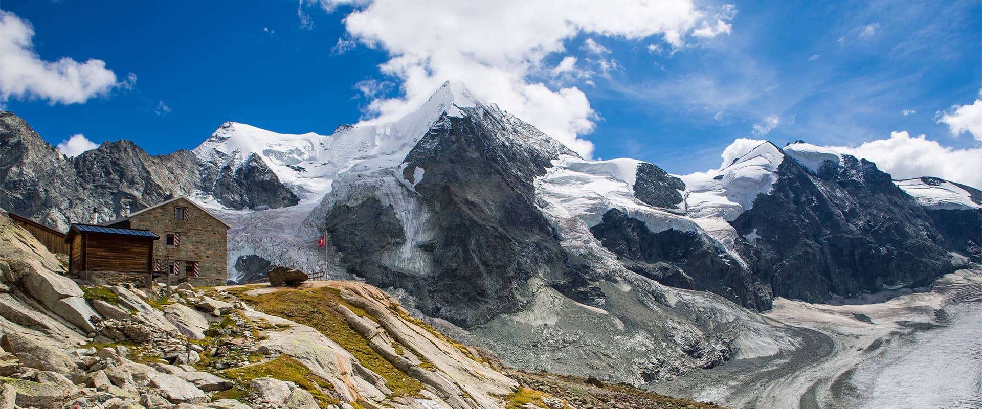
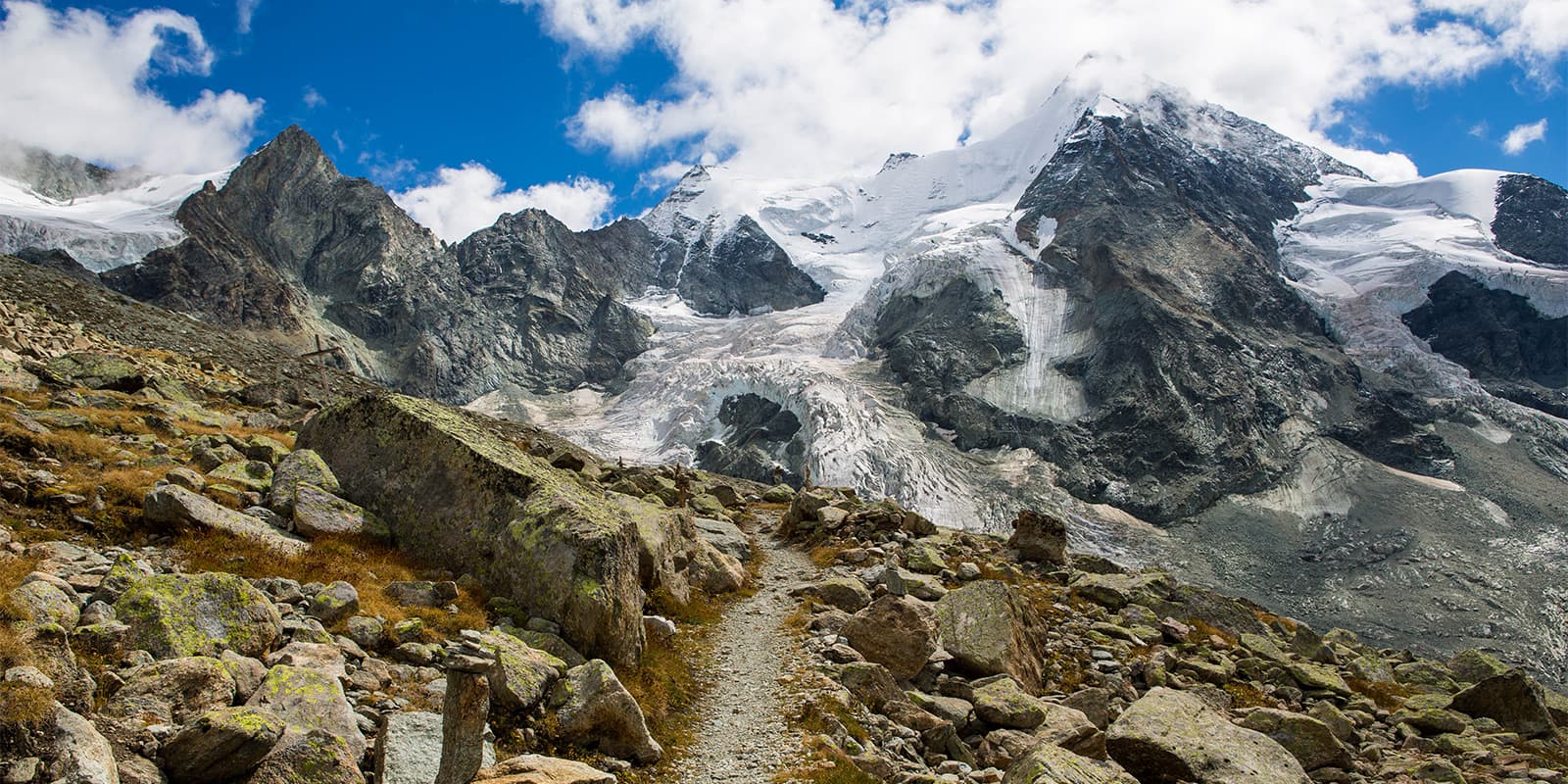
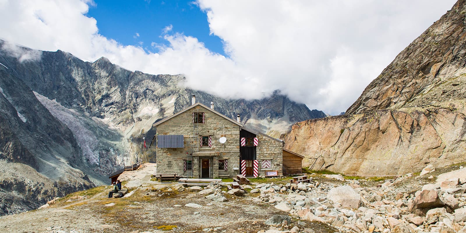
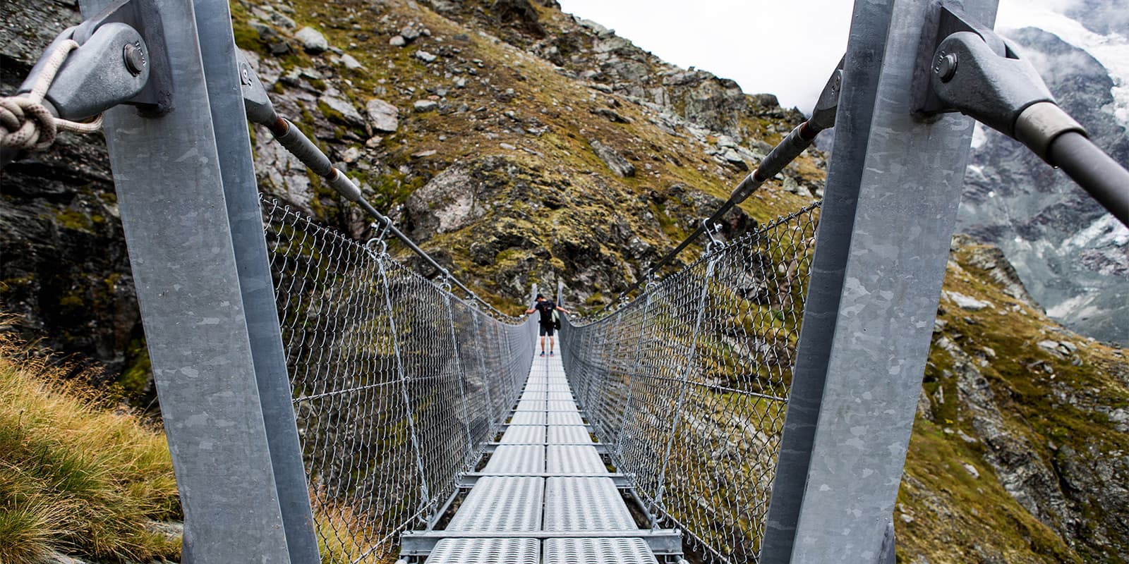
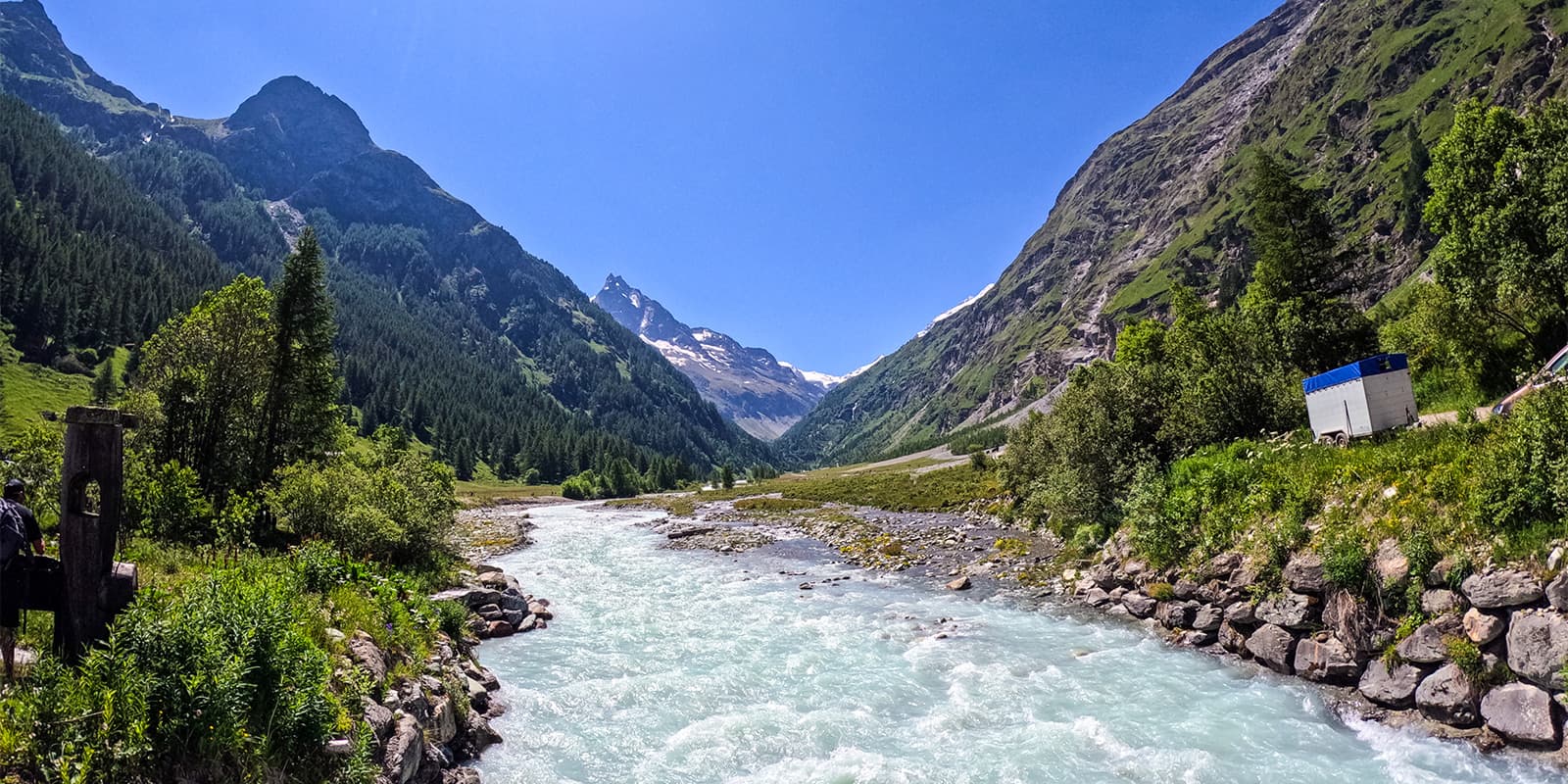
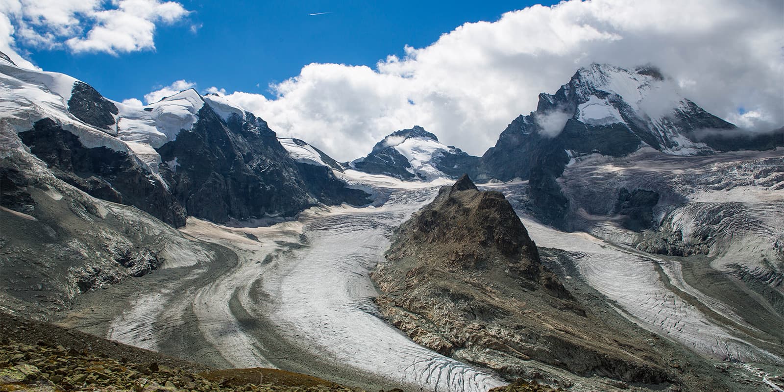
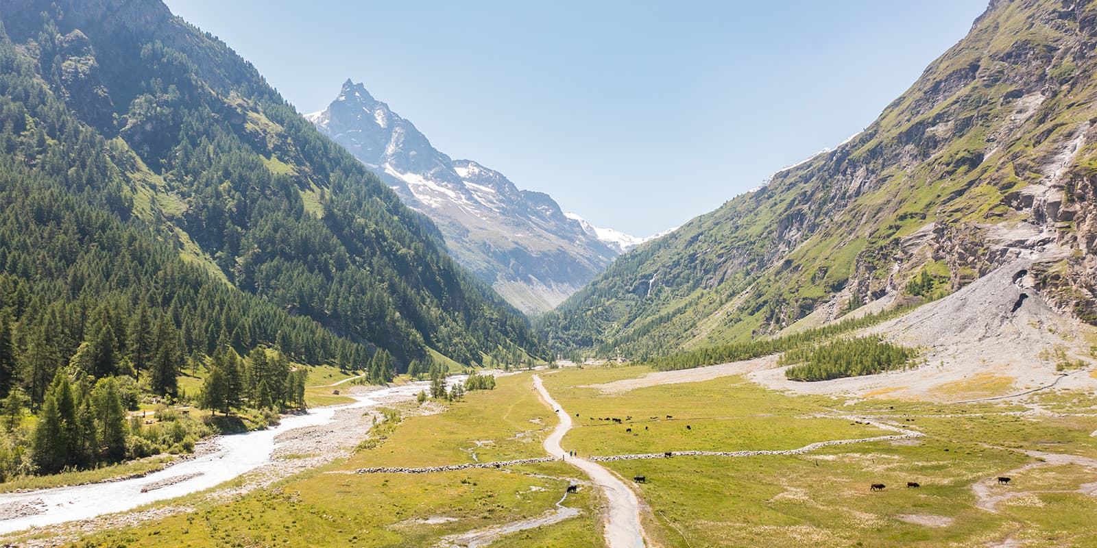
The hike to the Grand Mountet Hut has a beautiful view of the Zinal Glacier. The route alternates between forest paths, alpine meadows, and rocky terrain until you reach the hut. Nestled in the heart of the Imperial Crown, the Grand Mountet Hut serves as the starting point for various ascents.

You can choose to hike to the hut and back to Zinal in one day, or sleep at the hut before hiking more the next day. This is a great route to build your adventure from!

Elmar profile picture
Editor

Elmar Teegelbeckers

Passionate hiker Elmar spends months of his time on the trail. He’s usually on the lookout for hidden gems in one of his favourite countries such as Slovenia, Switzerland and Japan. He founded hiking-trails.com in need for a community and detailed information about the trails. Before this, he worked for the Alpine asscociation in the Netherlands[ (NKBV) but lost his heart to the trails.

Not long ago, Elmar published the book (in Dutch) Hiking Trails – best long-distance trails in Europe. With this book, website and socials, he hopes to inspire and shape an inclusive community for hikers all over world. No matter your speed, experience or level, you can get out there to enjoy the trails and connect with the heartwarming hiking community. Life is so much better outside and he hopes to inspire hikers to take their first, or next, step on the trail.

You can reach Elmar at info@hiking-trails.com.

View profile

The Trail

For this hike, you’ll follow the Navisence River along either bank, then take the small forest road that climbs to the right at the end of the Plats de la Lée. After about 30 minutes, turn left toward the bridge crossing the Navisence. From there, take the path on the right, which ascends in switchbacks above the moraine and continues along the slopes of Besso, where you’ll have a stunning view of the Zinal Glacier.

After crossing a footbridge and a section equipped with ropes and chains, a long, nearly flat rocky stretch remains before reaching the hut. From here, you can continue hiking past the hut, stop for a meal before heading down, or even spend the night!

Accommodations

Accommodations before and after this trail are plentiful, as you’ll stay in Zinal, which has many options. Additionally, you have the choice to book a night at the Grand Mountet Hut itself!

Accommodation in Zinal:

Best time of the year

This trail is accessible from the end of June to the end of September. This is when the trail will be accessible and the hut will actually be open, an important factor when hiking to it! If you want to check the weather before heading to Zinal, you can call the hut warden or email the Valais Tourism Board for more information on the trail conditions.

Safety & Gear

As you hike to the Grand Mountet Hut, you’ll be glad for a bag full of layers and snacks. Additionally, you’ll also want to bring lots of water, either in bottles or a hydration pack for easier access. Many people find hiking poles helpful for this trek, as the ascent can be a bit tough on the knees in such a short amount of time.

Additionally, you’ll want to download the GPX for the trail in an offline file to your device just in case. Let someone know where you’re going ahead of time and keep them updated if your plans change!

Difficulty

Hiking to the Grand Mountet Hut from Zinal is a moderate-difficult hike. You’ll ascend over 1200 meters in about 10 kilometers, which can be tough. However, the length of the trail means that you’ll have time to spare once you reach the hut.

The trick to having a good time on the trail will be training ahead of time. You can take day hikes in your area, prioritizing ones with uneven ground to build your balance. Other options are to go for trail runs, or to use the gym for lower body strength training and to work on your balance. All will help!

Good to know

Between the village of Zinal and the Grand Mountet Hut, there is no restaurant. You can enjoy a meal or a drink when you arrive at the Grand Mountet Hut and will be glad for any extra snacks that you bring as you hike.

You can take the train or drive to Zinal. If you drive, it’s best to park in the city center and take the bus to the trailhead.

route
point-to-point
highest point
2.894m (9.495 ft)

Want to submit a trail or make this page more complete?

Always read the disclaimer

Terms of Use: important to all visitors on this website. We strive to publish high quality content and information on this website. However it’s always possible that we’re missing out on some crucial information. In spite of the fact that this route, associated GPS track (GPX and maps) were prepared under diligent research by the specified contributor and/or contributors, the accuracy of such and judgement of the author is not guaranteed. Therefore, hiking-trails.com and contributors are in no way liable for personal injury, damage to personal property, or any other such situation that might happen to individuals hiking or following this route. Should you choose to hike this trail, this is always at your own risk. Check out our guidelines for safety hiking and Leave No Trace principles at the hiking 101 page.

Download GPX

Join the community!

Login or create a FREE account 😊

With an account you can:

Download GPX files

Pin trails to your wishlist

Mark trails as hiked by you

Rate hiking trails

Comment on trails, blogs and gear reviews

Happy trails!
Login

Don't have an account yet? Register here