Panoramic view of lush green mountains near body of water

GR221 Mallorca

Ruta de Pedra en Sec

About the GR221 Mallorca

country
Spain
length
140 km(87 mi)
Type of trail
Long-distance
difficulty

Difficulty is highly personal. Be aware of the weather conditions as bad weather turns easier trails in difficult trails especially in the mountains.

Moderate
accommodation

Lodging means a mix of hotels, hostels or AirBnB’s.

Lodging
Elevation gain
5925 m(19439 ft)
terrain
Mountains, Coastal, Forest
remoteness
Some of the time
Show more

The GR221 Mallorca is a beautiful trail traversing the UNESCO World Heritage Site of the Serra de Tramuntana mountains along the northern ridge of Mallorca, stretching from Port d’Andratx to Port de Pollença. The island boasts stunning scenery and often favourable weather patterns making this 140km trail a very inviting adventure for hikers.

The trail can be hiked in 1-2 weeks, but note that there are 3 alternative starting points, and 3 alternative finishing points, so depending on which you choose, these will dictate how long your hike will take. There is the option to tag on additional detours along the trail to summit extra local peaks. The main route is presented over 9 stages, between 10km – 24km days.

Women standing in mountains with hiking poles
Author

Jess Fellows

Having always been ‘sporty’ but never one to excel in any particular pursuit, Jess loves the simplicity of long distance: you don’t need to be particularly talented or fast at walking, you need only put one foot in front of the other. 

And it’s going the distance that truly tests one’s character. Slowing right down to see the natural world and its magnificence, and truly seeing it. To continuously be navigating new waters, and learning along the way. It’s the sense of freedom and resilience that Jess is consistently hungry for, to witness herself in all manner of experiences and extremes. To trust each tiny step, and to remember the bigger picture will take care of itself.

After a few long distance cycle tours, Jess was supposed to cycle around the world. Having planned and saved for many years, only a global pandemic could be the reason she didn’t go. So in the summer of 2020, craving some transformation and adventure, she decided to shave her head and start walking from her house in Bristol. She would go for 3-4 days at a time and enjoyed a few trips exploring the landscapes around the city and beyond. It was on these hikes that she and her partner started dreaming of bigger hikes for even more nature immersion. The thru hiking obsession had begun so by the summer of 2021 they were ready to take on the UK’s longest footpath along the South West Coast Path. The following summer they decided to return to Turkey to trek the Lycian Way, followed by hiking the GR5 route across the French Alps. After some shorter thru hikes in the UK, Europe and walking in the Himalayas, they are currently preparing for the PCT in 2024.

Jess has type one diabetes, eats a plant based diet and wears barefoot shoes. For work she is a wedding celebrant and yoga teacher on retreats. Check out her website to read more about her offerings and insights on her blog, and follow her PCT journey @uprootlife.

View profile

The Trail

The trail follows old stone-paved paths that celebrate the region’s limestone heritage, passing many historic stone structures throughout the beautiful landscape of mountains, forests, and coastline. The Drystone route is an ideal trail for exploring the history of Mallorca.

The route itself mostly follows old miners’ paths, historic mountain trails, and paved ways. Many of these ancient footpaths have been made accessible for hiking, as restored by Consell de Mallorca. Note that some of the hiking paths can be rocky, stony, and rough underfoot, and occasionally rather steep. Most stretches have been signposted and waymarked but some parts require considered route-finding.

As well as the footpaths themselves, expect to see the historic dry stonework technique used for walls and agricultural terraces. Additionally, lime kilns and snow houses for storing ice are still present and dotted along the route. Amongst them, are olive trees that have been growing for centuries, old-age pine forests, mountain villages, and breathtaking sea views. The combination of rocky mountains, coastal conditions, and warm weather offers a variety of vegetation, and the path is enhanced by the surrounding Mediterranean scrub of maquis and garrigue.

It’s uncommon to meet holidaymakers in Mallorca taking day hikes along the trail, so you can generally enjoy the trail and views in peace while also taking advantage of the tourist towns for services and swimming in the sea. Usually, the trail ends each stage in one of the charming mountain towns, where hikers can choose between the simple accommodation of the refuges or in more luxurious hotels and Airbnb’s. There are restaurants and shops to provide your food and supplies.

The route has good transport links and facilities along the way.

Stages

The GR221 can be comfortably hiked in 9 stages, beginning in Port d’Andratx and finishing in Port de Pollença.

Stages of the GR221

Stage 1:

Port d’Andratx – La Trapa, 11 km | 7 mi

Stage 2:

La Trapa – Estellencs, 24 km | 15 mi

Stage 3:

Estellencs – Esporles, 14 km | 9 mi

Stage 4:

Esporles – Valldemossa, 10 km | 6 mi

Stage 5:

Valldemossa – Deià, 14 km | 9 mi

Stage 6:

Deià – Sóller, 13 km | 8 mi

Stage 7:

Sóller – Tossals Verds, 20.5 km | 13 mi

Stage 8:

Tossals Verds – Lluc, 14 km | 8 mi

Stage 9:

Lluc – Port de Pollença, 19.5 km | 12 mi

Accommodations

When hiking the GR221 Mallorca it’s popular to stay in the beautiful mountain hostels ‘refugis’ along the trail and also in hotels and B&Bs. Wild camping is possible but not officially allowed so try to get permission beforehand, and should an emergency require camping then always leave no trace and act responsibly and respectfully.

Many of the mountain hostels are buildings with historical significance. They have been restored to a very high standard and are run by the Mallorcan government. They are kept very clean and the bunk rooms are generally very comfortable. It’s possible to have meals at the lodgings. They usually provide breakfast, a picnic lunch, and dinner all at a reasonable price. Note that linen and towels are available but for an extra fee. Beds can be booked in advance online. Sometimes it’s possible to reserve a bed on arrival, but don’t rely on it.

Best time of the year

It’s possible to hike the GR221 Mallorca nearly all year round but note that it can be very hot in the summer, and although rare, snowfall can cover the path during winter on the higher passes. The best time for average temperature would be late Spring/early Summer/early Autumn. Mallorca has a Mediterranean climate with very little rainfall and an average of 300 days of sunshine per year. However, in the Tramuntana Mountains, the weather is more changeable so be prepared for rain, wind, and storms. Many sections are exposed and without shade.

Safety & Gear

Before you head out, do some thorough research on the trail. This includes assessing factors such as trail difficulty, length, elevation gain, and terrain and then comparing those factors to your physical and mental abilities. Seek out insights not only from this website, but also from guidebooks, hikers who hiked this trail already, and the local hiking organization.

Stay informed about the weather conditions. Mallorca can be blazing hot and is known to be hit with surprise storms, so be sure to check with locals or a weather radar before you hit the trail.

Staying properly hydrated and nourished is important, especially here. Bring enough water and snacks to keep up your energy and prevent dehydration and exhaustion. Bring at least two liters of water with you each day!

Invest in the right hiking gear, including comfortable, supportive footwear, proper hiking clothing, such as warm base layers and a hardshell rain jacket, hiking poles, a well-fitted backpack, and essential equipment like maps, GPS devices (when needed), and a first-aid kit. Check out our comprehensive gear list for long-distance trails like the GR221 Mallorca.

Respect the principles of Leave No Trace by minimizing your impact on the environment. Stick to designated trails, pack out all trash, and show respect for wildlife and natural habitats.

Good to know

Accessing the trailheads is relatively straightforward. From Palma, you can take a direct bus to Port d’Andratx, which takes around an hour. Once you’ve finished in Pollença, the bus back to Palma is equally simple and takes around an hour and a half.

Many sections of the trail pass through private land where livestock roam, be mindful to close any gates you go through and leave no trace.

Camping at La Trapa (the former monastery) is permitted for free, though there are no facilities and it’s only possible with a permit. Either in the form of permission from the caretaker there or by reserving online. It’s an incredible spot with exquisite views of the Island Dragonera.

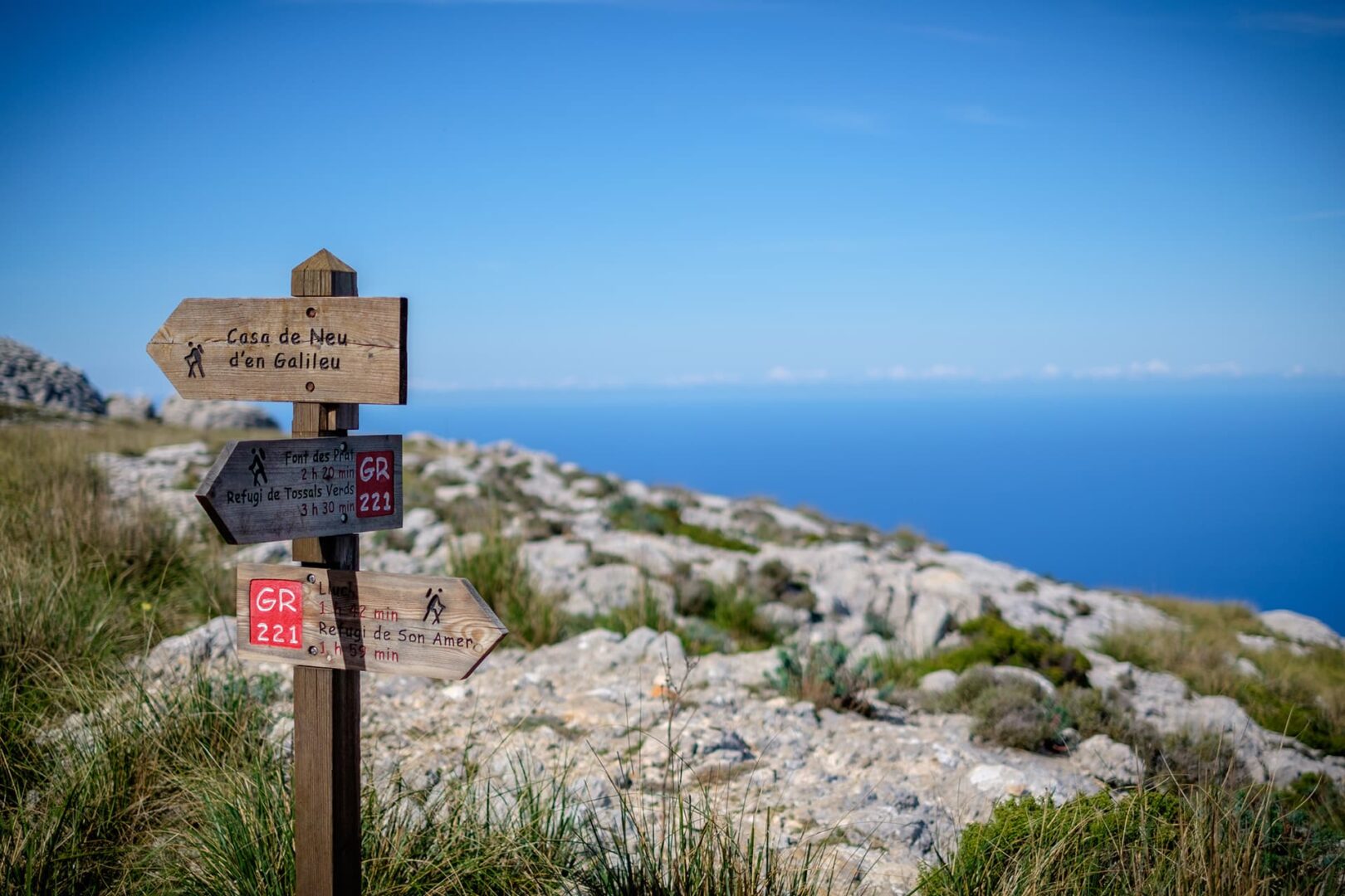
A guidebook, and paper or digital map will be helpful for the unmarked sections. The timings on the signpost indicating distances aren’t very accurate, check maps for realistic distances.

Water isn’t easily found other than in the towns or at the mountain refugis, be sure to carry enough with you between water points as there are few, if any, natural water sources along the way. Since the infrastructure for accommodation (often offering meals) and shops is good across the island, you can pack light and need only purchase food for 1 or 2 days before or after the respective stage if you prefer to cook for yourself.

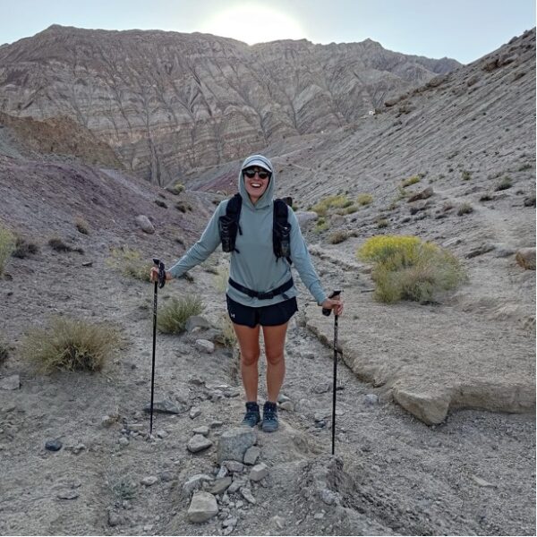
The rocky terrain can be tough underfoot and requires mindful placement. Walking poles would be recommended. Each section of the GR221 Mallorca would be accessible as a day hike for those interested in breaking it up as the trail passes through numerous towns and intersects many roads.

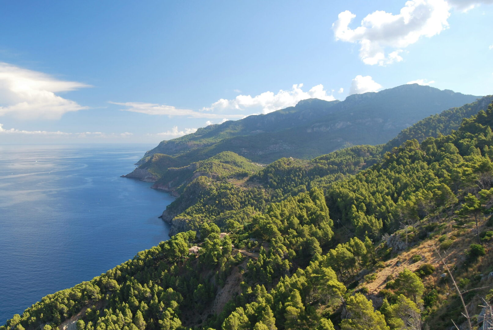
There aren’t any official start or finish signs to mark the trail in Port d’Andratx or Port De Pollença, the only telling symbol is that you’ve reached the sea. Note that the final few kilometers between Pollença and Port De Pollença are along a very straight, busy highway, which many skip by taking a bus.

Route
Point to point
Highest point
1200m (3937 ft)

Want to submit a trail or make this page more complete?

Comments

Be the first one to comment on this trail!

Reply to this trail

Your email address will not be published. Required fields are marked *

Reply to this trail

Log in to comment on this trail
Always read the disclaimer

Terms of Use: important to all visitors on this website. We strive to publish high quality content and information on this website. However it’s always possible that we’re missing out on some crucial information. In spite of the fact that this route, associated GPS track (GPX and maps) were prepared under diligent research by the specified contributor and/or contributors, the accuracy of such and judgement of the author is not guaranteed. Therefore, hiking-trails.com and contributors are in no way liable for personal injury, damage to personal property, or any other such situation that might happen to individuals hiking or following this route. Should you choose to hike this trail, this is always at your own risk. Check out our guidelines for safety hiking and Leave No Trace principles at the hiking 101 page.

Download GPX

Join the community!

Login or create a FREE account 😊

With an account you can:

Download GPX files

Pin trails to your wishlist

Mark trails as hiked by you

Rate hiking trails

Comment on trails, blogs and gear reviews

Happy trails!
Login

Don't have an account yet? Register here