About the GR20

country
France
length
193 km(120 mi)
Type of trail
Thru-hike, Long-distance
difficulty

Difficulty is highly personal. Be aware of the weather conditions as bad weather turns easier trails in difficult trails especially in the mountains.

Strenuous
accommodation

Lodging means a mix of hotels, hostels or AirBnB’s.

Camping, Mountain huts
Elevation gain
12775 m(41913 ft)
terrain
Mountains
remoteness
Most of the time
Show more

The GR20 is said to be the most beautiful but also the hardest long-distance trail in Europe. Situated on the Isle of Corsica in the Mediterranean Sea, it runs from north to south across the Island. Corsica is called the Mountain Range in the Sea, which makes sense, as soon as you see it from above. With only a thin coastline in front of them, the mountains rise steeply into the sky, all across the Island.

While being only 180-193 km long (depending on your route), the trail still takes you 12-16 days to hike. The reason is that the trail is mostly a high alpine route. Most hikers even need 20 days to complete it, because its lovely scenery invites you to stay for one or two zero-days.

man with blue sunglasses
Author

Bjorn Dziambor

Hi, I’m Björn, from Kiel, Northern Germany. I’m a 35-year-old Civil Engineer succesfully hiked the Pacific Crest Trail NoBo in 2023. As an alien, there’s lots of stuff to do, before you lock your house in Germany and move to the U.S. for half a year.I love being outside, hiking, climbing, running, and swimming. Cooking, Baking, and dehydrating food is also a passion of mine.

Together with his partner Anika, Björn invented the Laeppie for European thru-hikers.

View profile

The Trail

The trail is often done southbound, starting in Calenzana and ending after approx. 193 km in Conca, but it can be hiked in both directions. Be aware that the northern part is a high alpine route, with a lot of climbing and deep, steep valleys next to the trail. You should be able to handle heights for this. It also might take you 2-3 days to make it to the next exit point, if you decide that you want to bail out. At the half-point in Vizzavona, the trail changes rapidly and evolves into a more relaxed routed environment. While it still has steep climbs and descents, it is not as extreme as the northern part.

If you like to play it safe and check your limits before trying your luck, I would recommend starting in Conca, going northbound, and deciding in Vizzavona if you want to take the train out or continue further North. But be aware that the northern part is twice or even thrice as hard and sketchy as the southern part.

While hiking, you’ll mostly walk through National Park Areas. Even though the Island is cultivated, you will feel isolated most of the time, even with many other hikers around you. The trail is marked in the colors of red and white and you should have a very secure step because you often cross slippery stones or walk on loose gravel. The so-called trail is often just a pass. We highly advise you to camp at one of the Refuges or Bergeries (farms), as wild camping is forbidden and will be fined heavily!

If you walk Sobo, you will start your hike in the Town of Calenzana. Expect hot temperatures on your climb up into the mountains. As you continue to climb, you will recognize that the dry and hot environment is becoming more green and cooler. Your first days are going to be more climbing than hiking. Enjoy breathtaking views in this high alpine setting. While seeing harsh peaks and valleys on your way south, you will still see the Mediterranean Sea for almost all of your trip. You will cross lush pine forests, fresh springs, and even bigger rivers.

A lot of leg strength and trained ankles are needed, the climb and descent is usually straight up the mountain, with few switchbacks.

Some trails are secured with iron chains to give you better protection on your climbs, your hands will have as much work as your feet here! You usually enter and exit sections via so-called Brèches and Boccas, small gaps in crests and ridges.

Make sure to visit some of the highest mountains on Corsica, while hiking, e.g. the Monte Cinto (leave your backpack before doing this side trail, it is much sketchier than the GR20).

You will share your experience with many others. Corsica is known for its stunning beauty, and the GR20 is also well known. So expect many others beside you and respect them. Nonetheless, we experienced only friendly hikers and even had a little tramily.

Already on your first day, you will climb up a 1000 m. From this day on, you will be at heights between 1400 and 2000 m above sea level. The lowest point is at the halfway point in Vizzavona with 920 m.

Stages

The trail is normally completed in about 16 stages, not including rest days.

Stages of the GR20

Stage 1:

Calenzana – Ortu di u Piobbiu Refuge, 11.4km | 7.1 mi (7h) (Medium)

Stage 2:

Ortu di u Piobbiu Refuge – Carrozzu, 7.3km, | 4.5 mi (7h) (Hard)

Stage 3:

Carrozzu – Haut Asco (Exit-Point), 4.7km | 2.9 mi (5.5h) (Hard)

Stage 4:

Haut Asco – Ballone, 9km | 5.6 mi (9.5h) (Hard)

Stage 5:

Ballone – Ciottulu di Mori, 6.6km | 4.1 mi (6h) (Medium)

Stage 6:

Ciottulu di Mori – Manganu, 24.1km | 15 mi (9h) (Hard) Exit-Point in Castel de Vergio. Split recommended.

Stage 7:

Manganu – Petra Piana, 8.7km | 5.4 mi (6h) (Hard)

Stage 8:

Petra Piana – L’Onda (Exit-Point), 10.2km | 6.3 mi (4h) (Medium)

Stage 9:

L’Onda – Vizzavona (Exit-Point), 10.4km | 6.5 mi (7.5h) (Medium)

Stage 10:

Vizzavona – Capanelle (Exit-Point), 15.7km | 9.8 mi (5.5h) (Easy)

Stage 11:

Capanelle – Col de Verde (Exit-Point), 12.5km | 7.8 mi (4.5h) (Easy)

Stage 12:

Col de Verde – Usciolu, 15.6km | 9.7 mi (7.5h) (Medium)

Stage 13:

Usciolu – Crocce, 10.9km | 6.8 mi (5.5h) (Medium)

Stage 14:

Crocce – Asinau, 10.2km | 6.3 mi (4h) (Medium)

Stage 15:

Asinau – Bavella Pass (Exit-Point), 11km | 6.8 mi (4.25h) (Medium)

Stage 16:

Bavella Pass – Conca (Exit-Point), 18.1km | 11.2 mi (7h) (Medium)

Accommodations

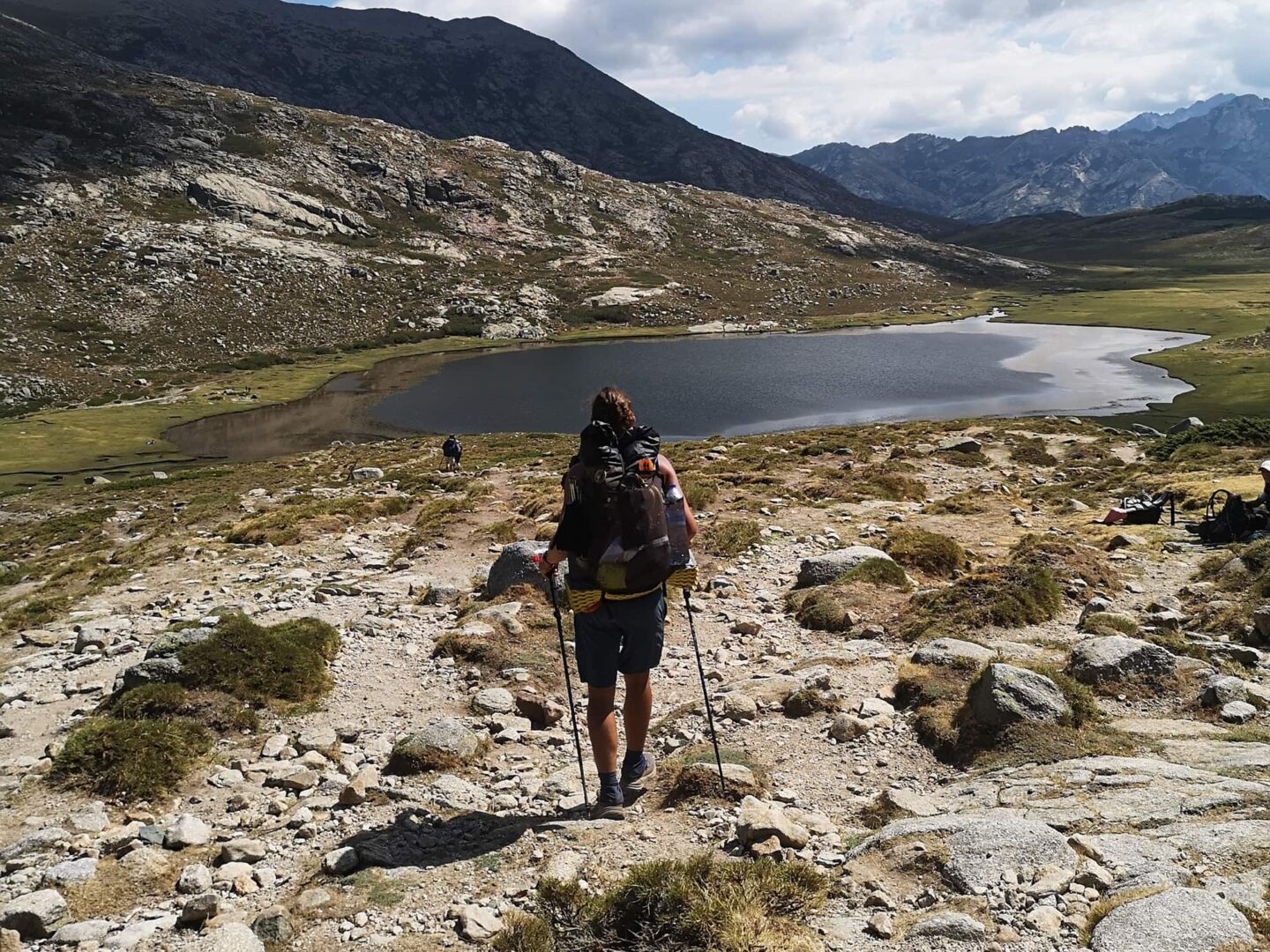
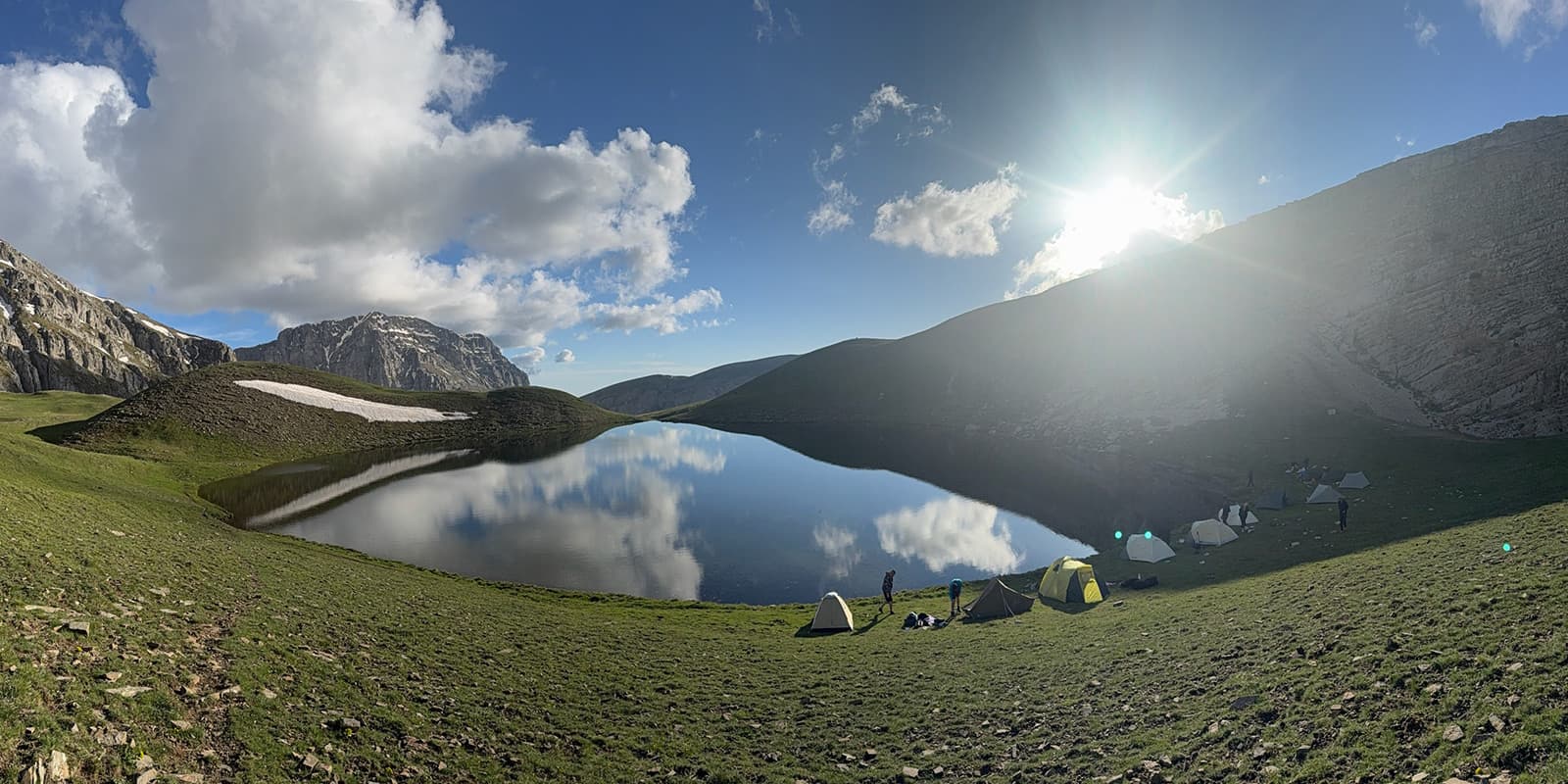
Wild camping is strictly forbidden as you mostly hike through national parks. Luckily, camping is still allowed in designated areas. These are refuges or biwak-places that usually also mark your day’s hike end. Within these refuges, you can rent a tent, sometimes a bunk bed in a dorm room, or simply just pitch your own tent.

The prices vary from 7-12€ and are cheaper if you book in advance. These advanced bookings are highly recommended, just to save money. The National Parks don’t want the huts to have too much cash in their registers to avoid robberies. To achieve this, the National Park gives a discount to whoever books in advance via their website. You will have to have a loose plan at hand, to know when you will be where. Don’t stress out though, if you arrive a day too late or early, nobody cares and we personally never had problems getting a nice camp spot, even when arriving late.

There are also Farmers and Shepherds, who offer accommodation for about the same price, sometimes their premises are in an even better condition than the refuges.

All the places offer food to resupply and also cooked meals. In the evening, a hiker meal for around 20€ is offered (mostly pasta, wine, and a dessert).

Be aware, that almost no place accepts cards, as cell service is very thin up in the mountains, so make sure to have enough cash with you, as there are NO ATMs on the trail or in towns.

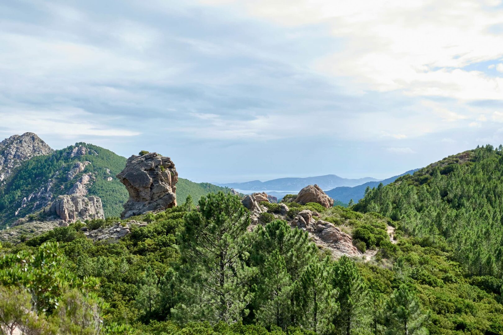
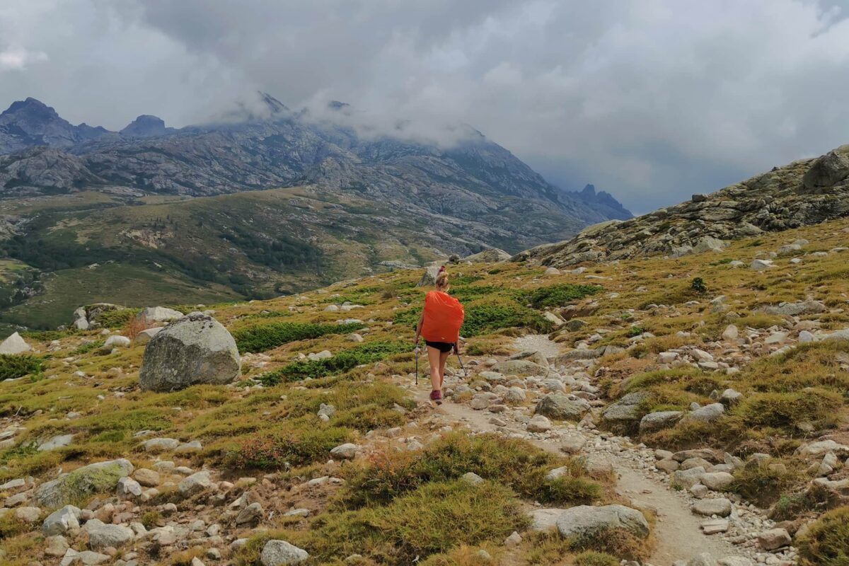
The campsites are mostly situated in beautiful flat areas that offer stunning views and breathtaking sundowns/rises.

Be aware that the resupply can be very pricey, as most of the food has to be brought up there by humans or helicopters. Half a liter of beer cost us 8€, a liter of wine was 10€ and a package of Pasta was 4€. Make sure to try the famous Corsican cheese and sausage!
Cooking stations with gas stoves are available in most places, so you could also just cook your own food in the evening.

You can book your accommodation here: PNR Corsica

Best time of the year

The best time of the year to hike the GR20 is undoubtedly in summer and September. As you’re hiking in the mountains, be aware that there might be snowfields in early summer and there might be early snowfalls in late summer and early autumn. Generally, the hiking season on Corsica is limited to the summer months when the weather is milder and the snow has melted, making the trails accessible. Be aware that during August, thunderstorms appear daily, as hot water evaporates from the ocean and hits the colder air within the mountains. Often you can already see the clouds forming in the morning before they start climbing up into the mountains.

Keep in mind that the weather in the high mountains can change rapidly, and it’s essential to be prepared for various conditions, including sudden rain or snow showers. Always check trail conditions, and local weather forecasts before embarking on a high-alpine hike. Because cell service is limited to high peaks, don’t hesitate to ask local farmers and shepherds, as they often know the latest forecasts and also have a feeling for the weather. Additionally, consider your hiking experience and skill level, as almost the whole trail is challenging and requires proper fitness, good foot stability, and no fear of heights.

Safety & Gear

This trail is known as one of the hardest in Europe for a reason! Prepare by thoroughly researching the trail and understanding its difficulty level, terrain, and potential hazards. Consider your mental and physical abilities and train to be sure you’re ready. Download detailed maps and guidebooks (links below) for navigation and plan your route carefully, considering factors such as daily distances, elevation gains, and camping options. Know that it’s okay to end at any exit point.

Check the weather forecast before setting out and be prepared for rapidly changing conditions, including high winds, rain, and snow at higher elevations. Dress appropriately in layers and wear sturdy hiking boots with good ankle support to navigate rugged and rocky terrain safely.

Pack essential items such as plenty of water, high-energy snacks, a first aid kit, and a fully charged mobile phone or satellite communication device for emergencies. Consider bringing a GPS device or compass for navigation, especially in areas with limited signage or visibility.

Traveling solo on the GR20 is not recommended due to its remote and challenging nature. Consider hiking with a companion, especially if you’re less experienced in mountainous terrain.

While hiking, stay on marked trails and be cautious of steep ascents, exposed ridges, and unstable ground. Take regular breaks to rest and rehydrate, and listen to your body’s signals to avoid injury or fatigue.

Respect local regulations and wildlife along the trail, and Leave No Trace of your visit to preserve the natural beauty of the Corsican wilderness.

Good to know

The GR 20 is a very famous hiking trail and is visited by mostly Europeans. Even though it can be full in the evening in the refuges, everyone will still find a place to sleep. Nonetheless, we still encourage you to prebook your stay. The National Parks prefer the prebooking, to have an idea of people hiking the trail. They also give you a nice discount and you are not bound exactly to your booked days. If you arrive one or two days late, nobody will judge you for it and you can still use your ticket.

The local supermarket in Calenzana sells screwable gas containers, which we could not find in Calvi.

There are enough springs, rivers, and water sources at the mountain huts and restaurants along the way for water. This means that you’ll need to bring your filter or boil.

While this is a busy trail, it still feels remote most of the time. Be aware that at times, it can take you up to three days to reach the next exit point.

Getting on and off the trail

Getting to Calenzana can be challenging, as the bus just drives once per day. If you arrive at the Calvi airport, it would be best to share a taxi with other hikers from there to Calenzana and sleep there on the premises of the Alpine Club.

Getting away from Conca can also be challenging. The next bus connection to the bigger cities runs from Sainte-Lucie-de-Porto-Vecchio. The local Campsite (Gite de la Tonnelle) offers a daily shuttle, but sometimes it doesn’t drive. You can also just hike down the mountain or hitchhike. Make sure to book the bus in advance online here: Rapides Blues.

Route
Point to point
Highest point
Monte Incudine 2134m (7001 ft)

Guidebooks

GR20 guidebook Cicerone

GR20 Guidebook Cicerone

View guidebook

Want to submit a trail or make this page more complete?

Comments

Be the first one to comment on this trail!

Reply to this trail

Your email address will not be published. Required fields are marked *

Reply to this trail

Log in to comment on this trail
Always read the disclaimer

Terms of Use: important to all visitors on this website. We strive to publish high quality content and information on this website. However it’s always possible that we’re missing out on some crucial information. In spite of the fact that this route, associated GPS track (GPX and maps) were prepared under diligent research by the specified contributor and/or contributors, the accuracy of such and judgement of the author is not guaranteed. Therefore, hiking-trails.com and contributors are in no way liable for personal injury, damage to personal property, or any other such situation that might happen to individuals hiking or following this route. Should you choose to hike this trail, this is always at your own risk. Check out our guidelines for safety hiking and Leave No Trace principles at the hiking 101 page.

Download GPX

Join the community!

Login or create a FREE account 😊

With an account you can:

Download GPX files

Pin trails to your wishlist

Mark trails as hiked by you

Rate hiking trails

Comment on trails, blogs and gear reviews

Happy trails!
Login

Don't have an account yet? Register here