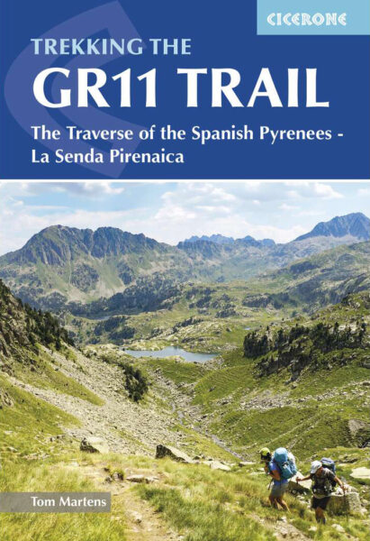
About the GR11

Pyrenees
country
Spain, Andorra
length
840 km(522 mi)
Type of trail
Thru-hike, Long-distance
difficulty

Difficulty is highly personal. Be aware of the weather conditions as bad weather turns easier trails in difficult trails especially in the mountains.

Difficult
accommodation

Lodging means a mix of hotels, hostels or AirBnB’s.

Mountain huts, Wild camping
Elevation gain
39000 m(127953 ft)
terrain
Mountains
remoteness
Most of the time
Show more

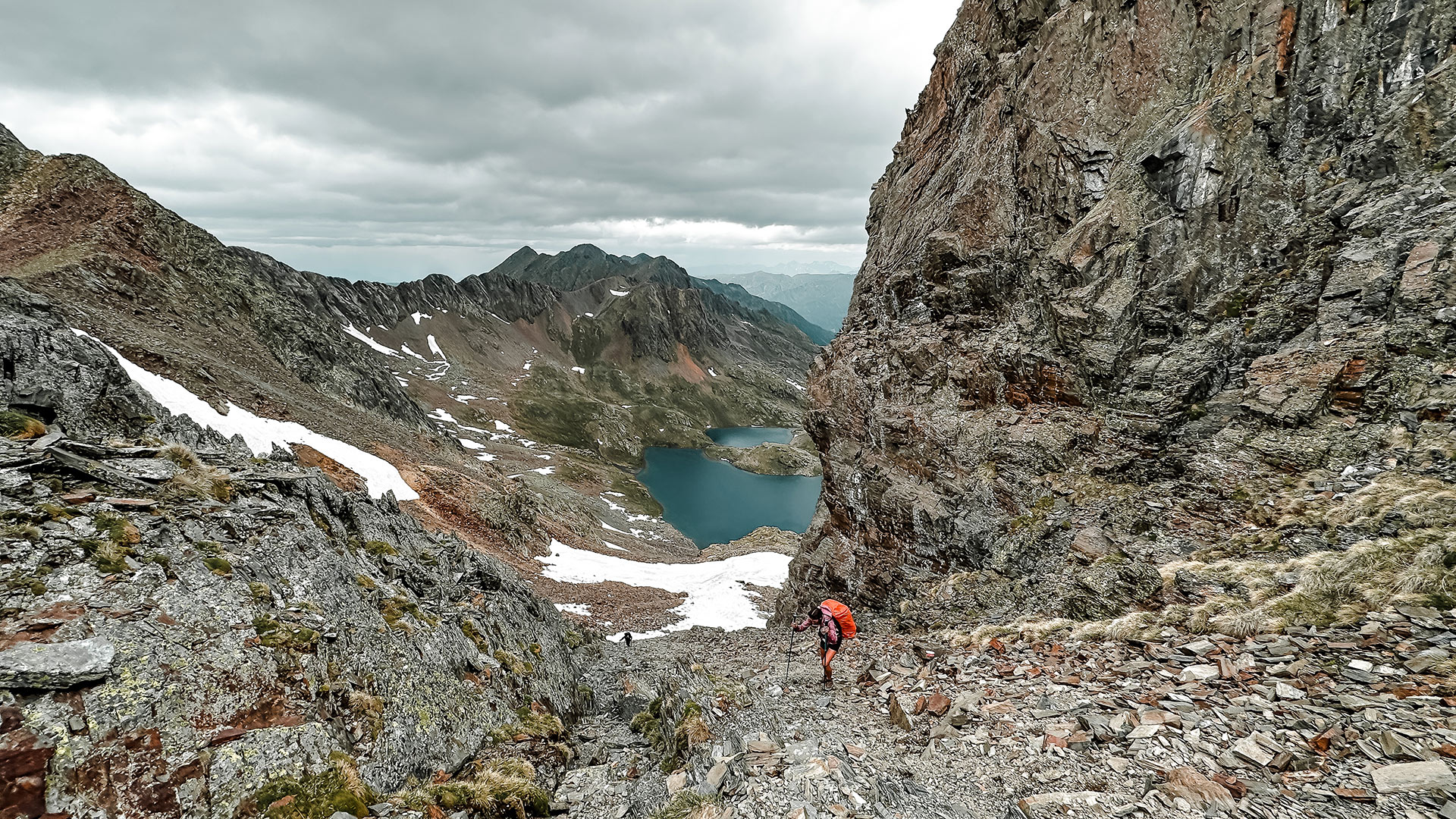
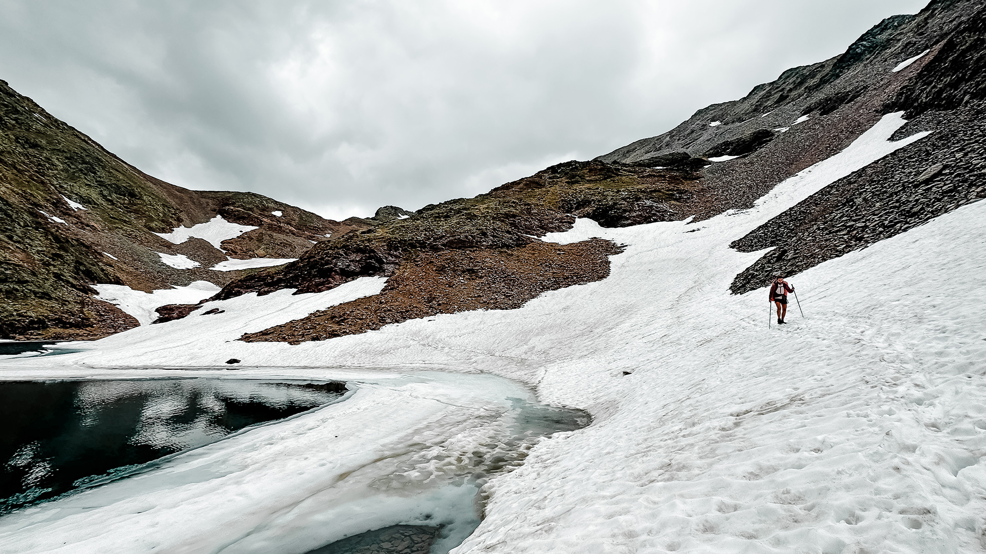
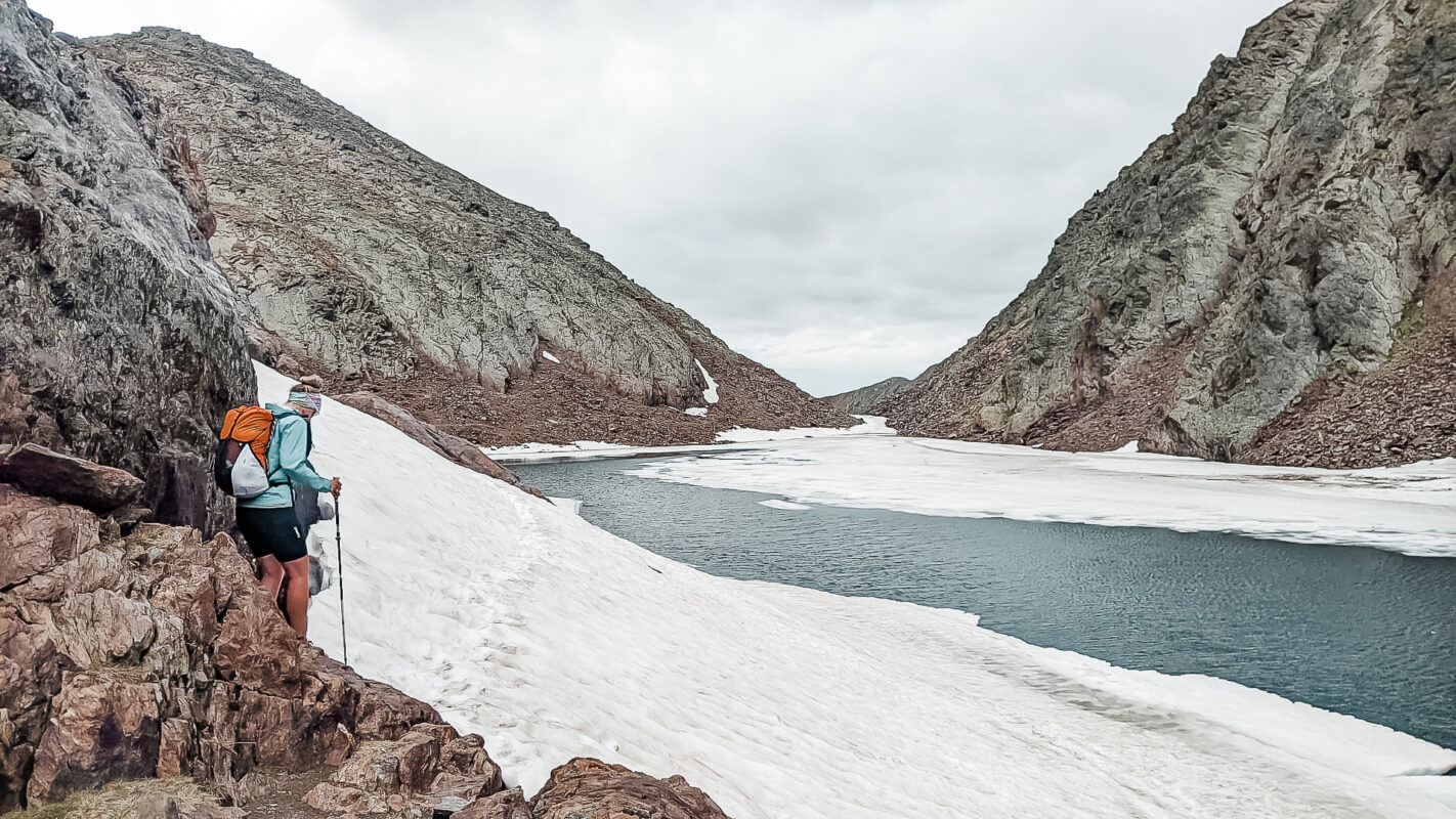
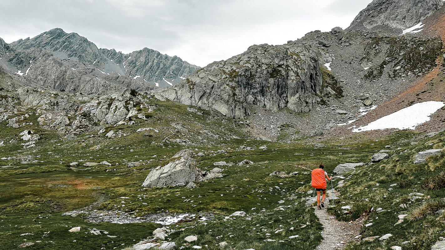
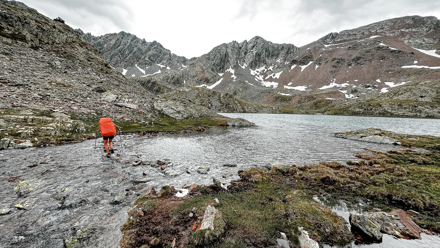
The GR11 is the star of all the trails in the southern Pyrenees. It is a route of outstanding beauty and landscape diversity that crosses the mountain range from the Mediterranean Sea to the Atlantic Ocean and can be hiked in either direction. The GR11 was finished in 1986 and is fully marked.

Also known as the Ruta Transpirenaica or Trans-Pyrenean Route, it is a legendary long-distance hiking trail that goes along the entire length of the Spanish Pyrenees and stretches approximately 820 kilometers (510 miles) from the Atlantic Ocean to the Mediterranean Sea.

Stiina Kristal

Stiina Kristal

Stiina is an IML-qualified mountain leader and an experienced long-distance hiker. Together with her partner Kris, they love to explore trails all around the world, learning more about themselves with every adventure.

View profile

The Trail

The GR11 passes through steep mountains in Catalonia and Aragon and gentler mountains in Navarra, Basque Country, and East Catalonia. Throughout this hike, you’ll come to know the beauty of Spain that you cannot find in the cities.

The first and last sections of the GR11 pass through numerous villages, thus offering a break from the heat and exposure of the hills. The central section can be truly wild and breathtaking, weather permitting. The route can vary from gentle flat tracks to very steep slopes or scree to exposed paths. For most of the route in the High Pyrenees the trails are technical and rocky, so supportive footwear and hiking poles are essential.

You will certainly see some wildlife, such as marmots, isards, foxes, and ibexes. There are five main sections to the trail.

Section 1, Cabo Higuer to Zuriza, marks the beginning of the trail, where you start at the Atlantic Ocean at Cabo Higuer, starting into the Pyrenees with an first ascent that introduces the diverse terrains to come. Section 2, Zuriza to Panticosa, continues through the Pyrenees, and has more challenging routes and higher elevations. This section is known for its alpine scenery and remoteness.

Next, you’ll head into section 3, Panticosa to Espitau de Vielha. Here, you’ll find lots of glacial lakes and some villages to re-stock as well.
Section 4, Vielha to Refugio Baiau , transitions into an even more rugged and remote area, where you’ll feel the wilderness of the Pyrenees properly. This segment will test your endurance but rewards you with some of the most breathtaking views and solitude.
Finally, you’ll go from Refugio Baiau to Cap de Creus in section 5 to finish the trail. You’ll descend to the Mediterranean coast at Cap de Creus for a final hurrah.

Accommodations

It is possible to hike the whole trail hut to hut. The route is also dotted with a lot of small, very basic unmanned huts (called cabanas or rifugis).

Wild camping in Spain and Andorra is illegal but oftentimes tolerated and you will certainly see other hikers wild camping. For wild camping, please respect the Leave No Trace principles by setting up camp late and leaving early.

Best time of the year

The best walking in the High Pyrenees is from July to September because it is unlikely that the passes in the High Pyrenees will be free of snow until July. In the summertime, get ready for really warm temperatures even in high altitudes. Prepare to start early morning to avoid enormous heat over the mid-day. Despite the summer Mediterranean climate in higher altitudes, temperatures can drop below 0 degrees Celsius at night.

Safety & Gear

Hiking in the Pyrenees can be risky, so be sure to prepare before you set out. Download the GPX, map, or guidebook for the trail (links below) and bring a power bank.

The weather can change rapidly, check the forecast each day before you begin. You can use a weather radar app or talk with locals at the mountain hut, as they will know the region’s weather patterns best.

Be sure to pack layers and shoes with sticky grip for when you’re in the High Pyrenees, as well as sun protection since you’ll be at such a high elevation.

Good to know

There are a few things to note as you prep for this hike. First, you will likely meet shepherd dogs along the route, so be respectful and aware. Try to walk a wide arc around them and their herd.

You’ll need to start early in the day because late afternoon and evening thunderstorms are quite common in this region. If you find yourself on trail when a surprise storm comes, seek shelter immediately.

Make sure you download your GPX because mobile phones do not work in large areas of the Pyrenees.

Finally, water can be obtained from natural sources along the route. Always filter or boil as there might be cattle around.

Route
Point to point
Water
Natural sources, with filter
Highest point
2780M (9120 FT)

Guidebooks

Guidebook GR11 trail

GR11 guidebook

View guidebook

Want to submit a trail or make this page more complete?

Comments

Be the first one to comment on this trail!

Reply to this trail

Your email address will not be published. Required fields are marked *

Reply to this trail

Log in to comment on this trail
Always read the disclaimer

Terms of Use: important to all visitors on this website. We strive to publish high quality content and information on this website. However it’s always possible that we’re missing out on some crucial information. In spite of the fact that this route, associated GPS track (GPX and maps) were prepared under diligent research by the specified contributor and/or contributors, the accuracy of such and judgement of the author is not guaranteed. Therefore, hiking-trails.com and contributors are in no way liable for personal injury, damage to personal property, or any other such situation that might happen to individuals hiking or following this route. Should you choose to hike this trail, this is always at your own risk. Check out our guidelines for safety hiking and Leave No Trace principles at the hiking 101 page.

Download GPX

Join the community!

Login or create a FREE account 😊

With an account you can:

Download GPX files

Pin trails to your wishlist

Mark trails as hiked by you

Rate hiking trails

Comment on trails, blogs and gear reviews

Happy trails!
Login

Don't have an account yet? Register here