About the Eifelsteig

country
Germany
length
313 km(194 mi)
Type of trail
Long-distance
difficulty

Difficulty is highly personal. Be aware of the weather conditions as bad weather turns easier trails in difficult trails especially in the mountains.

Moderate
accommodation

Lodging means a mix of hotels, hostels or AirBnB’s.

Lodging
Elevation gain
6350 m(20833 ft)
terrain
Forest, Hills
remoteness
Most of the time
Show more

Just at the border between the Netherlands and Germany starts one of the Top Trails of Germany, the Eifelsteig. The trailhead lies in Aachen-Kornelimünster and takes you in 313 kilometers to Trier, Germany’s oldest city. Here you will find plenty of pristine nature, solitary river valleys, expansive forests, beautiful views, rugged rock formations, and volcanic landscapes. Hike at your own pace and feel at one with nature.

The route is divided into 15 stages, which can easily be extended or shortened. This long-distance trail runs right through the Eifel area. On most of the stages, away from civilization, it’s common to encounter no one for hours on end.

Elmar profile picture
Editor

Elmar Teegelbeckers

Passionate hiker Elmar spends months of his time on the trail. He’s usually on the lookout for hidden gems in one of his favourite countries such as Slovenia, Switzerland and Japan. He founded hiking-trails.com in need for a community and detailed information about the trails. Before this, he worked for the Alpine asscociation in the Netherlands[ (NKBV) but lost his heart to the trails.

Not long ago, Elmar published the book (in Dutch) Hiking Trails – best long-distance trails in Europe. With this book, website and socials, he hopes to inspire and shape an inclusive community for hikers all over world. No matter your speed, experience or level, you can get out there to enjoy the trails and connect with the heartwarming hiking community. Life is so much better outside and he hopes to inspire hikers to take their first, or next, step on the trail.

You can reach Elmar at info@hiking-trails.com.

View profile

The Trail

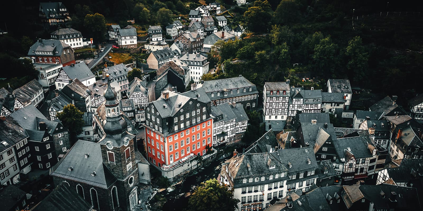
The starting point of the Eifelsteig is Kornelimünster, just outside Aachen. From here, the route heads south towards Trier. The first part starts easy and partially runs through the Inde Valley. Besides the beautiful Struffelt Heath, the moorlands, aptly named High Fens, are particularly nice. Monschau is a perfectly preserved medieval half-timbered town. Wander through the alleys in search of the best photo opportunity and take a moment to relax on a cozy terrace by the Rur river before diving back into nature.

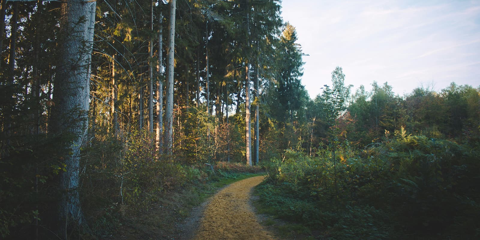
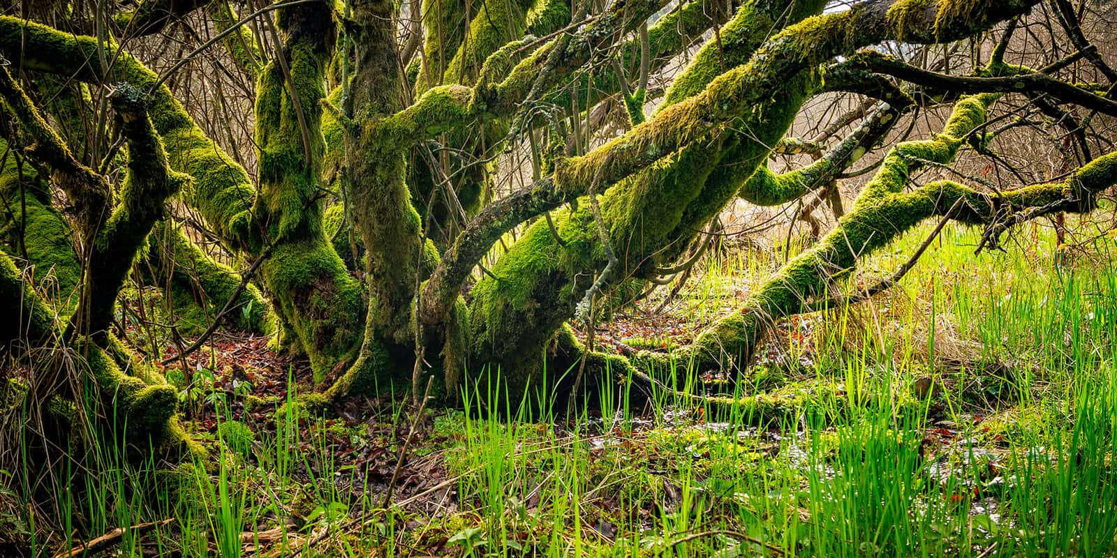
Heading towards Einruhr, the route continually ascends and descends. You are rewarded with beautiful vistas over the open landscape. The stretch through the Eifel National Park is pure nature. In the national park, nature is allowed to take its course again. More than 10,000 plant and animal species live here, a few thousand of which are endangered. With a bit of luck, you might even encounter a wildcat at dusk. This feline is also known as the Eifel tiger. In the autumn, you can hear the roaring of the deer.

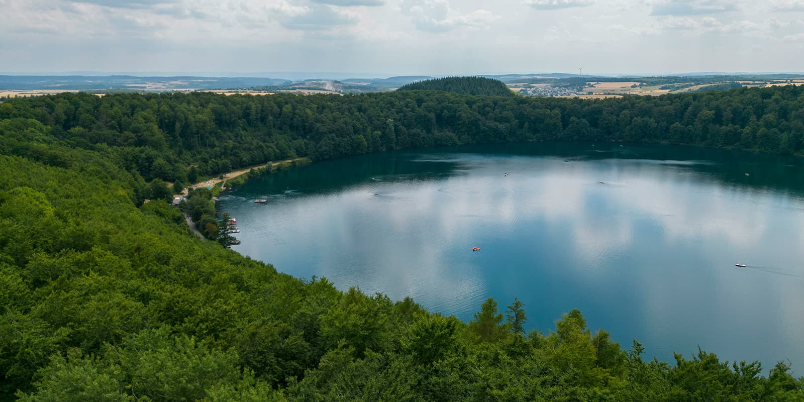
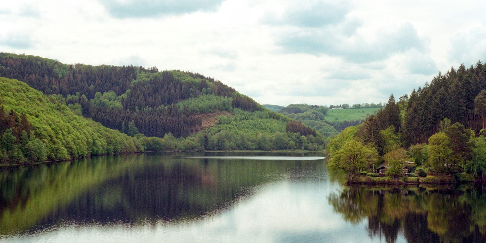
Apart from forests, you also hike along beautiful rocky paths by the Ober- and Urftsee reservoirs. The huge Vogelsang complex was once a training institute for the Nazis. Besides an exhibition on this dark chapter in German history, there is also an exhibition on the nature of the national park.

Alternatingly, you hike over peaks, high plateaus, and through river valleys. Charming towns, quarries, a Roman aqueduct, and a few monasteries provide variety. From Kalvarienberg, you have a beautiful view over hills covered with juniper bushes and meadows. The Dreimühlen waterfall in the Ahbach Valley is also beautiful.

The area now known as the Volcanic Eifel was a tropical sea about 400 million years ago, complete with coral reefs. The ancient coral reef near Gerolstein is now called the Gerolsteiner Dolomites and towers high above the landscape. The city is known for its mineral water. At the Helenenquelle, you can fill up your flask with fresh water before continuing your hike. The Nerother Kopf is the highest peak of the Eifelsteig. Here are a few caves that were formed by the extraction of volcanic rock to make millstones.

After Daun, you pass by the most imaginative geological feature of the Volcanic Eifel, the Maars. They are the result of massive steam explosions that blew deep holes in the earth. Water remains in these round holes, and the Maars are also called the ‘Eyes of the Eifel.’ Towards Manderscheid, you can immerse yourself in peace in the idyllic valley of the Lieser. In Manderscheid, close to each other, are two castle ruins. Once they were the scene of a power struggle between the Electors of Trier and the Dukes of Luxembourg, now they are picturesque spots to rest.

The path now mostly goes downhill. You walk through the beautiful river valleys of the Salm and the Kyll. You reach the other side of the Butzerbach via a suspension bridge. Here and there, impressive red sandstone formations lie directly along the path. Various legends surround the gigantic Genoveva cave. From a path above the Moselle, you can already see Trier in the distance. In Germany’s oldest city, numerous monuments from Roman times can still be seen. The final destination is reached and you’ve completed one of the Top Trails of Germany and the Eifelsteig comes to an end.

Stages

You can hike the Eifelsteig in 15 stages depending on your preference.

15-stage itinerary

Stage 1:

Kornelimünster – Roetgen, 14 km | 8.7 mi

Stage 2:

Roetgen – Monschau, 17 km | 10.5 mi

Stage 3:

Monschau – Einruhr, 24 km | 15 mi

Stage 4:

Einruhr – Gemünd, 21 km | 13 mi

Stage 5:

Gemünd – Kloster Steinfeld, 17.5 km | 11 mi

Stage 6:

Kloster Steinfeld – Blankenheim, 23 km | 14 mi

Stage 7:

Blankenheim – Mirbach, 18 km | 11 mi

Stage 8:

Mirbach – Hillesheim, 26 km | 16 mi

Stage 9:

Hillesheim – Gerolstein, 21 km | 13 mi

Stage 10:

Gerolstein – Daun, 24 km | 15 mi

Stage 11:

Daun – Manderscheid, 23 km | 14 mi

Stage 12:

Mandersheid – Kloster Himmerod, 18 km | 11 mi

Stage 13:

Kloster Himmerod – Bruch, 20 km | 12.5 mi

Stage 14:

Bruch – Kordel, 28 km | 17.4 mi

Stage 15:

Kordel – Trier, 17 km | 10.5 mi

Accommodations

Every stage ends at a village so it’s quite easy to book your stay there. Many guest houses also serve regional cuisine like the local specialties. If a summer hike in peak season July and August is a must for you, make sure to secure your accommodations well in advance to avoid fully booked accommodations while you’re hiking or planning the trail.

Best time of the year

The best time to hike the Eifelsteig is probably in the spring in April and May or fall in September and October. During these months, the weather is the best for hiking, with warmer temperatures and longer daylight hours. This way, you will avoid the summer’s peak temperatures and potential crowds. Spring has blooming flora, and autumn offers a display of foliage, enhancing the beauty of the trail.

Safety & Gear

It’s a well-marked trail, but having a downloaded map or GPS route on your phone as a backup is wise. Always bring your essentials for a safe trail experience, like good shoes with enough grip. Bring your layers, at least a baselayer, mid-layer, and a hardshell rain jacket for occasional rain showers. Take enough water and food with you.

Good to know

The Eifelsteig is a great hike for beginner long-distance hikers or if you want to get away from it all for a week. The paths are not technical and easy. There are enough facilities along the way and you will meet some other hikers. It offers a nice mix of tranquility and sociability on the trail.

Route
Point to point
Highest point
660m (2165 ft)

Want to submit a trail or make this page more complete?

Comments

Be the first one to comment on this trail!

Reply to this trail

Your email address will not be published. Required fields are marked *

Reply to this trail

Log in to comment on this trail
Always read the disclaimer

Terms of Use: important to all visitors on this website. We strive to publish high quality content and information on this website. However it’s always possible that we’re missing out on some crucial information. In spite of the fact that this route, associated GPS track (GPX and maps) were prepared under diligent research by the specified contributor and/or contributors, the accuracy of such and judgement of the author is not guaranteed. Therefore, hiking-trails.com and contributors are in no way liable for personal injury, damage to personal property, or any other such situation that might happen to individuals hiking or following this route. Should you choose to hike this trail, this is always at your own risk. Check out our guidelines for safety hiking and Leave No Trace principles at the hiking 101 page.

Download GPX

Join the community!

Login or create a FREE account 😊

With an account you can:

Download GPX files

Pin trails to your wishlist

Mark trails as hiked by you

Rate hiking trails

Comment on trails, blogs and gear reviews

Happy trails!
Login

Don't have an account yet? Register here