About the Dientes de Navarino

country
Chile
length
50 km(31 mi)
Type of trail
Long-distance
difficulty

Difficulty is highly personal. Be aware of the weather conditions as bad weather turns easier trails in difficult trails especially in the mountains.

Difficult
accommodation

Lodging means a mix of hotels, hostels or AirBnB’s.

Wild camping
Elevation gain
2081 m(6827 ft)
terrain
Mountains, Forest
remoteness
All the time
Show more

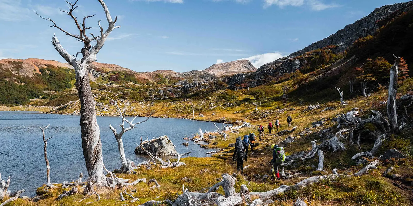
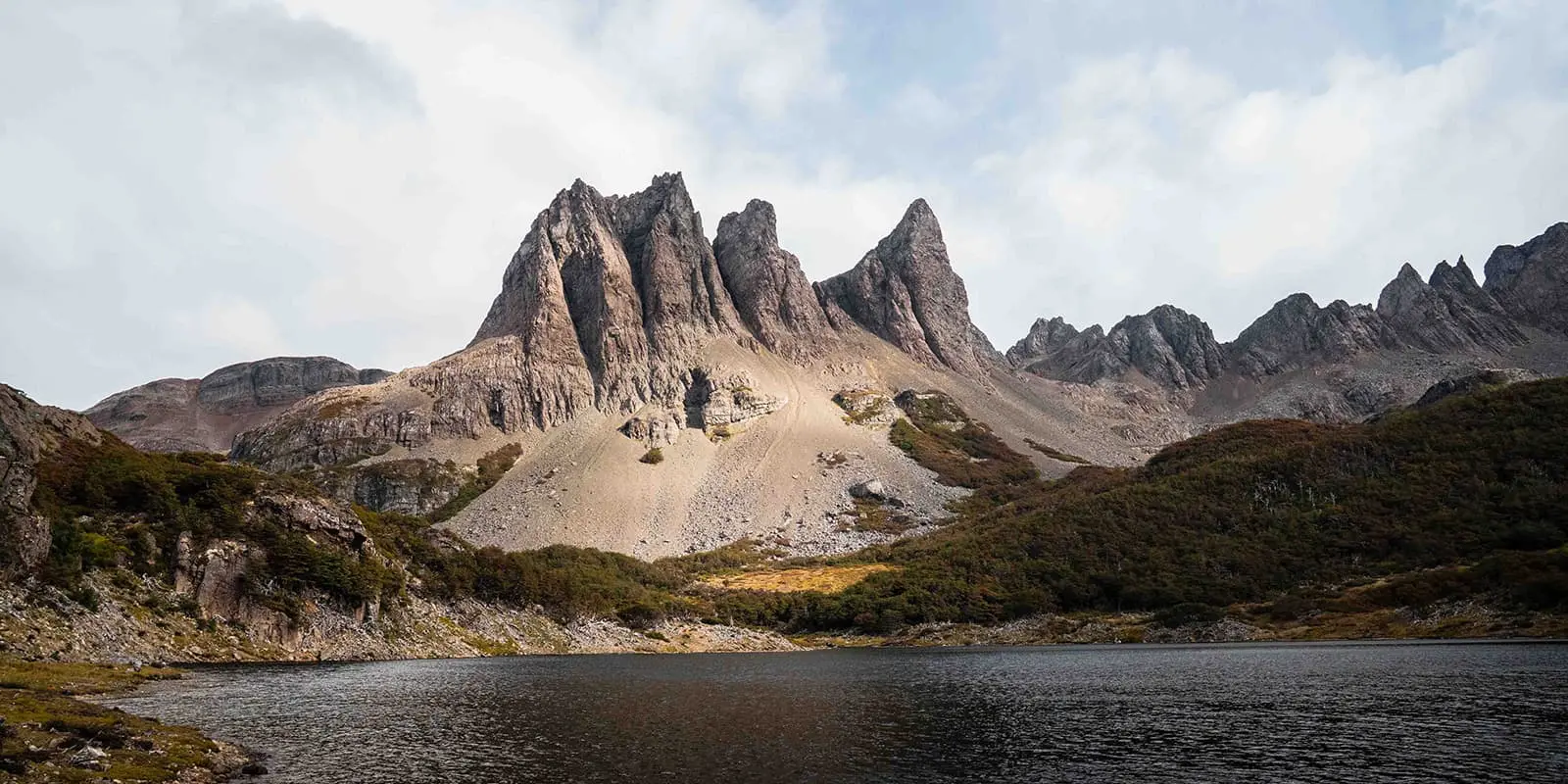
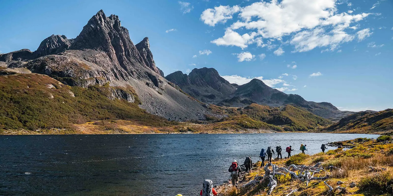
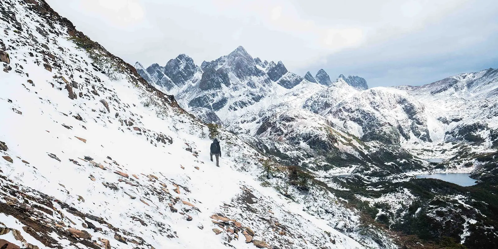
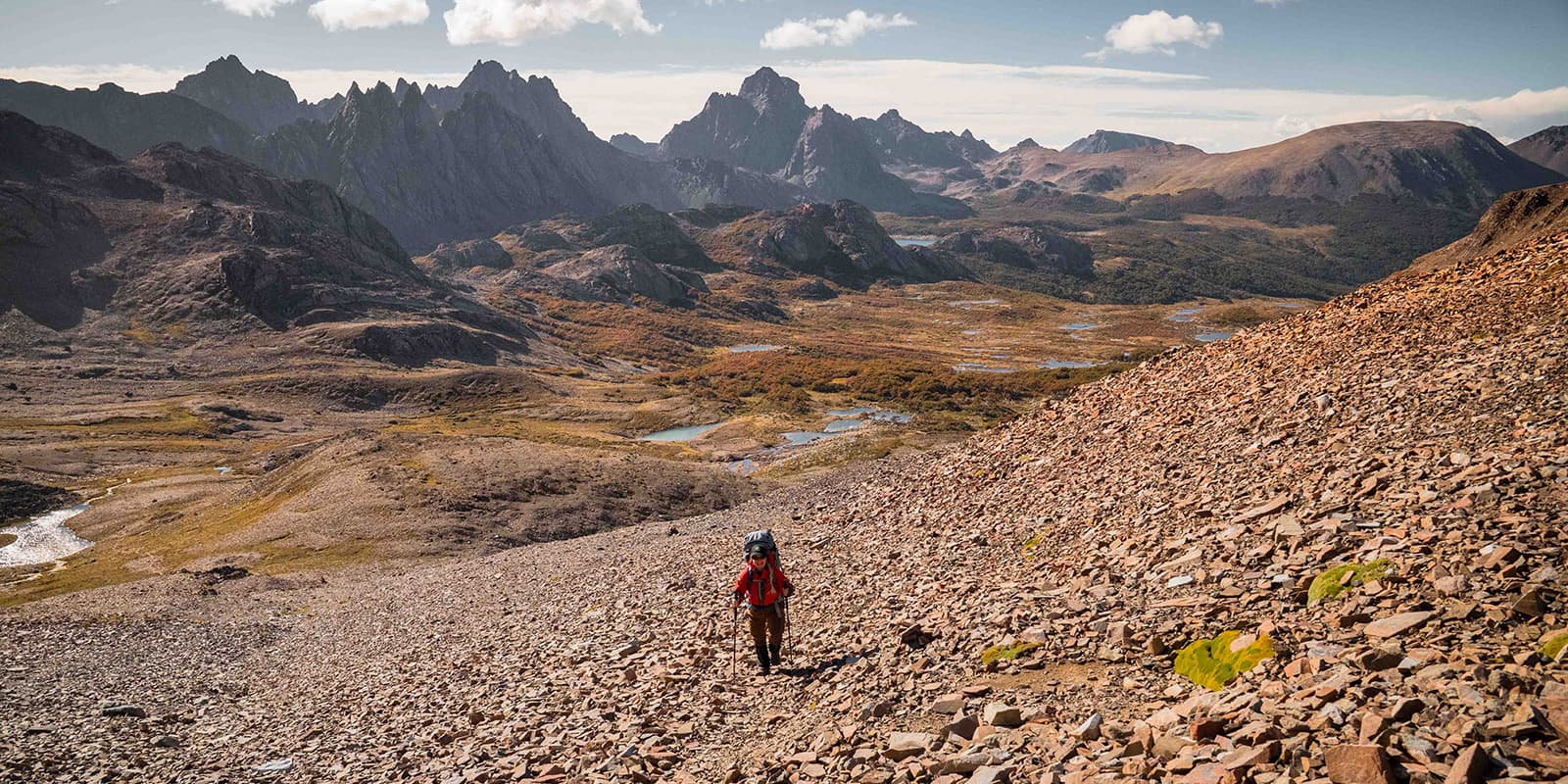
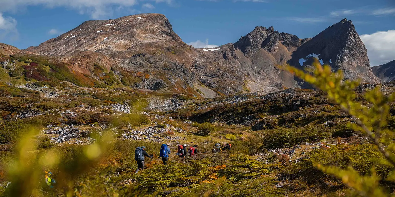
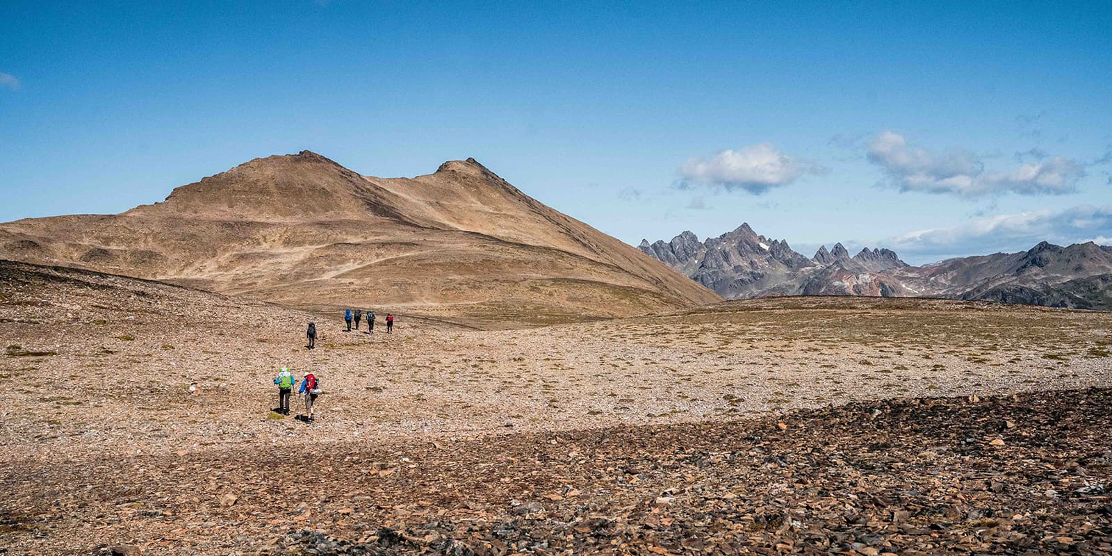
The Dientes de Navarino Circuit is one of the world’s southernmost serious treks: a trail through a region that’s been entirely shaped by wind, ice, and extreme weather. You will start in Puerto Williams, a small town on the Beagle Channel, and you’ll soon trade phone bars for bogs and windy horizons.

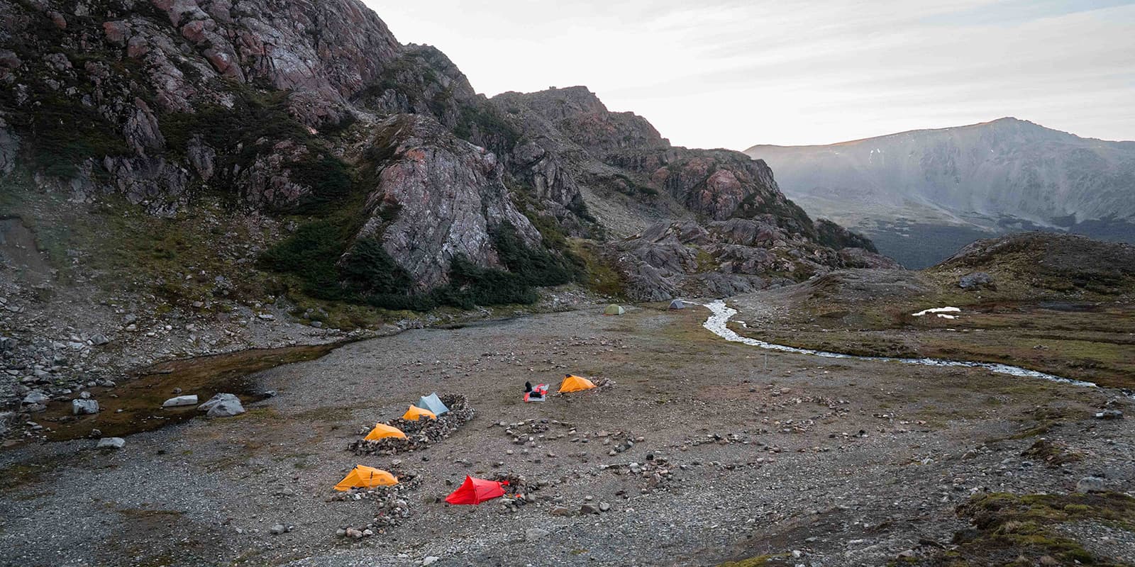
This trail is extremely remote and will require that you carry all of your food and gear to be self-sufficient for the entire time you’re on the trail. You should have previous experience with difficult terrain, long food carries, and wild camping before starting this trail. Plus, you should also be comfortable with prolonged cold, wet, and wind for this.

Monica & Albert from Amarok adventures

Monica & Albert from Amarok Adventures

Albert and Monica are licensed AIMG guides and Senior Polar Guides by PTGA, combining their passions for the outdoors, the polar regions, and high mountains. With backgrounds rooted in exploration (Albert behind the camera, capturing the raw essence of each journey, and Mónica driven by a lifelong love for climbing, skiing, and wild terrain), they’ve built a life around sharing remote, meaningful adventures with others. Together they run Amarok Adventures, designing and guiding the kind of expeditions they’d choose for themselves: authentic, challenging, and deeply connected to the landscapes they love. You can follow them on Instagram @amarokadventures.

View profile

The Trail

Over roughly 50 kilometers and usually done in four to six days, depending on weather, the circuit goes around the jagged skyline that gives the Dientes their name. The passes are steep. The highest point that most groups cross sits around 850 meters (Paso Virginia), and that climb gives you a rare view of, on a clear day, Cape Horn and the open Southern Ocean to one side, and the Beagle Channel on the other side.

But the Dientes are not dramatic only in profile. Walking here is a true lesson in contrasts. One hour, you will be struggling through subantarctic forest, and the next you will be on a moraine with blue-green lagoons. The campsites are on the firmest ground possible near the bogs; others are placed in almost perfect shelters that hikers have built from dead trees left by beavers.

You’ll be aware of the weather for the entire trail. Fog, rain, sleet, snow, and sun make the route feel totally unstable. Throughout the route, mud is also everywhere. This is something you should accept, as fighting it will only make the trail unpleasant. You’ll also need to be good at route finding, as the cairns can be difficult to spot, mountain passes can disappear under the fog & clouds, and the descents can be tricky.

Finally, you come back toward Puerto Williams, where the town’s simple lodgings, local seafood, and conversation with people who live at the edge of the map can feel like arriving on a different planet. You’ll be able to warm up, dry your gear, and celebrate the crossing with others. That final Austral beer in front of the Beagle will taste like a reward you earned with your knees and your nerves.

Stages

The Dientes de Navarino trail is normally completed in 4-6 days, depending on the weather. It is normal to add extra days if the weather is too extreme to hike in, and you should prepare accordingly with extra food in case you need to take longer than the suggested four days.

Suggested 4-Day Dientes de Navarino Itinerary

Stage 1:

Puerto Williams – Laguna del Salto, 11 km | 6.8 mi

Stage 2:

Laguna del Salto – Laguna Escondida, 9 km | 5.6 mi

Stage 3:

Laguna Escondida – Laguna Martillo, 15 km | 9.3 mi

Stage 4:

Laguna Martillo – Paso Virginia – Laguna Guanacos – Puerto Williams, 15 km | 9.3 mi

Accommodations

There are no huts, shelters, or serviced facilities anywhere along the Dientes de Navarino. You will wild camp throughout the entire trail in spots that you can find that are protected from the elements. There are sometimes “shelters” that have been created by past hikers, and other times you’ll just need to find the firmest ground near the bogs. Bring a setup that is as weather-proof as possible, and be sure to keep your gear in dry bags for this trail!

Best time of the year

The best time to hike the Dientes de Navarino Circuit is during the southern summer, from January to March. These are the months with the most stable daylight, slightly milder temperatures, and the highest chances of clear windows for crossing the passes. Even then, “stable” in Tierra del Fuego still means fast-changing weather, strong winds, and the possibility of every season in a single day.

Even at the peak of summer, the Dientes remain unpredictable. Snow can fall at any time of year, winds can shut down passes, and a normal day can quickly turn into an expedition challenge.

Safety & Gear

Preparation is the only way to succeed on the Dientes de Navarino Circuit. Bring layered, quick-dry clothing, a waterproof and windproof shell, sturdy waterproof boots, and gaiters (essential for the constant mud and bogs). Pack a warm hat, gloves, sunglasses, and sunscreen. Nights can be cold and damp, so use a sleeping bag rated to at least -5°C to -10°C, plus an insulated sleeping pad to stay warm on wet or soft ground. Carry a reliable stove, spare parts, a lightweight water filter, and basic personal meds and blister care.

Objective hazards on the Dientes also require proper gear and planning. The trail includes steep passes, loose rock, slippery peat, and sections where weather can shut down visibility. Navigation and communications are mandatory: a map, a compass, the GPX downloaded offline, and a satellite messenger or satellite phone, plus a personal locator beacon for emergencies.

Difficulty

The Dientes de Navarino Circuit is rated as difficult, not because of distance or altitude, but because the trail conditions are so challenging. The route is short on paper, but the reality on the ground is far tougher than the numbers suggest. A 6km day can turn into a 10-hour hike depending on weather conditions.

The terrain is the biggest factor. The Dientes are built out of bogs, boulders, peat, and passes. Much of the route crosses wet, uneven ground where every step sinks, slips, or tilts. The peat bogs will swallow your ankles, and beaver-altered landscapes will force you to detour. And even higher up, the steep climbs to the passes, loose scree, and long descents make it a different type of difficult. Even short distances can take hours because the ground rarely gives you an easy time.

Good to know

There is no phone signal anywhere on the circuit, so all communication relies on satellite devices. Weather forecasts, route updates, and emergency contacts all depend on these systems.

You can expect wet feet most days: between peat bogs, beaver-damaged terrain, and shallow crossings, staying dry is unrealistic. Good boots and patience go a long way, and once you start moving again, your feet warm up quickly.

Leave-no-trace rules are taken seriously. Campsites are small and fragile, cooking must be done with stoves only, and waste management is strict to protect this unique subantarctic ecosystem. Camp hygiene and food discipline matter, especially with the damp climate and limited flat, dry ground.

Solitude is almost guaranteed. You may see one or two small teams during the entire circuit, and often no one for days. The Dientes is one of the last truly wild trekking routes on the planet.

route
Circuit
highest point
Paso Virginia 850M (2.788 ft)

Want to submit a trail or make this page more complete?

Always read the disclaimer

Terms of Use: important to all visitors on this website. We strive to publish high quality content and information on this website. However it’s always possible that we’re missing out on some crucial information. In spite of the fact that this route, associated GPS track (GPX and maps) were prepared under diligent research by the specified contributor and/or contributors, the accuracy of such and judgement of the author is not guaranteed. Therefore, hiking-trails.com and contributors are in no way liable for personal injury, damage to personal property, or any other such situation that might happen to individuals hiking or following this route. Should you choose to hike this trail, this is always at your own risk. Check out our guidelines for safety hiking and Leave No Trace principles at the hiking 101 page.

Download GPX

Join the community!

Login or create a FREE account 😊

With an account you can:

Download GPX files

Pin trails to your wishlist

Mark trails as hiked by you

Rate hiking trails

Comment on trails, blogs and gear reviews

Happy trails!
Login

Don't have an account yet? Register here