About the Cape Wrath Trail

country
Scotland
length
375 km(233 mi)
Type of trail
Long-distance
difficulty

Difficulty is highly personal. Be aware of the weather conditions as bad weather turns easier trails in difficult trails especially in the mountains.

Difficult
accommodation

Lodging means a mix of hotels, hostels or AirBnB’s.

Wild camping
Elevation gain
13248 m(43465 ft)
terrain
Hills
remoteness
Most of the time
Show more

Not officially designated, this trail is a true test of physical and mental endurance. However, any strenuous moments will be swiftly overshadowed by the untouched beauty that awaits. The route takes you to the wildest and most remote places in Scotland.

Known as the most challenging trail in the UK, the Cape Wrath Trail (CWT) earns its reputation for a reason. With no official route or waymarks, and often no paths at all, hikers must rely on various sources, each suggesting a different way. Be aware of the first moment you find yourself facing a boggy field with no visible path, knee-deep in the swamp, knowing turning back is not an option anymore.

Profile picture Sancia Gimbel.
Author

Sancia Gimbel

Sancia Gimbel, born and raised in Germany, has always searched for her next adventure. Having predominantly traveled solo, she is well acquainted with the advantages and disadvantages of being a solo hiking woman. Having hiked several trails all over Europe, her favorite place (and biggest adventure) is still Scotland.

Her current plan is to explore South America, mostly through backpacking and hiking in Patagonia, and North America through road trips and hiking over the next few years. You can follow her adventures on Instagram!

View profile

The Trail

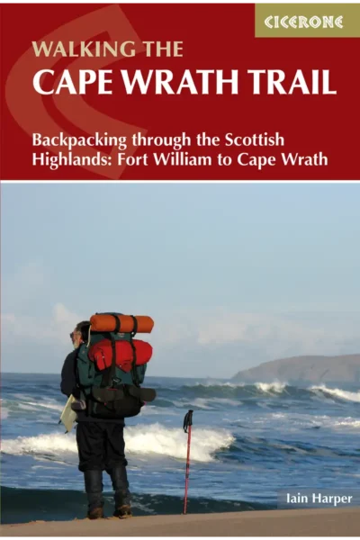
The Cape Wrath Trail is an excellent long-distance trail but be prepared. This trail is not for beginners.

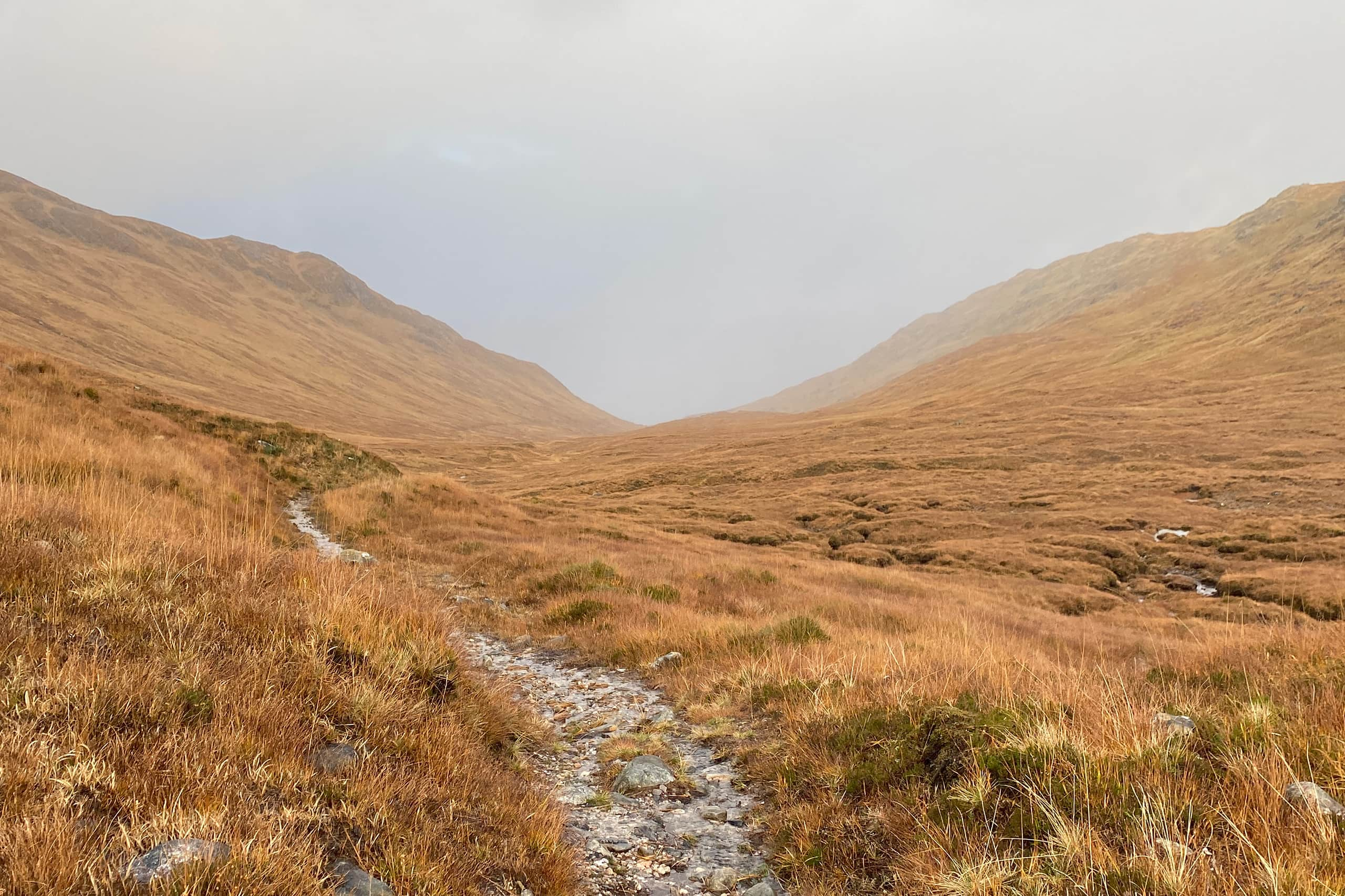
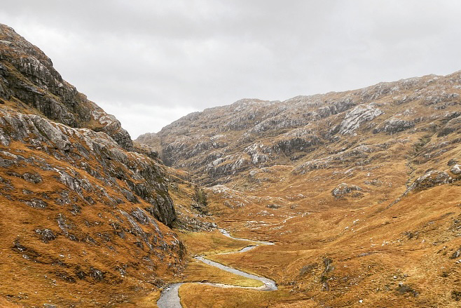
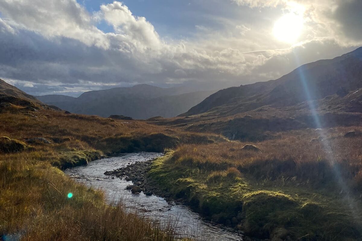
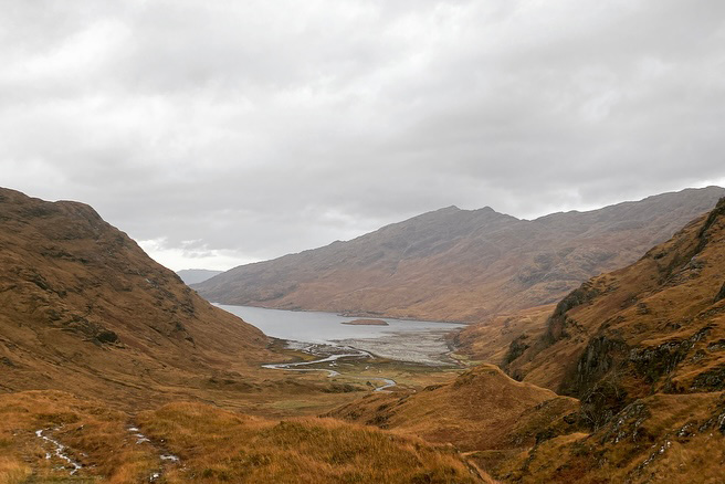
Beyond having the right gear to face the rough Scottish weather, a crucial element for tackling the Cape Wrath Trail is the ability to read and navigate by using a paper map. While GPX maps are available (check the link below), they won’t guide you through the boggy Highlands. There are mostly no established paths, and all you’ll know is that you need to reach the end of the valley and climb between two “hills” to get to the other side. Something visible on a map but challenging to follow blindly with an offline GPS, especially on a stormy day without visibility. Trust me; I’ve tried it.

But as a safety backup on your phone? Absolutely!

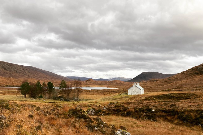
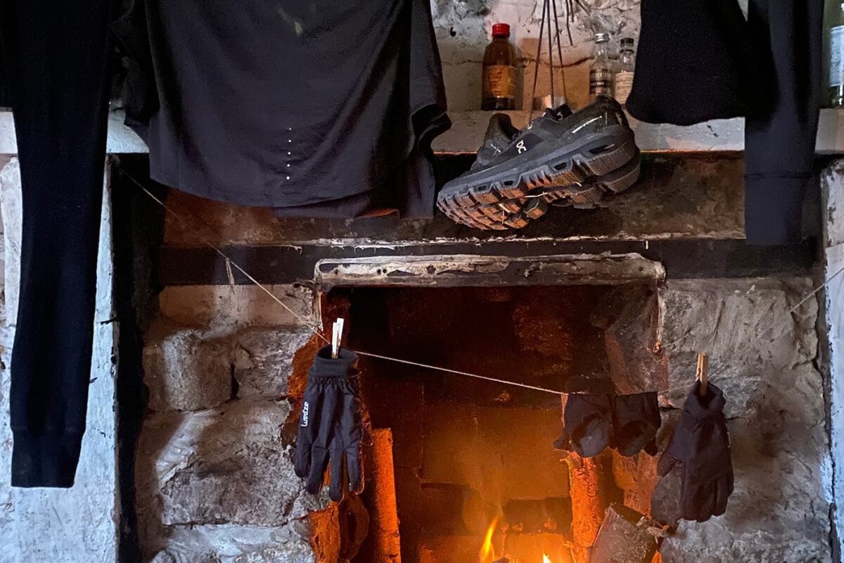
Another factor is the trail’s wide remoteness. There are sections where you find yourself alone in the wild Highlands for about five days until you reach the next small village. Keep in mind, that this also means being far from help, and finding an escape route requires more effort than usual. And yes, you have to carry some food! The only “bigger” city you’ll cross is Ullapool (which needs prior planning) with full accommodations. You’ll find small village shops in between, offering standard local food. The good thing about Scotland: water is everywhere! Some areas even allow you to carry none at all. BUT, please don’t forget your water filter!

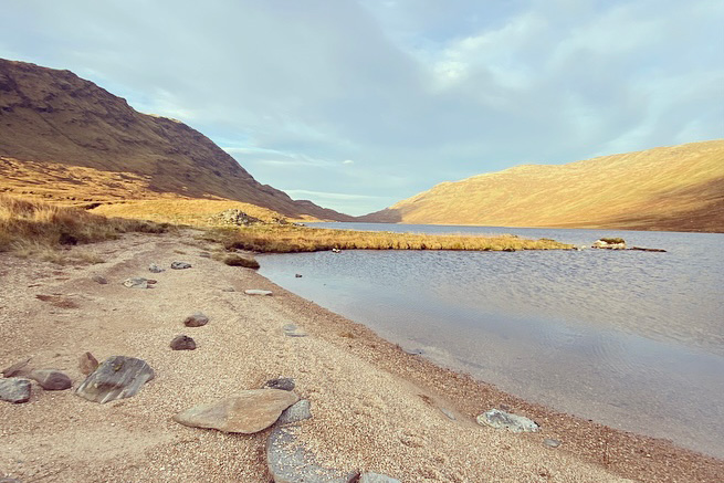
Yet another challenge is the tricky river crossings—countless small, wide, deep, and wild ones. Some can be very dangerous, especially after rain. Not infrequently, you’ll have to follow a river until you find a safe spot to pass, sometimes for miles.

So, let’s say…

You’ll brave remote country, rugged terrain, Scottish wind, unrelenting rain, engage in your private war against the midges, find your way, fall into muddy holes, and feel like the most adventurous person on earth… It will be tough. But it will be an adventure that will stay with you for the rest of your life!

How to Get Around

Glasgow and Edinburgh boast major international airports. Fort William, the starting point, can be easily reached by bus. Alternatively, the train journey from Glasgow to Fort William is highly recommended, offering scenic views that make the trip worthwhile in itself. Even from London, you can travel by bus.

On the Trail

Due to the remoteness of the Cape Wrath Trail, there are limited points for joining or escaping. Shiel Bridge, Kinlochewe, Dundonnell, Ullapool, Inchnadamph, Rhiconich, Kinlochbervie, and Durness are the only villages with bus services. In Scotland, hitchhiking is quite common. As a solo female traveler, I exercise caution, although I’ve been fortunate to encounter friendly people willing to offer a ride even when soaked and muddy. However, it’s a personal decision, and I would never recommend it outright.

Around Cape Wrath

Cape Wrath itself is an active military firing range. Before leaving the last village (as there will be almost no reception once around Cape Wrath), check if you are allowed to enter or if it’s closed. Or look out for red flags which are hoisted when nobody can pass.

Upon reaching Cape Wrath (Congratulations!), you have two options to return:

  • During the Summer Months: An open coffee shop and a mini-bus operate from Cape Wrath to a small ferry to Durness, where bus services are available.
  • Out of Season: Options are limited, and you need to walk back to the last village with a bus service (1-2 days). Another option is to walk to Durness using the 4×4 track until the ferry, but this entails navigating very boggy and rough terrain around the bay (1-2 days).

Stages

The stages provided here serve as an example, bearing in mind that there are numerous alternative routes. Exercise caution, as these stages may not necessarily lead you back to civilization. Some conclude at a bothy or nowhere, while others end in a tiny 4-house village, often with a B&B, but this is mostly operational during the summer months. Additionally, keep in mind that the terrain is exceptionally strenuous. Depending on the weather, certain areas can be particularly challenging and may require more time than you are accustomed to.

Stage 1:

Fort Willian – Glenfinnan 34.3 km | 21.25 mi

Stage 2:

Glenfinnan – Glen Dessarry 18.1 km | 11.25 mi

Stage 3:

Glen Dessarry – Barisdale 24.8 km | 15.5 mi

Stage 4:

Barisdale – Morvich 31.5 km | 19.5 mi

Stage 5:

Morvich – Strathcarron 38.7 km | 24 mi

Stage 6:

Strathcarron – Kinlochewe 34,7 km | 21.5 mi

Stage 7:

Kinlochewe – Strath na Sealga 27.3 km | 17 mi

Stage 8:

Strath ne Sealga – Inverlael 18.2 km | 11.25 mi

Stage 9:

Inverlael – Oykel Bridge 33.5 km | 20.5 mi

Stage 10:

Oykel Bridge – Inchnadamph 29.9 km |18.5 mi

Stage 11:

Inchnadamph – Glendhu 19.3 km | 12 mi

Stage 12:

Glendhu – Rhiconich 30.6 km | 19 mi

Stage 13:

Rhiconich – Sandwood Bay 16.2 km | 10 mi

Stage 14:

Sandwood Bay – Cape Wrath 12.9 km | 8 mi

Accommodations

Given the remote nature of the Cape Wrath Trail, accommodation options are limited. In addition to very small villages, some may have a tiny shop stocking essential local provisions (not specifically for hiking), but many areas offer no amenities at all. A few villages provide accommodation choices such as hotels, hostels, B&Bs, or camping sites, but these are typically available only during the summer months. If you plan to stay, it’s advisable to check for vacancies beforehand.

A slight detour on your journey allows you to visit Ullapool, a larger city with supermarkets and outdoor shops to replenish your food and gear supplies. Therefore, ensure you pack enough food with the necessary energy provisions for a strenuous hike.

Best time of the year

Similar to many other countries, the optimal time for hiking is during the summer months (April-September). However, Scotland offers a unique proposition with its landscape dominated by hills, lots of hills! The highest mountain, Ben Nevis, stands at 1345m (4413ft). So yes, Scotland is hikable all year long, and each season brings its advantages and challenges.

Summer Months: During the summer, you are blessed with long days, providing ample time to cover your distance without feeling rushed. It’s an opportunity to enjoy lochs for a swim and have leisurely lunches with scenic views. Especially in certain highland areas, hiking during the dark should be avoided due to boggy terrains that require special attention. The summer months generally offer the driest days, with temperatures reaching about 18-20°C (65-68°F). However, Scotland’s abundance of water, including rivers, lakes, and marshes, brings its biggest challenge: MIDGES! Tiny little mosquitoes that can be quite bothersome and sting.

Winter Months: On the upside, winter months are free of midges, but there’s a trade-off. Expect a lot of rain, and snow is possible from the end of October until March. The days become significantly shorter, nights colder, and storms more frequent, making camping more challenging. But in the winter months, you have the opportunity to see the country with fresh eyes as trees and fields undergo a transformation, changing their colors from green to warm orange all over.

In conclusion, a very German piece of advice from my side: “There’s no such thing as bad weather, only the wrong gear!” Scotland will be your grandest adventure with the right equipment.

Safety & Gear

Ensure you’ve chosen the right season for you.

For Summer Months:

  • Don’t forget a mosquito net for your face, thin long sleeves, trousers (no worries, Scottish summers rarely exceed 20°C), or insect repellent.
  • Opt for a tent that is mosquito-safe.
  • Since it rains about 182 days in Scotland (lucky you, this part of Scotland counts as one of the driest), a rain jacket is essential, even in summer. You will never be safe from getting wet.

For Winter Months:

  • Always pack a hardshell raincoat and rain trousers – you will get wet!
  • Depending on your chosen trail, include an ice axe and crampons.
  • A tent is often inevitable, especially in remote areas where bothies or village accommodations may not be accessible. During winter, storms can be intense, so ensure your tent has sufficient safety lines. If not, your tent may break or fly away. A dangerous situation in which none of us wants to find ourselves.

General Gear:

  • A water filter is a must-have due to Scotland’s abundance of water sources and rich wildlife. Filter or boil water for at least 3 minutes. This way some areas even allow you to carry none at all.
  • A paper map is recommended for a good overview of the area, helping you find quick escape routes or alternative paths. And as a good practice for upcoming trails where you simply need it.
  • Scotland is home to diverse wildlife, including deer, birds, and seals. Not a danger for you but maintain a respectful distance to avoid disturbance.
  • Always check the weather before heading back on the trail.
  • Due to remote areas with unreliable reception, especially for solo hikers, a satellite tracker is highly recommended and can be a lifesaver.
  • A guidebook provides insights into upcoming terrain and helps you find suitable spots for your tent, considering the boggy areas where camping may be restricted.

With this comprehensive gear, you can hike with confidence, whether navigating through summer rains or winter storms. Stay safe and enjoy the adventure!

Good to know

Wild Camping

Wild camping is officially allowed in Scotland! Let me tell you about the “Scottish Outdoor Access Code” (link below).

Lightweight camping is permitted in small numbers and only for 2 or 3 nights at the same place. Do not camp on private property, in enclosed fields of crops, or near farm animals, and stay well away from buildings, roads, and historical structures. Do not disturb deer stalking or grouse shooting. If you’re close to a house, ask the landowner for permission (Scottish people are super friendly). As always, leave no trace.

There are some special rules for specific National Parks; please check them out on their website. Additionally, they have a useful page about campsites all over the country and a lot of other helpful information!

Scottish Bothies

Hiking in Scotland offers a special treat: their bothies! While we’re all familiar with mountain shelters, often used in emergencies or bad weather, they may not always entice us to spend a night unless absolutely necessary. However, the Scottish bothy takes the experience to a whole new level. Some even come equipped with a flushing toilet or electricity.

These huts are lovingly cared for, not just by the Mountain Bothy Association (www.Mountainbothies.org.uk — yes, you can become a member and support them), but also by locals who enjoy spending a night in the wilderness.

The best part? You don’t pay, but it operates on a system of trust and respect:

  • Always leave the bothy better than you found it!
  • Everyone is welcome! It’s not “your” bothy.
  • No vandalism.
  • Take all your rubbish.
  • You can leave useful things for the next person but never leave rotting food.
  • Bury human waste far away from the bothy and water sources.
  • Ensure the doors and windows are properly closed when you leave.

Keep in mind, the act of offering us a free and often charity-run shelter is a kind one! Please treat it with the utmost respect!

Route
Point to point
Highest point
722m (2368 ft)

Guidebooks

guidebook cover Cape wrath trail

Cape Wrath Trail

View guidebook

Want to submit a trail or make this page more complete?

Comments

Be the first one to comment on this trail!

Reply to this trail

Your email address will not be published. Required fields are marked *

Reply to this trail

Log in to comment on this trail
Always read the disclaimer

Terms of Use: important to all visitors on this website. We strive to publish high quality content and information on this website. However it’s always possible that we’re missing out on some crucial information. In spite of the fact that this route, associated GPS track (GPX and maps) were prepared under diligent research by the specified contributor and/or contributors, the accuracy of such and judgement of the author is not guaranteed. Therefore, hiking-trails.com and contributors are in no way liable for personal injury, damage to personal property, or any other such situation that might happen to individuals hiking or following this route. Should you choose to hike this trail, this is always at your own risk. Check out our guidelines for safety hiking and Leave No Trace principles at the hiking 101 page.

Download GPX

Join the community!

Login or create a FREE account 😊

With an account you can:

Download GPX files

Pin trails to your wishlist

Mark trails as hiked by you

Rate hiking trails

Comment on trails, blogs and gear reviews

Happy trails!
Login

Don't have an account yet? Register here