About the Bohusleden

country
Sweden
length
350 km(217 mi)
Type of trail
Long-distance
difficulty

Difficulty is highly personal. Be aware of the weather conditions as bad weather turns easier trails in difficult trails especially in the mountains.

Easy
accommodation

Lodging means a mix of hotels, hostels or AirBnB’s.

Camping, Lodging, Shelters
Elevation gain
3900 m(12795 ft)
terrain
Countryside, Flat, Forest
remoteness
Some of the time
Show more

Sweden is usually known as a cold destination with rough weather. However, many travelers are surprised to find that summer in the country’s south is mild, making it an ideal hiking destination. Hiking the Bohusleden is like walking right into an Astrid Lindgren book. Thick forest, clear lakes for swimming, and landscapes decorated with iconic red houses – the Bohusleden is 350 kilometers of Sweden’s beauty.

Despite being flat compared to trails in the Alps or the Pyrenees, many people flock to Sweden every year to immerse themselves in its nature. The Bohusleden is easy to reach from Gothenburg and, with low elevation, suitable for beginners.

selfie Maja
Author

Maja

Maja grew up in Bavaria. Her outdoorsy parents inspired her to start adventuring and backpacking as a teenager. After adventures in Scandinavia and Patagonia, she thru-hiked the Pacific Crest Trail in 2023 and has her eyes set on the Triple Crown. If she doesn’t hike, she runs: you can follow Maja on Instagram @running.pdf

View profile

The Trail

Sweden is famous for the “The Right of Public Access.” The locals call it ‘Allemansrätten.’
The principle gives everyone in Sweden, including tourists, the freedom to enjoy the outdoors and the responsibility to respect the environment and landowners. Most importantly, the ‘Allemansrätten’ allows you to pitch your tent as long as you don’t disturb the landowner or damage nature. Remember the “Leave No Trace” principles and you will find an abundance of peaceful, remote campsites along the Bohusleden.

If you plan to hike the Bohusleden from South to North (northbound or NoBo in hiker jargon), the start is easily accessible by public transport. Your options are the Älsvåkersgården bus stop or the Gunnebo Park bus stop at the Stensjön (but you miss a few km if you start here).

The Bohusleden crosses multiple nature reserves, the first is the Delsjön Nature Reserve, followed by the Knipeflågsbergen Nature Reserve. You walk through deep forests and past meadows and fields. Beautiful lakes invite you to a swim break (it’s not as cold as it looks), or give your legs a break and rent a canoe. Take a side quest to the Bohus Fortress, built in the 1300s.

Despite being not too far from civilization, you have good chances to spot an elk, roe deer, fox, or badger. In stage 8 (there are 27 official stages) in the Svartedalen nature reserve, the area becomes wilder, untouched, and slightly hilly. Moss-covered boulders create an enchanting magic forest atmosphere. Next to beautiful viewpoints and swimming areas, you pass by farm ruins, which take you on a journey back in time.

In the Bäveån Nature Reserve, you can visit the world-unique 20-meter-deep shell bank.
Stop for lunch along the Bäveån River or the Surveln Lake. Once upon a time, the Uddevalla Sound connected the Baltic Sea with the North Sea. The Bohusleden is a mix of dirt roads and forest paths with occasional short road sections. Generally, the trail is well-marked and easy to navigate.

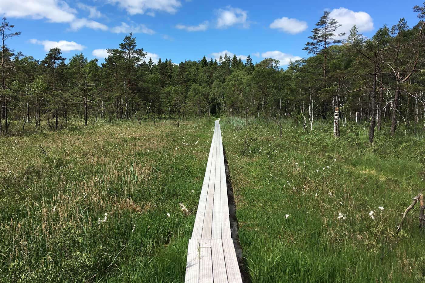
Almost halfway, the trail climbs up to the wilderness of Herrestadsfjället. Here, the hike becomes a bit more challenging. Between Metsjö and Kaserna you’ll experience woodland, cliff edges, and dreamy rural landscapes.

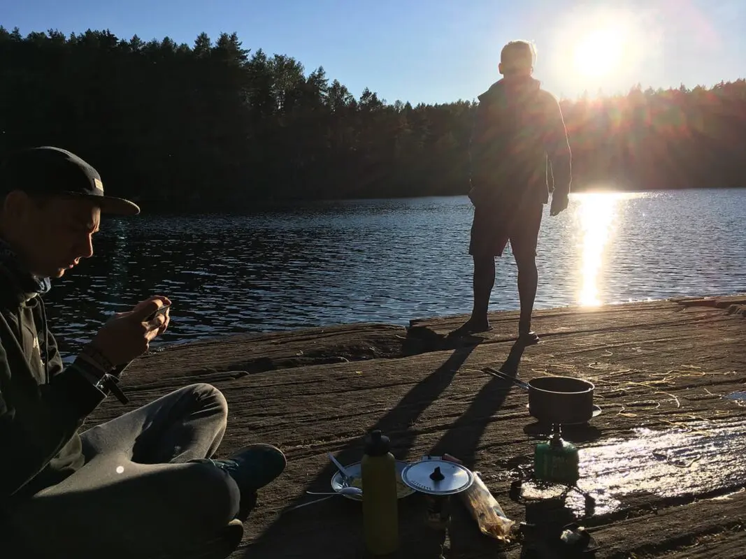
If you’re into fishing, get a Swedish fishing license for your Bohusleden hike. You can buy one online or locally, for example, in the town of Munkedal. The Örekils River along the trail is one of southern Sweden’s best fishing waters.

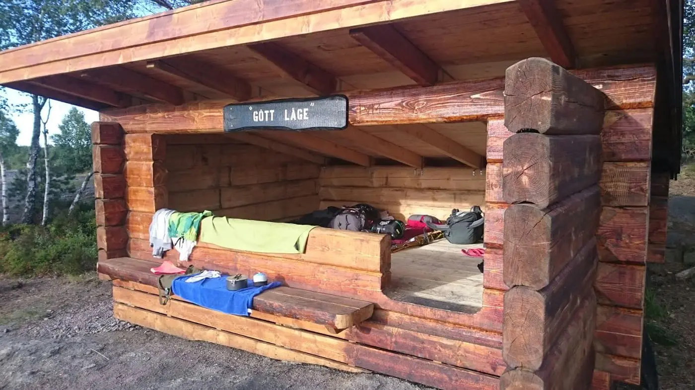
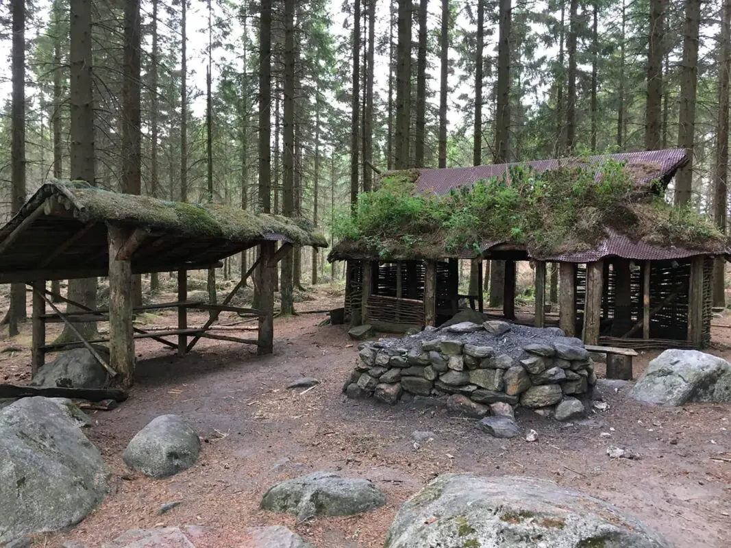
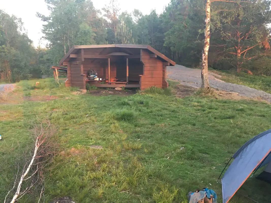
Vaktarekullen, in the middle of the wilderness, is a special area where nature from the north and the south intertwine. You come across dwarf birch or arctic kidney lichen, which are usually found way up north. Two of the best overnight spots along the trail are the cottage at Vaktarekullen and the wind shelter at Stora Holmevattnet’s southern shore.

Between Flötemarksön and Porsås the Bohusleden is not contiously marked. We recommend bringing a compass and a map or a GPS. In the District of Tanum, the Bohusleden passes Älgfallet, the highest waterfall along the trail. Cross a little footbridge to enter Norway if you wish. In this part, the scenery changes into the Tolvmanstegen, a high mountainous landscape and one of the most beautiful sections. If the weather is good, you can view the sea to the west. The Bohusleden crosses through a large wind farm here (not quite like the one on the Pacific Crest Trail).

The final and steepest part of the Bohusleden leads to Björnerödspiggen, the highest mountain of the trail, 222 meters above sea level. At the top, you’ll find an impressive Bronze Age cairn, a hut/shelter, and a BBQ area.

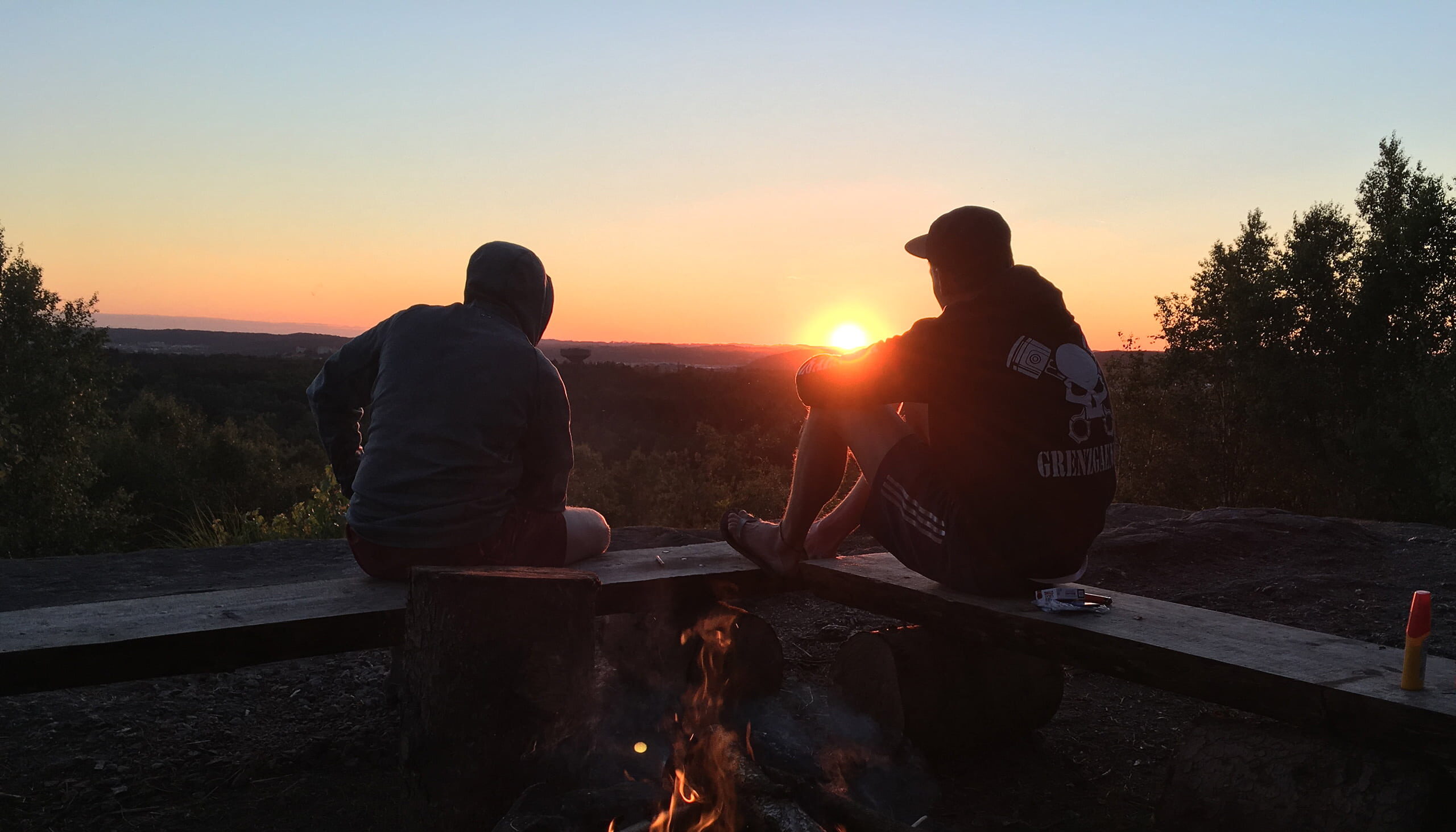
Climb the viewing tower for some impressive views and spend the night watching a beautiful sunset. On the last stretch, before the Bohusleden ends in Strömstad, hikers can explore rock carvings from the Bronze Age in Jörlov and an impressive cave. In Strömstad, you will find restaurants, hotels, shops, and public transport back to Gothenburg.

Stages

There are 27 stages official stages of the Bohusleden, offering a total of 350 km hiking trails through Bohuslän’s nature. Stretching all the way from  Älvsåker in the south, bordering to Halland, to Strömstad in the north.

Official stages

Stage 1:

Blåvättnerna – Stensjön 25 km | 15.5 mi

Stage 2:

Stensjön – Skatås 8 km | 5 mi

Stage 3:

Skatås – Kåsjön 10 km | 6.2 mi

Stage 4:

Kåsjön – Jonsered 8 km | 5 mi

Stage 5:

Jonsered – Angereds kyrka 12 km | 7.5 mi

Stage 6:

Angereds kyrka – Fontin 17 km | 10.5 mi

Stage 7:

Fontin – Grandalen 16 km | 10 mi

Stage 8:

Grandalen – Bottenstugan 8.5 km | 5.2 mi

Stage 9:

Bottenstugan – Lysevatten 12 km | 7.5 mi

Stage 10:

Lysevatten – Hasteröd 12 km | 7.5 mi

Stage 11:

Hasteröd – Vassbovik 22 km | 13.7 mi 

Stage 12:

Vassbovik – Glimmingen 12 km | 7.5 mi

Stage 13:

Glimmingen – Bjursjön 12 km | 7.5 mi

Stage 14:

Bjursjön – Metsjö 13 km | 8 mi

Stage 15:

Metsjö – Kaserna 17 km | 10.6 mi

Stage 16:

Kaserna – Borgmästarbruket 6 km | 3.7 mi

Stage 17:

Borgmästarbruket – Kyrkoryr 11 km | 6.8 mi

Stage 18:

Kyrkoryr – Kynnefjälls natur 10 km | 6.2 mi

Stage 19:

Kynnefjälls natur – Vaktarekullen 16 km | 10 mi

Stage 20:

Vaktarekullen – Flötemarksön 12 km | 7.5 mi

Stage 21:

Flötemarksön – Porsås 14 km | 8.7 mi

Stage 22:

Porsås – Nornäs 7 km | 4.4 mi

Stage 23:

Nornäs – Vassbotten 13 km | 8 mi

Stage 24:

Vassbotten – Håvedalen 19 km | 11.8 mi

Stage 25:

Håvedalen – Krokstrand 11 km | 6.8 mi

Stage 26:

Krokstrand – Högstad 13 km | 8 mi

Stage 27:

Högstad – Strömstad 15 km | 9.3 mi

Accommodations

There are several accommodation options along the Bohusleden, such as small guest houses, B&Bs, or huts with beds. Many need to be booked way in advance, and this offers you less flexibility on your hiking itinerary. This is why we recommend hiking the trail with a tent, tarp, or hammock.

The Vindskyddskartan shows you simple wooden shelters along the Bohusleden. They’re nothing fancy, just an elevated floor out of wooden planks, 3 walls, and a roof over your head – some say it reminds them of the Appalachian Trail. These shelters sleep 4-6 people, depending on how cozy you want it to be, and cannot be reserved in advance. First come, first serve. But beware, they are beloved by hikers and rodents alike. Hang your food!

Best time of the year

The best time of the year to hike the Bohusleden is in the summer months; June, July, and early August are usually sunny and warm, with temperatures reaching 25 degrees Celsius.

There’s always a chance of rain, but it shouldn’t get too cold. If you are a bit more flexible with colder nights, you can also hike the Bohusleden in late spring and early autumn.

Safety & Gear

This is a long trail, so it’s important to train for the trail and work on your physical and mental fitness before beginning. You can learn more by talking with people who have already hiked the trail, as well as from this website, and the guidebooks.

Always tell someone your hiking plans. Share details like when you expect to start and finish, your trail route, and emergency contacts. Obviously, your plans will change throughout 350 km, but giving people a rough idea of where you’ll be is helpful.

Check the weather forecast before heading out. Avoid hiking during weather warnings like thunderstorms, heavy rain, or intense heat, as these can be hazardous. Find shelter if you’re caught in weather like this!

Bring plenty of water and snacks. Make sure to pack at least two liters of water for each day and some high-energy snacks to stay hydrated and energized.

Familiarize yourself with the trail map and carry navigation tools such as a compass or GPS to help you stay on course and prevent getting lost. Bring a mobile device where you can load the GPX.

Invest in proper hiking gear. Wear supportive shoes and appropriate clothing like warm layers and a rain jacket. Use hiking poles, carry a comfortable pack, and bring essentials like maps, a GPS device, and a first-aid kit. Check out our detailed gear list for more suggestions.

Lastly, practice Leave No Trace principles. Stick to marked trails, pack out all your trash, and respect wildlife and natural areas.

Good to know

Route
Point to point
Highest point
220m (721 ft)

Want to submit a trail or make this page more complete?

Comments

Be the first one to comment on this trail!

Reply to this trail

Your email address will not be published. Required fields are marked *

Reply to this trail

Log in to comment on this trail
Always read the disclaimer

Terms of Use: important to all visitors on this website. We strive to publish high quality content and information on this website. However it’s always possible that we’re missing out on some crucial information. In spite of the fact that this route, associated GPS track (GPX and maps) were prepared under diligent research by the specified contributor and/or contributors, the accuracy of such and judgement of the author is not guaranteed. Therefore, hiking-trails.com and contributors are in no way liable for personal injury, damage to personal property, or any other such situation that might happen to individuals hiking or following this route. Should you choose to hike this trail, this is always at your own risk. Check out our guidelines for safety hiking and Leave No Trace principles at the hiking 101 page.

Download GPX

Join the community!

Login or create a FREE account 😊

With an account you can:

Download GPX files

Pin trails to your wishlist

Mark trails as hiked by you

Rate hiking trails

Comment on trails, blogs and gear reviews

Happy trails!
Login

Don't have an account yet? Register here