About the Bärentrek

Alps
country
Switzerland
length
120 km(75 mi)
Type of trail
Long-distance
difficulty

Difficulty is highly personal. Be aware of the weather conditions as bad weather turns easier trails in difficult trails especially in the mountains.

Moderate
accommodation

Lodging means a mix of hotels, hostels or AirBnB’s.

Lodging, Mountain huts
Elevation gain
7750 m(25427 ft)
terrain
Mountains
remoteness
Some of the time
Show more

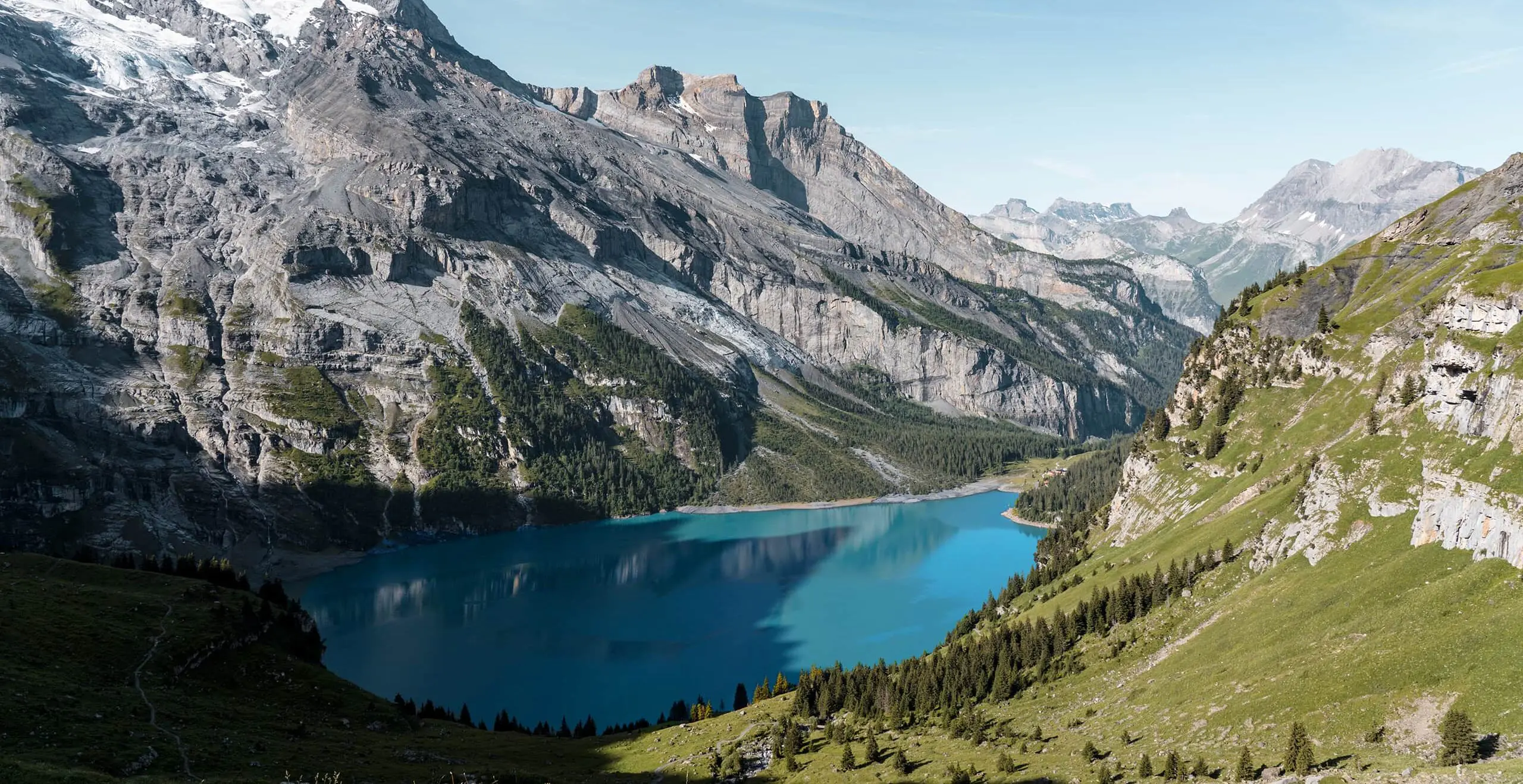
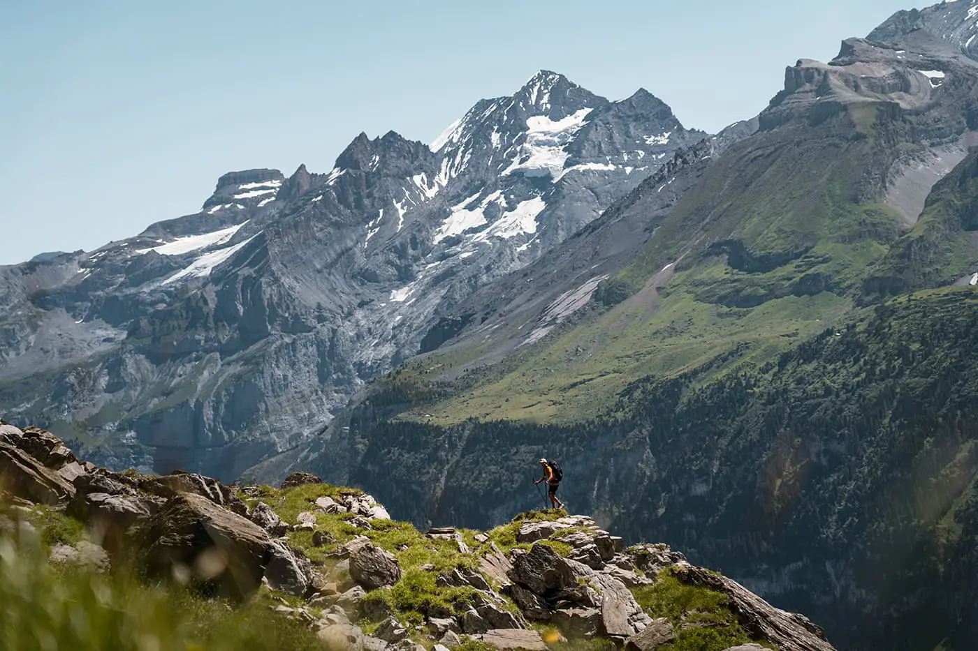
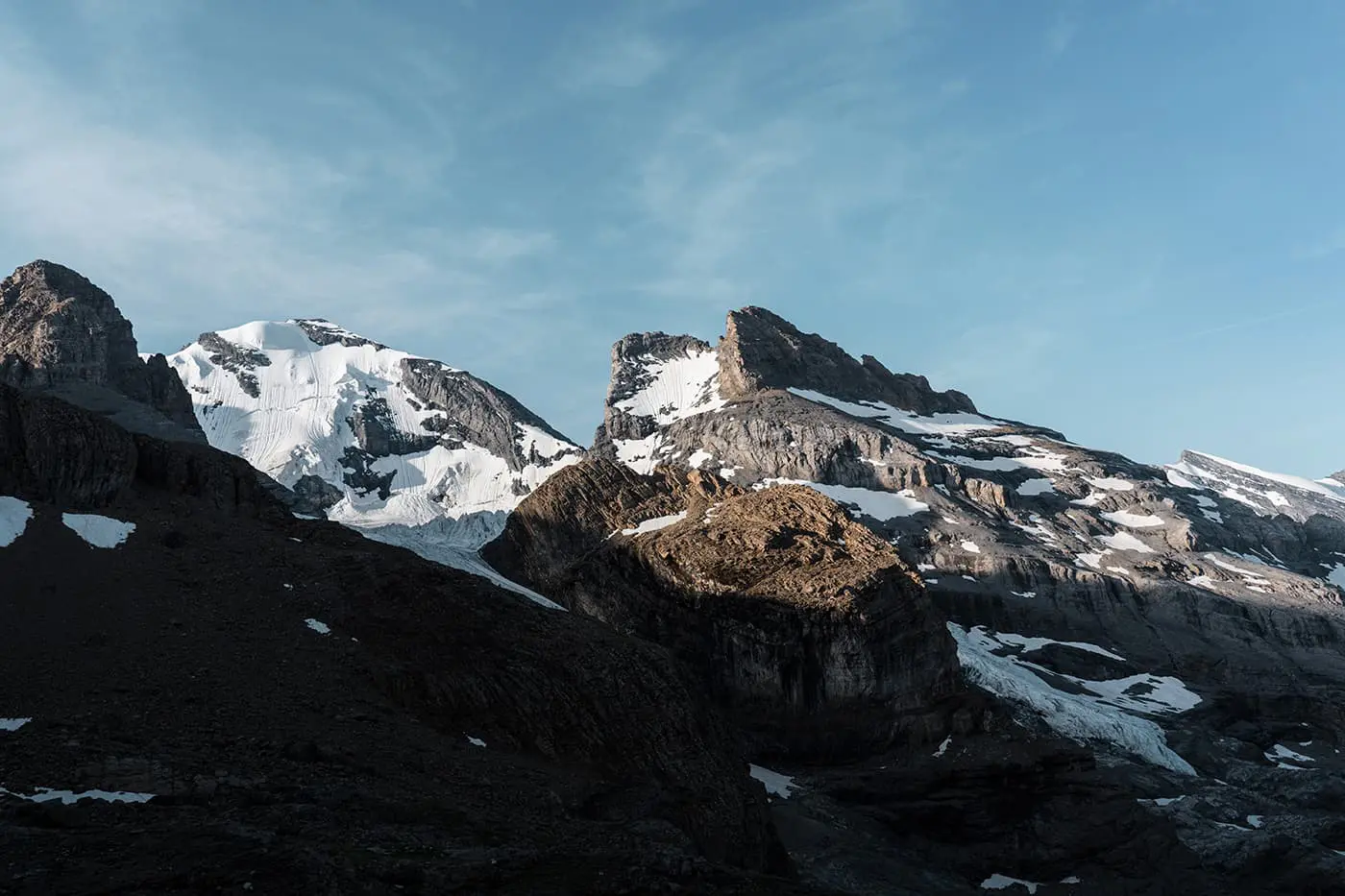
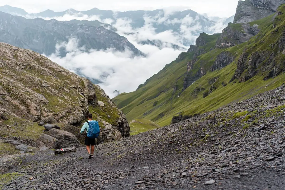
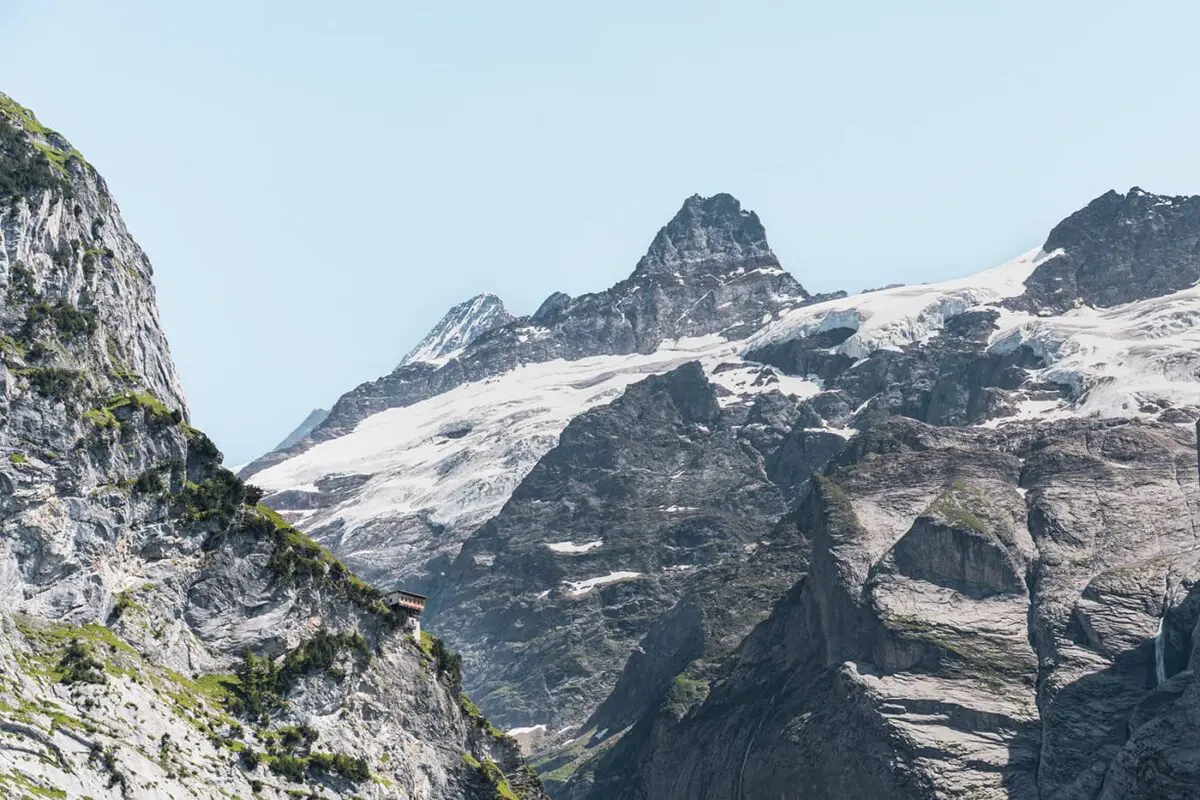
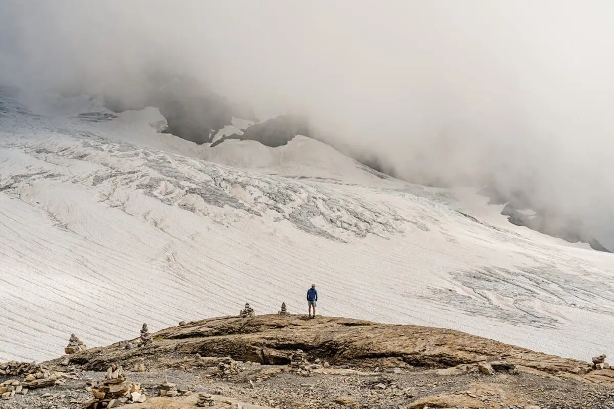
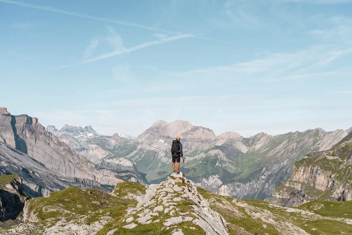
In the Jungfrau Region of Bernese Oberland, you can find one of Switzerland’s most renowned hiking trails: the Bärentrek. This long-distance trail through Switzerland’s beautiful Jungfrau Region is designed for both beginning and experienced long-distance hikers. You can complete it by staying in mountain huts and lodging along the way. This trek offers a unique opportunity to journey through some of the most spectacular landscapes the Swiss Alps have to offer, including close-up views of iconic 4000-meter-high peaks like the Eiger, Mönch, and Jungfrau.

The Bärentrek is characterized by its diverse terrain, with everything from gentle alpine meadows to difficult mountain paths. The trail passes through alpine villages like Grindelwald, Lauterbrunnen, Mürren, and Adelboden which allows you to experience the local culture and hospitality not only in the larger villages but in the small towns as well.

Editor

Elmar Teegelbeckers

Passionate hiker Elmar spends months of his time on the trail. He’s usually on the lookout for hidden gems in one of his favourite countries such as Slovenia, Switzerland and Japan. He founded hiking-trails.com in need for a community and detailed information about the trails. Before this, he worked for the Alpine asscociation in the Netherlands[ (NKBV) but lost his heart to the trails.

With this website and socials, he hopes to shape an inclusive community for hikers all over world. No matter your speed, experience or level, you can get out there to enjoy the trails and connect with the heartwarming hiking community. Life is so much better outside and he hopes to inspire hikers to take their first, or next, step on the trail.

View profile

The Trail

The Bärentrek is part of the Via Alpina 1. This almost 400-kilometer thru-hike through Switzerland and the Swiss Alps stretches from east to west, featuring a daily altitude gain of over 1000 meters. It’s a demanding hike that rewards with views of the Bernese Oberland’s four-thousanders, alpine lakes, flower-filled meadows, and panoramic mountain huts. The trail, marked from village to village, allows you to experience Swiss mountain culture, complete with local cuisine.

The Via Alpina 1 is one of Switzerland’s seven National Routes and goes through 14 Alpine passes and seven cantons, offering diverse landscapes and cultural experiences. It is part of a network of five trails across eight Alpine countries, highlighting the region’s natural and cultural diversity. Plus, in Switzerland’s normal style, you can expect well-marked trails and accommodation options, from cozy mountain huts to luxurious hotels depending on your budget.

The trail is particularly demanding during the “king’s stage,” recognized as the most beautiful yet strenuous part of the journey towards Kandersteg. The reward for this challenging day is a night at the Blümlisalp hut, perched at 2840m, which has views next to a glacier, making the strenuous journey worthwhile. The feeling of being amidst the colossal mountains is both humbling and awe-inspiring.

From here, the trail leads to Oeschinensee, an alpine lake known for its vibrant blue waters. For those seeking a shorter journey, the Bärentrek offers a condensed experience, encompassing stages 10 to 15 of the Via Alpina 1, ideal for experiencing a portion of the trail.

The Via Alpina 1 is categorized as a medium-difficulty trail. Although it doesn’t involve technical climbing, the trail’s elevation gains are both a physical and mental challenge. Please be careful with the altitudes that exceed 2000m and the quickly changing Alpine weather conditions.

Stages

You’ll have several options to hike the Bärentrek. These are the regular stages, but you can also choose to sleep in the Rotstockhutte, Gspalternhornhutte, or Blumlisalphutte. We can highly recommend staying in at least one of these mountain huts.

Stage 1:

Meiringen – Grindelwald, 23 km | 14 mi

Stage 2:

Grindelwald – Lauterbrunnen, 20 km | 12 mi

Stage 3:

Lauterbrunnen – Griesalp, 22 km | 14 mi

Stage 4:

Griesalp – Kandersteg, 17 km | 11 mi

Stage 5:

Kandersteg – Adelboden, 16 km | 10 mi

Stage 6:

Adelboden – Lenk, 14 km | 9 mi

Accommodations

When hiking the Bärentrek, you can choose between many accommodations every day. From luxury stays to more basic accommodations such as mountain huts. The stages end almost always in a mountain village where you’ll find hotels, B&Bs, and hostels. For most, you can show up and book your accommodation the day you arrive. However, for stays in the mountain huts, you’ll need to book them at least three months in advance.

Mountain huts alongside the way

Instead of staying in Lauterbrunnen, you can choose to stay at the Rotstockhütte or Gspaltenhornhütte, a bit further. Instead of staying at the Griesalp, you can stay in the Blumlisalphütte.

Best time of the year

The best time of the year to hike the Bärentrek is from late June to early or mid-September. These periods typically offer better weather in the mountains, longer daylight hours, and less chance of snow-packed trails. When you go hiking earlier in the season you may find snowfields on your way or if you go later you might end up in a snowstorm. Also, not all accommodations, especially the mountain huts, are open in the off-season.

Safety & Gear

Safety

Navigating the Bärentrek, you’ll traverse a mix of meadows and mountain passes, which means you’ll need to have a deep respect for the natural surroundings. The Alps are famous for their quickly changing weather, with clear skies that can give way to storms or rain, particularly at higher elevations.

Thorough preparation is crucial for a fulfilling hike. The Switzerland Mobility website offers valuable resources, such as trail guides, maps, and advice. These tools are essential, whether you’re mapping out your daily journey or searching for places to stay along the path, making for a safe trail experience.

Essential Gear

Remember to pack your hiking boots with a reliable grip. Dress with a layering strategy allows you to adapt to fluctuating temperatures and weather conditions. Begin with a moisture-wicking base layer, add an insulating layer for warmth, and complete your ensemble with a waterproof and windproof outer layer for protection against the weather. Don’t forget to pack a down jacket to stay warm during the brisk mornings and cool evenings.

Good to know

The Bärentrek is a physically demanding hike. The trails are mostly not too technical, only some parts are more difficult. However, you often walk in alpine terrain, frequently above the tree line, and nearly every day you cross a mountain pass. Prepare physically and be alert to rapidly changing weather conditions in the mountains by keeping an eye on the weather forecast.

Route
Point to point
Highest point
2778m (9114 ft)

Want to submit a trail or make this page more complete?

Comments

Be the first one to comment on this trail!

Reply to this trail

Your email address will not be published. Required fields are marked *

Reply to this trail

Log in to comment on this trail
Always read the disclaimer

Terms of Use: important to all visitors on this website. We strive to publish high quality content and information on this website. However it’s always possible that we’re missing out on some crucial information. In spite of the fact that this route, associated GPS track (GPX and maps) were prepared under diligent research by the specified contributor and/or contributors, the accuracy of such and judgement of the author is not guaranteed. Therefore, hiking-trails.com and contributors are in no way liable for personal injury, damage to personal property, or any other such situation that might happen to individuals hiking or following this route. Should you choose to hike this trail, this is always at your own risk. Check out our guidelines for safety hiking and Leave No Trace principles at the hiking 101 page.

Download GPX

Join the community!

Login or create a FREE account 😊

With an account you can:

Download GPX files

Pin trails to your wishlist

Mark trails as hiked by you

Rate hiking trails

Comment on trails, blogs and gear reviews

Happy trails!
Login

Don't have an account yet? Register here