About the Aurlandsdalen

country
Norway
length
53 km(33 mi)
Type of trail
Hut to hut, Long-distance
difficulty

Difficulty is highly personal. Be aware of the weather conditions as bad weather turns easier trails in difficult trails especially in the mountains.

Moderate
accommodation

Lodging means a mix of hotels, hostels or AirBnB’s.

Mountain huts
Elevation gain
1102 m(3615 ft)
terrain
Mountains, Forest, Hills
remoteness
Some of the time
Show more

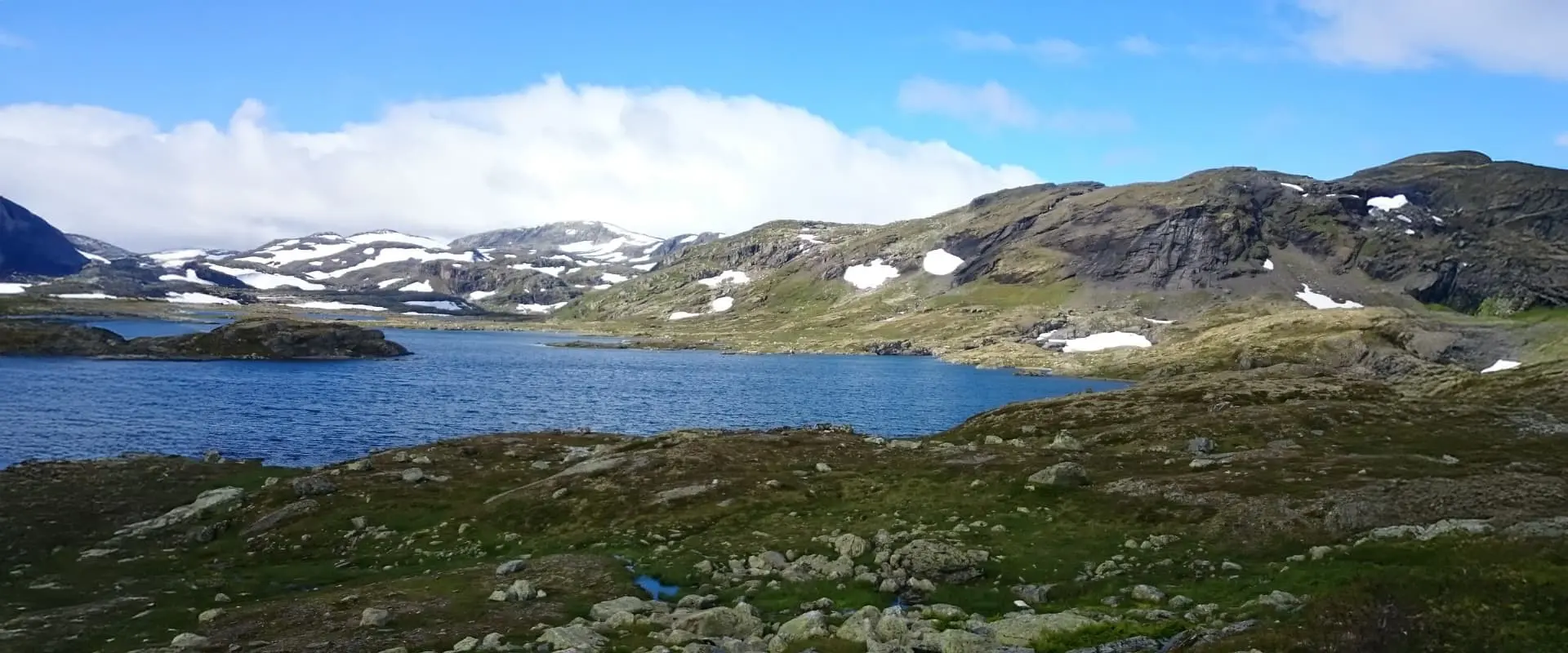
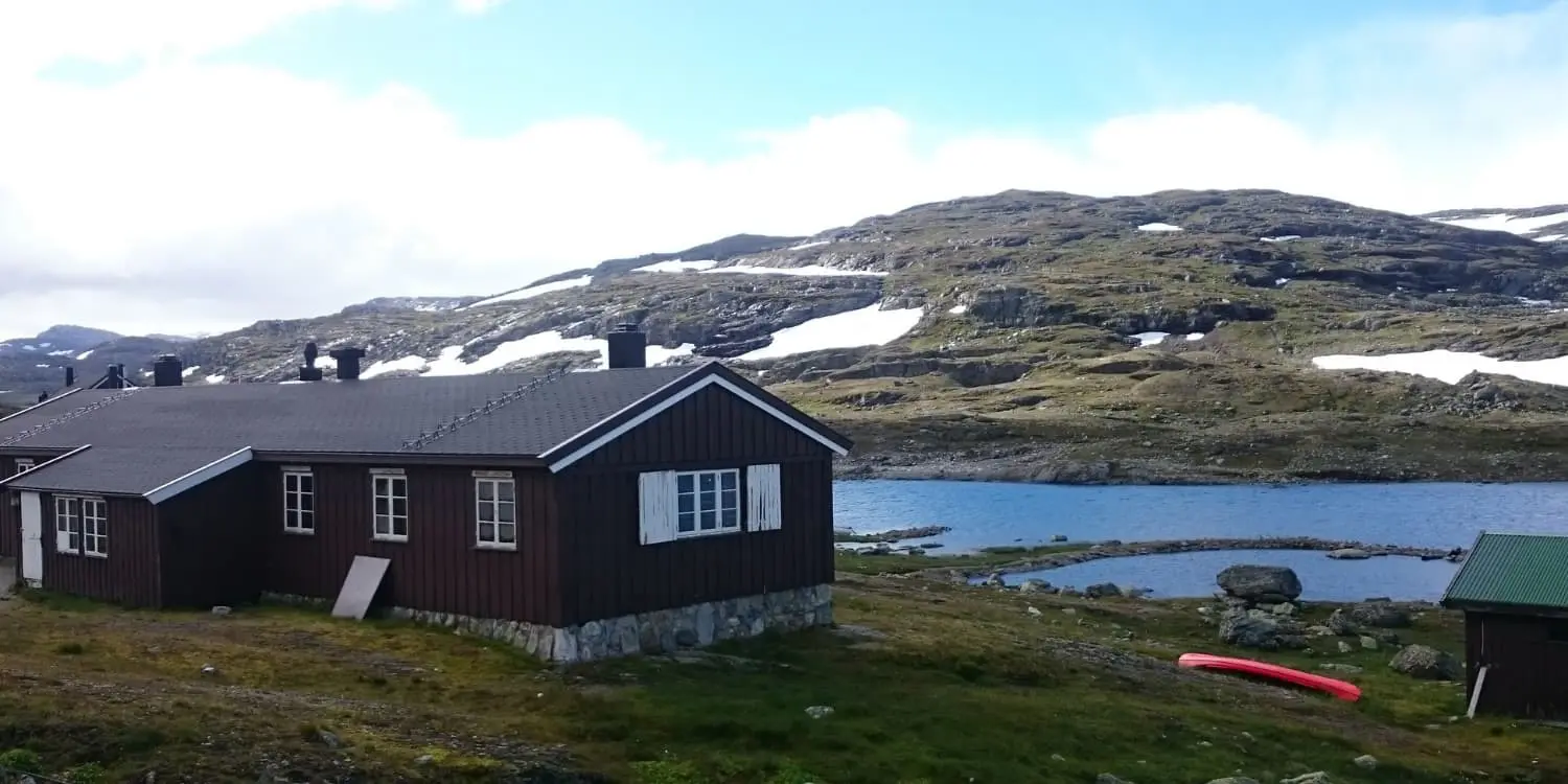
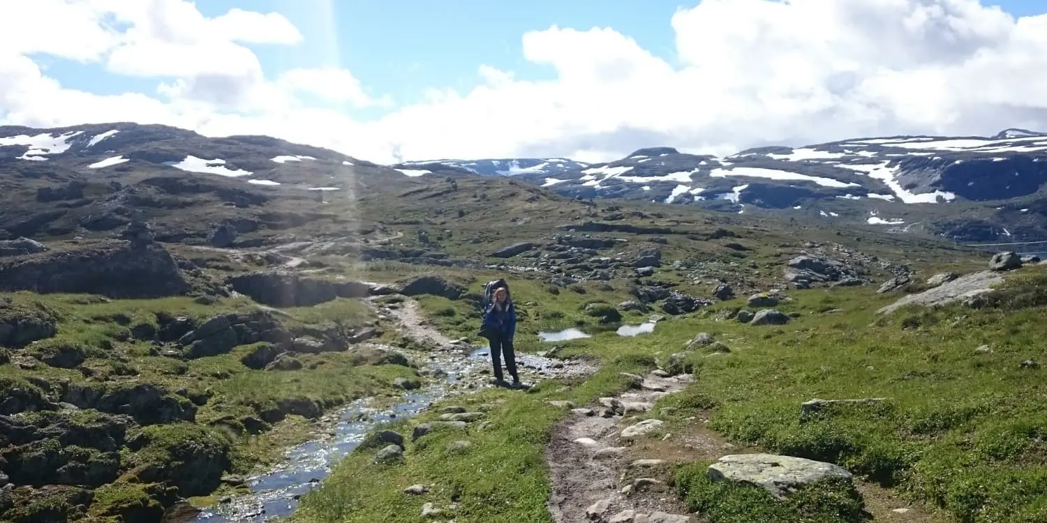
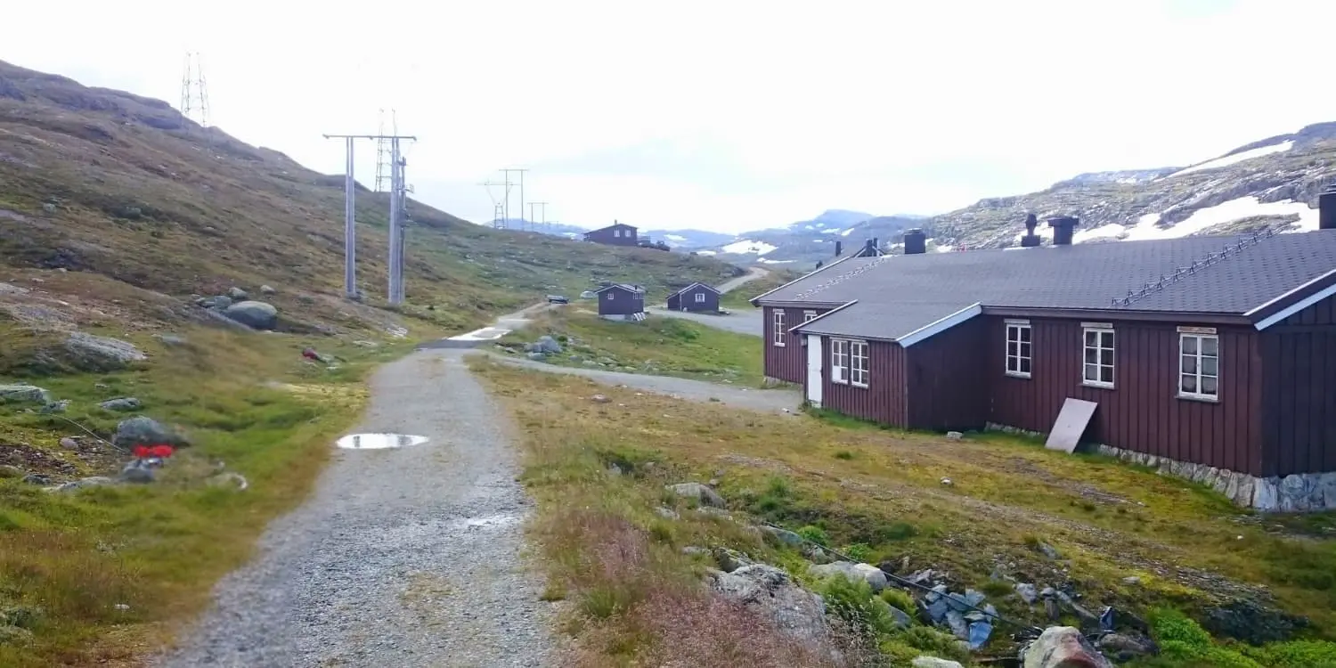
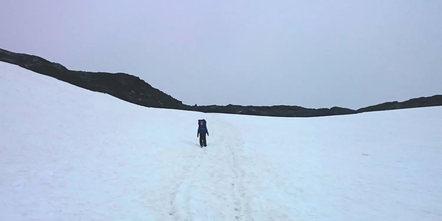
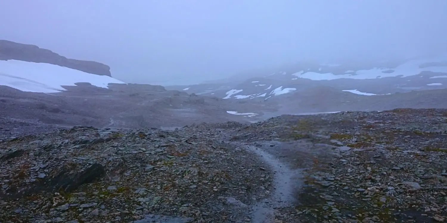
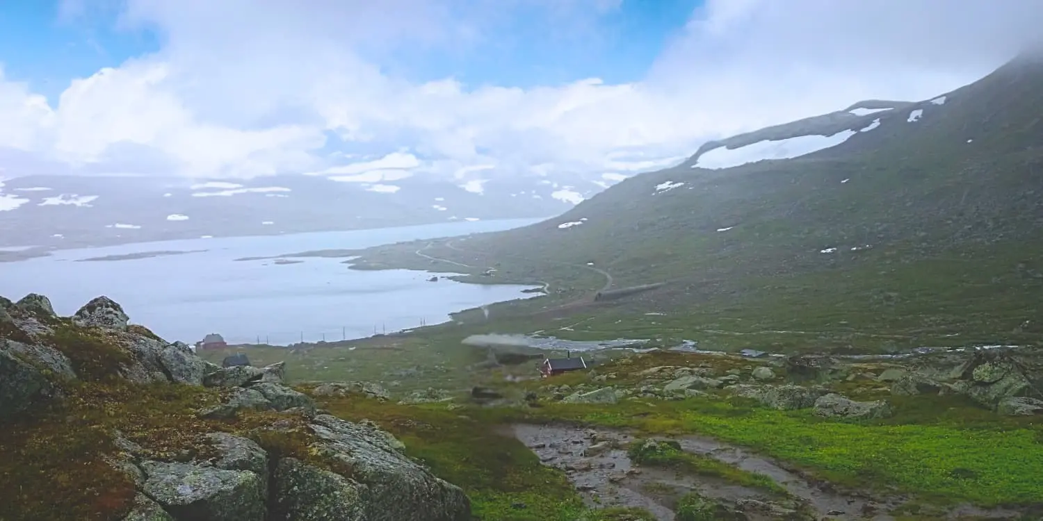
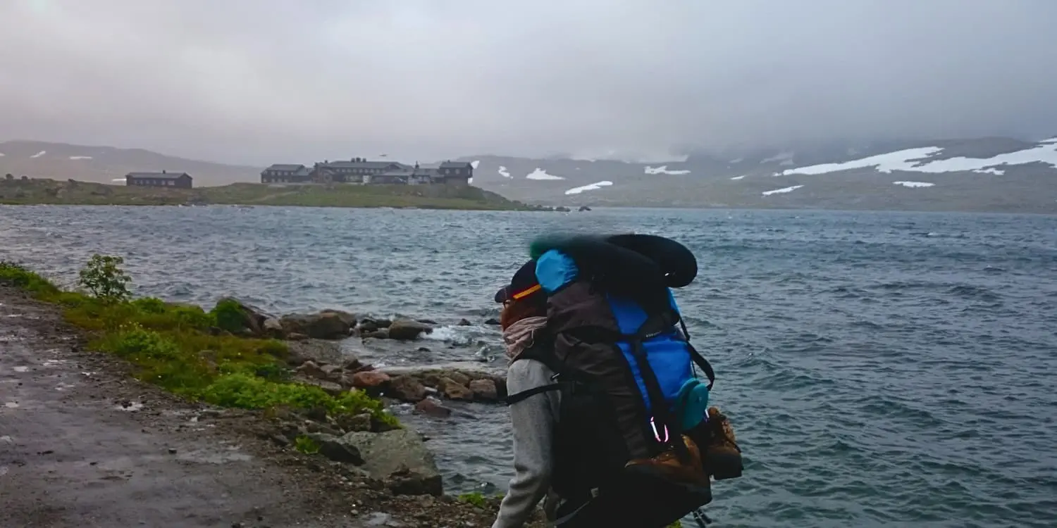
The Aurlandsdalen is a narrow glacier valley that runs for 40 kilometers in Western Norway. This route was formed many years ago as the fastest connection to drive cattle from western to eastern Norway. Nowadays the Aurlandsdalen takes you through glacier plateaus and narrow paths full of leafy vegetation to huts run by the DNT (Norwegian Tourist Association).

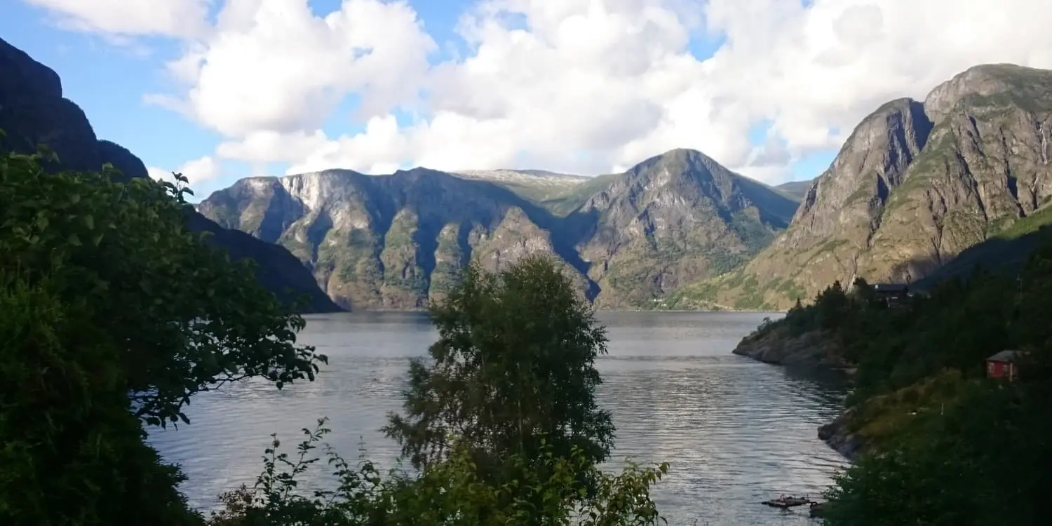
Follow the iconic red “Ts” for a truly scenic hike that follows several rivers to meet the Sognefjord. The trail is 50 kilometers long and runs in 4 stages through the entirety of the Aurlandsdalen valley.

Irene Fernandez profile picture

Irene Fernandez

Irene Fernandez grew up in Spain in a region with nearly 0 mountains. So, when she got a taste of the mountains at age 19, she discovered a whole new world. With a 9-5 as marketing manager, she spends her free time bookmarking routes and planning getaways to “touch grass.” Few things make her happier than getting to an Austrian mountain hut after a long hiking day and ordering a weissbier and a brettljause.

View profile

The Trail

The trail begins in the secluded Finse, which is only reachable by train. The train ride alone will set the mood for the adventure to come in the glacial area. Many people book an overnight at the huge Finsehytta before starting, which will allow for an early start on your first walking day. On a clear day, during the ascent from Finse, you’ll see spectacular views over Hallingskarvet National Park and even Jotunheim. The perfect reward for a challenging walk in icy conditions. You will also pass several hunting shelters on your way to the cozy Geiterygghytta, known as the gate to Aurlandsdalen.

You’ll spend the second stage hiking across large grazing areas, ascending to find the Rossdalen Lake, crossing an aluminum bridge, and pushing on another ascent until you find the Breibakka River. Leaving the last remains of snow behind, you’ll cross the wooden bridge and descend, following the curve of the valley that starts forming next to the path. The road here then will bring you to the privately owned Steinbergdalshytta where you’ll spend the night.

Your third day leaves Steinbergdalshytta to continue following the river and its several water preserves. With many short zig-zag descents and ascents, you will leave the rocky landscapes and pass a grassy valley before getting into forested areas. At the end of the day, the choice of where to sleep is between the DNT-owned Aurlandshytte or the private ØsterbÞ Fjellstove where private cottages are available.

The fourth and final day is known as one of the most beautiful hikes in the region. The solitude of the first days will disappear as you descend into the valley and run into many day hikers who will be exploring the valley from Vassbygdi, your final destination for the day. On the way, you will come across lush plant life, summer flowers, and waterfalls. There are also several pit stops at different summer farms like Sinjarheim. If you’re not ready to be done yet, there is an option to take a bus from Vassbygdi to the base of the fjord in the touristic Flam. This is a great place to dive into Viking culture and visit the Borgund stave church, one of the most beautiful stave churches that dates back to 1200 AD. From the Flam train station, you can then catch a ride to either Oslo or Bergen.

Stages

The trail is normally hiked in 4 days, with not many hiking detours or alternatives available to shorten or expand the route. The trail follows the marked red “Ts.”

Aurlandsdalen 4-day itinerary

Stage 1:

Finse – Geiteryggshytta, 15km | 9.3 mi

Stage 2:

Geiterygghytta – Stemmerdalen, 10km | 6.2 mi

Stage 3:

Stemmerdalen – Østerbþ, 10km | 6.2 mi

Stage 4:

Østerbþ – Vassbygdi, 18km | 11.2 mi

Accommodations

This trail is well-serviced with DNT-run and private huts. You’ll find that it’s necessary to book in advance, especially in the summer months. The DNT huts have special prices for DNT members for both lodging and food. Half board is provided in all huts, but you are welcome to use facilities to prepare your own mountain food if you prefer. The beds provided are in shared bunk rooms. Toilets are usually shared and outside, and the huts have dry rooms available for overnight storage of your wet gear.

Along the way, you will also find DNT emergency shelters that open with a DNT-issued key available to members. These are unstaffed self-service huts with facilities that range from a simple roof above your head to a small cooking setup.

Before starting the trail you can stay overnight at the Finsehytta hut.

Accommodation per stage

Stage 4:

Several B&Bs or camping options in FlÄm before moving onward to Oslo or Bergen

Best time of the year

The best time of the year to hike the Aurlandsdalen is in summer through early September. The first stages of the Aurlandsdalen are through a glacier valley, so snow is present all year round. Rain and mild snowfall are no strangers to Norwegian summers.

The weather can change rapidly and a sunny morning can turn into a rainy afternoon. Luckily all huts are equipped with dry rooms to help you start the next day with a dry pair of socks. Always check the forecast before starting the day or consult with the hut warden, especially for the first two stages.

Safety & Gear

Good rain gear is a must for this hike, as the weather is truly unpredictable. For the first and second days, sturdy walking boots and walking sticks will keep you in balance in the icy conditions. A pair of micro-spikes or boot chains will also help in these conditions.

Navigating the route is easy using downloaded GPX, the official DNT maps, and the red “T” trail markets along the way. Keep your eyes peeled for these iconic marks, especially on wide stretches of ice and grazing areas.

Difficulty

The Aurlandsdalen is rated as moderate because it combines easy, broad paths with narrow gravel trails, and rocky and icy broad passages on the first and second days. These passages are short, but nonetheless, a good grippy walking shoe and walking sticks are musts.

You can train for the Aurlandsdalen by taking long hikes or walks with your full backpack, which is a great way to build strength and endurance. If you want to really prepare for anything, you can try taking these hikes in rainy or cold weather and only walk on uneven ground. This will help with your balance and mimic the conditions of the trail better.

Good to know

The Aurlandsdalen is only accessible in the summer months, with many hikes opening only as the weather softens. Check the opening times with every hut and make sure you book a bed when possible. While the huts have some supplies for sale, it is recommended that you bring your own snacks and preplan your meals. Check in advance if the hut will be serving half board on the dates you are there. The last stage of the hike is very popular for day hikers, so make sure to enjoy the solitude of the first days.

route
point-to-point
highest point
1646m (5400 ft)

Want to submit a trail or make this page more complete?

Always read the disclaimer

Terms of Use: important to all visitors on this website. We strive to publish high quality content and information on this website. However it’s always possible that we’re missing out on some crucial information. In spite of the fact that this route, associated GPS track (GPX and maps) were prepared under diligent research by the specified contributor and/or contributors, the accuracy of such and judgement of the author is not guaranteed. Therefore, hiking-trails.com and contributors are in no way liable for personal injury, damage to personal property, or any other such situation that might happen to individuals hiking or following this route. Should you choose to hike this trail, this is always at your own risk. Check out our guidelines for safety hiking and Leave No Trace principles at the hiking 101 page.

Download GPX

Join the community!

Login or create a FREE account 😊

With an account you can:

Download GPX files

Pin trails to your wishlist

Mark trails as hiked by you

Rate hiking trails

Comment on trails, blogs and gear reviews

Happy trails!
Login

Don't have an account yet? Register here