About the Annapurna Base Camp Trail

Himalaya
country
Nepal
length
110 km(68 mi)
Type of trail
Long-distance
difficulty

Difficulty is highly personal. Be aware of the weather conditions as bad weather turns easier trails in difficult trails especially in the mountains.

Moderate
accommodation

Lodging means a mix of hotels, hostels or AirBnB’s.

Lodging, Mountain huts
Elevation gain
8400 m(27559 ft)
terrain
Mountains, Forest, Hills
remoteness
Some of the time
Show more

The Annapurna Base Camp trail! Often considered as “the easiest” trail of the Himalayas, due to the easy access to the start, maintained and clean trail, wide availability of teahouses, and overall comfort of the accommodations, this is indeed quite clean and one of the easiest in terms of organization, planning, and resources. However, the Annapurna Base Camp trail is not to be underestimated in terms of effort as it requires quite a good fitness level, as you’ll have a lot of elevation changes, sometimes spending the whole day going up and down stairs, to reach in the end the same altitude as when you started. It is quite a workout but also has accessible and maintained trails, so it can be done by mostly anyone used to hiking or with enough preparation.

black and white portrait photo
Author

Jérôme Servais

Jerome left everything he had behind in Belgium ten years ago and after a long trip reached Southeast Asia where he lived there for a couple of years. From Vietnamese rice terraces to Borneo’s deep jungles, from Mount Fuji to the Everest base camp, he hasn’t stopped moving since, always looking for new challenges and seeing as many wonders as he can. You can discover his photographer’s work and follow Jerome on Instagram here: @jerome_srv

View profile

The Trail

In the past, people used to start the Annapurna Base Camp trail in Nayapul or Birethanti, but the construction of a new dirt road leading to Ghorepani made it possible for most hikers to start from there way higher, as it is the last village accessible by jeep from Pokhara through a rough dusty teeth-grinding road as Nepal is infamous for.

Also, you can reach Ghorepani by foot from the old Annapurna circuit trek in Tatopani. From there, Ghorepani still feels like a tourist hub with slightly higher prices for day hikers that just come to the Poon Hill viewpoint and then head down back to Pokhara. Poon Hill requires a ticket to climb up, but you will see way better viewpoints if you hike the ABC trek, as soon as you reach Deurali Pass a few kilometers after the start of your trek, and it offers similar views for free. After Deurali Pass, you will go down through what feels like a series of mildly thick jungles, with river waterfalls and huge elevation drops and climbs as you go through a few river canyons. This part of the forest can be very warm and humid so hike in something light or synthetic as you will sweat a lot. You’ll then reach the village of Tadapani, which offers incredible views of the next valley you will explore, with the Annapurna South summit and the beautiful Macchapuchre, also called “fishtail” due to its recognizable shape. After that, you will keep going down, and soon reach the lowest elevation in Chomron, the biggest village in the region after Ghorepani. This village sits on a cliff, one side towards India, one side towards the Annapurna. The first side has more sun, but the second one has a better view. I recommend staying at the top, towards the International Guesthouse, because after that the village goes down quite deeply and the bottom is colder due to less sun and the river.

After that, you will go down the steep and high steps of the village, find the mandatory ABC checkpoint office, most likely a friendly orange seller, and start going higher and higher from there. However, you will not be done with stairs, and it can become very heavy on your knees and thighs so take it easy and stretch and rest enough. You will then go up through the last rice terraces beautifully carved in the cliff and go more and more towards the river gorge. From Sinuwa you will start to enter the canyon created by the river fed by the glacier and will follow the same unique path towards ABC.

From here you can decide to make a stop halfway between Chomrong and ABC, either in Bamboo, Dovan, or Upper Dovan, depending on your pace, energy, and level. These three places are quite similar as they seem built purposefully for welcoming hikers or porters, but yet do feel like a small village. If you want to take your time, you can hike up in three days, a lot of options on where to sleep between Chomrong and ABC can create different schedules. Try to calculate it depending on which time or part of the day you want to be at ABC, if you just want to go to the top and back on the same day and sleep at a lower altitude, or sleep on the camp at night (which I strongly recommend), depending of your level of fitness and acclimatization.

After Dovan and the million stairs, you will go progressively more into the wilderness and once you reach Deurali (3200m) the last “village”, you will have proper rugged mountain terrain with little vegetation. This part climbs up quite a lot but tends to be more progressive and less steep than before, with only one or two major hills to climb. On top of the canyon, you can find the Machhapuchhre base camp, at 3700m and you can sleep there if you don’t feel like pushing to ABC (4120m), as this last push can stretch an already long day and you will tackle the most difficult part in terms of level of oxygen, cold and lack of light. However, I remember leaving Upper Dovan at around 9 and making it to ABC for 4 PM, but the sun was setting, so going all the way up for the night is doable but I would recommend it only if you are already acclimatized and fit. This part is undeniably the most beautiful as you will keep going up side by side with the glacier’s moraine of Annapurna, and will be surrounded by Macchapuchre behind you, and some of the most noticeable Annapurna range summits in front of you. The ABC lodge has something quite special in itself by its location and history, and take the time to explore the monuments of hikers and Maurice Herzog’s statue behind the camp. In front of the camp, facing Machhapuchhre, it is an incredible spot to observe stars at night if you are lucky and have warm clothes.

From there, it’s only going down, you will go back by the same trail you came from, but it will show you a very different perspective than when you hiked up before. Going down is faster, and you can reach Bamboo from ABC in one day. After, you can stop in Chomrong again, and either keep going back towards Ghorepani, but most people can now catch a jeep in Ghandruk. For this, you can ask your local teahouse, and from Chomrong, only walk to Jinhu then the longest suspended bridge in the region towards Ghandruk. The state of roads and availability of jeeps or buses for transport can vary from one season to the other, but word is going fast most guesthouses even in Pokhara or Kathmandu will be able to advise you better once you get there.

Stages

You can trek the Annapurna Base Camp in 7 to 12 days, most hikers choose these 7 stages to complete the Annapurna Base Camp trek. Make sure you acclimatize and take it slow on these high altitudes.

Stages Annapurna Base Camp

Stage 1:

Ghorepani – Tadapani, 13 km | 8 mi

Stage 2:

Tadapani – Chomrong, 13 km | 8 mi

Stage 3:

Chomrong – Dovan, 12 km | 7.5 mi

Stage 4:

Dovan – Annapurna Base Camp, 16 km | 10 mi

Stage 5:

Annapurna Base Camp – Bamboo, 17 km | 10.5 mi

Stage 6:

Bamboo – Chomrong, 11 km | 6.8 mi

Stage 7:

Going back to catch a jeep from Ghorepani (2 days) or Jinhu/Gandruk (next to Chomrong)

Accommodations

Most tea houses along the Annapurna Base Camp trail look the same past Chomrong, as it almost feels like some “villages” were just built a few years ago especially to accommodate hikers and porters on their way to ABC. They provide cheap accommodation, which can be negotiable if you are in a lower season or end of the season. The maximum you’d pay would be 1000-1500 rupees per night. Some guesthouses can decrease prices if you suggest eating dinner and breakfast in their home. Most of the rooms consist of two single-person beds, with a plug, a light, and a table. It is more comfortable than it seems and they are usually surprisingly clean. Pro-tip is to spot the guesthouses that have a fireplace or an oven and try to avoid the first houses you encounter at the entrance of a village, as they tend to be more crowded, and those further down the village will welcome you more warmly with probably cheaper options and potential to negotiate.

Locals are very friendly and they will not mind if you wander around a bit before finding the perfect teahouse for you. Some offer hot showers, or at worst a bucket of hot water, sometimes with a fee of a hundred or more rupees. Near the end of the hike, there are only two options to sleep, the Machhapuchhre base camp, and the Annapurna Base camp. My favorite one was the International Guesthouse in Chomrong, where I stayed twice because of the most amazing hot shower of all the Himalayas.

Best time of the year

Nepal has two main active seasons, each one between winter and the monsoon. The first most crowded and arguably the best time of the year to hike in the Himalayas is between September and December, and the second period ranges from April to May. The first tourist season tends to be described as the one having the most clear blue skies and the least rain with a dry atmosphere and progressively colder temperatures, but shorter days. The second period tends to be more humid, with remnants of the last winter. Still, it shows more attractive colors in the fauna as spring unveils beautiful flowers like rhododendrons and many others.

Outside of these periods, the Annapurna Base Camp trail might be either uncomfortably hot and humid in summer, or extremely cold and snowy in winter. Bear in mind that due to climate change effects in the region, over the past couple of years, the starting/ending dates tend to be more variable and each season tends to shift or linger, therefore predictions on the weather a few months/weeks prior might not follow usual trends anymore. As an example, I was still hiking in January 2023 in the Everest region, and according to locals, trails should have been covered in snow already. Also, it has been reported that a few heavy monsoon rain showers tend to still happen up until late October, enough to create flooding of river beds or even landslides in many regions of the Himalayas. From personal experience, and maybe luck, the end of November / December seems to be the best weather-wise and with fewer crowds due to being considered the “end of season”.

Prices can also be a bit bargained with tourism agencies or tea houses regarding room prices, depending on the season and tourist affluence of the moment. For instance, in Annapurna, it is easier to get a free room if you stay eating dinner and breakfast in a lodge or discount a shower if you are in low season.

Safety & Gear

Altitude

Altitude Sickness or Acute Mountain Sickness (AMS) is a medical consideration faced while trekking in the Himalayas and it is nothing to joke about. It rarely occurs at altitudes lower than 2,800m/9,186 ft., and only minor symptoms occur below 3,000m/9842ft. The sickness occurs when the body does not adjust well to the lack of oxygen at higher altitudes. The major cause of high altitude sickness is ascending to a height greater than 2,800m or 9000 ft. too rapidly. Giving the body little to no time to get used to the thinner air and lower oxygen levels triggers AMS.

The primary signifier of altitude sickness is a persistent headache. However, if not addressed in due time, it may develop into more complicated variations such as high-altitude cerebral edema and high-altitude pulmonary edema. Medicine like Diamox can be taken to help prevent symptoms. However, they are to take into consideration that they are not a cure, just temporarily help your body to acclimatize, but do not take them if you are stranded at a high altitude with severe symptoms. The only medicine is to go down on altitude as quickly as you can, and nothing else. Taking paracetamol or anything else can even worsen the effects.

It is imperative to communicate your symptoms immediately to a person in your group, a guide of another group, or a staff from the tea houses who will know what to do. Many hikers each year get surprised and get into trouble once they reach 4000m. It is recommended to not go higher than 500m in elevation compared to the elevation of the last place you slept, as it is after 6 hours at high altitude that the “discreet” symptoms can occur in your body.

Most hiking groups and guides will stop in Samagoan to have a rest day to acclimatize, however, they can advise not to if they see you fit and show no symptoms of altitude sickness, as was the case for me. There are many more detailed articles regarding AMS and its effect on the body, and it is always good to know what are the basic symptoms and how they affect the body before going to this region.

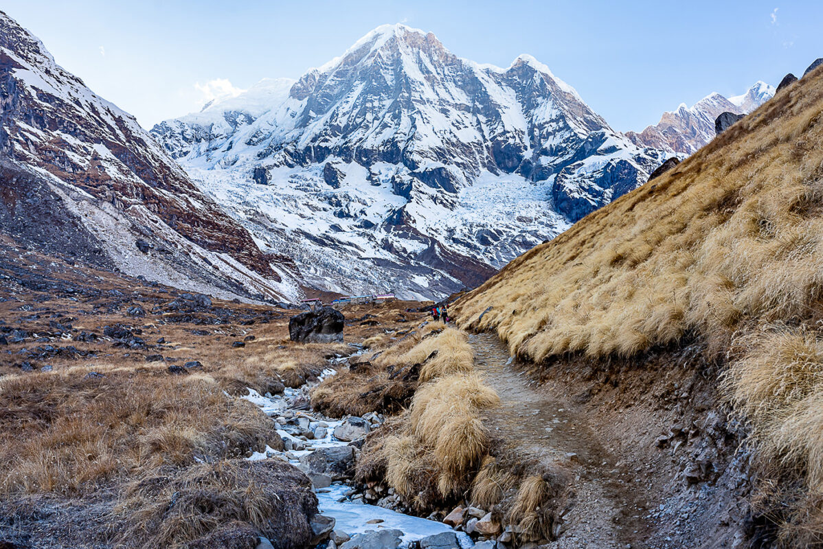
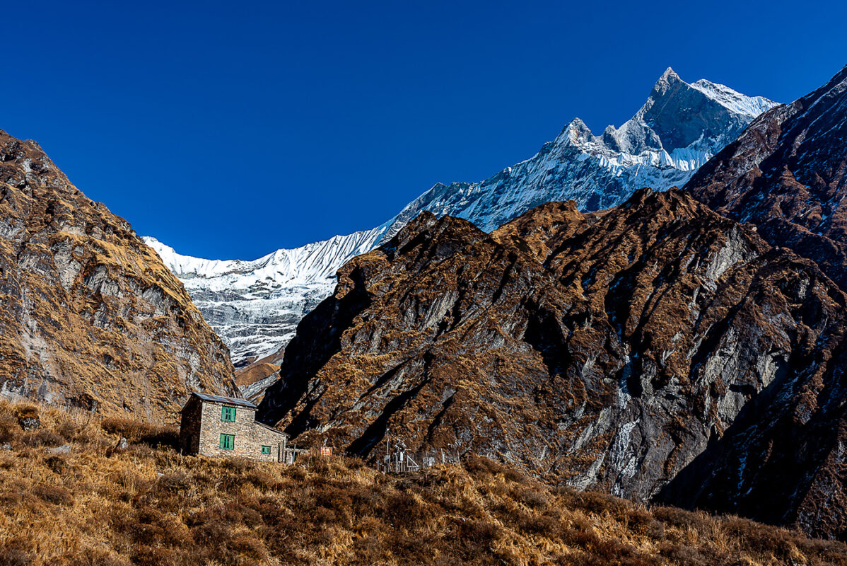
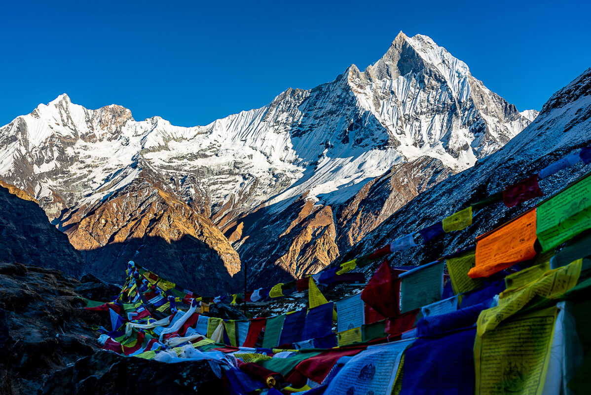
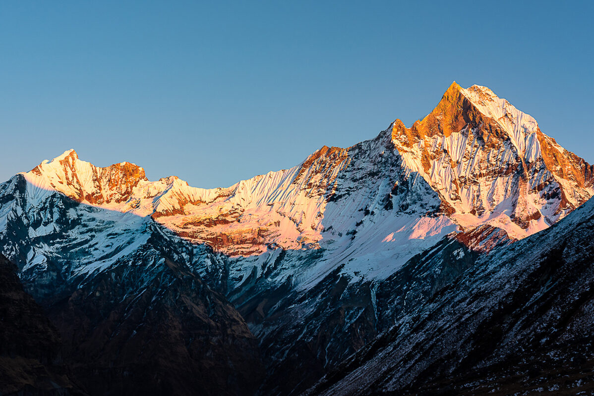
There’s a way to avoid this on this trail, if you are worried, you can decide to sleep at a lower altitude the day before the base camp (the two last accommodations are in the village of Deurali and then Machhapuchhre base camp) and hike up to the base camp, then down in the same day and not sleep at 4120m.

Cold

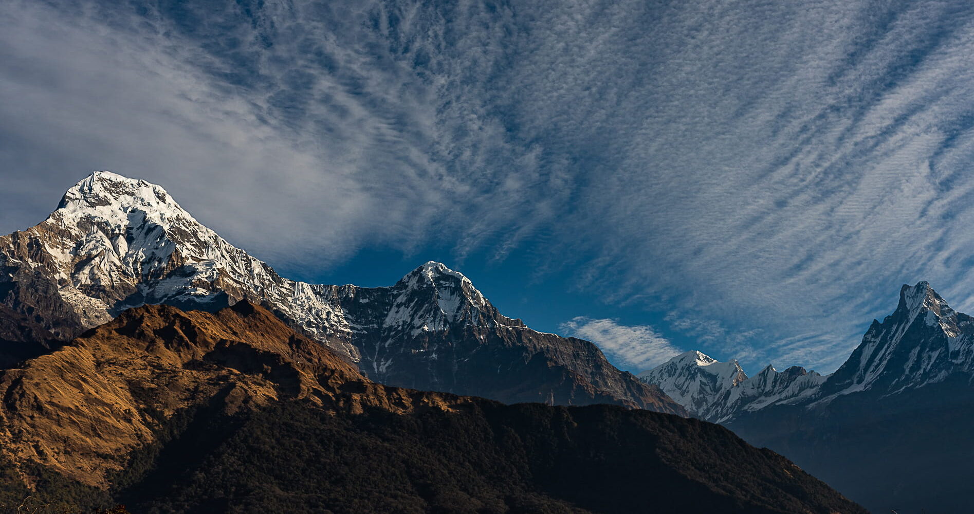
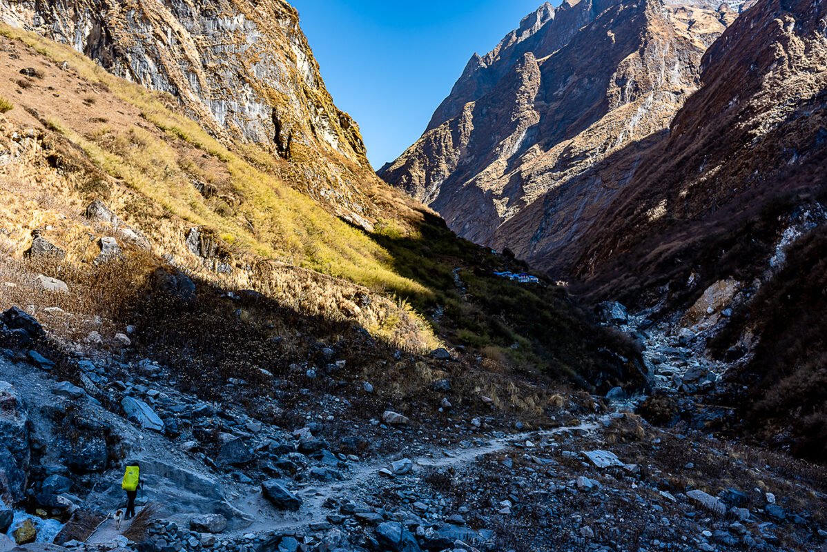
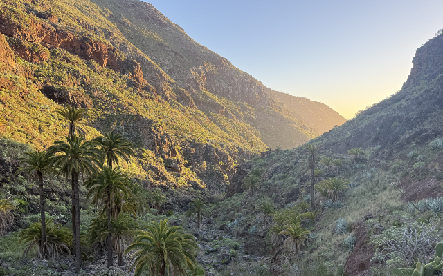
From Chomrong, you’ll progressively get colder and colder, and be careful as since you will hike inside a canyon in a south-north axis, the Sun will set behind the mountain way quicker than usual, and temperatures can drop quite dramatically very fast starting from 3 PM, it is very good practice to start hiking quite early in the morning (leaving no later than 9 AM). Starting from 3000m, it is advisable to wear proper gear for the season and not underestimate the temperatures. For instance, when I slept at the base camp, temperatures in my room were negative and it is strongly recommended to bring a sleeping bag with you, even if most lodges provide thick blankets and often fire in the kitchen area.

Recommended gear

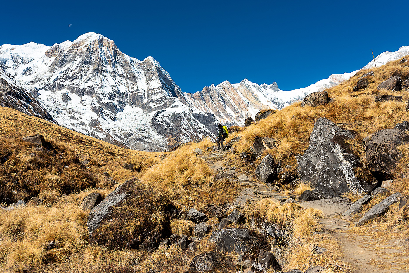
The Annapurna Base Camp trail is not very rugged except towards the end, but for the vast majority, the trail is quite wide, frequented, and overall well maintained. There’s an uncountable amount of stairs, so a pair of walking sticks can help as you will go on top, and it helps alleviate the pain on your knees when you go down as well. There’s no ice except during colder months (January-March) but if you go on other trails in the region, a pair of microspikes can be helpful. Warm clothes for the evening as rare are the rooms heated. A sleeping bag for the night, even during the warmer seasons. A system to filtrate or purify your water. You can have a lightweight backpack as long as it fits a sleeping bag, warm clothes, water, and snacks. I’ve done this trail in mid-hiking boots, but it is easily doable in trail runners as well, except if there’s snow.

All of the gear listed here can be found in all knock-off markets of Kathmandu or Pokhara. Some small gear can be replaced in some shops during the trail, but choice can be limited with higher prices. Not that they are necessary, but you can find most bookshops in Kathmandu have cheap paper maps of the region. You can pack some snacks from Kathmandu and Pokhara that will be cheaper, like nuts, snickers, biscuits, tea bags, coffee bags, honey, peanut butter, etc but the Annapurna has a nice supply chain and often you can find most of the snacks and drinks you can imagine in all the tea houses there.

Good to know

Permit cost:

  • Annapurna Conservation Area Project (ACAP Permit) 30 USD

This permit also grants you access to the Annapurna Circuit trek. It can be bought for 3000 NRP without the help of a tourist agency at the Tourist Service Centre and the Department of National Parks and Wildlife Conservation in Kathmandu, as well as The Annapurna Conservation Area Project (ACAP) office in Pokhara. It will not be difficult to obtain and every guesthouse in Kathmandu will be able to direct you. They can also be bought on the spot when you enter the national park, but it’s more expensive. Be prepared to have 2 passport pictures when you apply for each permit (if you require more permits later, you will also need to bring more pictures, and they are more expensive to be made on the spot). It used to be recommended to also get a TIMS card (hiker’s ID) in Kathmandu, but it’s now rarely recommended nowadays as even tourist agencies will advise you not to waste your money on it, and during my 46 days in the Himalayas, nobody ever asked me to show it. However, tourism laws and politics can change quickly each season, so always double-check this information with your agency or official sources. This permit is to be kept with you at all times, and to be able to show them at control checkpoints (one in Ghorepani and one in Chomrong).

Water and food

Every village I passed on the Annapurna Base Camp trail had a water fountain (except base camps) and water was widely available, but that can change a little bit depending on the seasons. It’s well recommended to have your own filtration or purification system to avoid buying plastic bottles of water and possible water contamination. Water in the area (taps and fountains) is from the mountain and unfiltered. I used a filter like Platypus, but chlorine tabs work well, are cheap, and are widely available in Kathmandu’s pharmacies. Always take water from moving water as lakes in the areas are heavily sedimented and can clog filters faster.

Food in teahouses is usually very good, quite filling, and calorie-heavy, but the price increases proportionally to the altitude. I strongly recommend trying local food, like the famous dal bhat (rice and lentil curry) which provides everything you need for a full day of hiking or to recover from it, and locals will swear by it as they eat it every day. Every guesthouse has its recipe, which can vary from passable taste to the most exquisite flavors. You can also try momos (stuffed dumplings, steamed or fried), and many other Tibetan or Indian-influenced dishes, to combine with masala chai tea. If you can find a place that makes Snickers-roll, you have to try it (after you finish your hike). The guesthouses are very resourceful, and some pizzas aren’t that bad either.

Remoteness

Peak time on the Annapurna Base Camp trail can be quite busy and can lead to overcrowded trails and villages before ABC, but rare shortages of accommodation space from what I’ve heard. If it’s busy (especially with large groups), try to hike a little bit ahead of them to be able to have more options for accommodation at the end of the day. The nature is quite wild and remote, however, you can see human influence up until Deurali at least and the trail is very clean and well maintained overall.

Local wildlife

Some gray langurs can be seen between Chomrong and Bamboo. They are completely wild and often hang out in villages not so far from human activity. If you see them on the trail, they can throw small branches at you, so be wary of their presence. It is rare to see mules and yaks here compared to other regions of the Himalayas. However, a good practice is to always position yourself the furthest away from the cliff when passing or crossing a beast of burden. As they are loaded “on their side” with gas canisters, rice bags, and more, they are not aware of their real width and can push people towards cliffs when they walk next to them. You will see quite a few eagles and birds of prey and can hear marmots whistling sometimes.

Packages

Many tourist agencies in Kathmandu or Pokhara offer packages (jeep + guide + porter + anything else) and do not hesitate to ask to personalize what you want. It is not necessary to have a porter unless you have a large group or a family for example. Many agencies offer tours that are similar and prices can always be haggled. I have also done it without a guide, however, I am not sure if the regulations have changed regarding the possibility of doing it solo now, so check upon your arrival. Also, keep in mind anything tour or trip bought online before arrival in Nepal will be double or triple the price of any tour you can get here.

Route
Start to summit and back
Highest point
4100m (13450 ft)

Want to submit a trail or make this page more complete?

Comments

Be the first one to comment on this trail!

Reply to this trail

Your email address will not be published. Required fields are marked *

Reply to this trail

Log in to comment on this trail
Always read the disclaimer

Terms of Use: important to all visitors on this website. We strive to publish high quality content and information on this website. However it’s always possible that we’re missing out on some crucial information. In spite of the fact that this route, associated GPS track (GPX and maps) were prepared under diligent research by the specified contributor and/or contributors, the accuracy of such and judgement of the author is not guaranteed. Therefore, hiking-trails.com and contributors are in no way liable for personal injury, damage to personal property, or any other such situation that might happen to individuals hiking or following this route. Should you choose to hike this trail, this is always at your own risk. Check out our guidelines for safety hiking and Leave No Trace principles at the hiking 101 page.

Download GPX

Join the community!

Login or create a FREE account 😊

With an account you can:

Download GPX files

Pin trails to your wishlist

Mark trails as hiked by you

Rate hiking trails

Comment on trails, blogs and gear reviews

Happy trails!
Login

Don't have an account yet? Register here