About the Alta Via Del Granito

Dolomites
country
Italy
length
29 km(18 mi)
Type of trail
Hut to hut, Long-distance
difficulty

Difficulty is highly personal. Be aware of the weather conditions as bad weather turns easier trails in difficult trails especially in the mountains.

Moderate
accommodation

Lodging means a mix of hotels, hostels or AirBnB’s.

Mountain huts
Elevation gain
2763 m(9065 ft)
terrain
Mountains
remoteness
Most of the time
Show more

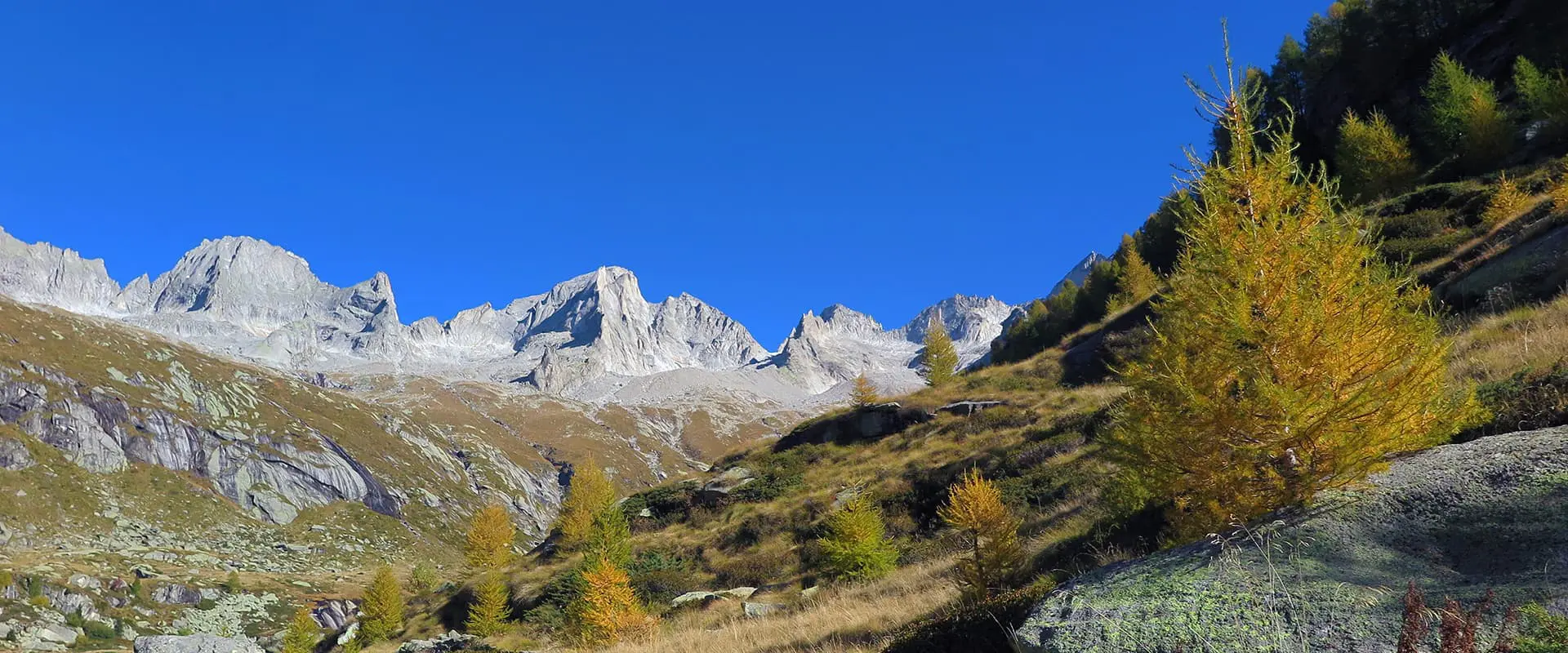
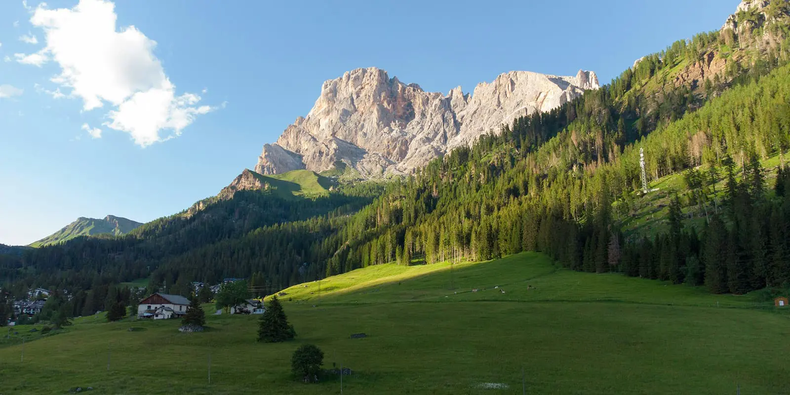
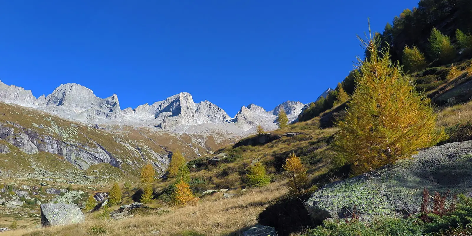
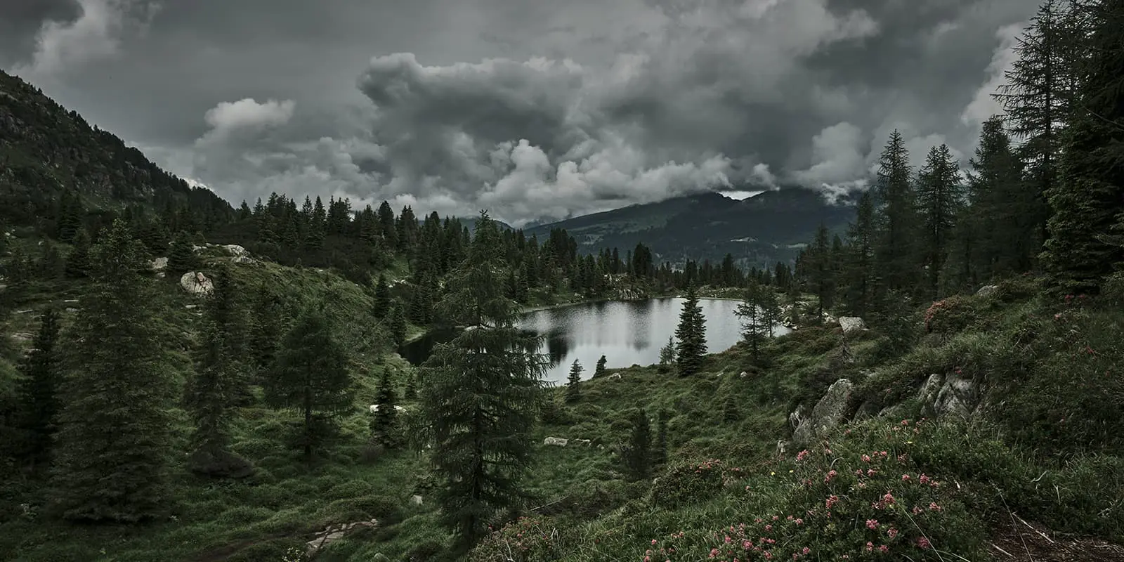
The Alta Via Del Granito is a three-day circular hike through the unique granite area of the northern Italian Lagorai chain, part of the Dolomites. The trail connects old paths, former military roads, and two mountain huts. It stretches through a less-traveled but majestic region, which turns it into a real insider hidden gem.

The Alta Via Del Granito is an easy hiking trail suitable for those who want to explore the Dolomites off the beaten track and away from the crowds.

Merle profile picture

Merle Wünderling

Merle is an outdoor enthusiast who’s passionate about hiking, rock climbing, mental health, and sustainability. Born in Germany but at home in the world, she’s hiked trails in New Zealand (Abel Tasman Coast Track, Kepler Track), Europe (Rota Vicentina/ Fishermen’s Trail, Tour du Mont Blanc, GR20 Corse, Kungsleden… ), and the Balkans (Peaks of the Balkans). Over the years she became a bit of a nerd, constantly improving her gear for upcoming hikes, such as GR11 Spain, Tour des Ecrins, Te Araroa, and the Transcaucasian Trail.

You can follow Merle on Instagram @merlewunderkind.

View profile

The Trail

From the Malga Sorgazza hut restaurant, a steep path leads over the Costa Brunella Lake to the Quarazza Pass. From here, the route continues to Forzelon di Rava. Here, you have the option to make a detour to Cimon Rava, with a magnificent view of the peaks of the Cresta del Frate. This is followed by a descent before continuing to the summit of the Val di Rava. From the subsequent Forcella Ravetta, the path leads steeply downhill through a small forest to the Caldenave hut.

From the Caldenave hut, the route continues downhill, past torrents and lakes in the Holletal Valley and uphill to the Todeschen Buse saddle. The trail leads north along the east face of the Cencelloberg and the Lasteatis peak to the Forcella Magna. This was an important pass during the First World War. On the descent to the Socede Pass, you will find trenches also from WWI. The last few meters lead over granite rocks to the Rifugio Cima d’Asta, also known as the Brentari hut.

From the Brentari hut, a descent over granite rocks will lead you to the cable car. A forest path takes you back to the starting point of the hike. If you’re an ambitious hiker, you may also enjoy climbing the Cima d’Asta, the highest peak on the tour at 2,847 m (9340 ft).

Stages

The Alta Via del Granito takes 3 days and two nights. It can be hiked in both directions, depending on the availability of sleeping places in the huts.

3-stage itinerary

Stage 1:

Sorgazza Alm – Caldenave Hut, 9.6 km | 6 mi

Stage 2:

Caldenave Hut – Brentari Hut, 12.2 km | 7.6 mi

Stage 3:

Brentari Hut – Sorgazza Alm, 7 km | 4.3 mi

Accommodations

Along the Alta Via Del Granito, you will find mountain huts that offer basic but comfortable accommodation. Make sure to book the huts far in advance, especially during the peak summer months. They fill up fast!

Mountain huts per stage

Stage 1:

Caldenave hut

Stage 2:

Brentari hut

Best time of the year

Hiking the Alta Via Del Granito is best from mid-June through the end of September/ beginning of October, when there is no snow and the huts are open. However, be aware of the high season between July and August, when the huts (and trails) will likely be full.

Depending on the year, the early or late shoulders of the season may see snow, and you’ll need to bring micro-spikes. Check in with the huts before starting your hike to assess the trail conditions.

Safety & Gear

Before the hike, gather information about the route (length, altitude, difficulty, current conditions) and assess your skills realistically.

Invest in the right hiking gear, including comfortable, supportive footwear with a good grip, proper hiking clothing, such as warm base layers and a hardshell rain jacket, hiking poles, a well-fitting backpack, and essential equipment like maps, GPS devices (or the GPX on your mobile), and a first-aid kit. Check out our comprehensive gear list for long-distance trails.

If you walk by yourself, share your plans with somebody else for your safety.

When staying overnight in the mountain huts, bring a light sleeping bag, in addition to the provided blankets, and earplugs for a restful night.

The weather in the high mountains can change rapidly. Always check the trail conditions and local weather forecasts. Be prepared for all conditions, including rain, sun, or snow and alter your itinerary if needed.

Stay properly hydrated and nourished. Ensure you have enough water and snacks to maintain energy levels and prevent dehydration and exhaustion. Bring at least two liters of water with you.

Respect the principles of Leave No Trace by minimizing your impact on the environment. Stick to designated trails, take all your trash with you, and show respect for wildlife and natural habitats (keep your distance, don’t feed them).

Difficulty

The Alta Via Del Granito is an moderate hiking trail suitable for those who want to explore the Dolomites off the beaten track and crowd. Apart from the optional summit of Cima d’Asta, the trail is comfortable for people with an average fitness level who are ready to be on the trails for 6+ hours a day.

Good to know

The starting point of the Alta Via del Granito is Malga Sorgazza – an old rifugio that has been converted into a restaurant. It is located around an hour from Trento.

The Club Alpino Italiano (CAI) is responsible for the maintenance and marking of the trails and the operation of the mountain huts.

Route
Circuit
highest point
2,847m (9340 ft)

Want to submit a trail or make this page more complete?

Always read the disclaimer

Terms of Use: important to all visitors on this website. We strive to publish high quality content and information on this website. However it’s always possible that we’re missing out on some crucial information. In spite of the fact that this route, associated GPS track (GPX and maps) were prepared under diligent research by the specified contributor and/or contributors, the accuracy of such and judgement of the author is not guaranteed. Therefore, hiking-trails.com and contributors are in no way liable for personal injury, damage to personal property, or any other such situation that might happen to individuals hiking or following this route. Should you choose to hike this trail, this is always at your own risk. Check out our guidelines for safety hiking and Leave No Trace principles at the hiking 101 page.

Download GPX

Join the community!

Login or create a FREE account 😊

With an account you can:

Download GPX files

Pin trails to your wishlist

Mark trails as hiked by you

Rate hiking trails

Comment on trails, blogs and gear reviews

Happy trails!
Login

Don't have an account yet? Register here