About the Aletsch Panoramaweg

Aletsch Arena
country
Switzerland
length
31 km(19 mi)
Type of trail
Long-distance
difficulty

Difficulty is highly personal. Be aware of the weather conditions as bad weather turns easier trails in difficult trails especially in the mountains.

Moderate
accommodation

Lodging means a mix of hotels, hostels or AirBnB’s.

Lodging
Elevation gain
1900 m(6234 ft)
terrain
Mountains
remoteness
Some of the time
Show more

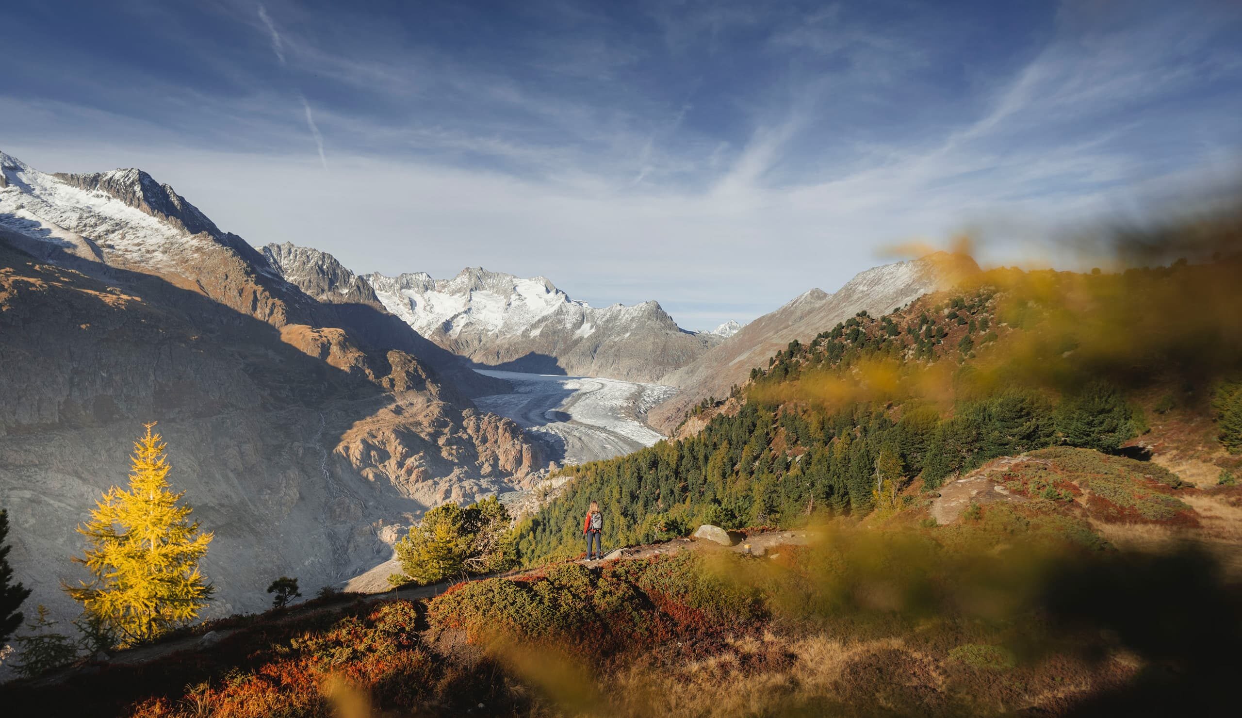
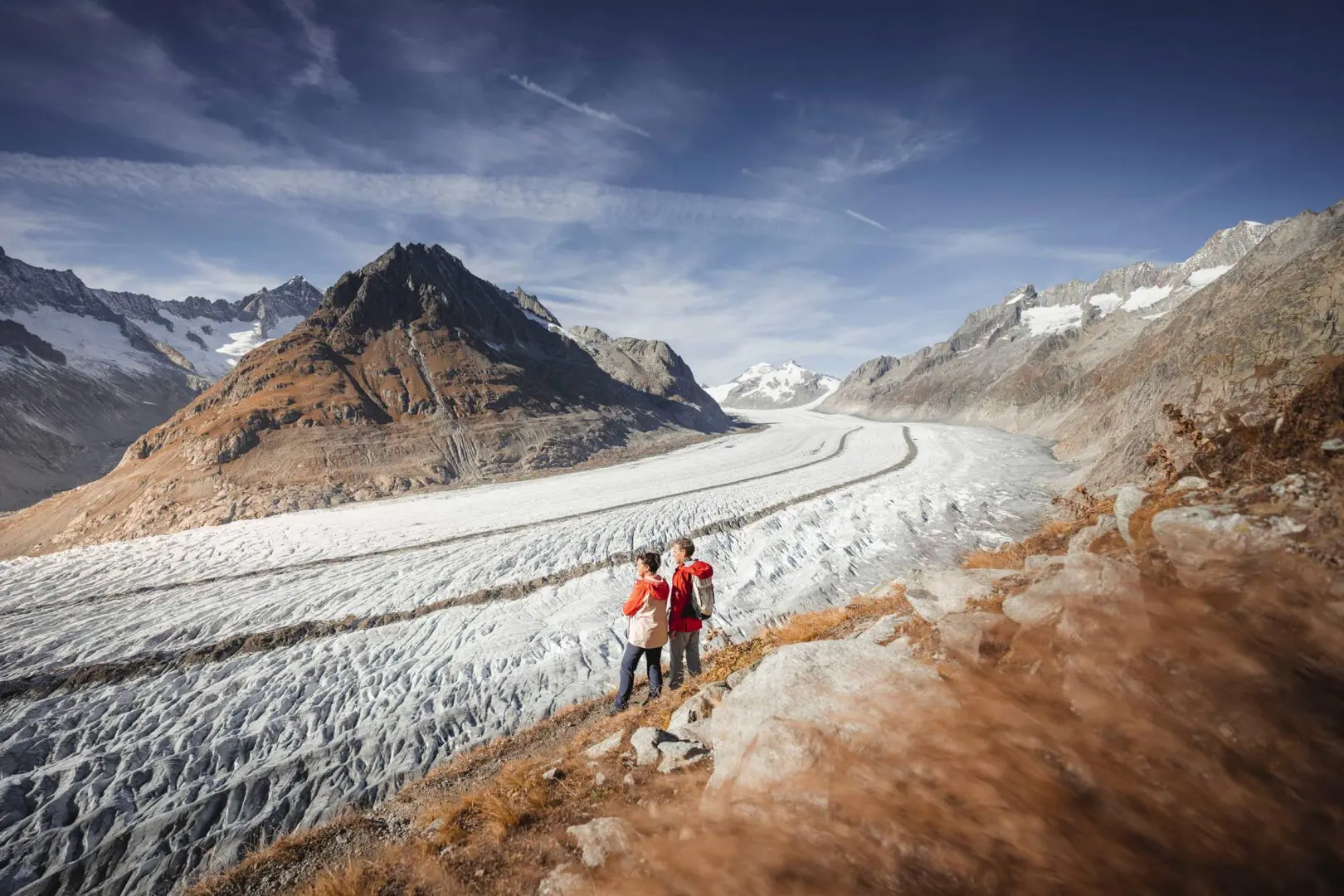
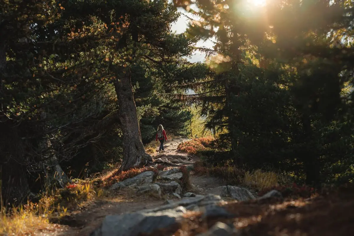
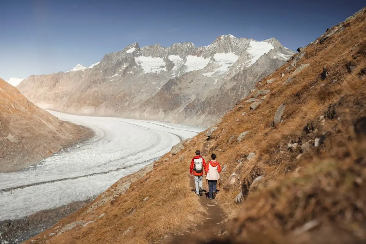
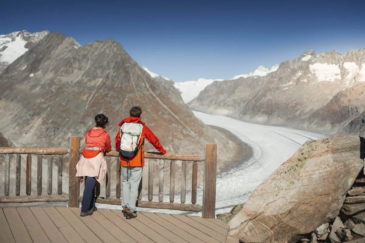
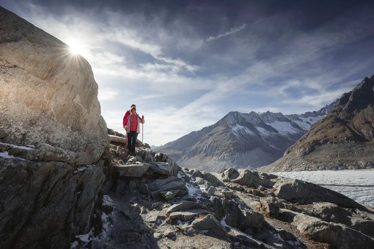
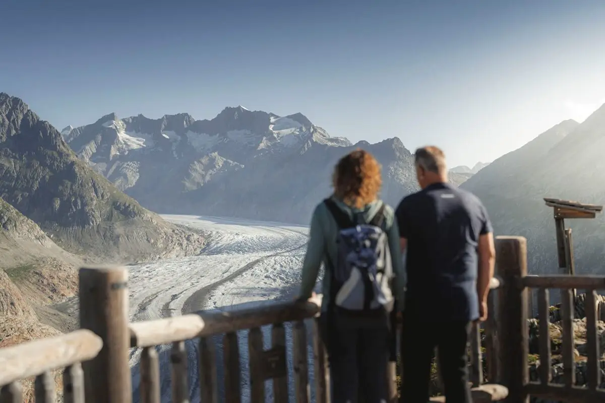
The Aletsch Panoramaweg, a long-distance trail through UNESCO World Heritage Site, is a great opportunity to hike through this stunning area at an easy pace in three stages. The trails lead you through Wallis/Valais’ most famous region: the Aletsch Arena. With views of the 20-kilometer-long Aletsch Glacier, the longest glacier of the Alps, and a path through the old Aletsch Forest, it’s a real beauty!

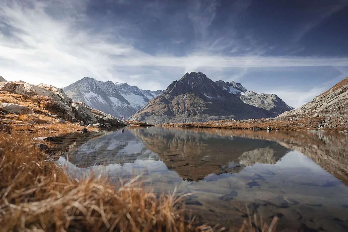
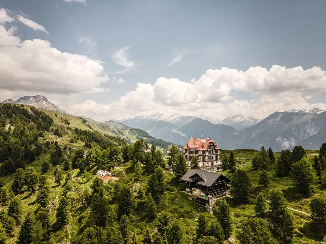
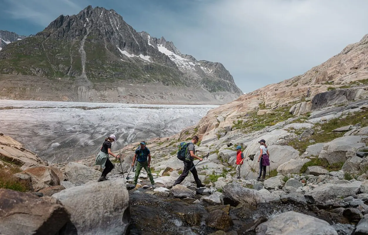
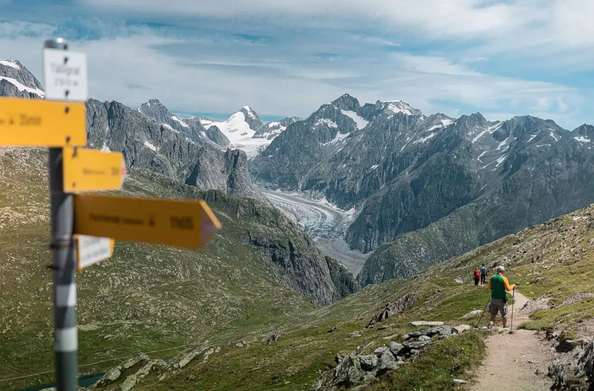
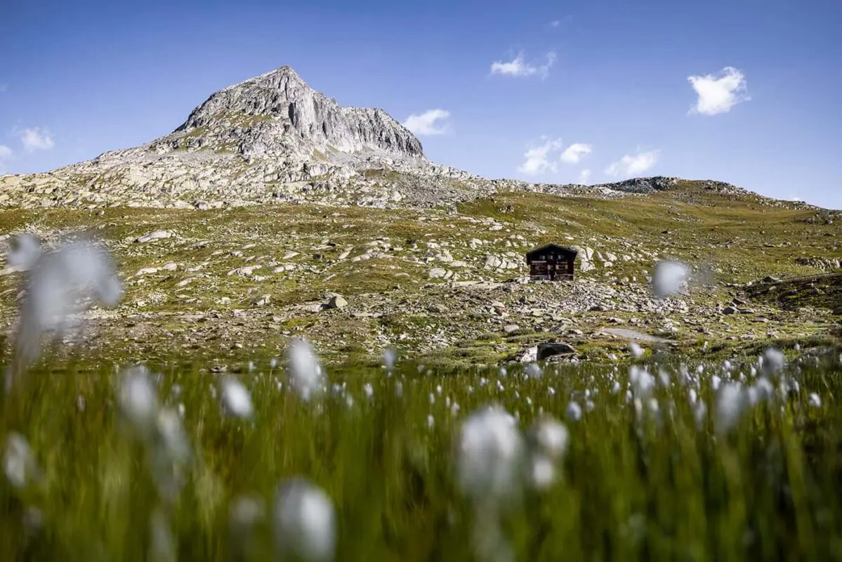
The Aletsch Arena is a part of the Swiss Alps Jungfrau-Aletsch UNESCO World Heritage Site and offers 300 kilometers of hiking trails across the region. These trails provide an opportunity to explore everything from the Aletsch Glacier to ancient stone pine forests, some of which are over 1000 years old. The region is known for its five suspension bridges in the Aletsch Goms area, and a diversity of experiences for hikers of all abilities.

Editor

Elmar Teegelbeckers

Passionate hiker Elmar spends months of his time on the trail. He’s usually on the lookout for hidden gems in one of his favourite countries such as Slovenia, Switzerland and Japan. He founded hiking-trails.com in need for a community and detailed information about the trails. Before this, he worked for the Alpine asscociation in the Netherlands[ (NKBV) but lost his heart to the trails.

With this website and socials, he hopes to shape an inclusive community for hikers all over world. No matter your speed, experience or level, you can get out there to enjoy the trails and connect with the heartwarming hiking community. Life is so much better outside and he hopes to inspire hikers to take their first, or next, step on the trail.

View profile

The Trail

The Aletsch Panorama Trail is a three-day trek from Belalp to Bellwald, designed to offer views of the Aletsch and Fiescher Glaciers at every turn. As climate change reshapes the landscape, the trail no longer crosses the Aletsch Glacier and is now replaced by safer paths like the 124-meter suspension bridge over the Massa Gorge. Along the way, the Villa Cassel and the Aletsch Pro-Natura Centre are a must-visit to learn more about the conservation efforts of the glacier and this World Heritage site. Throughout the trek, you’ll come to love not only the Aletsch Glacier but also the ancient Swiss stone pines of the protected Aletsch Forest.

The trail passes some of the best viewpoints along the trail such as Hohfluh, Moosfluh, and the Bettmerhorn top station, offering panoramic views of the massive glacier, which won’t disappoint you. Follow the stone paths and hike towards the Märjelensee Lake as you can sleep in the Gletscherstube next to the water. On the last part, the trail gives you a view of the Fiescher Glacier during the descent. With the Goms mountains as a backdrop, another highlight is crossing the next bridge: the Aspi-Titter suspension bridge. The trail ends at Bellwald after approximately 30 kilometers.

Stages

You can hike the Aletsch Panoramaweg at your own pace, choosing distances that suit your pace. You can even hike the trail in two days if you’re up for the challenge. Also, you can choose your starting point. Blatten, Belalp is a great starting option to follow the official stages. A possible route is to hike the trail in these three stages.

Stage 1:

Blatten, Belalp – Riederalp, Riederfurka, 10 km | 6 mi

Stage 2:

Riederalp, Riederfurka – Märjelensee, 12 km | 8 mi

Stage 3:

Märjelensee – Bellwald, 9 km | 6 mi

Accommodations

You can choose a variety of accommodations in the villages along the way. These are the suggested accommodation options at the end of this three-day itinerary.

Stage 1: Riederalp, Riederfurka (search for Riederalp)
Stage 2: Märjelensee – Gletscherstube
Stage 3: Bellwald

Best time of the year

The best time to hike the Aletsch Panoramaweg and overall in the Aletsch Arena is undoubtedly from June through late September. This period is the best hiking season in the Aletsch Arena when the weather is the most stable with longer daylight hours. During this time, the high-altitude meadows bloom with a vibrant array of alpine flowers, and the trails are mostly snow-free. In June there might be some snow on the trails but from July it should be melted making it easier to hike the trails, especially the more challenging routes.

Autumn hiking gives you the option of lesser crowds and the landscape turns into a stunning palette of golds, reds, and browns. However, the weather can be more unpredictable with a higher chance of snowfall. Mornings can be crisp, and higher altitudes might start to see the first dustings of snow within this period.

Safety & Gear

Before you start the trail, check the weather forecast and be aware of the trail conditions such as snow. Ensure your fitness is enough for hiking this trail.

Bring a map with you and put the GPX on your mobile for navigation. Be sure to start with a fully charged mobile phone, possibly with a power bank if you think you’ll need it. Dress in layers and always bring a hardshell and warmer jacket with you to layer for the always-changing conditions. And of course, choose hiking shoes with a good grip. We also recommend other essentials such as a first-aid kit, extra food, and water.

Start your day early to avoid being caught by afternoon thunderstorms which are common in mountainous regions. Mountain weather in general can change fast. Be prepared for sudden drops in temperature and unexpected rainfall. Stay on marked trails to minimize environmental impact and reduce the risk of getting lost. Yield to uphill hikers and respect wildlife. Leave no trace by packing out all the trash.

Good to know

Hiking in the Aletsch Arena, in the heart of the Swiss Alps, is a unique experience. It’s important to know that the Aletsch Panoramaweg is a mountain trail. This means that the trails go over varied terrain including high-altitude mountain trails, rocky paths, and suspension bridges only advised if you’re okay with heights. Weather in the Alps can change rapidly. Before setting out, check the local weather forecast and be prepared for all conditions. Morning hikes are often recommended to avoid afternoon thunderstorms.

Route
Point to point
Highest point
2489m (8166 ft)

Guidebooks

Logo Aletsch Arena

Aletsch Arena Downloads

View guidebook

Want to submit a trail or make this page more complete?

Comments

Be the first one to comment on this trail!

Reply to this trail

Your email address will not be published. Required fields are marked *

Reply to this trail

Log in to comment on this trail
Always read the disclaimer

Terms of Use: important to all visitors on this website. We strive to publish high quality content and information on this website. However it’s always possible that we’re missing out on some crucial information. In spite of the fact that this route, associated GPS track (GPX and maps) were prepared under diligent research by the specified contributor and/or contributors, the accuracy of such and judgement of the author is not guaranteed. Therefore, hiking-trails.com and contributors are in no way liable for personal injury, damage to personal property, or any other such situation that might happen to individuals hiking or following this route. Should you choose to hike this trail, this is always at your own risk. Check out our guidelines for safety hiking and Leave No Trace principles at the hiking 101 page.

Download GPX

Join the community!

Login or create a FREE account 😊

With an account you can:

Download GPX files

Pin trails to your wishlist

Mark trails as hiked by you

Rate hiking trails

Comment on trails, blogs and gear reviews

Happy trails!
Login

Don't have an account yet? Register here