Logo Aletsch Arena

About the Aletsch Glacier Trail

Aletsch Arena
country
Switzerland
length
12 km(7 mi)
Type of trail
Day hike
difficulty

Difficulty is highly personal. Be aware of the weather conditions as bad weather turns easier trails in difficult trails especially in the mountains.

Moderate
accommodation

Lodging means a mix of hotels, hostels or AirBnB’s.

Lodging
Elevation gain
510 m(1673 ft)
terrain
Mountains
remoteness
Most of the time
Show more

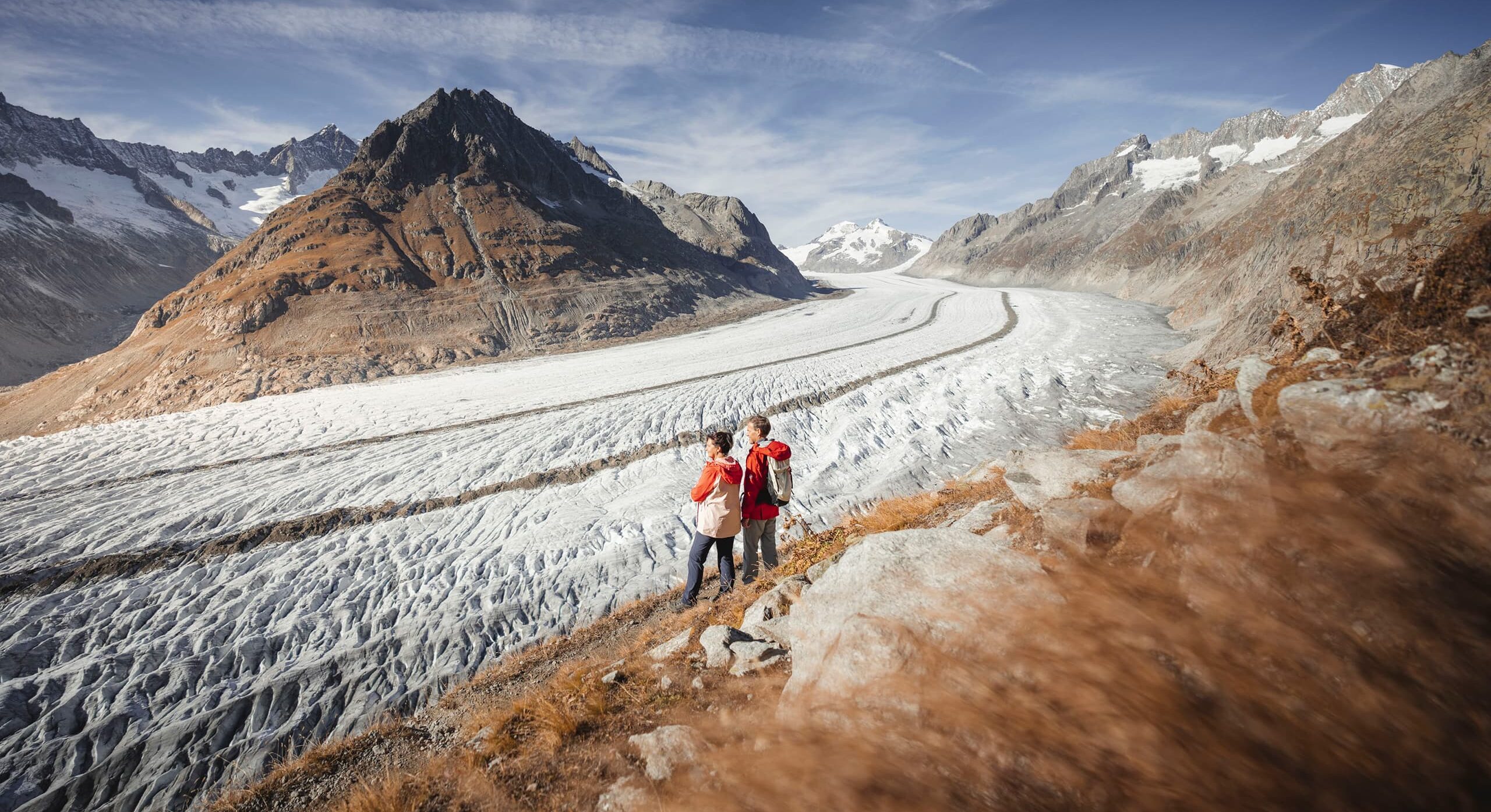
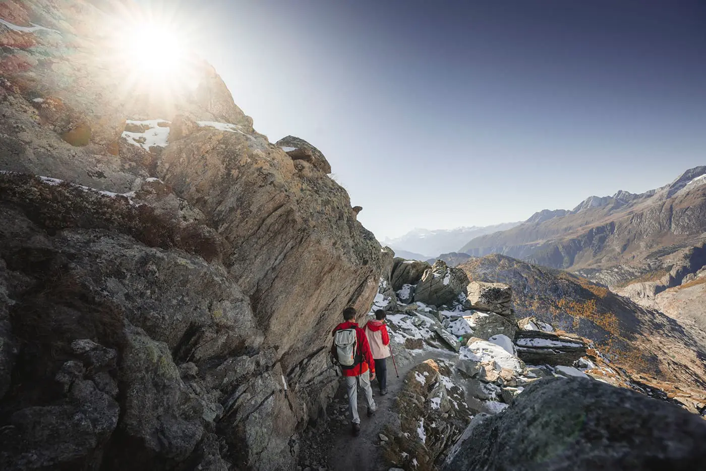
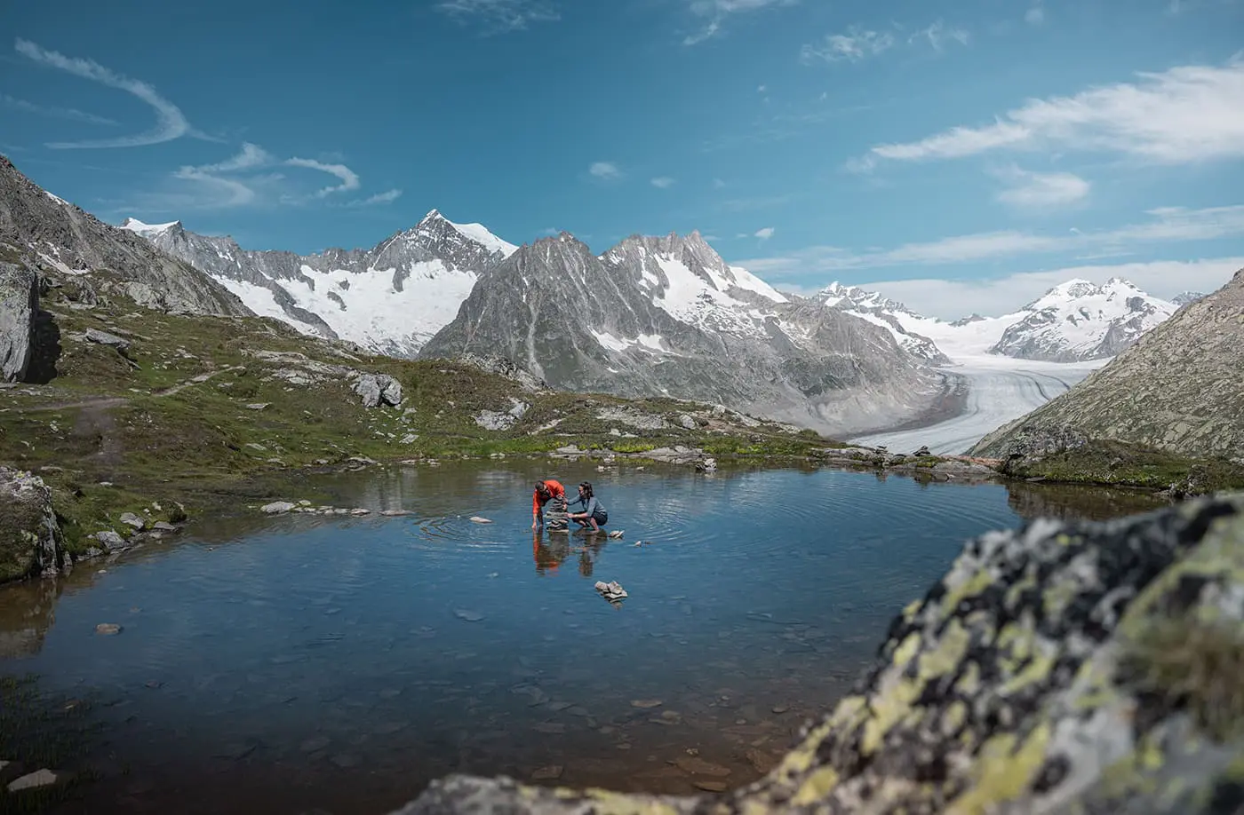
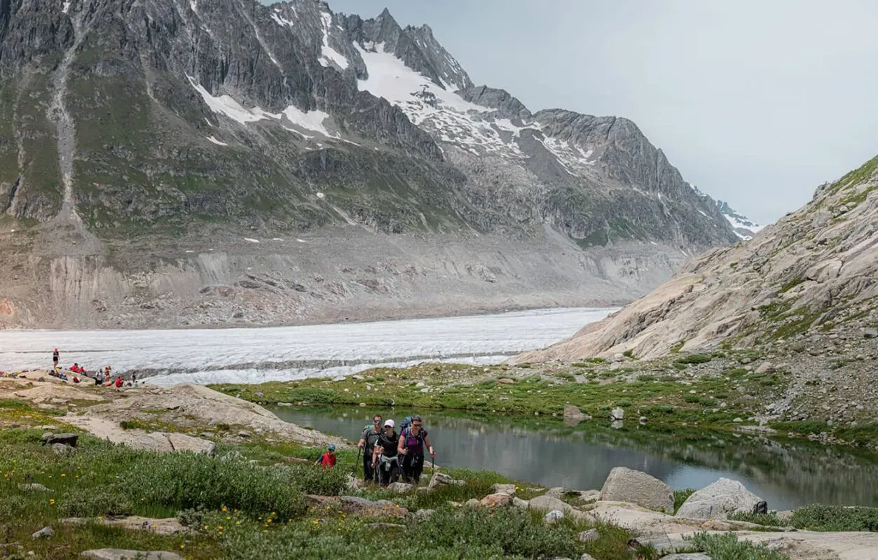
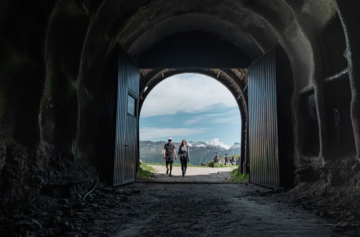
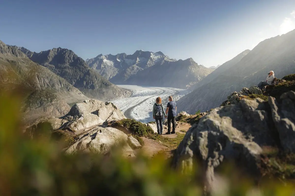
Discover the Aletsch Arena at its best and day-hike the Aletsch Glacier Trail. This trail, beginning at the Moosfluh upper cable station, starts above Riederalp and ends after 12 kilometers at the Fiescheralp upper cable station. It is a perfect day hike for all hikers who want to see the Aletsch Glacier in full glory. The panoramic views of the largest glaciers in the Alps never get boring on this trail while you hike in the UNESCO World Heritage site. Please note that you’re not hiking on the Aletsch Glacier on this trail.

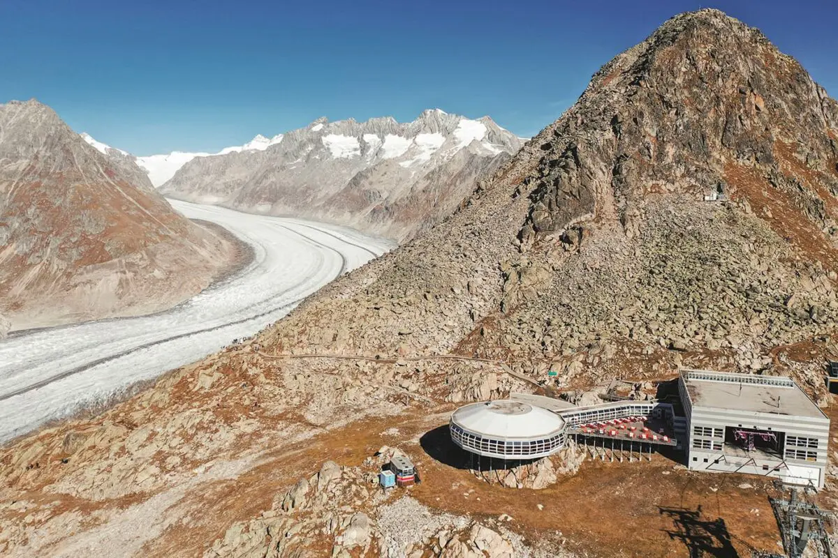
The Aletsch Glacier is the largest glacier in the Alps, located in the eastern Bernese Alps in the Swiss canton of Valais. It extends over 20 kilometers and covers more than 80 square kilometers entirely. It’s a valley glacier, which forms when snow accumulates over time, compresses into ice, and flows outward to the lower altitudes.

Editor

Elmar Teegelbeckers

Passionate hiker Elmar spends months of his time on the trail. He’s usually on the lookout for hidden gems in one of his favourite countries such as Slovenia, Switzerland and Japan. He founded hiking-trails.com in need for a community and detailed information about the trails. Before this, he worked for the Alpine asscociation in the Netherlands[ (NKBV) but lost his heart to the trails.

With this website and socials, he hopes to shape an inclusive community for hikers all over world. No matter your speed, experience or level, you can get out there to enjoy the trails and connect with the heartwarming hiking community. Life is so much better outside and he hopes to inspire hikers to take their first, or next, step on the trail.

View profile

The Trail

Originating from the northern flanks of the Eiger, Mönch, and Jungfrau mountains, the Aletsch Glacier flows southward towards the Aletsch Forest and past the Märjelensee lake before splitting into smaller parts. The Aletsch Glacier Trail partly follows the Aletsch Panoramaweg 39. Stage two of this long-distance trail overlaps from Moosfluh until the Gletscherstube at the Märjelensee before hopping off from the Aletsch Panoramaweg 39 towards the cable car station above Fiescheralp, the endpoint of the trail.

The Aletsch Arena, situated in the Swiss Alps Jungfrau-Aletsch UNESCO World Heritage Site, has an impressive network of 300 kilometers of hiking trails suitable for all skill levels. Highlights include the magnificent Aletsch Glacier, the longest in the Alps, and ancient stone pine forests that have stood for centuries. Another attraction is the collection of five suspension bridges in the Aletsch Goms area.

Accommodations

You can choose a variety of accommodations in the car-free villages in the Aletsch Arena to start this day hike. Riederalp, Fiescheralp, and Bettmeralp are perfect basecamp locations for exploring the region. Riederalp is the closest village to the trailhead of the Aletsch Glacier Trail.

Best time of the year

The best time to hike the Aletsch Glacier Trail and overall in the Aletsch Arena is undoubtedly from June through late September. This period is the best hiking season in the Aletsch Arena when the weather is the most stable with longer daylight hours. During this time, the high-altitude meadows bloom with beautiful alpine flowers, and the trails are mostly snow-free. In June there might be some snow on the trails but by July it should be melted, making it easier to hike the trails.

Autumn brings a beautiful hiking experience with fewer crowds and the landscape turns into a palette of golds, reds, and browns in the forest. Although the weather can be a bit more unpredictable with a higher chance of snowfall. Mornings can be crisp, and higher altitudes might start to see the first snow within this period.

Safety & Gear

Before setting out, check the weather forecast and be aware of the trail conditions such as snow. Check in with yourself to see if your fitness level is good enough for hiking this trail.

Bring a map with you and load the GPX on your mobile for navigation. Start with a fully charged phone, and bring a power bank if you need it. Dress in layers and always pack a hardshell and jacket with you to adapt to the changing conditions in the mountains. Choose hiking shoes with a good grip. The other essentials we recommend you include are a first-aid kit, extra food, and water.

Mountain weather in general can change fast. Be prepared for sudden drops in temperature and unexpected rainfall. Start your day early to avoid being caught by afternoon thunderstorms which are common in mountainous regions. Stay on marked trails to minimize environmental impact and reduce the risk of getting lost. Say hi to other hikers and respect wildlife. Leave no trace by packing out all the trash.

Good to know

This trail goes over varied terrain including high altitude trails and rocky paths. Weather in the Alps can change rapidly, so before setting out, check the local weather forecast and be prepared for all conditions.

Route
Point to point
Highest point
2487m (8160 ft)

Guidebooks

Logo Aletsch Arena

Aletsch Arena Downloads

View guidebook

Want to submit a trail or make this page more complete?

Comments

Be the first one to comment on this trail!

Reply to this trail

Your email address will not be published. Required fields are marked *

Reply to this trail

Log in to comment on this trail
Always read the disclaimer

Terms of Use: important to all visitors on this website. We strive to publish high quality content and information on this website. However it’s always possible that we’re missing out on some crucial information. In spite of the fact that this route, associated GPS track (GPX and maps) were prepared under diligent research by the specified contributor and/or contributors, the accuracy of such and judgement of the author is not guaranteed. Therefore, hiking-trails.com and contributors are in no way liable for personal injury, damage to personal property, or any other such situation that might happen to individuals hiking or following this route. Should you choose to hike this trail, this is always at your own risk. Check out our guidelines for safety hiking and Leave No Trace principles at the hiking 101 page.

Download GPX

Join the community!

Login or create a FREE account 😊

With an account you can:

Download GPX files

Pin trails to your wishlist

Mark trails as hiked by you

Rate hiking trails

Comment on trails, blogs and gear reviews

Happy trails!
Login

Don't have an account yet? Register here