About the Albsteig

country
Germany
length
320 km(199 mi)
Type of trail
Long-distance, Thru-hike
difficulty

Difficulty is highly personal. Be aware of the weather conditions as bad weather turns easier trails in difficult trails especially in the mountains.

Moderate
accommodation

Lodging means a mix of hotels, hostels or AirBnB’s.

Lodging
Elevation gain
10471 m(34354 ft)
terrain
Hills, Countryside, Forest
remoteness
Some of the time
Show more

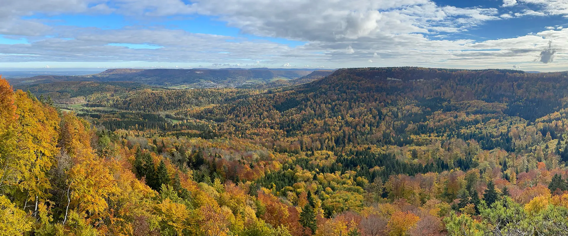
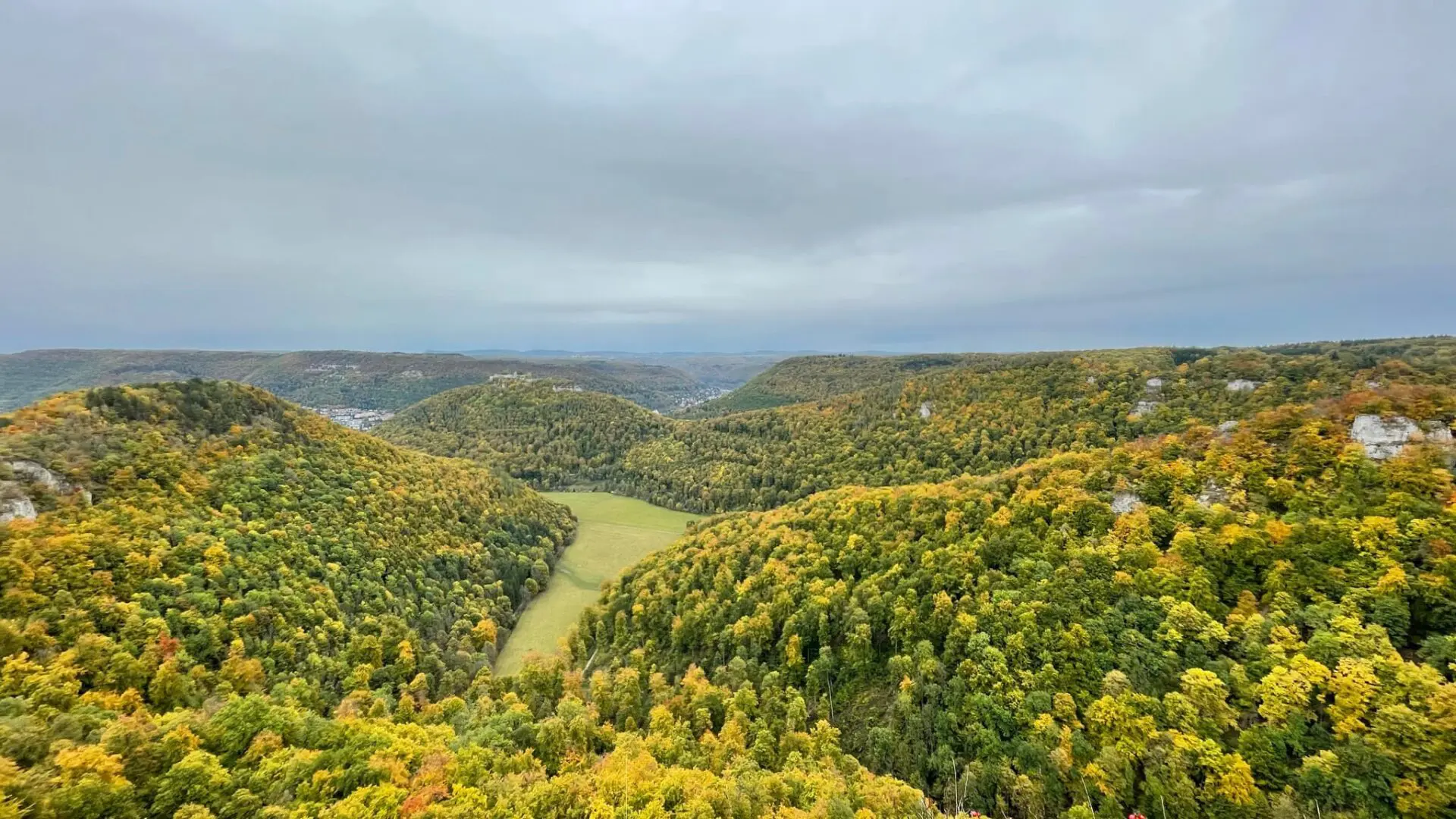
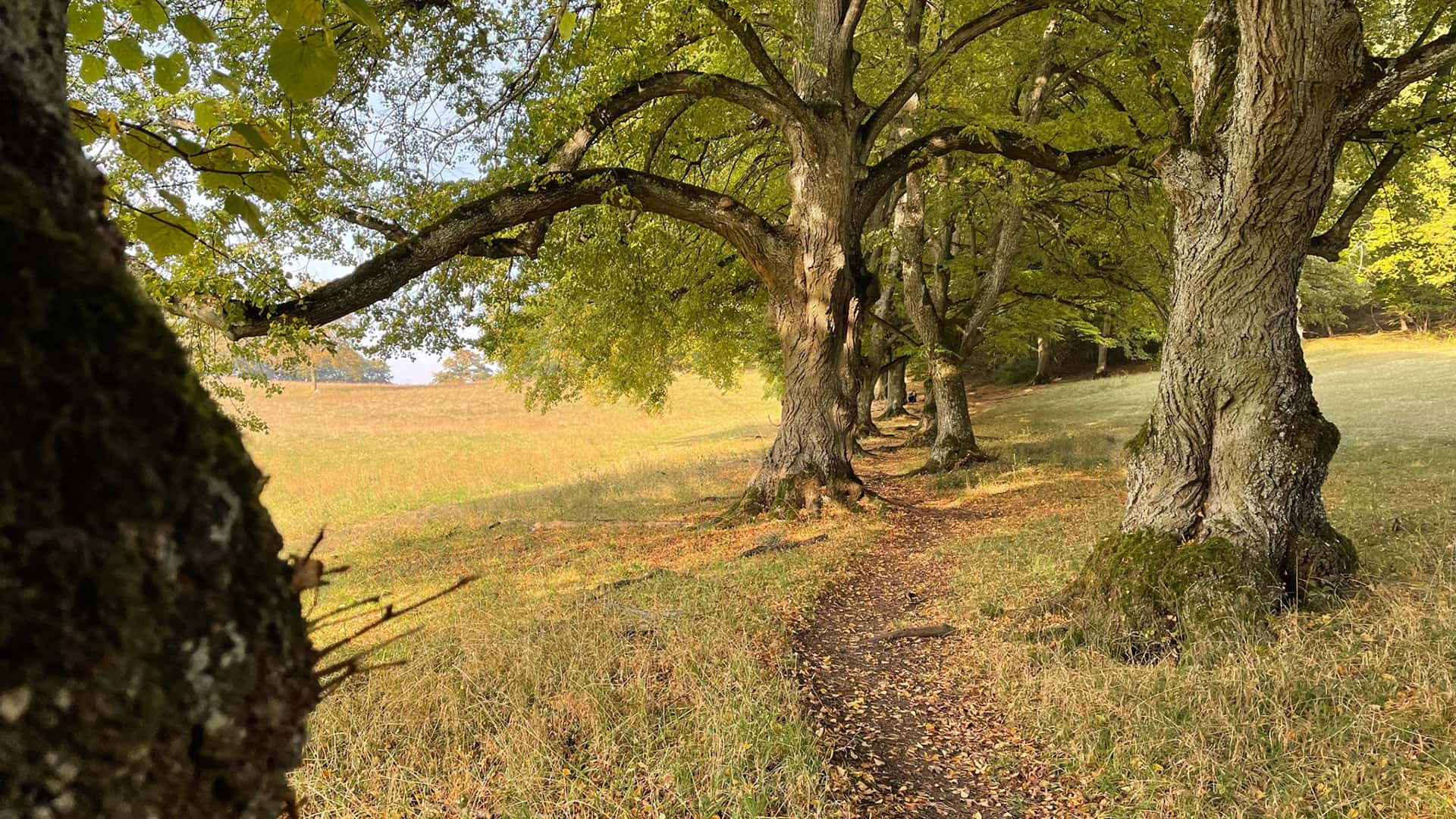
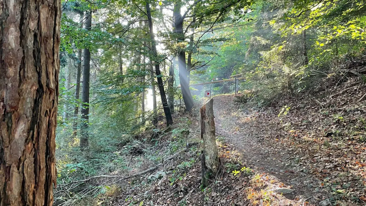
The Albsteig trail (HW 1) is the oldest main trail in the Swabian Albs. For more than 100 years, hikers have enjoyed the many sights along the 360km route, which mostly follows natural paths along the Albtrauf from Donauwörth across the entire northern slope of the Swabian Alb to Tuttlingen. It is marked by a red triangle with the tip pointing towards Tuttlingen.

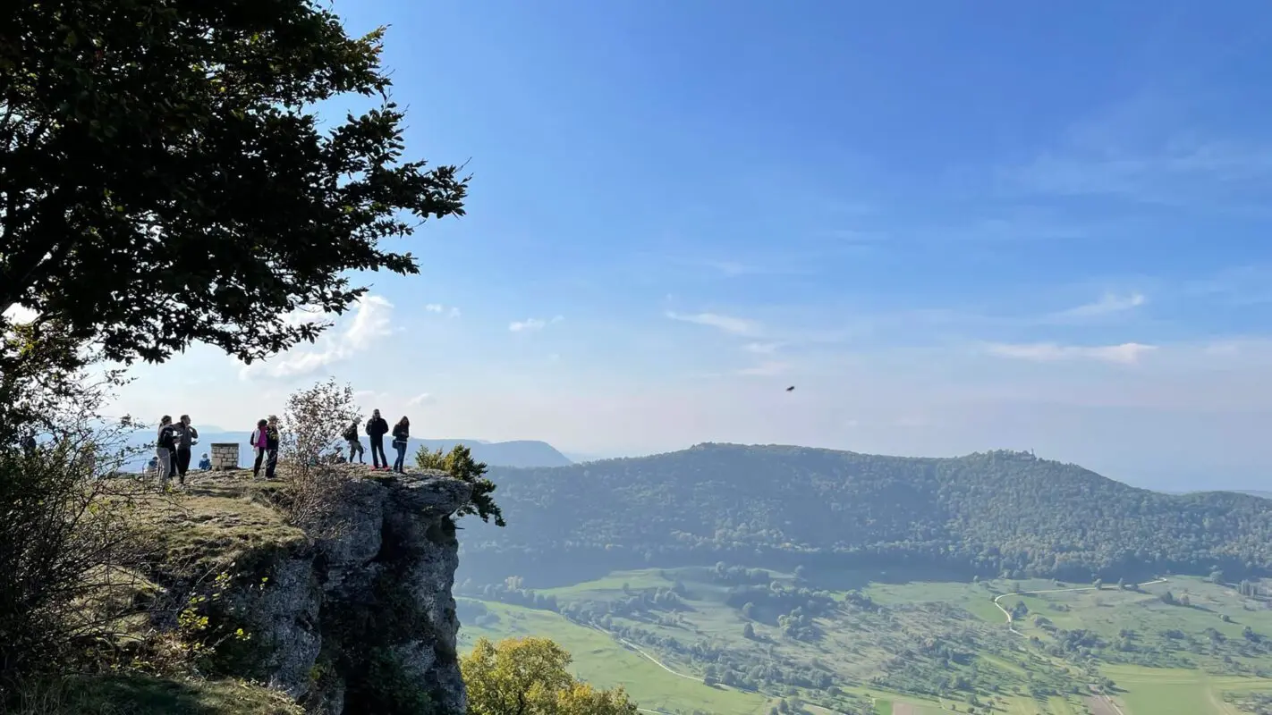
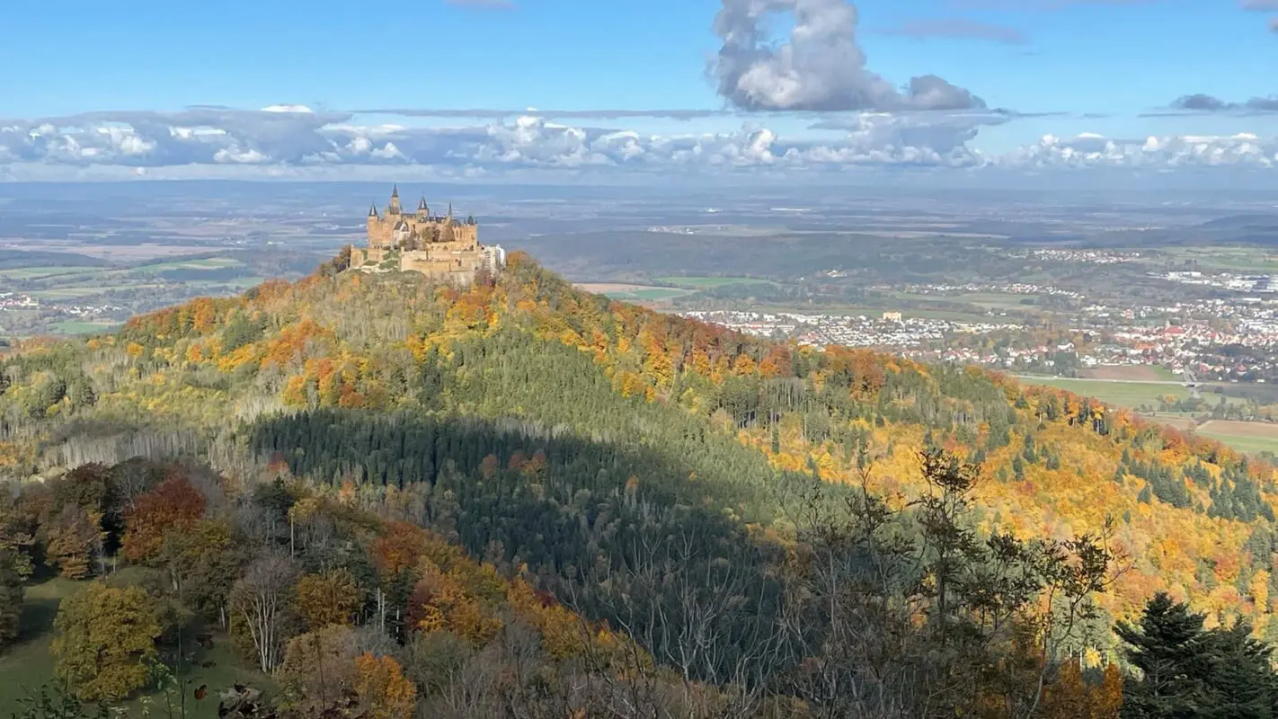
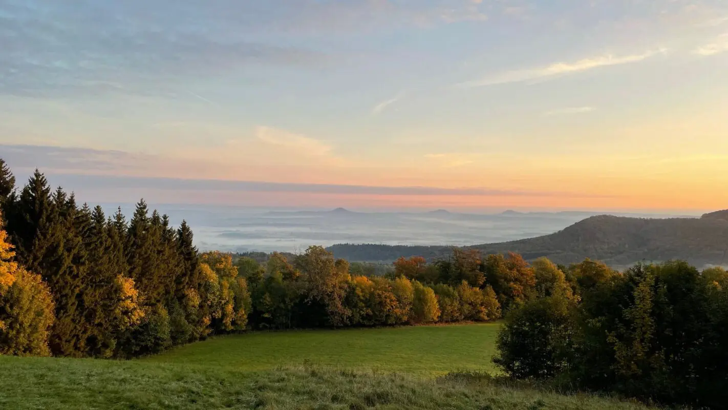
The Swabian Alb is largely located in Baden-Württemberg (southern Germany) and is a high plateau that has been fragmented by erosion. The northern edge trail follows the cliffs of the Swabian Alb, with repeated views of the lower Alb foothills.

Andreas Scholz profile picture
Author

Andreas Scholz

Andreas Scholz was born in a small Swabian village in Germany. It wasn’t until the age of 35 that he began to discover the big wide world, and since then he has been traveling the most diverse long-distance hiking trails in Germany.

You can follow Andi on Instagram @startthetrail.wanderblog

View profile

The Trail

The HW 1 first passes through the Wörnitz valley to Harburg and then runs along the edge of the Nördlinger Ries and Härtsfeld, often through woodland and flat terrain up to 600 meters above sea level. The Albtrauf is not as pronounced here as further along the route, but there are still views of the charming surrounding countryside and villages of the Ostalb.

You’ll hike through the lovely valley at the source of the Kocher River to Unterkochen and from there to the imposing Rosenstein Massif with its rock caves and castle ruins near Heubach.

Another highlight on the Albsteig trail is the imposing Reußenstein ruin. It is enthroned on a rock above the Neidlinger Valley. The route continues past numerous viewing rocks. The Breitenstein offers fantastic views and a memorial stone commemorating the 100th anniversary of the Albsteig trail (2008). The route then passes castle ruins, which offer wonderful views of the Alb foreland. The trail then leads through the Randecker Maar, a former volcanic vent, to Teck Castle. The castle is another hiking center of the Swabian Albverein with a magnificent view.

Finally, walk along the Albtrauf ridge past the Hohenneuffen ruins to Bad Urach. The Urach Waterfall awaits! The spring water plunges more than 30 meters to create a breathtaking spectacle.

The well-preserved Lichtenstein Castle is also open to the public. The last third of the Albsteig trail passes the Nebelhöhle cave and some magnificent panoramic peaks such as the Roßberg (Roßberghaus visitor center and viewing tower), the Dreifürstenstein near Mössingen and the Raichberg (Nägelehaus visitor center and viewing tower). It is worth making a short detour to the Zeller Horn viewing point for a unique view of Hohenzollern Castle.

Finally, you reach the Lemberg, the highest mountain in the Swabian Alb at 1015 meters, which also has a lookout tower. The view from here is often phenomenal over the Northern Alps. The final destination, Tuttlingen, is reached via the Dreifaltigkeitsberg.

Stages

Suggested 16-day itinerary for the Albsteig

Stage 1: Donauwörth – Harburg, 17 km | 10.5 mi

Stage 2: Harburg – Mönchsdeggingen, 12 km | 7.5 mi

Stage 3: Mönchsdeggingen – Bopfingen, 27 km | 17 mi

Stage 4: Bopfingen – Aalen-Unterkochen, 27 km | 17 mi

Stage 5: Aalen-Unterkochen – Heubach, 24 km | 15 mi

Stage 6: Heubach – Kuchalb (Donzdorf), 27 km | 17 mi

Stage 7: Kuchalb (Donzdorf) – Boßler (Gruibingen), 25 km | 15.5 mi

Stage 8: Boßler (Gruibingen) – Burg Teck, 23 km | 14 mi

Stage 9: Burg Teck – Bad Urach, 23 km | 14 mi

Stage 10: Bad Urach – Honau, 26 km | 16 mi

Stage 11: Honau – Willmandingen, 21 km | 13 mi

Stage 12: Willmandingen – Jungingen, 24 km | 15 mi

Stage 13: Jungingen – Burgfelden, 22 km | 13.5 mi

Stage 14: Burgfelden – Ratshausen, 22 km | 13.5 mi

Stage 15: Ratshausen – Risiberg (Dürbheim), 26 km | 16 mi

Stage 16: Risiberg (Dürbheim) – Tuttlingen, 13 km | 8 mi

Official 23-stage itinerary

Stage 1:

Donauwörth – Harburg, 16.9 km | 10.5 mi

Stage 2:

Harburg – Mönchsdeggingen, 11.3 km | 7 mi

Stage 3:

Mönchsdeggingen – Schweindorf, 13.5 km | 8.4 mi

Stage 4:

Schweindorf – Bopfingen, 13.6 km | 8.5 mi

Stage 5:

Bopfingen – Hülen, 12.4 km | 7.7 mi

Stage 6:

Hülen – Unterkochen, 15 km | 9.3 mi

Stage 7:

Unterkochen – Heubach, 21.7 km | 13.5 mi

Stage 8:

Heubach – Weissenstein, 14.8 km | 9.2 mi

Stage 9:

Weissenstein – Gingen an der Fils, 16.1 km | 10 mi

Stage 10:

Gingen an der Fils – Kornbergsattel near Gruibingen, 16.3 km | 10.2 mi

Stage 11:

Kornbergsattel near Gruibingen – Ochsenwang, 22.9 km | 14.2 mi

Stage 12:

Ochsenwang – Owen (Teck), 8.2 km | 5 mi

Stage 13:

Owen (Teck) – Bad Urach, 21 km | 13 mi

Stage 14:

Bad Urach – Holzelfingen, 22.8 km | 14.2 mi

Stage 15:

Holzelfingen – Genkingen, 15.8 km | 9.8 mi

Stage 16:

Genkingen – Talheim, 14.9 km | 9.3 mi

Stage 17:

Talheim – Jungingen, 17.9 km | 11.1 mi

Stage 18:

Jungingen – Stich near Onstmettingen, 14.2 km | 8.8 mi

Stage 19:

Stich near Onstmettingen – Laufen an der Eyach, 12.2 km | 7.6 mi

Stage 20:

Running on the Eyach – Ratshausen, 17.4 km | 10.8 mi

Stage 21:

Ratshausen – Gosheim, 10.6 km | 6.6 mi

Stage 22:

Gosheim – Risiberg, 14.8 km | 9.2 mi

Stage 23:

Risiberg – Tuttlingen, 11.9 km | 7.4 mi

Accommodations

There are many restaurants, hotels, inns, guesthouses, and private rooms in all price categories along the Albsteig trail, and these can be found at tourist information centers. Swabian cuisine is a must, with classics such as Zwiebelrostbraten, Maultaschen, and Käsespätzle.

Some accommodation providers even offer a pick-up and delivery service for longer stays. Both members and non-members of the Schwäbischer Albverein can stay and eat in the association’s hiking hostels at reasonable prices. Unfortunately, these are often only open on public holidays or at weekends.

Best time of the year

In theory, the Albsteig trail can be walked all year round. Of course, the main walking season in a low mountain range is from spring to autumn. You will be walking through beech woods or sections of coniferous forest, as well as across the rough grasslands and meadows of the Alb plateau.

Each season has its charms: in spring you can experience the bright, delicate green of the leaves; in summer you can hike in the pleasant shade of the deciduous trees; autumn, with its golden time (Indian summer), is the great hiking season on the Swabian Alb. In winter you can enjoy even more panoramic views through the fallen leaves of the trees and, in special weather conditions, you can hike in the sun above a huge sea of fog.

However, take extra care on icy paths and trails.

Safety & Gear

When planning the Albsteig hike it’s important to consider several key factors to guarantee a secure outdoor adventure. Before starting your hike, conduct thorough research on your chosen trail. This includes assessing factors such as trail difficulty, length, elevation gain, and terrain. Gather valuable insights not only from this website but also from guidebooks, hikers who hiked this trail already, and local hiking tourism organizations.

Effective planning is paramount. Share your hiking plans with your family or friends, providing details like your anticipated start and end times, chosen trail route, and emergency contact information. This information serves as a critical safety measure in case of unforeseen circumstances.

Stay informed about the weather conditions in the area where you intend to hike. Avoid embarking on your journey during severe weather conditions, including thunderstorms, heavy rainfall, or extreme heat, as these can pose significant risks to your safety.

Staying properly hydrated and nourished is essential. Ensure you have an ample supply of water and energy-rich snacks to maintain your energy levels and prevent dehydration and exhaustion. Bring at least two liters of water with you.Familiarize yourself with the trail map and carry navigation tools such as a compass or GPS device to stay oriented and avoid getting lost.

Invest in the right hiking gear, including comfortable, supportive footwear, proper hiking clothing, such as warm base layers and a hardshell rain jacket, hiking poles, a well-fitted backpack, and essential equipment like maps, GPS devices (when needed), and a first-aid kit. Check out our comprehensive gear list for long-distance trails like this.

Respect the principles of Leave No Trace by minimizing your impact on the environment. Stick to designated trails, pack out all trash, and show respect for wildlife and natural habitats.

Good to know

Donauwörth and Tuttlingen are accessible by train and public transport. In addition, many stage towns are connected to a functioning rail or bus network. However, smaller towns are served less frequently or not at all, especially at weekends and on public holidays. Up-to-the-minute information can be found on the Deutsche Bahn app (DB Navigator).

Especially in rural areas, many restaurants have up to three days off, especially at the beginning of the week. However, most pubs and restaurants are open on Thursdays and at weekends.

Route
Point to point
Highest point
1015m (3.330 ft)

Want to submit a trail or make this page more complete?

Comments

Be the first one to comment on this trail!

Reply to this trail

Your email address will not be published. Required fields are marked *

Reply to this trail

Log in to comment on this trail
Always read the disclaimer

Terms of Use: important to all visitors on this website. We strive to publish high quality content and information on this website. However it’s always possible that we’re missing out on some crucial information. In spite of the fact that this route, associated GPS track (GPX and maps) were prepared under diligent research by the specified contributor and/or contributors, the accuracy of such and judgement of the author is not guaranteed. Therefore, hiking-trails.com and contributors are in no way liable for personal injury, damage to personal property, or any other such situation that might happen to individuals hiking or following this route. Should you choose to hike this trail, this is always at your own risk. Check out our guidelines for safety hiking and Leave No Trace principles at the hiking 101 page.

Download GPX

Join the community!

Login or create a FREE account 😊

With an account you can:

Download GPX files

Pin trails to your wishlist

Mark trails as hiked by you

Rate hiking trails

Comment on trails, blogs and gear reviews

Happy trails!
Login

Don't have an account yet? Register here