About the Eislek Trail

country
Luxembourg, Belgium
length
106 km(66 mi)
Type of trail
Long-distance
difficulty

Difficulty is highly personal. Be aware of the weather conditions as bad weather turns easier trails in difficult trails especially in the mountains.

Moderate
accommodation

Lodging means a mix of hotels, hostels or AirBnB’s.

Lodging, Camping
Elevation gain
3260 m(10696 ft)
terrain
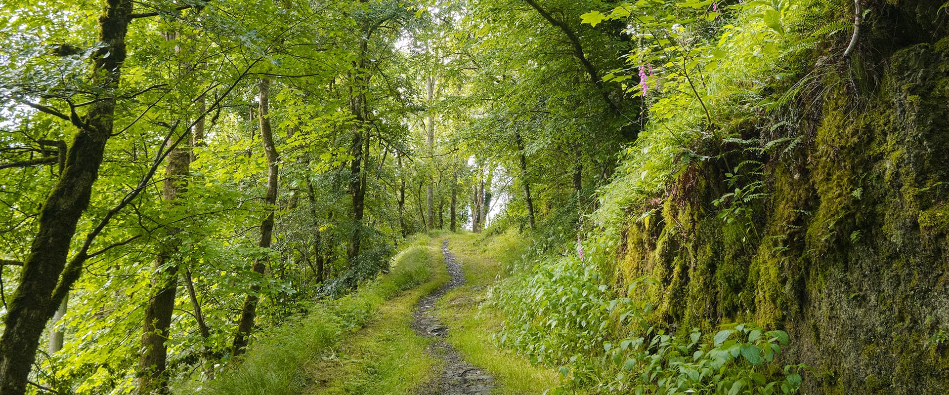
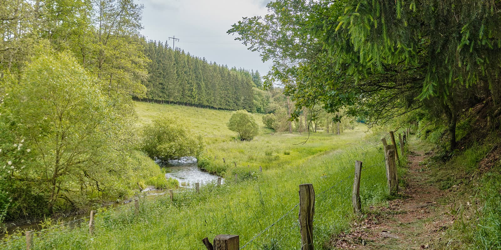
Hills, Forest
remoteness
Some of the time
Show more

The Eislek Trail is a 106-kilometer-long trail that runs through the beautiful Eislek region. This region stretches from the northern part of Luxembourg to the southern part of Belgium and is known for its dense forests, deep valleys, and windy plateaus. With more than 1900 kilometers worth of trails and paths, it is no wonder these whimsical landscapes are very popular amongst hiking enthusiasts. What better way to explore this region than by a 5-day trek covering the most spectacular views? And that is exactly what you can expect from the Eislek Trail.

The trail itself was created in 2012 by EscapArdenne and is considered one of the ‘Leading Quality Trails – Best of Europe,’ a quality label that hiking trails can obtain when meeting some strict conditions. Not too long after creating the Eislek Trail, EscapArdenne extended the route to the picturesque town of Ettelbrück with a new trail, the ‘Lee Trail’. These two trails can perfectly be combined if you’re looking for a challenging 8-day trek.

Women holding hiking pasport
Author

Hanne Govaerts

Hanne Govaerts is a Belgian outdoors enthusiast. During the week she works a full-time office job but every moment of spare time she tends to spend outdoors, on trail. Her passion for hiking started at the early age of 16, when she impulsively went on a summer camp hiking the Wicklow Way in Ireland. Ever since, her holidays have been filled with hiking trips such as the Matterhorn Trek in Switzerland and the Kumano Kodo Nakahechi Route in Japan. Hanne’s main goal is to hike all the Belgian long-distance trails. With its +/- 10.000 kilometers of trails throughout the country, it’s a challenge that should not be taken lightly. You can follow her hiking adventures on her Instagram account @hannehikes.

View profile

The Trail

Starting at Kautenbach in Luxembourg and ending in La Roche-en-Ardenne in Belgium, this route doesn’t only cross borders but also passes through an astonishing amount of 30 nature reserves, 45 unique viewpoints, three cities, and 19 villages. And this whilst following 60% unpaved and natural trails.

The trailhead is located in Kautenbach. Due to its train station, it is easy to reach by public transport. However, one can hike the Eislek Trail in both directions. The trail leaves Kautenbach by taking a small and steep unpaved path that was once a path to transport cattle. The trail provides you with a breathtaking view of the valley of Wiltz before descending back to the campsite of Kautenbach.

From there, the trail takes the ‘Kriibsewee’ or ‘Lobster way’ up to the castle of Schibberech. This oddly named path is based on a story that dates back to 1748. It’s said that the owner of the castle caught two farmers catching lobsters in its river. As punishment, they had to carve this eastern path to the castle into the hillside.

After passing Lellingen and Enscherange, also known as the center of Luxembourg (which ironically is not the center of Luxembourg), the path runs through some dense forests before passing the intersection to Munshausen. This typical medieval village is well-worth a visit. Running along the hilltop, the trail treats you with a beautiful sight of the Abbey of Clervaux right before entering the city.

Following a train line, the path leaves Clervaux again to enter the lush forest of ‘Beischend.’ There’s a folklore saying that the villagers of a town that was once located in this forest, are still looking after their houses there. On the highest point of the forest, there is a stone cairn. When descending, the trail passes an airplane wreck that was downed in World War II.

After a few kilometers the trail, once again, passes a World War II memorial: an old monastery that was used as a ‘residency’ for Jewish people. A tragic history that got its own memorial on the site that is now used as an education center.

Right after, the trail ascends and descends again, before getting a clear view of the church tower of Troisvierges. The path doesn’t enter the city but runs along the river and takes you to the watermills of Tretterbach. There used to be more than 10 watermills along the river but only 5 ruins remain. At the watermill of Asselborn, you can stop for dinner, a good night’s sleep, a shop with some local products, and even some first-aid products for hikers.

After leaving the watermill of Asselborn, the path takes you up to the plateau of Wincrange. This is a beautiful wide grass hill that offers some panoramic views. From there, the plateau swings all the way to the canal of Bernistap, a canal that would’ve connected the river Maas to the river Moezel in Luxembourg using the river Ourthe in Belgium. However, this ambitious project has never been completed.

Before you fully realize it, the trail runs along and – after a kilometer or so – crosses the border into Belgium. After walking through some forests, you bump into the city ‘Houffalize.’ Due to its unique location, Houffalize was never able to expand. Therefore, all the streets (and their names) have remained pretty much the same as in the past. Houffalize is a well-known holiday destination for Belgians who are looking for a little getaway in their own country.

After leaving Houffalize, the trail runs under the big viaduct of Highway E25 before entering the mysterious forests of ‘Nabiselle.’ If you’re lucky, you might even spot an otter, a wild cat, or a black woodpecker. Right up the hill, the trail passes the village ‘Bonnerue.’ Due to its location, you’ll be greeted by some panoramic views over the valley. The trail then runs through the forests to stumble across the confluence of the two Ourthes (rivers) and the dam of Nisramont before ascending to Nadrin.

Starting from Nadrin, the trail descends very steeply to the river bank. This is the area of ‘Hérou,’ called out as one of the most extraordinary Walloon heritage sites due to its beautiful and authentic views of the river Ourthe as well as beautiful rock formations.

From the river bank, the trail follows ‘Le Cheslé,’ which are roads that were used for carts and trolleys in the First Iron Age (approximately 2500 years ago). When ascending back to the next village, do keep your eyes open, if you’re lucky you might even spot a beaver!

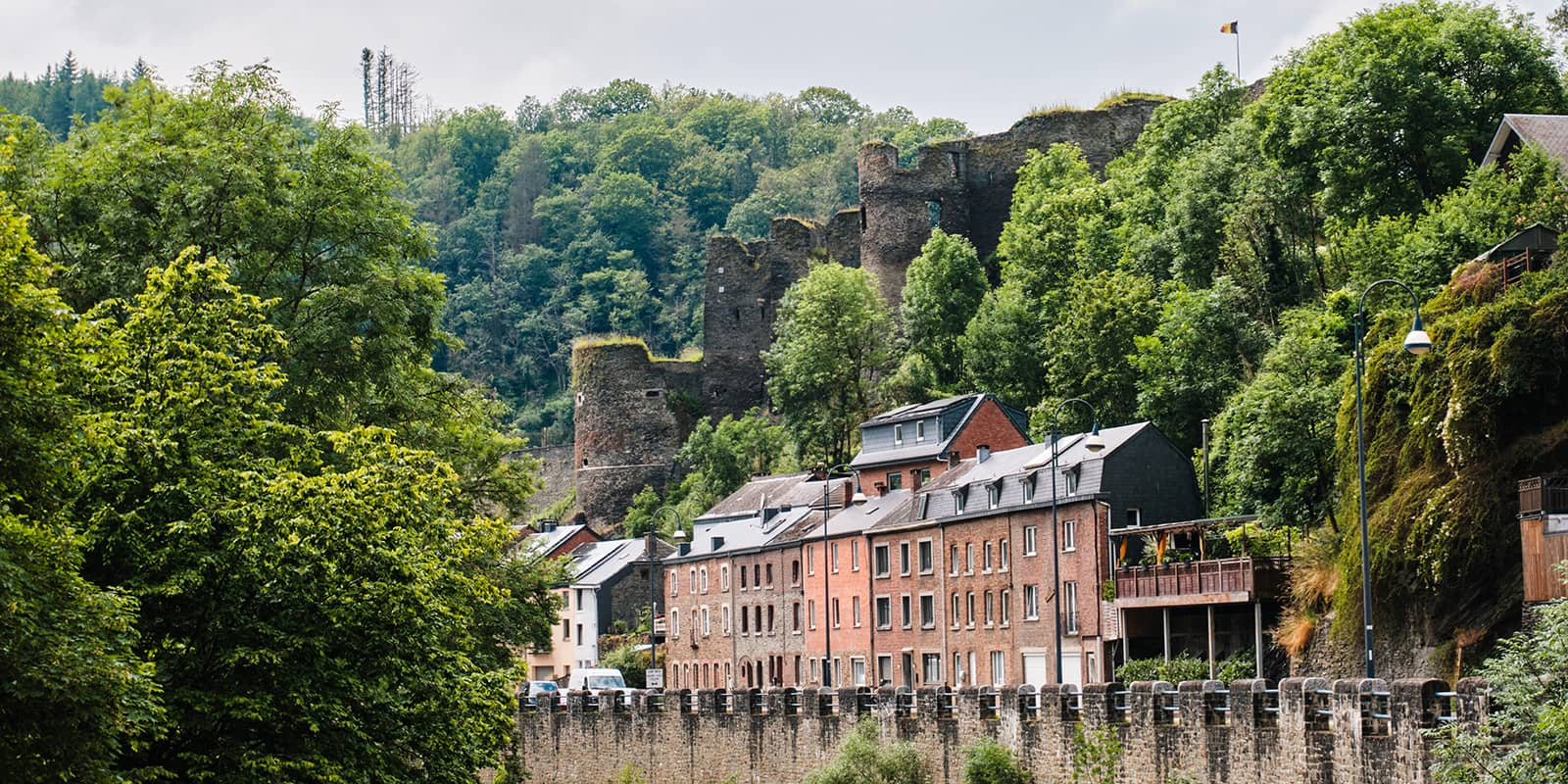
After passing some small villages, the trail enters once again a forest and starts its descent to La Roche-en-Ardenne, a city known for its rocky massif and its castle on top of the hill in the city center, and the ending destination of the Eislek Trail. Don’t forget to grab a nice and tasty Belgian waffle (which can be found at the ice cream shop right before the entryway to the castle) before heading out of the city again.

Stages

5-stage itinerary

Stage 1:

Kautenbach – Clervaux, 25.5 km | 15.8 mi

Stage 2:

Clervaux – Asselborn, 20 km | 12.4 mi

Stage 3:

Asselborn – Houffalize, 20.7 km | 12.8 mi

Stage 4:

Houffalize – Nadrin, 23.4 km | 14.5 mi

Stage 5:

Nadrin – La Roche-en-Ardenne, 18 km | 11.2 mi

Accommodations

Since every stage ends in a small village, it is possible to hike the Eislek Trail by using B&B/ hotels or even by camping with a tent on campsites. Due to the limited lodging in the smaller towns, it is important to book the hotels in advance.

Lodging: 

Stage 1: Robbesscheier (1km off the trail)
Stage 2: Domaine du Moulin d’Asselborn (on the trail)
Stage 3: Hotel du Commerce Houffalize (300m off the trail)
Stage 4: L’Hostellerie du Panorama (750m off the trail)
Stage 5: Floreal la Roche-en-Ardenne (600m off the trail)

Camping:

If you’d like to stay overnight before starting the trail, you can camp at the Kautenbach campsite, conveniently located at the trail’s starting point.

Campsites per stage

Stage 1:

Camping Clervaux

Stage 2:

Camping Troisvierges (on the trail)

Best time of the year

Luxembourg and Belgium have moderate temperatures year-round. Therefore this trail can be walked any time of year. During the winter, around November until March, it can be cold and occasionally snowy. Due to the steep passages along the way, it is not recommended to hike the trail during the winter months. In summer, from June until September, the temperatures are higher. However, the weather can be unpredictable so one should always be prepared for rain.

Safety & Gear

The Eislek Trail is located in a very hilly part of Luxembourg and Belgium. Some parts can be physically demanding. Therefore comfortable hiking shoes and a good backpack are no luxury items on this trail. I also recommend hiking with trekking poles, especially when the rocks get slippery to obtain balance but also to restrain any knee injuries when descending down.

The trail is marked in both directions and it’s never far from a village. But do bring your own map or topo guide and the official GPX file to make sure you don’t get lost in the woods when the waymarkings aren’t clear. In case of emergencies, it’s important to know your way back to the nearest village.

Good to know

Since the Escapardenne trails are pretty popular in the European hiking community, there is a chance to book a hiking package. This includes, for example, luggage shuttles, lodging, etc. There are multiple websites where you can book these kinds of packages.

Water resources: the trail passes lots of villages with plenty of water resources.

Route
Point to point
Highest point
505m (1657 ft)

Want to submit a trail or make this page more complete?

Always read the disclaimer

Terms of Use: important to all visitors on this website. We strive to publish high quality content and information on this website. However it’s always possible that we’re missing out on some crucial information. In spite of the fact that this route, associated GPS track (GPX and maps) were prepared under diligent research by the specified contributor and/or contributors, the accuracy of such and judgement of the author is not guaranteed. Therefore, hiking-trails.com and contributors are in no way liable for personal injury, damage to personal property, or any other such situation that might happen to individuals hiking or following this route. Should you choose to hike this trail, this is always at your own risk. Check out our guidelines for safety hiking and Leave No Trace principles at the hiking 101 page.

Download GPX

Join the community!

Login or create a FREE account 😊

With an account you can:

Download GPX files

Pin trails to your wishlist

Mark trails as hiked by you

Rate hiking trails

Comment on trails, blogs and gear reviews

Happy trails!
Login

Don't have an account yet? Register here