About the Eagle’s Path

country
Poland
length
4.5 km(3 mi)
Type of trail
Day hike
difficulty

Difficulty is highly personal. Be aware of the weather conditions as bad weather turns easier trails in difficult trails especially in the mountains.

Strenuous
accommodation

Lodging means a mix of hotels, hostels or AirBnB’s.

Mountain huts, Lodging
Elevation gain
607 m(1991 ft)
terrain
Mountains
remoteness
Some of the time
Show more

The Eagle’s Path is a trail in the Tatra Mountains, the highest mountains in Poland, and the only alpine mountain range in Poland. Notably, they are also the highest range in the Carpathian chain. This trail is considered the most difficult and dangerous trail in Poland and all of the Tatra Mountains, yet the most picturesque.

Leading through the passes and peaks above 2000 meters, it is extremely exposed and not suitable for people with a fear of heights. It requires very strong physical condition, ample mountain experience, and proper equipment. If you love climbing, ridge hiking, adrenaline, and challenges, this trail is made for you! But please note that this trail is only for very experienced hikers and climbers.


jakub & Monica profile picture
Author

Monika & Jakub

Monika & Jakub are a couple from Poland (Kraków) who love hiking! They are also interested in bikepacking, wild camping, and outdoor photography. They specialize in the Dinaric Alps (Balkan countries) and Polish trails. You can follow Jakub & Monika on Instagram @_bry_dzia_ & @de_moniqua

View profile

The Trail

The Eagle’s Path is very popular, another reason why it is very dangerous. It can be quite crowded where facilities are installed. So, it is a good idea to start early in the morning to skip the crowds. Since its inception, approximately 140 people have lost their lives on it. Make no mistake, you need to stay sharp and keep track of the weather forecast throughout the day.

“Orla Perć” is a ridge trail. In good weather conditions, the views will be magnificent. It is marked red, with a red dot at its beginning (Zawrat Pass) and its end (Krzyżne Pass). The Krzyżne Pass, where the trail finishes, is famous for its beautiful panoramic views of a vast part of the High Tatras, considered by some as the most beautiful view in Polish Tatras.

The trail is partially one-way on the Zawrat-Kozia Przełęcz section. The remaining part of Kozia Przełęcz – Krzyżne Pass is a two-way. If you plan to hike the trail in one day, you should choose the Zawrat-Krzyżne Pass direction. For a person with good physical condition, you need to plan for 5-6 hours to complete the trail in good weather conditions.

Keep in mind that the trail starts and ends on the ridge! The beginning of the trail – Zawrat Pass (2158m) can be reached from two places: Kuźnice (1025m) and Palenica Białczańska (984m).

You’ll find the blue trail leads from Kuźnice to Zawrat. On the way, there is a year-round open “Murowaniec” Shelter, where you can stay overnight if you book in advance. It is worth noting that shelters in the season must be booked far in advance, especially on weekends.

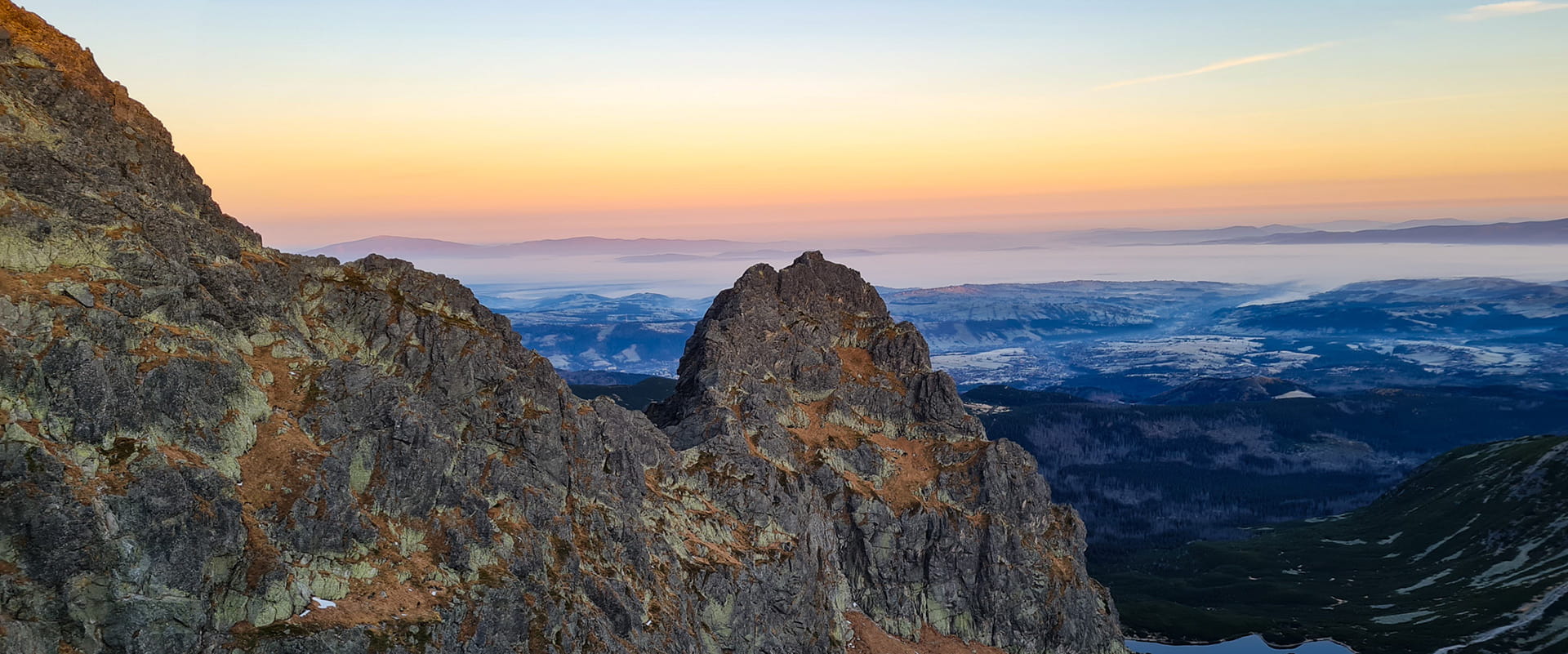
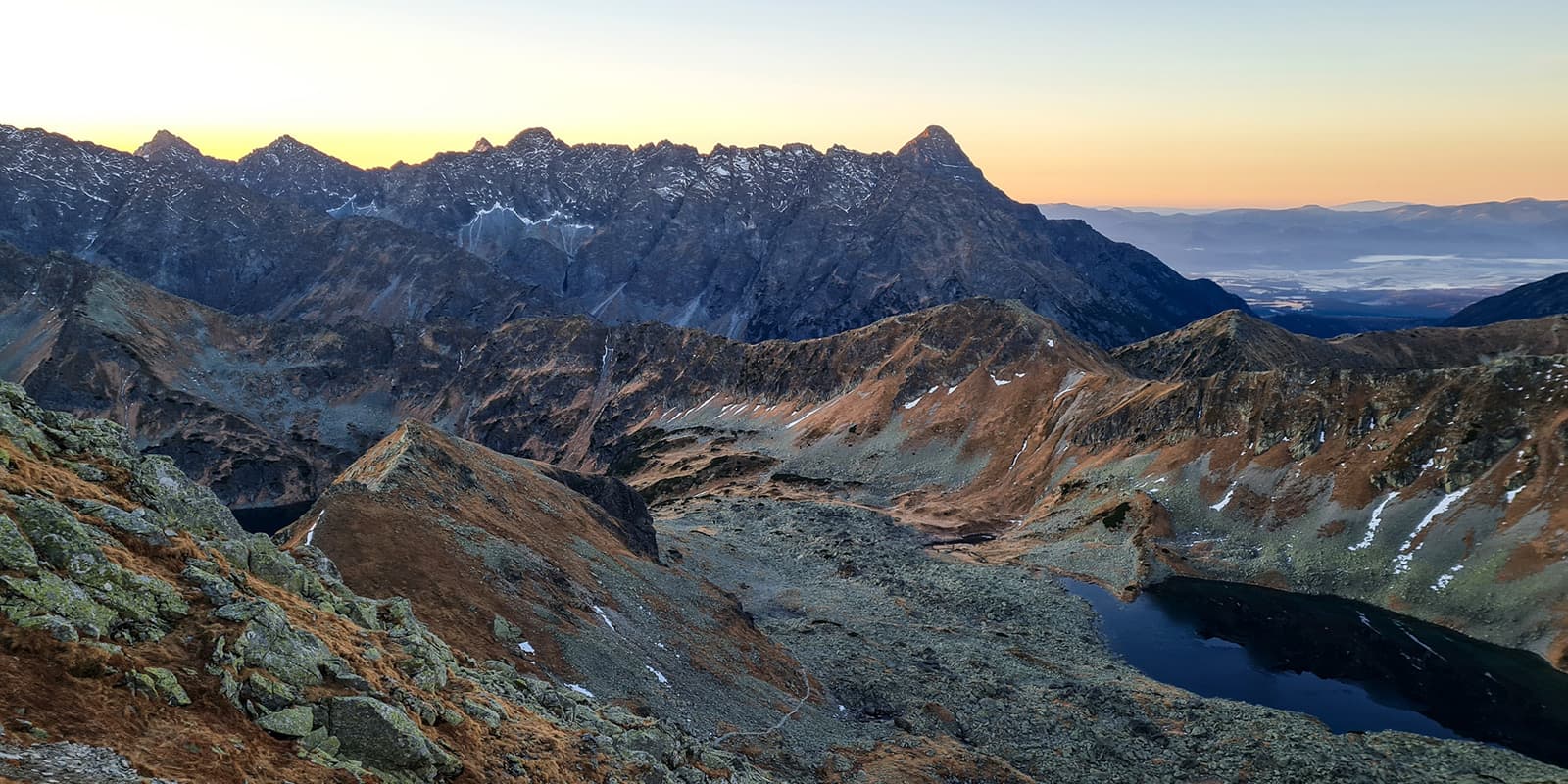
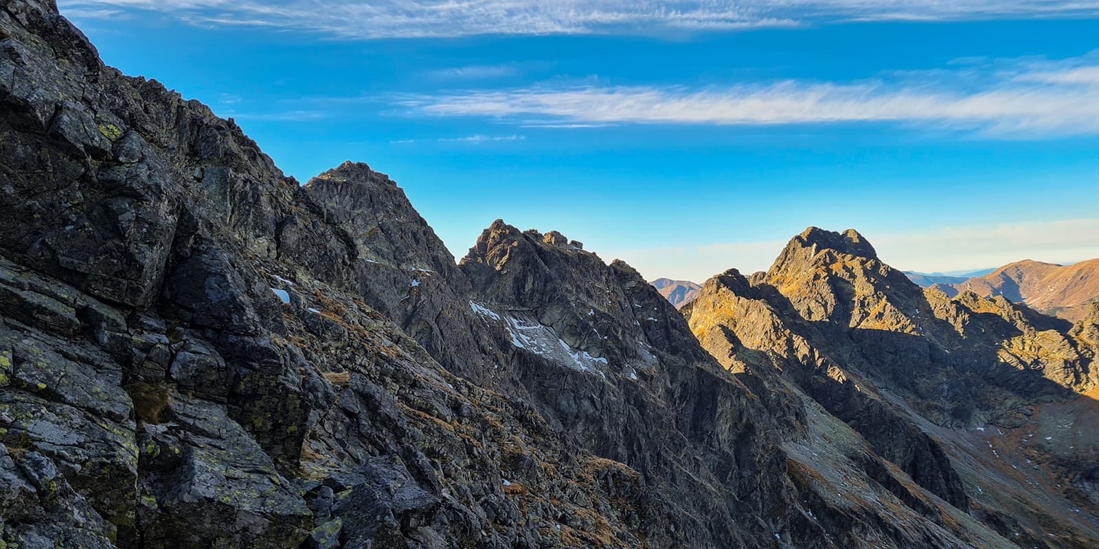
If you choose to hike from Palenica Białczańska, you will take the red trail, then the green trail towards the “Valley of Five Polish Ponds” and then the blue trail to “Zawrat Pass.” In the Valley of Five Ponds, there is a year-round shelter, where you can stay overnight if you book it in advance. Both shelters are open all year round, and you can order food and replenish your water. There are no springs or water sources on the Eagle’s Path trail.

To get to the beginning of the “Orla Perć” trail, you should plan about 4-5 hours and a climb of approximately 1250 meters. You should set aside about the same amount of time for the descent. If you plan to sleep in the shelter, you will get to the trail in about 2 hours and you should count on the descent in the same amount of time to get back to the shelter.

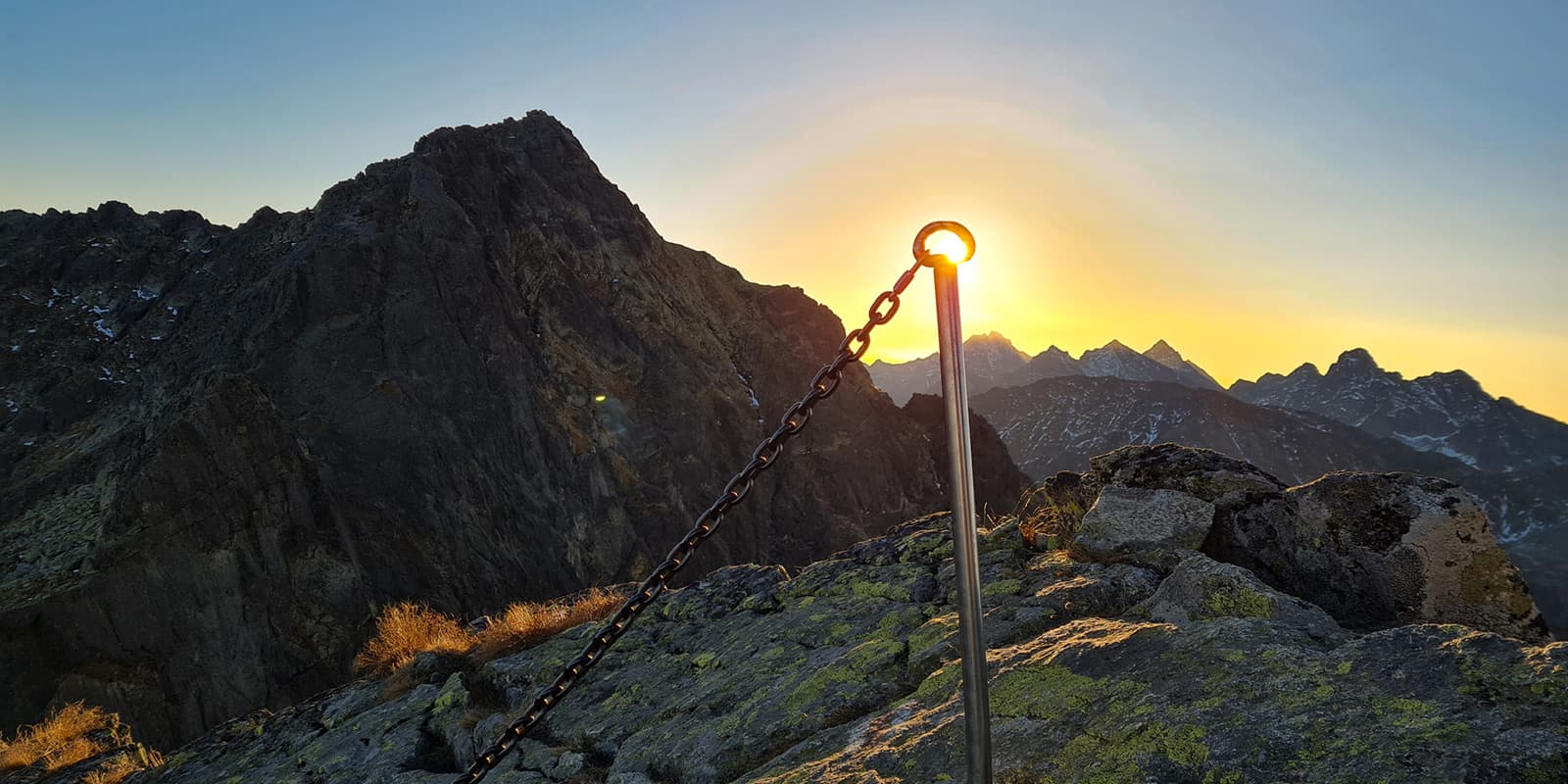
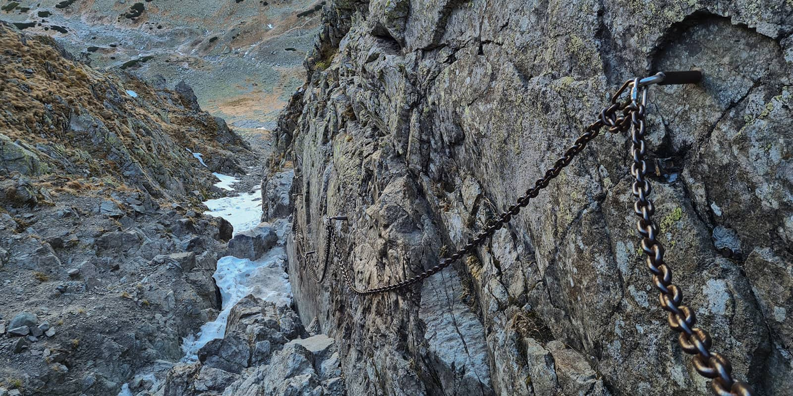
The trail is secured with artificial facilities like chains, metal steps, and two ladders, but it is not a via ferrata.

The most important rule when moving on chains is one person per chain. If, while using the chain, someone else wants to use it, you must intervene immediately. This can cause a loss of balance and a fall from a great height for both of you.

The entire trail is located within the Tatra National Park. You should familiarize yourself with the regulations that apply there. Some of the most important rules are:

  • Do not leave the marked trail
  • No camping
  • No swimming in lakes
  • No hiking on the trail after dark (in the period from March 1st to November 30th)
  • Do not leave any rubbish
  • Do not feed wild animals

It is worth remembering that the Tatras are not only a tourist attraction, but above all a home to many species of wild animals such as brown bear, lynx, wolf, fox, deer, marmot, and chamois (mountain goat). The ban on walking after dark is not only to allow animals to move freely but is also a form of protecting tourists from the consequences of an encounter with
a surprised animal.

Accommodations

Best time of the year

The best time to walk the Eagle’s Path safely is from June to October. But note that by September the trail can be covered with snow and at some points, especially on the northern side, there may be icy patches. You need to keep track of the weather and use local information points. Slipping and falling from a great height can be fatal, so it is not recommended to walk this trail in winter conditions.

Safety & Gear

For your safety, always stay on the trail. Take enough water with you, and download the app “RATUNEK” (RESCUE) provided by Polish mountain rescue operations. Let your friends know about your plans and estimated return time. This is a very difficult trail only for experienced hikers with the right experience.

Required equipment:

  • Helmet required
  • Headlamp
  • Approach shoes
  • In June, September, October (depend on the weather) crampons might be needed.
  • Chain gloves will be very useful
  • Trekking poles for approach and descent
  • Good sunglasses
  • Via Ferrata leash and climbing harness are not required but if you prefere to feel more secure, it can be useful during critical points.

Additionally, do not keep anything in the side pockets of your backpack that could fall out. A bottle of water or a thermos could hurt someone climbing below. Keep such things inside your backpack. It is worth installing the app RATUNEK (RESCUE). In the event of an accident, just press the button on your phone’s display three times and the emergency services will be informed about the need to carry out a rescue operation. The application also will transmit your current location to the services using GPS and even the battery level of your phone.

Good to know

The larger area of the Tatras Mountains is very small in comparison to the population of Poland that is interested in hiking the trail. This means that, especially in high season, it will become crowded. Remember to book your accommodation and parking well in advance. Both can be done through the website.

There are no water sources or springs on the entire Eagles’s Path trail! Keep in mind that especially during the summer, you need to carry enough water for the whole day hike with you. Water is available in the mountain shelter below the ridge.

Recommended apps:

Route
Point to point
Highest point
2291m (7516 ft)

Want to submit a trail or make this page more complete?

Comments

Be the first one to comment on this trail!

Reply to this trail

Your email address will not be published. Required fields are marked *

Reply to this trail

Log in to comment on this trail

Join the community!

Login or create a FREE account 😊

With an account you can:

Download GPX files

Pin trails to your wishlist

Mark trails as hiked by you

Rate hiking trails

Comment on trails, blogs and gear reviews

Happy trails!
Login

Don't have an account yet? Register here