small mountain path in the Alps

Liechtensteiner Panoramaweg

Route 66

About the Liechtensteiner Panoramaweg

Alps
country
Liechtenstein
length
47 km(29 mi)
Type of trail
Hut to hut, Long-distance
difficulty

Difficulty is highly personal. Be aware of the weather conditions as bad weather turns easier trails in difficult trails especially in the mountains.

Difficult
accommodation

Lodging means a mix of hotels, hostels or AirBnB’s.

Mountain huts, Lodging
Elevation gain
2500 m(8202 ft)
terrain
Mountains, Forest, Hills, Urban
remoteness
Some of the time
Show more

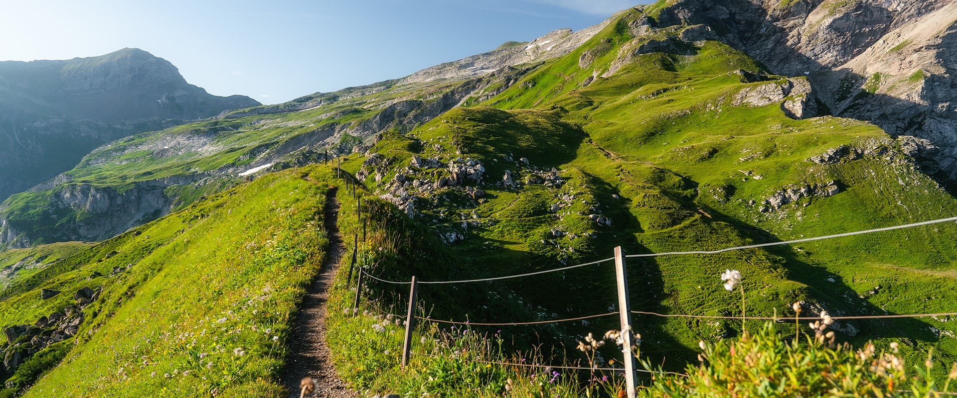
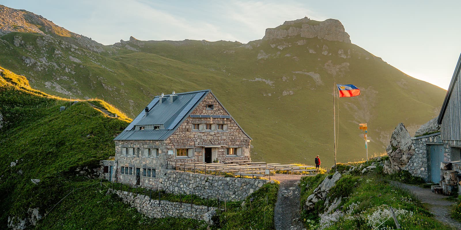
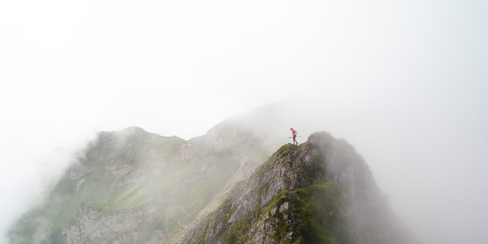
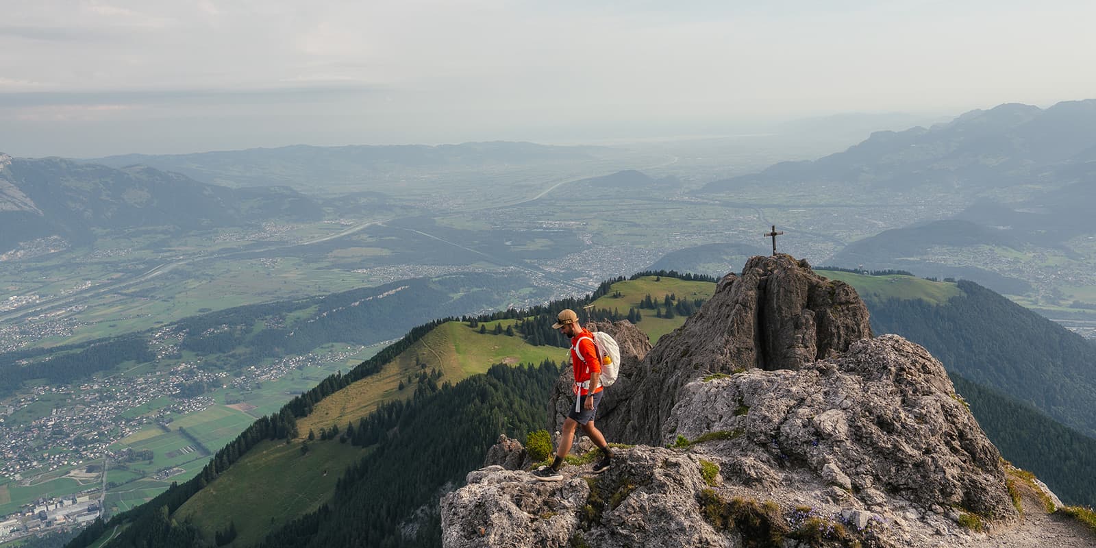
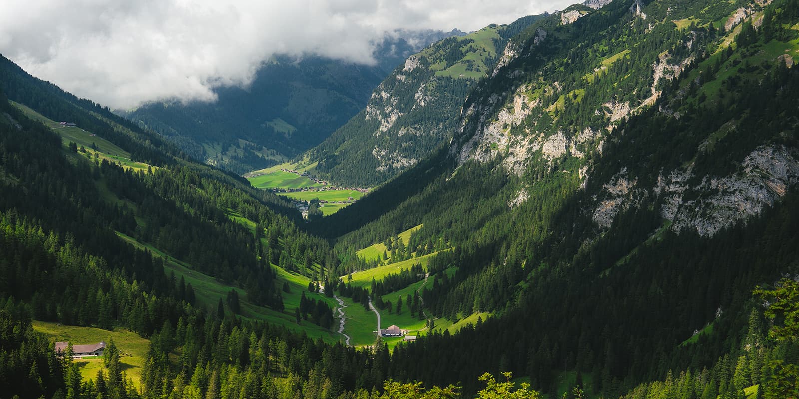
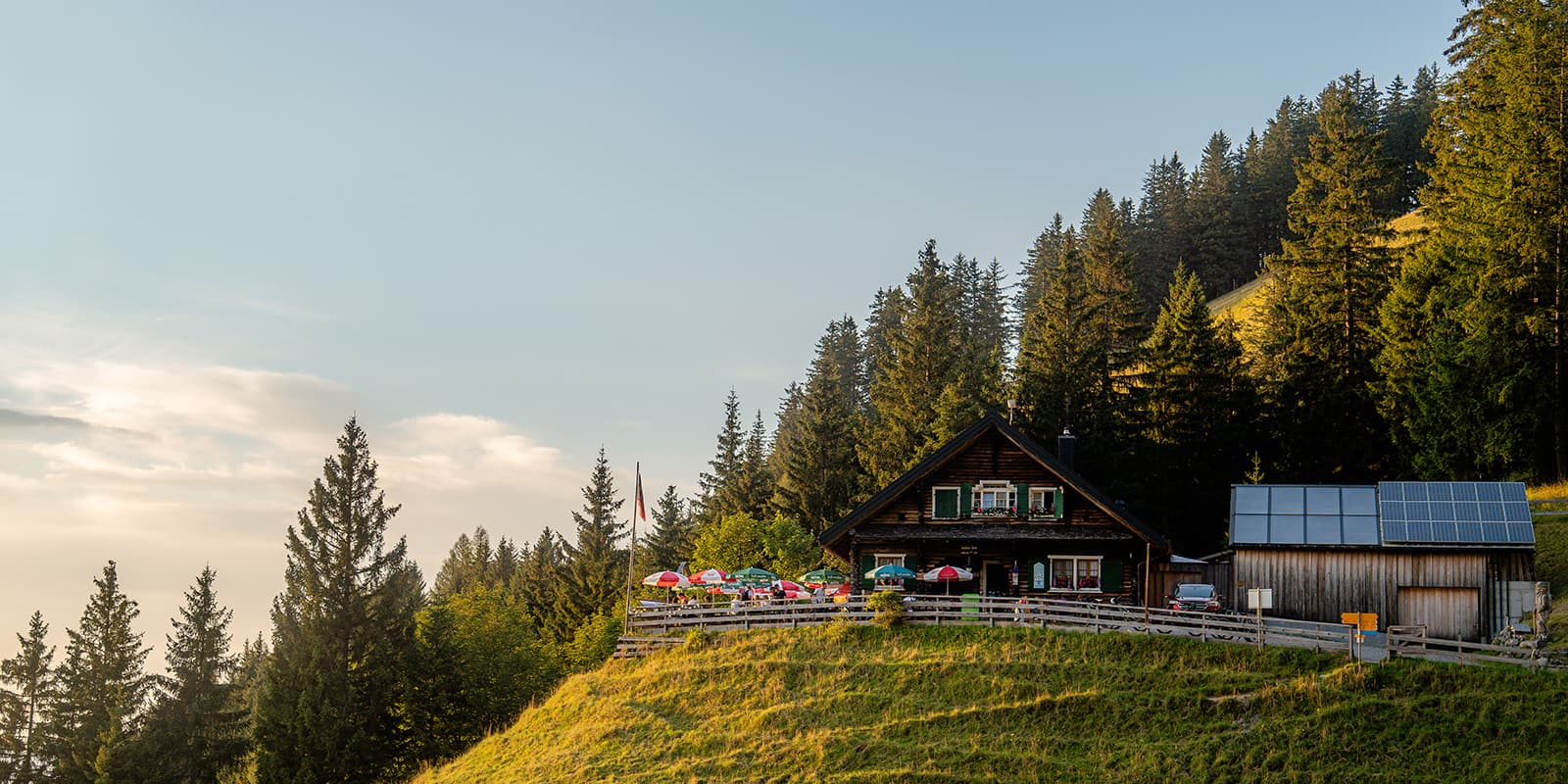
The Alps don’t end in Switzerland, you can also find them in the tiny country of Liechtenstein and hike through them on the Liechtensteiner Panoramaweg, also known as Route 66. This 48-kilometer trail crosses various landscapes in its short but sweet length. Along the way, you’ll see breathtaking views of the Rhine Valley and surrounding Alps.

It has historical significance as it follows some traditional paths used by local communities and is perfect for hikers who are looking for a remote, peaceful trail. The route is popular among people who want the chance to experience pristine nature without crowds. You’re sure to love this trail that crosses one of the smallest countries in the world.

Elmar profile picture
Editor

Elmar Teegelbeckers

Passionate hiker Elmar spends months of his time on the trail. He’s usually on the lookout for hidden gems in one of his favourite countries such as Slovenia, Switzerland and Japan. He founded hiking-trails.com in need for a community and detailed information about the trails. Before this, he worked for the Alpine asscociation in the Netherlands[ (NKBV) but lost his heart to the trails.

Not long ago, Elmar published the book (in Dutch) Hiking Trails – best long-distance trails in Europe. With this book, website and socials, he hopes to inspire and shape an inclusive community for hikers all over world. No matter your speed, experience or level, you can get out there to enjoy the trails and connect with the heartwarming hiking community. Life is so much better outside and he hopes to inspire hikers to take their first, or next, step on the trail.

You can reach Elmar at info@hiking-trails.com.

View profile

The Trail

The Liechtensteiner Panoramaweg goes through alpine ridges, valleys, and meadows. You’ll climb steep paths to the Pfälzerhütte, crossing trailsin the forest to end on a high plateau. On the descent, the route cuts through forests, where trees give way to clear views of the Rhine Valley. The trail will then take you past ridgelines and down to the peaceful village of Malbun. Each stage is very different, high altitude alpine trails to smooth stretches through the woods. You can hike the route 66 in both directions.

The first stage of the Liechtensteiner Panoramaweg goes from Ruggell to the Gafadura Hütte. You’ll start in the urban area but as soon as you pass Planken the trail goes up towards the mountain hut. A tough steep ascend through the woods will be rewarded with views of Liechtenstein’s peaks and a cozy stay at the Gafadura mountain hut, which is a great resting point and has delicious food.

The second stage from the Gafadura Hütte to Sücka is about 12 kilometers and takes 5 hours to complete. It offers a mix of alpine meadows and rugged sections, with panoramic views of the Rhine Valley. You’ll also get to hike the Fürstensteig, one of the most famous trails in Liechtenstein and you’ll hike along the Drei Schwestern. This part is an alpine blue white marked trail which means it’s a technical trail. After the technical paths you’ll descend towards the mountain hut / hotel Sücka. At the moment this accommodation is closed, a great option to stay is the Swiss Youth Hostel in Schaan-Vaduz. Public transport is never far away and a great way to get to the hostel.

In the third stage from Sücka to the Pfälzerhütte is great, you’ll hike 12 kilometers which will take about 6 hours. On this day, the trail descends through forested paths and you’ll climbing some ridges peaking some prominent peaks. The stage ends at the beautiful Pfälzerhütte. The last day is short and sweet to the cozy town of Malbun. It’s only a few kilometers and a perfect way to end your trail in this tiny beautiful country in the Alps.

Stages

You can hike this trail in either three or four stages depending on your own preferences. Also you can hike the Liechtensteiner Panoramaweg in both directions, you’ll either start in Ruggell or in Malbun. Extra tip: start in Ruggell and stay a few more days in the cozy mountain town Malbun.

4-day itinerary

Stage 1:

Ruggell – Gafadura Hütte, 21km | 13 mi

Stage 2:

Gafadura Hütte – Sücka, 12km | 7 mi

Stage 3:

Sücka – Pfälzerhütte, 13km | 8 mi

Stage 4:

Pfälzerhütte – Malbun, 9km | 5 mi

Accommodations

Accommodation along the trail includes mountain huts and guesthouses. The mountain huts you’ll stay in are the Pfälzerhütte and the Gafadura Hütte, which has meals these are traditional mountain hut accommodations. In addition, Sücka is more a mountain hotel (closed at the moment) and you can sleep at the Swiss Youth Hostel in Schaan-Vaduz for a comfortable night. You’ll be able to find options for all budget ranges there. Note that wild camping is not permitted, it’s wise to book the accommodations in advance as these fill up quickly.

Overnights per stage

Stage 1:

Gafadura Hütte

Stage 2:

Sücka (closed) alternative: Swiss Youth Hostel in Schaan-Vaduz

Stage 3:

Pfälzerhütte


Best time of the year

The best time to hike the Liechtensteiner Panoramaweg is between June and September. The weather is best in this period and the Pfälzerhütte will be open. Plus, the trails will be most likely free of snow! Liechtenstein is known for having mild summers, with the occasional heat spell when it can reach over 30 degrees Celsius. If so, be sure to start early and take lots of breaks and take some extra water with you.

Safety & Gear

The Liechtensteiner Panoramaweg requires good fitness, as the trail includes steep ascents and descents. You can prepare by packing good hiking shoes, waterproof clothing, and a map or download the GPX on your mobile. Weather conditions can change rapidly in the mountains, so it’s important to check the forecast and carry extra layers. As always, basic first aid supplies and plenty of water are essential for a safe hike. On the second stage you’ll hike on alpine trails. Make sure you have the experience for such exposed rocky sections.

Good to know

The Liechtensteiner Panoramaweg is a great trail for a long weekend break and everyone who wants to discover the most beautiful hiking trails in Liechtenstein.Despite its modest size you’ll hike on stunning alpine mountain paths with the Fürstensteig & Drei Schwestern Trail as a part of the Panoramaweg as the absolute highlight. The trails are well-marked, making it easy to navigate.

Kind of trail
Point-to-point
Highest point
2359M (7735 FT)

Want to submit a trail or make this page more complete?

Comments

Be the first one to comment on this trail!

Reply to this trail

Your email address will not be published. Required fields are marked *

Reply to this trail

Log in to comment on this trail
Always read the disclaimer

Terms of Use: important to all visitors on this website. We strive to publish high quality content and information on this website. However it’s always possible that we’re missing out on some crucial information. In spite of the fact that this route, associated GPS track (GPX and maps) were prepared under diligent research by the specified contributor and/or contributors, the accuracy of such and judgement of the author is not guaranteed. Therefore, hiking-trails.com and contributors are in no way liable for personal injury, damage to personal property, or any other such situation that might happen to individuals hiking or following this route. Should you choose to hike this trail, this is always at your own risk. Check out our guidelines for safety hiking and Leave No Trace principles at the hiking 101 page.

Download GPX

Join the community!

Login or create a FREE account 😊

With an account you can:

Download GPX files

Pin trails to your wishlist

Mark trails as hiked by you

Rate hiking trails

Comment on trails, blogs and gear reviews

Happy trails!
Login

Don't have an account yet? Register here