About the Señor De Huanca

country
Peru
length
16 km(10 mi)
Type of trail
Pilgrimage, Day hike
difficulty

Difficulty is highly personal. Be aware of the weather conditions as bad weather turns easier trails in difficult trails especially in the mountains.

Moderate
accommodation

Lodging means a mix of hotels, hostels or AirBnB’s.

Camping, Lodging
Elevation gain
2100 m(6890 ft)
terrain
Mountains
remoteness
Most of the time
Show more

The Señor (or Lord) of Huanca – was founded as a sacred route over 300 years ago.  Nowadays the local people celebrate by walking the route every 14th of September as part of a religious Catholic festival done as a pilgrimage. However, it can be done at any time.

The story of the trail dates back to 1675. Diego Quispe, a Native tired of the mistreatment of the Spanish, while working at a local mine, saw one of his fellow slaves being attacked by a Spanish guard and stood up for him. He subsequently became an ‘outlaw’ to the Spanish regime and so he immediately escaped to Huanca and prayed that they would not find him. He found a cave to take refuge and at some point, the image of the bloody Christ would appear before him. Astonished by the miracle, Diego sent a painter to that precise place to reproduce what he had seen. Where the stone was painted, a chapel was built that would later become the sanctuary we see today.

Matt Waugh profile picture

Matt Waugh

Matt Waugh hails from Scotland but has traveled extensively since leaving high school, covering treks all around the world.

He first arrived to Peru and to the mountains in 2006, and from then was hooked on trekking in the Andean landscapes. Initially covering the more popular routes such as the Inca trail to Machu Picchu, but then on to other lesser-known routes and Inca trails.  He now runs his own sustainable tour and trek agency centered on trekking with stays in local villages along the way. Wishing travelers to gain cultural immersion and insight into the local traditions such as farming, textiles, and shamanic rituals associated with the culture.

For more information or to book with him, email info@southandestravel.com.

View profile

The Trail

To get to the trailhead, you will need to get to the Suburb of San Jeronimo (outside of Cusco). If you know your way around and ideally speak Spanish, then you can take a cheap ‘collectivo’ bus from Cusco downtown. Ideally from the Limapampa bus stop or any other stop along the ‘Avenida de La Cultura’.  The cost is 1 sol (30 cents USD). Naturally, it will take some time because of frequent stops (around 45 minutes from downtown) to get to the San Jeronimo market or square. Otherwise, you can take a taxi for around 15 soles (from downtown) in 25 minutes.

From San Jeronimo main square you have two options: the first option is to hire a taxi. The price will depend on your negotiation skills. Usually around 40 soles or more to take a taxi from there to Huacoto village. The second option is to hike it. You will need to hike out from the town square, northeast on the right-hand-side of the church (can be Calle Tupac Amaru meeting up with Calle Romerito) or directly from Romerito about 3- blocks further east from the town square/plaza.

Once you have left town you will be on an obvious dirt-track road that leads you uphill to an archaeological site called Raqayraqayniyuq – turn right here!

You will then need to follow part of the road, take some shortcuts through the curves and follow smaller trails that will dissect the road on and off for the first 1 hour of walking. You will then be on a steeper section that diverts from the dirt road and has some markings and an occasional blue sign indicating that it is part of the Señor Huanca route. This may only be once or twice along the way. Once you hike up for around 1 more hour, you will meet the road again and flatten, a few minutes later you will have the first sighting of the small remote village of Huacoto. Continue until you see a path deviation going downhill on the right (if you do not wish to follow the meandering road all the way to the village) then back uphill at the entry point of the village and a large sign with Huacoto – letting you know you have made the milestone of 4084m in elevation.

Now that you’re in the village either via taxi or walking, you’ll need to begin the actual pilgrimage. Walk through the beginning of the village and veer left. You will see a small school down on your right-hand side. Continue uphill near a building that has a row of houses on your left. Then upwards passing some more rural mud-brick farmhouses to some steps that lead you up to the cross and viewpoint.  You may be greeted by ducks and hens, and/or barked at by some local dogs. They are harmless but make a point of letting you know you are walking through their territory. 30-40 minutes later you have reached the cross and viewpoint.

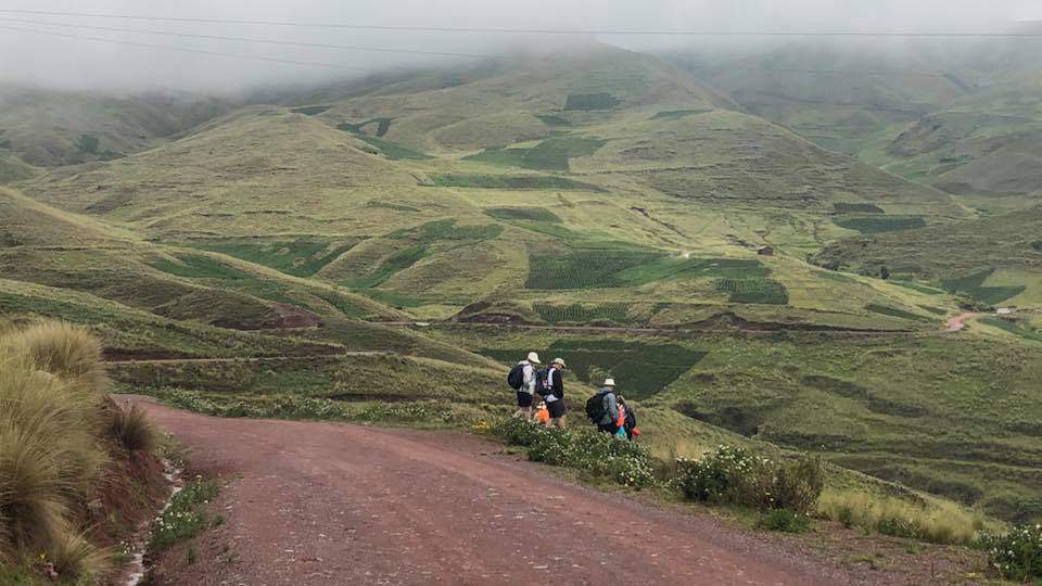
Upon leaving the cross, note that slightly uphill to your left (back to the village) you will see a rough pathway that you can take that will lead you across a high plain. This obvious path is on undulating and rolling terrain that gradually ascends, but after 1 hour you will reach the highest point marked with an obvious picnic spot or place for setting up a camp. At this point, there is no more uphill.  Another 5 minutes downhill (you may also note walking down on your left a nearby cave that may relate to the story and legend of Diego and Señor de Huanca) and you will make it to a small set of ruins and a fabulous look-out down to the Sacred Valley. Ideal to take a picnic here – don’t get too close to the edge though!

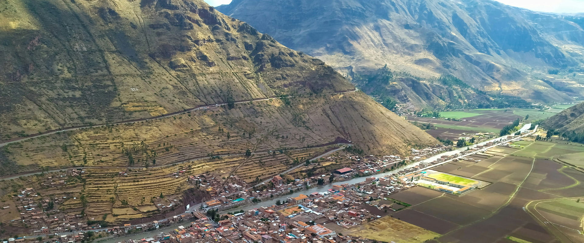
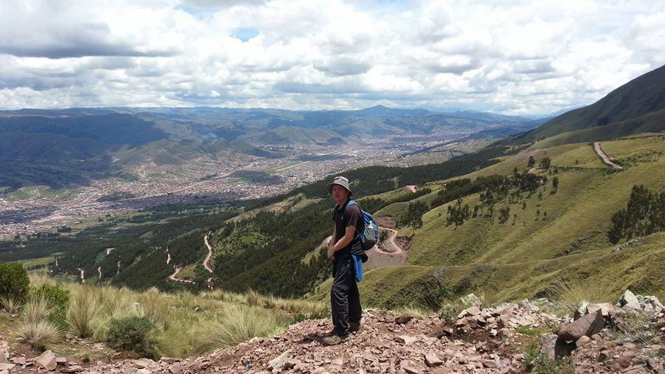
From here, you can even see the bright-red rooftop of the Señor de Huanca Church and your goal for this trek.

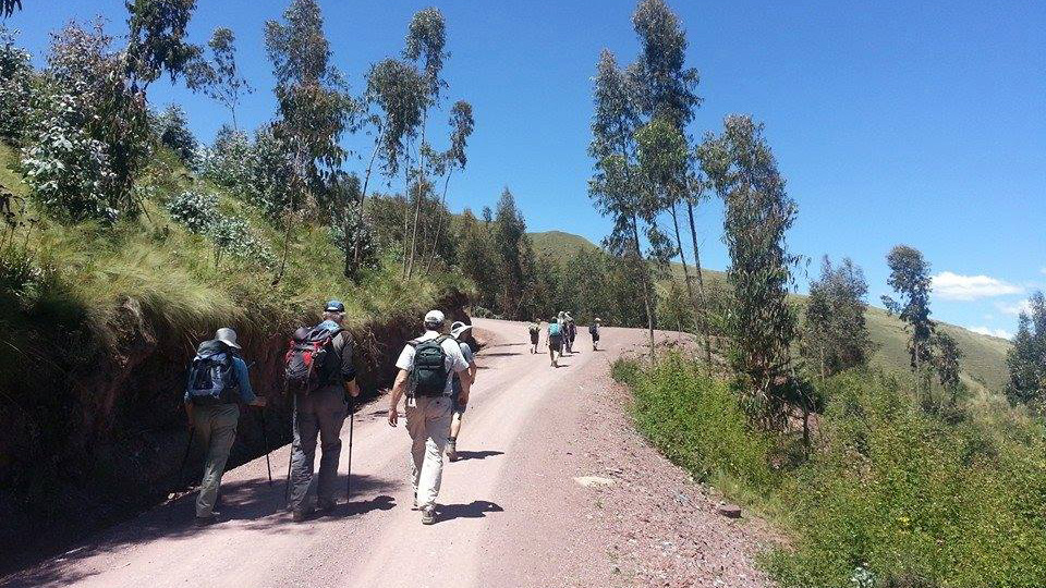
Walking down you have to follow the path (it has signs) initially in a ‘zig-zag’ formation and tread carefully as some switchbacks are quite steep and riddled with stones and rocks.

As you approach the church (within eye-sight almost the entire way) you will start making out a stone pathway some of which was originally constructed hundreds of years ago and when the pilgrimage first began.

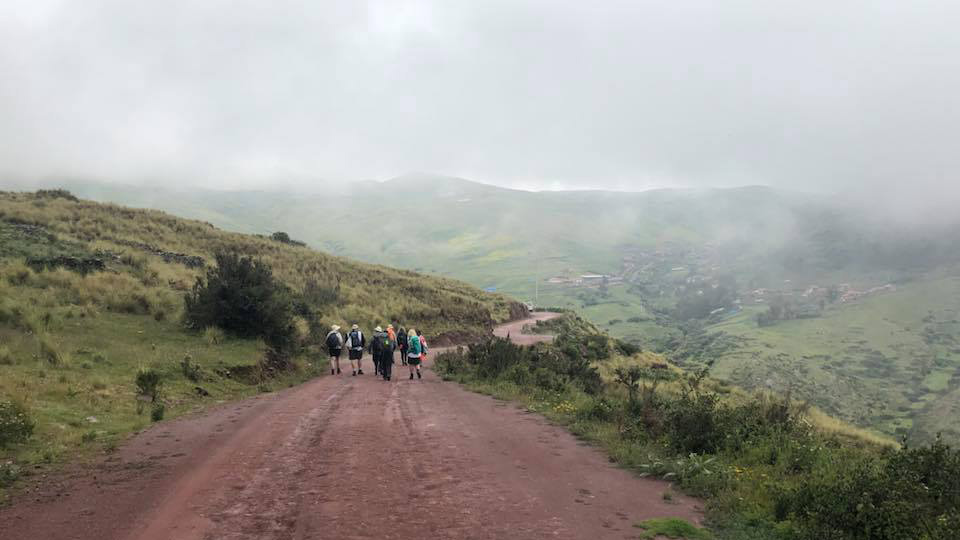
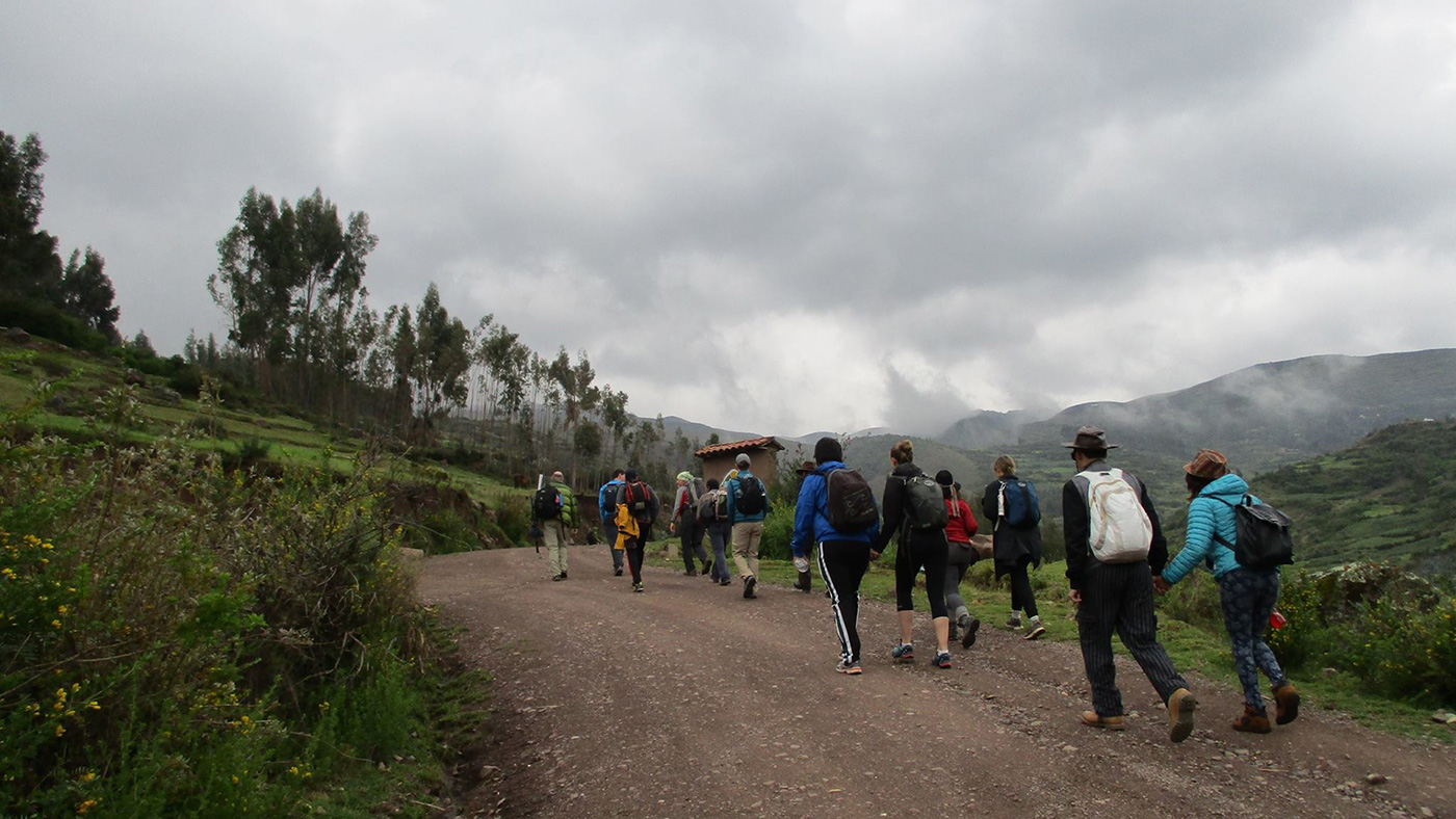
Stopping lots to admire the views, the complete downhill section should take between 2-2.5 hours, but less if you are quick on your feet and don’t stop regularly.

Once you arrive at the grounds of the Sanctuary you pass through a Eucalyptus forest and some religious statues, and a few minutes further you have reached the church and your main goal of the trek

From here it is recommended to find a taxi (or call one) to take you to the pretty market town of Pisac where you can get some dinner, or continue with your next days of adventure. Taxis would typically cost around 25 soles with negotiation. There is a small collectivo minivan that turns up irregularly – this can take you to San Salvador (the nearest town for a couple of soles (less than a dollar) and from there you can find another collectivo (for 2 soles) by the bridge to take you to Pisac one direction or back to San Jeronimo (for 5 soles) in the other direction, then transfer from there to Cusco center.

From Pisac, you can get vans that will take you back to Cusco for 5 soles (1.5 USD) and about 50 minutes by road.

Accommodations

To give you added time and added authenticity of being in the wilderness you may wish to bring a tent and sleep out in the open. This would be best done somewhere on the flat/table-top section between the cross & viewpoint, and the high-pass.

Best time of the year

The best time of the year to hike in this area of the Andes known as Cusco and the Sacred Valley is between April and October – outside of those months is considered wet season and can be prone to landslides.

And if you decide to do it on the actual day of the celebrated Pilgrimage (14th of September) you will be going alongside potentially thousands of other Peruvians who prefer to take the journey during the night in order to be at the church by dawn in order to make early morning prayer at the church.

Keep in mind that the weather in the high mountains can change rapidly, and it’s important to be prepared for all conditions, including rain or snow. Always check trail conditions and local weather forecasts before starting a high-alpine hike. Additionally, consider your hiking experience and skill level, as some trails can be challenging and require proper equipment and experience.

Safety & Gear

Bring a rain jacket/wind-breaker in case of some wind at the pass or freak rain in the dry season. You’ll also be happy to have a sweater with a hood or a warm fleece and down-jacket just in case (might not be necessary for most of the journey). As well as layers, bring a sunhat or beanie and good boots or cross-trainers with decent grip. Trekking poles are subject to preference – but are handy for the long downhill section. Finally, load your day-pack with the essentials: picnic snacks, water, a camera, and sunscreen.

Good to know

The church and grounds of the Sanctuary receive visitors daily most to practice their religion so please be peaceful/respectful to the local customs and beliefs.

Consider bringing out any trash along the way, whether it’s your own or others.

Route
Point to point
Highest point
4274m (14021 ft)

Want to submit a trail or make this page more complete?

Comments

Be the first one to comment on this trail!

Reply to this trail

Your email address will not be published. Required fields are marked *

Reply to this trail

Log in to comment on this trail
Always read the disclaimer

Terms of Use: important to all visitors on this website. We strive to publish high quality content and information on this website. However it’s always possible that we’re missing out on some crucial information. In spite of the fact that this route, associated GPS track (GPX and maps) were prepared under diligent research by the specified contributor and/or contributors, the accuracy of such and judgement of the author is not guaranteed. Therefore, hiking-trails.com and contributors are in no way liable for personal injury, damage to personal property, or any other such situation that might happen to individuals hiking or following this route. Should you choose to hike this trail, this is always at your own risk. Check out our guidelines for safety hiking and Leave No Trace principles at the hiking 101 page.

Download GPX

Join the community!

Login or create a FREE account 😊

With an account you can:

Download GPX files

Pin trails to your wishlist

Mark trails as hiked by you

Rate hiking trails

Comment on trails, blogs and gear reviews

Happy trails!
Login

Don't have an account yet? Register here