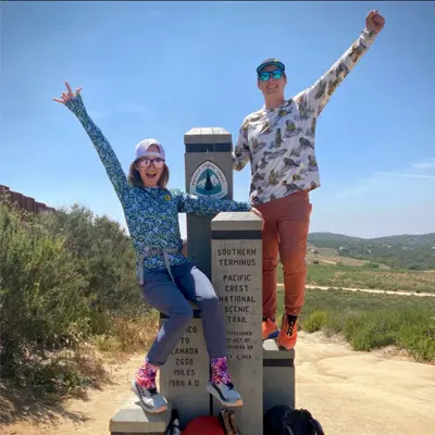
About the Tahoe Rim Trail

country
United States
length
280 km(174 mi)
Type of trail
Long-distance
difficulty

Difficulty is highly personal. Be aware of the weather conditions as bad weather turns easier trails in difficult trails especially in the mountains.

Difficult
accommodation

Lodging means a mix of hotels, hostels or AirBnB’s.

Camping, Lodging, Wild camping
Elevation gain
8534 m(27999 ft)
terrain
Mountains, Forest
remoteness
Some of the time
Show more

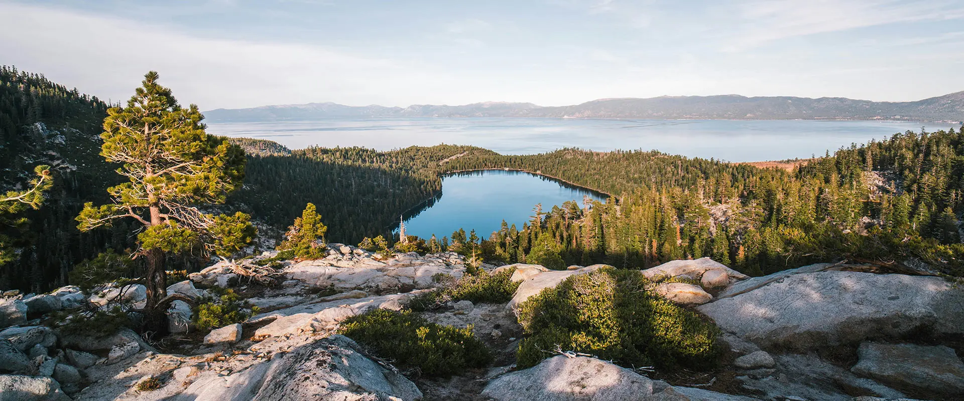
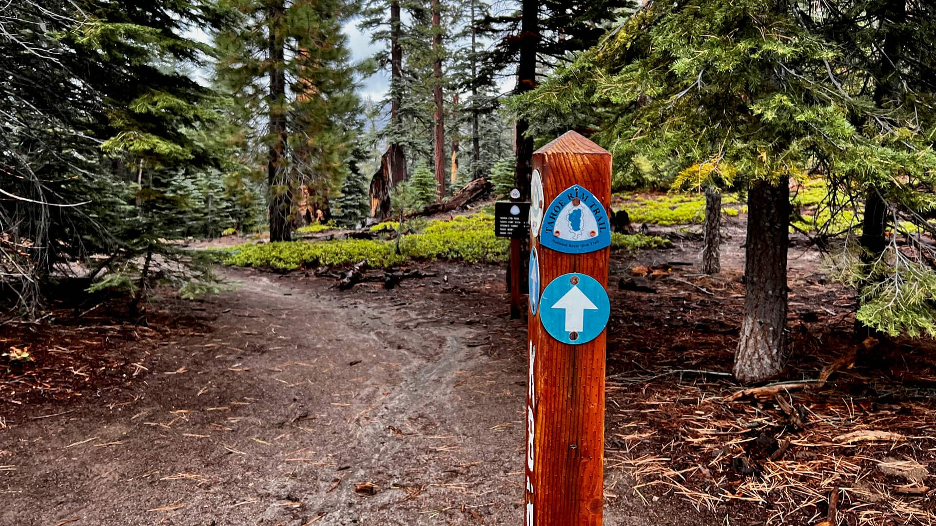
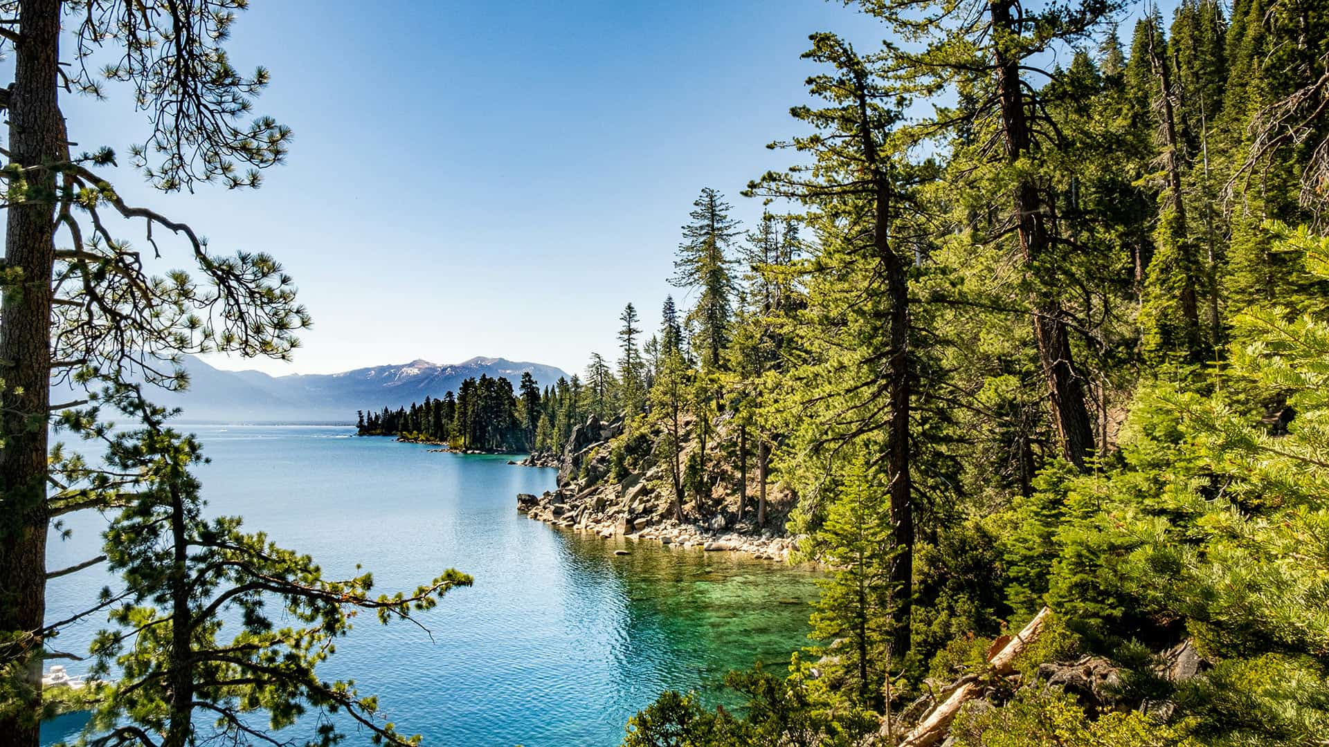
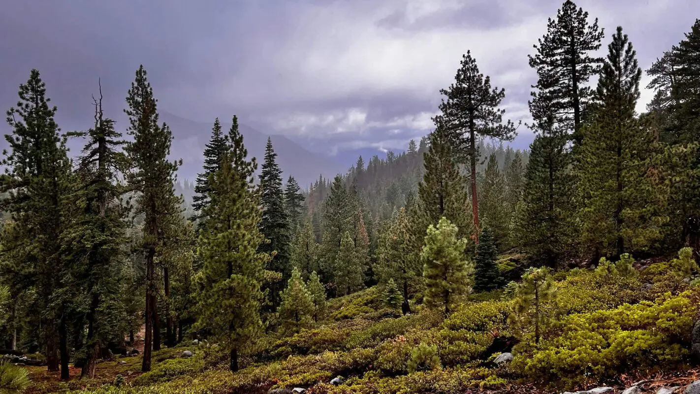
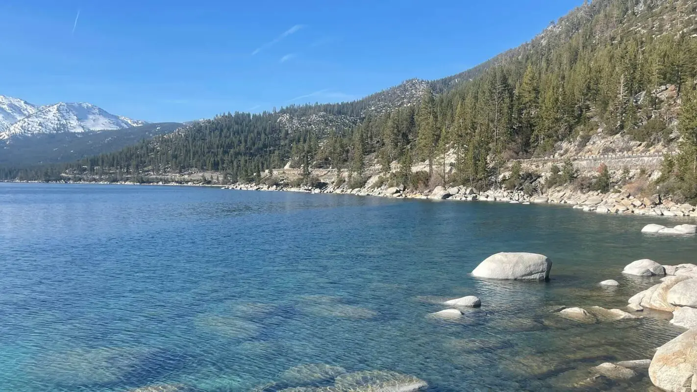
The Tahoe Rim Trail is a 165-mile loop around Lake Tahoe, the largest freshwater lake in the Sierra Nevada Range and the largest alpine lake in North America. The water is one of the purest natural sources in the world, and it is infamous for its clear blue color. However, the trail only gets near the lake once, the rest is up on the mountain ridgeline surrounding the lake.

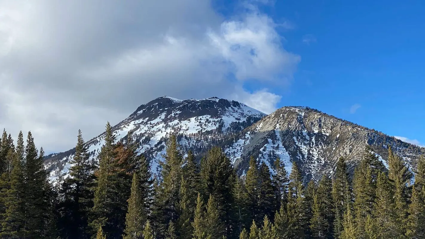
The lake sits on the border of California and Nevada, so the trail will take you through 2 states. You will be treated to frequent views overlooking the incredible lake as you make your way around the rim. The trail ranges from 6,500 ft elevation at its lowest to 9,214 ft at its highest, on Relay Peak. On the Southwest side of the lake, the trail goes through Desolation Wilderness, the most popular and remote section. Glaciers scraped the soil from this area leaving behind bare granite and hundreds of lakes. The Tahoe Rim Trail has mountain peaks, pristine alpine lakes, meadows of wildflowers, fascinating geography and volcanic activity, and a variety of wildlife.

Brian Walsh profile picture
Author

Brian Walsh

Brian grew up in New England hiking the White Mountains of NH. He thru-hiked the 2,200-mile Appalachian Trail with his now-fiance in 2021 and they have been avid long-distance backpackers ever since, completing the Trans Catalina Trail, Tahoe Rim Trail, and John Muir Trail. In 2024 they will be thru-hiking from Mexico to Canada on the Pacific Crest Trail.

You can follow them on Instagram @trekking_thru

View profile

The Trail

Permits & Regulations for Tahoe Rim Trail

The only part of the trail that requires an overnight permit is Desolation Wilderness, however, I strongly recommend you get a TRT Thru Hike Permit. Getting a permit for Desolation is much more competitive than the TRT Thru Hike Permit, and it gives you flexibility on which dates you enter the wilderness. It is also important to get a permit to help the TRTA keep track of who is using the trail to help them maintain it. Make sure to get your permit at least 2 weeks in advance of when you start your hike!

Here is the info for applying for the TRT Thru Hike Permit. Make sure to print your permit and bring it with you on the trail!

It is required that you store all of your food and smellable items in a Bear Proof canister in the Desolation Wilderness and strongly recommended for the rest of the trail. There are a lot of black bears in this area so please do your part to protect them by storing your food safely and responsibly!

If you intend to use a stove for cooking or have campfires (ONLY allowed in the campgrounds) along the trail, you also need to get a California Campfire Permit. It’s very easy to do, you just have to watch a short video online and answer a quiz, then print it out and make sure you bring it with you on the trail.

Stages

The trail is broken up into 8 different segments, the Tahoe Rim Trail Association has a lot of info about each one and downloadable maps on their website, it’s a fantastic resource for planning your hike!


  • Tahoe City – Brockway Summit, 33 km | 20.5 mi
  • Brockway Summit – Mt. Rose Summit / Tahoe Meadows, 32.5 km | 20.2 mi
  • Mt. Rose Summit / Tahoe Meadows – Spooner Summit, 38.5 km | 24.1 mi
  • Spooner Summit – Kingsbury South Connector, 30.5 km | 19 mi
  • Kingsbury South Connector – Big Meadow, 37 km | 22.9 mi
  • Big Meadow – Echo Lakes, 29 km | 18.3 mi
  • Echo Lakes – Barker Pass, 52 km | 32.5 mi
  • Barker Pass – Tahoe City, 26.5 km | 16.4 mi

Accommodations

The Tahoe Rim Trail passes through a few campgrounds and one town, but for the most part, you will be dispersed (wild) camping. Local regulations require that you camp at least 100 and no more than 300 feet from the trail, and at least 100 feet from any water source. There are lots of options and it is relatively easy to find tent spots that are established from previous use already.

Since this trail is a loop, you can start from any trailhead and go either clockwise or counterclockwise. There is a lot of flexibility with how you do it, but here is the itinerary that worked out great for me!

I chose to start at Spooner Summit Trailhead because the East of the lake is the dry side, and Spooner is right in the middle of a 25-mile section with no on-trail water sources. Leaving our car here, we were able to split that into two manageable sections, and left plenty of water in our van for when we got back to it! If you don’t park here, you can walk a mile or so down the road to Spooner Lake and get water there, so this isn’t a necessity. If you don’t have a car and are taking public transportation, it’s easiest to start from Tahoe City, the only town the trail passes directly through.

Stage 1:

Spooner Trailhead – Marlette Campground, 15.2 km | 9.5 mi

Stage 2:

Marlette Campground – Mount Rose Campground, 23.3 km | 14.5 mi

Stage 3:

Mt Rose Campground – unmarked tent site, 27 km | 16.7 mi

Stage 4:

Unmarked tent site – Unmarked Tentsite, 31 km | 19.3 mi

Stage 5:

Unmarked Tentsite – Tahoe City, 9 km | 5.5 mi

Stage 6:

Tahoe City – N. Fork Blackwood Creek, 23 km | 14.2 mi

Stage 7:

N. Fork Blackwood Creek – Fontanellis Lake, 30.5 km | 19 mi

Stage 8:

Fontanellis Lake – Aloha Lake, 15.8 km | 9.8 mi

Stage 9:

Aloha Lake – Showers Lake, 26.5 km | 16.5 mi

Stage 10:

Showers Lake – Star Lake, 35.7 km | 22.2 mi

Stage 11:

Star Lake – Burke Creek, 22.5 km | 14 mi

Stage 12:

Burke Creek – Spooner Trailhead, 22 km | 13.6 mi

Best time of the year

The best time of year to hike the Tahoe Rim Trail is July through early September. The Sierra Nevada gets a lot of snow during the winter and often doesn’t melt until late June, so if you are planning to hike earlier, pay close attention to trail reports to see if winter hiking equipment is necessary. Once September comes the temperature starts to drop and by October snowstorms are a risk. Wildfires are also unfortunately common in the late summer and can result in dangerous air quality, so keep an eye out for wildfires in the area.

Keep in mind that the weather in the high mountains can change rapidly, and it’s essential to be prepared for various conditions, including sudden rain or snow showers during all months of the year. Always check trail conditions, and local weather forecasts before embarking on a high-alpine hike.

Safety & Gear

Research the trail to understand its difficulty, length, and terrain using resources like this website, guidebooks, previous hikers, and local hiking organizations. Be sure you put it into perspective of your abilities and experience.

Inform friends or family of your hike details including start and end times, route, and emergency contacts for safety. And check the local weather and avoid hiking in severe conditions to stay safe. Ensure you stay hydrated and nourished by bringing enough water—at least two liters in summer—and snacks to maintain energy levels.

Familiarize yourself with the trail map and carry navigation tools like a compass or GPX on your mobile device. Invest in the right hiking gear, including proper footwear and clothing, and essentials such as a first-aid kit. Check our gear list for specific recommendations.

Adhere to Leave No Trace principles by keeping to trails, packing out trash, and respecting wildlife and habitats.

Good to know

You need to book permits for the Desolation Wilderness section of the trail. However, it is better to just book a Tahoe Rim Trail thru-hiking permit, as these are easier to get and provide you with more flexibility.

Water sources can be scarce in some places, particularly on the East Side from Kingsbury South to Mt Rose, as well as 15 miles on the northwest side from Gray Lake to Watson Lake.

The trail is medium-busy. Lake Tahoe is a touristy area, but the trail itself is usually far enough away from the crowds to feel remote. However the trail crosses plenty of roads and trailheads with easy hitches into nearby towns, so if you need to bail out for any reason it isn’t difficult. The only truly remote area is Desolation Wilderness, a 32-mile section of the trail with no road crossings or easy outlets.

Route
Circuit
Highest point
2808m (9,214 ft)

Want to submit a trail or make this page more complete?

Comments

Be the first one to comment on this trail!

Reply to this trail

Your email address will not be published. Required fields are marked *

Reply to this trail

Log in to comment on this trail
Always read the disclaimer

Terms of Use: important to all visitors on this website. We strive to publish high quality content and information on this website. However it’s always possible that we’re missing out on some crucial information. In spite of the fact that this route, associated GPS track (GPX and maps) were prepared under diligent research by the specified contributor and/or contributors, the accuracy of such and judgement of the author is not guaranteed. Therefore, hiking-trails.com and contributors are in no way liable for personal injury, damage to personal property, or any other such situation that might happen to individuals hiking or following this route. Should you choose to hike this trail, this is always at your own risk. Check out our guidelines for safety hiking and Leave No Trace principles at the hiking 101 page.

Download GPX

Join the community!

Login or create a FREE account 😊

With an account you can:

Download GPX files

Pin trails to your wishlist

Mark trails as hiked by you

Rate hiking trails

Comment on trails, blogs and gear reviews

Happy trails!
Login

Don't have an account yet? Register here