coastal town near Amalfi, Italy

Path of the Gods

il Sentiero degli Dei

About the Path of the Gods

country
Italy
length
7 km(4 mi)
Type of trail
Day hike
difficulty

Difficulty is highly personal. Be aware of the weather conditions as bad weather turns easier trails in difficult trails especially in the mountains.

Easy
accommodation

Lodging means a mix of hotels, hostels or AirBnB’s.

Lodging
Elevation gain
780 m(2559 ft)
terrain
Coastal, Forest, Hills
remoteness
None of the time
Show more

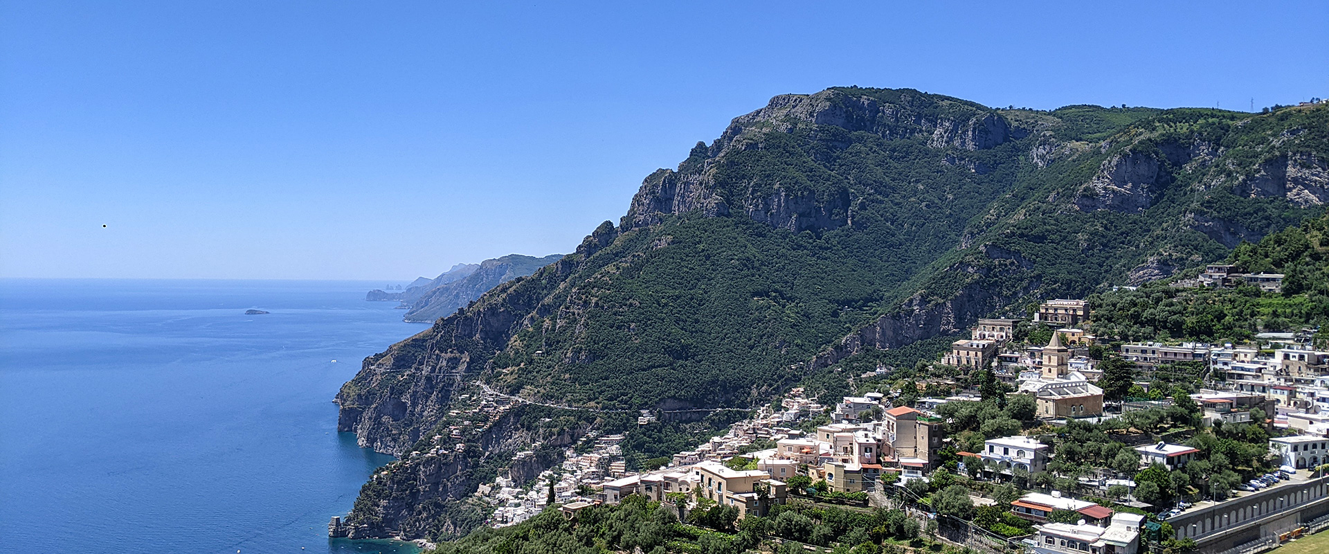
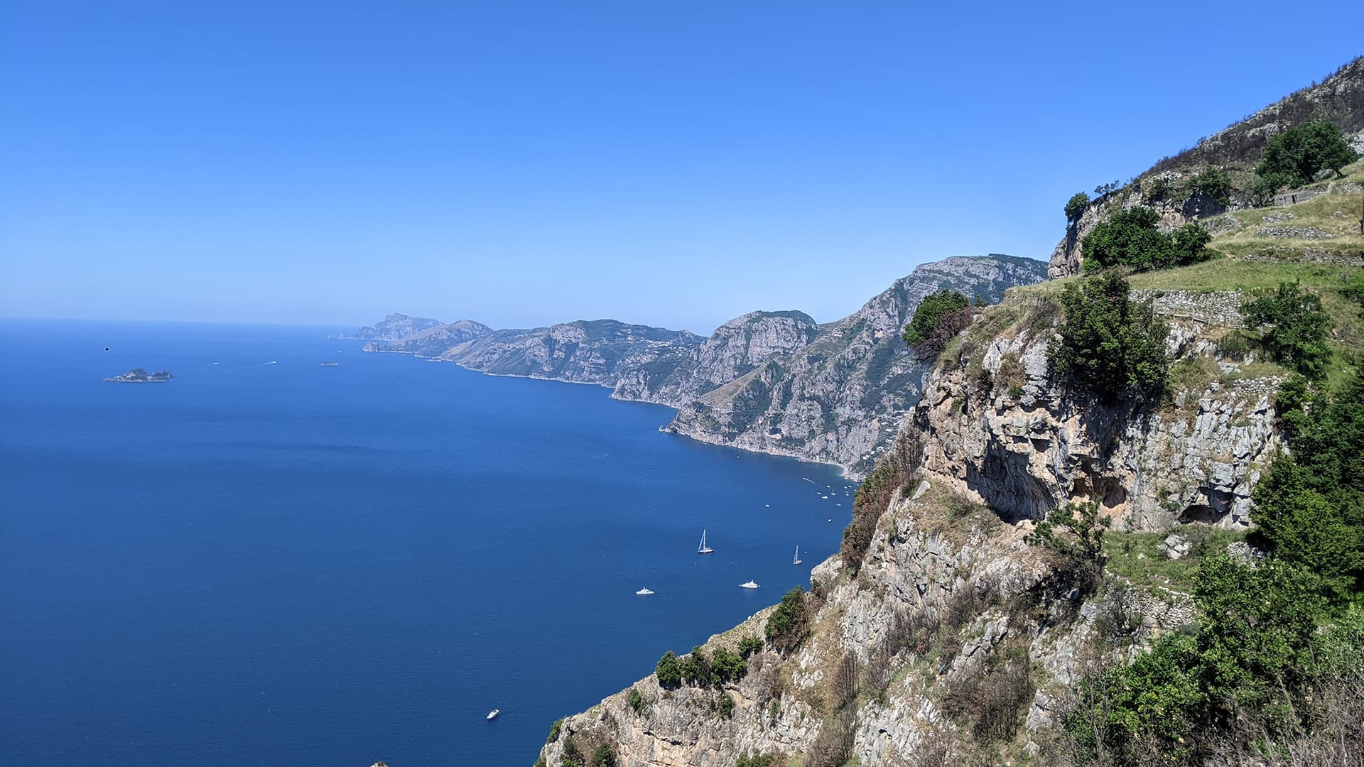
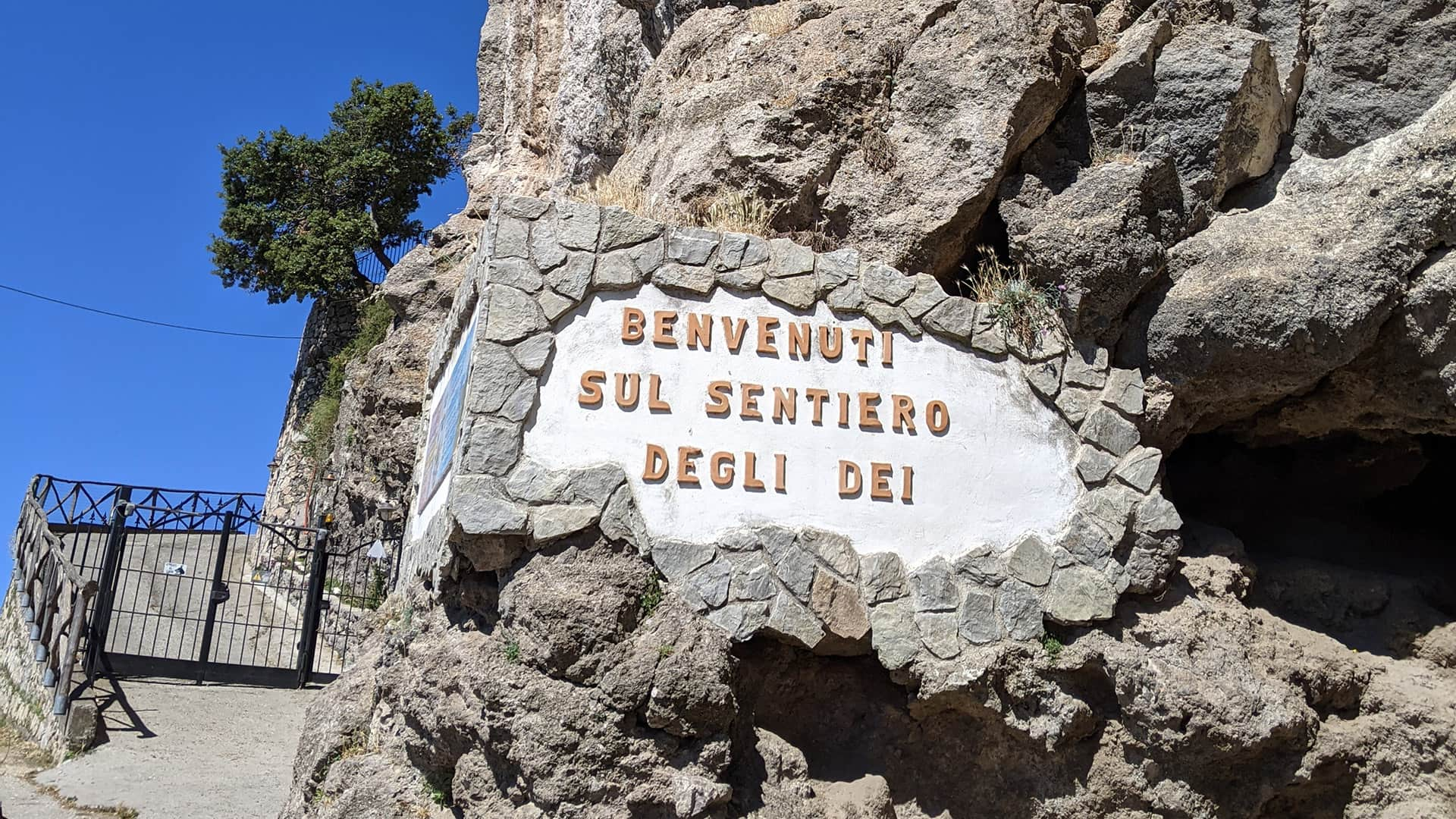
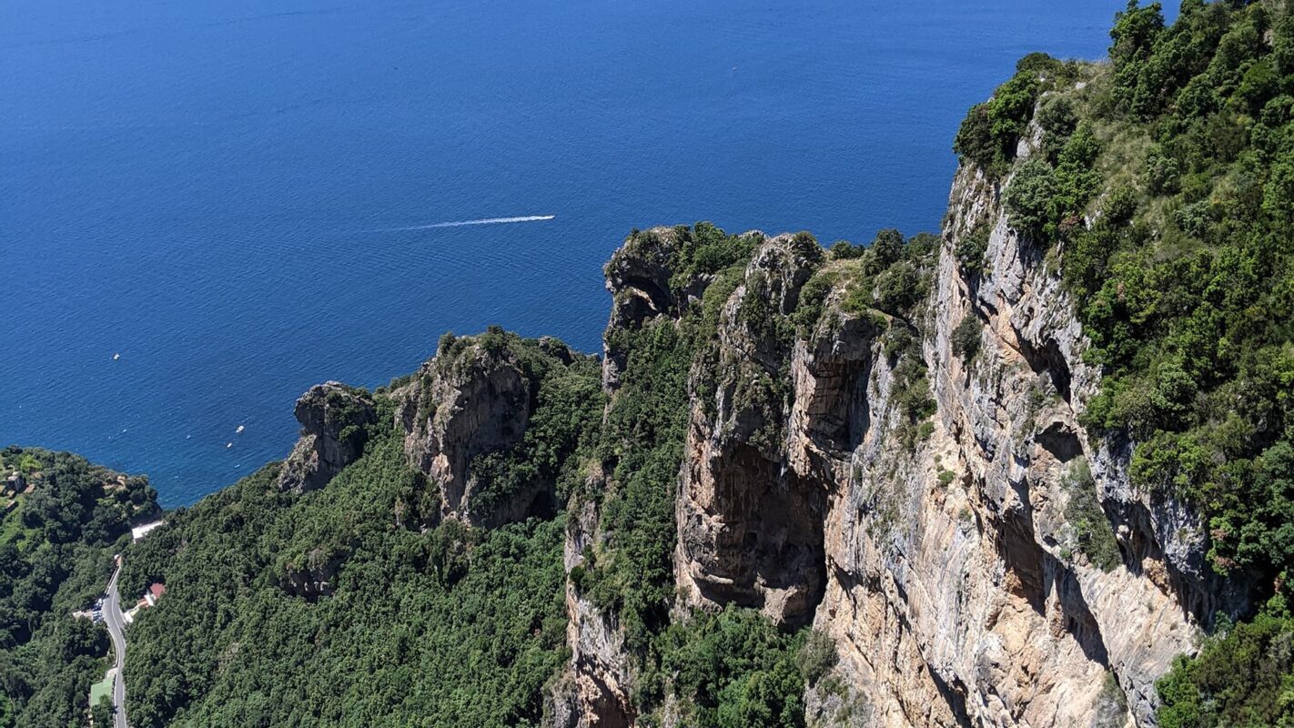
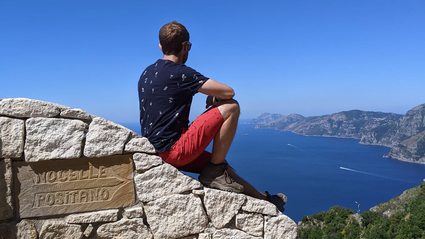
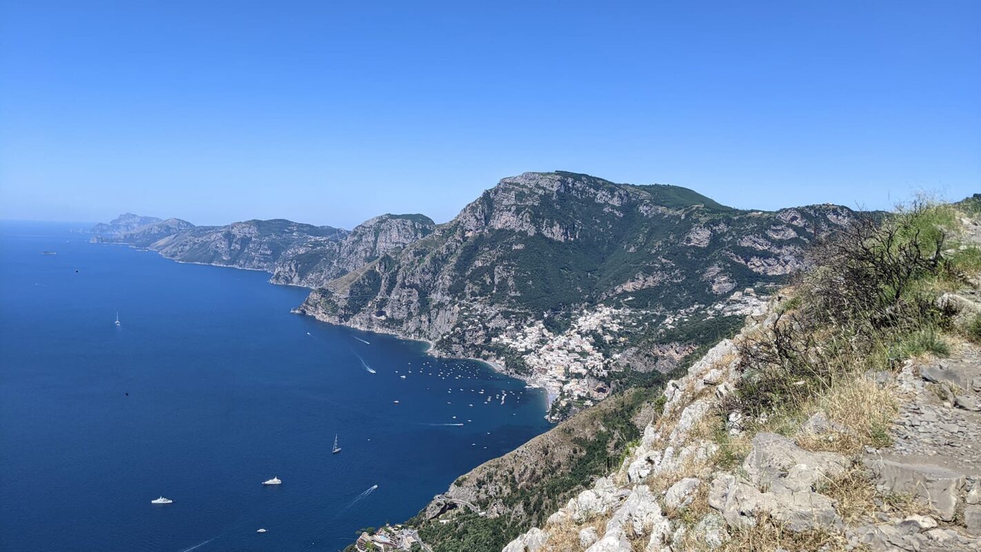
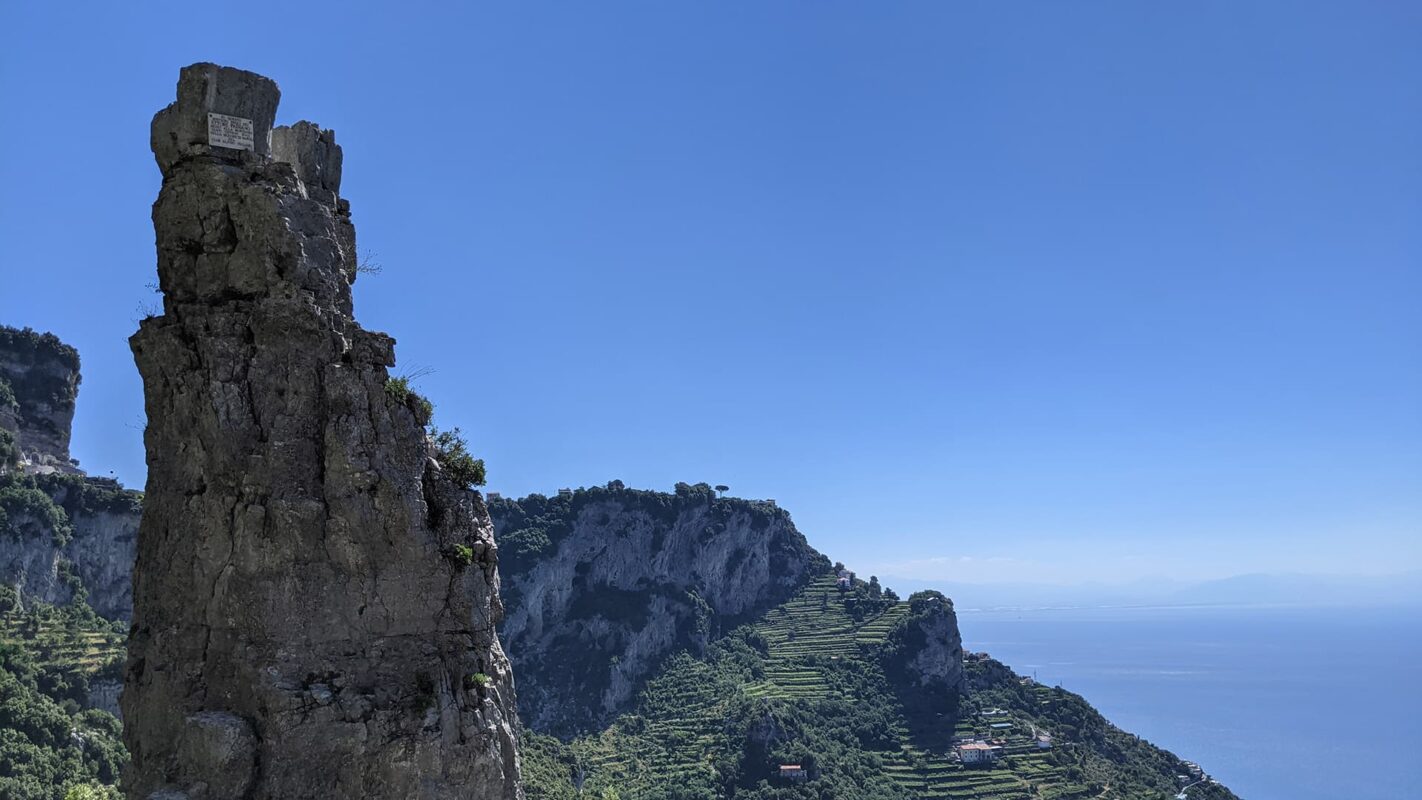
The Path of the Gods trail (il Sentiero degli Dei) is perfect for a day trip and takes you along the stunning Amalfi coast. This 7km hike will give you breathtaking views of one of Europe’s most beautiful coastlines, dotted with crystal blue waters and steep cliffs, where you can enjoy the panoramic views and charming villages. So, instead of renting a scooter, why not explore this beautiful coastline on foot?!  

The hike is doable on both a day trip from nearby Naples or as a morning activity when staying on the Amalfi Coast. The hike can be done in both directions, however, we recommend you start in the mountain town of Bomerano di Agerola and hike towards the glamorous town of Positano. From there you can easily take a boat back to Amalfi from which a bus will take you back to the parking lot in Bomerano.

man hiking up mountain
Author

Marco Koevoets

Marco Koevoets was born below sea level in the world’s flattest country: the Netherlands. Marco has a passion for traveling and nature, especially coastal or island hikes. You can follow Marco on Instagram @marcokoevoets

View profile

The Trail

The trail starts in the village of Bomerano, where you can park (for free) in the parking lot and walk to the trailhead. After the first few hundred meters the first viewpoints will commence and they won’t disappear until you reach the sand at Positano beach! The hike will lead you from this inland village through the mountainous cliffs, sporadically joined by olive farms and wine fields exposing magnificent views of the coast and its cliffs. Some moments you will find yourself walking the path on 500m high cliffs, however, in general, the trail is well-maintained. On the way you will pass multiple small settlements/houses where you can stop for an espresso or buy a bottle of water and enjoy the amazing views.

This mythical landmark hike has inspired poets and artists alike. Legend has it that the cliffs were cut into the earth by the gods as they stampeded down from heaven to save Ulysses from the mermaids’ song. The hike can be somewhat challenging due to the steepness in certain parts, however, considering the relatively modest ascent it is very doable for average hikers.

The official trail ends in the tiny town of Nocelle which sits in the mountains, above Positano. However, once you finish the hike, it is possible to continue the walk to the coast (circa 30 minutes), which ends at the beach. However, it does involve around 400m of descending steep stairs. In case you want to save your knees, a local bus will run approximately once per hour to Positano. When deciding to hike down you can opt for the “upper trail”, which will give you more magnificent views compared to the less steep regular walk down.

Accommodations

The Amalfi coast is scattered with hotels and resorts, alternatively there are a few boutique hotels in Bomerano.

Best time of the year

The best time of the year to hike the Path of the Gods is undoubtedly the shoulder season. This means either April to June or September to October, so you can avoid the summer heat and crowds and the rainy winter weather.

Good to know

Even though it’s a day hike, you’ll want to be prepared for anything! Make sure to pack lots of sun protection and water for the exposed sections, at least 2 liters. You will see quite a few stalls to buy water along the way, but you don’t want to pay tourist prices for something you could have filled up at your hotel.

This is an easy hike, so comfortable (hiking) shoes and a small backpack are sufficient. However, due to walking alongside steep cliffs, the hike is not recommended for people who suffer from a fear of heights or vertigo. Also, be careful in rainy conditions as the trail might be slippery.

Route
Point to point
Highest point
650m (210 ft)

Want to submit a trail or make this page more complete?

Comments

Be the first one to comment on this trail!

Reply to this trail

Your email address will not be published. Required fields are marked *

Reply to this trail

Log in to comment on this trail
Always read the disclaimer

Terms of Use: important to all visitors on this website. We strive to publish high quality content and information on this website. However it’s always possible that we’re missing out on some crucial information. In spite of the fact that this route, associated GPS track (GPX and maps) were prepared under diligent research by the specified contributor and/or contributors, the accuracy of such and judgement of the author is not guaranteed. Therefore, hiking-trails.com and contributors are in no way liable for personal injury, damage to personal property, or any other such situation that might happen to individuals hiking or following this route. Should you choose to hike this trail, this is always at your own risk. Check out our guidelines for safety hiking and Leave No Trace principles at the hiking 101 page.

Download GPX

Join the community!

Login or create a FREE account 😊

With an account you can:

Download GPX files

Pin trails to your wishlist

Mark trails as hiked by you

Rate hiking trails

Comment on trails, blogs and gear reviews

Happy trails!
Login

Don't have an account yet? Register here