About the East Highland Way

country
Scotland
length
132 km(82 mi)
Type of trail
Long-distance
difficulty

Difficulty is highly personal. Be aware of the weather conditions as bad weather turns easier trails in difficult trails especially in the mountains.

Moderate
accommodation

Lodging means a mix of hotels, hostels or AirBnB’s.

Wild camping, Camping, Lodging
Elevation gain
2152 m(7060 ft)
terrain
Hills, Forest
remoteness
Some of the time
Show more

This trail starts where the famous West Highland Way ends, in Fort William. Unlike the West Highland Way, the East Highland Way is an unofficial route, quieter, and more remote. Almost the entire way is not waymarked, but no worries – it mostly follows visible tracks along the route, with just two pathless sections in between.

You’ll be treated to enchanting broadleaf forests, loch sides, serene mountain wilderness, and unspoiled marshland. Encounter endless breathtaking waterfalls, countless water holes for a refreshing swim, and some adventurous river crossings. Overall, you get everything you could wish for in just one trail.

Profile picture Sancia Gimbel.
Author

Sancia Gimbel

Sancia Gimbel, born and raised in Germany, has always searched for her next adventure. Having predominantly traveled solo, she is well acquainted with the advantages and disadvantages of being a solo hiking woman. Having hiked several trails all over Europe, her favorite place (and biggest adventure) is still Scotland.

Her current plan is to explore South America, mostly through backpacking and hiking in Patagonia, and North America through road trips and hiking over the next few years. You can follow her adventures on Instagram!

View profile

The Trail

The East Highland Way connects Fort William and Aviemore, both renowned outdoorsy areas in Scotland. Begin in the shadows of Ben Nevis, Scotland’s highest mountain, and wake up to a breathtaking view. The trail predominantly follows forestry tracks through woodlands but also ventures into open sections with superb views across the central Highlands.

Be aware of the most challenging section, Laggan to Newtonmore, passing through the remote Glen Bachor with three river crossings, which may be impassable in difficult conditions. In case of bad weather, there are alternative routes on minor roads and cycle paths.

Due to the lack of waymarks, self-sufficiency and navigation skills are a must for this trail. A map is necessary. Given that you spend almost all the time on visible tracks, an online map is probably sufficient. However, during bad visibility in boggy areas, a paper map for a better overview is recommended.

Despite being an easy walk and having accommodation available almost every day, this trail is considered moderate. For enthusiastic hikers, the best part is that it links three popular long-distance trails: the West Highland Way, the Great Glen Way, and the Speyside Way. So, if you can’t get enough, just keep walking!

How to get Around

Both your starting point, Fort William, and your endpoint, Aviemore, have railway and bus stations connecting to major cities in Scotland, including those with international airports.

On your way, Spean Bridge, Kingussie, and Newtonmore also have rail and bus services. Tulloch is served by rail, and Kincraig is accessible by bus. However, it’s important to note that the central section until Newtonmore is without public transport.

Stages

Just an example, some stages are pretty long, so feel free to set as you wish. These stages are created to bring you back to civilization daily.

Stage 1:

Fort William – Spean Bridge 19 km | 11.8 mi

Stage 2:

Spean Bridge – Inverlair 16.5 km | 10.25 mi

Stage 3:

Inverlair – Feagour 35 km | 21.7 mi

Stage 4:

Feagour – Laggan 8.5 km | 5.3 mi

Stage 5:

Laggan – Newtonmore 15.5 km | 9.6 mi

Stage 6:

Newtonmore – Kincraig 23.75 km | 14.75 mi

Stage 7:

Kincraig – Aviemore 16.5 km | 10.25 mi

Accommodations

Along most of the way, there is a wide choice of accommodations. However, the central part, Inverlair to Pattack, lacks any facilities. Some hikers arrange for a pick-up/drop-off with their last and further B&B if they prefer not to carry a tent for wild camping. Official campsites are available in Fort William, Newtonmore, and Aviemore. However, wild camping is always a legal option.

Shops are available in almost every section but keep in mind that some of them are just small local shops, so it’s advisable to pack in advance. Water sources are plentiful along the way, but it’s important to use your water filter.

For those who prefer not to carry their baggage, there are many organizations offering baggage transfer services or guided tours.

Best time of the year

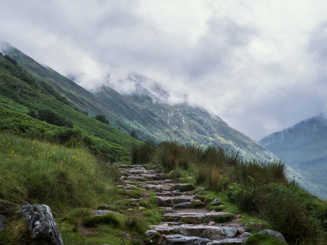
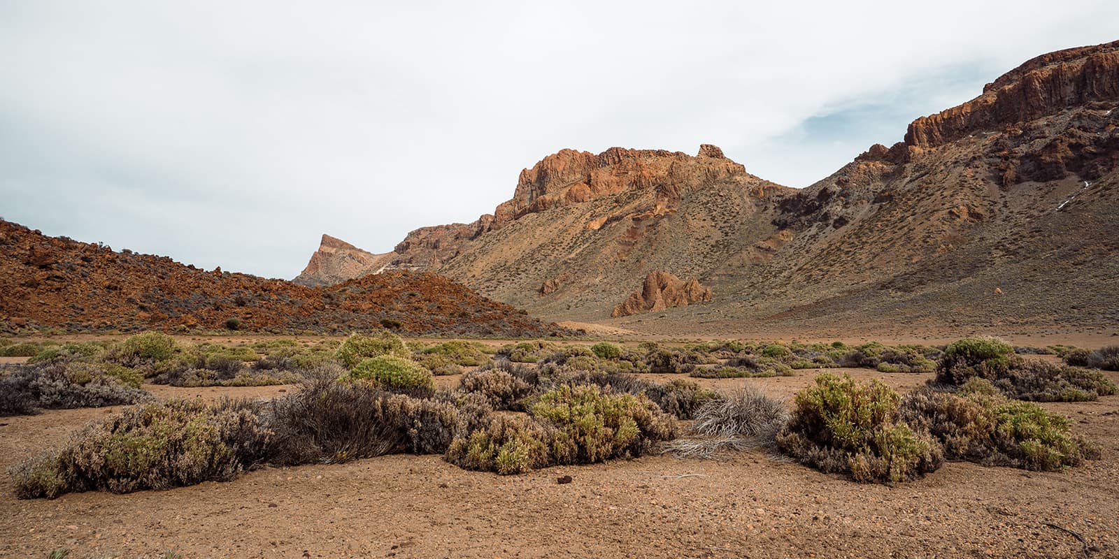
Similar to many other countries, the optimal time for hiking is during the summer months (April-September). However, Scotland offers a unique proposition with its landscape dominated by hills, lots of hills! The highest mountain, Ben Nevis, stands at 1345m (4413ft). So yes, Scotland is hikable all year long, and each season brings its advantages and challenges.

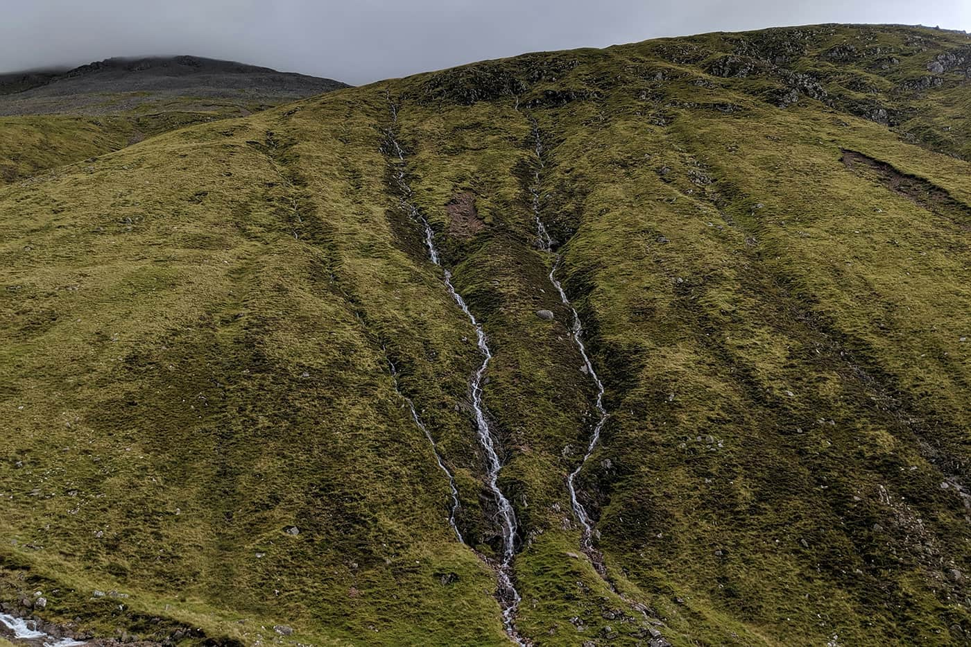
Summer Months: During the summer, you are blessed with long days, providing ample time to cover your distance without feeling rushed. It’s an opportunity to enjoy lochs for a swim and have leisurely lunches with scenic views. Especially in certain highland areas, hiking during the dark should be avoided due to boggy terrains that require special attention. The summer months generally offer the driest days, with temperatures reaching about 18-20°C (65-68°F). However, Scotland’s abundance of water, including rivers, lakes, and marshes, brings its biggest challenge: MIDGES! Tiny little mosquitoes that can be quite bothersome and sting.

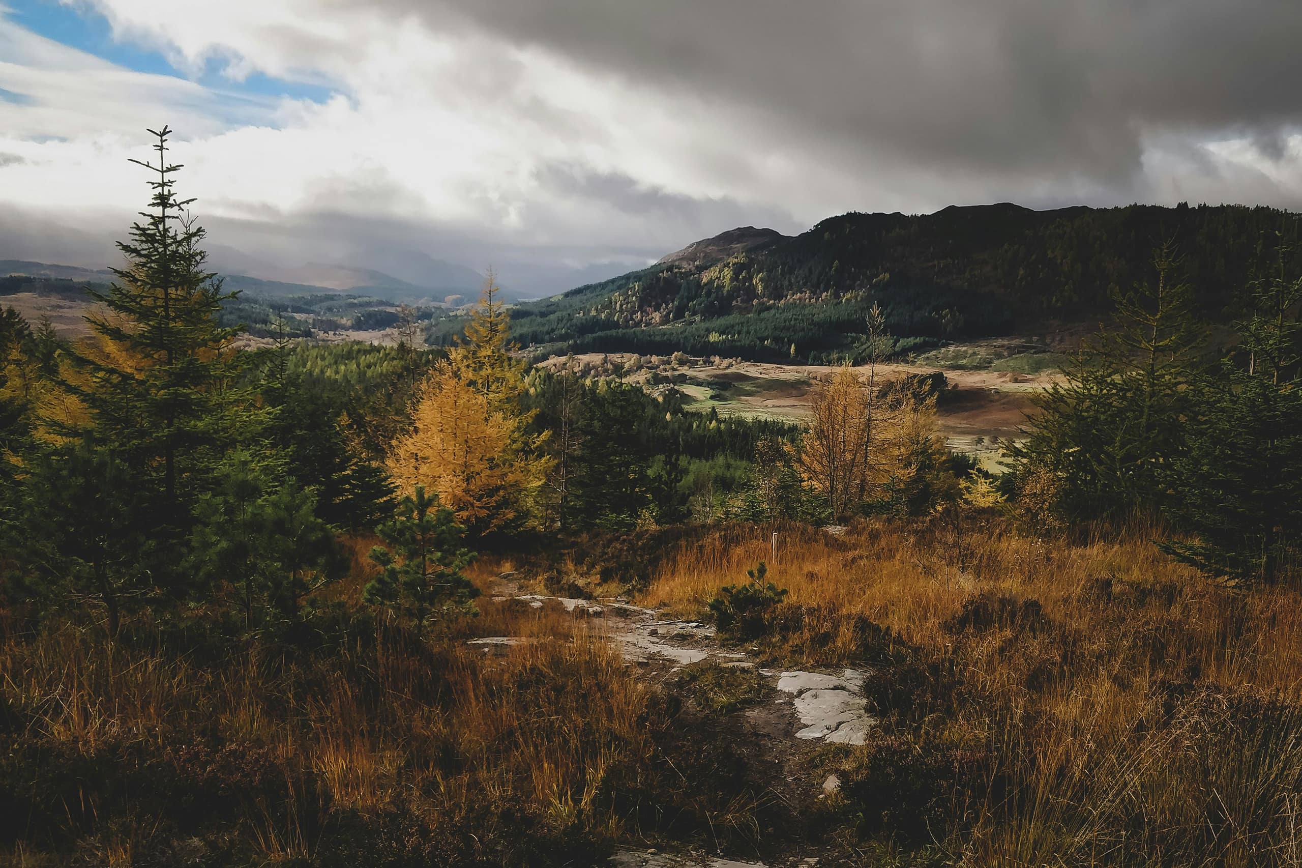
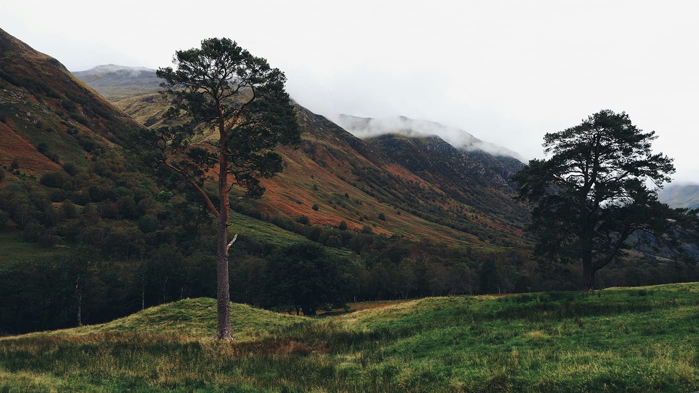
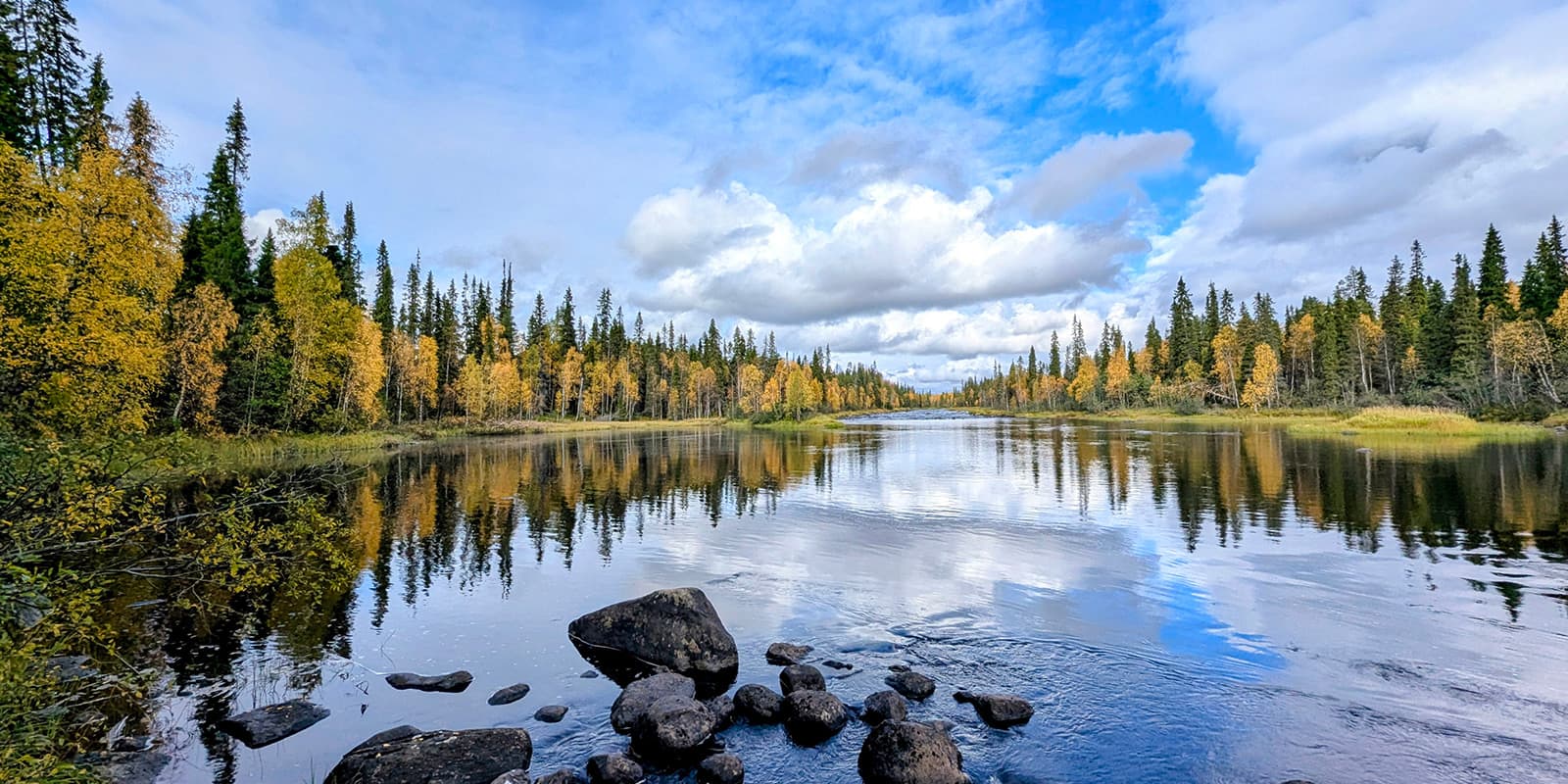
Winter Months: On the upside, winter months are free of midges, but there’s a trade-off. Expect a lot of rain, and snow is possible from the end of October until March. The days become significantly shorter, nights colder, and storms more frequent, making camping more challenging. But in the winter months, you have the opportunity to see the country with fresh eyes as trees and fields undergo a transformation, changing their colors from green to warm orange all over.

In conclusion, a very German piece of advice from my side: “There’s no such thing as bad weather, only the wrong gear!” Scotland will be your grandest adventure with the right equipment.

Safety & Gear

Ensure you’ve chosen the right season for you.

For Summer Months:

  • Don’t forget a mosquito net for your face, thin long sleeves, trousers (no worries, Scottish summers rarely exceed 20°C), or insect repellent.
  • Opt for a tent that is mosquito-safe.
  • Since it rains about 182 days in Scotland (lucky you, this part of Scotland counts as one of the driest), a rain jacket is essential, even in summer. You will never be safe from getting wet.

For Winter Months:

  • Always pack a hardshell raincoat and rain trousers – you will get wet!
  • Depending on your chosen trail, include an ice axe and crampons.
  • A tent is often inevitable, especially in remote areas where bothies or village accommodations may not be accessible. During winter, storms can be intense, so ensure your tent has sufficient safety lines. If not, your tent may break or fly away. A dangerous situation in which none of us wants to find ourselves.

General Gear:

  • A water filter is a must-have due to Scotland’s abundance of water sources and rich wildlife. Filter or boil water for at least 3 minutes. This way some areas even allow you to carry none at all.
  • A paper map is recommended for a good overview of the area, helping you find quick escape routes or alternative paths. And as a good practice for upcoming trails where you simply need it.
  • Scotland is home to diverse wildlife, including deer, birds, and seals. Not a danger for you but maintain a respectful distance to avoid disturbance.
  • Always check the weather before heading back on the trail.
  • Due to remote areas with unreliable reception, especially for solo hikers, a satellite tracker is highly recommended and can be a lifesaver.
  • A guidebook provides insights into upcoming terrain and helps you find suitable spots for your tent, considering the boggy areas where camping may be restricted.

With this comprehensive gear, you can hike with confidence, whether navigating through summer rains or winter storms. Stay safe and enjoy the adventure!

Good to know

Wild Camping

Wild camping is officially allowed in Scotland! Let me tell you about the “Scottish Outdoor Access Code” (link below).

Lightweight camping is permitted in small numbers and only for 2 or 3 nights at the same place. Do not camp on private property, in enclosed fields of crops, or near farm animals, and stay well away from buildings, roads, and historical structures. Do not disturb deer stalking or grouse shooting. If you’re close to a house, ask the landowner for permission (Scottish people are super friendly). And, as always, leave no trace!

There are some special rules for specific National Parks; please check them out on their website. Additionally, they have a useful page about campsites all over the country and a lot of other helpful information!

Scottish Bothies

Hiking in Scotland offers a special treat: their bothies! While we’re all familiar with mountain shelters, often used in emergencies or bad weather, they may not always entice us to spend a night unless absolutely necessary. However, the Scottish bothy takes the experience to a whole new level. Some even come equipped with a flushing toilet or electricity.

These huts are lovingly cared for, not just by the Mountain Bothy Association (www.Mountainbothies.org.uk — yes, you can become a member and support them), but also by locals who enjoy spending a night in the wilderness.

The best part? You don’t pay, but it operates on a system of trust and respect:

  • Always leave the bothy better than you found it!
  • Everyone is welcome! It’s not “your” bothy.
  • No vandalism.
  • Take all your rubbish.
  • You can leave useful things for the next person but never leave rotting food.
  • Bury human waste far away from the bothy and water sources.
  • Ensure the doors and windows are properly closed when you leave.

Keep in mind, the act of offering us a free and often charity-run shelter is a kind one! Please treat it with the utmost respect!

Route
Point to point
Highest point
377m (1236 ft)

Guidebooks

cover guidebook

East Highland Way

View guidebook

Want to submit a trail or make this page more complete?

Comments

Be the first one to comment on this trail!

Reply to this trail

Your email address will not be published. Required fields are marked *

Reply to this trail

Log in to comment on this trail
Always read the disclaimer

Terms of Use: important to all visitors on this website. We strive to publish high quality content and information on this website. However it’s always possible that we’re missing out on some crucial information. In spite of the fact that this route, associated GPS track (GPX and maps) were prepared under diligent research by the specified contributor and/or contributors, the accuracy of such and judgement of the author is not guaranteed. Therefore, hiking-trails.com and contributors are in no way liable for personal injury, damage to personal property, or any other such situation that might happen to individuals hiking or following this route. Should you choose to hike this trail, this is always at your own risk. Check out our guidelines for safety hiking and Leave No Trace principles at the hiking 101 page.

Download GPX

Join the community!

Login or create a FREE account 😊

With an account you can:

Download GPX files

Pin trails to your wishlist

Mark trails as hiked by you

Rate hiking trails

Comment on trails, blogs and gear reviews

Happy trails!
Login

Don't have an account yet? Register here