About the Andalucian Coast-to-Coast Walk

country
Spain
length
416 km(258 mi)
Type of trail
Long-distance
difficulty

Difficulty is highly personal. Be aware of the weather conditions as bad weather turns easier trails in difficult trails especially in the mountains.

Moderate
accommodation

Lodging means a mix of hotels, hostels or AirBnB’s.

Lodging, Camping
Elevation gain
12330 m(40453 ft)
terrain
Mountains, Coastal, Countryside, Forest, Hills
remoteness
Some of the time
Show more

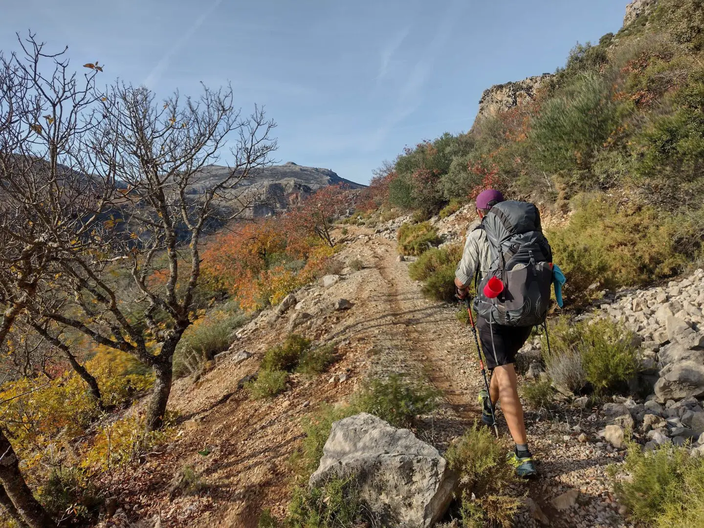
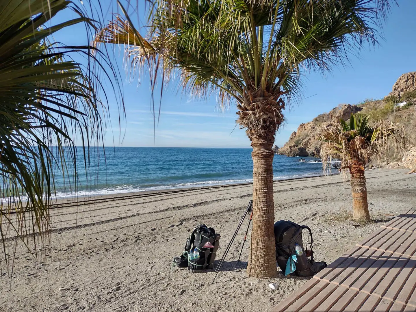
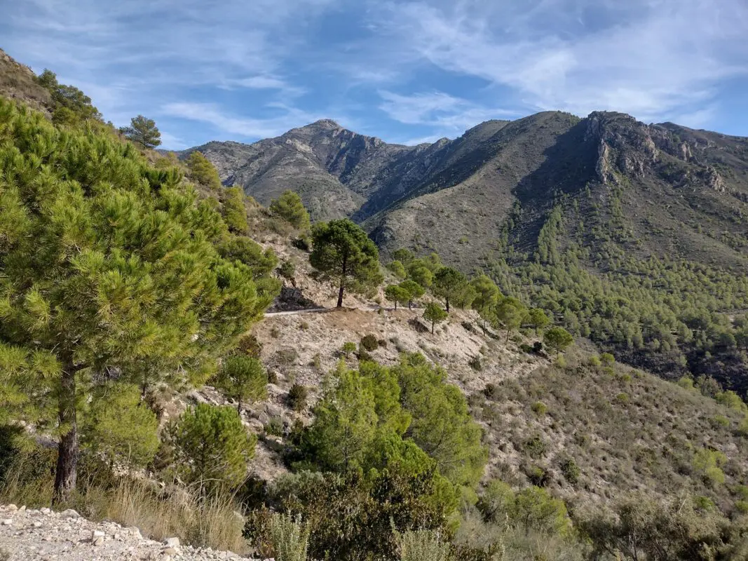
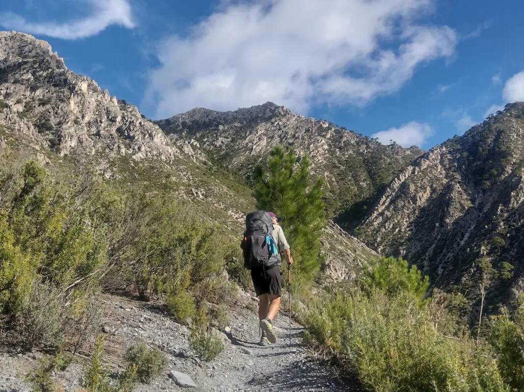
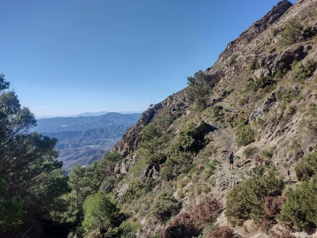
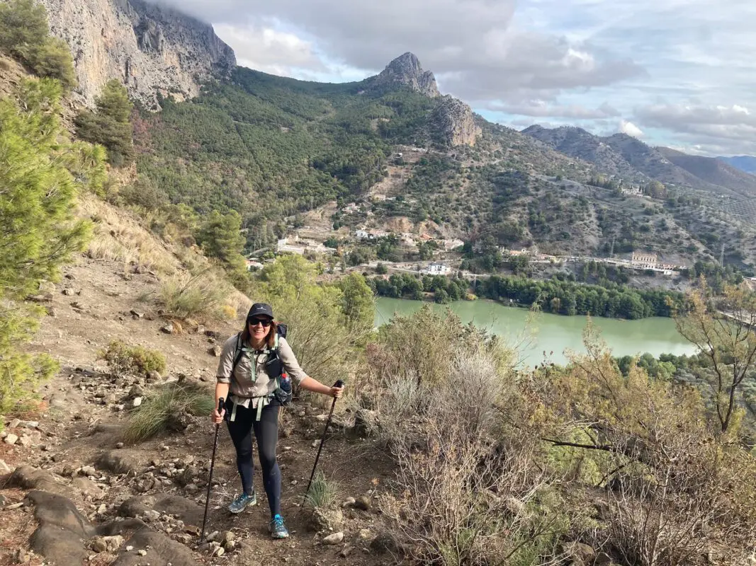
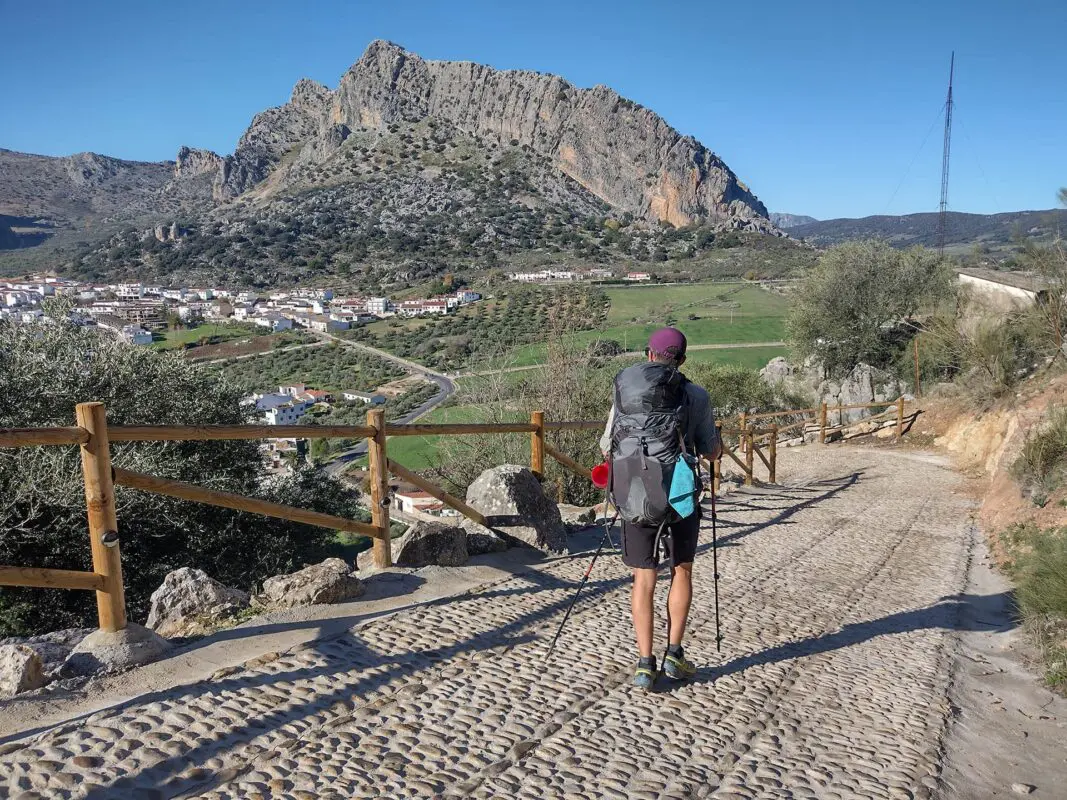
The Andalucian Coast to Coast Walk is not so much a formal trail as it is a concept dreamt up by the late Cicerone author and expert on Andalucia, Guy Hunter-Watts. With an average daily elevation of just 587 meters, and the opportunity to stay at guesthouses at the end of each day, this three-week trek is designed to be accessible to all long-distance hikers. However, it still packs a punch, taking you through an amazing variety of terrain, from jagged peaks to rugged coasts to olive, almond, and orange groves.

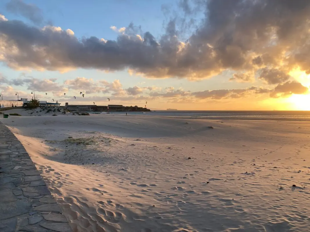
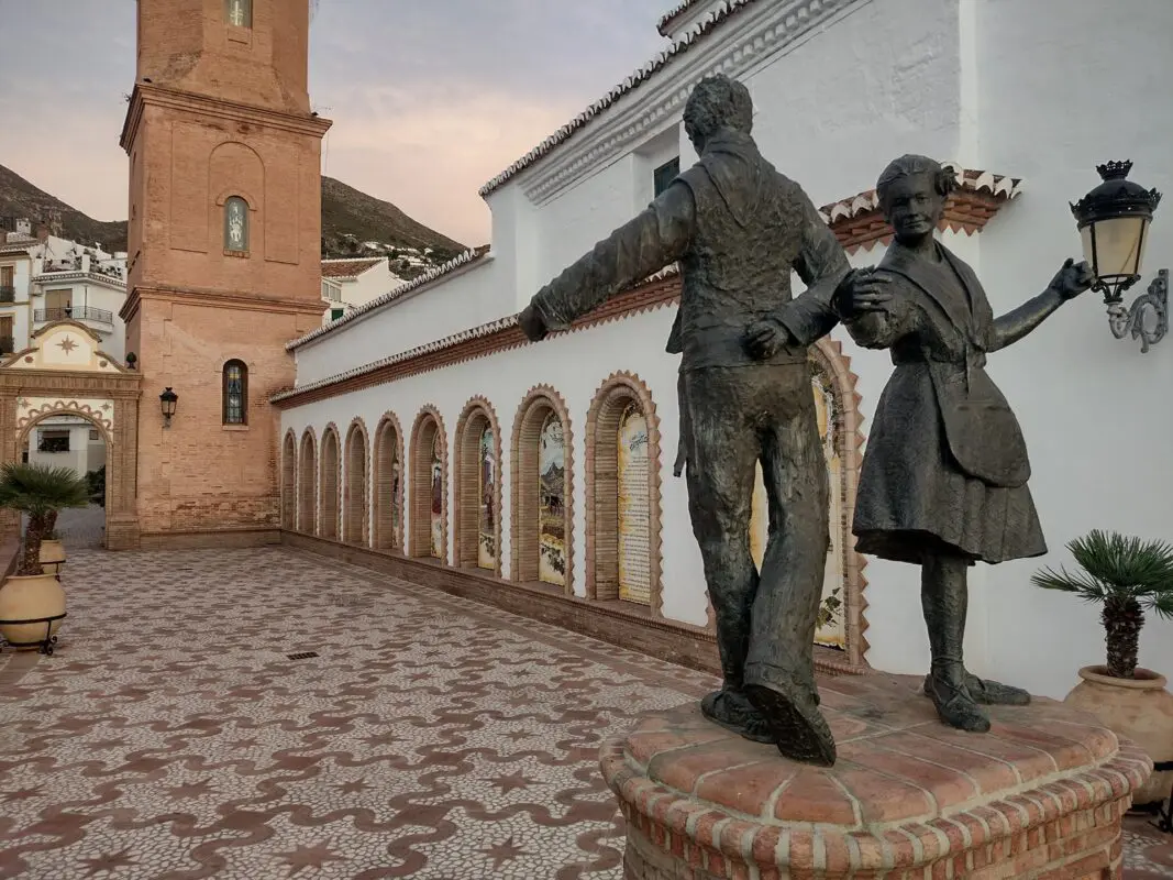
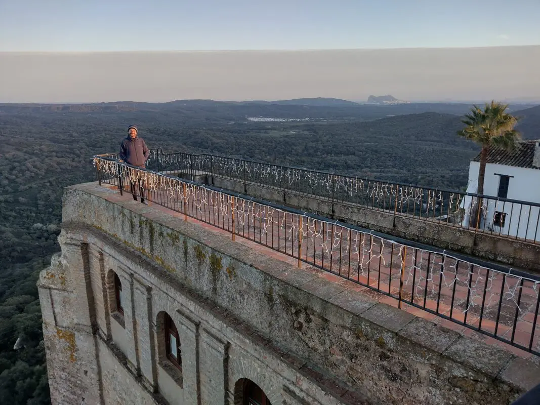
Although it’s a ‘coast to coast,’ it heads straight into the interior on day one and stays in the mountains, rolling hills, and countryside of Andalucia until the final few days. Heading from east to west, it allows you to stick your toes in the Mediterranean at the very start and in the chillier waters of the Atlantic at the end. Along the way, it explores several mountain ranges and some of the most beautiful whitewashed hilltop villages of the region, including Frigiliana, Competa, El Burgo, Ronda, and Cortes de la Frontera. This is a hike that combines natural beauty with culture, offering you an intimate portrait of rural Spanish life and the history of the region.

Close up of women in blue jacket with food in her hand
Author

Sarah Busby

Sarah Busby is a British freelance editor based in Cornwall. Happiest when on a long-distance trail, she aims to spend at least two to three months each year hiking. Highlights of the last ten years include the Pacific Crest Trail in America, the W Trek in Patagonia, the Annapurna Sanctuary and Poon Hill trails in Nepal, the GR10 across the Pyrenees, the GR5 from Geneva to Nice, the Via Alpina in Switzerland, the Lycian Way in Turkey, the Peaks of the Balkans Trail, the Tour du Mont Blanc, the Andalucian Coast to Coast Walk in Spain, the West Highland Way and Great Glen Way in Scotland, and the Pennine Way in England. You can follow Sarah on Instagram.

View profile

The Trail

You begin at the small beach in Maro, an understated white village in a charming and far less touristed area of the Costa Del Sol. Maro is just a few miles east of Nerja, which would be a good jumping-off point as it has plenty of hotels and supermarkets (Malaga, a 1.5-hour bus ride away, is the nearest airport). The walk starts with a bang in the Sierra de Tejeda, Almijara y Alhama, a striking mountain chain characterized by tall, jagged peaks and deep gorges.

After a couple of days, you’ll begin to skirt the flank of La Maroma, an iconic sight in the region and the highest mountain in the area at 2069m. You then move on to the Sierra de Camarolos, the Sierra del Torcal, and El Chorro, the latter well known for its famous Caminito del Rey walkway which is pinned high on the sheer cliffs that line the famous gorge. At around the midway point, you reach the untamed Parque Nacional Sierra de las Nieves. This is where you hit Ronda – an extraordinary destination that’s worth at least one night’s stop, if not a rest day, to visit the Moorish citadel and the famous Puente Nuevo bridge that sits 100 meters above the dramatic El Tajo Gorge. It’s also a lively foodie destination, so it’s worth sampling the tapas bars, and nightlife.

After Ronda, you head into the Sierra de Grazalema, the wild and isolated Libar Valley being a particular high point. At this point, you begin to head back south towards the sea, passing through the Parque Natural de los Alcornocales. Castillo de Castellar is right on the trail here, a stunningly preserved medieval hilltop castle and walled village. Again, a fantastic place to stop for one night with very affordable rooms in the castle itself. In your last few days, as you start to descend from the mountains, you’ll see Gibraltar and the Rif mountains of Africa in the distance. You’ll hit the Atlantic at Tarifa, the windswept southernmost point of Spain, just a short ferry hop from Morocco. From here, it’s just a final coastal stretch to Bolonia, ending at its impressive dunes and kilometer-long beach. From Bolonia, it’s worth taking a bus or taxi back to Tarifa or Algeciras, where there are far more public transport and accommodation options. Check out a full recap of this trail on my Instagram account.

Stages

You can hike the trail in about 3 weeks, give or take a day or two if you decide to take a rest day. You’ll hike from Maro to Bolonia in 416 kilometers.

Stages of the Andalucian Coast-to-Coast Walk

Stage 1:

Maro – Frigiliana, 15.2 km | 9.5 mi

Stage 2:

Frigiliana – Cómpeta, 18.5 km | 11.5 mi

Stage 3:

Cómpeta – Sedella, 14 km | 8.7 mi

Stage 4:

Sedella – Alcaucín, 17.3 km | 10.8 mi

Stage 5:

Alcaucín – Ventas de Zafarraya, 18.5 km | 11.5 mi

Stage 6:

Ventas de Zafarraya – Riogordo, 23.4 km | 14.5 mi

Stage 7:

Riogordo – Villanueva de Cauche, 16.3 km | 10.1 mi

Stage 8:

Villanueva de Cauche – Villanueva de la Concepción, 15 km | 9.3 mi

Stage 9:

Villanueva de la Concepción – Valle de Abdalajís, 21.3 km | 13.2 mi

Stage 10:

Valle de Abdalajís – Carratraca, 25.8 km | 16 mi

Stage 11:

Carratraca – El Burgo, 22.8 km | 14.1 mi

Stage 12:

El Burgo – Ronda, 26.3 km | 16.3 mi

Stage 13:

Ronda – Montejaque, 11.7 km | 7.3 mi

Stage 14:

Montejaque – Cortes de la Frontera, 19.5 km | 12.1 mi

Stage 15:

Cortes de la Frontera – El Colmenar, 15.8 km | 9.8 mi

Stage 16:

El Colmenar – Jimena de la Frontera, 25 km | 15.5 mi

Stage 17:

Jimena de la Frontera – Castillo de Castellar, 22.1 km | 13.7 mi

Stage 18:

Castillo de Castellar – Los Barrios, 24.5 km | 15.2 mi

Stage 19:

Los Barrios – El Pelayo, 25.5 km | 15.8 mi

Stage 20:

El Pelayo – Tarifa, 17.4 km | 10.8 mi

Stage 21:

Tarifa – Bolonia, 20.5 km | 12.7 mi

Accommodations

As I said above, The Andalucian Coast to Coast Walk is designed to end in a village every day, so there will always be options to stay in guesthouses and hotels. In larger places, such as Ronda and Tarifa, there will be several options, but in small villages like El Burgo, there’s sometimes only one, so it’s best to do your research and book ahead where accommodation is scarce. I hiked this trail in November and December when it was very quiet, and I never had an issue booking places a few days in advance, but I carried a tent that I could fall back on. In high season, it would definitely be worth booking accommodation for the whole trail in advance. I was able to find accommodation in every village on Booking.com, so it was relatively easy to organise without having to resort to email or phone.

Accommodation was very reasonably priced, often costing between 30 and 40 euros a night. This was in low season, but Andalucian mountain towns are generally good value. In smaller villages, especially in the mountains, it might be worth checking to see if breakfast and dinner is available at your accommodation as the grocery stores can be very small (or non-existent) and the opening hours erratic! It’s certainly worth stocking up on hiking snacks when you are in bigger places with larger supermarkets, such as Ronda or Los Barrios.

Best time of the year

Andalucia is the ideal all-year-round European hiking destination, making it a great winter option when snow renders the Alps and Pyrenees inaccessible. However, most people hike this trail in the spring and autumn. These shoulder seasons give you the best of both worlds. There will be warm weather, a low chance of rain, and more guesthouses and shops open, but fewer tourists than in the high season. I would say it’s best to avoid the height of summer if you can as the heat and lack of water sources in this arid climate can make the climbs pretty uncomfortable.

However, even in winter, we had lots of sunshine and warm weather, alongside some mist and rain. There was a dusting of snow on top of one of the highest summits, La Maroma, but you don’t climb high enough for this to cause an issue. Still, the weather can change quickly in the mountains, and it’s important to be prepared with good winter layers and waterproofs, even in summer. I still used all of mine at various points along the trail. One thing to note if you walk this trail in winter is that the hours of daylight are obviously short. In December, we had from 8-8.30 am until 6 pm. The longest stage is 7.5 hours, so this shouldn’t be a problem, but it’s worth keeping in mind if you start late.

Safety & Gear

As you plan your hike, we recommend you assess factors such as trail difficulty, length, elevation gain, and terrain and think about your abilities in handling each of these. You should read guidebooks, talk to those who’ve hiked this trail already, and to local hiking and tourist organizations, as well as read this website.

Share your hiking plans with your family or friends, including your start and end times, chosen route, and emergency contact.

Each day, check the weather in the area you’re hiking. You can talk with locals, check a weather radar app, or even better, both. Avoid starting if you see severe weather conditions on the forecast, including thunderstorms, heavy rainfall, or extreme heat.

Bring enough water and snacks to maintain your energy and prevent dehydration and exhaustion. This means at least two liters of water! Familiarize yourself with the trail map and carry navigation tools such as a compass or GPS device so you don’t get lost.

Invest in the right hiking gear, including comfortable, supportive footwear, proper hiking clothing, such as warm base layers and a hardshell rain jacket, hiking poles, a well-fitted backpack, and essential equipment like maps, GPS devices (when needed), and a first-aid kit. Check out our comprehensive gear list for long-distance trails like this.

Respect the principles of Leave No Trace by minimizing your impact on the environment. Stick to designated trails, pack out all trash, and be respectful of wildlife and natural habitats.

Good to know

Many people didn’t speak English in the more remote villages along the trail, so it’s worth downloading Spanish on Google Translate so you can communicate more easily. This also shows respect for locals.

Grocery stores are often closed on Sundays and they close for a period in the middle of the day (often from 1 or 2 pm until 4 or 5 pm), so it’s worth incorporating this into your planning. Don’t be fooled into thinking that food will always be available because you’re going through villages.

There were water sources in every village, usually fountains, but some of these were turned off in December 2023 because of drought. However, there was usually the opportunity to buy bottled water in each village. I found that water sources were very unpredictable in between villages and rivers and streams were often dry given the arid climate. I’d be careful to take enough water each morning to last you for the entire stage, especially in warmer months. We treated any water we drank from wild sources, but we still got what we think was a water-borne parasite, so it might be worth treating all water that isn’t bottled.

The Andalucian Coast to Coast Walk is the brainchild of Cicerone author Guy Hunter-Watts, getting the guidebook is really an essential part of your preparation. It follows a mixture of established trails, such as the GR249 and GR7, as well as local mountain paths, old mule tracks, and rural farm roads, so you’ll be following lots of different signposting depending on the day. This makes it simple in some ways – there is only one resource to buy and it contains everything you need. That said, the trail does seem to be on the HiiKER app – though I noted some slight variations from the author’s route. The book was published in 2018, so it’s worth checking the Cicerone book page for updates on the route.

Route
Point to point
Highest point
1420m (4659 ft)

Guidebooks

The Andalucian Coast to Coast Walk

View guidebook

Want to submit a trail or make this page more complete?

Comments

Be the first one to comment on this trail!

Reply to this trail

Your email address will not be published. Required fields are marked *

Reply to this trail

Log in to comment on this trail
Always read the disclaimer

Terms of Use: important to all visitors on this website. We strive to publish high quality content and information on this website. However it’s always possible that we’re missing out on some crucial information. In spite of the fact that this route, associated GPS track (GPX and maps) were prepared under diligent research by the specified contributor and/or contributors, the accuracy of such and judgement of the author is not guaranteed. Therefore, hiking-trails.com and contributors are in no way liable for personal injury, damage to personal property, or any other such situation that might happen to individuals hiking or following this route. Should you choose to hike this trail, this is always at your own risk. Check out our guidelines for safety hiking and Leave No Trace principles at the hiking 101 page.

Download GPX

Join the community!

Login or create a FREE account 😊

With an account you can:

Download GPX files

Pin trails to your wishlist

Mark trails as hiked by you

Rate hiking trails

Comment on trails, blogs and gear reviews

Happy trails!
Login

Don't have an account yet? Register here