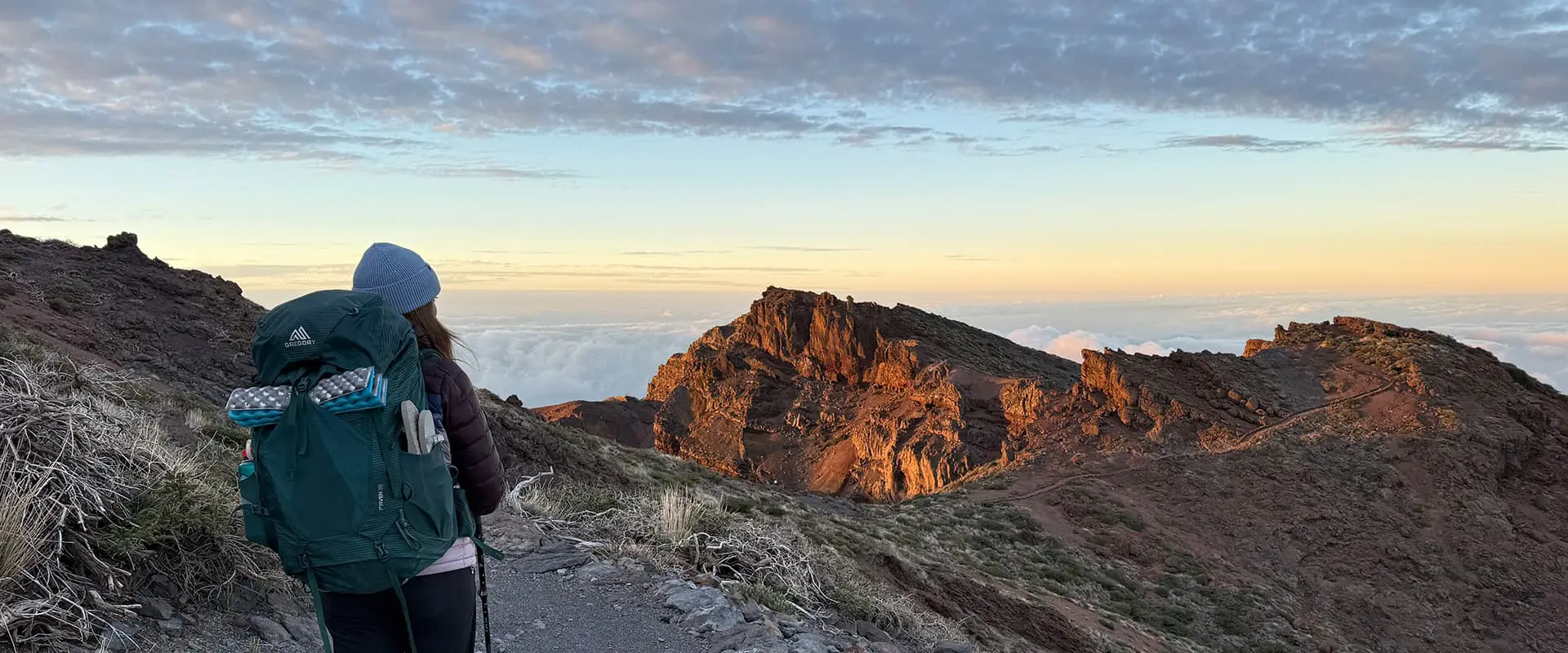
Stage two begins at the observatory, where your taxi will drop you back off. From here, you will hike to El Pilar recreational area, which is a roughly 26-kilometer day. While the climbing is not as strenuous as the day before, you will still have quite a few smaller climbs as you trace the edge of the crater. This is a very beautiful section of the trail if you have clear weather and can see down into the national park. There is an unmanned hut, the Rifugio Punta de los Roques, at the 30-kilometer mark where many people have lunch. This serves as a great halfway point for the day, and some people decide to make the trail into four days and sleep here. There is also portable water, so you can refill.
From the hut, you will begin to hike downhill toward El Pilar, and the weather will start to change as you head into the forest. This is where it gets moodier and cooler, giving you a break from the sun that was likely very strong the days before. There’s also water at the 36-kilometer mark that you can filter, so you don’t need to carry too much when you begin on this day. Soon you will arrive to El Pilar, which is a recreation area in the middle of the forest. There are covered outdoor kitchens, non-potable water spigots, and lots of flat spots to set up your tent.
On the final stage, you will leave El Pilar and climb up through the forest in the morning. The climb is gradual and will be a good warm-up. After about an hour and a half, you will emerge above the clouds once again and walk among the volcanoes on the Ruta de los Volcanes. This path will take you between the many volcanoes in the area, where the ground turns into loose, black sand and lava fields. You will hike between the volcanoes, descending on sometimes very steep trail, for about 8 kilometers before the sand dunes turn into forest. Here, you will hike for about 5 kilometers until you reach the town of Los Canarios. There is a Spar in town and some restaurants where you can have a late lunch before the final section of the hike. Once you’re ready, you will hike toward the end point at Faro de Fuencaliente. This section is really unique and you will be back in the lava fields and surrounded by volcanic rock. When you finally reach the coast 6 kilometers later, you will be greeted by a delicious restaurant, beautiful salt flats and a charming red and white striped lighthouse.