About the West Coast Trail

country
Canada
length
75 km(47 mi)
Type of trail
Long-distance
difficulty

Difficulty is highly personal. Be aware of the weather conditions as bad weather turns easier trails in difficult trails especially in the mountains.

Difficult
accommodation

Lodging means a mix of hotels, hostels or AirBnB’s.

Camping
Elevation gain
1800 m(5906 ft)
terrain
Forest, Coastal
remoteness
All the time
Show more

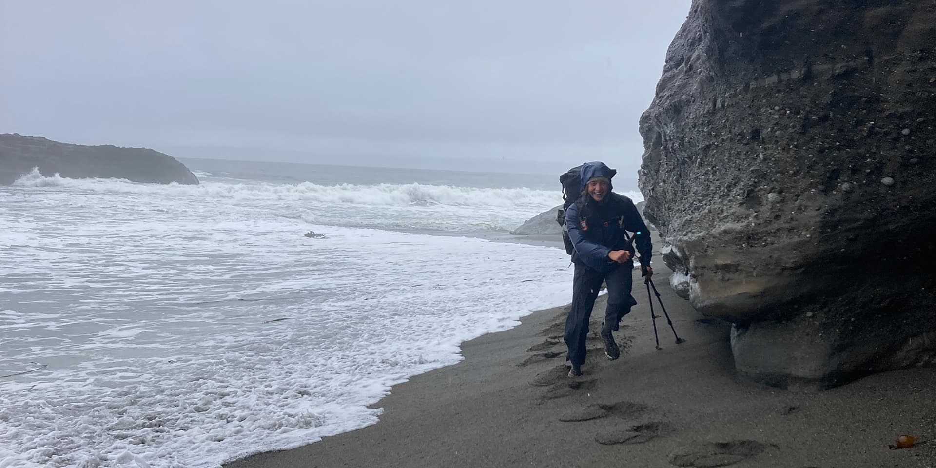
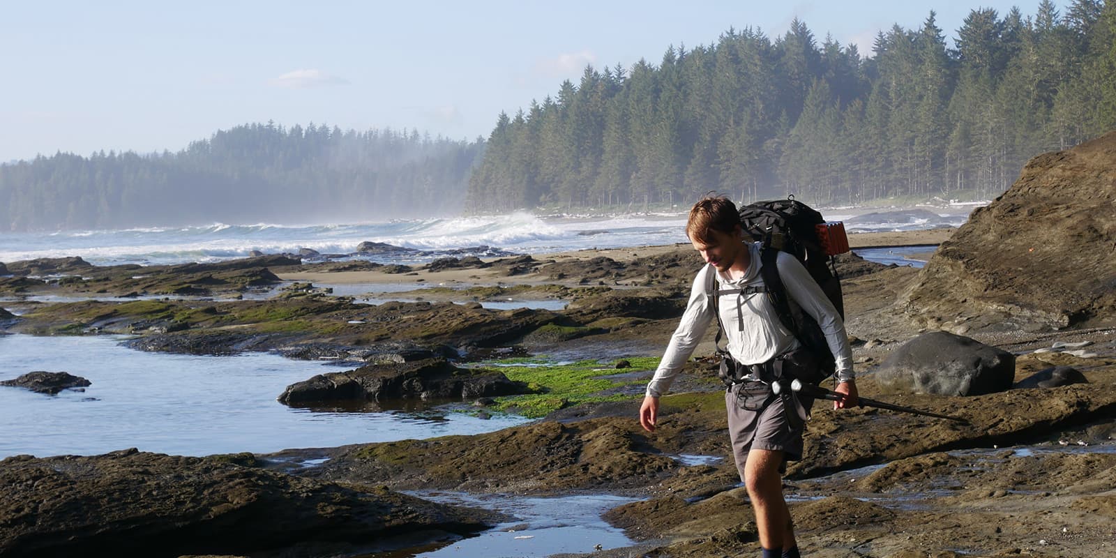
The West Coast Trail is a 75-kilometer coastal hiking trail on the southwest coast of Vancouver Island, Canada. It runs between Pachena Bay in the north and the Gordon River near Port Renfrew in the south, and is within Pacific Rim National Park Reserve. The trail is known for its tough terrain and wild coastal ecology. You will walk through a combination of sandy beaches, rocky shorelines, temperate rainforest, and structures such as ladders, cable cars, and boardwalks throughout the hike.

The trail follows historic coastal routes that were used by Indigenous communities long before European contact and later became part of a lifesaving path for shipwreck survivors along what was known as the “Graveyard of the Pacific.” Today, access is strictly regulated by Parks Canada.

Sifre van Teeffelen

Sifre van Teeffelen is a PhD student based in Lyon, originally from the Netherlands. She loves to hike because it connects her to the fascinating natural world, and reaching destinations solely by the power of her feet has something special about it. She hiked the Pacific Crest Trail in 2024 and has explored many trails across Europe.

Enthusiastic and adventurous, she thrives on challenges, both in the laboratory and in the great outdoors. You can follow her adventures on Instagram: @sifrevanteeffelen. 

View profile

The Trail

Starting at Pachena Bay, you reach the coastline almost immediately. After a short forest section, wide sandy beaches define the early kilometers of the trail. At low tide, walking is relatively straightforward, with firm sand and great views along the coast. It’s hard to get tired of this. Several side routes and points of interest appear early on, including a junction to Sea Lion Rock.

As you continue south, the trail alternates between short beach sections and thick rainforest. The terrain is often muddy, with exposed roots and uneven ground requiring your constant attention. There are boardwalks frequently to help, but they can be slippery, especially later in the season, so be careful! You will come across a few ladder systems on this stage, some higher than ten meters. You will end the day at Tsusiat Falls, which is a major landmark and also the campsite, located directly on the beach.

Next up is one of the longer and more varied sections of the trail. Depending on tide levels, you alternate between inland forest routes and exposed coastal sections. You will need to be careful in your timing, as some beach routes are only passable at low tide. Inland sections involve ladders, bridges, and muddy sections, while hiking by the coast will require some careful boulder scrambling.

The next day, at Walbran Creek, you will reach a key transition point marked by a manually operated cable car crossing. From here, you approach Owen Point, a coastal headland that can only be safely rounded at very low tide. You must assess real-time ocean conditions when you’re there, as the waves can quickly make your passage unsafe. If you’re there at the wrong time with it or are uncomfortable assessing the situation, there is an inland alternative that bypasses the headland through steep forest with ladders. You’ll end at Thrasher Cove, which is tucked into a sheltered bay and is often used as the final overnight.

The last section is short but steep, beginning with a long ladder ascent out of Thrasher Cove. You then descend gradually through the forest before reaching the Gordon River, where a ferry crossing marks the official end of the West Coast Trail. After crossing, you must check out with Parks Canada.

Stages

There are no official stages on the West Coast Trail. The stages below reflect how we hiked the trail. With approximately 15 possible campsites, you can easily adapt your hike to your pace, weather conditions, and preferences.

Suggested 6-day itinerary of the West Coast Trail

Stage 1:

Pachena Bay – Darling River, 14 km | 9 mi

Stage 2:

Darling River – Tsusiat Falls, 10 km | 6 mi 

Stage 3:

Tsusiat Falls – Cribs Creek, 17 km | 11 mi

Stage 4:

Cribs Creek – Walbran Creek, 12 km | 7 mi 

Stage 5:

Walbran Creek – Thrasher Cove, 17 km | 11 mi

Stage 6:

Thrasher Cove – Gordon River, 5 km | 3 mi

Accommodations

Accommodation along the West Coast Trail is limited to designated campsites, all clearly marked on the official trail map. These campsites are well spaced, so you have flexibility in your daily distances and the possibility to adjust plans when need be. Most camps are located directly on the beach or near rivers, so you will have access to fresh water and the amazing coast. Each campsite is equipped with bear boxes for food storage, and most (but not all!) also have simple facilities like pit toilets.

Best time of the year

The West Coast Trail is open seasonally, from May 1 to October 7. Outside these dates, the trail is closed.  Early-season hikes in May and June often mean you will have higher water levels, colder temperatures, and more rain, making river crossings and muddy sections more challenging.

Mid-summer usually is the best time because the weather is more stable, though fog and rain will still be common. Late-season hikes in September and early October can be quieter, but come with shorter daylight hours and thus may require a bit more planning on your part as you consider the tides.

Safety & Gear

The West Coast Trail requires some seriously thoughtful preparation when it comes to gear and safety. Sturdy footwear with good grip is essential because of the constant rain, deep mud, and slippery wooden infrastructure, along with reliable rain gear to stay warm and dry in the rainforest. Trekking poles are not a luxury here but a crucial tool, especially in the mud and during river crossings.

Tides play a critical role along the trail, so carrying and understanding the tide tables provided by Parks Canada is also very important for a safe hike. Certain coastal sections are only passable at low tide, and conditions can change quickly.

Finally, wildlife is another factor: the trail runs through an active bear habitat, so it is recommended to bring bear spray. All food and scented items must be stored in bear boxes at designated campsites.

Difficulty

The West Coast Trail is often described as one of Canada’s toughest hikes, not because of extreme distances or elevation gain, but because of the technical difficulty. Progress along the trail is slow and very demanding. There are constant transitions between muddy rainforest, slippery boardwalks, steep ladders, rocky shorelines, and super risky tidal zones.

Many ladders exceed ten meters in height and require your full focus, especially when wet. And the coastal sections can feel exposed and unforgiving, with how wild the waves, narrow rock corridors, and limited escape routes are if the conditions worsen.

Good to know

For this trail, a Parks Canada entry fee and a trail permit are mandatory. At the start, you must attend a compulsory briefing on safety, tides, and trail conditions, and at the end of the trail, you are required to check out again. The West Coast Trail is popular and strictly regulated: only a limited number of hikers are allowed to start each day, so booking well in advance is essential.  Two ferry crossings are included along the trail, at Gordon River and Nitinat Narrows.

The West Coast Trail can be hiked northbound or southbound, or you can start halfway via Nitinaht Village. Extra tip: you can connect the West Coast Trail to the Juan de Fuca Trail at Port Renfrew, which is ideal as a warm-up or as an extension of your adventure.

route
point-to-point
highest point
210m (690 ft)

Want to submit a trail or make this page more complete?

Always read the disclaimer

Terms of Use: important to all visitors on this website. We strive to publish high quality content and information on this website. However it’s always possible that we’re missing out on some crucial information. In spite of the fact that this route, associated GPS track (GPX and maps) were prepared under diligent research by the specified contributor and/or contributors, the accuracy of such and judgement of the author is not guaranteed. Therefore, hiking-trails.com and contributors are in no way liable for personal injury, damage to personal property, or any other such situation that might happen to individuals hiking or following this route. Should you choose to hike this trail, this is always at your own risk. Check out our guidelines for safety hiking and Leave No Trace principles at the hiking 101 page.

Download GPX

Join the community!

Login or create a FREE account 😊

With an account you can:

Download GPX files

Pin trails to your wishlist

Mark trails as hiked by you

Rate hiking trails

Comment on trails, blogs and gear reviews

Happy trails!
Login

Don't have an account yet? Register here