Town of La Seu d'Urgell with mountains in background

GR150 Cadí Circuit

Circuito del Cadí

About the GR150 Cadí Circuit

Catalonia
country
Spain
length
156 km(97 mi)
Type of trail
Long-distance, Hut to hut
difficulty

Difficulty is highly personal. Be aware of the weather conditions as bad weather turns easier trails in difficult trails especially in the mountains.

Moderate
accommodation

Lodging means a mix of hotels, hostels or AirBnB’s.

Mountain huts, Lodging
Elevation gain
8198 m(26896 ft)
terrain
Mountains
remoteness
Some of the time
Show more

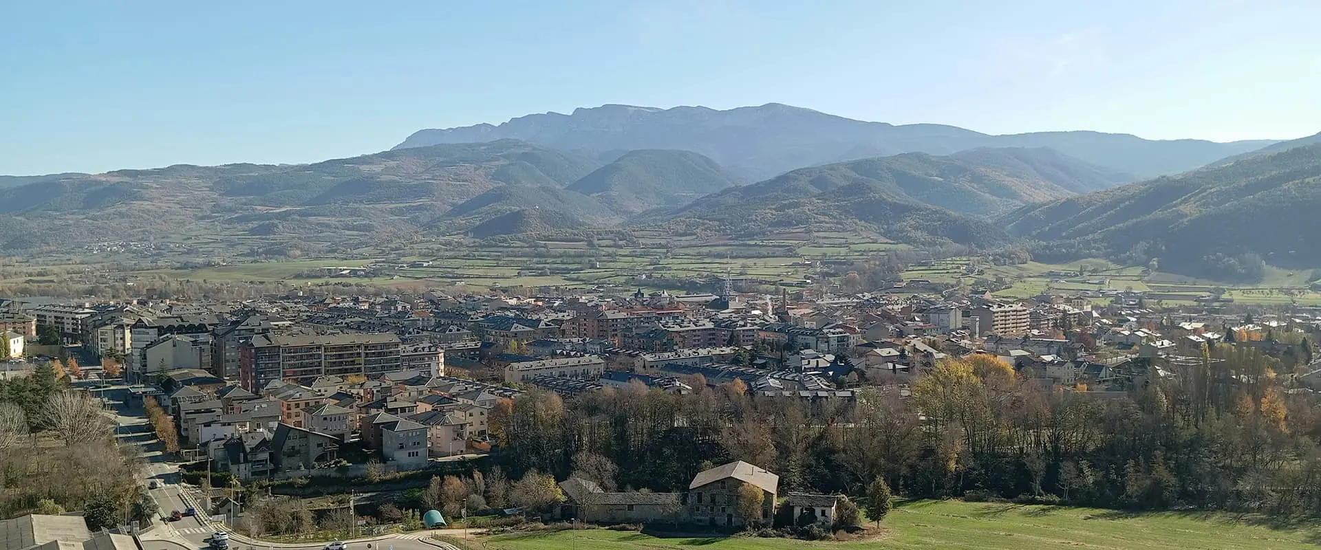
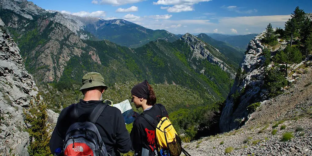
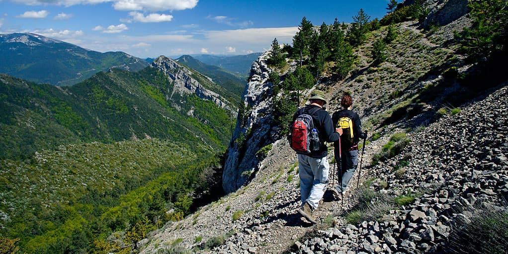
GR150 Cadí Circuit, also known as the Circuito del Cadí, loops for about 150 kilometers around the Cadí-Moixeró Natural Park, one of Catalonia’s most dramatic pockets of mountains. The route starts and finishes in Bagà, a small mountain town at the park’s southern edge, from where you will make your way through forests, over ridges, and into peaceful valleys with stone villages.

This is not a very popular trail, so you need to be ready to hike sections alone and not have much company in the small towns. Because it isn’t one of the more frequented trails in the region, it isn’t overly polished and is definitely more rugged and lived-in. However, that is what makes it an adventure!

Elmar profile picture
Editor

Elmar Teegelbeckers

Passionate hiker Elmar spends months of his time on the trail. He’s usually on the lookout for hidden gems in one of his favourite countries such as Slovenia, Switzerland and Japan. He founded hiking-trails.com in need for a community and detailed information about the trails. Before this, he worked for the Alpine asscociation in the Netherlands[ (NKBV) but lost his heart to the trails.

Not long ago, Elmar published the book (in Dutch) Hiking Trails – best long-distance trails in Europe. With this book, website and socials, he hopes to inspire and shape an inclusive community for hikers all over world. No matter your speed, experience or level, you can get out there to enjoy the trails and connect with the heartwarming hiking community. Life is so much better outside and he hopes to inspire hikers to take their first, or next, step on the trail.

You can reach Elmar at info@hiking-trails.com.

View profile

The Trail

The first stage climbs out of Bagà through oak and pine, with views of the limestone walls of the Serra del Cadí above the treeline. By the time you reach Gósol, after about 24 kilometers, you’ll feel in the rhythm of the walk. Gósol’s a sleepy place, once home to Picasso for a spell, and a great spot to settle into the slower pace of the trail. From there, stage two continues over Coll de la Mola, crossing into the province of Alt Urgell before descending into Fórnols, a quiet farming village where you can stay in a simple casa rural and enjoy a proper meal after a long day.

Stage three takes you toward La Seu d’Urgell, a great market town and the largest along the route. It’s a good place to restock and spend the night in comfort before heading back into the hills. The next stretch, from La Seu to Ansovell, brings you back into high country, a remote-feeling climb that rewards you with views of the Cadi ridge in full relief. Ansovell itself is little more than a cluster of stone houses, but it has a tucked-away charm and basic accommodations.

The following day to Estana feels wilder. The trail follows narrow ridges and meadows, where you’ll likely see vultures circling above. Estana is high up in the hills and is one of those rare Pyrenean villages that still feels untouched. From here, the route drops gradually to Bellver de Cerdanya, a bigger town with shops, hotels, and a handful of good restaurants. It’s a natural breaking point and a chance for more variety in your meals.

On stage seven, you will hike from Bellver to Alp, a day of open walking with wide valley views and easier terrain underfoot. After a nice day in the valley, stage eight is characterized by the long climb to Coll de Pal, the high point of the loop, and arguably the most spectacular. There’s a small mountain refuge nearby where you can spend the night surrounded by stars and silence. The final leg descends steadily back to Bagà, where you can celebrate a hike well hiked.

Stages

The stages of the GR150 Cadí Circuit take you from accommodation to accommodation, so it’s best not to modify them.

GR150 Cadí Circuit 9-Day Itinerary

Stage 1:

Bagá – Gósol, 23.7 km | 14.7 mi

Stage 2:

Gósol – Fórnols, 18 km | 11.2 mi

Stage 3:

Fórnols – La Seu d’Urgell, 18.2 km | 11.3 mi

Stage 4:

La Seu d’Urgell – Ansovell, 19.8 km | 12.3 mi

Stage 5:

Ansovell – Estana, 12 km | 7.5 mi

Stage 6:

Estana – Bellver de Cerdanya, 19.2 km | 11.9 mi

Stage 7:

Bellver de Cerdanya – Alp, 14.6 km | 9 mi

Stage 8:

Alp – Pal pass, 12.8 km | 7.9 mi

Stage 9:

Pal pass – Bagá, 13 km | 8 mi

Accommodations

You can stay in lodging and mountain huts (refugios) along the GR 150 Cadí Circuit. You will pass by towns and small villages on the route and will have the option of sleeping there. It is helpful to book ahead when you can, as there are not many options. When staying in the mountain huts, be sure to bring a sleeping bag liner.

Note: It is illegal to wild camp throughout the park. Be respectful and book your accommodations in the villages along the way!

Best time of the year

The GR150 Cadí Circuit can be hiked through the spring, summer, and early fall. Because the highest point on the trail is 2111 meters, you shouldn’t encounter snow until later in the season. It should also melt early enough that you can hike throughout the spring. If you are unsure of the trail conditions, you can call the mountain huts or accommodations in the towns to ask for live updates.

Safety & Gear

To prepare for the Cadí Circuit, you should plan all of your accommodations ahead of time, pack appropriately, and make sure you’re in good physical shape. For deciding your accommodations, this comes with having a strong itinerary. As you plan your stages, confirm where/how you will sleep each night to avoid surprises. It is also helpful to share this itinerary with someone you trust, so they know where you are along the way.

Additionally, you will need to pack well for the trail. This includes bringing a comfortable, ergonomic backpack, shoes with strong grip for steep descents, and enough layers to keep you cool in the day and warm in the evenings. Other helpful items to bring are a sleeping bag liner for the mountain huts, a headlamp, and a basic first aid kit.

Finally, being in strong physical shape will make this all the more enjoyable. It is recommended that you train before hiking the GR 150. Important things to consider are that you will be on trail for 4-6 hours every day (not including breaks). So, your stamina, balance, strength, and cardio should be trained to keep you comfortable as you go.

Difficulty

The GR150 Cadí Circuit is a moderately difficult trail. You will gain about 1000 meters every day, which is significant for new hikers. If you are an experienced long-distance hiker, this trail will not be anything crazy, but it will still put you to the test for 9 days of hiking. As this is not a popular trail, you may not see many other people while you walk. Depending on how social you are, this may make the trail easier or more difficult. Either way, it is something to take into mind!

Good to know

You can reach Bagà by road from Barcelona/Vic (via C-16), and, if you need to, there are bus/train connections in the broader region as well.

The GR 150 is in the Catalunya region of Spain, which is home to many counties. You will hike through three different counties (Berguedà, Alt Urgell, Cerdanya), so you will see how all three differ in their architecture, landscapes, and even culture while being so close to each other.

route
circular
highest point
2111m (6926 ft)

Want to submit a trail or make this page more complete?

Always read the disclaimer

Terms of Use: important to all visitors on this website. We strive to publish high quality content and information on this website. However it’s always possible that we’re missing out on some crucial information. In spite of the fact that this route, associated GPS track (GPX and maps) were prepared under diligent research by the specified contributor and/or contributors, the accuracy of such and judgement of the author is not guaranteed. Therefore, hiking-trails.com and contributors are in no way liable for personal injury, damage to personal property, or any other such situation that might happen to individuals hiking or following this route. Should you choose to hike this trail, this is always at your own risk. Check out our guidelines for safety hiking and Leave No Trace principles at the hiking 101 page.

Download GPX

Join the community!

Login or create a FREE account 😊

With an account you can:

Download GPX files

Pin trails to your wishlist

Mark trails as hiked by you

Rate hiking trails

Comment on trails, blogs and gear reviews

Happy trails!
Login

Don't have an account yet? Register here