About the Sant Jeroni Summit Loop

Catalonia
country
Spain
length
10 km(6 mi)
Type of trail
Day hike
difficulty

Difficulty is highly personal. Be aware of the weather conditions as bad weather turns easier trails in difficult trails especially in the mountains.

Moderate
accommodation

Lodging means a mix of hotels, hostels or AirBnB’s.

Lodging
Elevation gain
676 m(2218 ft)
terrain
Mountains, Hills
remoteness
Some of the time
Show more

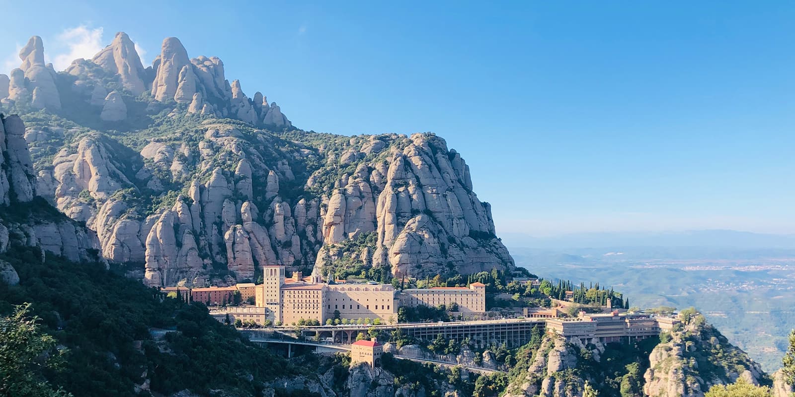
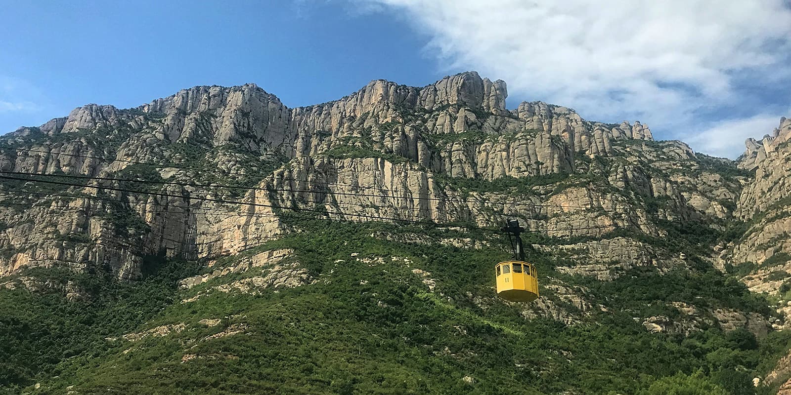
If you are looking for some exercise and nature in Catalunya, the Sant Jeroni Summit Loop is a good option. It’s the highest point in the range, with 360° views at the top and a trail that threads past the famous cliffs of Montserrat.

The trail is full of forest paths, stone steps, and little surprises along the way, like needle-thin spires and an old hermitage tucked near the finish. On clear days, you’ll see the Pyrenees, the Llobregat valley, and the whole saw-toothed skyline laid out like a map.

women in blue smiling at camera
Editor

Katie Mitchell

After a whirlwind 10 years on the road (and trail!), Katie has hiked the Camino Frances, the Peaks of the Balkans, the Fisherman’s Trail, the Cumbria Way, the Pembrokeshire Way, and more in Europe and the United States. She is an avid trail runner and you can find her either on the trail or in a cafe in a new city, sampling all of their gluten-free treats. You can follow her adventures on Instagram.

View profile

The Trail

You’ll start and end the loop at the Montserrat Monastery complex. From here, walk up through shaded paths and stairways, keeping an eye out for named rock formations. The Gorros come first, a cluster of four needles. La Gorra Frígia is the tallest, topped by a cross, and it gives you a fine preview of Sant Jeroni rising behind. Keep a steady pace here, even though stopping every five minutes for photos is tempting!

The trail takes you through scrub and oak trees, then crosses a little wooden footbridge over the Santa Maria stream. From here, the path steepens, with steps cut into the rock and switchbacks that will take you higher, although they don’t feel sketchy. The views open and close as you hike between towers, which is half the fun.

A few minutes below the summit, you’ll pass the Hermitage of Sant Jeroni, which is a good breather spot. From there, it’s a short push to the viewing area on the top. On a crisp day, you’ll pick out the Pyrenees to the north, Barcelona’s plain far off to the southeast, and Montserrat’s spires right at your feet.

Best time of the year

You can hike to Sant Jeroni all year round. Luckily, the peak is only 1236 meters above sea level, which means it will not get cold enough to snow on this peak. That makes it possible year-round for you to access the trail.

Safety & Gear

While the hike to Sant Jeroni is rated as a moderate hike, there are still some steep sections you should take care on. To prepare for these, you should bring shoes with good grip and poles if you need them. Additionally, pack enough water and a hat, as the hike is exposed with very little shade. Finally, you will be hiking for about four hours, so bringing snacks may also be a nice treat to keep your energy levels up.

Difficulty

The San Jeroni Summit Loop is a moderately difficult trail. You will hike for about four hours (10.5 km) in the sun with 676 meters of elevation gain. This can be difficult for some, and the Sant Joan funicular can be used to reduce elevation climbing.

Good to know

If you don’t have the time to hike the full loop, you can take the Sant Joan funicular to the Plà de les Taràntules to begin the trail from the upper station. That will cut down on most of the climbing, so you can enjoy the hiking at the top and the views without as much strain.

To get to Monestir de Montserrat (Montserrat Monastery) from Barcelona, you can take the R5 commuter train from Plaça Espanya to Monistrol de Montserrat, then transfer to the cog-railway (Cremallera) or cable-car, which takes you to the mountain station.

route
Circular
highest point
1236m (4055 ft)

Want to submit a trail or make this page more complete?

Always read the disclaimer

Terms of Use: important to all visitors on this website. We strive to publish high quality content and information on this website. However it’s always possible that we’re missing out on some crucial information. In spite of the fact that this route, associated GPS track (GPX and maps) were prepared under diligent research by the specified contributor and/or contributors, the accuracy of such and judgement of the author is not guaranteed. Therefore, hiking-trails.com and contributors are in no way liable for personal injury, damage to personal property, or any other such situation that might happen to individuals hiking or following this route. Should you choose to hike this trail, this is always at your own risk. Check out our guidelines for safety hiking and Leave No Trace principles at the hiking 101 page.

Download GPX

Join the community!

Login or create a FREE account 😊

With an account you can:

Download GPX files

Pin trails to your wishlist

Mark trails as hiked by you

Rate hiking trails

Comment on trails, blogs and gear reviews

Happy trails!
Login

Don't have an account yet? Register here