About the Gspon High-Altitude Trail

Alps
country
Switzerland
length
14 km(9 mi)
Type of trail
Day hike
difficulty

Difficulty is highly personal. Be aware of the weather conditions as bad weather turns easier trails in difficult trails especially in the mountains.

Moderate
accommodation

Lodging means a mix of hotels, hostels or AirBnB’s.

Lodging, Camping, Mountain huts
Elevation gain
740 m(2428 ft)
terrain
Mountains, Forest
remoteness
None of the time
Show more

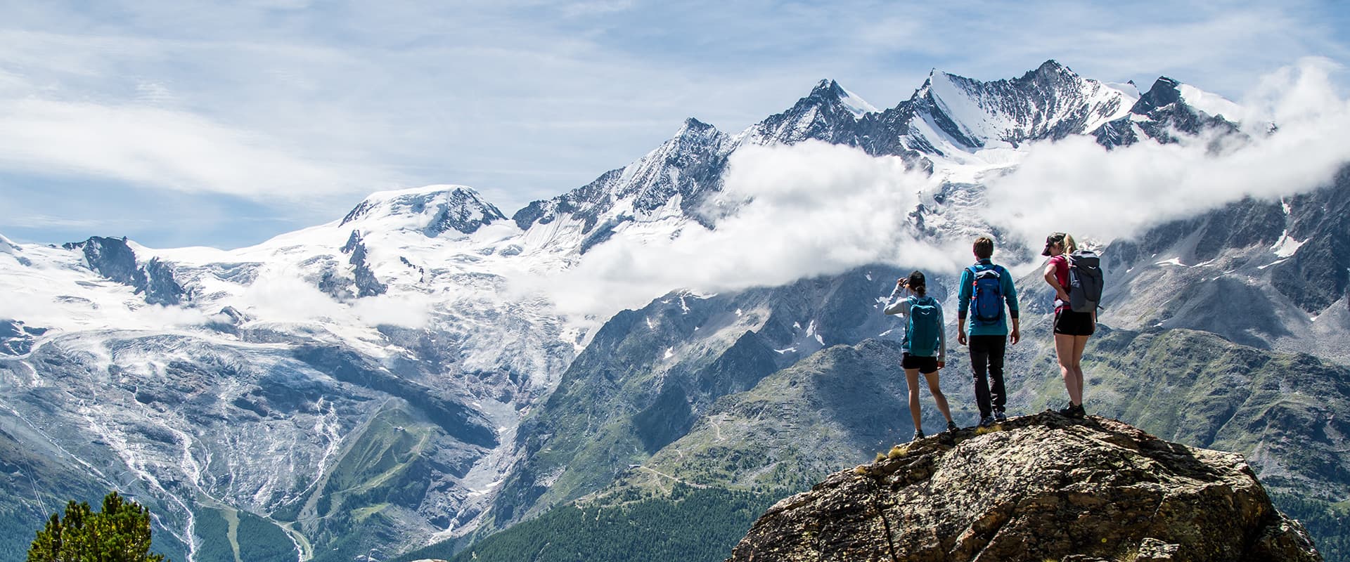
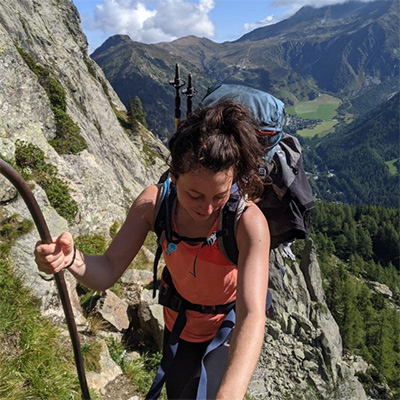
Staldenried-Gspon, home of the Gspon High-Altitude Trail, is not only known for Europe’s highest soccer pitch but also for its impressive mountain world with numerous 4,000-meter peaks and glaciers. Whether winter sports enthusiasts, hikers, mountain bikers, mountaineers, or climbers, the village attracts outdoor sports enthusiasts all year round.

The Gspon High-Altitude Trail is a 14-kilometer (8.7 mi.) day hike, that leads from the mountain village of Gspon past Siwibode to Kreuzboden in Saas-Grund. The trail will delight you with panoramic views of the 4000-meter peaks of the Valais Alps. And, with a bit of luck, it is possible to spot a few native animals, such as deer, ibex, marmots, or eagles, along the way.

Merle profile picture

Merle Wünderling

Merle is an outdoor enthusiast who’s passionate about hiking, rock climbing, mental health, and sustainability. Born in Germany but at home in the world, she’s hiked trails in New Zealand (Abel Tasman Coast Track, Kepler Track), Europe (Rota Vicentina/ Fishermen’s Trail, Tour du Mont Blanc, GR20 Corse, Kungsleden… ), and the Balkans (Peaks of the Balkans). Over the years she became a bit of a nerd, constantly improving her gear for upcoming hikes, such as GR11 Spain, Tour des Ecrins, Te Araroa, and the Transcaucasian Trail.

You can follow Merle on Instagram @merlewunderkind.

View profile

The Trail

The cableway takes you from Stalden up to the official start of the trail – the mountain station in Gspon. The village awaits with the first stunning views into the Rhone as well as the Saaser Valley. After the Alpenblick mountain hotel, the path then leads to the right and downhill for a short distance, before the continuous ascent to Siwiboden begins. With its stunning view of the entire Mischabel chain, this is one of the highlights of this hike.

A short time later, the descent to Saas-Grund begins, accompanied by views of the surrounding 4000-metre peaks. The trail first leads in the direction of Hoferälpi and from there continues via Grüebe to Kreuzboden. This part of the hike contains tricky passages in scree, which means you will need to be surefooted and have some previous hiking experience. From Kreuzboden, you’ll then have the choice of continuing the descent either with the Hohsaas mountain railway or on foot, from Grubenalp via Heimischgarte to Saas-Balen.

Best time of the year

The best time of the year to hike the Gspon High-Altitude Trail is from June to October, when there is no snow. Because this is a high-altitude hike, the snowbanks can linger into the summer, which means it’s important to check the conditions before you go. You can do this by calling the tourism board or using the webcams listed on the tourism board’s website. If you’re still unsure, it’s worth bringing micro-spikes with you as a backup.

Safety & Gear

Take as little as possible and as much as needed: Wear layers, bring suitable footwear, and be prepared for rain and shine. If you’re not sure what to bring, you can use our day-hiking gear list for inspiration.

Also, remember to bring a first-aid kit. The trail is well marked but it is always wise to bring an additional map and the downloaded GPX file for the trail.

The weather in the high mountains can change rapidly. Always check the trail conditions and local weather forecasts to prepare for what the mountains may throw at you.

Finally, make sure to stay properly hydrated and bring at least two liters of water with you. When it comes to nutrition it is easiest to bring snacks, such as energy bars, nuts, or dried fruits, to maintain your energy level.

Difficulty

The Gspon High-Altitude Trail is a moderately challenging hiking trail. The hike contains some tricky passages in scree, but there is also a shortcut option by taking the mountain railway.

If you’re thinking about training for the Gspon High-Altitude Trail, you can try taking hikes at home on uneven terrain to work on your balance or using the stairmaster at the gym to work on your hill-climbing endurance. It can also be very helpful if you try these while wearing a weighted vest or a full-day pack to simulate the amount you’ll actually be carrying on the hike.

Good to know

The Gspon High-Altitude Trail in Saas-Grund/Saastal can be reached easily by public transport. The SBB takes you to Visp, where you can take either the bus or the Matterhorn-Gotthardbahn towards Stalden-Saas. From there, continue with the cable car to Gspon.

Those who come by car take either the Furka Pass/ Furka car transport from the east or the Simplon Pass/ Simplon car transport from the south. There is a parking garage at the station in Stalden.

route
point-to-point
highest point
2468m (8097 ft)

Want to submit a trail or make this page more complete?

Always read the disclaimer

Terms of Use: important to all visitors on this website. We strive to publish high quality content and information on this website. However it’s always possible that we’re missing out on some crucial information. In spite of the fact that this route, associated GPS track (GPX and maps) were prepared under diligent research by the specified contributor and/or contributors, the accuracy of such and judgement of the author is not guaranteed. Therefore, hiking-trails.com and contributors are in no way liable for personal injury, damage to personal property, or any other such situation that might happen to individuals hiking or following this route. Should you choose to hike this trail, this is always at your own risk. Check out our guidelines for safety hiking and Leave No Trace principles at the hiking 101 page.

Download GPX

Join the community!

Login or create a FREE account 😊

With an account you can:

Download GPX files

Pin trails to your wishlist

Mark trails as hiked by you

Rate hiking trails

Comment on trails, blogs and gear reviews

Happy trails!
Login

Don't have an account yet? Register here