Vallon de Réchy green mountain valley

Walking Tour of the Val d’Anniviers

About the Walking Tour of the Val d’Anniviers

Alps
country
Switzerland
length
81 km(50 mi)
Type of trail
Long-distance, Hut to hut
difficulty

Difficulty is highly personal. Be aware of the weather conditions as bad weather turns easier trails in difficult trails especially in the mountains.

Moderate
accommodation

Lodging means a mix of hotels, hostels or AirBnB’s.

Mountain huts
Elevation gain
3222 m(10571 ft)
terrain
Mountains
remoteness
Most of the time
Show more

Come and discover the beauty of a walking tour of the Val d’Anniviers, where the landscapes alone will make you fall in love with the area. You’ll spend your nights in cozy mountain huts in the heart of the Alps and experience delicious local cuisine. An unforgettable adventure awaits—are you ready for the challenge?

The Walking Tour of the Val d’Anniviers is a new version of this trail in the region, recently renovated and updated for hikers starting in the summer 2025 season. You’ll have a chance to enjoy one of the most acclaimed mountain regions in Switzerland on this tour: Anniviers.

women in blue smiling at camera
Editor

Katie Mitchell

After a whirlwind of 8 years on the road (and trail!), Katie has hiked the Camino Frances, the Peaks of the Balkans, the Fisherman’s Trail, and extensively in the United States. She is an avid trail runner and now lives in Colorado where she plays in the mountains in her free time. You can follow her adventures on Instagram.

View profile

The Trail

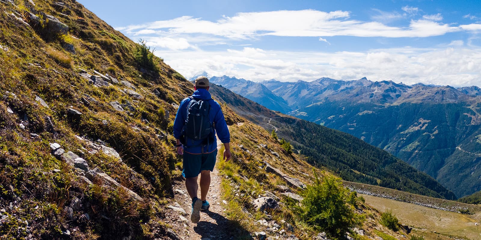
The actual daily hiking time (excluding breaks) ranges from 3h40 (on the first day) to an average estimate of 7h30. This tour is designed for moderately experienced but well-trained hikers. The route has few technical difficulties and should be comfortable if you’re used to hiking in the mountains. You’ll be able to walk at your own pace, take a break for picnics along the way, and soak in the scenery of the valley.

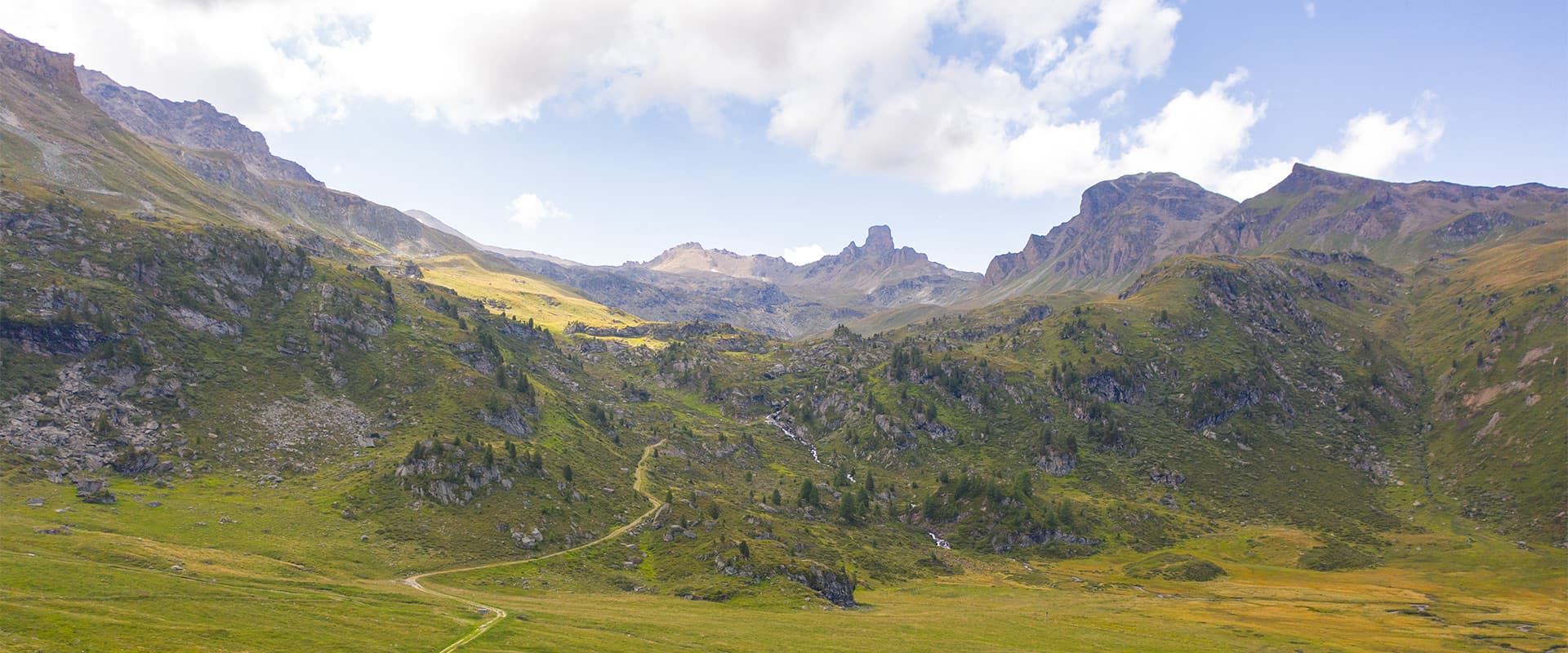
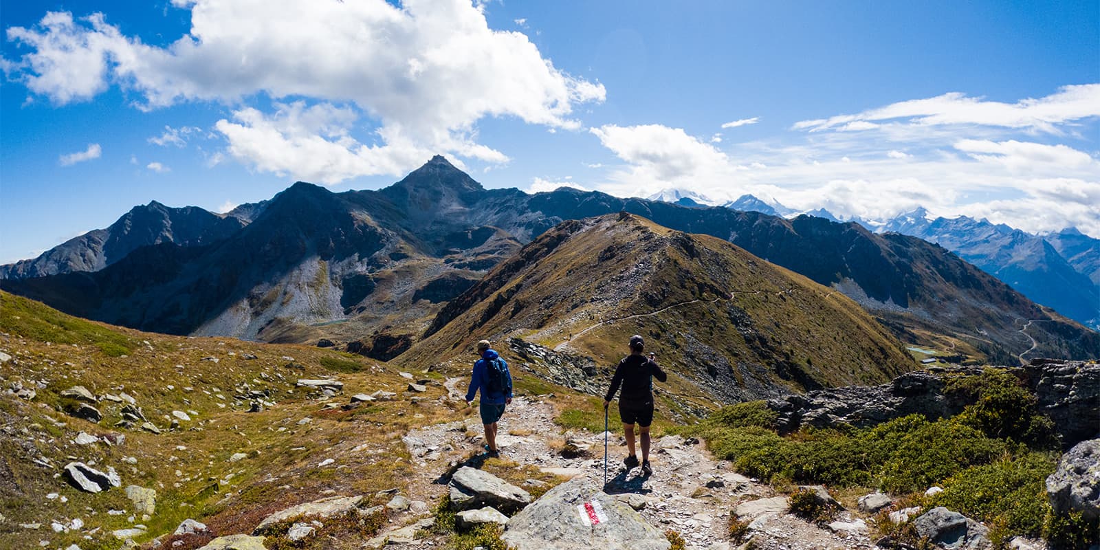
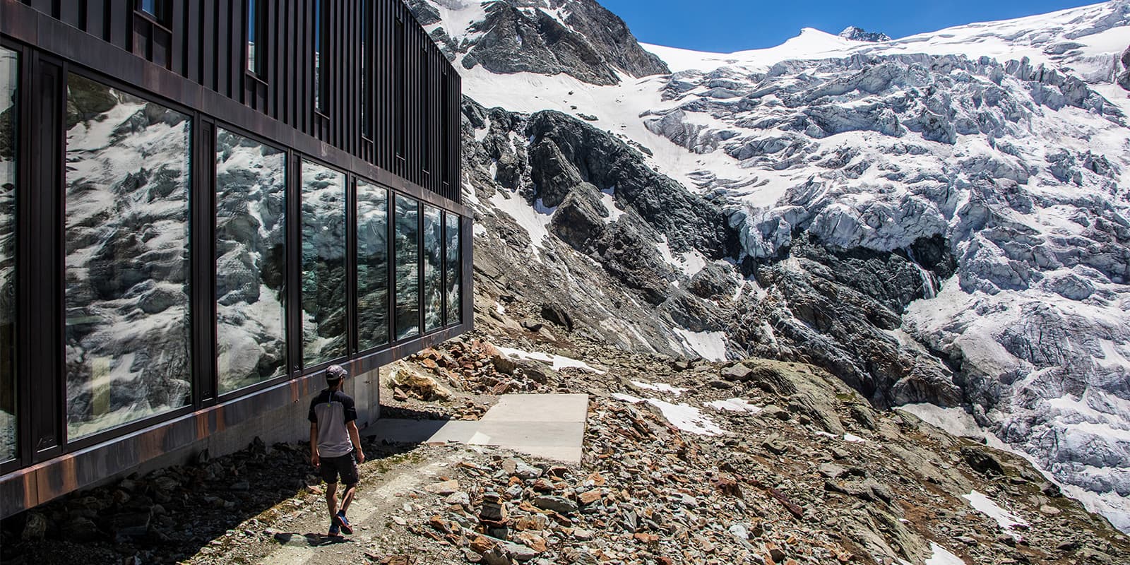
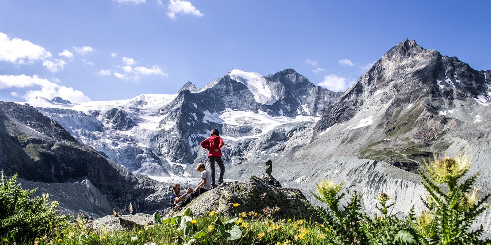
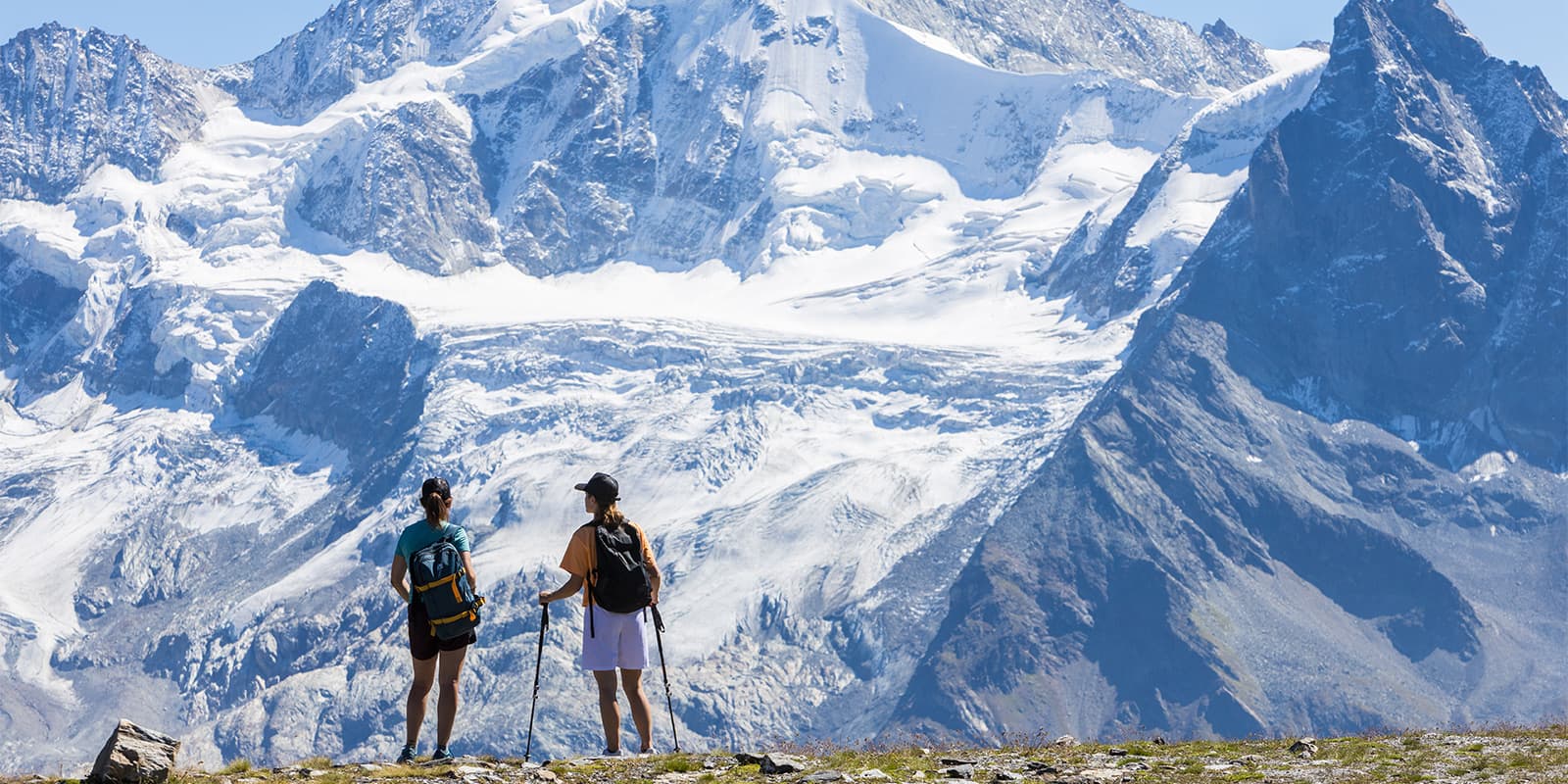
As you hike, you’ll pass views of the Imperial Crown, with its 6 summits of more than 4000 meters: Bishorn, Weisshorn, Zinalrothorn, Obergabelhorn, Dent Blanche, and Matterhorn. These peaks are renowned globally for how impressive they are and this trek is the perfect way to see them all. You’ll also spend time at the Moiry dam, which is a shade of blue like no other. There’s a bus stop here in case you need to descend to the valley, and a restaurant with a view of the dam as well. You’ll pass through multiple nature reserves and see the towns of the area, really getting a full picture of Anniviers.

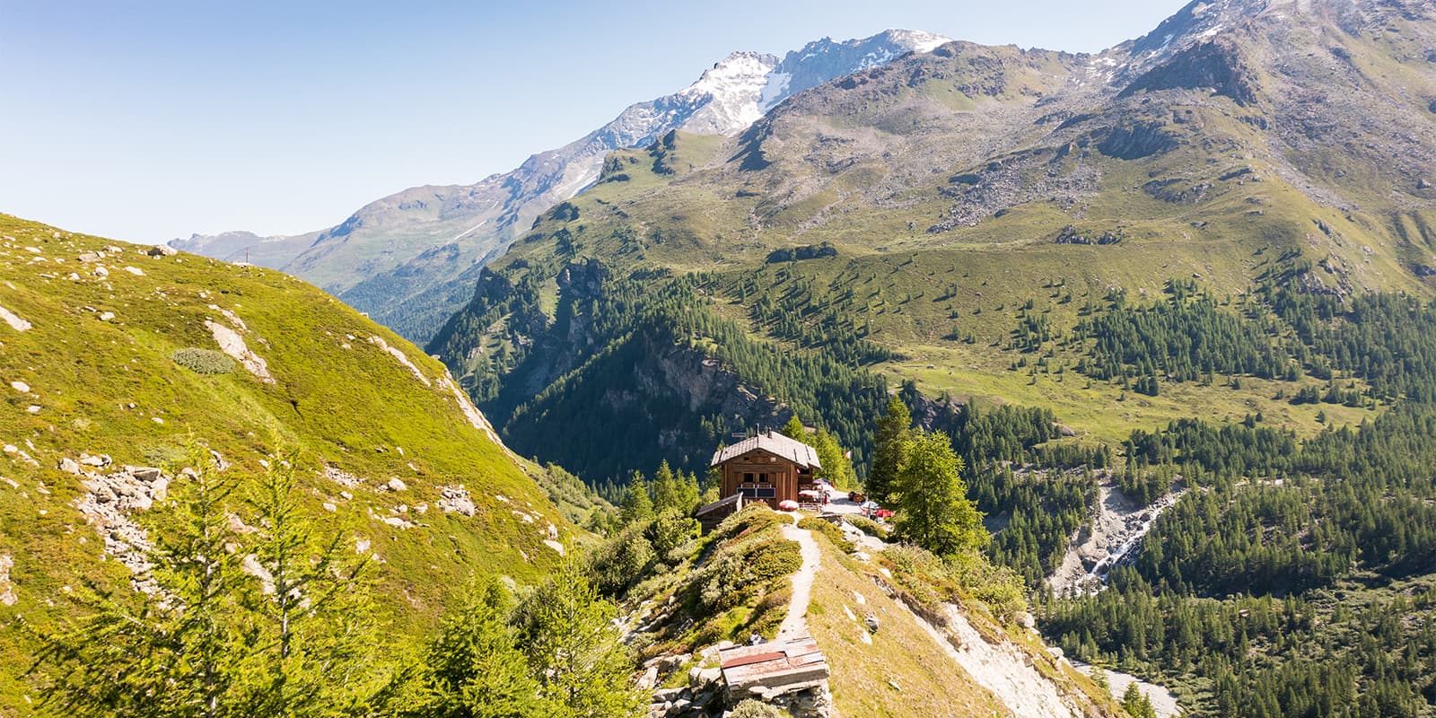
There are a few ways to attempt this tour. Either you can hike it independently and book the huts yourself, or you can book the tour directly through Anniviers Tourism. Booking with Anniviers Tourism has a few benefits, as they’ll take care of your hut bookings (with tourist tax), all food (full board), and provide you with a topographic map, 1:25’000, of Val d’Anniviers. You will need to bring a lunch for the first day, though.

Stages

The Walking Tour of the Val d’Anniviers is a great way to explore the Valais region over 5 days. The stages, as listed, will be difficult to change, so it’s best to stick with this itinerary.

5-day Walking Tour of the Val d’Anniviers itinerary

Stage 1:

Chandolin Tourist Office –Bella-Tola Hut, 9.4 km | 5.8 mi (+632M – 262M)

Stage 2:

Cabane Bella-Tola – Hôtel Weisshorn – Zinal – Petit Mountet Hut, 21.7 km | 13.5 mi (+766m -995m)

Stage 3:

Petit Mountet Hut – Zinal – Corne de Sorebois – Moiry Hut , 17.7 km | 11 mi (+794m -1119m)

Stage 4:

Moiry Hut – Torrent Alpage – Sex de Marinda – Becs de Bosson Hut, 17.6 km | 11 mi (+1015m -861m)

Stage 5:

Becs de Bosson hut – Lac du Louché (Vallon de Réchy) – Ar du Tsan – Bisse de Vercorin – Vercorin, 14.7 km | 9.1 mi (+15m -1676m)

Accommodations

Along the way, you’ll stay in mountain huts. Below are the huts of the tour that you’ll book using the links provided. Hiking between mountain huts is a special way to experience the alpine, as you’ll have a chance to stay in the mountains without needing to descend every day to a valley. These huts will usually have dormitory-style rooms that you’ll share with other hikers and communal meal times.

Make sure you book your beds as early as possible! There’s always a chance that they may fill up, and you’ll need to find another time to enjoy this trail.

Mountain huts per stage

Stage 1:

Bella-Tola Hut

Stage 3:

Moiry Hut

Best time of the year

This trail is accessible from June 26 to September 15, based on the opening dates of the mountain huts. Outside this period, the tour is still possible, but overnight stays will possibly require alternative accommodations.

Keep in mind that the weather in the high mountains is never stagnant, and can change at any moment. You’ll want to pack for this, bringing hiking clothing and gear that can withstand the elements.

If you’re unsure of the conditions, you can call the hut wardens before you go for a real-time report of how accessible the trail is. Additionally, you’ll want to keep an eye on the weather each day before you leave the hut to start hiking. Sometimes delaying your start by just one hour can save you a lot of discomfort!

Safety & Gear

This trail’s paths sometimes cross areas without clear markings, where there may be steep slopes and narrow, exposed passages. They are intended for hikers with good physical fitness, mountain experience, and an awareness of altitude-related risks. Proper equipment and thorough preparation will be necessary to make sure you have a safe and environmentally respectful hike.

Here are some important guidelines to follow:

  • Stay on marked trails.
  • Always close gates and fences behind you.
  • Take regular breaks and stay well-hydrated.
  • If thunderstorms are a risk, start early—storms often occur in the late afternoon.
  • If bad weather approaches, seek shelter quickly.
  • In case of difficulty, do not take unnecessary risks and turn back if needed.
  • Respect nature and follow the regulations in protected areas.

Difficulty

The Walking Tour of the Val d’Anniviers is a medium-difficulty trail. Daily, you’ll ascend between 750-1015 meters, and on the final day, you will descend 1676 meters. This can be trying on your knees, so it’s important to train for a trail like this! Bringing hiking poles will also be beneficial in packing for the tour.

Training for the Walking Tour of the Val d’Anniviers will make it a much more enjoyable experience. Try taking training hikes around your local area, bringing a full pack with you. It’s best if you stay out as long as you can on these hikes, as some of the days on this trail can be up to 7.5 hours of walking.

Good to know

In certain areas of the Val d’Anniviers and the Vallon de Réchy, livestock guardian dogs (Patous) watch over sheep. These dogs are not dangerous, but they can be protective of their flock. To avoid any issues, keep your distance from the flock and do not attempt to approach or pet the dogs. You’ll also need to walk around the flock calmly and avoid sudden movements. To check the exact locations of flocks and guardian dogs, refer to this interactive map.

You can park your car for free at the Vissoie football field. From there, take the bus to Chandolin. With the Anniviers Liberté Pass, you can travel for free by bus throughout the Val d’Anniviers. Upon arrival in Vercorin, you can take the bus back to Vissoie.

If you’re coming by bus, you can take the bus from Sierre train station to Vissoie. Upon arrival in Vercorin, you can take the bus back to Sierre train station.
If you are traveling by bus to or from Sierre, you will need to pay the full fare. The Anniviers Liberté Pass is only valid within the Val d’Anniviers.

route
point-to-point

Want to submit a trail or make this page more complete?

Join the community!

Login or create a FREE account 😊

With an account you can:

Download GPX files

Pin trails to your wishlist

Mark trails as hiked by you

Rate hiking trails

Comment on trails, blogs and gear reviews

Happy trails!
Login

Don't have an account yet? Register here