About the Coronallacs Trail

Pyrenees
country
Andorra
length
92 km(57 mi)
Type of trail
Hut to hut, Long-distance
difficulty

Difficulty is highly personal. Be aware of the weather conditions as bad weather turns easier trails in difficult trails especially in the mountains.

Difficult, Strenuous
accommodation

Lodging means a mix of hotels, hostels or AirBnB’s.

Mountain huts, Lodging
Elevation gain
6449 m(21158 ft)
terrain
Mountains, Forest
remoteness
Some of the time
Show more

The Coronallacs Trail is a 92-kilometer (57 mi.) circular hut-to-hut hiking trail through the mountains of Andorra. It is a physically demanding route through high mountain terrain, where you will cover between 13 and 22 kilometers (8-13.6 mi.) daily in five stages. The perfect challenge that still gives you a chance to recover each night.

Therefore, you will be rewarded with spectacular views and restful nights in four manned high-mountain shelters. The trail starts and ends at the tourist office in the town of Escaldes-Engordany.

Merle profile picture

Merle Wünderling

Merle is an outdoor enthusiast who’s passionate about hiking, rock climbing, mental health, and sustainability. Born in Germany but at home in the world, she’s hiked trails in New Zealand (Abel Tasman Coast Track, Kepler Track), Europe (Rota Vicentina/ Fishermen’s Trail, Tour du Mont Blanc, GR20 Corse, Kungsleden… ), and the Balkans (Peaks of the Balkans). Over the years she became a bit of a nerd, constantly improving her gear for upcoming hikes, such as GR11 Spain, Tour des Ecrins, Te Araroa, and the Transcaucasian Trail.

You can follow Merle on Instagram @merlewunderkind.

View profile

The Trail

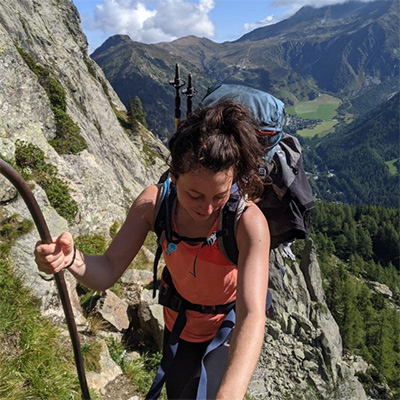
The first stage takes you from Escaldes-Engordany to the Illa Refuge. From the tourist office, the path crosses La Tosca bridge and follows the GR7 all the way to the Madriu-Perafita-Claror Valley – a UNESCO Cultural Landscape World Heritage Site. It continues to Entremesaigües until it reaches the mountain chalets in Ràmio and the Fontverd Refuge.

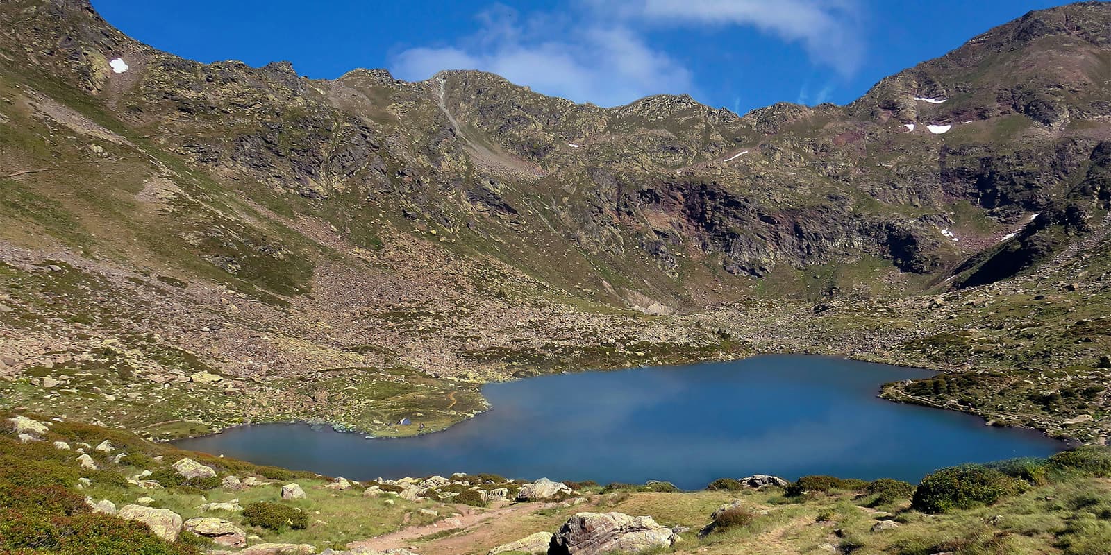
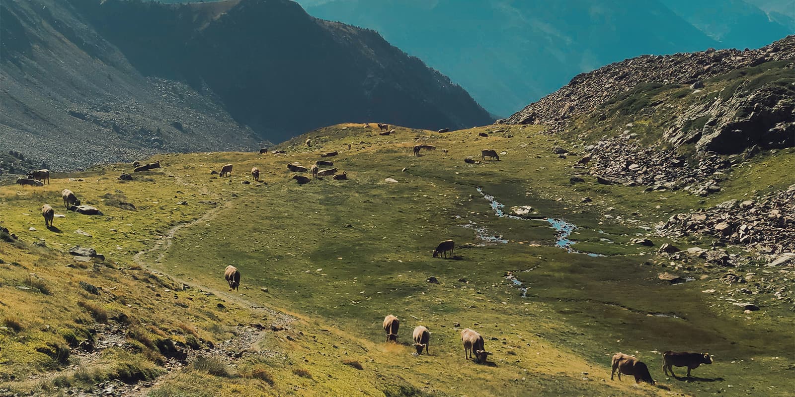
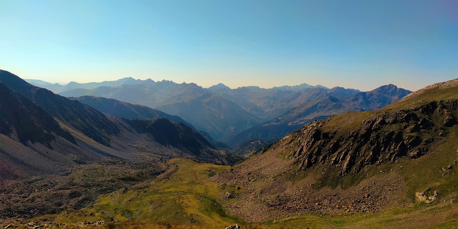
Between Fontverd and the River Els Orris, you might be able to spot some wildlife, such as chamois, wild boar, mouflon, and marmots if you’re lucky. From the large meadow of Pla de l’Ingla, you can see the Estall Serrer mountains, the Setut pass, and Portelleta Peak, as well as the Civera Valley pass. Short before the L’Illa hut, the trail comes across the first lakes, which also surround the hut. Since there is no light pollution, make sure to watch the stars. It is also worth it to stay an extra night to explore the nearby lakes.

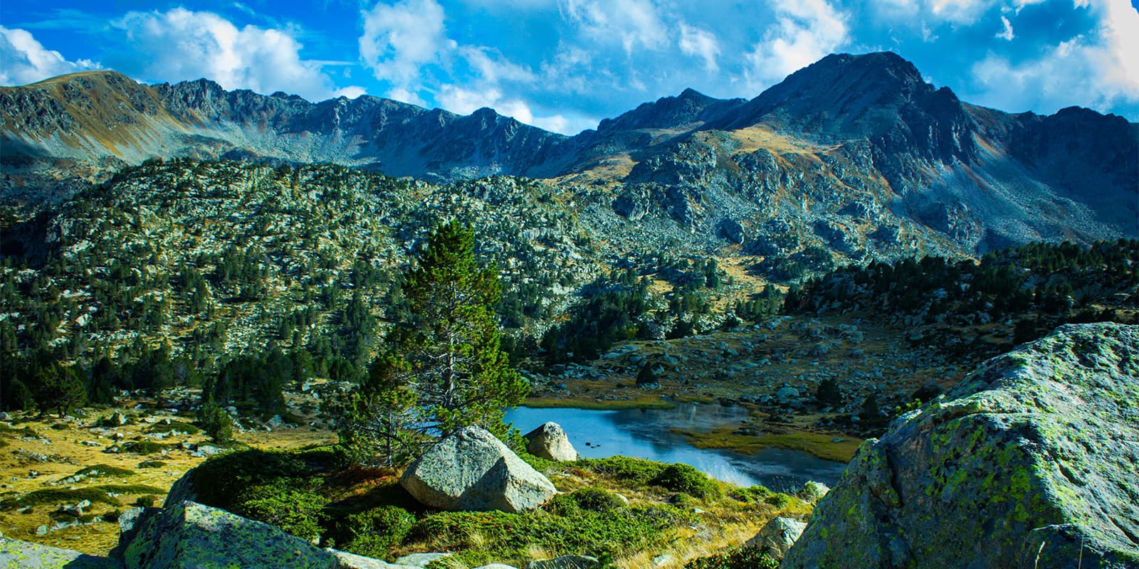
From L’Illa hut, the path climbs up to the Pessons pass. At 2810m (9216 ft), this is the highest point of the whole trail. From here, it is possible to see the Pessons lakes. A descent leads to the Pla de les Pedres shelter and will continue until you reach Envalira. It is followed by an ascent to the Port Dret pass, which offers stunning views of not only Andorra but also France and the Soldeu, as well as the Siscaró Valleys. The next descent leads, past the Siscaró hut, to the Juclà hut. It is highly recommended to watch the sunrise through the Coll de l’Alba saddle.

The third stage continues from Juclà hut to Sorteny hut. You will first pass the remnants of a cabin and the River Manegó before you head to the Cabana Sorda lake and mountains. The trail continues between the Coma de Varilles peak, Tosa de Carraup, and up the Collada de Cabana Sorda pass, with beautiful views. Afterward, it descends slightly along Coma de Varilles to the Coms de Jan hut before it ascends to the Collada dels Meners pass and lakes. From here, it is possible to see the upcoming part of the trail as well as the two surrounding valleys. From Collada dels Meners, the trail descends into the Sorteny Valley and to the hut with the same name. If you have time and energy left, you can visit the botanical gardens or enjoy some butterfly spotting.

From the Sorteny hut, the next day starts with a descent to the villages of El Serrat and Llorts. It is followed by a short but steep ascent, past the L’Angonellla shelter and lake, to Clot del Cavall. Afterward, it comes along La Massana and descends slightly to the Fonts hut and the Pla de l’Estany before it leads all the way to the foot of Comapedrosa mountain and the Valls del Comapedrosa Natural Park. Follow there, the trail follows the signs towards Aigüesjuntes until you reach the Comapedrosa hut.

The fifth and last stage leads from the Comapedrosa hut all the way back to the town of Escaldes-Engordany. First, the trail ascends to Portella de Sanfons, with spectacular views of the Aneto and Pica d’Estats mountains. Then, it heads towards the Port Vell and Port Negre passes and the Coll de la Botella saddle. Next, it leads slowly back down til it reaches the forest. It continues on to the Collada de Montaner pass and descends through Els Cortals de Sispony, which leads to the town of Sispony. Afterward, you will follow the La Grella road, cross the River Muntaner, and continue up to the Camí de la Birrena road.

From there, you will take the Camí Ral track, which leads to the capital city. The trail continues along the Rec del Solà up to the school of Sant Ermengol, where you have to cross the playground and descend down to Els Escalls bridge. You will pass Caldea before you will finally return to the starting point.

Stages

The Coronallacs Trail is usually hiked in five stages.

5-stage itinerary

Stage 1:

Escaldes – Engordany town center – L’Illa hut, 12.6 km | 7.8 mi

Stage 2:

L’Illa hut – Juclà hut, 19.4 km | 12 mi

Stage 3:

Juclà hut – Sorteny hut, 16.9 km | 10.5 mi

Stage 4:

Sorteny hut – Comapedrosa hut, 21.9 km | 13.6 mi

Stage 5:

Comapedrosa hut – Escaldes – Engordany, 21.4 km | 13.3 mi

Accommodations

There are four mountain huts along the way, which offer half board, so you don’t have to carry too much weight. You will still need to bring water for each day and snacks as well as a small amount of gear, but otherwise the huts will be able to take care of the majority of your needs.

Make sure to book your accommodations in advance, especially during the peak summer months, which are July and August. Mountain hut reservations usually open in the spring usually, and can be found on their website with options for how to book. Usually, you will submit a form, email them, or call the hut to reserve a bed.

Mountain huts per stage

Stage 1:

L’Illa hut

Stage 2:

Juclà hut

Stage 3:

Sorteny hut

Stage 4:

Comapedrosa hut

Stage 5:

Escaldes – Engordany (lodging)

Best time of the year

The best time to hike the Coronallacs Trail is from June to September when there is no snow and the accommodations are open. If you choose to hike in July and August, you’ll likely encounter more people on the trail, as this is the peak season for hiking in Europe. Huts will be busier, but you will have more people to share the experience with. If you’d like to hike with a higher chance of solitude, it’s best to book at the beginning or end of the season.

If you decide to hike in the early or late times of the season, it’s worth checking on the trail conditions before you begin your hike. Call the huts to check that the trail is clear and accessible, as well as to ask if there’s anything special that you need to pack to accommodate changing trail conditions.

Safety & Gear

The Coronallacs Trail is a challenging hike. You will need to have experience in alpine terrain, surefootedness, and proper equipment. Above all else, mountain-minded thinking and awareness will be your best safety measure. By packing smart and taking the necessary precautions, you’ll have a fun time and be safe while you do it.

Alongside packing properly, being aware of your surroundings is of vital importance. Always bring a map (that you know how to read) and the GPX loaded offline to a device with you. Send a friend your plans and inform them if they change. Additionally, talk with people at the huts about their plans for the day to make sure there haven’t been any closures of the trail.

You will also want to stay properly hydrated and nourished. Check that you have enough water and snacks to maintain your energy levels and prevent dehydration and exhaustion.

Difficulty

The Coronallacs Trail is a challenging hike, which includes demanding stages with large elevation changes and technical passes. Therefore, a good level of fitness and some previous hiking experience is required. It is recommended that you train for this hike by taking a full backpack out on training walks and hikes to prepare your body for the demands of carrying more weight as you exercise.

Good to know

You can fill up your water at the mountain huts between the stages. Make sure to take enough drinking water for the day and top up your water supply whenever possible. Especially in remote sections or near livestock grazing areas, it is recommended to use a water filter or purification tablets.

Andorra is best reached by (rental) car. Driving from Toulouse, Perpignan, Barcelona, Reus, and Girona airports all take about 3 hours. There is a paid car park in Escaldes, which costs 30€ for 5 days. There is also a free car park at Grau Roig.

route
circuit
highest point
2810m (9216 ft)

Want to submit a trail or make this page more complete?

Join the community!

Login or create a FREE account 😊

With an account you can:

Download GPX files

Pin trails to your wishlist

Mark trails as hiked by you

Rate hiking trails

Comment on trails, blogs and gear reviews

Happy trails!
Login

Don't have an account yet? Register here