About the Translagorai

Alps
country
Italy
length
44 km(27 mi)
Type of trail
Hut to hut, Long-distance
difficulty

Difficulty is highly personal. Be aware of the weather conditions as bad weather turns easier trails in difficult trails especially in the mountains.

Moderate
accommodation

Lodging means a mix of hotels, hostels or AirBnB’s.

Mountain huts, Wild camping
Elevation gain
3362 m(11030 ft)
terrain
Mountains
remoteness
Most of the time
Show more

The Translagorai is a 43.6-kilometer (27 mi.) long-distance hike through the Lagorai Mountain Range on the east side of the Dolomites. This rather unknown trail leads from the high trail of the Panarotta mountain range to the Rolle Pass. It can also be hiked in the opposite direction.

The trail leads through wild nature, with mountain lakes and dream-like flowery meadows, and is perfect if you want to explore a stunning landscape off the beaten track, away from the crowd.

Merle profile picture

Merle Wünderling

Merle is an outdoor enthusiast who’s passionate about hiking, rock climbing, mental health, and sustainability. Born in Germany but at home in the world, she’s hiked trails in New Zealand (Abel Tasman Coast Track, Kepler Track), Europe (Rota Vicentina/ Fishermen’s Trail, Tour du Mont Blanc, GR20 Corse, Kungsleden… ), and the Balkans (Peaks of the Balkans). Over the years she became a bit of a nerd, constantly improving her gear for upcoming hikes, such as GR11 Spain, Tour des Ecrins, Te Araroa, and the Transcaucasian Trail.

You can follow Merle on Instagram @merlewunderkind.

View profile

The Trail

From the Manghen Pass, the hike starts via Forcella del Frate, past Forcella Ziolera and Pala del Becco. The route first goes downhill to the Montalon mountain lake and then uphill to Forcella Montalon and on to Forcella Valmoena. From Forcella Valmoena, you will continue to Forcella Busa dalla Neve and Forcella Buse dall’Or until you finally reach Forcella Lagorai. Here you can camp next to the Lagorai lakes. Sleeping next to the water will be one of the most relaxing nights you’ve had in a while as you hear the waves lap near your tent – enjoy this!

The next day, the trail first leads in the direction of Forcella di Coppola. Hiking along the ridge, you’ll reach the Litegosa summit. You’ll then descend to the Litegosa Pass, followed by the Sadole Pass. The stage ends at the Rifugio Baita Monte Cauriol. Here, you’ll get to have a warm, delicious meal and stretch out on a real bed. You’ll see more people, but also get to bask in a bit more comfort!

The third stage leads from Rifugio Baita Monte Cauriol, past the bivacco Coldosè, to the bivacco Paolo and Nicola. If you’re particularly fast, you can also continue from here up to Forcella Cece and over the Valbona summit to the bivacco Aldo Moro.

The last stage of the Translagorai goes through the Natural Park of Paneveggio. First, the trail leads to Forcella Ceremana and then downhill to the Colbricon Pass, with a mountain hut of the same name, but without sleeping facilities. The hike ends in Malga Rolle. From here there are bus connections to Predazzo and Val di Fiemme.

Stages

The Translagorai can be hiked in both directions and takes an average of 4 days.

4-stage itinerary

Stage 1:

Manghen Pass – Lagorai Scharte, 12.6 km | 7.8 mi 

Stage 2:

Lagorai Scharte – Rifugio Baita Monte Cauriol, 12.2 km | 7.6 mi

Stage 3:

Rifugio Baita Monte Cauriol – Forcella Valmaggiore, 9.6 km | 6 mi 

Stage 4:

Forcella Valmaggiore – Malga Rolle, 15 km | 9.3 mi 

Accommodations

There are several shelters and bivouacs along the Translagorai. For reservations in peak hiking season (July and August) you need to book your accommodations far in advance. For wild camping, check out our guide on the best practices.

Accommodations per stage

Stage 1:

Bivouac near the Lagorai Lakes

Stage 3:

Bivacco Paolo e Nicola or bivacco Aldo Moro

Best time of the year

The best time to hike the Translagorai is in summer, from July until September. This is when the mountain passes are clear of snow and the mountain huts and refuges are open. Be aware that in heavy snowfall years, there may be lingering snowbanks in early July. These should be fine to hike through, just be sure to bring micro-spikes and check in with the hut wardens before you hike any sections that could be obstructed for safety reasons.

Safety & Gear

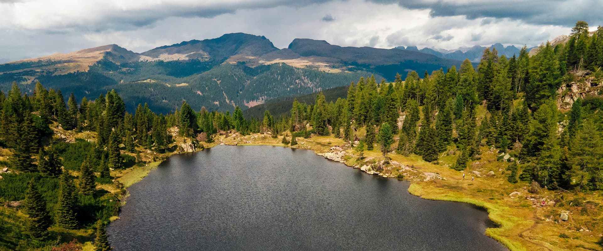
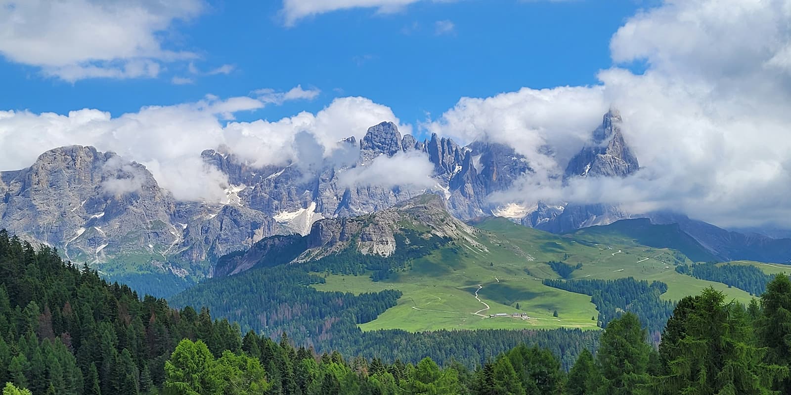
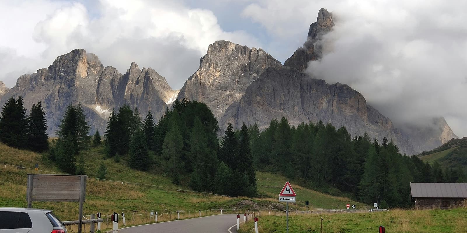
Before you start out, research info about the route (length, altitude, difficulty, current conditions) and assess your skills realistically. The Translagorai is a challenging hike that requires experience in alpine terrain, surefootedness, and proper equipment.

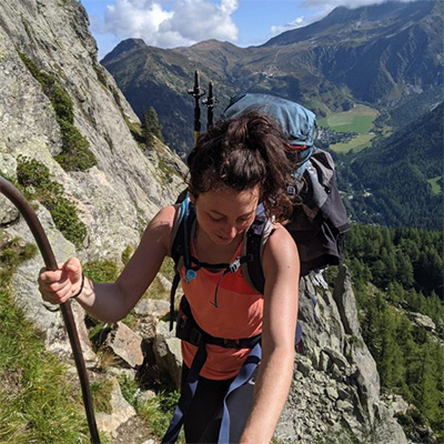
Invest in the right hiking gear, including comfortable, supportive footwear with a good grip, proper hiking clothing, such as warm base layers and a hardshell rain jacket, hiking poles, a well-fitted backpack, and essential equipment like maps, GPS devices (or the GPX on your mobile), and a first-aid kit.

For staying overnight in the refuges, bring a light sleeping bag, in addition to the provided blankets, and earplugs for a restful night. Check out our comprehensive gear list for long-distance trails for more ideas.

If you walk by yourself, share your plans with somebody else for your own safety. And if you switch your itinerary mid-trip, be sure to update them!

The weather in the high mountains can change rapidly. Always check the trail conditions and local weather forecasts, be prepared for all conditions, including rain, sun, or snow and alter your itinerary if needed.

Stay properly hydrated and nourished. Ensure you have enough water and snacks to maintain energy levels and prevent dehydration and exhaustion. Bring at least two liters of water with you. Especially in remote sections or near livestock grazing areas, it is recommended to use a water filter or purification tablets.

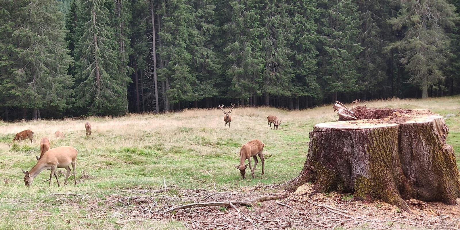
Respect the principles of Leave No Trace by minimizing your impact on the environment. Stick to designated trails, take all your trash with you, and show respect for wildlife and natural habitats (keep your distance and don’t feed them).

Difficulty

Translagorai is a medium-to-difficult hiking trail with high-altitude passes and rugged mountain terrain. The path is generally easy to walk and not too technical. Nevertheless, previous alpine experience is an advantage. The trail is rated T3 on the alpine mountain trail ratings.

Good to know

The Translagorai is a dog-friendly trail. However, they must be kept on a leash. When reserving at the mountain huts, you’ll need to check in with them about accommodations for your four-legged friend as well. It’s worth including this in your email or on the phone when you book!

You can fill up your water at the mountain huts and guesthouses between the stages. Make sure to take enough drinking water for the day and top up your water supply whenever possible. Especially in remote sections or near livestock grazing areas, it is recommended to use a water filter or purification tablets.

route
point-to-point
highest point
2,572m (8438 ft)

Want to submit a trail or make this page more complete?

Always read the disclaimer

Terms of Use: important to all visitors on this website. We strive to publish high quality content and information on this website. However it’s always possible that we’re missing out on some crucial information. In spite of the fact that this route, associated GPS track (GPX and maps) were prepared under diligent research by the specified contributor and/or contributors, the accuracy of such and judgement of the author is not guaranteed. Therefore, hiking-trails.com and contributors are in no way liable for personal injury, damage to personal property, or any other such situation that might happen to individuals hiking or following this route. Should you choose to hike this trail, this is always at your own risk. Check out our guidelines for safety hiking and Leave No Trace principles at the hiking 101 page.

Download GPX

Join the community!

Login or create a FREE account 😊

With an account you can:

Download GPX files

Pin trails to your wishlist

Mark trails as hiked by you

Rate hiking trails

Comment on trails, blogs and gear reviews

Happy trails!
Login

Don't have an account yet? Register here