About the Sentiero delle Orobie Occidentali

Alps
country
Italy
length
75 km(47 mi)
Type of trail
Long-distance, Hut to hut
difficulty

Difficulty is highly personal. Be aware of the weather conditions as bad weather turns easier trails in difficult trails especially in the mountains.

Difficult
accommodation

Lodging means a mix of hotels, hostels or AirBnB’s.

Mountain huts, Lodging
Elevation gain
4780 m(15682 ft)
terrain
Mountains
remoteness
Some of the time
Show more

The Sentiero delle Orobie is a network of hiking trails that stretches across the entire Orobie Alps, an impressive mountain range in Lombardy, northern Italy. The trail system includes both the Sentiero delle Orobie Occidentali (Western Orobie Trail) and the Sentiero delle Orobie Orientali (Eastern Orobie Trail), which is the perfect way to explore the mountains in their entirety, from west to east.

This region is right above Bergamo, making it easy to travel to with public transportation. Depending on your trail of choice, you’ll stay in mountain huts and lodging – a great way to spend a week this summer!

Merle profile picture

Merle Wünderling

Merle is an outdoor enthusiast who’s passionate about hiking, rock climbing, mental health, and sustainability. Born in Germany but at home in the world, she’s hiked trails in New Zealand (Abel Tasman Coast Track, Kepler Track), Europe (Rota Vicentina/ Fishermen’s Trail, Tour du Mont Blanc, GR20 Corse, Kungsleden… ), and the Balkans (Peaks of the Balkans). Over the years she became a bit of a nerd, constantly improving her gear for upcoming hikes, such as GR11 Spain, Tour des Ecrins, Te Araroa, and the Transcaucasian Trail.

You can follow Merle on Instagram @merlewunderkind.

View profile

The Trail

The Sentiero delle Orobie Occidentali (Western Orobie Trail) begins in the valley near Bergamo and extends towards the western peaks, giving you breathtaking views of the central and western Alps. You’ll enjoy several high-altitude passages with dramatic ridges and cliffs. The trail starts from Cassiglio and touches the main refuges of the Orobie, crossing the most interesting areas from a naturalistic, environmental, and mountaineering point of view. You will thus have the opportunity to cross a large part of the upper Brembana Valley without much difficulty while still getting to enjoy short excursions into Taleggio Valley, Valsassina, and Valtellina.

Compared to its Eastern counterpart, the Occidentali doesn’t present great difficulties and can be tackled by all hikers with minimal training. There are a few sections with chains, however, they shouldn’t present difficulties and can be tackled without the use of special equipment such as a via ferrata set.

Finally, the Occientali is a point-to-point trail, while the Sentiero delle Orobie Orientali is a circuit. You’ll join up with the Orientali at the end of the Occidentali at the Calvi Refugio.

Stages

The Sentiero delle Orobie Occidentali is usually hiked in six stages. However, many variations are possible due to the fact that the trail can be reached from various villages in the valleys. Therefore, it is possible to walk single stages or adapt the stages to your itinerary.

6-day itinerary

Stage 1:

Cassiglio – Rifugio Lecco, (7h)

Stage 2:

Rifugio Lecco – Rifugio Cesare Benigni, (6.25h)

Stage 3:

Rifugio C.Benigni – Rifugio S.Marco 2000, (3.25h)

Stage 4:

Rifugio San Marco 2000 – Foppolo, (7.5h)

Stage 5:

Foppolo – Rifugio Fratelli Longo, (3h)

Stage 6:

Rifugio Fratelli Longo – Rifugio Fratelli Calvi, (3h)

Accommodations

Along the way, you will find numerous rifugios (mountain huts) where you will spend the night. These huts are a great chance to try local cuisine (who doesn’t want an Italian dinner after a long day in the mountains?!) and sleep in a warm bed. The rooms in huts are usually dormitory style, meaning you will share a room with other folks staying there. Bring your earplugs, an eye mask, and a sleeping bag liner and you’ll be all set.

The biggest trick here is to book your accommodation in advance, especially during the peak summer months. The huts tend to fill up very quickly, especially on a trail as beloved as this one!

Mountain huts per stage

Stage 1:

Rifugio Lecco

Stage 4:

Foppolo (campsite, hostel, guesthouses, hotels)

Best time of the year

The best time to hike the Sentiero delle Orobie Occidentali is from May until October when there is no snow and accommodation are open. There may still be snowbanks on the early side of the season, which means you’ll just need to call the huts ahead of time if you’re hiking in May or June to check the trail conditions. They’ll be able to tell you everything you need to know – like if you’ll need to detour at all or bring micro-spikes. July and August are the peak hiking months, so you’ll definitely have full huts and more folks on the trail to talk with.

Safety & Gear

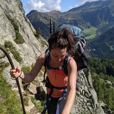
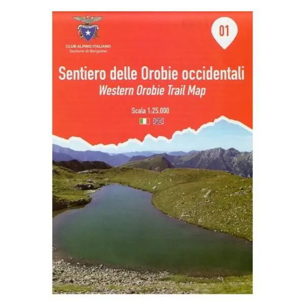
Sentiero delle Orobie Occidentali is a challenging hike, which means they require experience in alpine terrain, surefootedness, and proper equipment. You can prepare for these routes by training beforehand, and bringing the right gear. This looks like comfortable, supportive footwear with a good grip and proper hiking clothes, such as warm base layers and a hardshell rain jacket. You will also want to bring hiking poles, a well-fitted backpack, maps, GPS devices (or the GPX on your mobile), and a first-aid kit. For more ideas on what to bring, check out our comprehensive gear list for long-distance trails.

Very important: if you walk by yourself, share your plans with somebody else for your own safety. And if you change your plans while in the mountains, be sure to let that person know!

For staying overnight in the mountain huts, bring a light sleeping bag, in addition to the provided blankets, and earplugs for a restful night. Huts require that you bring a sleeping bag liner at least, as this will keep you clean while using their provided blankets and pillows.

The weather in the high mountains can change at the drop of a hat. Each morning, check on the local weather forecast to be prepared for all conditions. If it’s looking a bit iffy, check in with the hut warden for advice on what to do.

You’ll be able to eat at the huts, but you’re still responsible for water and snacks on the trail. Take at least 2L of water each day, supplementing with electrolytes if you need them. Additionally, be sure to bring lots of snacks to keep your energy up!

Finally, try to respect the principles of Leave No Trace by minimizing your impact on the environment. Stick to designated trails, take all your trash with you, and show respect for wildlife and natural habitats (keep your distance and don’t feed them).

Difficulty

The Sentiero delle Orobie Occidentali & Orientali are considered challenging. This is because of their steep ascents, rocky paths, and some exposed sections that require good physical fitness and alpine hiking experience. It’s suitable for experienced hikers comfortable with long-distance trekking in mountainous terrain.

Good to know

Consider becoming a member of the Club Alpino Italiano – Bergamo (CAI Bergamo) to help maintain the huts and trails and benefit from discounts on overnight stays in CAI mountain huts. If you’re planning a summer of hut tours, this is a smart call! Sometimes the discounts can be as much as 50% off.

You can also fill up your water at the mountain huts between the stages. Make sure to take enough drinking water for the day and top up your water supply whenever possible.

Route
point-to-point
highest point
2260m (7414 ft)

Guidebooks

guidebook sentiero delle orobie

Sentiero delle Orobie Occidentali

View guidebook

Want to submit a trail or make this page more complete?

Always read the disclaimer

Terms of Use: important to all visitors on this website. We strive to publish high quality content and information on this website. However it’s always possible that we’re missing out on some crucial information. In spite of the fact that this route, associated GPS track (GPX and maps) were prepared under diligent research by the specified contributor and/or contributors, the accuracy of such and judgement of the author is not guaranteed. Therefore, hiking-trails.com and contributors are in no way liable for personal injury, damage to personal property, or any other such situation that might happen to individuals hiking or following this route. Should you choose to hike this trail, this is always at your own risk. Check out our guidelines for safety hiking and Leave No Trace principles at the hiking 101 page.

Download GPX

Join the community!

Login or create a FREE account 😊

With an account you can:

Download GPX files

Pin trails to your wishlist

Mark trails as hiked by you

Rate hiking trails

Comment on trails, blogs and gear reviews

Happy trails!
Login

Don't have an account yet? Register here